Danckerts Family
The Danckerts were a prominent print and map publishing family active in Amsterdam for almost 100 years. The founding member of the family business was Cornelis I (1603-1656), who started producing and publishing maps in the second part of the 1620s. His sons, Dancker (1634-1666) and Justus (1635-1701) were also active in the business.
Justus issued several atlases with his sons: Theodorus I (1663-c. 1727), Cornelis II (1664-1717), Johannes (?-1712), Eduard (?-after 1721), and his grandson Theodorus II (1701-1727).
Due to the use of the same first names by various family members, there is some confusion in the literature regarding the authorship of specific maps produced by the Danckerts.
Sold
As Koeman states (1967-71, II: 88), "Their cartographic work has, compared with that published by the Blaeus or Janssonius, attracted but little attention and has never received proper recognition."A detailed study was conducted and published in 2007 by Gyuri Danku and Zoltán Sümeghy, who distinguish the engravers and dated the maps: "The Danckerts Atlas. The Production and Chronology of Its Maps", published in Imago Mundi, Vol. 59, No. 1 (2007), pp. 43-77.
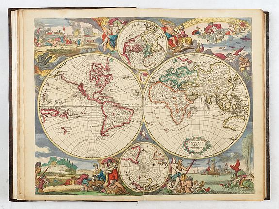
Apart from the Atlas, the Danckerts are famous for several monumental and beautiful wall-maps and views. Like all self-respecting Amsterdam print-sellers, Justus Danckerts I owned a complete set of wall-maps of the continents, each in four sheets, with scrolls, views and figures in the borders.
The atlas production
The Danckerts family sold maps in Amsterdam from approximately 1680 until 1727, when the stock of maps in Theodorus II, Cornelis I's great-grandson's shop, was sold.
Their atlas production began with Justus I Danckerts around 1680. These first atlases, published between 1688 and 1689, contained 26 to 30 maps.
The family then expanded their collection until around 1700, reaching approximately ninety maps.
From 1701 onwards, all of Europe and new parts of the world were included: the Danckerts atlases then comprised approximately 120 maps.
Production of Danckerts atlases ceased in the 1720s, after two sales of the stock, in 1713 and 1727; a few plates and maps continued to circulate until the mid-18th century.
These atlases are complex to date, as neither the title pages nor the maps bear dates.
Koeman divides them into five categories (this atlas falls into the fourth); with a map count ranging from 74 to 90. "Very few complete copies have survived (…).
Koeman (Cornelis). Atlantes Neerlandici. Amsterdam, 1969. Vol. 2 pp. 88-97: similar to the atlas described under "Dan 4", p. 93: "after 1696".
The Dankerts family
Gyuri DANKU and Zoltán SÜMEGHY wrote in "AN OUTLINE OF THE DANCKERTS ATLAS HISTORY" (2007) : Our knowledge on the production and publishing history of the Danckerts Atlas has been rather incomplete. Only few records relating to the activity of the Danckerts firm and to the life of the members of the family have survived (e.g. GREGORII, 1713; KLEERKOOPER – VAN STOCKUM, 1914–1916; KEUNING, 1955; VAN EEGHEN, 1965–1978; KOEMAN, 1969; WALLER, 1974; DE VRIES, 1986; FRENCH, 1999; DANKU, 2004; VAN DER KROGT – DANKU, 2004).
As KOEMAN (1969) notes: „It is very difficult to establish the year of publication as the younger Danckertses never dated their maps and title pages.” This is primarily why we have possessed quite a hazy and sketchy knowledge regarding even the most basic issues: when the individual maps of the Atlas were made and by whom; how the Atlas has developed and enlarged; how many types of the Atlas were actually published; what sources the compilers and engravers-etchers of particular maps used.
Justus Danckerts (1635–1701), a book and print publisher in Amsterdam, who had previously been only a second-rate figure in map publishing, decided to produce an atlas consisting of his own maps in the first half of the 1680s.Several factors probably influenced this decision.
Probably the most important of these was the fact that his elder sons Theodorus I (1660/1663–ca. 1727 ?) and Cornelis II (1664–1717) reached adulthood in these years and learned the basics of map-making, especially copper engraving and etching, which were considered indispensable in commercial cartography at that time. Considering details from the history of Amsterdam map- and atlas-making the decision of Justus I corresponds to the tendency of that age; besides the two most significant major firms grown out of the shadow of the two giants (the Hondius–Janssonius and the Blaeu) and already having an own atlas in the market (the Visscher and the De Wit), in the 80’s other firms also started to appear with more or less ambition in the field of geographical map and atlas publishing.
After the production of some maps in the beginning of the 80’s (e.g. Circulus Saxonicus, Portugallia), which we could call experimental, the atlas maps of the Danckerts were made, from ca. 1682–83, at an accelerating pace. Based on style investigations, it seems that by dividing the tasks the firm managed to produce 22 maps by 1686–87. The privilege of 12 September 1684 (KLEERKOOPER – VAN STOCKUM, 1914–1916) seems to confirm that by the middle of the 80’s the family felt itself prepared for long-term planning and providing proper protection for its ready and future works, including maps for the next 15 years.
The volumes now kept in the Vienna and Budapest libraries have a title page and printed index, and, in addition to 20 and 21 own maps, they contain 5 and 4 others, respectively, which were created by other firms (one by Visscher and the others by De Wit) and are in accordance with the index.
The first 26-sheet geographical atlas of the firm, which contained only self-created maps, could have been completed by 1690 at the earliest.
The next atlas type containing 30 items was probably completed by 1690–1692, followed by a 37-sheet one in 1692–94, a 50-sheet one in 1694–1696, and a 60-sheet one in the last years of the century, between 1698 and 1700.
As for the period between 1696 and 1700, it seems inevitable that by the end of the 1690s the plates of the early maps had been in use for 10–15 years; thus, many of them, for instance, those of the continent maps, needed extensive reworking.
After 1701, a new era began in the history of atlas-making. Besides the death of Justus I and Johannes reaching adulthood, the new war, the War of the Spanish Succession, now extending to the whole of Europe (and some other parts of the world) may have played an essential part in this.
In the early years of the new century, maps of the Theatres of War (or areas that could be depicted as such) were created and published one after another. First, maps of the Italian states, the southern Netherlands, and then the German provinces were created.
The Theatres of War
In the early years of the 1700's, maps of the Theatres of War (or areas that could be depicted as such) were created and published one after another. First, maps of the Italian states, the southern Netherlands, and then the German provinces were created.
The War of the Spanish Succession was a European great power conflict, fought between 1701 to 1714. While no longer the predominant European power, the Spanish Empire remained a large global entity, including the Spanish Netherlands, large parts of Italy, and the Americas. Its union with either France or Austria threatened the European balance of power, and the proclamation of Philip as king of Spain on 16 November 1700 led to war. Although by 1709 the Allies had forced France onto the defensive, Philip had confirmed his position in Spain, the ostensible cause of the war.
Also, the Danckerts added in this period maps of the Spanish and Italian regions, expanding their atlases with at least 20 maps.
In the case of maps made after ca. 1706, the signatures of Albert Schut’s style can be identified on the engravings of some published under the name of Cornelis II. The fact that Schut's name appeared on some of these maps indicates his increasing role in etching and engraving. It seems that he had made his earliest maps (e.g. Polonia – Numbered 68, Stiria, Norvegia) together with Johannes (and surely with Cornelis II), but around 1708–1712 he had already engraved a few Danckerts maps alone (e.g. Provences).
In the years between 1700 and 1712 (approx. until the death of Johannes) the firm managed to increase the number of atlas map sheets from 60 to 100. This is the explanation for the atlases with 75 and 100 sheets that were completed during Johannes' lifetime.
In the case of maps made after ca. 1706 the signatures of Albert Schut’s style can be identified on the engravings of some published under the name of Cornelis II. The fact that Schut's name appeared on some of these maps indicates his increasing role in etching and engraving. It seems that he had made his earliest maps (e.g. Polonia – Numbered 68, Stiria, Norvegia) together with Johannes (and surely with Cornelis II) but around 1708–1712 he has already engraved also a few Danckerts maps alone (e.g. Provences).
In the years between 1700 and 1712 (approx. until the death of Johannes) the firm managed to increase the number of atlas map sheets from 60 to 100. This is the explanation for the atlases with 75 and 100 sheets getting finished still in the life of Johannes. Several new prints from these years indicate the active initiative role of Cornelis II in defining the atlases’ content, such as the complementary plates published under his name (geographical-historical tables, flag and ship illustration prints). It was he who purchased Robijn and De Ram plates (world map and astronomical charts), which were then included in the atlases published by the family, also in those of Theodorus I, with a larger number of sheets.
The End
Biography sources indicate that in 1716–17, Theodorus I and in 1726, Theodorus II experienced financial difficulties (KLEERKOOPER – VAN STOCKUM, 1914–1916). In addition, several tragedies affected the family's life during these years. After 1720 we only have biography sources concerning Theodorus II. Being deep in debt, he had to hand over most of his stock to a creditor, T. Rijswijk, as mortgage in the months before his death. After his demise in the autumn, it was put up for auction for the benefit of the creditor on the orders of the city council. The auction was managed by two renowned book traders from Amsterdam, J. Oosterwijk and S. Schouten (KLEERKOOPER – VAN STOCKUM, 1914–1916). It was probably at this auction that other publishers (e.g., Ottens and Van Keulen) took possession of the map plates of the Danckerts atlas.
References
DANKU, Gyuri: Twaalf kaarten van Cornelis I Danckerts (1603–1656) in de Andreas Nagy atlas. 2004, Caert-Thresoor 23, Nr. 3, pp. 72–79.
DANKU, Gyuri – SÜMEGHY, Zoltán: The Danckerts Atlas. The Production and Chronology of Its Maps. 2007, Imago Mundi 59, Part 1 pp. 43–77
EEGHEN, Isabella Henriëtte van: Amsterdamse boekhandel 1680–1725. Scheltema & Holkema- Israel, Amsterdam, 1965–1978. Vol. 3 pp. 86–87, Vol. 4 p. 205, Vol. 5 p. 90, p. 120.
FRENCH, Josephine ed.: Tooley’s dictionary of mapmakers. Revised ed. Map Collector Publications Ltd., Richerad Arkway Inc., London, 1999. Vol. 1 p. 329, p. 331.
GREGORII, Johann Gottfried: Curieuse Gedancken von den vornehmsten und accuratesten altund -neuen Land-Charten nach ihrem ersten Ursprunge, Erfindung, Auctoribus und Scultoribus, Gebrauch und Nutzen entworffen auch denen Liebhabern der Zeitungen zum Vergnügen aus der Geographie, Historie, Chronologie, Politica und Jure Publico erläutert und nebst kurtzen Lebens- Beschreibungen der berühmtesten Geographorum ausgefertiget durch Johann Gottfried Gregorii von Toba aus Thüringen. H. Ph. Ritschel, Franckfurt und Leipzig, 1713. pp. 72–75
KEUNING, Johannes: Cornelis Danckerts and his “Nieuw Aerdsch Pleyn”. Imago Mundi 12, 1955, pp. 136–139.
DANKU – SÜMEGHY: AN OUTLINE OF THE DANCKERTS ATLAS HISTORY
KLEERKOOPER, M. M. – STOCKUM, Wilhelm Peter van: De boekhandel te Amsterdam, voornamelijk. in de 17de eeuw: Biographische en geschiedkundige Aanteekeningen. ’s-Gravenhage, Vol. 1. 1914–1916, p. 169–173, Vol. 2 pp. 1251–1252.
KOEMAN, Cornelis. ed.: Atlantes Neerlandici. Bibliography of terrestial, maritime and celestial atlases and pilot guides, published in the Netherland up to 1880. Theatrum Orbis Terrarum Ltd., Amsterdam, 1969, Vol. 2 p.88–97., Vol. 3 p. 191.
KROGT, Peter van der: Advertenties voor kaarten, atlassen, globes e. d. in Amsterdamse kranten 1621–1811. HES Uitgevers, 1985, p. 83: 376
KROGT, Peter van der – DANKU, Gyuri: De Andreas Nagy atlas: een atlas factice uit circa 1660. Caert-Thresoor 23, Nr. 3. 2004 pp. 66–71.
SÜMEGHY, Zoltán – DANKU, Gyuri: Identifying an undescribed Danckerts Atlas. Acta Universitatis Szegediensis 32–33, 1999, pp. 101–119.
TIELE, Pieter Anton: Nederlandsche Bibliographie van Land- en Volkenkunde. Amsterdam. 1884 (repr. Amsterdam, 1966).
VRIES, Dirk de: Danckerts (Familie). In: Kretschmer, I. – Dörflinger, J – Wawrik, F. eds.: Lexikon zur Geschichte der Kartographie. Von den Anfangen bis zum ersten Weltkrieg.
Franz Deuticke, Wien, 1986, p. 150
WALLER, François Gerard: Biographisch woorderboek van noord nederlandsche graveurs.
Beheerders van het Wallerfonds en bewerkt W. R. Juynboll, B. M. Israël, Amsterdam, 1974, pp. 74–75.
(DANKU – SÜMEGHY, 2007).
