Mapping of Iceland
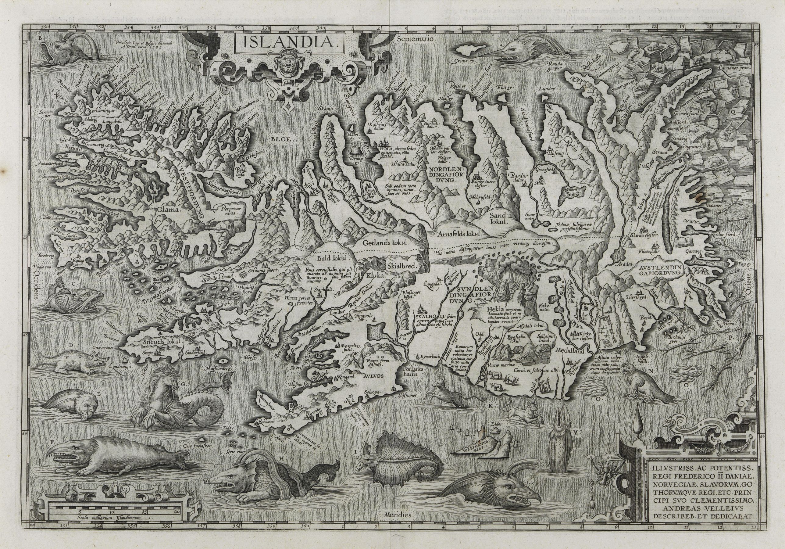
— Iceland barely existed on maps at all, or appeared as a vague northern blob mixed up with Thule, the legendary land the Greeks and Romans placed at the edge of the known world. Norse sagas contained real geographic knowledge of Iceland from the 9th-century settlement onward, but that knowledge didn't enter mainstream European cartography for centuries.
Ptolemaic revival (1480s–1500s)
— Early printed atlases based on Ptolemy's Geography began including Iceland, but shapes were crude and often fantastical — sometimes shown connected to Greenland or Norway.
Olaus Magnus and the "Carta Marina" (1539)
— This Swedish map was hugely influential and popularized the sea-monster-infested North Atlantic look. Iceland appears with volcanoes and mythical creatures, reflecting how little was actually known and how much imagination filled the gaps.
Guðbrandur Þorláksson's map (1590)
— This is the real turning point. An Icelandic bishop and scholar produced the first reasonably accurate map of Iceland based on local knowledge and surveying rather than secondhand European guesswork.
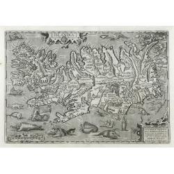
Ortelius and the "Islandia" map (1585 and later),
in Theatrum Orbis Terrarum) — Ortelius adapted Guðbrandur's work (via an intermediary map) into the version most collectors know today — the famous "Islandia" with sea monsters in the surrounding waters. This is the map shown in the image above; it's one of the most sought-after Icelandic antiquities, and it's very likely you've handled examples of it or its later states (Hondius and Janssonius reissued it repeatedly throughout the 1600s).
17th–18th century refinement
— Dutch cartographers (Blaeu, Janssonius, Visscher) kept reprinting variants of the Ortelius/Guðbrandur outline, gradually cleaning up the coastline while keeping the decorative sea monsters as a selling point.
Real accuracy didn't arrive until Danish government surveys in the late 1700s–1800s, once Iceland was mapped trigonometrically rather than by ship's-eye coastal sketching.
The Prof. and Dr. Schulte Collection in the Akureyri Museum
Akureyri Toy Museum, Nonni's house, Industrial Museum and Laufás Heritage. Daily 11:00-17:00 Site: https://www.minjasafnid.is/en/news/unique-icelandic-maps-exhibition-talk
The Schulte Collection currently includes 212 historical maps of Iceland from 1507 to 1849, which have been donated by the German couple Prof. Dr. Karl-Werner Schulte and Dr. Gisela Schulte-Daxbök to Akureyri Museum in 2014. A selection with alternating themes is exhibited yearly from spring to autumn.
Mapping Iceland
The personal collection of the Icelandic collector Reynir Finndal Gretarsson is online at: https://mymapsoficeland.com
The collection contains maps of Iceland from before 1850. The main purpose is to store the collection and make it publicly available digitally. Reynir also wrote a book on the history of the mapping of Iceland (Out of print).
https://islandskort.is/
The maps on the web https://islandskort.is/ have grown considerably in number, the map collection of the University of Iceland has been added, and the maps of the Icelandic geographer Thorvaldur Thoroddsen. Also, the maps were made by the survey department of the Danish General Staff and the Danish Geodetic Institute in the first half of the twentieth century. Finally, maps from the U.S. Army Map Service for 1948-1951 have been added.