Mappa Generalis regni Hungariae by Janos Lipszky.
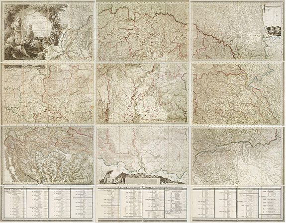
Mappa Generalis regni Hungariae partiumque adnexarum Croatiae, Slavoniae et Confiniorum Militarium Magni item PrincipatusTransylvaniae geometricis partium dimensionibus, recentissimisque astronomicis observationibus. . . Published: Vienna, Gebrüder Kilian Pest bzw Kunst- und Industrie-Comptoir Wien, 1811. Size: 70.9 x 88.6 inches. / 180.0 x 225.0 cm.
Published: Vienna, Gebrüder Kilian Pest bzw Kunst- und Industrie-Comptoir Wien, 1806.
Size: 70.9 x 88.6 inches. / 180 x 225 cm.
Copper-engraved map, printed on 12 sheets, intersected and pasted on linen (total 96 segments). The map itself is on 9 sheets, measuring approx. 138 x 213 cm. Below are 3 sheets (each 27 cm high) with statistical data, designed to be attached below the map.
The map has been engraved by G. and F. Prixner Karacs.
In the upper left is a beautifully engraved title, and in the lower part, a scale cartouche, both with figural representations.
Different scales are listed (Germanica Hungarica Millar, Millar Polonica, Gallica Millar, Millar Italica,
Anglica Millar, Millar Russica.)
This map has been sold
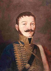 At the beginning of the 19th century, following the works of others in the previous century, Janos Lipszky (1766-1826), a Hungarian hussar officer, compiled and published, in print the first complete general map of the Hungarian Empire (Mappa generalis regni Hungariae, (1804-1808), together with the complete index of all settlements and other geographical names in it (Repertorium, 1808), and an overview map (Tabula generalis regni Hungariae, 1810).
Even now, researchers favor Janos Lipszky's map for its unprecedented completeness and accuracy, while people fond of beautiful maps find it aesthetically pleasing to browse. Due to the map's great interest, complete copies are available almost exclusively in public collections.
At the beginning of the 19th century, following the works of others in the previous century, Janos Lipszky (1766-1826), a Hungarian hussar officer, compiled and published, in print the first complete general map of the Hungarian Empire (Mappa generalis regni Hungariae, (1804-1808), together with the complete index of all settlements and other geographical names in it (Repertorium, 1808), and an overview map (Tabula generalis regni Hungariae, 1810).
Even now, researchers favor Janos Lipszky's map for its unprecedented completeness and accuracy, while people fond of beautiful maps find it aesthetically pleasing to browse. Due to the map's great interest, complete copies are available almost exclusively in public collections.
Reference: Reisz T. Csaba, The Giants of Hungarian Cartography.
