Atlas van Nederlandsch Oost- en West-Indie.
The mapping of the Netherlands East Indies can be divided into five phases; the first two, in between the first contacts (1597) and the Napoleonic Wars, the period of the Dutch trading Empire of the United East India Company (VOC), and the one between the Napoleonic wars and 1864 are characterized by hydrographic charting; from 1790 onward on a scientific level.
In 1864 the Topographic Survey was initiated, directly under de General Staff, and this meant putting the systematic survey started in 1850 on a secure basis.
The systematic mapping of Java took from 1850-1880, and the mapping of the outer islands was stated and took until 1940.
1./ The Period prior to 1816
2./1816-1864 : Von Derfelden and Melvill van Carnbee.
3./1864-1905 Versteeg to Enthoven.
4./ 1905 - 1942
In the period 1864 - 1905 some very detailed atlases came on the market, intended for the general public and school use.
Atlas van Nederlandsch Oost- en West-Indie (1884-1909)
This atlas was prepared by doctor I. Dornseiffen, and published by published by Seyffardt's Boekhandel, Amsterdam.
Dornseiffen published his "Atlas van Nederland (1861), "Nederland en Zijne Overzeesche Bezittingen (1863) and "Atlas van Nederlandsch Oost en West Indië" in 1884, 1894 and 1909.
The atlas was intended for use at home and high school.
The atlas ranks among the school atlases of the Dutch Indies by Havenga and van Gelder and Stemfoort & ten Siethoff.
Curiously Koeman only mentions only third, fourth and fifth editions. We offer some maps from the third (and earliest known) edition.
Atlas der Nederlandsche bezittingen in Oost-Indie. (1883-1885)
This formidable atlas by Stemfoort and ten Siethoff reflects the topographical survey and the prosperous state of the Dutch colonies. It's production was a government affair, and should be regarded as a follow up to the atlas by Melvill van Carnbée and Versteeg.
In most cases,the atlas is loose-leafed because the sheets were published in installments. Revised maps appeared in installments during the period 1897 - 1907.
First edition:
STEMFOORT, J. W. & J. J. TEN SIETHOFF.
Atlas der Nederlandsche bezittingen in Oost-Indie. Naar de nieuwste bronnen samengesteld en aan de regeering opgedragen. Gereproduceerd, op last van het Departement van Kolonien, aan de Topographische Inrichting te 's Gravenhage, onder leiding van den directeur C.A.Eckstein.
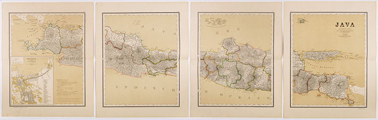
s-Gravenhage; 1883-1885; Topografische Inrichting. The atlas contained 14 double page lithographed maps, in colour; with legend; inset plans of several cities, ie. Batavia, Semarang, Soerabaja, Makasser, Amboina; maps: Java & Madoera, West Java, Midden Java, Oost Java, Noord Sumatra, Midden Sumatra, Zuid Sumatra, Banka/ Billiton/ Riouw, Noord Borneo, Zuid Borneo, Celebes, Kl. Soenda Eilanden, de Molukken & Overzichtskaart Ned.-Oost Indischen Archipel. Reference: Koeman Atlantes Neerlandici, volume VI, Stem A1.
Second revised edition:
STEMFOORT, J. W. & J. J. TEN SIETHOFF. Atlas Van Nederlandsch Oost-Indië. Bij het Topographisch Bureau te Batavia samengesteld in de Jaren 1897-1904. (Omgewerkete uitgave van den Atlas van J.W. Stemfoort en J.J. Ten Siethoeff, onder leiding van C.A. Eckstein)(Revised edn.).
's-Gravenhage, Topographische Inrichting, 1898- 1907. Large folio. orig. cloth with gilt title tooled on front cover. Ti.-p. with large Royal Dutch State Coat-of-Arms at head, coloured key to maps printed at tail. Double-spread Survey map of colonial Indonesia(1: 6 5000.000) with comparative (size) inset-map of the motherland in lower left corner, 1 double-spread survey-map of Java and Madura (4 maps: hydrography, Geology, residencies, Rail- & Tramways, Telegraph & Telephone-lines), 14 other mainly double-spread coloured lithographed maps, various scales.
All maps with extensive legend and keys, generally printed at tails; incl. inset-maps and plans (also with legend) of: Batavia, Semarang, Soerabaia, Bawean, Kangean-Archipelago (Eastern Java), Koeta-Radja & Greater Aceh, Nias, Fort de Kock & Padang, Banjak Islands, Bandjarmasin (Borneo), Minahassa, Makassar, Ambon Residency & Ambon-City, &c..
Atlas van Tropisch Nederland (1938)
BAKHUIS, L.A., A.O. & KONINKLIJK NEDERLANDSCH AARDRIJKSKUNDIG GENOOTSCHAP.
Atlas van Tropisch Nederland. Uitgave van het Koninklijk Nederlandsch Aardrijkskundig Genootschap, in samenwerking met den Topografische Dienst in Nederlandsch-Indië.
Batavia/Amsterdam, 1938. Folio. 44 x 35 cm. With 31 double pag. folding coloured maps (with 70 charts) with legend + separate index [register]. Text in Dutch, English, French and German. Including maps of the Dutch East Indies, Suriname and the Dutch Antilles. By command of the Dutch Royal Geographical Society K.N.A.G.

