Join our Newsletter and be the first to get notified about new listings. - Sign Up→
New Inventory
|
Contact
|
About
|
Create Account
|
Virtual Collection
Welcome,
Guest
Sign Up
Sign In
Virtual Collection
My Account
Sign Up
Sign In
Browse Catalog
0
$0
0
Your shopping cart is empty.
BuyNow Gallery
BuyNow Catalog
Invoices & Certificates
FAQ Buying in the BuyNow Gallery
Personal Information
Terms and conditions
Update / Add (shipping) address
Virtual Collection
Mailing List
Catalog Archive
FAQ
Interesting articles
Client Center
Contact Us
Consignor Center
Maps
BuyNow Catalog
Atlases
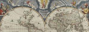
World
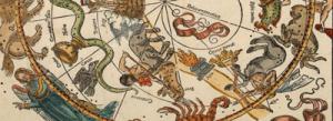
Celestial
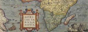
Africa
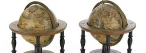
Globes
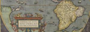
Americas
Map Types
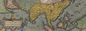
Asia
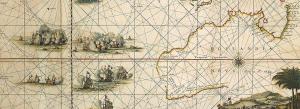
Sea Charts
Australia & Oceania
Title pages
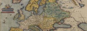
Europe
Map Makers & Explorers
The Archive
Curated Collection
Highlights
Latest Listings & Updates
Miscelleneous
BuyNow Catalog
Old Stocks & Bonds
Books
Medieval Manuscripts
Nuremberg Chronicle
Prints - Decorative
Posters / Publicity
Prints - 16-8th C.
East Meets West
Prints -19th C.
Maritime Prints
Prints - Modern
VOC & Trading Companies
Instruments, Games & Folding Fans
Virtual Collection
Search
0
$0
0
Your shopping cart is empty.
Welcome,
Guest
Browse Catalog
Wish List
Articles
Highlights
Mailing List
Sign Up
/
Sign In
All Categories
World Maps
America
Continent
America250
North America
Canada
Caribbean & Atlantic Ocean
Central America
Mexico
Pacific Ocean
South America
Europe
Continent
Austria
Belgium
British Isles
Eastern Europe
France
Germany
Greece
Italy
Luxembourg
Malta
Mediterranean & Islands
Netherlands
North Sea
Poland
Portugal
Russia / Baltic / Black Sea region
Scandinavia
Spain
Switzerland
Asia
Continent
Arabian Peninsular
China
Cyprus
East Asia
Holy Land & Jerusalem
India
Japan
Korea (and Japan)
Malaysia / Singapore
Central Asia
Near / Middle East
Persia / Armenia / Iran / Irak
Philippines
South East Asia
Syria
Taiwan
Tartary / Siberia
Thailand / Burma / Vietnam
Tibet
Turkey
Africa
Continent
North Africa
Central Africa
Southern Africa
Australia & Oceania
Pacific
Oceania
Australia
New Zealand
New Guinea
Pacific islands
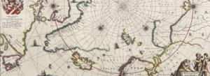
Polar maps
Atlases
Celestials
Celestials
Nuremberg Chronicle
Globes, Instruments, Games & Fans
Globes
Compasses / Sandglasses
Board games
Fans
Instruments others
Prints depicting instruments
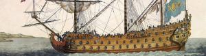
Maritime
Charts
Prints
Instruments
Objects
Map Types
Mapmakers / Explorers
Title Pages
Asian Made Maps & Items
Broadsheet maps
Carte-a-figures
Curiosities general
Exceptional original colors
Folding maps
Geological maps
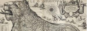
Leo Belgicus / Hollandicus
Manuscript maps
Nautical Charts
Pictorial & Advertising
Postal / Road maps
Transportation & Travel
Views & City Plans
Wall maps
Medieval & Oriental Manuscripts
Medieval manuscripts
Miniatures
Music / Antiphoner
Printed Leaves
Books
Oriental Manuscripts
Books
Bibliography
Old & Rare Books
Travel & Voyages
Maritime Books
Natural History
Prints / Drawings
Decorative prints
Prints 16-18th century
Prints 19th century
Prints modern / Contemporary
Erotica
Japanese prints
La Belle Époque
Military /Battles
Optical prints
Portraits / Figures
Topographical
Drawings
Posters & Publicity
Posters
Air France Posters
Circus & Movie Posters
Les Maitres de l'Affiche
Propaganda & War Posters
Publicity
Old Stocks & Documents
Stocks and bonds
Stock market prints
Documents
VOC & Trading Companies
Austrian Company
Danish Company
French Company
Ostend Company
Swedish Company
Triest Company
V.O.C.
West India Company
Reference Books
East Meets West
General
Belitung shipwreck
Silk Road
Central Asia
China
Constantinopolis (Istanbul)
East India Companies
India
Nagasaki & Yokohama Prints
Optical Prints
Taiwan
The Japan connection
Travel Books
Tulips
Group Lots
Maps
Prints
Catch All
Recent acquisitions
Map-fair Highlights


-300.jpg)

-300.jpg)


-300.jpg)