Browse Listings in Map Types > Geological maps
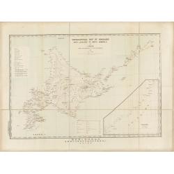
Topographical map of Hokkaido with localities of useful minerals.
Bilingual (English/Japanese) topographic map (1:1,500,000) of Hokkaido Island detailing the distribution of mineral deposits and mining sites (“useful minerals”), publish...
Date: Hokkaidōchō (Gouvernement de Hokkaidō), Sapporo, 1891
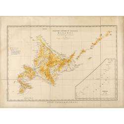
Mountain system of Hokkaido.
Bilingual English/Japanese map of Hokkaido showing elevations, volcanoes and roads for geological observations, with an inset of Chishima (Kuril Islands).
Date: Hokkaidōchō (Gouvernement de Hokkaidō), Sapporo, 1892
![[Soil map] Virginia-Maryland-West Virginia, Leesburg sheet.](/uploads/cache/23257-250x250.jpg)
[Soil map] Virginia-Maryland-West Virginia, Leesburg sheet.
Early color lithographed soil map by Julius Bien & Co. in New York for Department of Agriculture. Legends at side give detail on soil type, etc. They also include int...
Date: New York, 1903
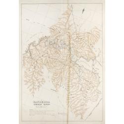
Canberra Contour Survey.
An important large-scale folding map by Charles Scrivener of the present-day city of Canberra, featuring contour lines and elevation data, created as part of the prelimin...
Date: Department of Lands, Sydney N.S.W. July, 1909
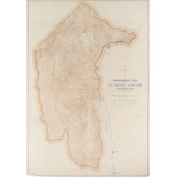
Topographical map of the Federal Territory, Australia.
This map, published by the New South Wales Department of Lands in Sydney in 1910, depicts the Federal Territory—the area designated to house Australia’s future federal ca...
Date: Sydney, Dept. of Lands, 1910
![[Lot of 2 maps] Map of part of New South Wales Australia shewing position of Commonwealth Territory / Map of New South Wales Australia…](/uploads/cache/49457-250x250.jpg)
[Lot of 2 maps] Map of part of New South Wales Australia shewing position of Commonwealth Territory / Map of New South Wales Australia…
Two maps depicting the region of New South Wales and the area designated as the future Commonwealth Territory (which later became the Australian Capital Territory).The fi...
Date: Department of Lands, Sydney NSW, 1911
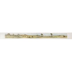
Cycloramic view of Canberra capital site, view looking from Camp Hill / … view looking from Vernon.
Showing an extensive panoramic view of the site of Canberra with various features named. Very large colour photo-mechanical print. Printed by John Sands Ltd [Syd].This 5 ...
Date: Sydney, John Sands, 1911

Carte géologique détaillée. Beyrouth.
Geological or soil map showing part of Lebanon with Beyrouth, including in top a colored legend with signs of the different geological ages. Provenance : Fondation P. Fal...
Date: Liban, Service geographique des F.F.L., 1945

Carte géologique détaillée. Jezzîne.
Geological or soil map showing part of Lebanon with Jezzîne, including a legend with signs of the different geological ages and giving many information of greatest intere...
Date: Liban, Service geographique des F.F.L., 1945

Carte géologique détaillée. Râchaïya Nord.
Geological or soil map showing part of Lebanon with Râchaïya , including a legend with signs of the different geological ages and giving many informations of greatest int...
Date: Liban, Service geographique des F.F.L., 1945

Carte géologique détaillée. Zahle.
Geological map showing part of Lebanon with Zahle. , including a legend with signs of the different geological ages. Provenance : Fondation P. Fallot
Date: Liban, Service geographique des F.F.L., 1945

Carte geologique detaillee. Jbail.
Geological or soil map showing part of Lebanon with Jbail antique Byblos Ancien Port phenicien / scale 1 : 50 000., including a legend with signs of the different geologi...
Date: Liban, Service geographique des F.F.L., 1945
