Browse Listings in Atlases
![[Incunable] (Rudimentum novitiorum: French:) La mer des histoires.](/uploads/cache/22865-250x250.jpg)
[Incunable] (Rudimentum novitiorum: French:) La mer des histoires.
One of the rarest of French illustrated incunables. The Mer des histoires (?A sea of stories?) is the French adaptation of the Latin Rudimentum novitiorum, an abridged h...
Date: Lyon: Jean Du Pré, 20-23 August 1491
Selling price: ????
Please login to see price!
Sold
Register Des Buchs der Chronicken und geschichten mit figure...
FIRST EDITION IN GERMAN. The famous Nuremberg Chronicle, a history of the world, published the year that Columbus returned to Europe after discovering America. The text i...
Date: Nuremberg, Anton Koberger, 23 Decembre, 1493
Selling price: ????
Please login to see price!
Sold in 2017
Supplementum. Supplementi de la Chroniche vulgare novamante agionto & emendato al anno 1503.
Interesting Italian text edition of this important chronicle, first published in Latin in 1483.With large woodcut title-border, woodcut border on leaf A1 and 107 (2 full-...
Date: Venise, Georgio de Rusconi, August 7th. 1508
Selling price: ????
Please login to see price!
Sold in 2008
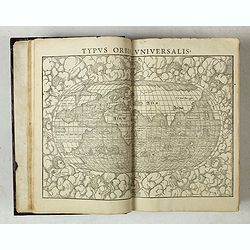
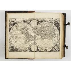
Geographia universalis, vetus et nova, complectens. . .
The rare FIRST EDITION of Sebastian Münster's Geographia Universalis, published in 1540. This was a new and important edition of Ptolemy, with redesigned maps and the te...
Date: Basel, 1540
Selling price: ????
Please login to see price!
Sold
(Fragment from the Cosmographia)
This fragment of the Cosmographia by Sebastian Münster covers the entire mathematical and geographical introductions given in Book I. In these twenty-two pages Münster...
Date: Basel, 1544
Selling price: ????
Please login to see price!
Sold in 2020
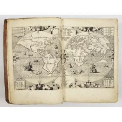
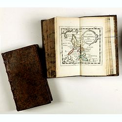
![In Somnium Scipionis Libri II.. [With world map]](/uploads/cache/12820-250x250.jpg)
In Somnium Scipionis Libri II.. [With world map]
With 5 schematic woodcuts and a fine woodcut map of the world (80 x 80 mm). The famous map of the world appears in the different printing in the 15th. and 16th Century in...
Date: Leyden 1550
Selling price: ????
Please login to see price!
Sold in 2010
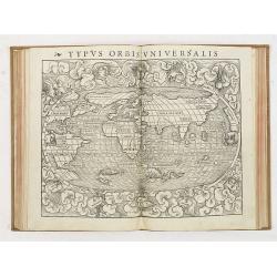
Cosmographiae universalis lib. VI.
Rare first Latin edition illustrated with a title-page within woodcut border, woodcut portrait of Munster on verso; 14 woodcut double-page maps, including 2 world maps (t...
Date: Basle, H. Petri, 1550
Selling price: ????
Please login to see price!
Sold in 2019
Biblia Sacra.
Famous "Polyglot" Bible, printed by the famous Plantin firm and prepared under the direction of Philip II of Spain. Including a world map well-known for its sho...
Date: Antwerp, 1583
Selling price: ????
Please login to see price!
Sold
Geographiae libri octo... ac emendatis per Gerardum Mercatorem
Rare second edition of Gerard Mercator's Cl Ptolemaei Alexandrini Geographiae Libri Octo:, printed from the 28 unaltered plates of the 1578 edition (the text on verso ha...
Date: Cologne, G. Kempen, 1584
Selling price: ????
Please login to see price!
Sold in 2025
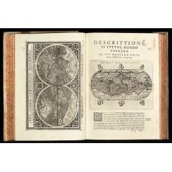
Epitome. Du Theatre du Monde d'Abraham Ortelius.
Third French text edition in an oblong format of this illustrated treatise of geography, which is considered as the first modern pocket-atlas. The atlas was printed by Pl...
Date: Antwerp, 1588
Selling price: ????
Please login to see price!
Sold in 2020
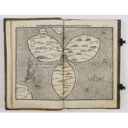
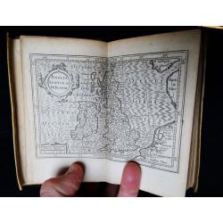
Itinerarium sacrae scripturae. . .
A relatively early edition of this famous book includes a world map in a cloverleaf (Shirley 142). The three principal continents, Europe, Asia, and Africa, are arranged ...
Date: Magdeburg, 1591
Selling price: ????
Please login to see price!
Sold in 2013
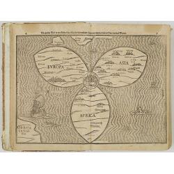
Itinerarium Sacrae Scripturae. Das ist: Ein Reisebuch uber die gantze heilige Schrifft. Zuvor gemehret mit einem Büchlein De monetis et mensuris. . .
The book includes a world map in the form of a clover leaf (Shirley 142). The three principal continents, Europe, Asia and Africa, are arranged in the form of a clover le...
Date: Magdeburg, P. Donat for A. Kirchner, 1592
Selling price: ????
Please login to see price!
Sold in 2009
Geografia cioe Descrittione Universale della Terra ... Nuovamente ... Rincontrati, & Corretti ... Gio. Ant. Magini ... Opera ... Tradotta dal R.D. Leonardo Cernoti
The first edition of Leonardo Cernoti's Italian translation of Ptolemy's Geografia based on the 1596 Latin edition of Magini published by G. B. & G. Galignani in 1597...
Date: Venice, 1597
Selling price: ????
Please login to see price!
Sold in 2011
Geografia di Claudio Tolomeo Alessandrino Tradotta di Greco nell'Idioma Volgare Italiano da Girolamo Ruscelli
Sixth edition of Ruscelli's translation of Ptolemy's Geografia edited and extended by Giuseppe Rosaccio published by the Hires of M. Sessa in 1598 and 1599.Illustrated wi...
Date: Venice, 1598
Selling price: ????
Please login to see price!
Sold in 2010
Geografia cioe Descrittione Universale della Terra ... Nuovamente ... Rincontrati, & Corretti ... Gio. Ant. Magini ... Opera ... Tradotta dal R.D. Leonardo Cernoti
The first edition of Leonardo Cernoti's Italian translation of Ptolemy's Geografia based on the 1596 Latin edition of Magini published by G. B. & G. Galignani in 1597...
Date: Venice, 1598
Selling price: ????
Please login to see price!
Sold in 2015
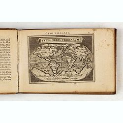
Epitome Theatri Orteliani, praecipuarum orbis regionum delineationes...
Latin pocket-size atlas of Ortelius' "Theatrum Orbis Terrarum", published for those who could not afford the expensive large atlases of the time. "A new se...
Date: Antwerp J.B., Vrients, 1601
Selling price: ????
Please login to see price!
Sold in 2020
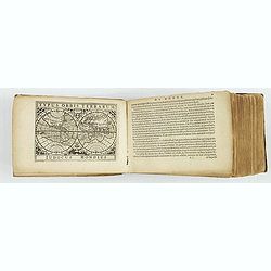
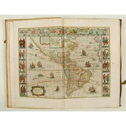
![Atlas - Tabularum geographicorum contractum libri quinque. [with 148 maps]](/uploads/cache/43919-250x250.jpg)
Atlas - Tabularum geographicorum contractum libri quinque. [with 148 maps]
Uncommon French text edition, published by Christoffle Goyot, in Leiden for Cornelis Claes. The Caert-Thresoor of 1598 set a new standard for minor atlases. Scholars like...
Date: Leiden, Christoffle Goyot, 1602
Selling price: ????
Please login to see price!
Sold in 2019
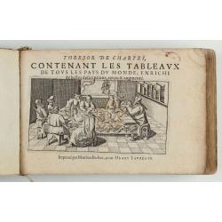
Thresor de Chartes, contenant les Tableaux de tous les Pays du Monde...
French text edition of the "Caert-Thresoor" first published in 1598, printed by Mattheaus BeckerII in Frankfurt am Main for Hendrick Laurensz, who succeeded his...
Date: Frankfurt am main, Matthias Becker for Hanry Laurentz, c. 1609
Selling price: ????
Please login to see price!
Sold in 2020
Atlas sive Cosmographicae Meditationes...
Latin text edition. With the Mercator-Hondius double portrait, inserted from 1613 in the various editions of the Atlas. "In the first decade of the seventeenth centu...
Date: Amsterdam, 1613
Selling price: ????
Please login to see price!
Sold
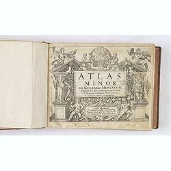
Atlas Minor. . .
Uncommon early French text-edition of this influential pocket atlas, published by Johannes Janssonius. The plates were executed by two of Holland's finest engravers, Abra...
Date: Amsterdam, 1613
Selling price: ????
Please login to see price!
Sold in 2012
Omnium Belgii, sive Inferioris Germaniae, Regionum Descriptio.
First edition in Latin of the oblong edition. Illustrated with 105 maps and views featuring Belgium, the Netherlands and the north of France. Variant without the genera...
Date: Arnhem, J. Jansson, 1616
Selling price: ????
Please login to see price!
Sold in 2019
Tabularum Geographicarum Contractarum
Third edition of this rare and influential pocket atlas. All maps are fine and dark impressions. World map engraved by J.Hondius (signed) is appearing twice; celestial ch...
Date: Amsterdam, J.Hondius, 1618
Selling price: ????
Please login to see price!
Sold
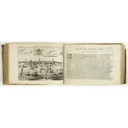
![Atlas Minor [Dutch edition]](/uploads/cache/08720-250x250.jpg)
Atlas Minor [Dutch edition]
Uncommon DUTCH text-edition of this influential pocket atlas, published by Johannes Janssonius. The plates were executed by two of Holland's finest engravers, Abraham Goo...
Date: Amsterdam, (1628) 1630
Selling price: ????
Please login to see price!
Sold in 2012
Carte Generalles des Royaumes & Provinces, de la haute et basse Allemagne, Reveües et Corigées, par le Sr. Tassin, Geographe Ordinaire de Sa Ma.té.
Illustrated with 51 (of 52) maps of The Netherlands, Belgiem, Germany, France, Poland, Bohemia...Christophe Tassin, who was active from 1633 till 1655, was appointed 'roy...
Date: Paris, [Sébastien Cramoisy], 1633
Selling price: ????
Please login to see price!
Sold in 2024
Archontologia Cosmica..
A first edition of this cosmographia by one of Germany most important publishers. The Archontologia Cosmica.. it was prepared by L.Gottfried.Illustrated with 65 copper en...
Date: Frankfurt 1638
Selling price: ????
Please login to see price!
Sold
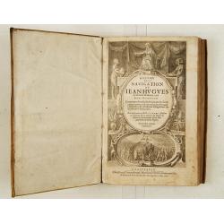
Histoire de la navigation.. aux Indes Orientales..
Incomplete copy of the last and most complete edition in French of this work that may be called the most important travel book of all periods. Unfortunately only 2 maps (...
Date: Amsterdam, 1638
Selling price: ????
Please login to see price!
Sold
Britannia, sive Florentiss. regnorum Angliae, Scotiae, Hiberniae, insularumq. adiacentium ex .
This miniature atlas is an abridged version of Camden's Brittania published by the Blaeu family in Amsterdam. It contains a total of 19 maps, with county maps taken from ...
Date: Amsterdam, 1639
Selling price: ????
Please login to see price!
Sold in 2018
Vierde Stuck der Aerdrycks-Beschryving, welck vervat Engelandt, i.e. Theatrum Orbis Terrarum. vol 4, England & Wales.
>An outstanding example of Joannes Blaeu's "Vierde Stuck der Aerdrycks-Beschryving, welck vervat Engelandt, i.e. Theatrum Orbis Terrarum": being volume 4, En...
Date: Amsterdam, 1648
Selling price: ????
Please login to see price!
Sold
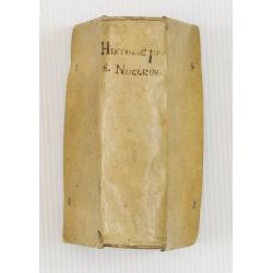
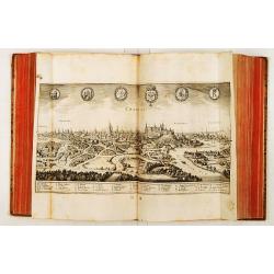
Historiae Universalis cum Sacraetum prophanae nucleus. . .
Charming universal history book with 15 charming wood cut engraved maps. The main copper engraved title page records Ulm under the title. This is the rare FIRST EDITION ...
Date: Ulm, Johannem Görlinum, 1650
Selling price: ????
Please login to see price!
Sold in 2008
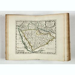
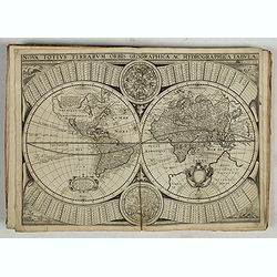
L'Asie En Plusieurs Cartes Nouvelles. . .
Apparently an unknown variant, maybe a state between 1652 and 1662. The title-page bears the date of the first edition (1652), the address of the second edition (B) missp...
Date: Paris, l'Autheur, 1652
Selling price: ????
Please login to see price!
Sold in 2017
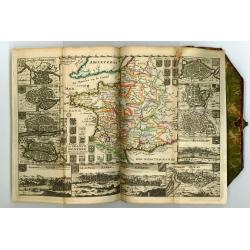
Theatre Geographiqiue de L'Europe. . .
Atlas illustrated with 57 double-page maps (of 60). Maps 24 (Bourgogne), 25 (Bresse) and 49 (Allemagne) are missing. The maps are numbered in ink in the upper right-hand ...
Date: Paris, 1653
Selling price: ????
Please login to see price!
Sold in 2019
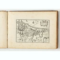
![[Atlas]](/uploads/cache/44057-250x250.jpg)
[Atlas]
>Early edition of Sanson’s atlas Cartes générales de toutes les parties du monde, before title page. Illustrated with 74 double page maps in original outline color...
Date: Paris, ca. 1655
Selling price: ????
Please login to see price!
Sold
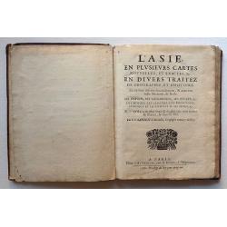
L'Asie en plusievers cartes nouvelles, et exactes, &c
17 copper-engraved double-page maps, outlined in contemp. color. Sheets measure: 27.3 x 36.5 cm. Plate images measure: approx. 20.0 x 26.0 cm., each map varying by a cm. ...
Date: Paris, Chez L'Autheur, rue S. Jacques, 1658
Selling price: ????
Please login to see price!
Sold in 2016
BIBLIA, dat is de gantsche H. Schrifture, vervattende alle de canonijcke boecken des Ouden en des Nieuwen Testaments.
Richly bound copy of the official Dutch 'Staten-Bijbel' after the Synod from Dordrecht. With engraved general title, 2 separate titles, 6 double-page engraved maps by Nic...
Date: Amsterdam, 1660
Selling price: ????
Please login to see price!
Sold
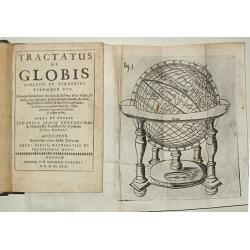
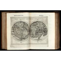
Tractatus de Globis coelesti et terrestri eorumque usu. Primum conscriptus a Roberto Hues Anglo atque iterum a Iudoce Hondio excusus?opera et studio J.I.Pontani?Adjicitur Brevarium totius orbis Terrarum Petri Bertii.
Small 8vo, 18 unnumb. leaves, 231 pp, old calf (rebacked). With 4 fold. engr. plates.First published in London in 1594 to accompany Emery Molyneux' globes. The text was r...
Date: Oxford, 1663
Selling price: ????
Please login to see price!
Sold
Douziéme volume de la Geographie Blavariane.. (America)
In 1662 Joan Blaeu published the most famous of his atlases, the 11-volume Atlas Major in Latin. In the following year editions in French , Dutch , Spanish and German edi...
Date: Amsterdam 1667
Selling price: ????
Please login to see price!
Sold
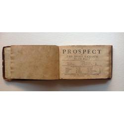
A Prospect of the Most Famous Parts of the World.
John Speed's miniature atlas, published in 1668, 3rd Edition. A rare edition that does not include the maps of British Isles. List of maps include: World map, Asia, Afric...
Date: Roger Rea, London, 1668
Selling price: ????
Please login to see price!
Sold in 2016
Cartes generales de la geographie ancienne et nouvelle ou les empires, monarchies, royaumes? Par les Sr. SANSON Geographes ordinaires de sa Majestè. TOME I. & II
The atlas has two printed title pages and two index sheets (the contents of the atlas does not correspond with the contents of the index sheets)Cartes generales de la geo...
Date: Paris Pierre Mariette, 1675
Selling price: ????
Please login to see price!
Sold
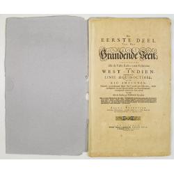
Het eerste deel van het Brandende Veen. . .
The text body of the extremely rare sea atlas by Arent Roggeveen, describing the American waters. The text pages have numerous figures of coastlines, plans, small town vi...
Date: Amsterdam, Pieter Goos, n.d. 1675 Amsterdam, Pieter Goos, n.d. 1675
Selling price: ????
Please login to see price!
Sold in 2008
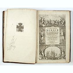
Le Grand & Nouveau Miroir ou Flambeau de la Mer.
Unrecorded french text edition. Engraved title-page, 32 double-page charts, 1 engraved text-chart of St.MALO, numerous woodcuts of astronomical diagrams, compass, geometr...
Date: Amsterdam, 1676
Selling price: ????
Please login to see price!
Sold

La Géographie Universelle contenant.
Edition unknown to Pastoureau.
Date: Paris, l'Auteur et Nicolas Langlois, 1682
Selling price: ????
Please login to see price!
Sold
La Géographie Universelle contenant. Les Descriptions, les cartes, et le Blason, des principaux Païs du Monde.
Rare pocket atlas of the world by Pierre Duval with the maps in original outlines colors (except for the China map) and the coats-of-arms and titles-pages beautifully emb...
Date: Paris, l'Auteur et Nicolas Langlois, 1682
Selling price: ????
Please login to see price!
Sold in 2017
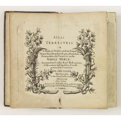
Atlas Terrestris: or a Book of Mapps of all the Empires, Monarchies, Kingdoms, Regions, . . . in the whole World.
One of a series of composite world atlases of varying contents published by John Seller (fl.1658-1698) from 1676 onwards and among one of the very earliest English world ...
Date: London: John Seller, [no date] c. 1684
Selling price: ????
Please login to see price!
Sold in 2010
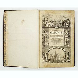
Le Grand & Nouveau Miroir ou Flambeau de la Mer..
A RARE EDITION of a French text edition of this fine Dutch Sea atlas of the West European waters with mostly plates originally engraved by Pieter Goos, who passed into th...
Date: Amsterdam, J. Robijn, 1684
Selling price: ????
Please login to see price!
Sold in 2015

A tutor to Astronomy and Geography. Or an easie and speedy way to know the Use of both the Globes, Celestial and Terestrial. With an appendix shewing the Use of the Ptolemaick Sphere. The fourth edition...
A tutor to Astronomy and Geography. Or an easie and speedy way to know the Use of both the Globes, Celestial and Terestrial. With an appendix shewing the Use of the Ptole...
Date: 4th edition, London, 1686
Selling price: ????
Please login to see price!
Sold
Memoires, historiques & geographiques du Royaume de la Moree, Negrepont, & des places maritimes jusques à Thessalonique. Recueillis & enrichis des cartes des païs & des plas des places.
First French translation and first Dutch edition of Vincenzo Maria Coronelli's (1650-1718) history of Greece, one of the basic source works on the Peloponnesus.On both co...
Date: Amsterdam, Wolfgang, Waesberge, Boom, Van Someren, 1686
Selling price: ????
Please login to see price!
Sold
Kurtze Beschreibung von dem Ursprung, Aufnehmen, Gebiete und Regierung der Weltberühmten Republick Venedig.
Short description of the origin, recording, and government areas of the world-famous “Venice Republick.” The first and only edition of this rare work. The copper eng...
Date: Nuremberg, 1686
Selling price: ????
Please login to see price!
Sold in 2015
Description de tout l'univers, en plusieurs Cartes, et en divers Traittez de Géographie et d'Histoire...
Very rare edition of this popular atlas by Nicolas Sanson, published by Arnout van Ravestein, in Amsterdam, in 1699.Pastoureau only mentions a Dutch version of Sanson's a...
Date: Amsterdam, Van Ravestein, 1699
Selling price: ????
Please login to see price!
Sold in 2018
Tabulae geographicae, quibus universa geographia vetus continetur
Fine historical atlas with 4 maps of the continents and 75 maps of the ancient world after Guillaume Sanson (1633-1703), Nicholas Sanson (1600-1667), Abraham Ortelius (15...
Date: Padua: Ex Typographia Seminarii, 1699
Selling price: ????
Please login to see price!
Sold in 2024
A System of Geography: or, a New & Accurate Description of the Earth in all its Empires, Kingdoms and States.
FIRST EDITION of Moll's important work with the title printed in red and black, 40 engraved maps, 2 full-page, small engraved map in text, 2 engraved solar diagrams. The...
Date: London, for A. and J. Churchill, 1701
Selling price: ????
Please login to see price!
Sold in 2014
Recueil des Voyages qui ont Servi a l'Etablissement et aux Progres de la Compagnie des Indes Orientales...
Very rare account of the Dutch voyages after Commelin. With title, 1 plate and 14 folding maps, including maps of Novaya Zemlya, Spitsbergen, Madagascar, St. Helena, Sout...
Date: Amsterdam, 1702
Selling price: ????
Please login to see price!
Sold in 2013
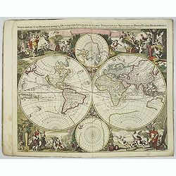
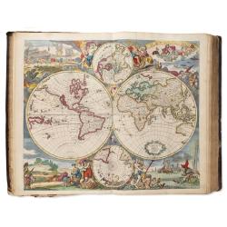
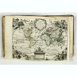
L'Atlas curieux ou le Monde réprésente dans des cartes. . .
The table is dated 1703.The atlas starts with a decorative engraved title page, followed by an engraving of globes, two celestials, two world maps , with maps of French p...
Date: Paris, 1703
Selling price: ????
Please login to see price!
Sold in 2024
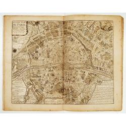
Atlas curieux Paris.
A fine series of 10 double page plans of Paris (c.450x530mm) showing the town's development during several ages. Prepared by Jean-Baptiste Bourguignon d' Anville,(1697-17...
Date: Paris 1705
Selling price: ????
Please login to see price!
Sold
Vues des villes de Londres, de Canterbury, de Colchester, et autres Lieux circonvoisins. - II. ... Vues des villes, edifices & autres choses remarquable de l'Escosse & d'Irlande. - III. and IV
Four books in one, printed Chez Pierre vander Aa, Leyden, Netherlands. Beautiful, very rare plate book of Great Britain in 6 parts with a total of 25 maps, and 216 pla...
Date: Leyden, 1707
Selling price: ????
Please login to see price!
Sold in 2023
Atlas Contractus sive Mapparum Geographicarum…
Rare variant of the first edition of Peter Schenk's "Sanson's atlas", compiled shortly after he had moved to the Vijgendam in 1706, hence the date "1706&qu...
Date: Amsterdam, 1708
Selling price: ????
Please login to see price!
Sold in 2024
LES TABLETTES GUERRIERES, OU CARTES CHOISIES POUR LA COMMODITE DES OFFICIERS.
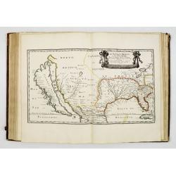
Most maps decorated with a borders showing town views and plans. The map of America with the island of California with an indented coastline and the place names R. d' Est...
Date: Amsterdam, 1709
Selling price: ????
Please login to see price!
Sold
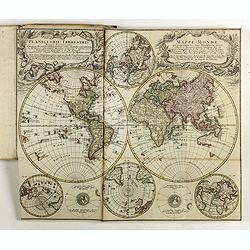
Nova totius geographica telluris projectio. . .
This is the first atlas of Gerard Valk, publisher, engraver and manufacturer of globes in Amsterdam. The latter joined in 1673 Petrus Schenck for the publication of maps....
Date: Amsterdam, ca. 1711
Selling price: ????
Please login to see price!
Sold in 2023
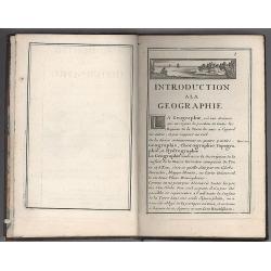
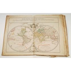
Introduction a la Geographie..
Second edition of this charming travel compendium. The title page illustrated with miniature world map in double hemisphere showing California as an island, with imprint ...
Date: Paris, 1717
Selling price: ????
Please login to see price!
Sold in 2008
Atlas
An important and rare atlas by the Danckerts family: containing 86 maps and double plates, most in color, titled in Latin, sometimes in Dutch or French: With an allegoric...
Date: Amsterdam, ca.1712-1717
Selling price: ????
Please login to see price!
Sold in 2025
Atlas with 19 maps, 2 Family trees and 3 historical tables.
Atlas including a double hemisphere world map, maps of Europe, Asia, Africa, North America (engraved by Cordier, showing California as an Island, based upon Sanson's land...
Date: Paris, 1719
Selling price: ????
Please login to see price!
Sold

Le Nouveau et Curieux Atlas Geographique et historique, ou Le Divertissement des Empereurs, Roys, et Princes. Tant dans la Guerre que dans la Paix. Dédié A Son A.R. Monseigneur le Duc d'Orléans Regent du Roîaume de France.
Charming world atlas with double hemisphere world and the North American map feature the Island of California. In Asia and the Pacific, Australia is incompletely mapped a...
Date: Paris, 1719
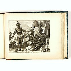
Habillemens de plusieurs nations représentez au naturel, en cent trente-sept belles figures.
Illustrated with a title page and 132 engraved plates of costumes (of 136) not following the numbering but grouped by countries.The plates showing various nations from al...
Date: Leiden, Pierre van der Aa, c. 1720
Selling price: ????
Please login to see price!
Sold in 2018
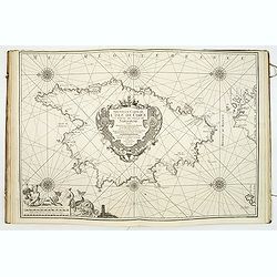
(Recueil de plans et ports de la Méditerranée).
Superb atlas of the Mediterranean containing 19 charts (including 1 double) engraved by Starckman, Coélemans, and B. Randon Hunting and mounted on heavy paper. Each char...
Date: Marseille, Laurent Brémond,1715-1726
Selling price: ????
Please login to see price!
Sold

Discours sur l'histoire universelle..
Three volumes with 26 maps, including the World and Continents, Israel, Middle sea area, Russia, Scandinavia,Denmark, Iceland,Poland, Britain, England, Scotland,Ireland,N...
Date: Amsterdam, 1730
Selling price: ????
Please login to see price!
Sold
![[Recueil de Voyages au Nord].](/uploads/cache/48310-250x250.jpg)
[Recueil de Voyages au Nord].
Extract from volume III of the "Recueil de Voyages au Nord", containing the reports of Linschoten's voyages, the first to the North through the Strait of Nassau...
Date: Amsterdam, Bernard, 1732
Selling price: ????
Please login to see price!
Sold in 2022
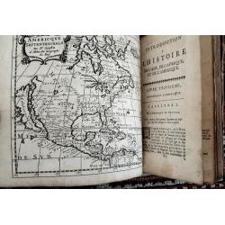
BRUZEN DE LA MARTINIERE: Introduction a l'histoire de l'Asie de l'Afrique et de l'Amérique.
Volume 2 (of 2) of his "Introduction a l'histoire de l'Asie de l'Afrique et de l'Amérique", complete with map of America, including a California as a island.Th...
Date: Amsterdam, Zacharie Chatelain, 1735
Selling price: ????
Please login to see price!
Sold in 2021
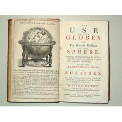
The Use of the Globes or The General Doctrine of the Sphere. To which is added a Synopsis of the Doctrine of Eclipses.
8vo, iv, 162, (2) p., old calf (slightly worn). With engr.front. and 29 fold. maps and plates.Plates includes advertisement of Senex' terrestrial and celestial globes, wo...
Date: London, J.Senex, 1740
Selling price: ????
Please login to see price!
Sold
A compleat Body of Ancient Geography both Sacred and Profane…
The third edition enlarged with eleven maps of Laurenberg and Blanchard. Atlas with 63 engraved maps. It includes 6 maps, in 7 sheets, making up a large map of the Holy L...
Date: The Hague, and sold by T.Osborne of London 1741
Selling price: ????
Please login to see price!
Sold in 2024
![Atlas général. [Composite atlas].](/uploads/cache/49062-250x250.jpg)
Atlas général. [Composite atlas].
ROBERT DE VAUGONDY, Gilles / SANSON, N. / JAILLOT, H. / BAILLIEU(L), Gaspard; ATLAS CONSISTING OF MOST OF THE EARLIEST PUBLISHED MAPS BY GILLES ROBERT DE VAUGONDY, 1720-1...
Date: Paris, ca.1743
Selling price: ????
Please login to see price!
Sold in 2024
Le Neptune Oriental ou Routier Général des Côtes des Indes Orientales et de la Chine...
First edition. - D'Après de Mannevillette (1707-1780) was a famous French sailor and hydrographer. During a voyage to China in 1728 he succeeded in correcting the latitu...
Date: Paris, Jean-François Robustel, 1745
Selling price: ????
Please login to see price!
Sold in 2011
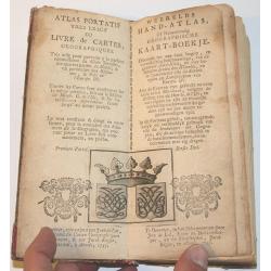
Atlas Portatif.
Small hand atlas of the world with 33 of 34 maps. Map nr. 4 (De Nieuwe en Ouden Oppervlakke en Doorzigtkundige Aardryks Bollen) is missing. The title page and register ar...
Date: Almelo, 1747
Selling price: ????
Please login to see price!
Sold in 2013
(Atlas with 23 maps by Homann)
Homann composite atlas including a double-hemispherical world map, continental maps of Europe, Africa and Asia, and region specific maps of most European countries, like ...
Date: Nuremberg, 1748
Selling price: ????
Please login to see price!
Sold in 2019
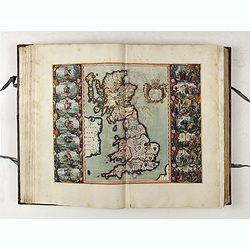
Geographia Magnae Britanniae Or, Correct Maps Of All The Counties In England, Scotland, And Wales; With General Ones Of Both Kingdoms, And Of The Several Adjacent Islands
We believe this to be the 1st edition. A subsequent edition had the caption in the bottom left-hand corner of the title page with the following names: T. Osborne, D. Brow...
Date: London, 1748
Selling price: ????
Please login to see price!
Sold in 2023
Atlas nouveau portatif à l'usage des militaires et du voyageur.
>Charming atlas with an engraved title, and 91 numbered and engraved double-page maps in orginal out line colors. The atlas starts by 36 pages text entitled 'Introduct...
Date: Paris, Le Rouge, Prault, Veuve Robinot, Briasson, 1756
Selling price: ????
Please login to see price!
Sold in 2022
Allgemeine Historie der Reisen zu Wasser und zu Lande: oder Sammlung aller Reisebeschreibungen, welche bis itzo in verschiedenen Sprachen von allen Volkernherausgegeben worden. . .
Collection of travel exploration of South and North America. With 19 copperengravings (10 folded maps). The maps of N. Bellin showing: (1) South-American continent, (2) G...
Date: Leipzig, 1757
Selling price: ????
Please login to see price!
Sold in 2009
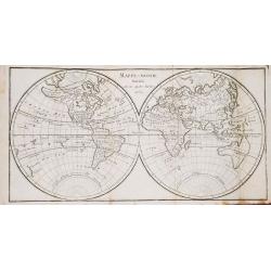
Dictionaire Géographique Universel, ou Description des Royaumes, Provinces, Villes... etc.
A very fine copy of Vosgien's geographical dictionary with a world map in two hemispheres and a map of Europe.
Date: Paris, 1759
Selling price: ????
Please login to see price!
Sold in 2019
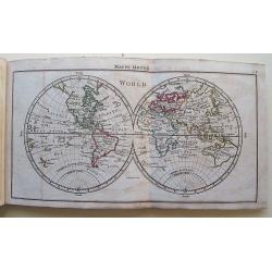
A New, General, and Universal Atlas...
Published by A. Dury, Robert Sayer & Carrington Bowles; oblong 12mo; engraved title, dedication plus 39 Copper Engraved Maps (Complete) Incl 6 folding. The folding ma...
Date: London, 1761
Selling price: ????
Please login to see price!
Sold in 2016
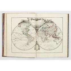
![Atlas Méthodique et Elémentaire de Geographie et d'histoire Dedie a Monsieur le President Henault. [4 volumes]](/uploads/cache/49026A-250x250.jpg)
Atlas Méthodique et Elémentaire de Geographie et d'histoire Dedie a Monsieur le President Henault. [4 volumes]
This is a very fine, typical French atlas, complete in its four volumes and very nice contempt. calf binding. It is in its rare first edition. The first edition of this a...
Date: Paris, 1761
Selling price: ????
Please login to see price!
Sold in 2024
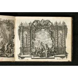
Atlas moderne ou collection de cartes sur toutes les parties du globe terrestre par plusieurs auteurs.
Typical 18th century French atlas, including maps by Janvier, Rizzi Zannoni and Bonne. Decorative title page: two women holding the title in a large drape, the page is fi...
Date: Paris, Lattré, 1762
Selling price: ????
Please login to see price!
Sold
Atlas Geographicus portatilis XXIX mappis orbis habitabilis regna exhibens ... Kurzgefasste Geographie
Pocket atlas of T. Lotter and T. Lobeck. Bound with "Kurzgefasste Geographie" of Lobeck. With one world map, one celestial map, 4 continents and 37 european map...
Date: Augsburg, 1762
Selling price: ????
Please login to see price!
Sold in 2010
