Please login to see price!.
Subscribe to be notified if similar examples become available.
Le Grand & Nouveau Miroir ou Flambeau de la Mer.. |
||||||||||||||||||||
|
||||||||||||||||||||
|
|
||||||||||||||||||||
|
Selling price: $...
Please login to see price! Sold in 2015 Missed this item! Be the first to get notified about our newly added listings. Add your name to our mailing list. Feel free to contact us if you have a question about this item. |
Virtual Collection - Save and collect this or any of your favorite items in one place.
If you want to save the items permanently, please sign in or create account first. |
|||||||||||||||||||
Description
A RARE EDITION of a French text edition of this fine Dutch Sea atlas of the West European waters with mostly plates originally engraved by Pieter Goos, who passed into the hands of J.Robijn. The atlas contains charts with updated addresses, dates, and some newly engraved plates for Jacob Robijn. Engraved title-page, 32 double-page charts, 2 engraved text-charts of St.MALO and D'OLLONNE, numerous woodcuts of astronomical diagrams, compass, geometrical instruments, and coastal lines, as well 1 volvelle in the text. With an Almanac from 1683-1691.
Chart of "Gallissien" bound upside down. Several charts cropped in the plate, internally paper very slightly browned as usual. Generally very good.
Pieter Goos' sea-atlas reflects a high professional standard The De Nieuwe Groote Zee-Spiegel follows the prototype of pilot guides, opening with an introduction into navigation, followed charts of the coasts west and south from the Netherlands. A chapter with sailing directions is devoted to each section of the coastline. Double-page charts accompany it, and woodcut coastal profiles are interspersed throughout the text. (Koeman IV, p. 192).In or shortly after 1680, Robijn obtained the plates and the rights of Pieter Goos's Zee-Spiegel. He reissued both the Dutch and English editions and obtained a privilege in 1686. In 1970 prof. Koeman wrote: Although Robijn states in his preface that he printed this work in three languages: Dutch, English, and French, apart from part V, no copy of a French edition is known to exist."
Our example has a privilege dated 29 May 1680. The title page of our example is dated 1684. However, the chart of the "Zuyder-Zee" bears the date 1686, and "De Texel Stroom" is bearing the date 1687. This atlas must have been published in or after 1686/7 as the volvelle op page 11 in " Instruction en l'art de Navigation" has been composed of a cut-out from a sheet of paper with English text on the verso. An English text version was printed in 1686.
The text is a translation by Paul Yvounet and is similar to another antique map of unrecorded 1676 edition currently in stock. The woodblocks are the same, now with an updated Almanac (here for 1683-1691), and only one volvelle is included. This example has a Privilege, and there are many differences in the included charts.
Many charts were printed from copper plates engraved by Pieter Goos; however, most of them have re-worked coastlines, soundings, and the engraving refreshed, resulting in darker impressions compared to the 1676 edition. The chart of the "Zuyder-Zee" bearing the date 1686. "De Texel Stroom," bearing a date of 1687. "Rivier van Bordeaux" is a newly engraved plate with the signature of J.Robijn.
"De Custen van Schotland met de Eylanden van Orcanese..", "Eylanden van Hitlant. . ." with signature of Jacob Theunisz op 't water inde Lootsman. "de Cust van Engeland tusschen Welles en 't Eyland Cogge. . ." with signature of Jacobus en Casparus Lootsman op 't water inde Lootsman.
Contents : engraved title, privilege, Instruction en l'art de Navigation, Almanach (1-32) Le premier Livre (pp. 1-34); Le deuxiesme Livre (pp.35-76). Le troiziéme Livre (pp.77-114). Le quatriéme Livre (pp.115-224).
The composition of the French edition is entirely different from the Dutch and English editions. It contains the Western Navigation with charts and descriptions of Great Britain, The Netherlands, Belgium, France, Portugal, Spain, Coast of Morocco with the Canary Islands, and 2 charts on a text sheet.
The translation into French is by Paul Yvounet.
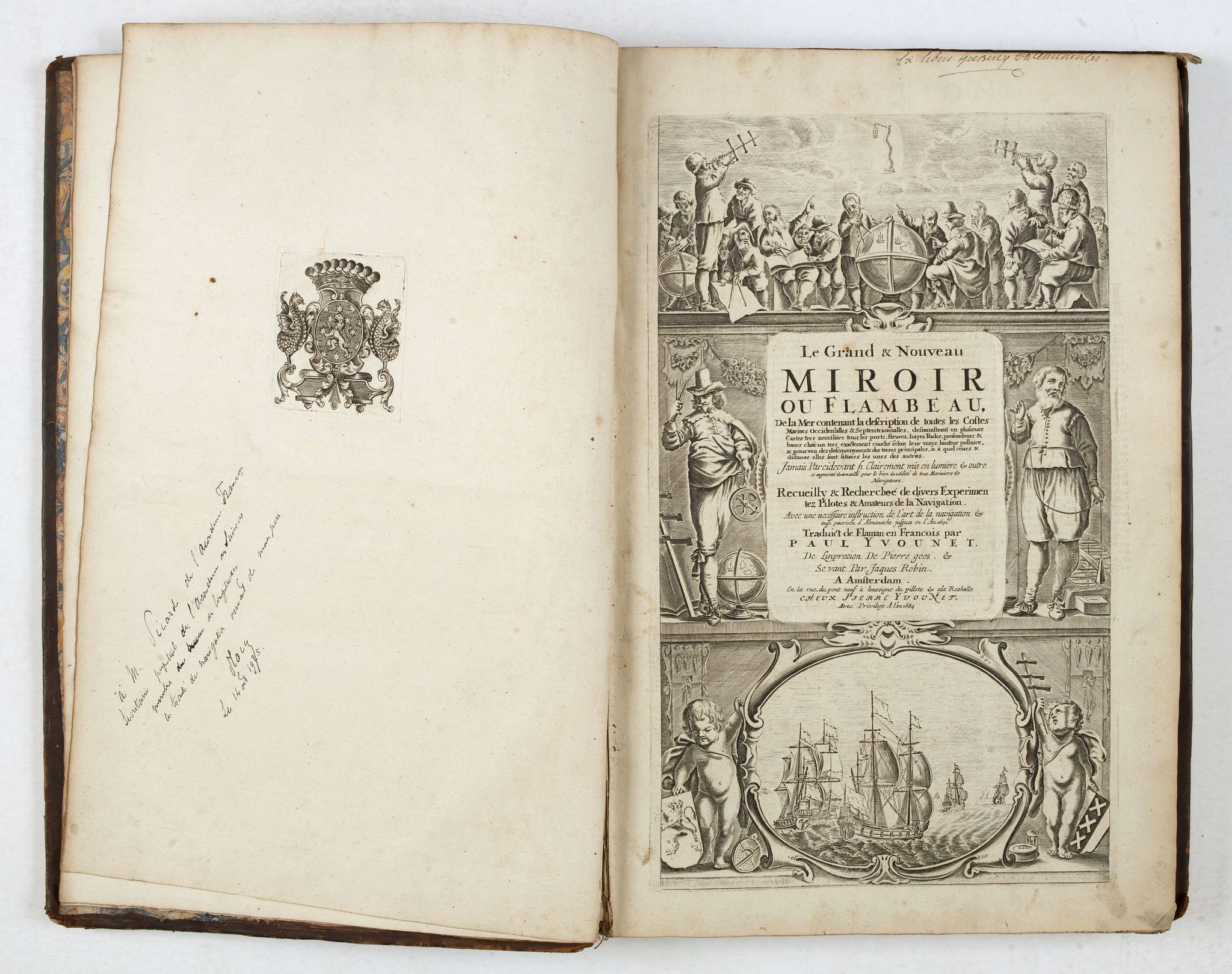
Very decorative engraved frontispiece with printed title. Three large vessels are in the foreground and two smaller ones in the distance in the lower part.
The old Pieter Goos title page has been used, but the inner text panel for the title has been covered before printing, and the following title is now printed from a different copper plate on this place. "GRAND & NOUVEAU MIROIR OU FLAMBEAU DE LA MER contenant la description de toutes les costes marines occidentales & septentrionales... recueilly & recherché de divers expérimentez pilotes & amateurs de la navigation. Traduict de Flaman en François par Paul Yvounet. Amsterdam, “ de linprecion de Pierre Goos & se vant par, Jacques Robin. A Amsterdam En la rue du pontneuf à lenseigne du pillote & a la rochelle CHEUX PIERRE YVOUNET. Avec Privilege A l'an 1684."
Apparently, the atlas was also for sale in the bookshop of the La Rochelle based booksellers Pierre and Paul Yvounet.
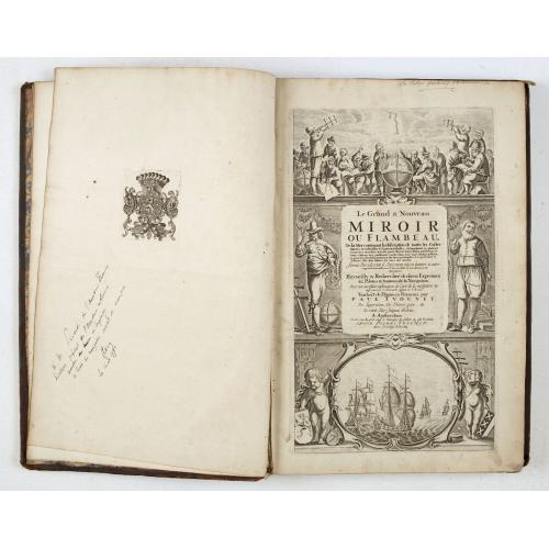
Provenance: Baron Quinette de Rochemont, (1838-1908) with his bookplate.
Appointed engineer in 1862 and Deputy General Secretariat of the Council of Civil Engineering. He was in charge of the port of Le Havre work, a position he held until 1879. In 1870, he distinguished himself as captain of Engineering of the National Guard and improvised lines of defense. Appointed chief engineer in 1879, he resided in Valenciennes, where he conducts studies on the connecting channel of the Scheldt to the Meuse. From 1892 to his death, he was in charge of the department of Marine Works of the School of Civil Engineering, He published “Cours de travaux maritimes professé à l'École nationale des ponts et chaussées. (Paris, C. Béranger, 1900). He was also a founder of the “l’Association Internationale des Congrès de Navigation.
Reference: Koeman does not mention a French text edition by Robijn. WorldCat mentions copies in California State Library - Sutro Library and BNF.
Chart of "Gallissien" bound upside down. Several charts cropped in the plate, internally paper very slightly browned as usual. Generally very good.
Pieter Goos' sea-atlas reflects a high professional standard The De Nieuwe Groote Zee-Spiegel follows the prototype of pilot guides, opening with an introduction into navigation, followed charts of the coasts west and south from the Netherlands. A chapter with sailing directions is devoted to each section of the coastline. Double-page charts accompany it, and woodcut coastal profiles are interspersed throughout the text. (Koeman IV, p. 192).In or shortly after 1680, Robijn obtained the plates and the rights of Pieter Goos's Zee-Spiegel. He reissued both the Dutch and English editions and obtained a privilege in 1686. In 1970 prof. Koeman wrote: Although Robijn states in his preface that he printed this work in three languages: Dutch, English, and French, apart from part V, no copy of a French edition is known to exist."
Our example has a privilege dated 29 May 1680. The title page of our example is dated 1684. However, the chart of the "Zuyder-Zee" bears the date 1686, and "De Texel Stroom" is bearing the date 1687. This atlas must have been published in or after 1686/7 as the volvelle op page 11 in " Instruction en l'art de Navigation" has been composed of a cut-out from a sheet of paper with English text on the verso. An English text version was printed in 1686.
The text is a translation by Paul Yvounet and is similar to another antique map of unrecorded 1676 edition currently in stock. The woodblocks are the same, now with an updated Almanac (here for 1683-1691), and only one volvelle is included. This example has a Privilege, and there are many differences in the included charts.
Many charts were printed from copper plates engraved by Pieter Goos; however, most of them have re-worked coastlines, soundings, and the engraving refreshed, resulting in darker impressions compared to the 1676 edition. The chart of the "Zuyder-Zee" bearing the date 1686. "De Texel Stroom," bearing a date of 1687. "Rivier van Bordeaux" is a newly engraved plate with the signature of J.Robijn.
"De Custen van Schotland met de Eylanden van Orcanese..", "Eylanden van Hitlant. . ." with signature of Jacob Theunisz op 't water inde Lootsman. "de Cust van Engeland tusschen Welles en 't Eyland Cogge. . ." with signature of Jacobus en Casparus Lootsman op 't water inde Lootsman.
Contents : engraved title, privilege, Instruction en l'art de Navigation, Almanach (1-32) Le premier Livre (pp. 1-34); Le deuxiesme Livre (pp.35-76). Le troiziéme Livre (pp.77-114). Le quatriéme Livre (pp.115-224).
The composition of the French edition is entirely different from the Dutch and English editions. It contains the Western Navigation with charts and descriptions of Great Britain, The Netherlands, Belgium, France, Portugal, Spain, Coast of Morocco with the Canary Islands, and 2 charts on a text sheet.
The translation into French is by Paul Yvounet.
Very decorative engraved frontispiece with printed title. Three large vessels are in the foreground and two smaller ones in the distance in the lower part.
The old Pieter Goos title page has been used, but the inner text panel for the title has been covered before printing, and the following title is now printed from a different copper plate on this place. "GRAND & NOUVEAU MIROIR OU FLAMBEAU DE LA MER contenant la description de toutes les costes marines occidentales & septentrionales... recueilly & recherché de divers expérimentez pilotes & amateurs de la navigation. Traduict de Flaman en François par Paul Yvounet. Amsterdam, “ de linprecion de Pierre Goos & se vant par, Jacques Robin. A Amsterdam En la rue du pontneuf à lenseigne du pillote & a la rochelle CHEUX PIERRE YVOUNET. Avec Privilege A l'an 1684."
Apparently, the atlas was also for sale in the bookshop of the La Rochelle based booksellers Pierre and Paul Yvounet.
Provenance: Baron Quinette de Rochemont, (1838-1908) with his bookplate.
Appointed engineer in 1862 and Deputy General Secretariat of the Council of Civil Engineering. He was in charge of the port of Le Havre work, a position he held until 1879. In 1870, he distinguished himself as captain of Engineering of the National Guard and improvised lines of defense. Appointed chief engineer in 1879, he resided in Valenciennes, where he conducts studies on the connecting channel of the Scheldt to the Meuse. From 1892 to his death, he was in charge of the department of Marine Works of the School of Civil Engineering, He published “Cours de travaux maritimes professé à l'École nationale des ponts et chaussées. (Paris, C. Béranger, 1900). He was also a founder of the “l’Association Internationale des Congrès de Navigation.
Reference: Koeman does not mention a French text edition by Robijn. WorldCat mentions copies in California State Library - Sutro Library and BNF.
FAQ - Guarantee - Shipping
Buying in the BuyNow Gallery
This item is available for immediate purchase when a "Add to Cart" or "Inquire Now" button is shown.
Items are sold in the EU margin scheme
Payments are accepted in Euros or US Dollars.
Authenticity Guarantee
 We provide professional descriptions, condition report (based on 45 years experience in the map business)
Paulus Swaen warrants the authenticity of our items and a certificate of authenticity is provided for each acquired lot.
Condition and Coloring
We indicate the condition of each item and use our unnique HiBCoR grading system in which four key items determine a map's value: Historical Importance, Beauty, Condition/Coloring and Rarity.
Color Key
We offer many maps in their original black and white condition. We do not systematically color-up maps to make them more sellable to the general public or buyer.
Copper engraved or wood block maps are always hand colored. Maps were initially colored for aesthetic reasons and to improve readability. Nowadays, it is becoming a challenge to find maps in their original colors and are therefor more valuable.
We use the following color keys in our catalog:
Original colors; mean that the colors have been applied around the time the map was issued.
Original o/l colors; means the map has only the borders colored at the time of publication.
Colored; If the colors are applied recently or at the end of the 20th century.
Read more about coloring of maps [+]
Shipping fee
A flat shipping fee of $ 30 is added to each shipment by DHL within Europe and North America. This covers : International Priority shipping, Packing and Insurance (up to the invoice amount).
Shipments to Asia are $ 40 and rest of the world $50
We charge only one shipping fee when you have been successful on multiple items or when you want to combine gallery and auction purchases.
Read more about invoicing and shipping
FAQ
Please have a look for more information about buying in the BuyNow gallery
Many answers are likely to find in the general help section.
Virtual Collection
![]()
With Virtual Collection you can collect all your favorite items in one place. It is free, and anyone can create his or her Virtual map collection.
Unless you are logged in, the item is only saved for this session. You have to be registed and logged-in if you want to save this item permanently to your Virtual Collection.
Read More[+]
Register here, it is free and you do not need a credit card.
Add this item to
Virtual Collection
or click the following link to see my Virtual Collection.
| Digital Image Download | |
|
Paulus Swaen maintains an archive of most of our high-resolution rare maps, prints, posters and medieval manuscript scans. We make them freely available for download and study. Read more about free image download |
Click the image for a free small image download. |
In accordance with the EU Consumer Rights Directive and habitually reside in the European Union you have the right to cancel the contract for the purchase of a lot, without giving any reason.
The cancellation period will expire 14 calendar days from the day after the date on which you or a third party (other than the carrier and indicated by you) acquires, physical possession of the lot. To exercise the right to cancel you must inform Paulus Swaen Inc, of your decision to cancel this contract by a clear statement (e.g. a letter sent by post, or e-mail (amsterdam@swaen.com).
To meet the cancellation deadline, it is sufficient for you to send your communication concerning your exercise of the right to cancel before the cancellation period has expired.
