Browse Listings in Atlases
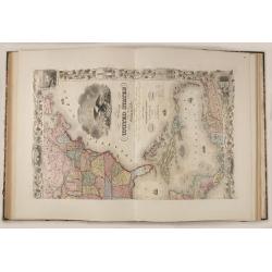
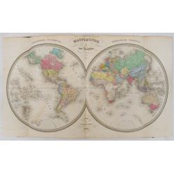
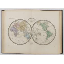
Atlas de Choix ou Recueil des Meilleures Cartes de Geographie Ancienne et Moderne.
Illustrated with 27 engraved single sheet maps and 33 double-page map sheets of which 7 are 2 or 4-sheet maps all with original hand-coloring. Including hand-colored tabl...
Date: Paris, c. 1860
Selling price: ????
Please login to see price!
Sold
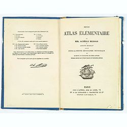
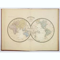
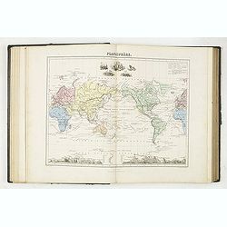
Petit Atlas Elementaire.
A small French mid-nineteenth century atlas, complete with 8 double page maps: Mappe Monde (twin hemi), Europe, Europe Centrale, Asie, Afrique, Amerique (Nord et Sud), Oc...
Date: Paris ca 1860
Selling price: ????
Please login to see price!
Sold in 2019
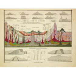
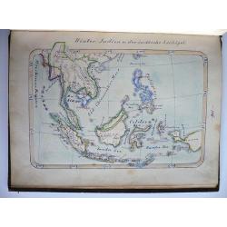
Atlas zu Alexander von Humboldt's Kosmos.
Folio, oblong. In the original 8 instalments, in original covers (sl. dam.). With 39 col. maps and 3 tables with 31 steelengravings. In new slipcase.The popular edition o...
Date: Stuttgart, T. Bromme, 1860-1861
Selling price: ????
Please login to see price!
Sold
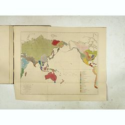
Six ethnographical maps illustrative of The Natural History of Man . . .
This atlas of six ethnographical maps were intended as a companion to Prichard's Natural History of Man, originally published in 1843, and the expanded five-volume editio...
Date: London and New York: H. Baillière, 1861
Selling price: ????
Please login to see price!
Sold in 2017
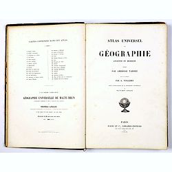
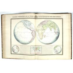
Atlas Universel de Geographie Ancienne et Moderne. . .
FULL TITLE: Ambroise Tardieu. Atlas universel de géographie ancienne et moderne, dresse par Ambroise Tardieu, revu et corrige´par A. Vuillemin, pour l'intelligence de l...
Date: Paris, 1861
Selling price: ????
Please login to see price!
Sold in 2019
Atlas Sphéroïdal et Universel de Géographie. Dressé à l'aide des documents officiels, récemment publiés en France et à l'étranger.
World atlas divided in 6 sections : World and spheres, Europe, Asia, Africa, America and Oceania, Illustrated with 63 maps in original colors, 22 double-page maps and 41 ...
Date: Paris, Veuve Jules Renouard, 1862
Selling price: ????
Please login to see price!
Sold in 2024
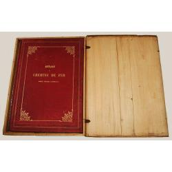
Atlas des Chemins de Fer.
Fine and curious atlas showing the rail road systems of France, Europe, England, United States, Russia, Germany, Italy, Spain, Algeria and the different regions in France...
Date: Paris 1863
Selling price: ????
Please login to see price!
Sold
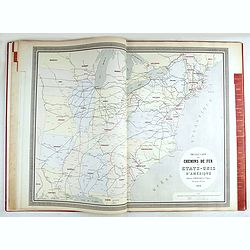
Atlas des Chemins de Fer.
Fine and curious atlas showing the rail road systems of France, Europe, England, United States, Russia, Germany, Italy, Spain, Algeria and the different regions in France...
Date: Paris, 1863
Selling price: ????
Please login to see price!
Sold in 2023
Atlas usuel de Géographie Moderne…
Complete with title page, contents page, and all 32 double-page maps of European and regional maps of the world, including Oceania, the Americas, Asia, Africa, etc. All i...
Date: Paris, c. 1865
Selling price: ????
Please login to see price!
Sold in 2024
Manuscript geography book on Asia, Africa, America and Australia with hand drawn maps
Manuscript Geography book/ Atlas, entitled: Geographie von Asien, Afrika, Amerika und Australien. Large 8vo. 152 numbered pages, with 8 full page maps (Asia, North Americ...
Date: Wurzburg, 1874
Selling price: ????
Please login to see price!
Sold in 2010
Atlas Geographie Moderne Physique et Politique. . .
The 1875 edition of Brue's Atlas Geographie Moderne Physique et Politique, complete with title page, contents page and all 21 folding maps of European and regional maps o...
Date: Paris, 1875
Selling price: ????
Please login to see price!
Sold in 2018
Atlas de Géographie Physique, Politique, Ancienne et Moderne contenant les cartes générales et particulières toutes les parties du Monde.
Complete with title page, contents page, and all 35 double-page maps of European and regional maps of the world, including Oceania, the Americas, Asia, Africa, etc. All i...
Date: Paris, 1875
Selling price: ????
Please login to see price!
Sold in 2024
Grand Atlas Universel, troisième édition.
William Hughes Grand Atlas Universel, troisième édition, illustrated with 51 color-printed double-page maps, including 2 world maps, with one original hand-colored map ...
Date: Paris, J. Rothschild, 1877-1878
Selling price: ????
Please login to see price!
Sold
Géographie Universelle, Atlas Migeon ... Géographes Historique, Scientifique, Industriel et Commercial. . .
Early edition of this popular French atlas with 42 engraved and hand-colored double-page maps, many with insets and/or engraved vignettes, decorative double-page title pa...
Date: Paris, 1878
Selling price: ????
Please login to see price!
Sold in 2015
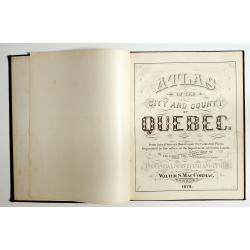
Atlas of the city and county of Quebec from actual surveys, based upon the cadastral plans deposited in the office of the Department of Crown Lands.
This scarce city atlas of Quebec is illustrated with 18 hand-colored maps made by Henry Whitmer, 1838-1920. The atlas contains 12 maps of Parishes, 5 maps of Quebec by ...
Date: Provincial Surveying and Pub. Co., Walter, S, MacCormac, manager,1879
Selling price: ????
Please login to see price!
Sold in 2023
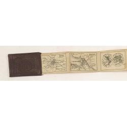
Russian Miniature Atlas
Charming miniature Russian atlas of the world. Blind stamped red linen cover and 20 maps and plans in leporello form. Including a plan of Moscow, St. Petersburg, world, E...
Date: Russia, c.1880
Selling price: ????
Please login to see price!
Sold in 2010
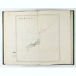
内務省地理局 (Administratif atlas of the Empire of Japan.)
Atlas of Japan published by the Home Ministry shortly after the start of Meiji period. The atlas contains 16 double page maps, with the border in original out line colors...
Date: Tokyo, Meiji 14 or 1881
Selling price: ????
Please login to see price!
Sold in 2025
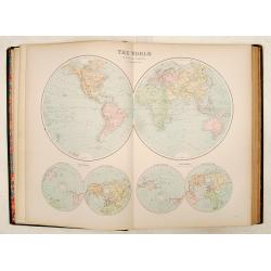
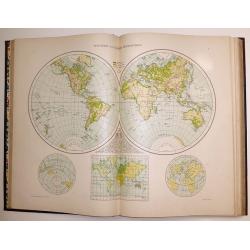
The Comprehensive Atlas & Geography of the World 1882 Blackie & Son
The full title of the atlas: 'The Comprehensive Atlas & Geography of the World comprising An Extensive Series of Maps, A Description, Physical and Political of all th...
Date: Glasgow, 1882
Selling price: ????
Please login to see price!
Sold in 2016
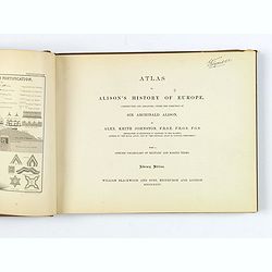
Alison's History of Europe.
An atlas with frontispiece, 108 battle and siege plans and maps, with 16 pp. lithographic explanation of Military Signs and Illustrations of Modern Fortification.Quarto s...
Date: Edinburgh, London, 1885
Selling price: ????
Please login to see price!
Sold in 2018
![[Atlas] Report of the Royal Commission on The Land Law (Ireland) Act, 1881, & The Purchase of Land (Ireland) Act, 1885,](/uploads/cache/43202-250x250.jpg)
[Atlas] Report of the Royal Commission on The Land Law (Ireland) Act, 1881, & The Purchase of Land (Ireland) Act, 1885,
The Land Acts were a series of measures to deal with the question of peasant proprietorship of land in Ireland in the nineteenth and twentieth centuries. Five such acts w...
Date: London, 1887
Selling price: ????
Please login to see price!
Sold in 2019
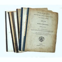
Atlas des ports étrangers. (Complete set of six volumes)
Six volumes, large 4°. First volume: 25 plates, 2nd volume: 24 plates, third volume: 25 plates, fourth volume: 24 plates, 5th volume: 23 plates, 6th volume: 13 plates: i...
Date: Paris, Imprimerie Nationale 1884-1886-1887-1888-1889-1890
Selling price: ????
Please login to see price!
Sold in 2014
The Universal Atlas published for The Atlas Publishing Company .
Published in London by Cassell and Company Ltd, London, Paris & Melbourne in 1893. A highly detailed Atlas of the World, in a folio size - illustrated with 117 colore...
Date: London, 1893
Selling price: ????
Please login to see price!
Sold in 2016
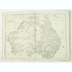
Chinese School world atlas.
School world atlas containg two world maps in double hemisphere and Mercator projection and maps of all parts of the world. Good section on maps of Australia and Pacific.
Date: Beijing, ca.1900
Selling price: ????
Please login to see price!
Sold in 2012
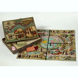
Le Tour du Monde en 80 jours d'après Jules Verne.
Goose game. World tour in 80 days according to Jules Verne's novel. Cardboard game box, with chromolithographed title plate, size 257 x 335 x 40mm, containing a tray, chr...
Date: Paris, ca. 1915
Selling price: ????
Please login to see price!
Sold in 2022
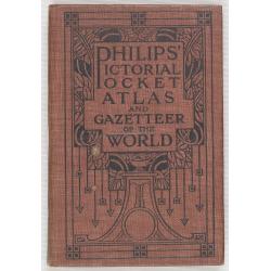
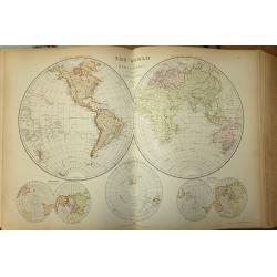
Philips' Pictorial Pocket Atlas and Gazeteer of the World.
A well-preserved copy of this charming little World-Atlas, not only interesting because of its clear maps and statistical diagrams, but also for its War Supplement. With ...
Date: London, Philips, c.1920
Selling price: ????
Please login to see price!
Sold in 2010

Die Karte Spricht! 30 bunte Bildkarten zur Erdkunde unseres Vaterlandes.
This unusual booklet, with 30 maps printed in attractive crude offset lithograph, were made in Wroclaw (Breslau), today Poland, but in 1930s, a part of Germany and beside...
Date: Breslau, Heinrich Handel, ca. 1935
Selling price: ????
Please login to see price!
Sold in 2018
![[ Facsimile] BLAEU, J. - Le grand atlas ou cosmographie Blauiana. (Atlas major).](/uploads/cache/16987-250x250.jpg)
[ Facsimile] BLAEU, J. - Le grand atlas ou cosmographie Blauiana. (Atlas major).
Facsimile of the original French edition of Joan Blaeu's Atlas Major, 1663. Printed in Amsterdam, by N.V. Theatrum Orbis Terrarum, 1967-68.12 volumes with 609 double-pag...
Date: Amsterdam 1968
Selling price: ????
Please login to see price!
Sold in 2008
