Please login to see price!.
Subscribe to be notified if similar examples become available.
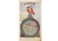
Atlas |
||||||||||||||||||||
|
||||||||||||||||||||
|
|
||||||||||||||||||||
|
|
Virtual Collection - Save and collect this or any of your favorite items in one place.
If you want to save the items permanently, please sign in or create account first. |
|||||||||||||||||||
Description
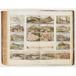
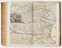
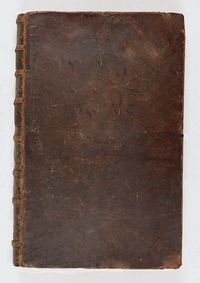
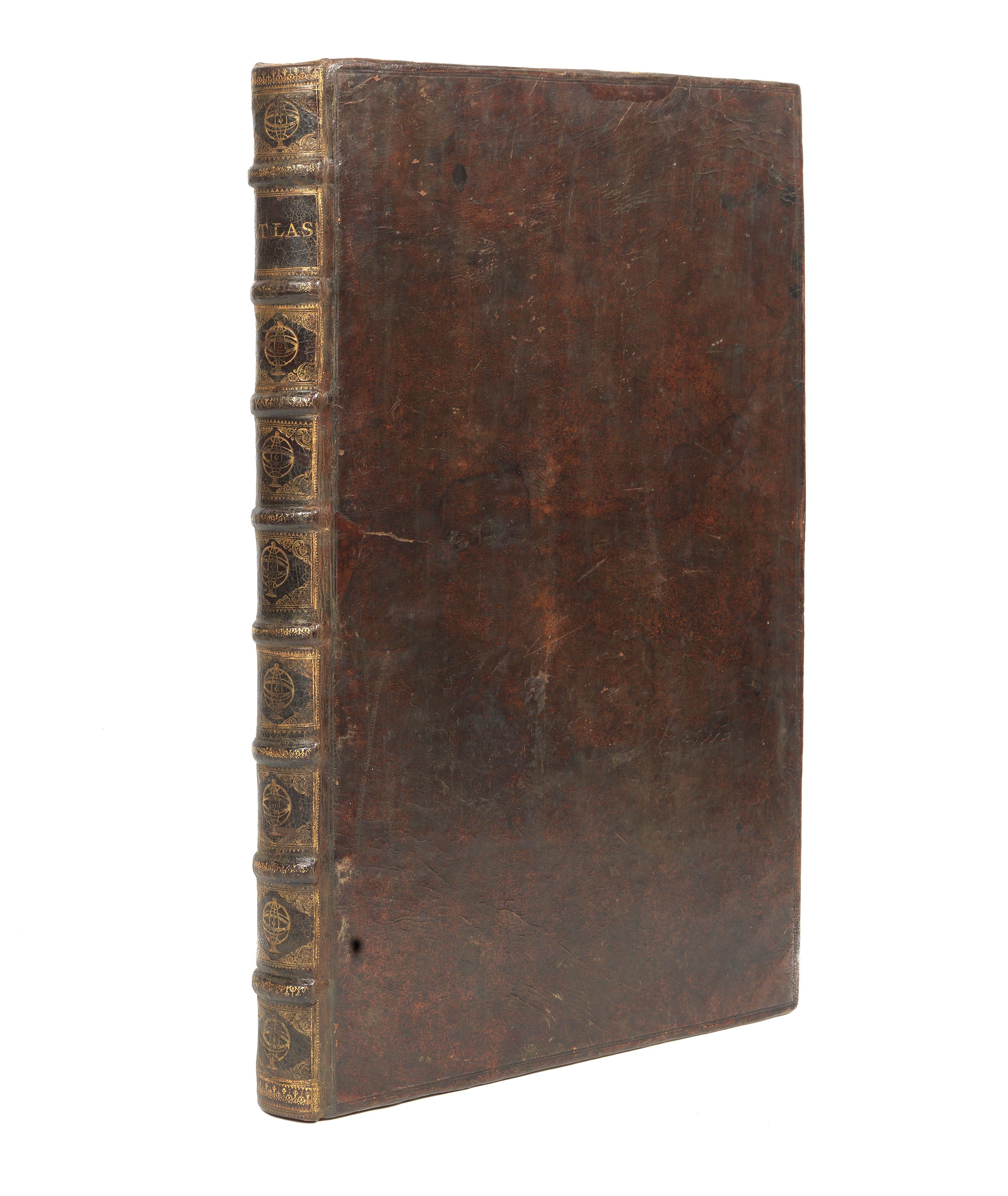
An important and rare atlas by the Danckerts family: containing 86 maps and double plates, most in color, titled in Latin, sometimes in Dutch or French: With an allegorical title (in second state, circa 1701-1705) with some marginal browning.Large Folio. Contemporary brown calf, spine ribbed and decorated in gold. (restored). Engraved title page, seventy-seven maps, six plates, two spheres. There is no index.
The maps are signed by Justus, Theodorus, Johannes, or Cornelis Danckerts (except for one by Frederik de Wit and three without names).Â
Cornelis II published the atlas between 1712 and 1717. With its extensive content of 86 maps, it offers a unique opportunity to study and compare the maps from the different generations of the Danckerts family. Several maps are engraved and signed by Albert Schut for Cornelis Danckerts II. The atlas also contains a large group of the earlier engraved maps, and several of the copper plates are updated or reworked.
The Danckerts were a prominent print and map publishing family active in Amsterdam for almost 100 years. The founding member of the family business was Cornelis I (1603-1656), who started producing and publishing maps in the second part of the 1620s. His sons, Dancker (1634-1666) and Justus (1635-1701) were also active in the business.
Justus issued several atlases with his sons: Theodorus I (1663-c. 1727), Cornelis II (1664-1717), Johannes (?-1712), Eduard (?-after 1721), and his grandson Theodorus II (1701-1727).
Due to the use of the same first names by various family members, there is some confusion in the literature regarding the authorship of specific maps produced by the Danckerts.
As Koeman states (1967-71, II: 88), "Their cartographic work has, compared with that published by the Blaeus or Janssonius, attracted but little attention and has never received proper recognition."
A detailed study was conducted and published in 2007 by Gyuri Danku and Zoltán Sümeghy, who distinguish the engravers and dated the maps: "The Danckerts Atlas. The Production and Chronology of Its Maps", published in Imago Mundi, Vol. 59, No. 1 (2007), pp. 43-77.
Apart from the Atlas, the Danckerts are famous for several monumental and beautiful wall-maps and views. Like all self-respecting Amsterdam print-sellers, Justus Danckerts I owned a complete set of wall-maps of the continents, each in four sheets, with scrolls, views and figures in the borders.
The atlas production
The Danckerts family sold maps in Amsterdam from approximately 1680 until 1727, when the stock of maps in Theodorus II, Cornelis I's great-grandson's shop, was sold.
Their atlas production began with Justus I Danckerts around 1680. These first atlases, published between 1688 and 1689, contained 26 to 30 maps.
The family then expanded their collection until around 1700, reaching approximately ninety maps.Â
From 1701 onwards, all of Europe and new parts of the world were included: the Danckerts atlases then comprised approximately 120 maps.
Production of Danckerts atlases ceased in the 1720s, after two sales of the stock, in 1713 and 1727; a few plates and maps continued to circulate until the mid-18th century.
These atlases are complex to date, as neither the title pages nor the maps bear dates.Â
Koeman divides them into five categories (this atlas falls into the fourth); with a map count ranging from 74 to 90. "Very few complete copies have survived (…).Â
Koeman (Cornelis). Atlantes Neerlandici. Amsterdam, 1969. Vol. 2 pp. 88-97: similar to the atlas described under "Dan 4", p. 93: "after 1696".Â
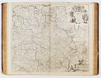
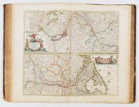
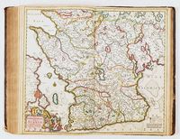
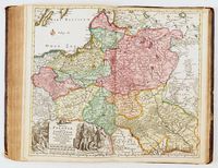
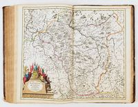
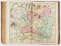
List of maps in this atlas:
- - [no number], ATLAS : Title page after a design by Gerard van Houten and engraved by Petrus Schenk I.
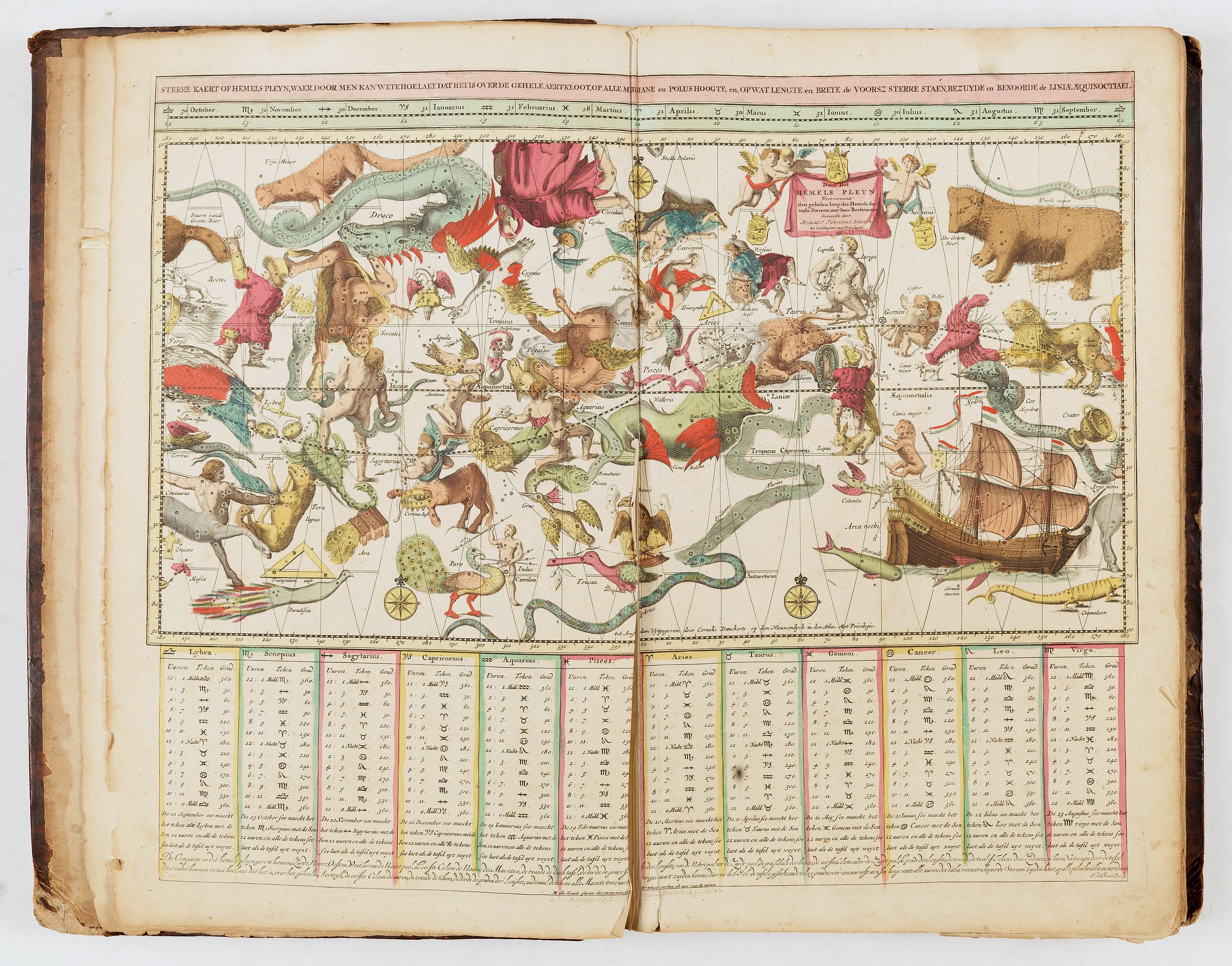
- - [no number], Hemels Pleyn. Celestial chart after Backer. Repair of a small tear.
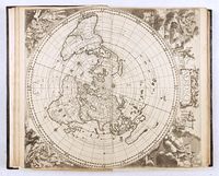
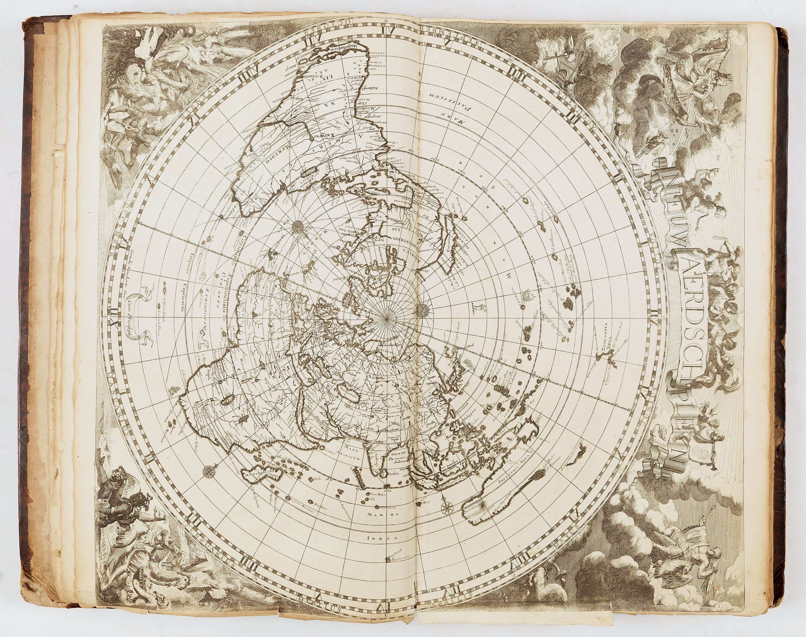
- - [no number], Neue ærdsch pleyn. World map in a polar projection. Uncolored.Â
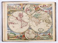
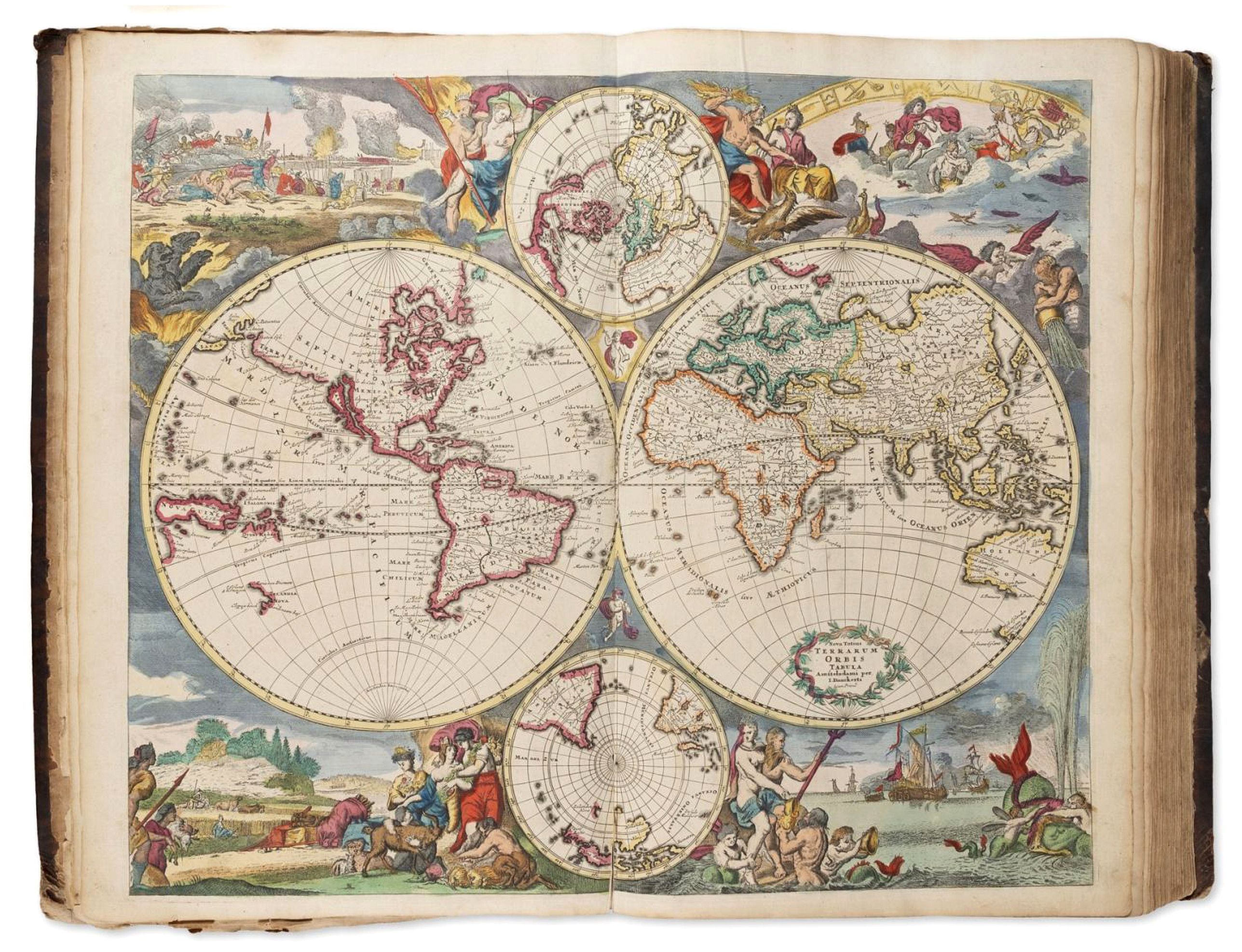
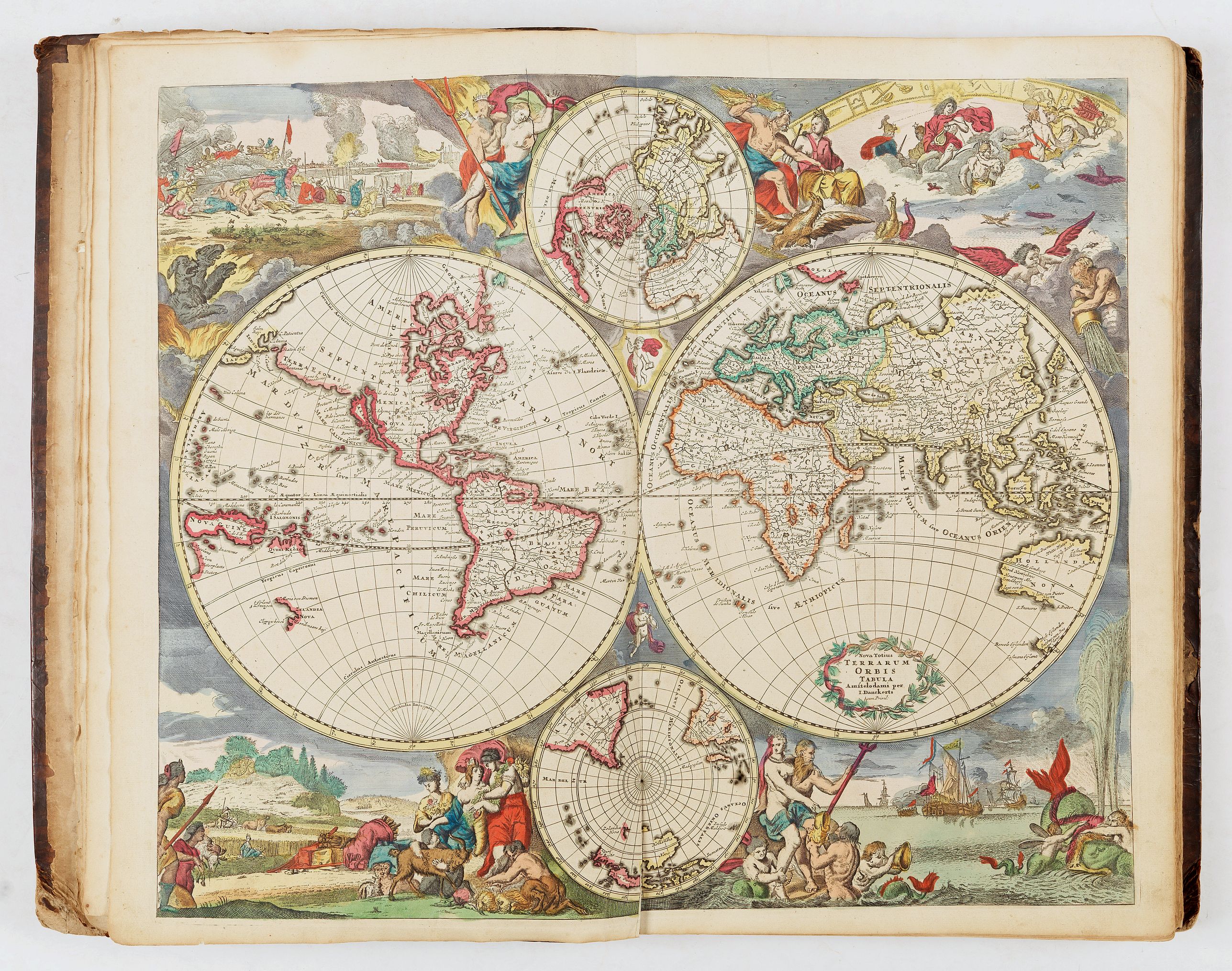
- - [no number], Terrarum orbi tabula [double hemisphere world map - see below description] - I. Danckerts.
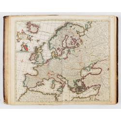
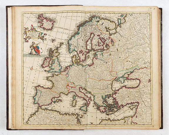
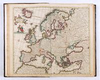
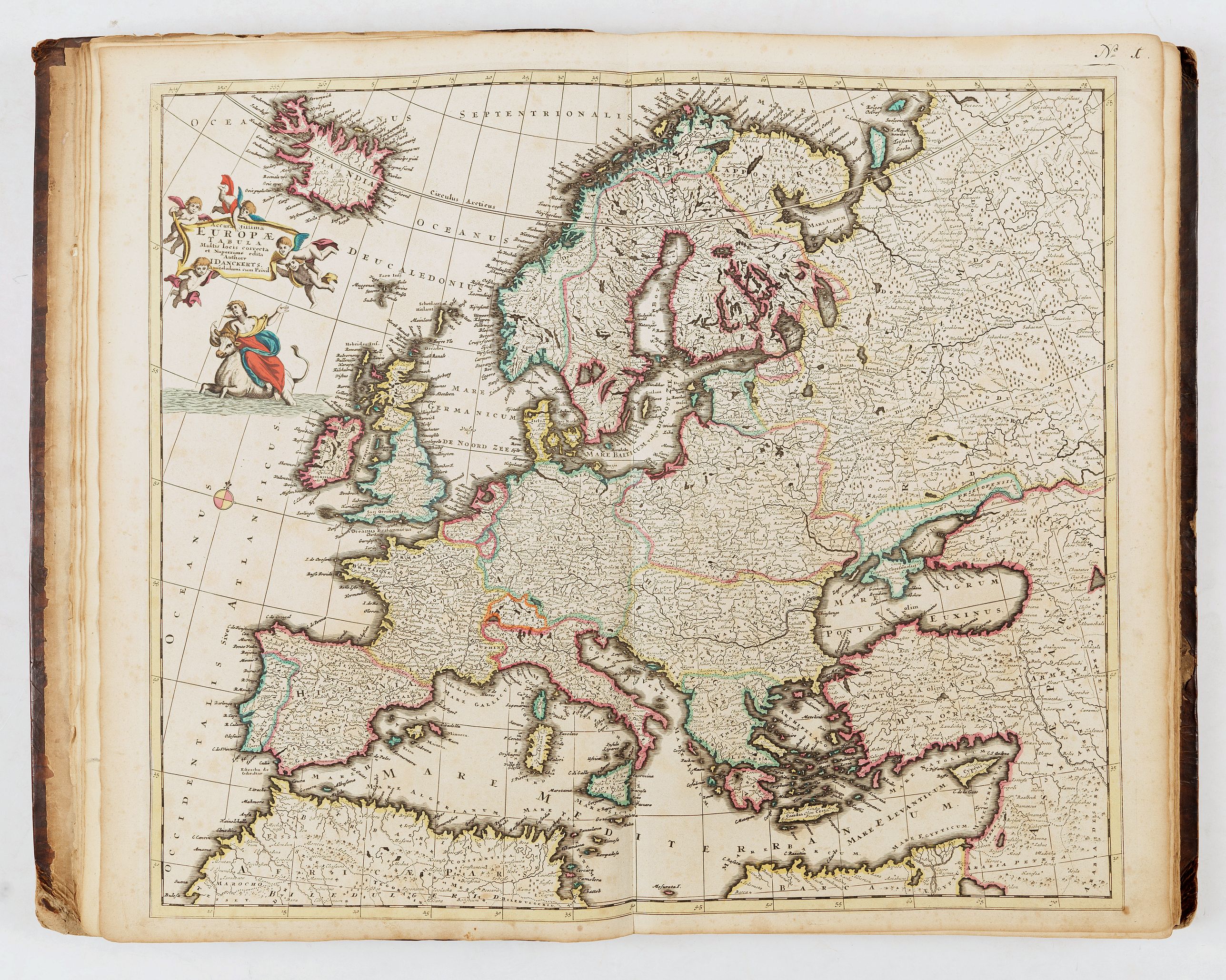
- 1, Europæ - J. Danckerts
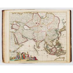
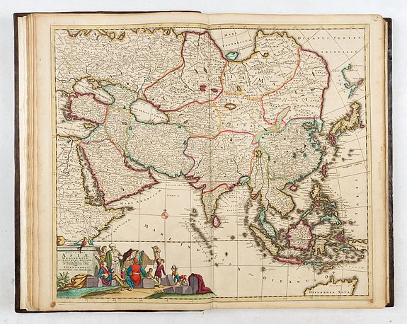
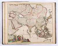
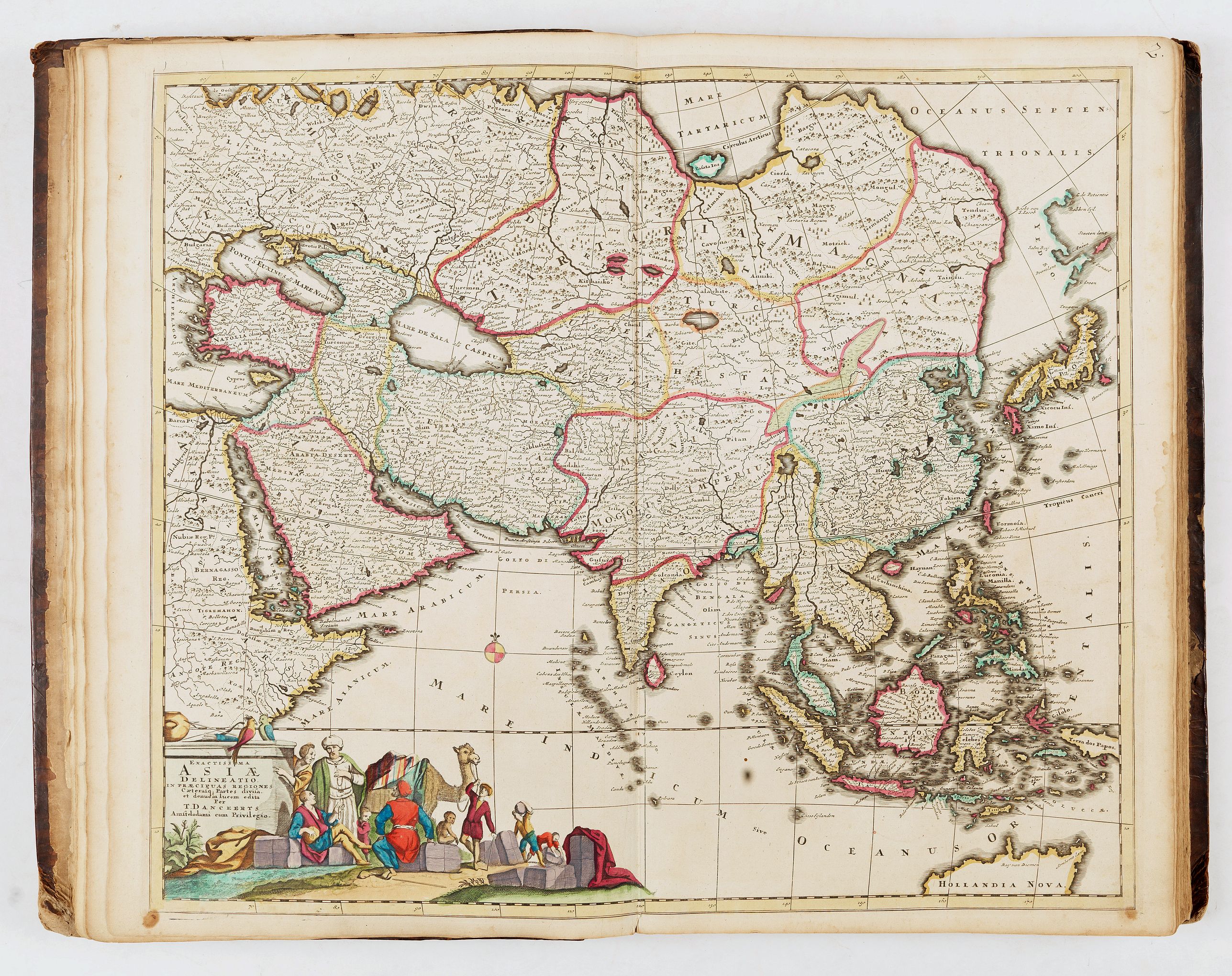
- 2, Asiæ - T. Danckerts
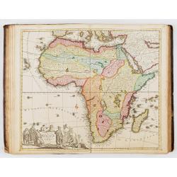
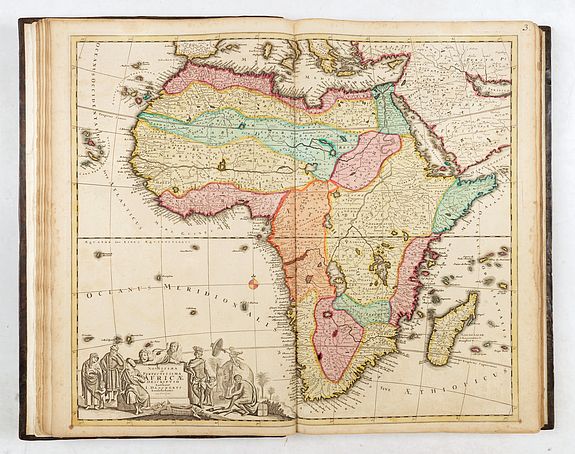
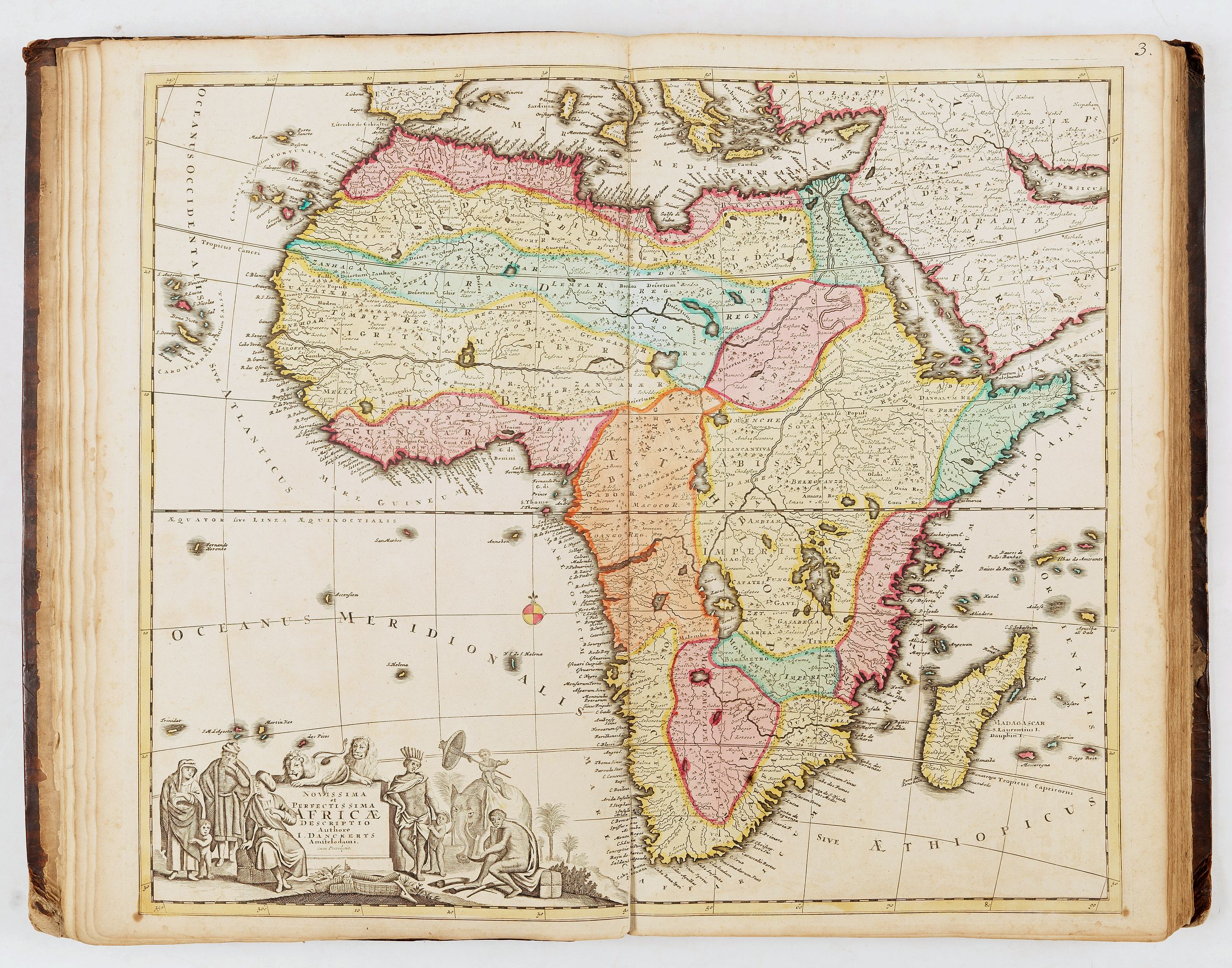
- 3, Africæ - J. Danckerts
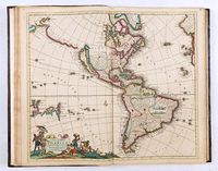
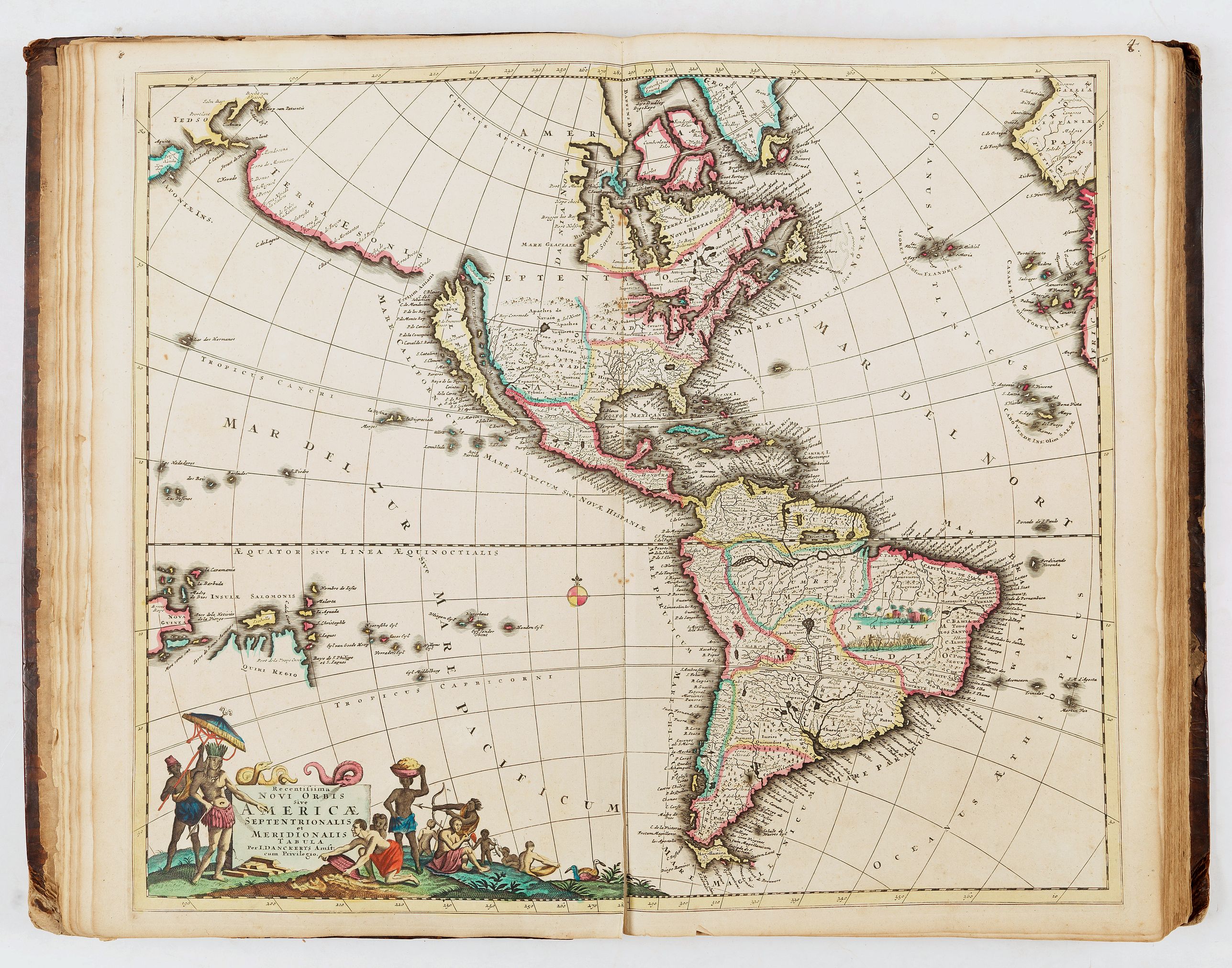
- 4, Americæ - J. Danckerts
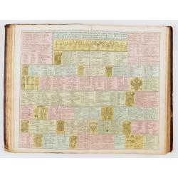
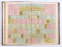
- no n°, Tableau généalogique - Cornelius Danckerts
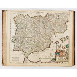
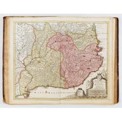
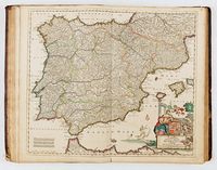
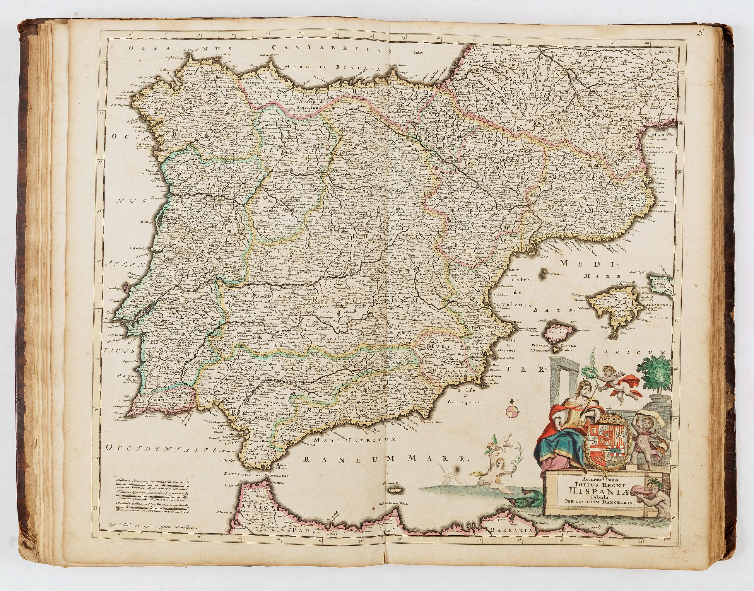
- 5, Hispaniæ - Justinium Danckerts
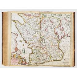
- 6, Regnum Castellæ veteris legionis et Gallæciæ - C. Danckerts
- 7, Regnum Castellæ novæ Andalusiæ - C. Danckerts
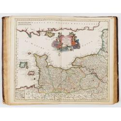
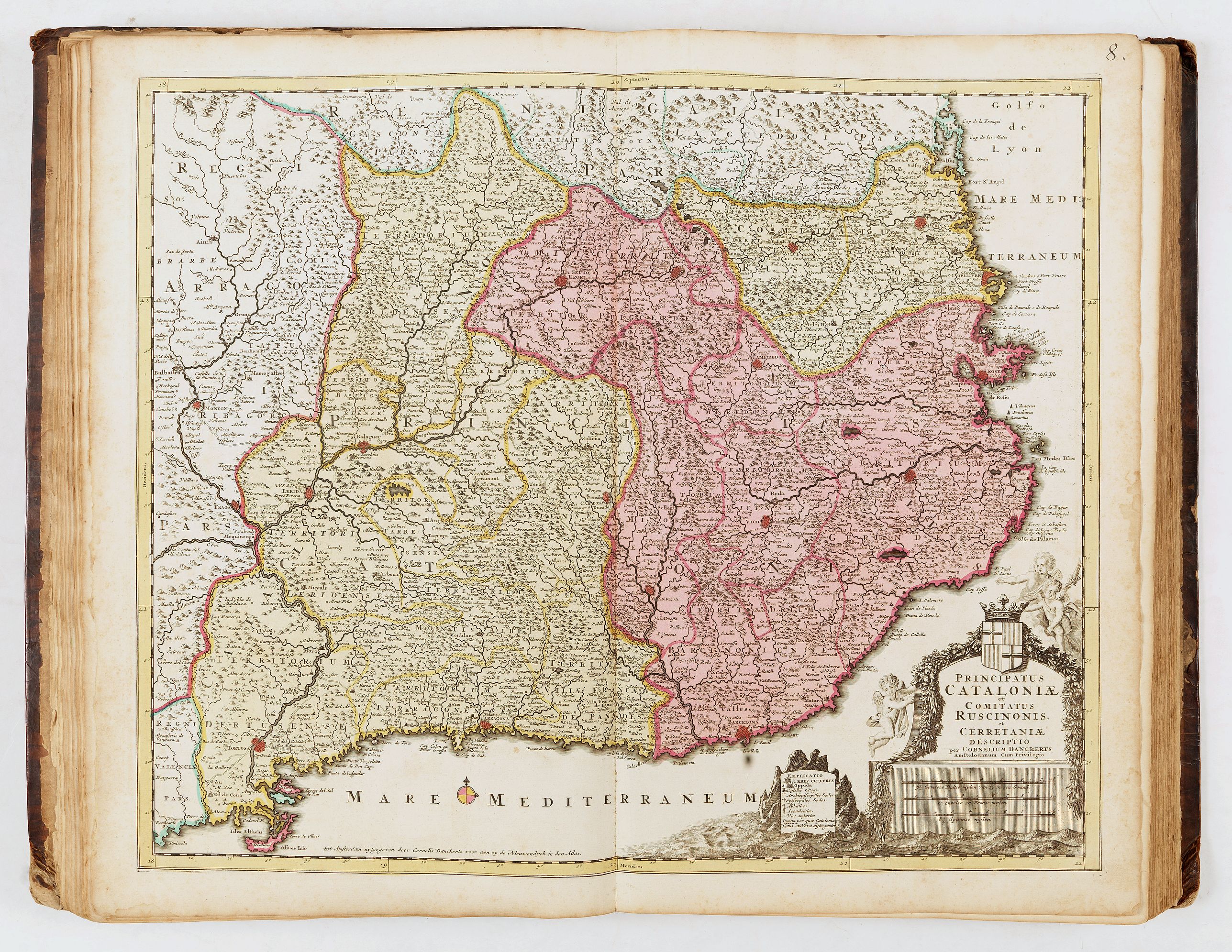
- 8, Cataloniæ - C. Danckerts
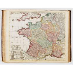
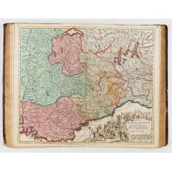
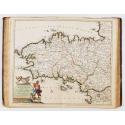
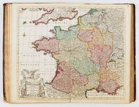
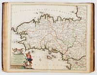
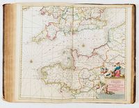
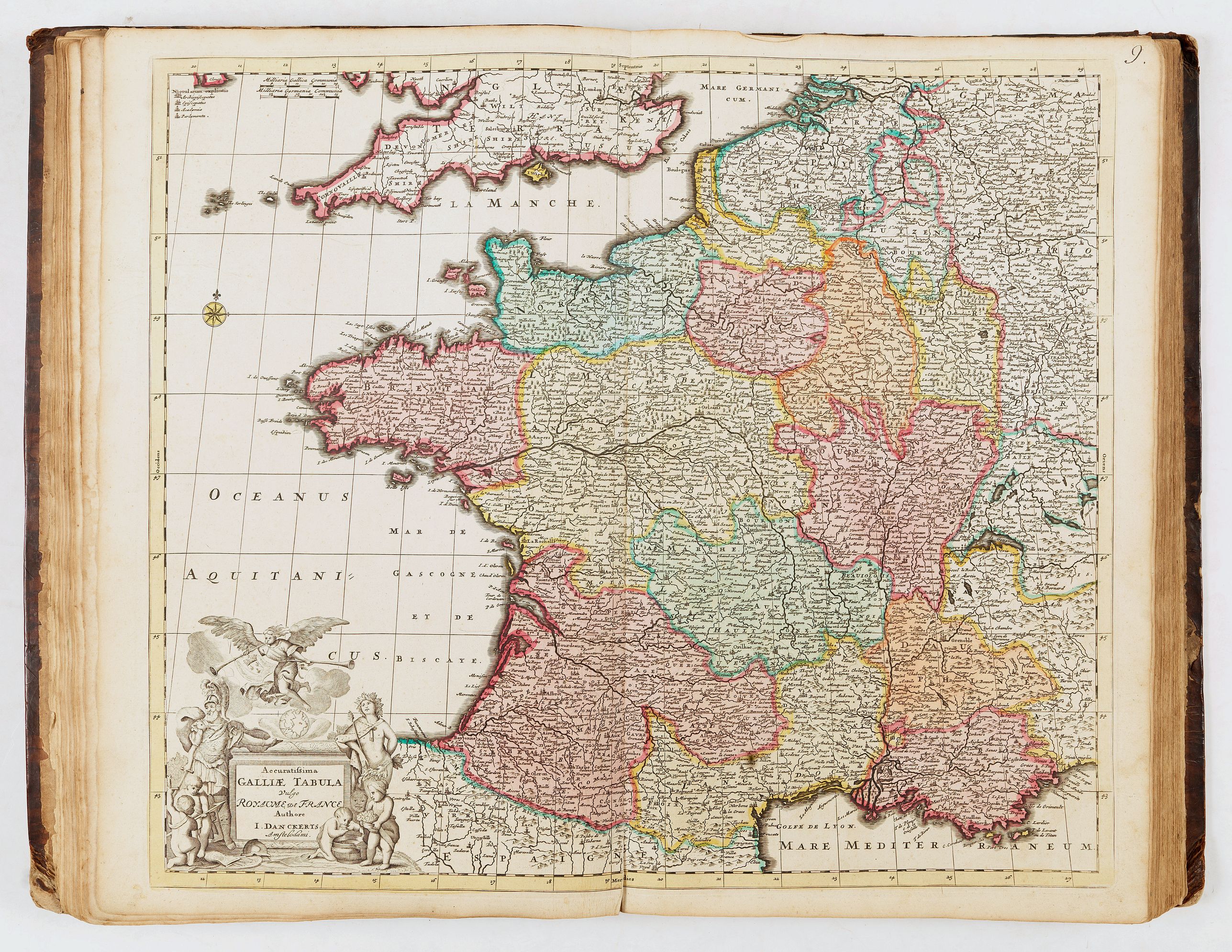
- 9, Galliæ - J. Danckerts
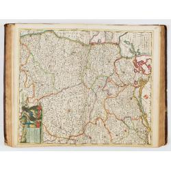
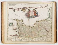
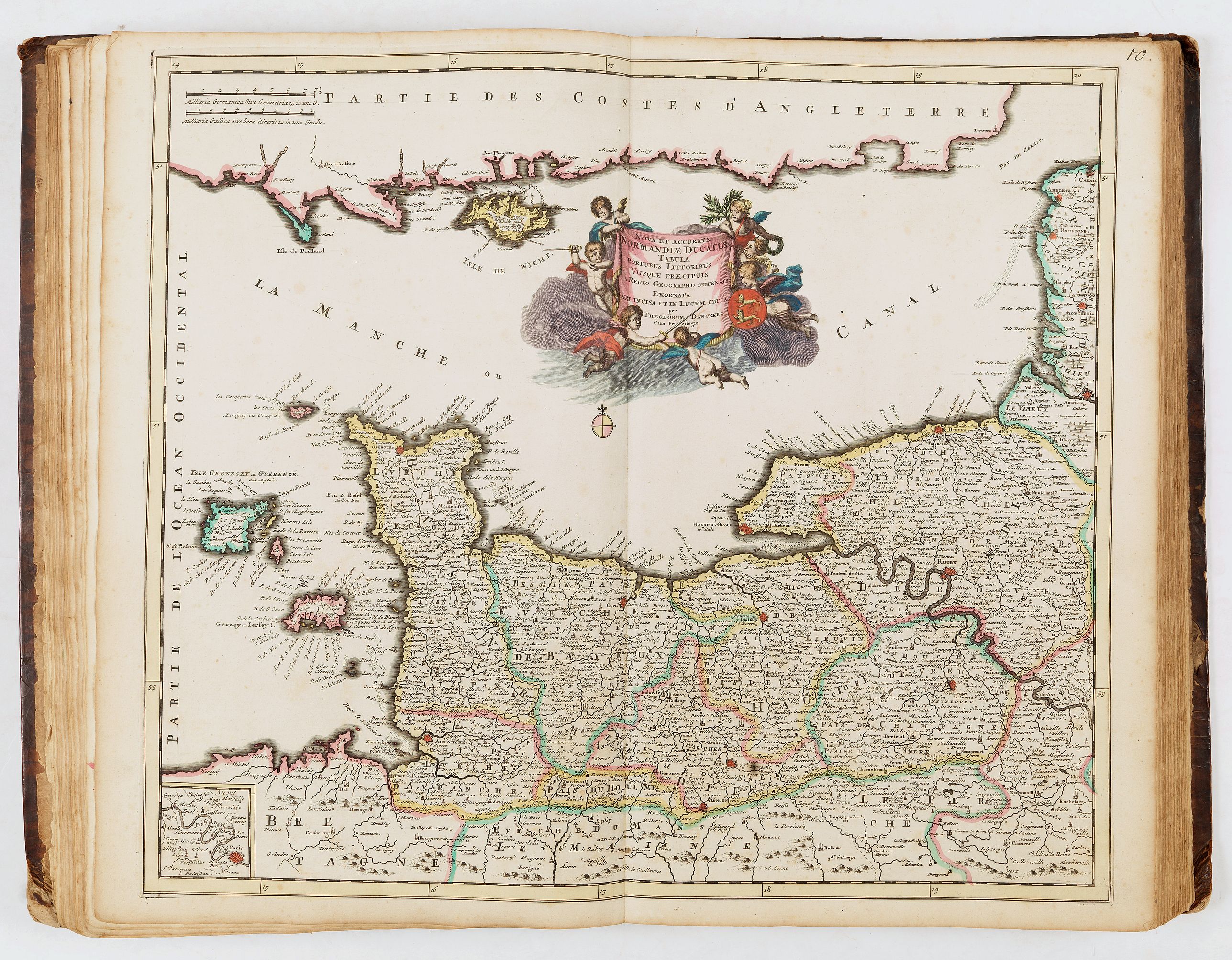
- 10, Normandiæ ducatus - Theodorum Danckerts
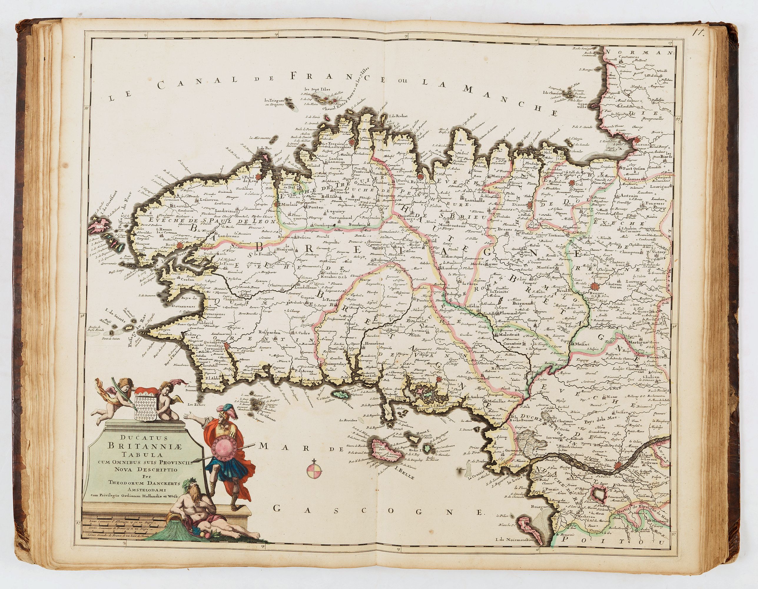
- 11, Britanniæ - Theodorum Danckerts
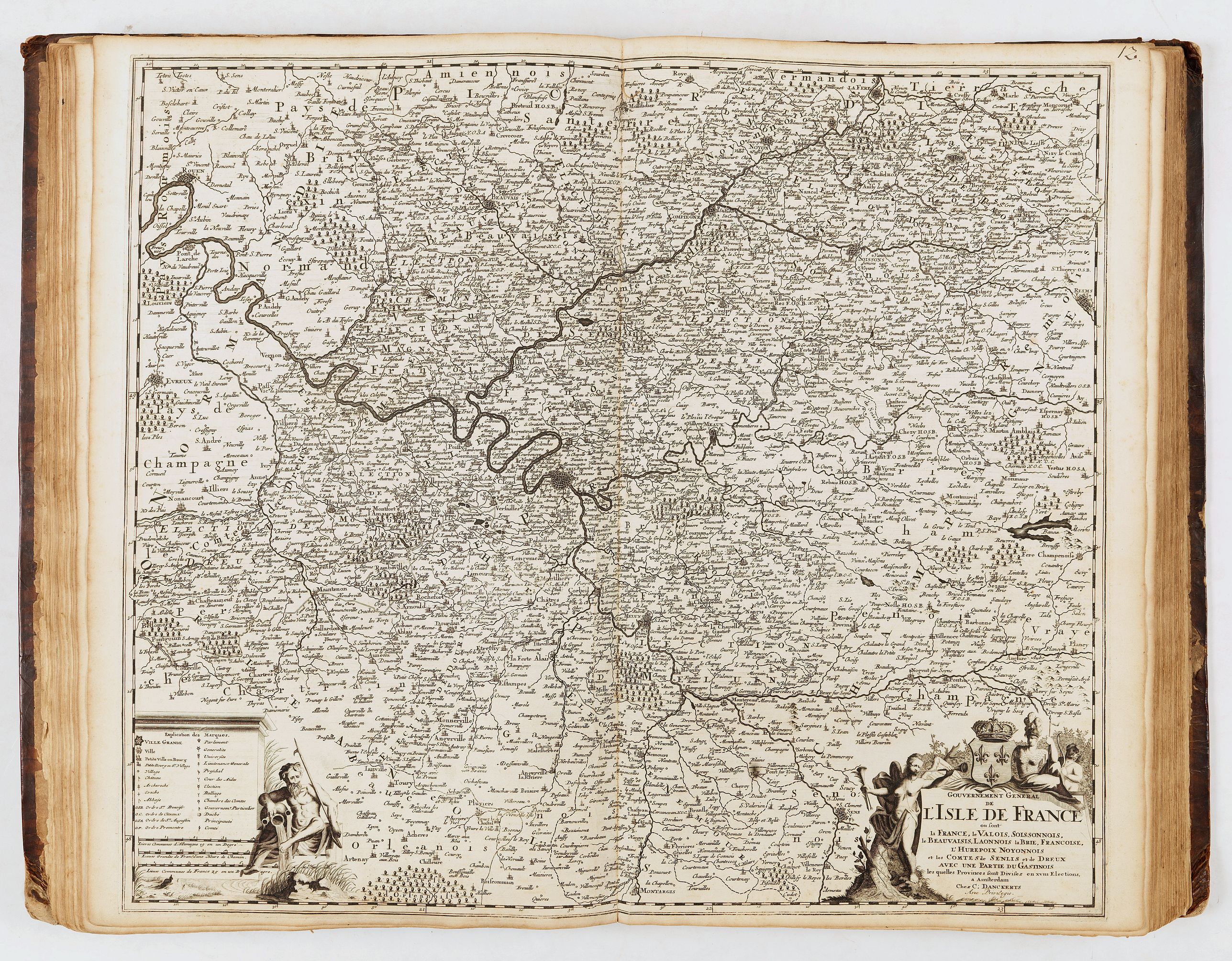
- 12, L'Isle de France, carte en noir, en français - C. Danckerts
- 13, Lotharingiæ - Theodorum Danckerts
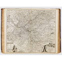
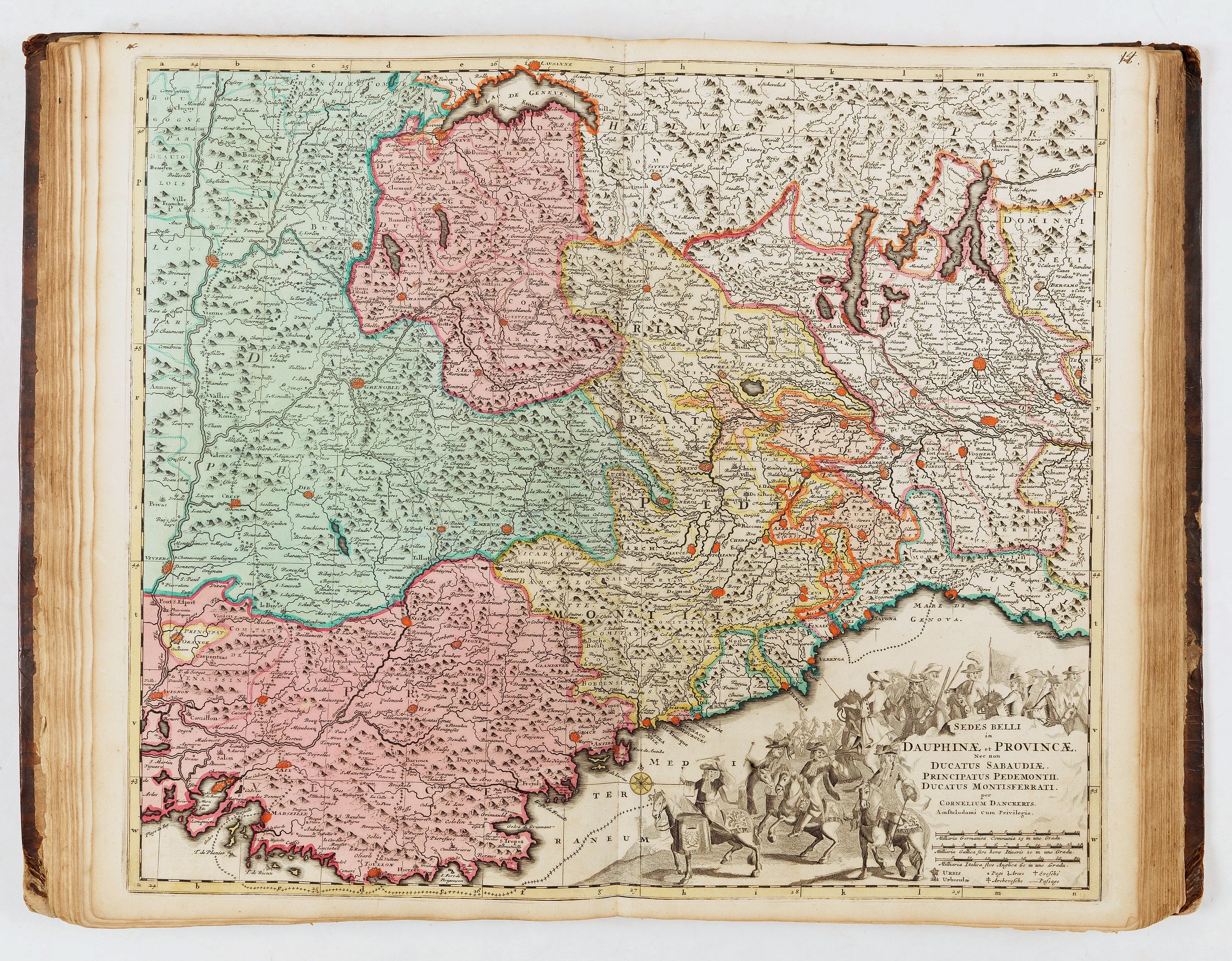
- 14, Dauphinæ - C. Danckerts
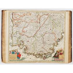
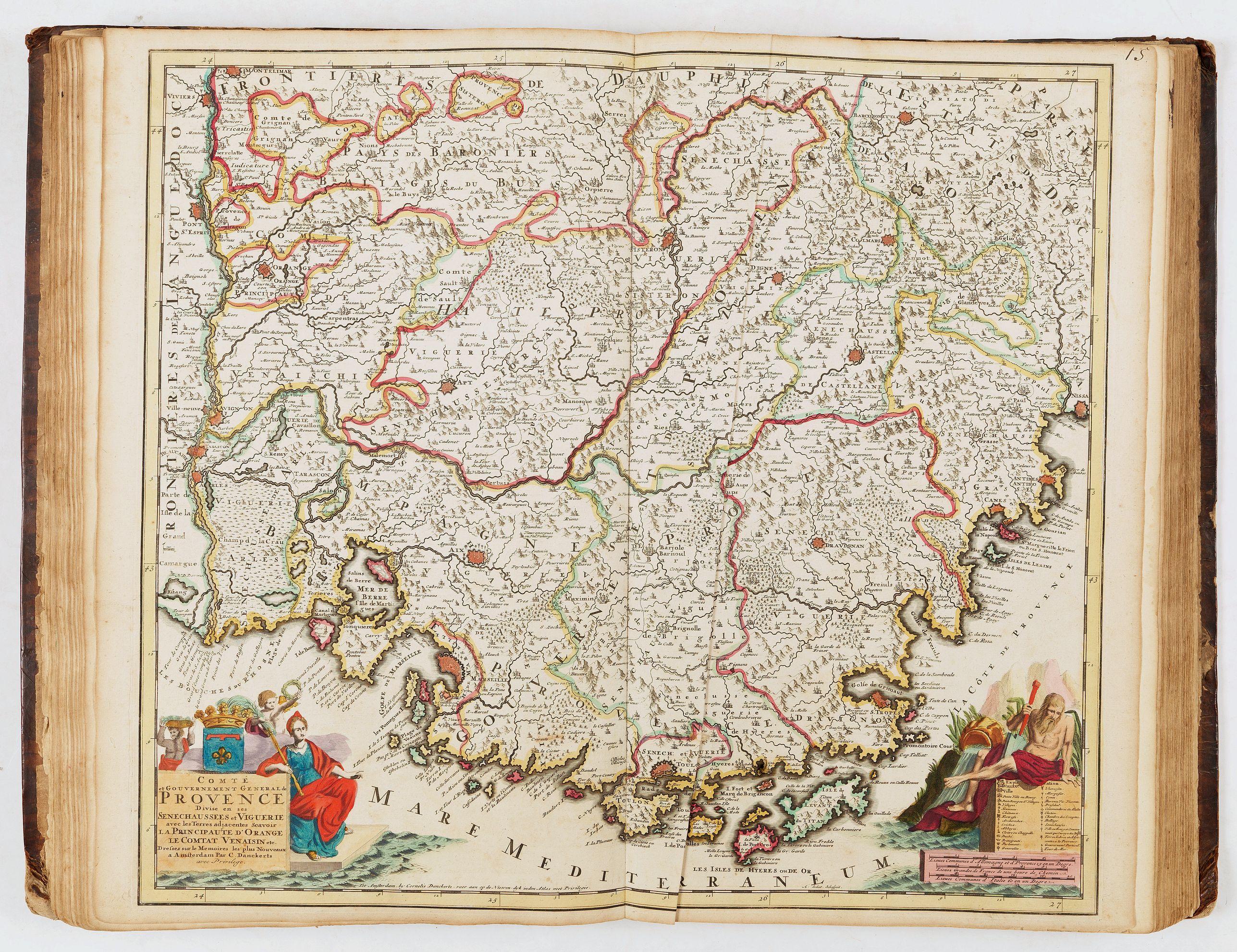
- 15, Provence - C. Danckerts
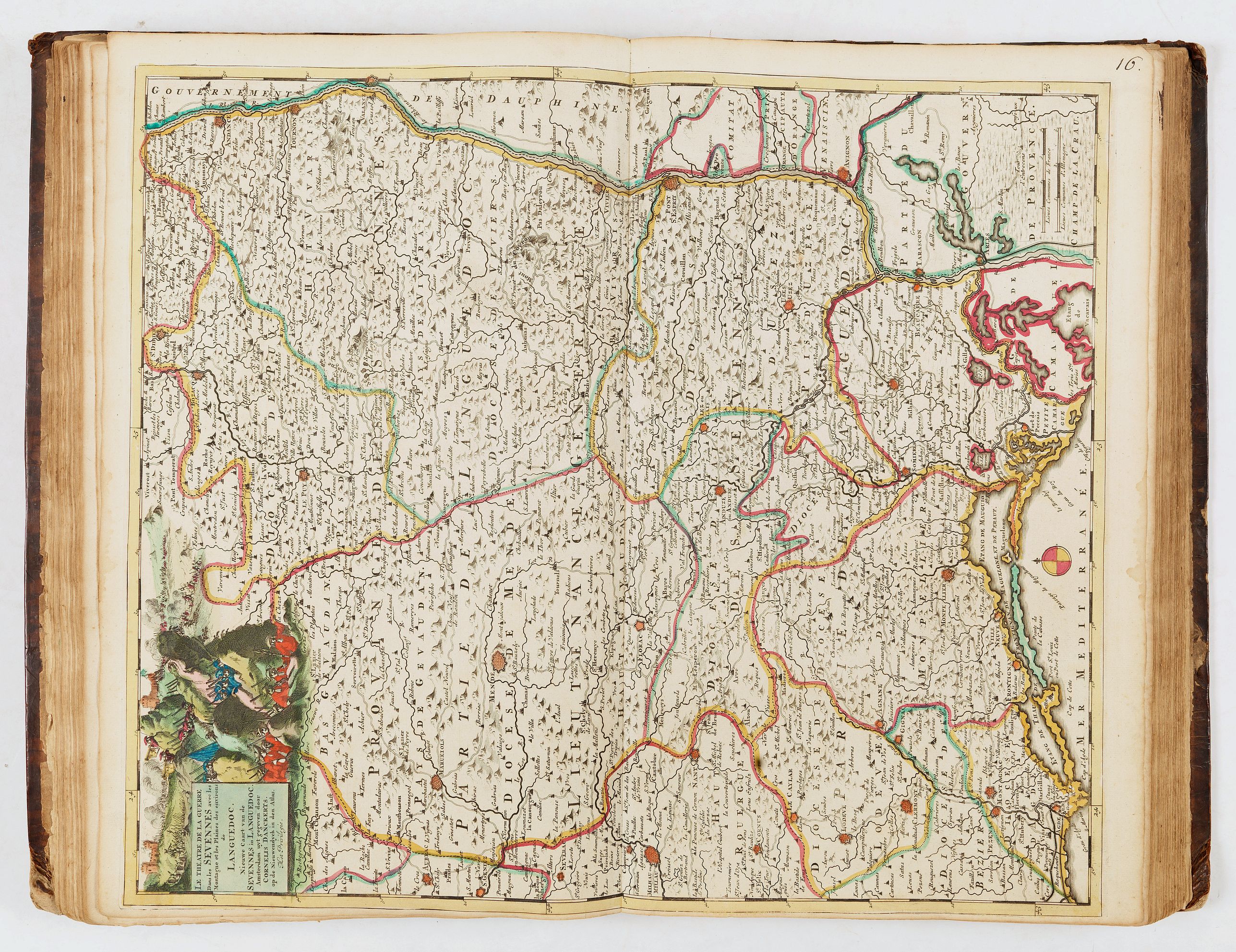
- 16, Sevennes et Languedoc - C. Danckerts
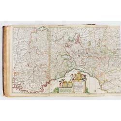
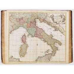
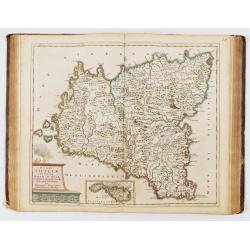
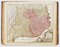
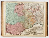
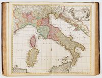
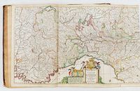
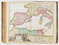
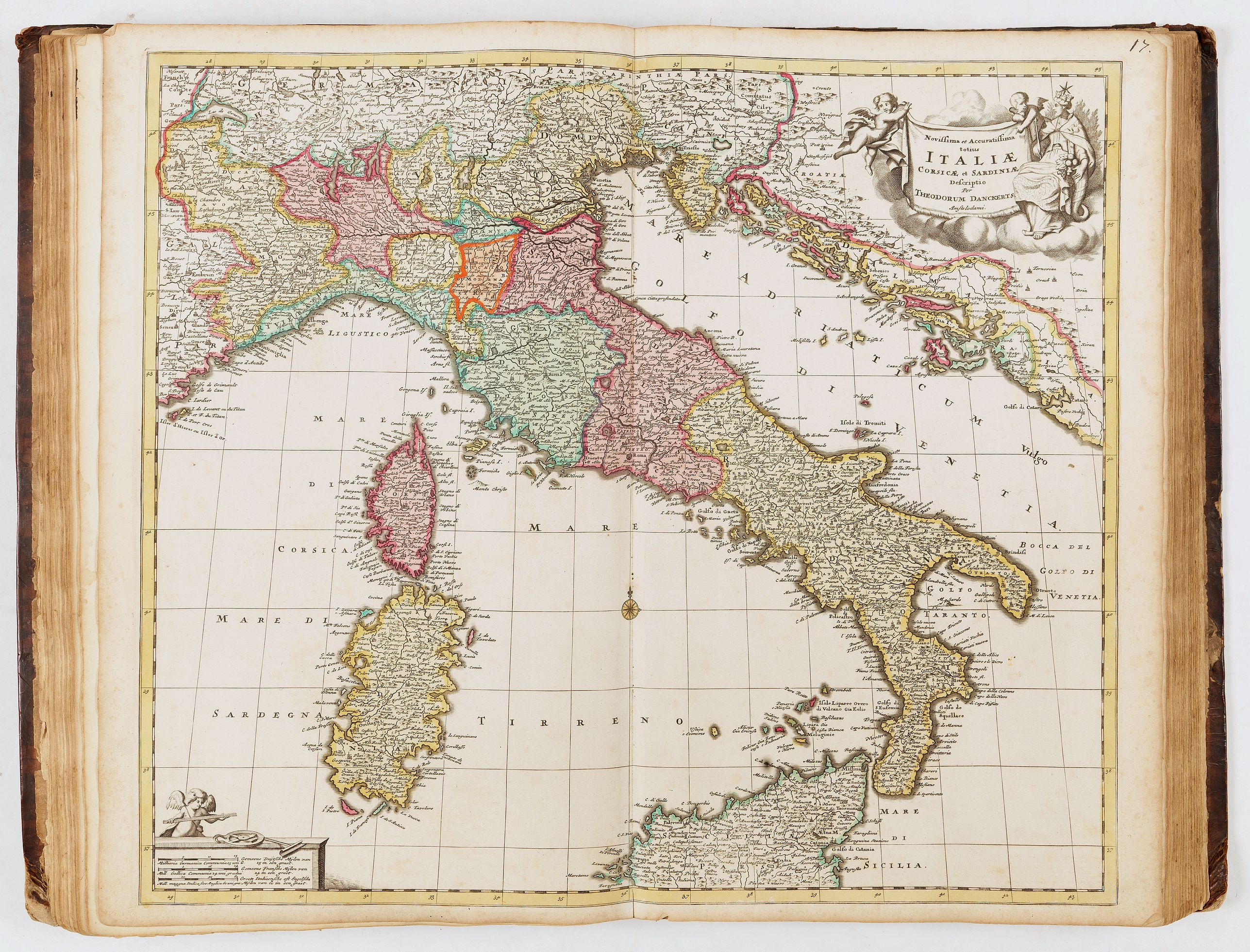
- 17, Italiæ Corsicæ et Sardiniæ - Theodorum Danckerts.
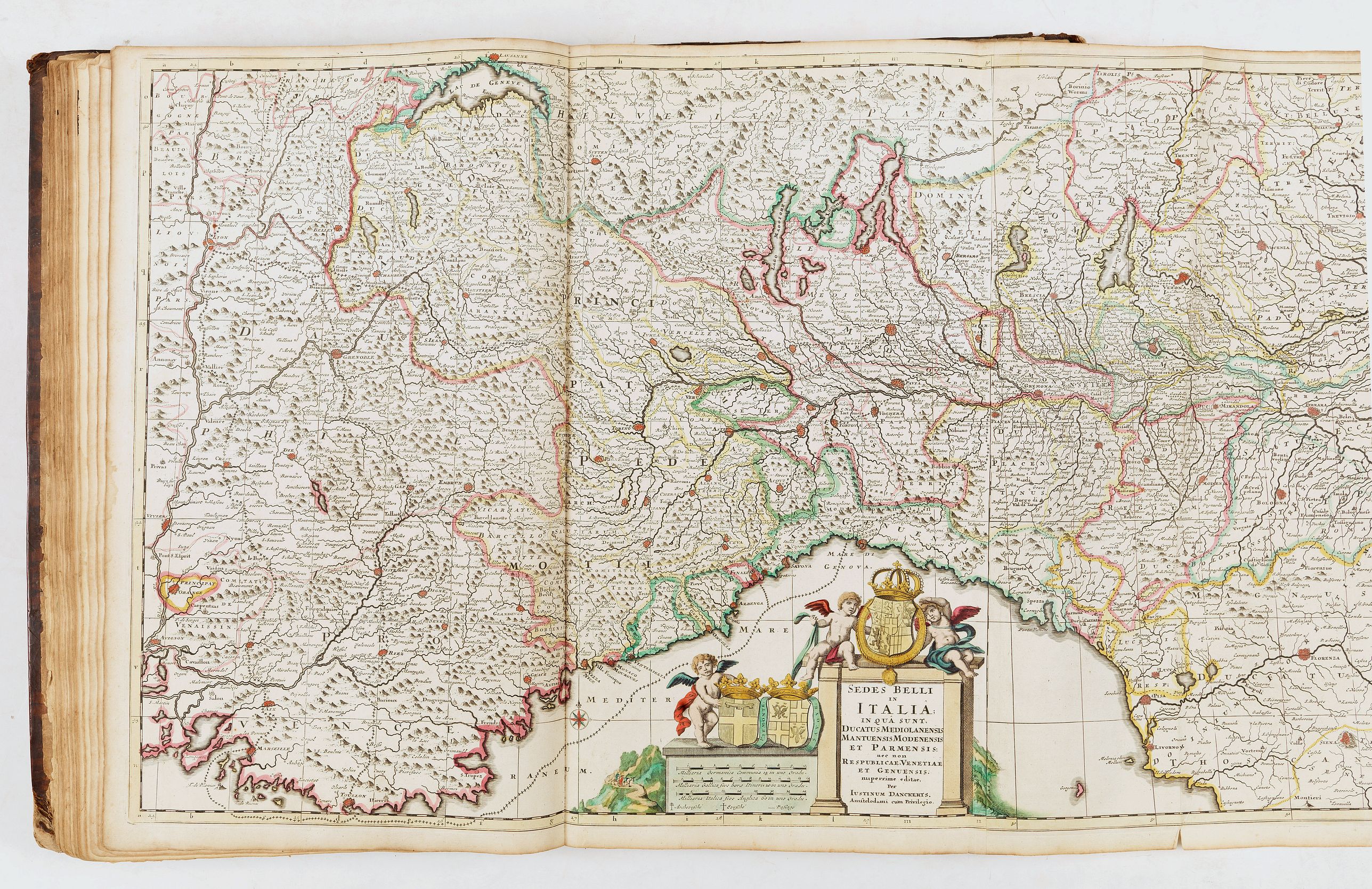
- 18, Italia in qua sunt Ducatus Mediolanensis Mantuensis… - Justinum Danckerts [dépliante].
- 19, Ducatum Sabaudiæ - Justinum Danckerts
- 20, Italia in qua sunt Ducatus Mantuensis Modenensis - J. Danckerts
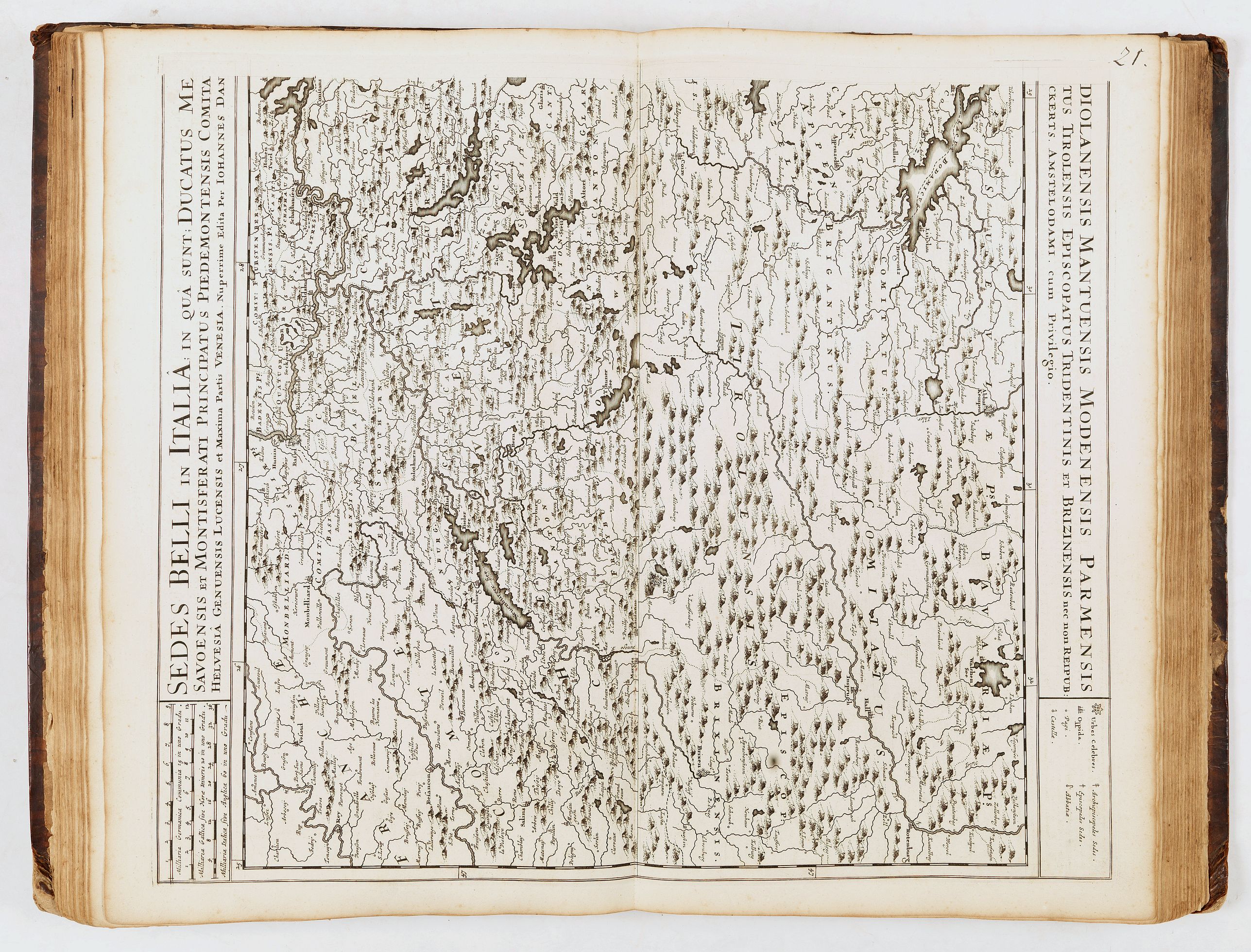
- 21, Ducatus Mediolanensis Mantuensis Modenensis Parmensis, en noir - Johannes Danckerts
- 22, Ducatus … Parmensis, Montisferrati - Iustinum Danckerts
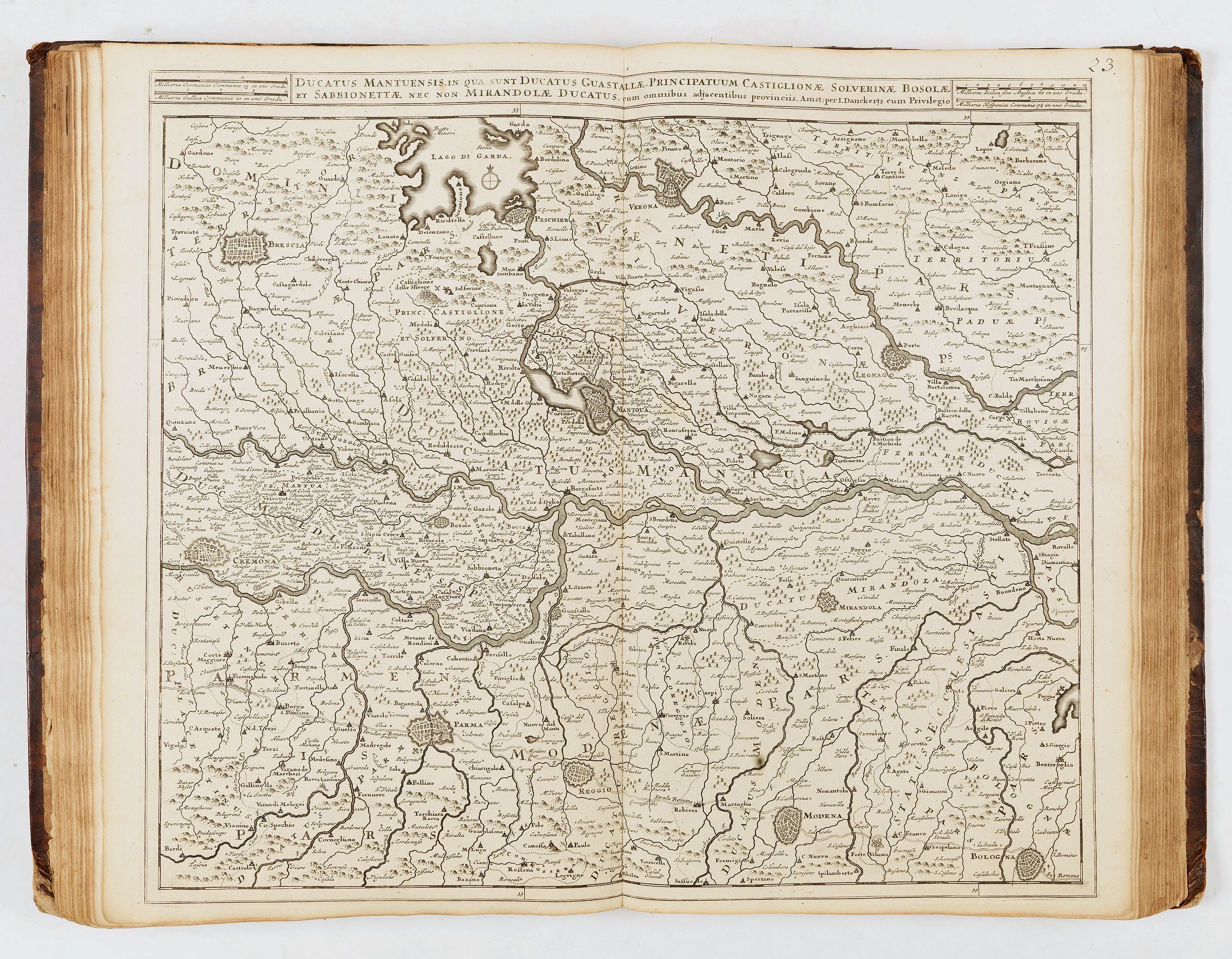
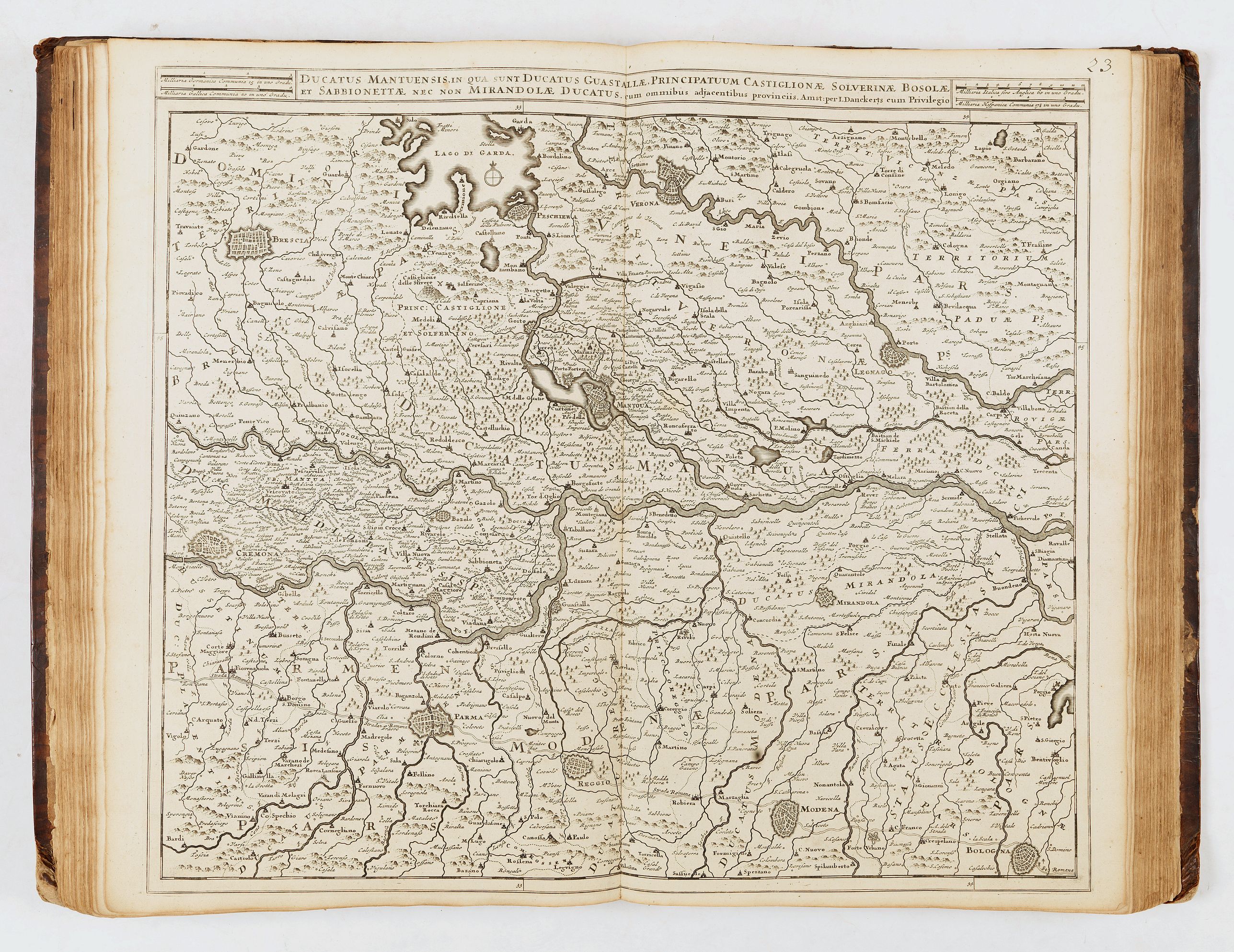
- 23, Ducatus… Guastallæ, principatuum Castiglionæ Silverinæ… (uncolored) - J. Danckerts
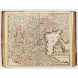
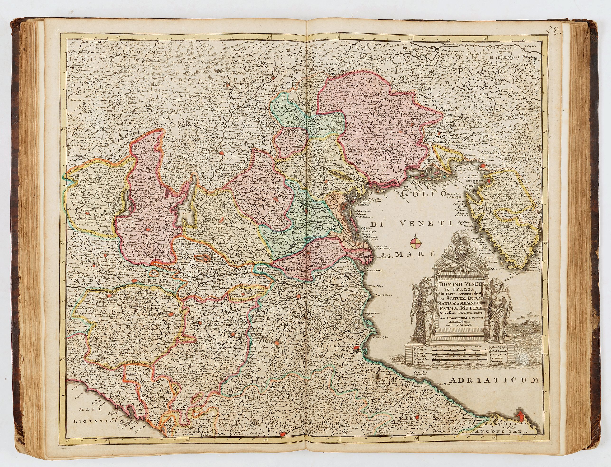
- 24, Dominii Veneti - Cornelius Danckerts
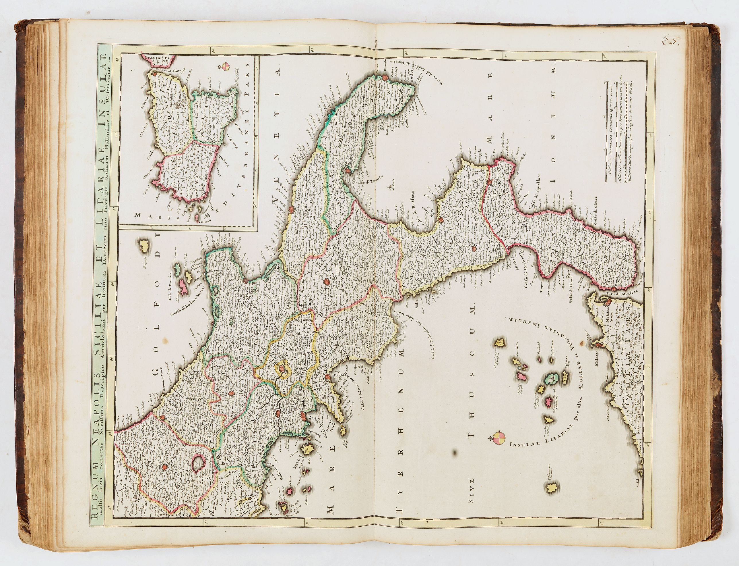
- 25, Regnum Neapolis Siciliæ et Lipariæ insulæ - Justinum Danckerts
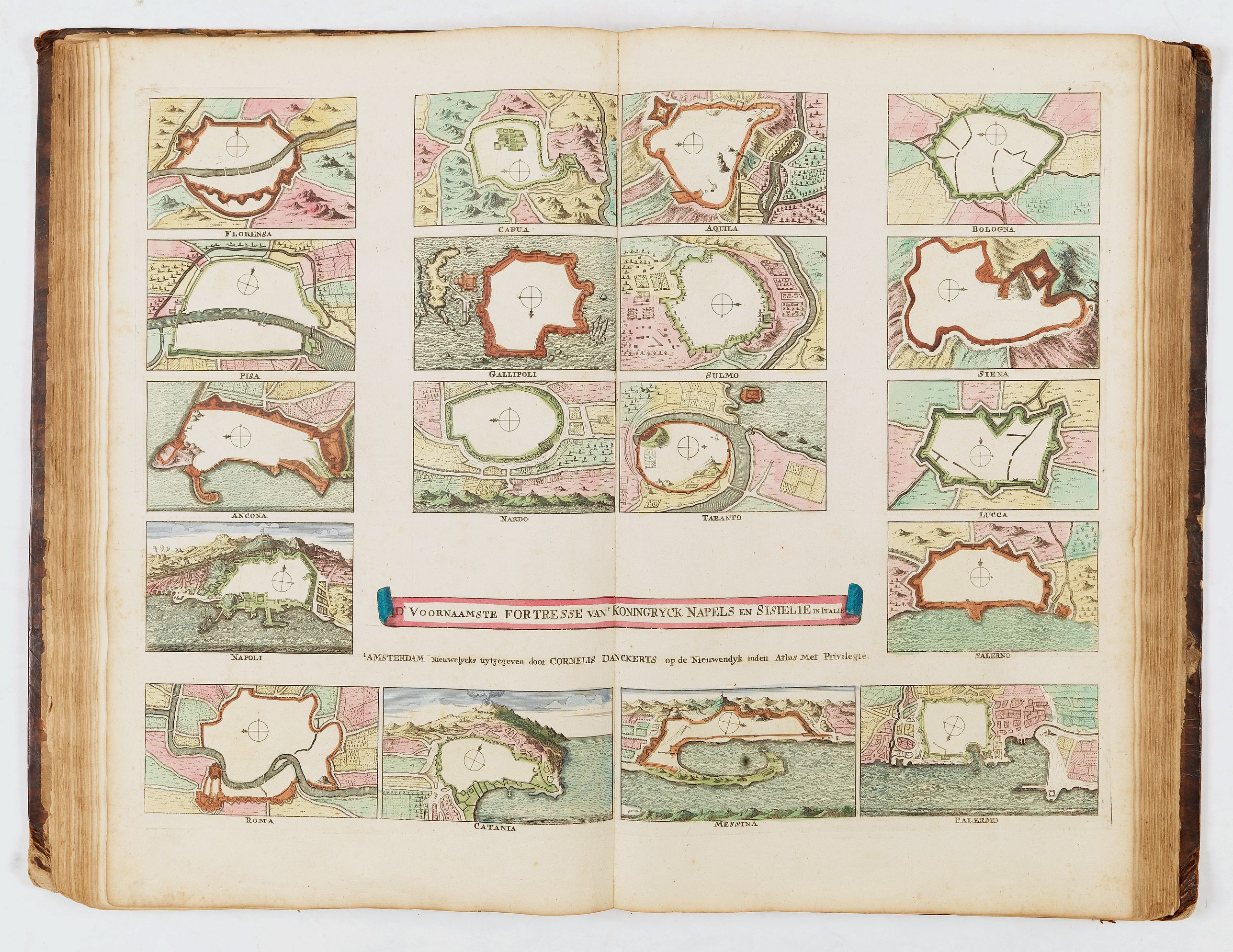
- [no number]Â Â Fortresse van Konyngrick Napels en Sisielie - Cornelius Danckerts
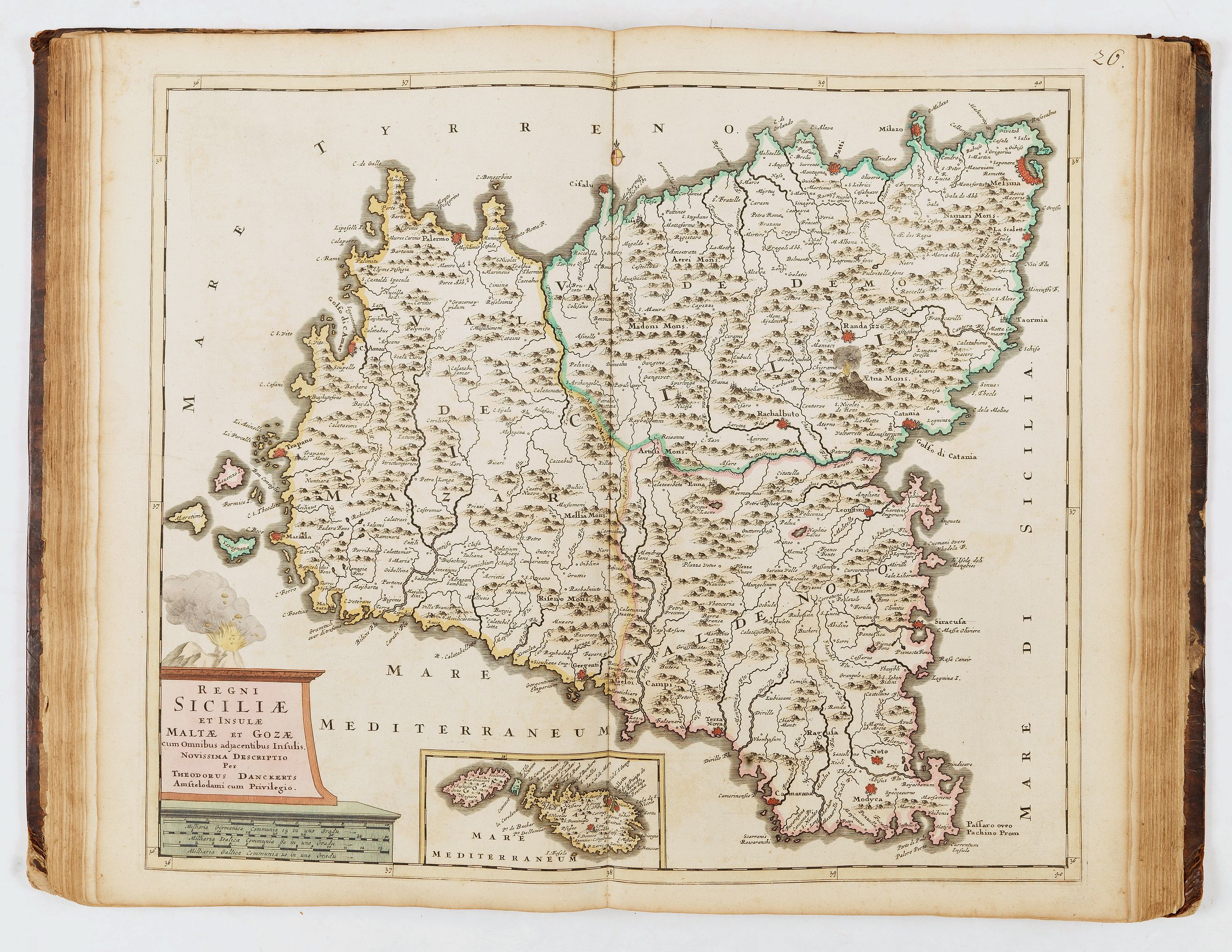
- 26, Regni Siciliæ et insulæ Maltæ - Theodorus Danckerts
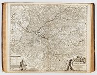
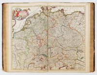
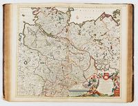
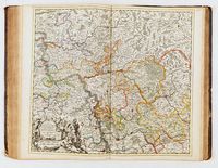
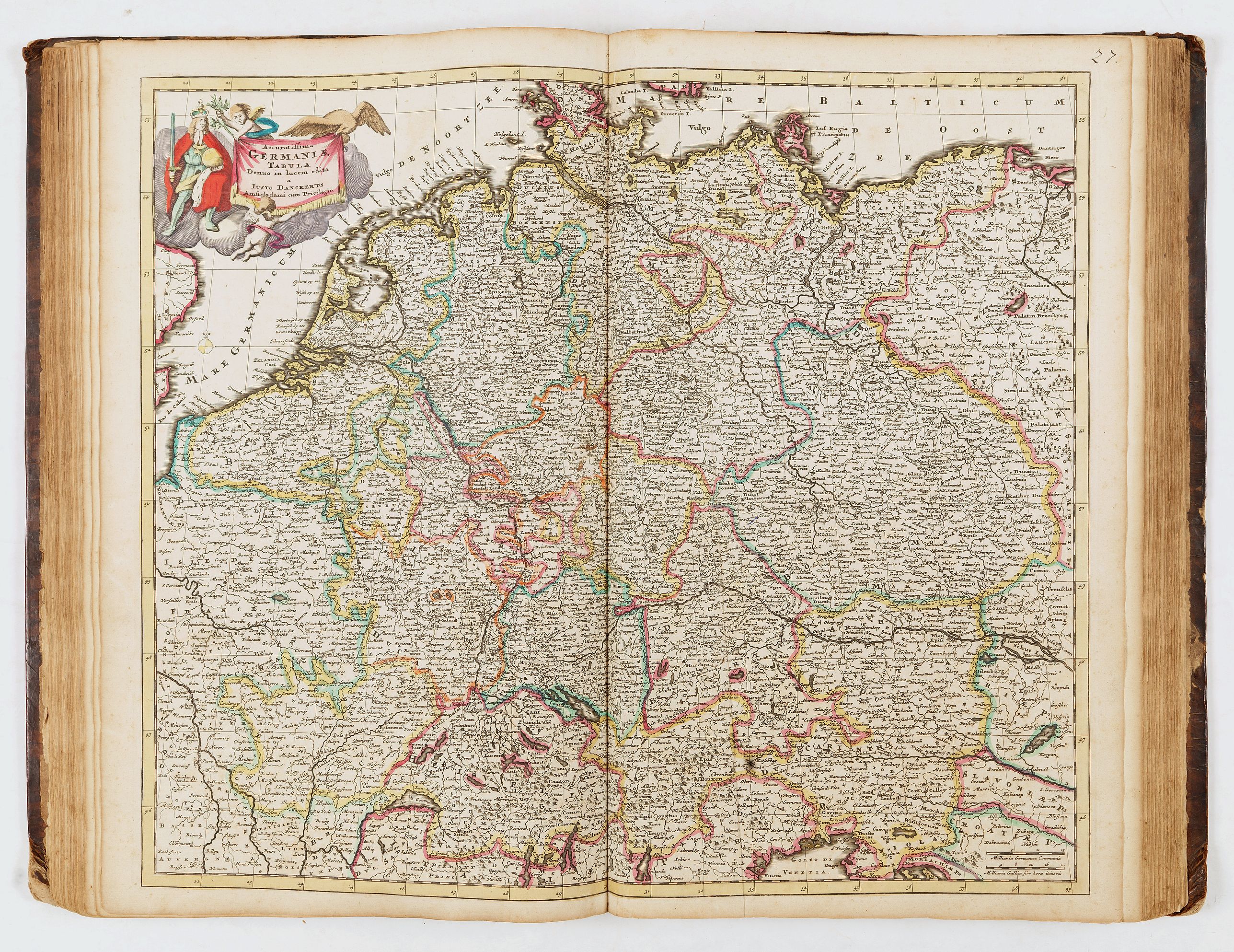
- 27, Germaniæ - Justo Danckerts
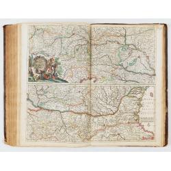
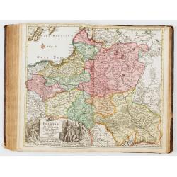
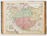
- 28, Circuli Austriaci - Justinum Danckerts
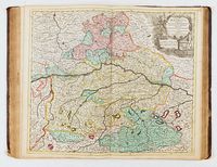
- 29, Tirolis - Cornelium Danckerts
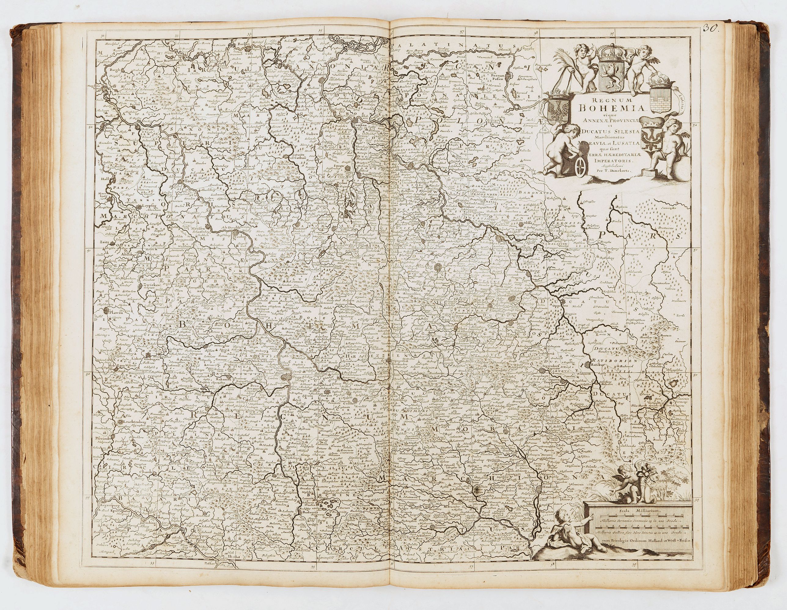
- 30, Bohemia, en noir - T. Danckerts
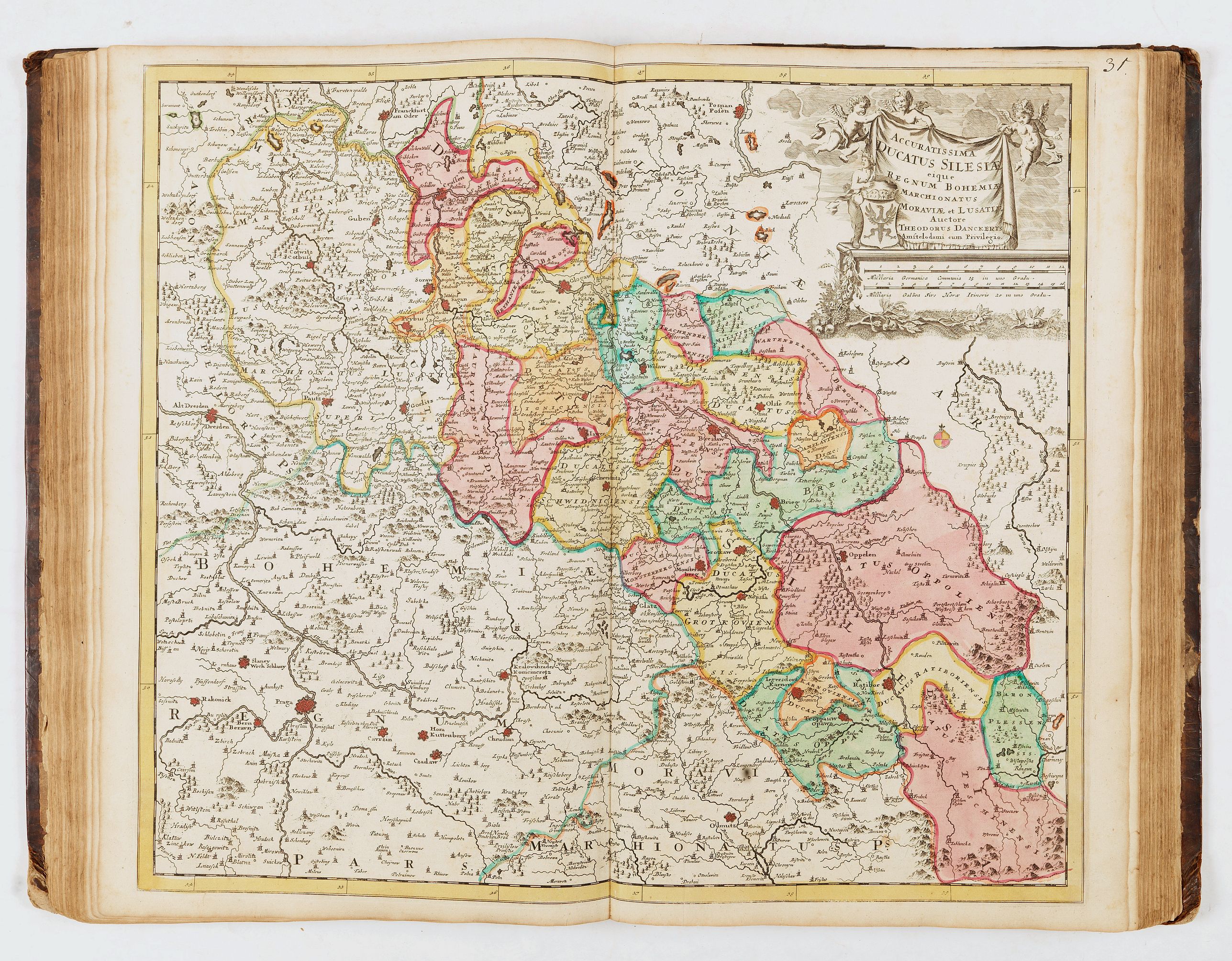
- 31, Ducatus Silesiæ - T. Danckerts
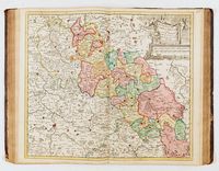
- 32, Circuli Saxoniæ superior pars meridionalis - Justinum Danckerts
- 33, Marchionatus Brandenburgensis - T. Danckerts
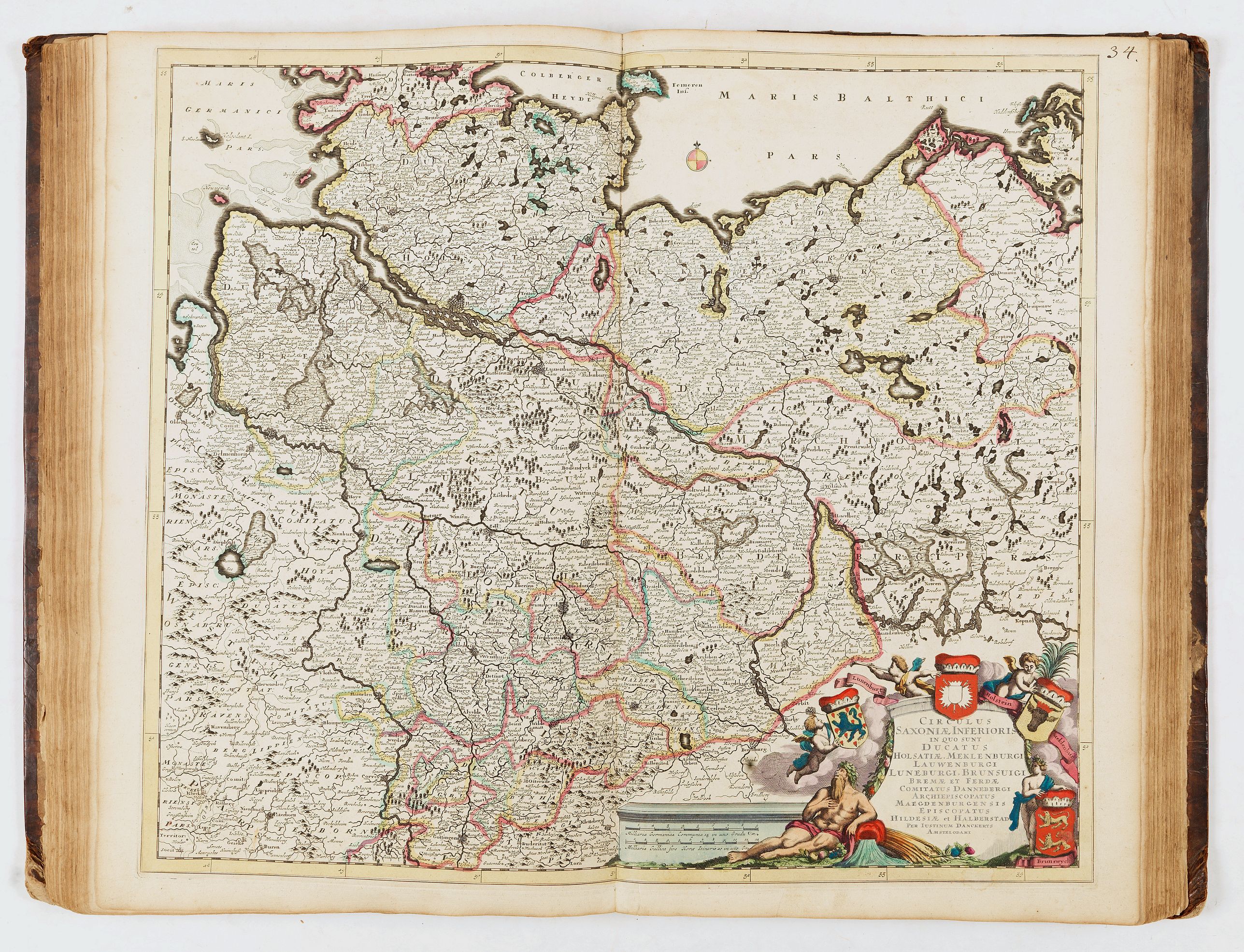
- 34, Circulus Saxoniæ inferioris - Justinum Danckerts
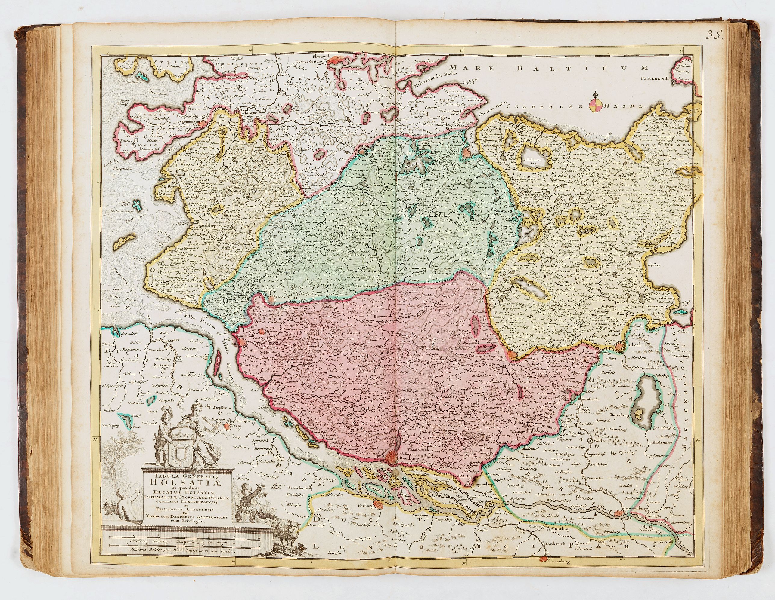
- 35, Holsatiæ - Theodorum Danckerts
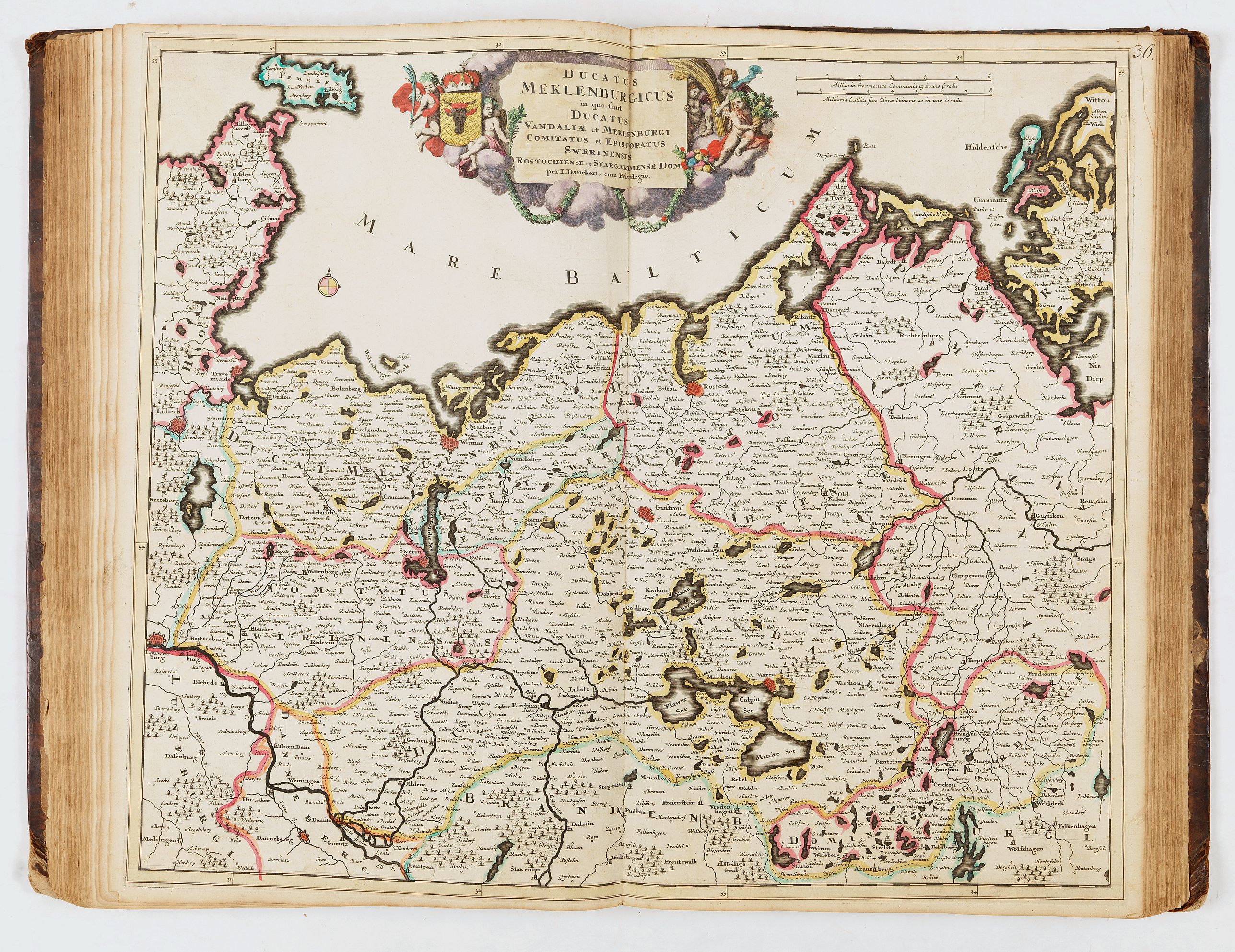
- 36, Ducatus Meklenburgicus - J. Danckerts
- 37, Ducatus Brunsuicensis - J. Danckerts
- 38, Circulus Franconicus - T. Danckerts
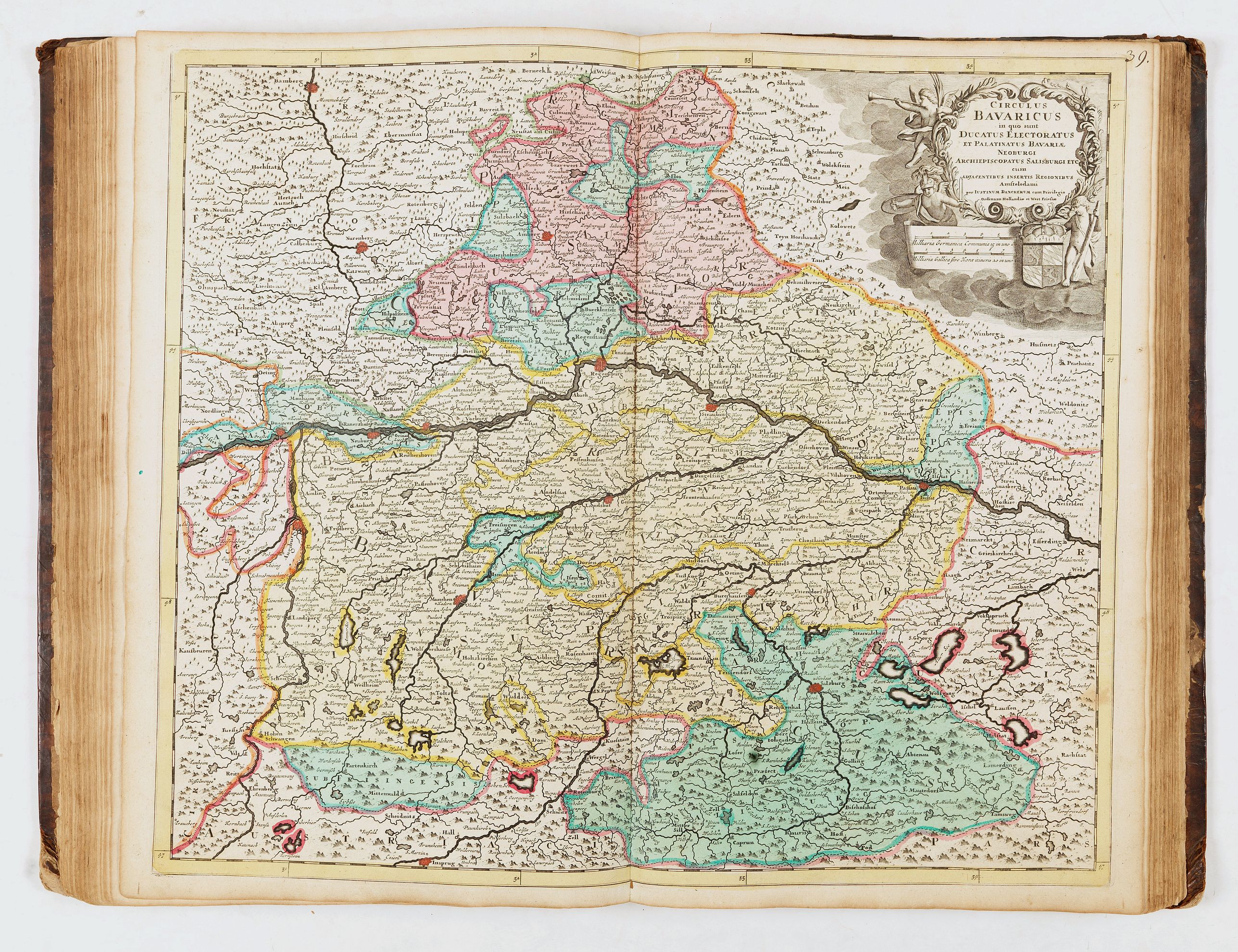
- 39, Circulus Bavaricus - Justinum Danckerts
- 40, Circulus Suevicus - Theodoris Danckerts
- 41, Ducatus Wirtenbergensis - Johannes Danckerts
- 42, Totius Flumenis Rheni - J. Danckerts
- 43, Rheni superioris Mosæ et Mosellæ - Theodorum Danckerts
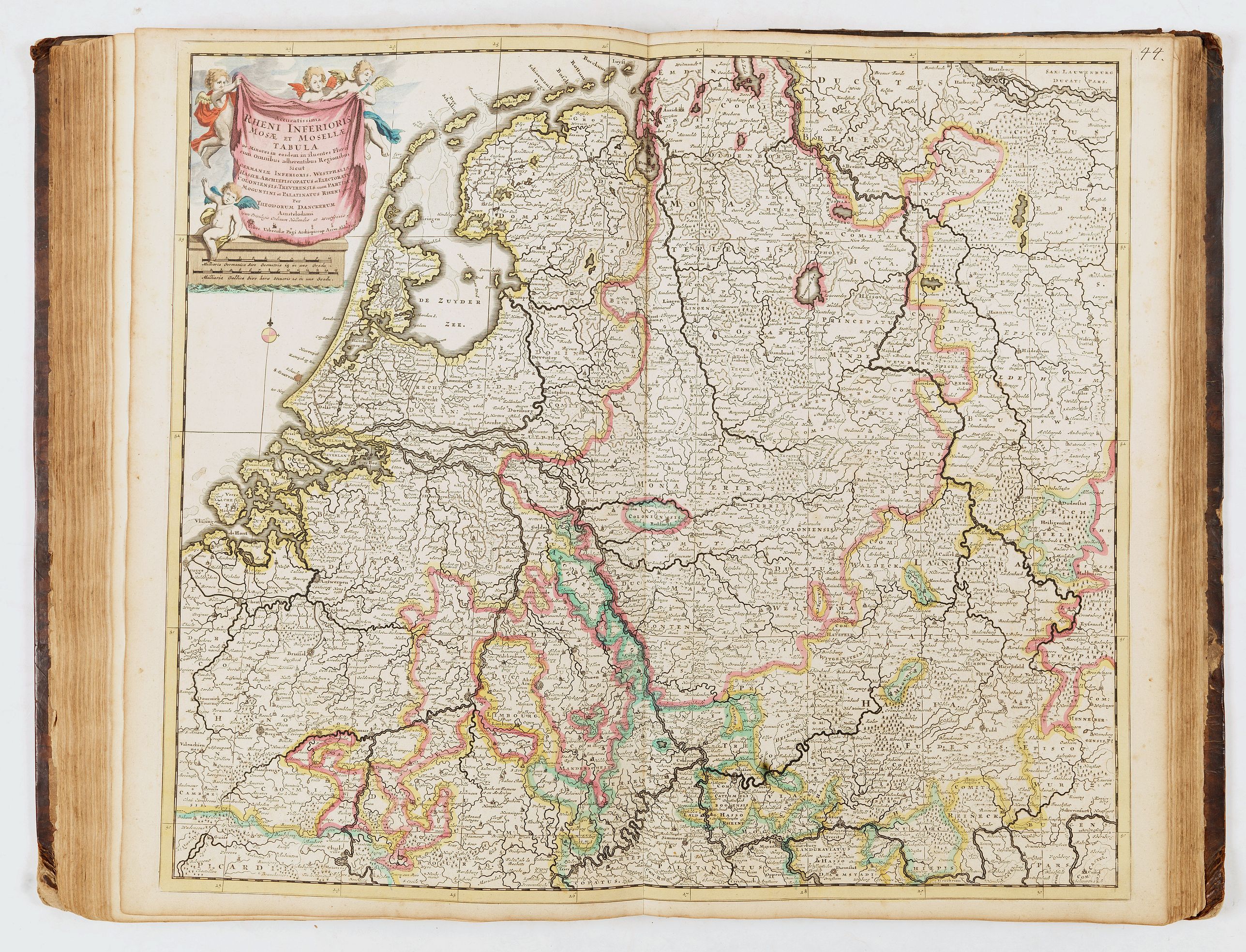
- 44, Rheni inferioris Mosæ et Mosellæ - Theodorum Danckerts
- 45, Electoratus et Palatinus ad Rhenum - Theodorus Danckerts
- 46, Archiepiscopatus et Electoratus Moguntini - Iustinum Danckerts
- 47, Archiepiscopatus et Electoratus Trevirensis - Theodorus Danckerts
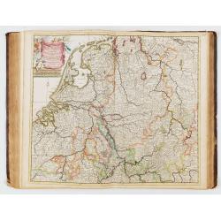
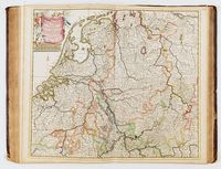
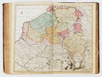
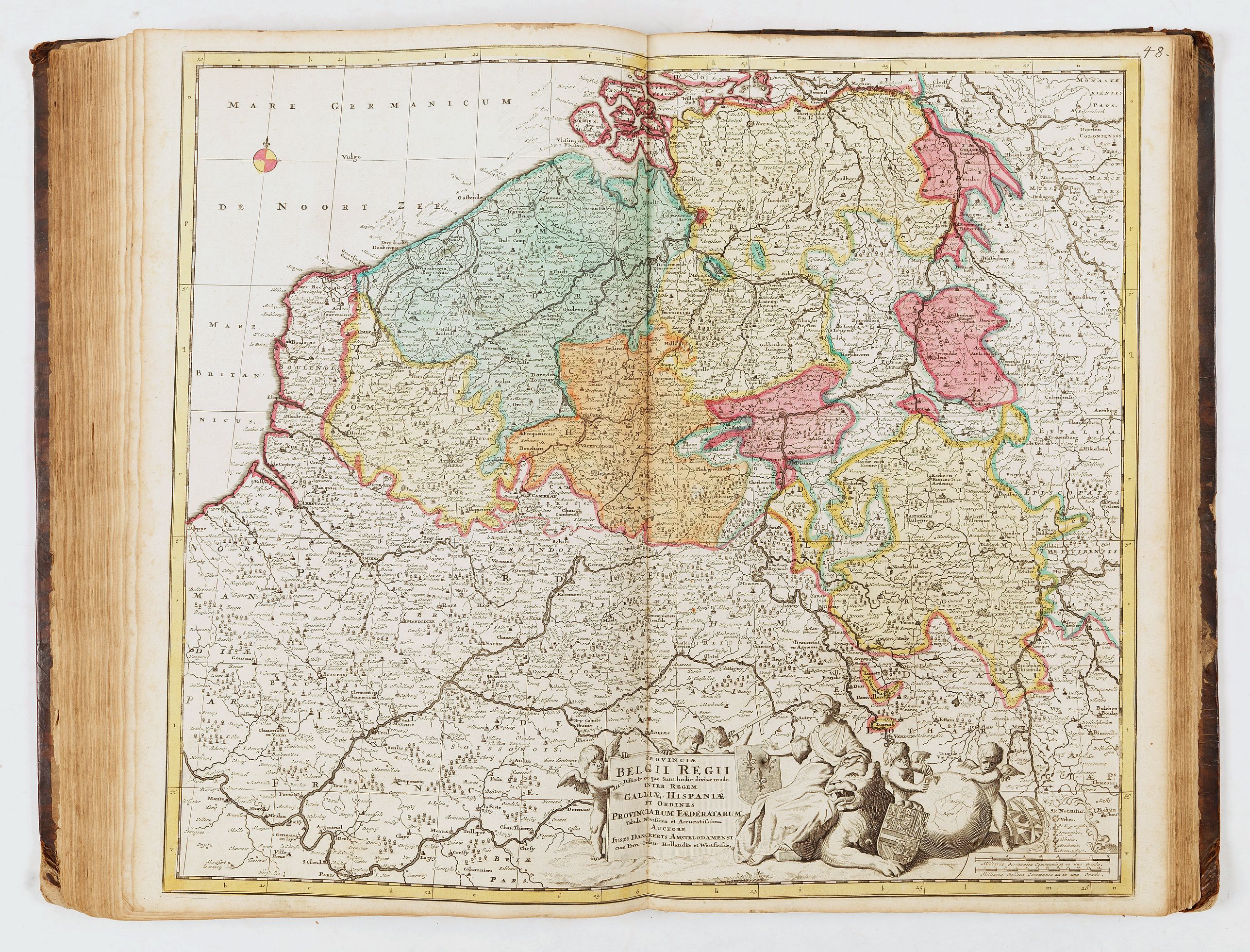
- 48, Provinciæ Belgii regii - Iusto Danckerts
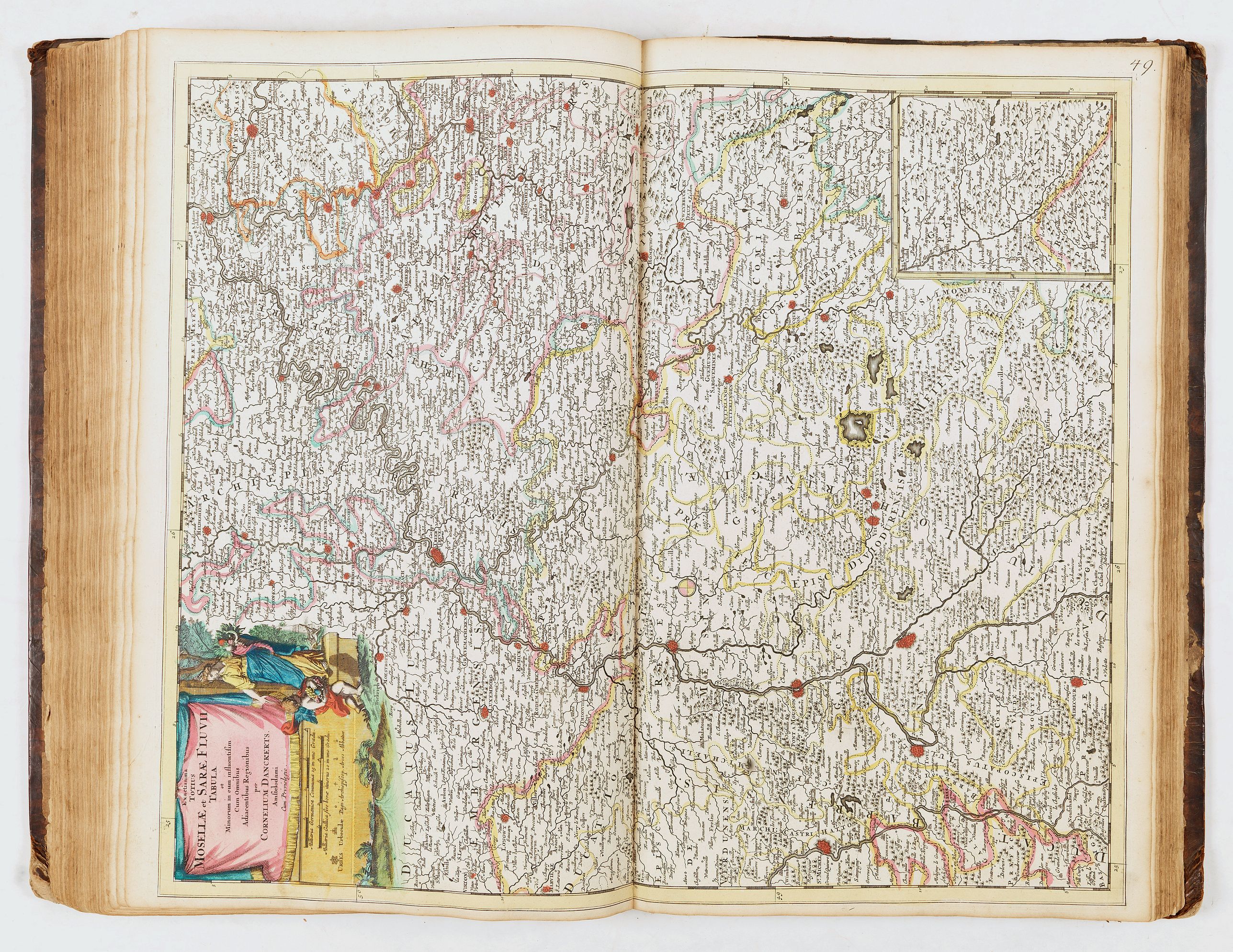
- 49, Mosellæ et Saræ Fluvii - Cornelius Danckerts
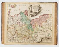
- 50, Circulus Westphaliæ - Justinum Danckerts
- 51, Episcopatuum Leodiensis et Coloniensis - T. Danckerts
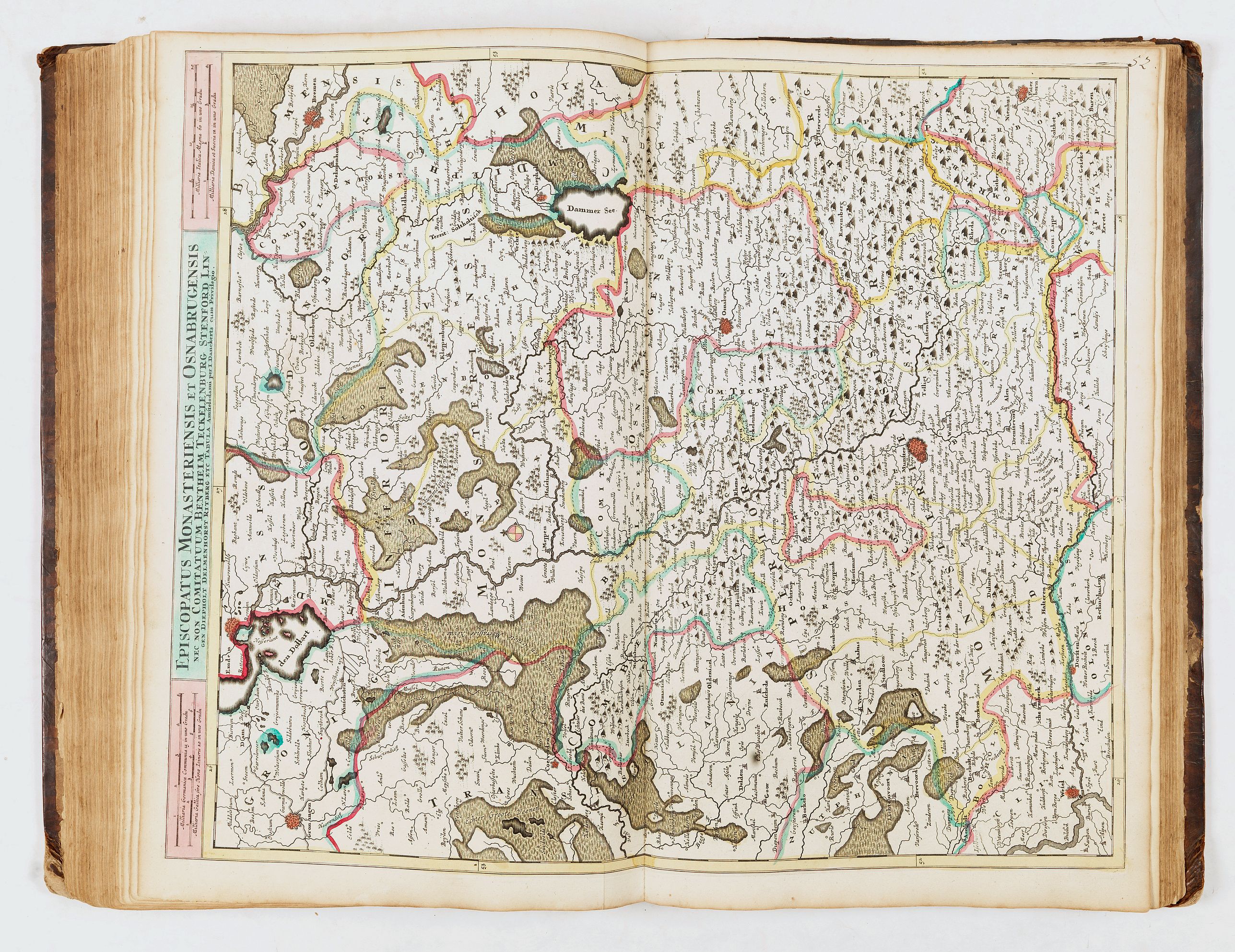
- 52, Episcopatus Monasteriensis et Osnabrugensis - J. Danckerts
- 53, Ducatus Wirtenbergensis - Johannes Danckerts
- 54, Ducatus Brabantiæ - Johannes Danckerts
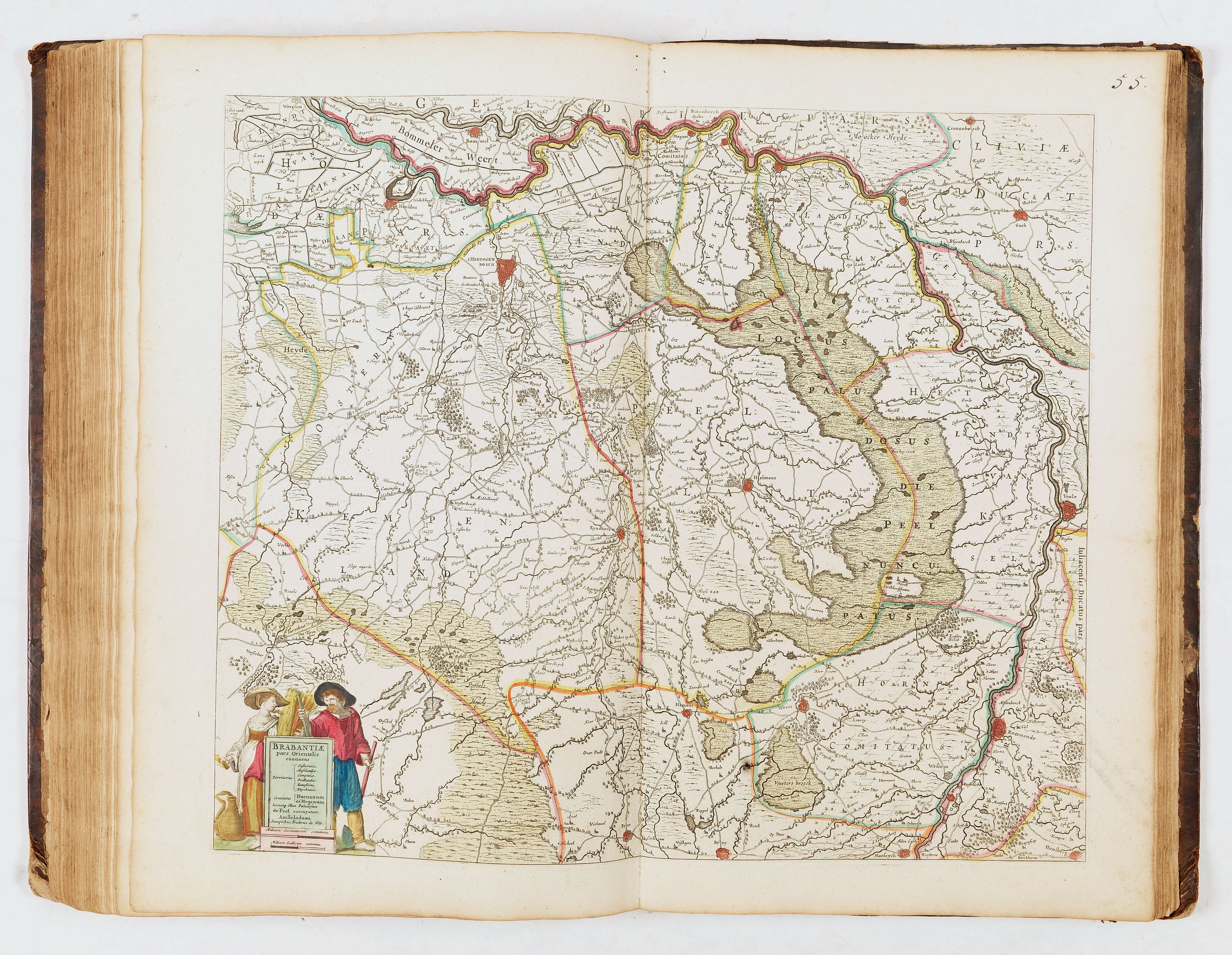
- 55, Brabantiæ par orientalis - Frederic de Witt
- 56, Quartæ partis Brabantiæ - not signed
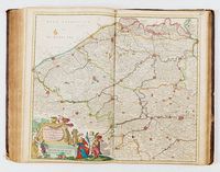
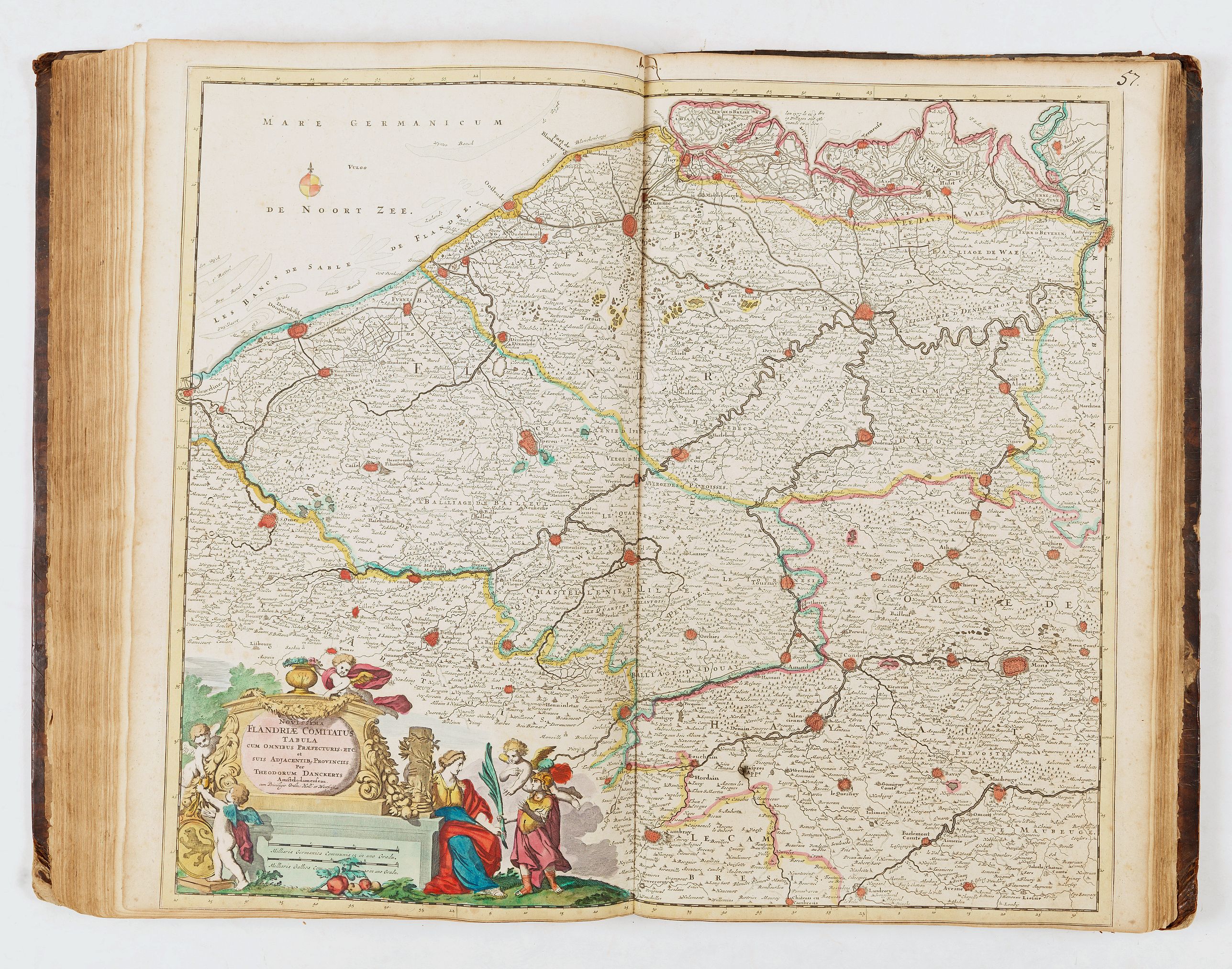
- 57, Flandriæ comitatus - Theodorum Danckerts
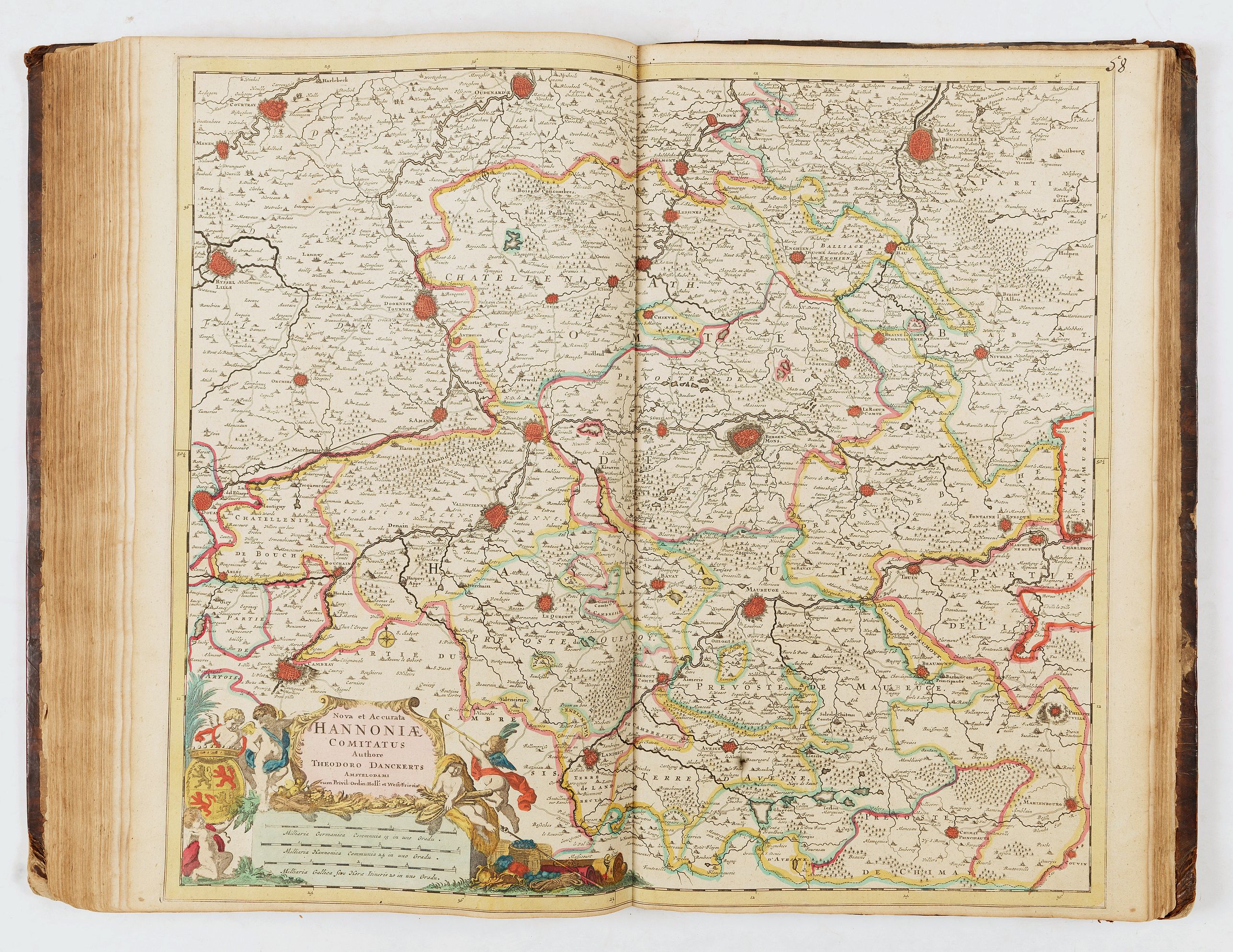
- 58, Hannoniæ comitatus - Theodorum Danckerts
- 59, Namurci comitatus - Theodorum Danckerts
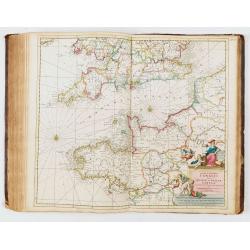
- 60, Canalis inter Angliæ et Galliæ - Theodorum Danckerts
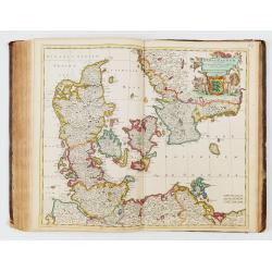
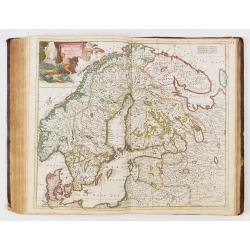
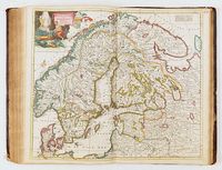
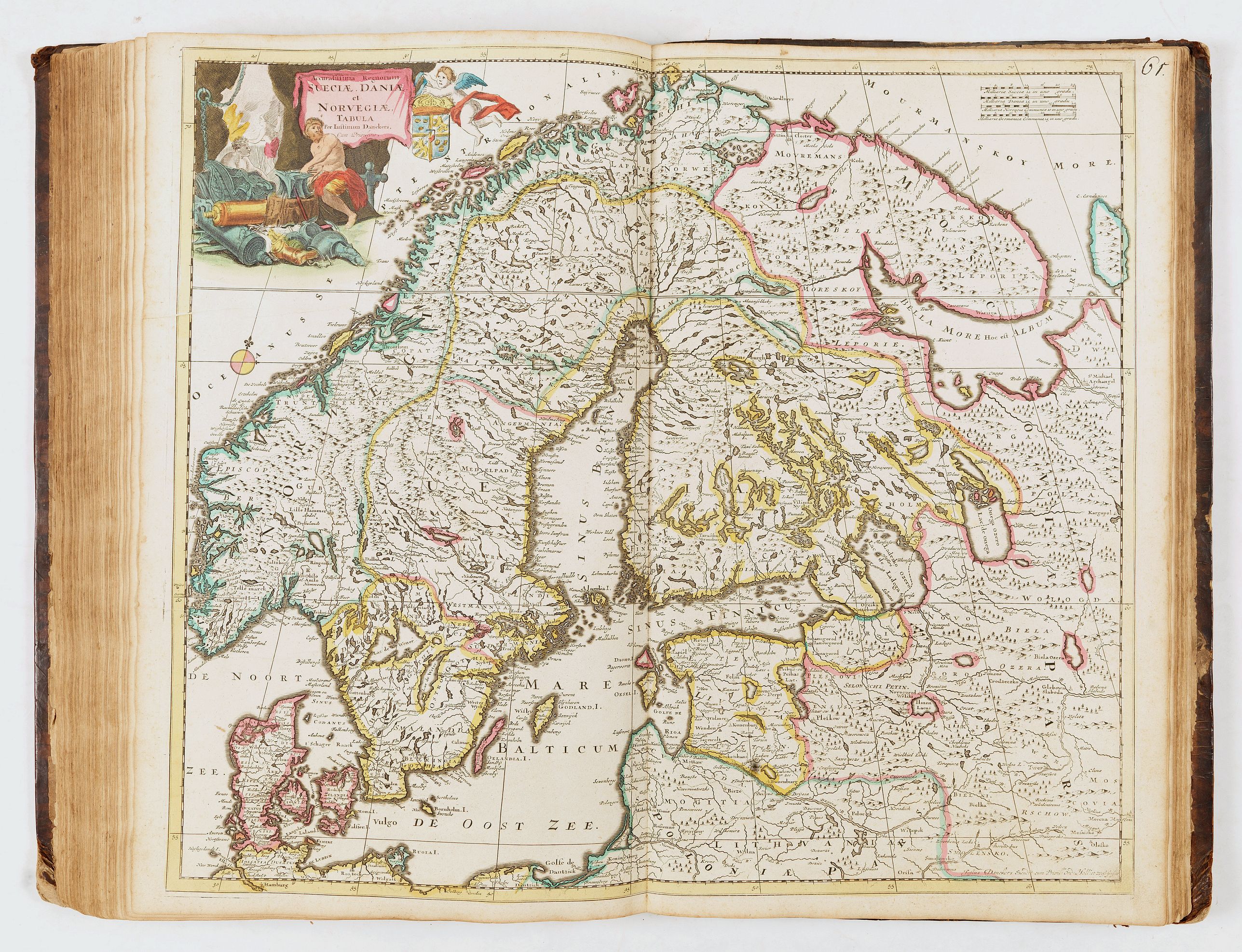
- 61, Sueciæ, Daniæ et Norvegiæ - Justinum Danckerts
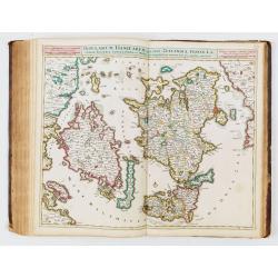
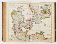
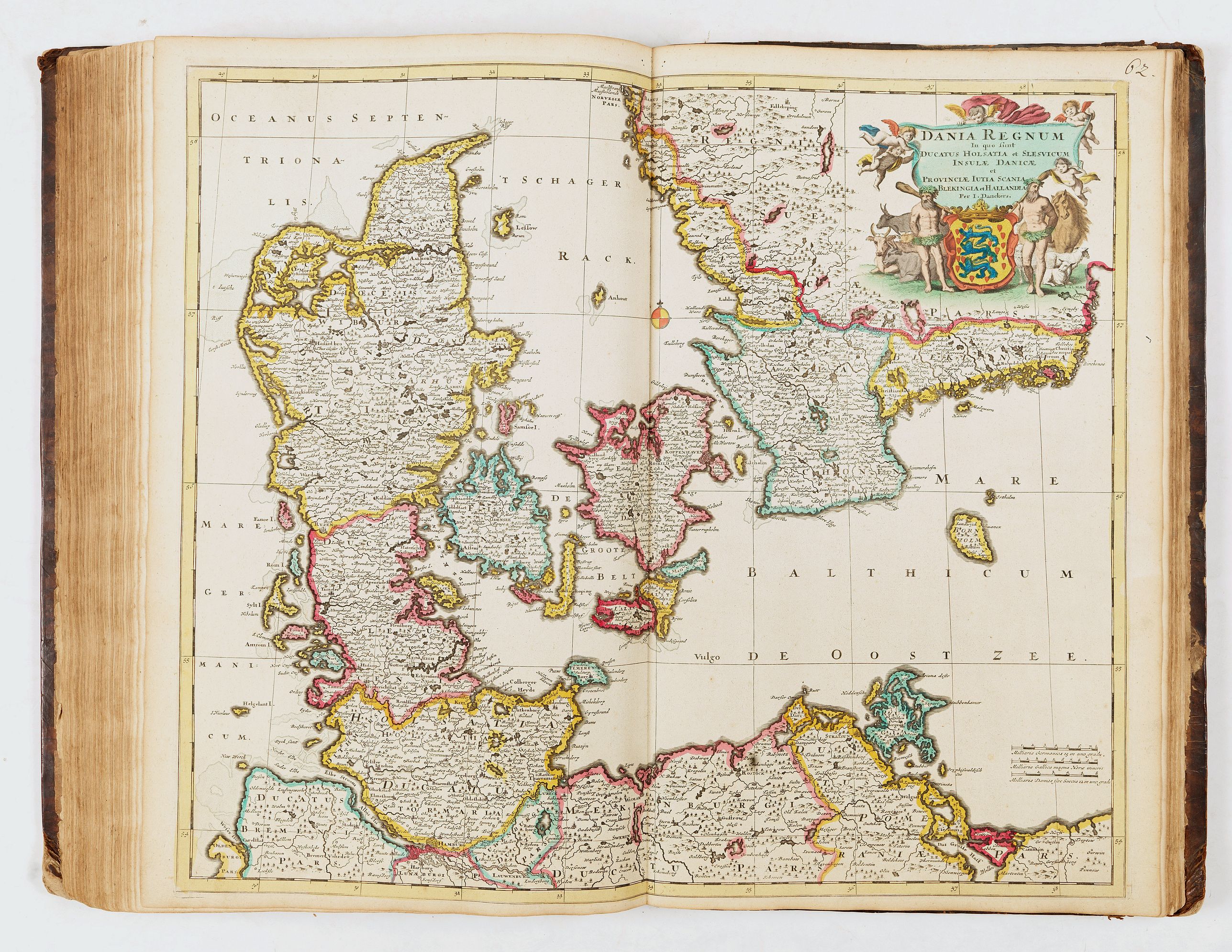
- 62, Dania regnum - J. Danckerts
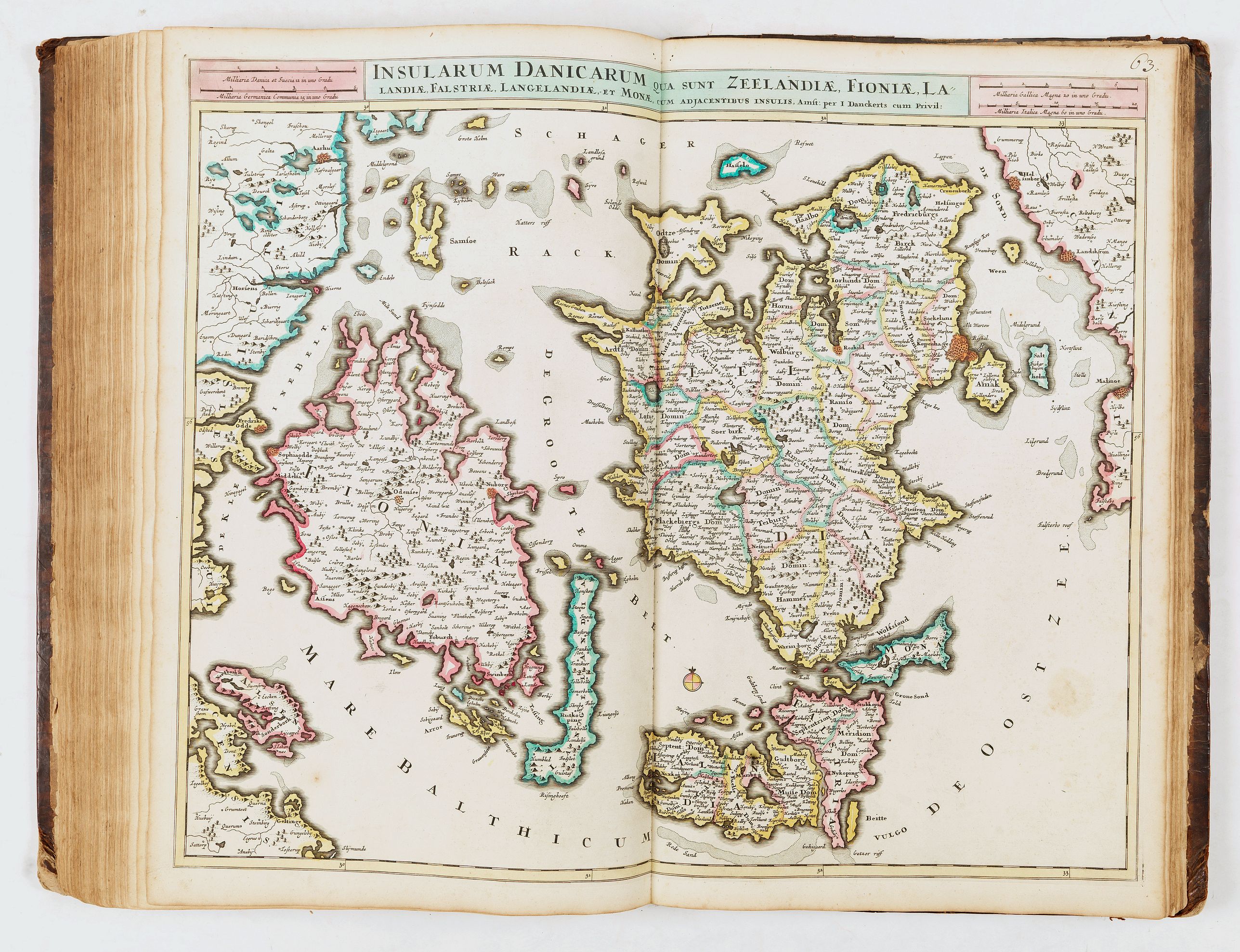
- 63, Insularum Danicarum qua snt Zeelandiæ, Fionæ…- J. Danckerts
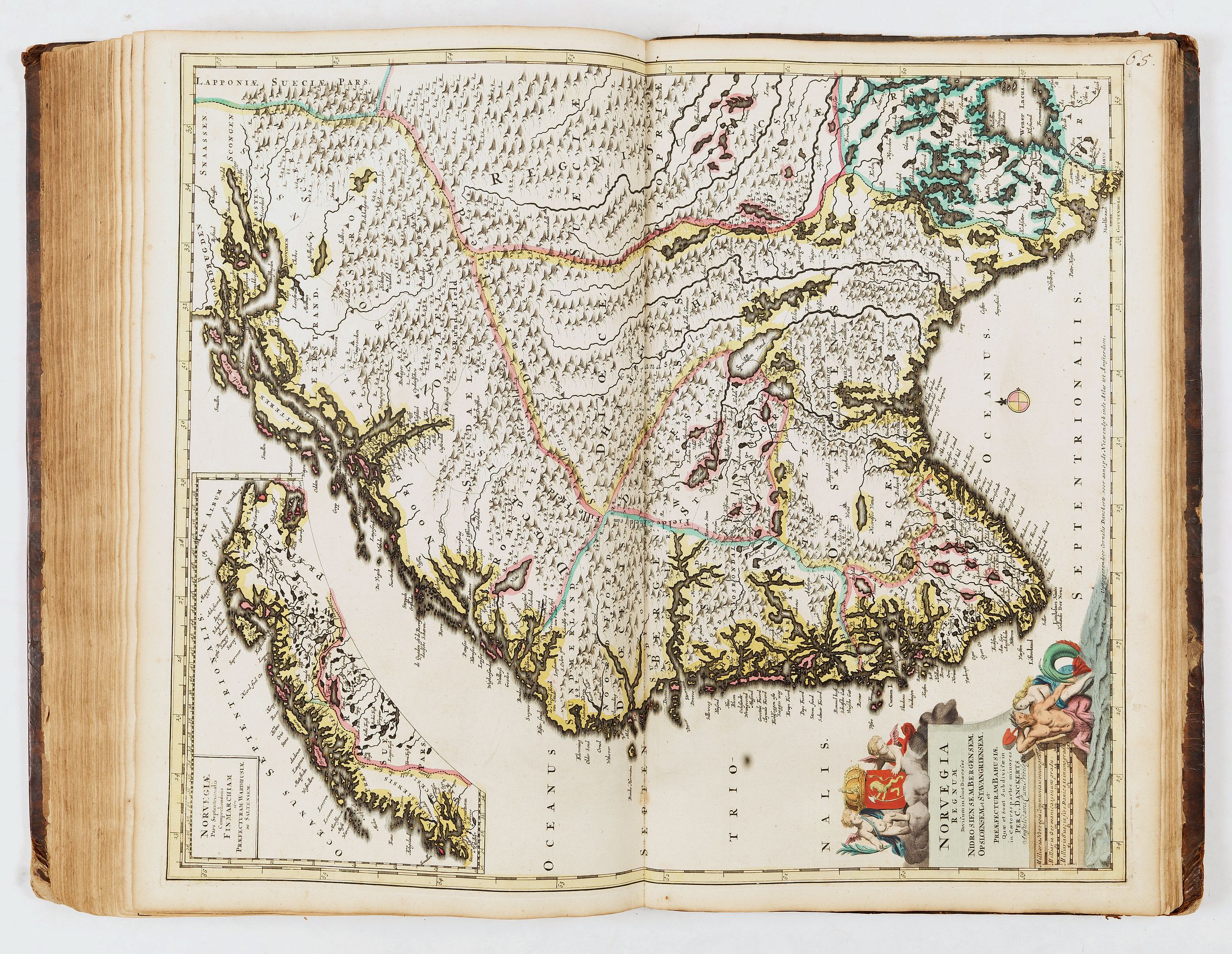
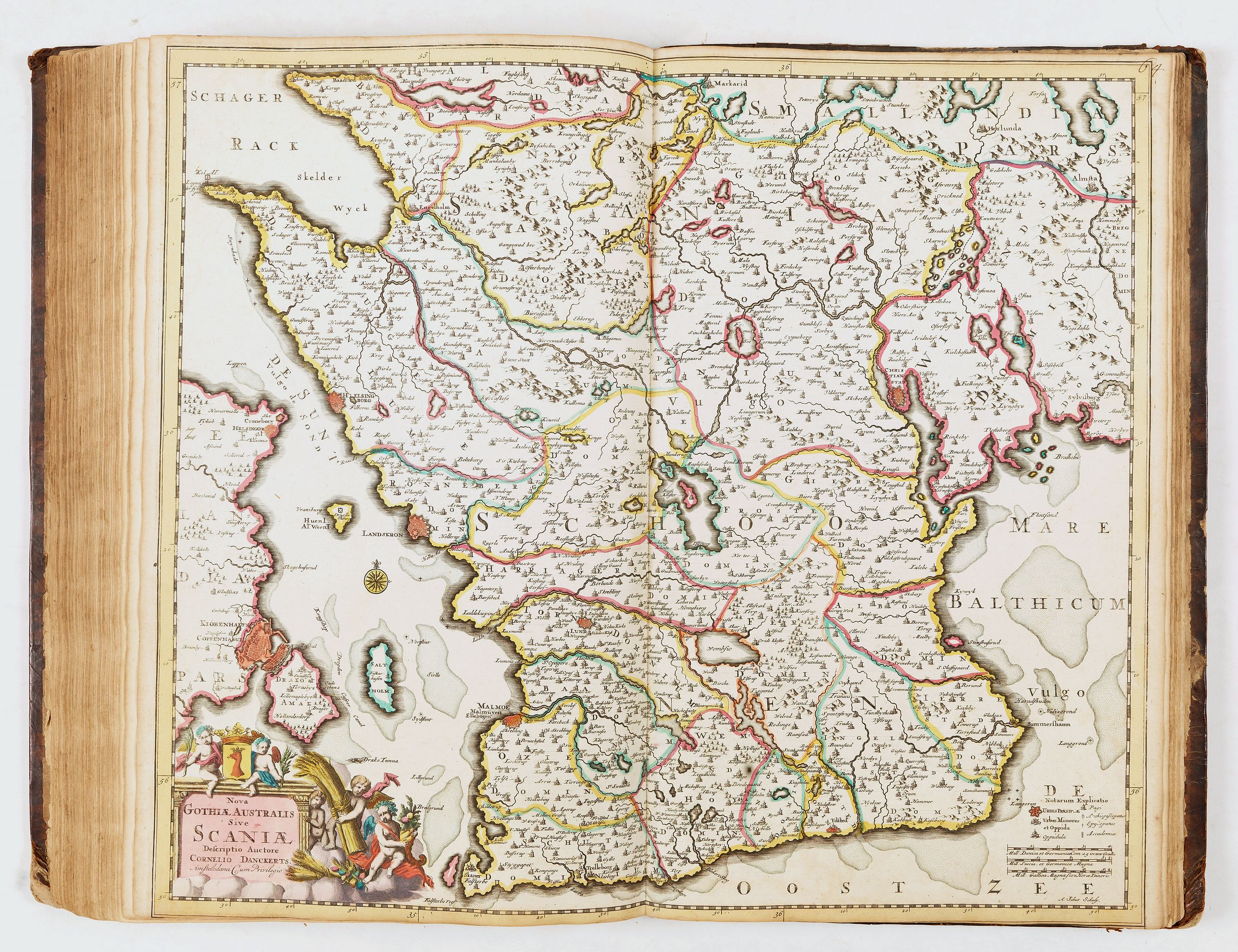
- 64, Nova Gothiæ Australis sive Scaniæ - Cornelius Danckerts
- 65, Norvegia regnum - C. Danckerts
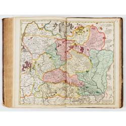
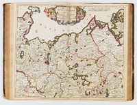
- 66, Totius Russiæ vulgo Muscoviæ - Justo Danckerts
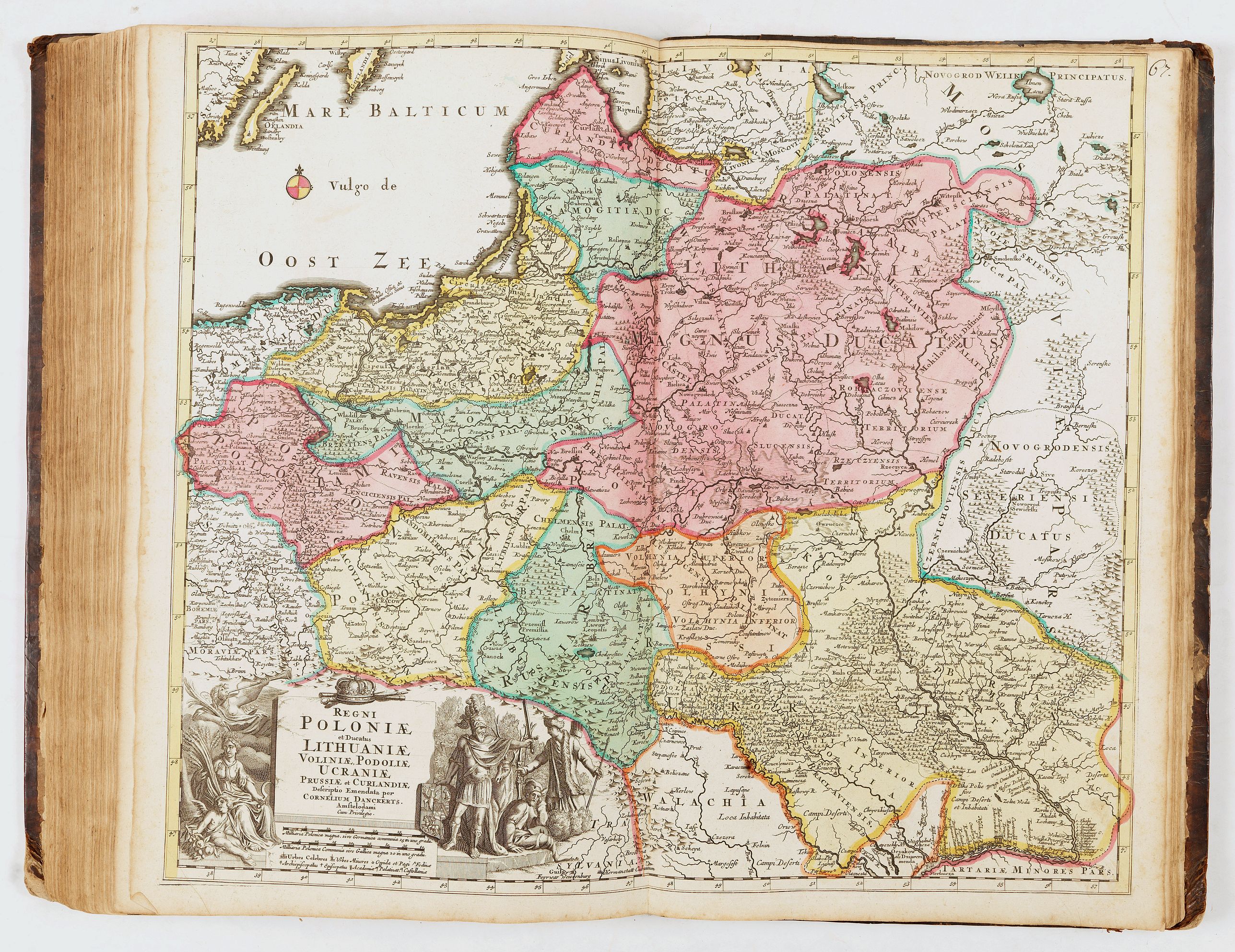
- 67, Regi Poloniæ et ducatus Lithuniæ - Cornelius Danckerts
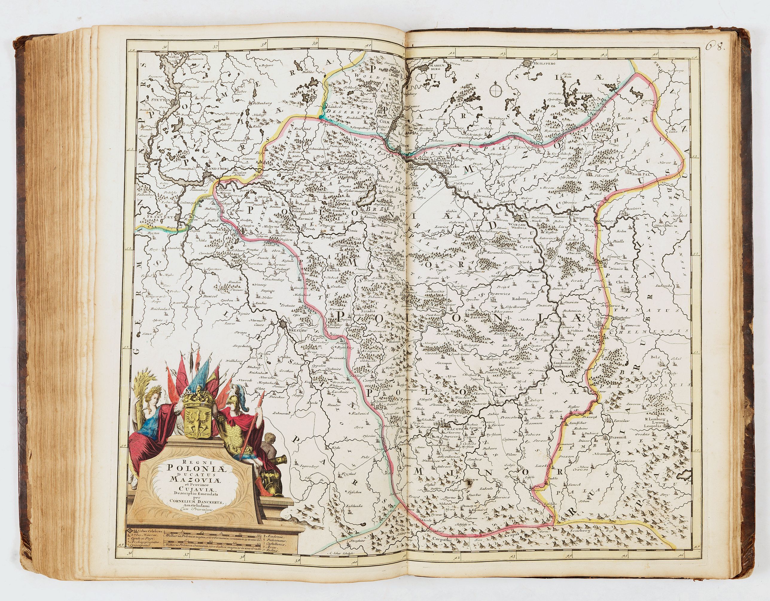
- 68, Regi Poloniæ, ducatus Mazoviæ - Cornelius Danckerts
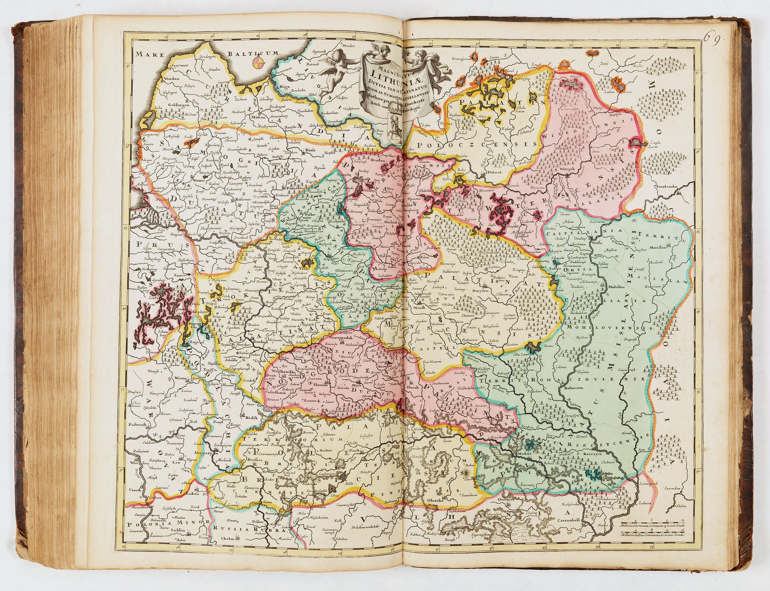
- 69, Lithuniæ - J. Danckerts
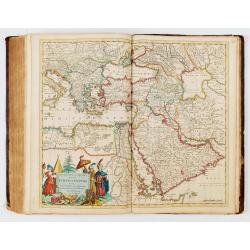
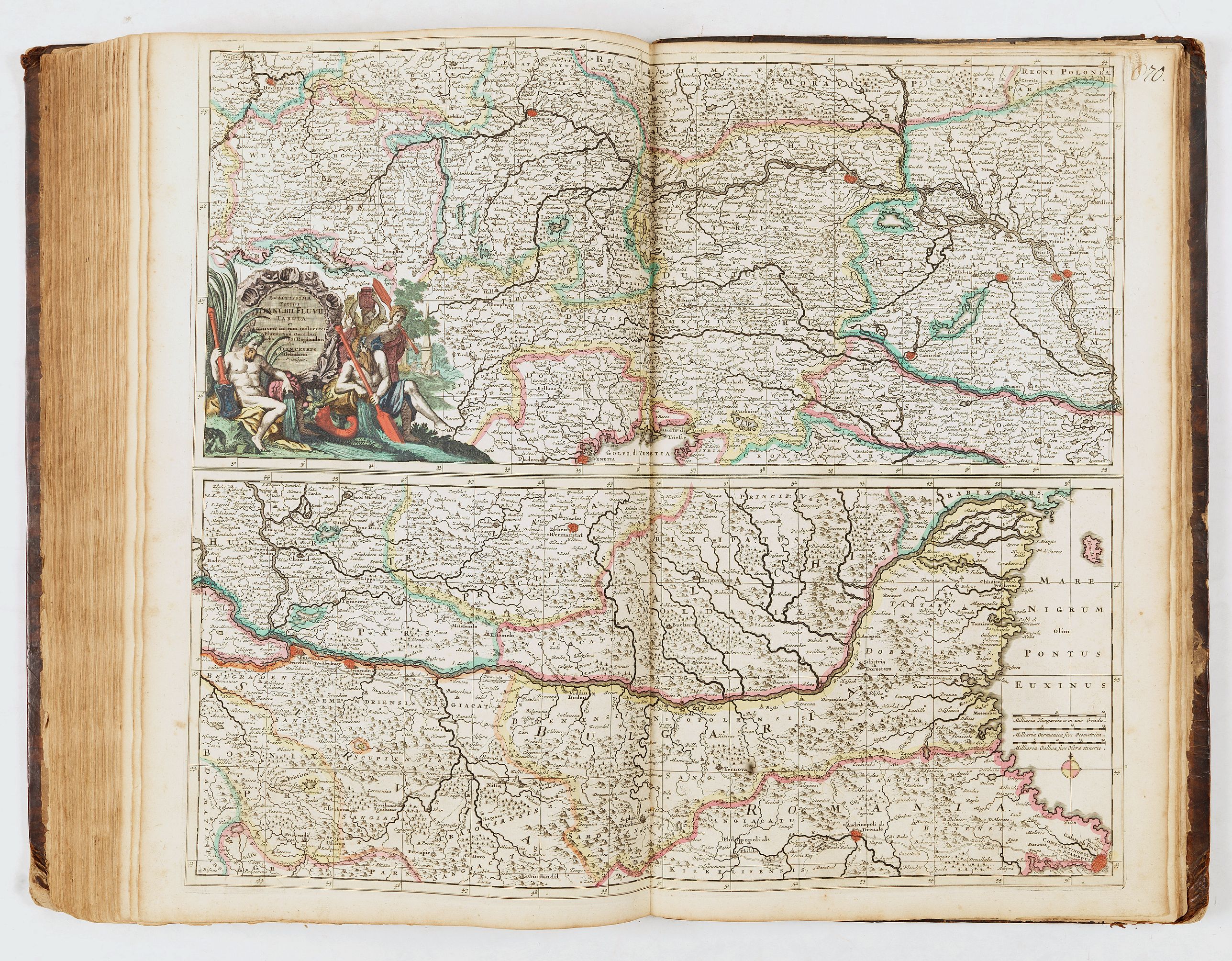
- 70, Totius Danubii fluvii - T. Danckerts
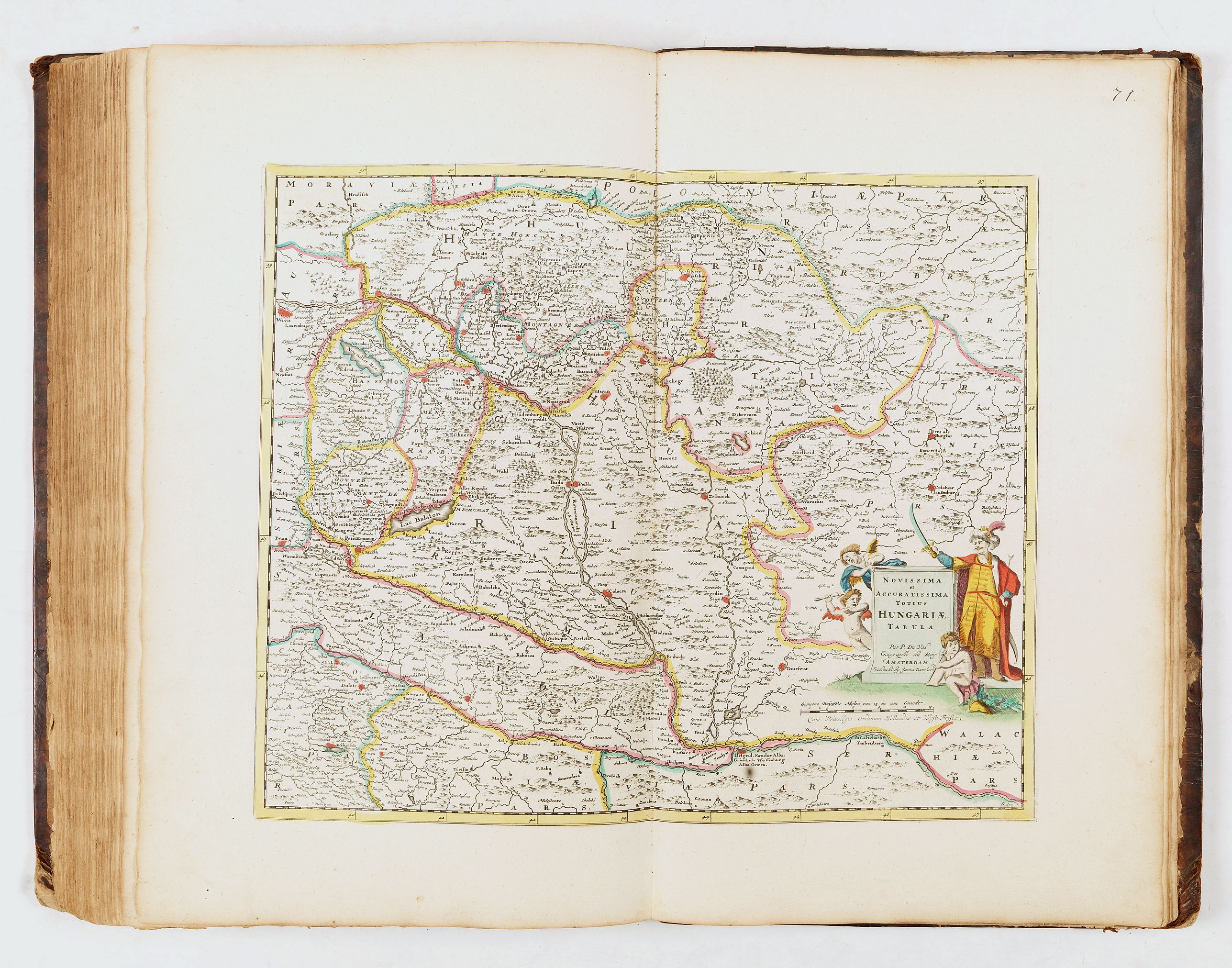
- 71, Totius Hungariæ - Justus Danckerts
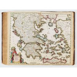
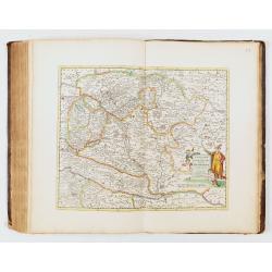
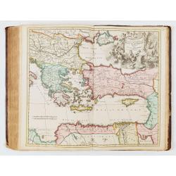
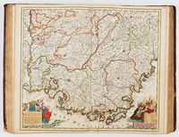
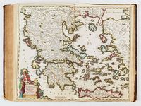
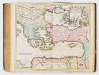
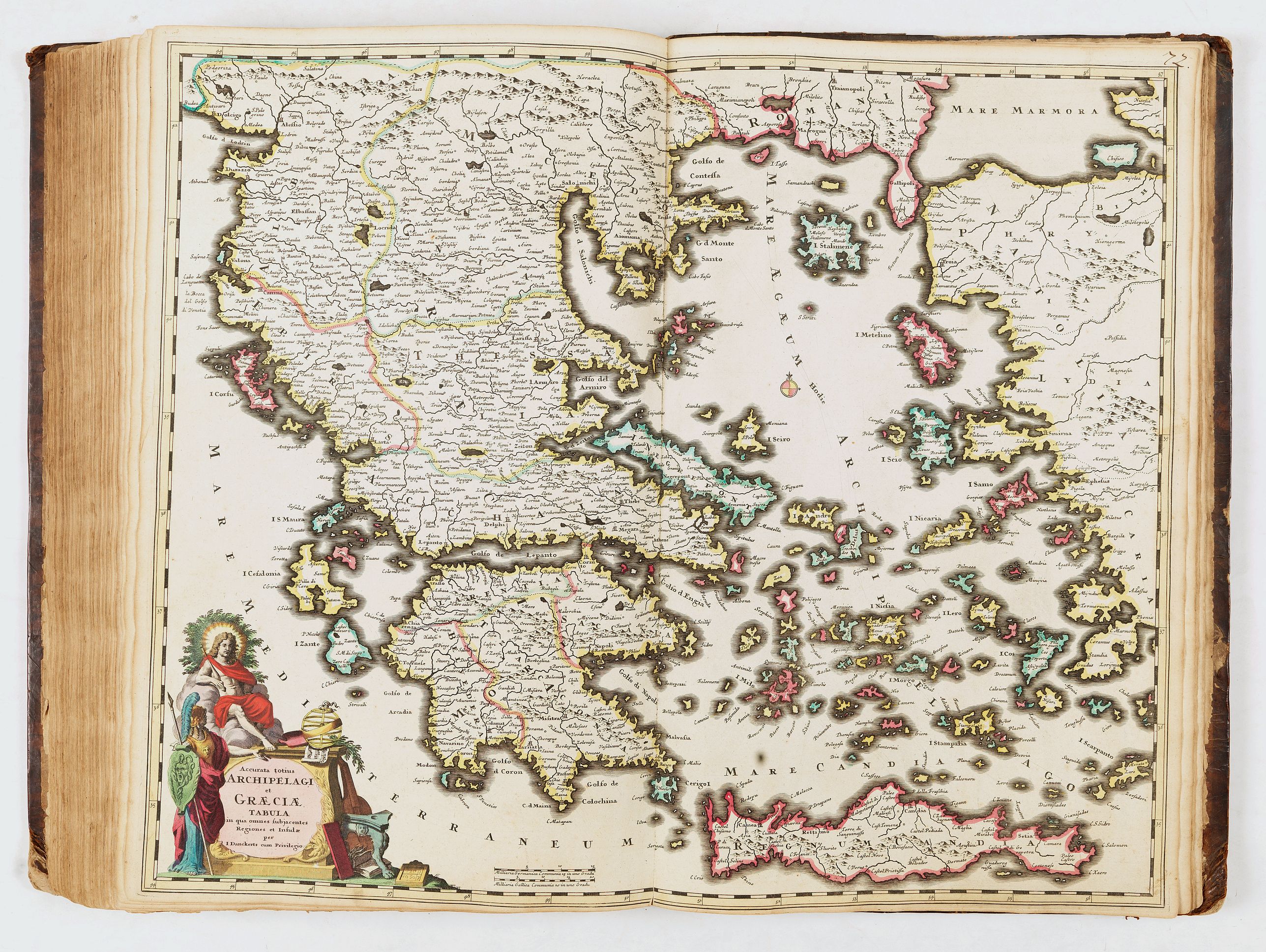
- 72, Archipelagi et Græciæ - I. Danckerts
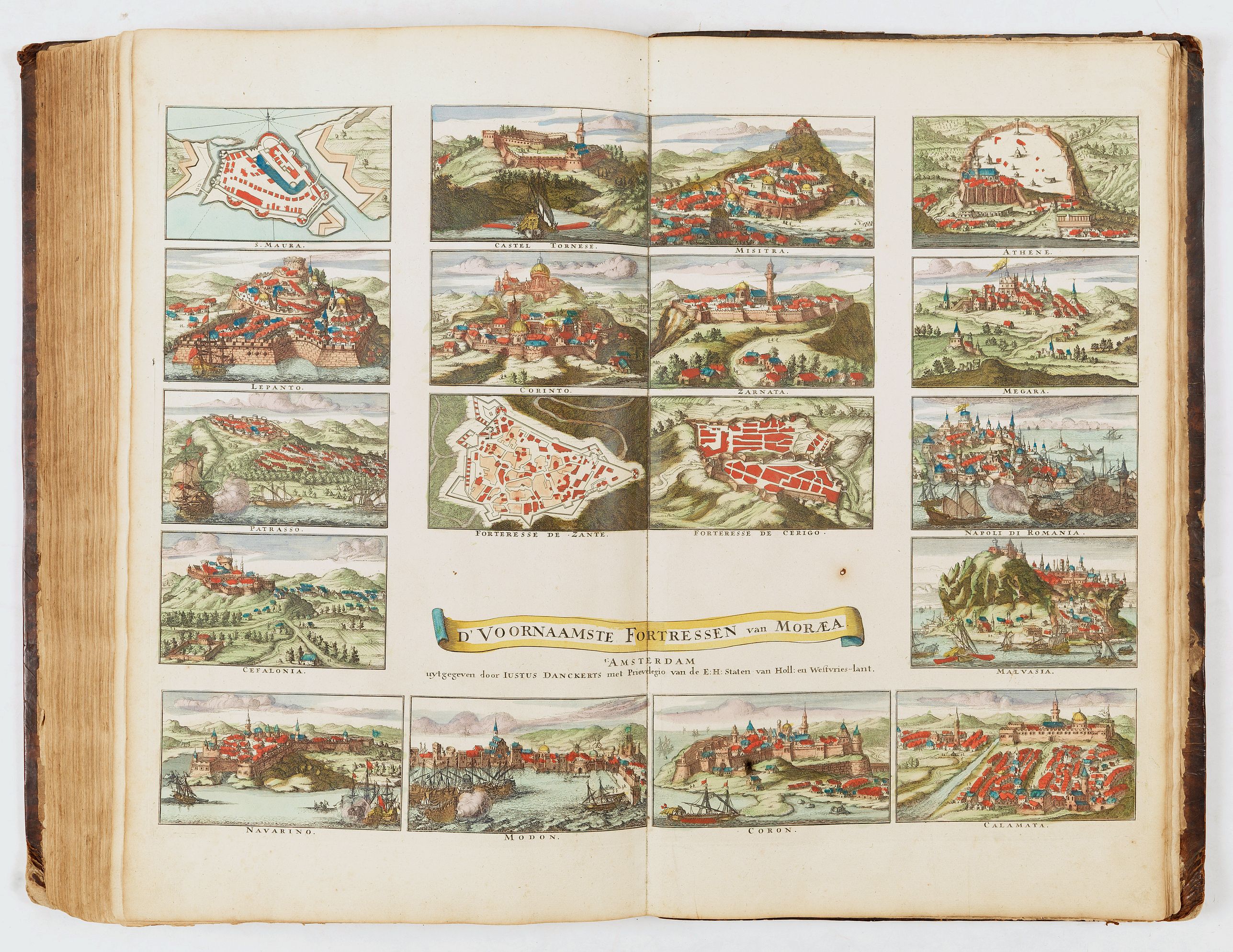
- - sans num., D'Voornaamste Fortressen van Moræa - Justus Danckerts
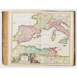
- 73, Occidentalioris districtus Maris Mediterranei - Justo Danckerts
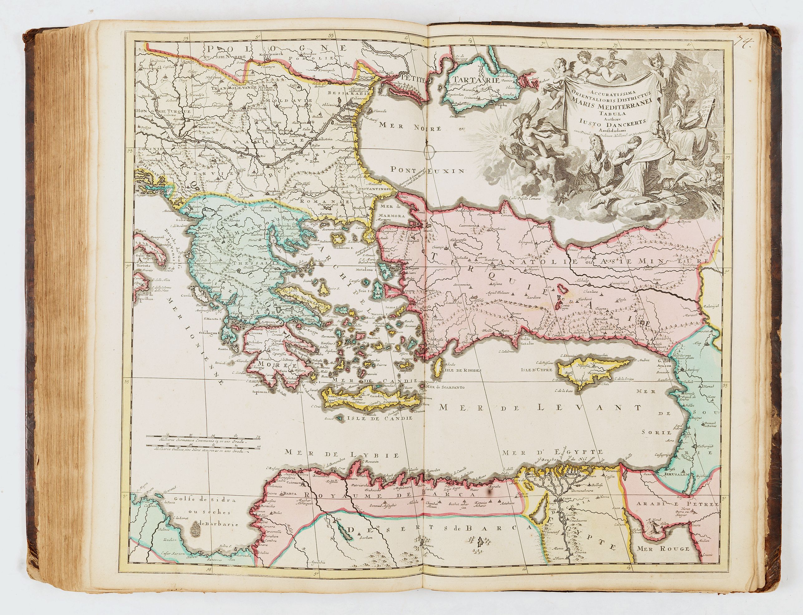
- 74, Orientalioris districtus Maris Mediterranei - Justo Danckerts
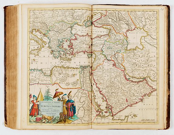
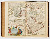
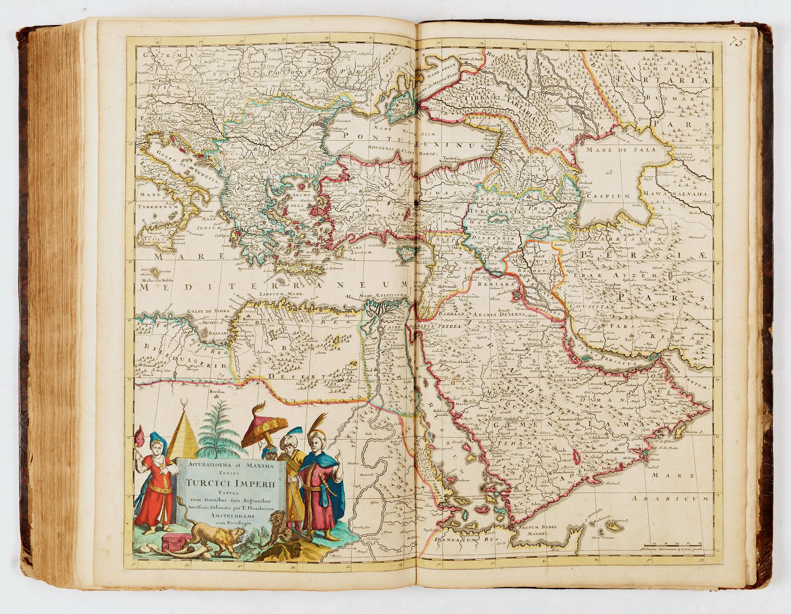
- 75, Totius Turcici Imperii - T. Danckerts
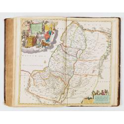
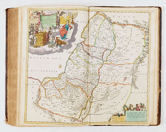
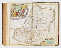
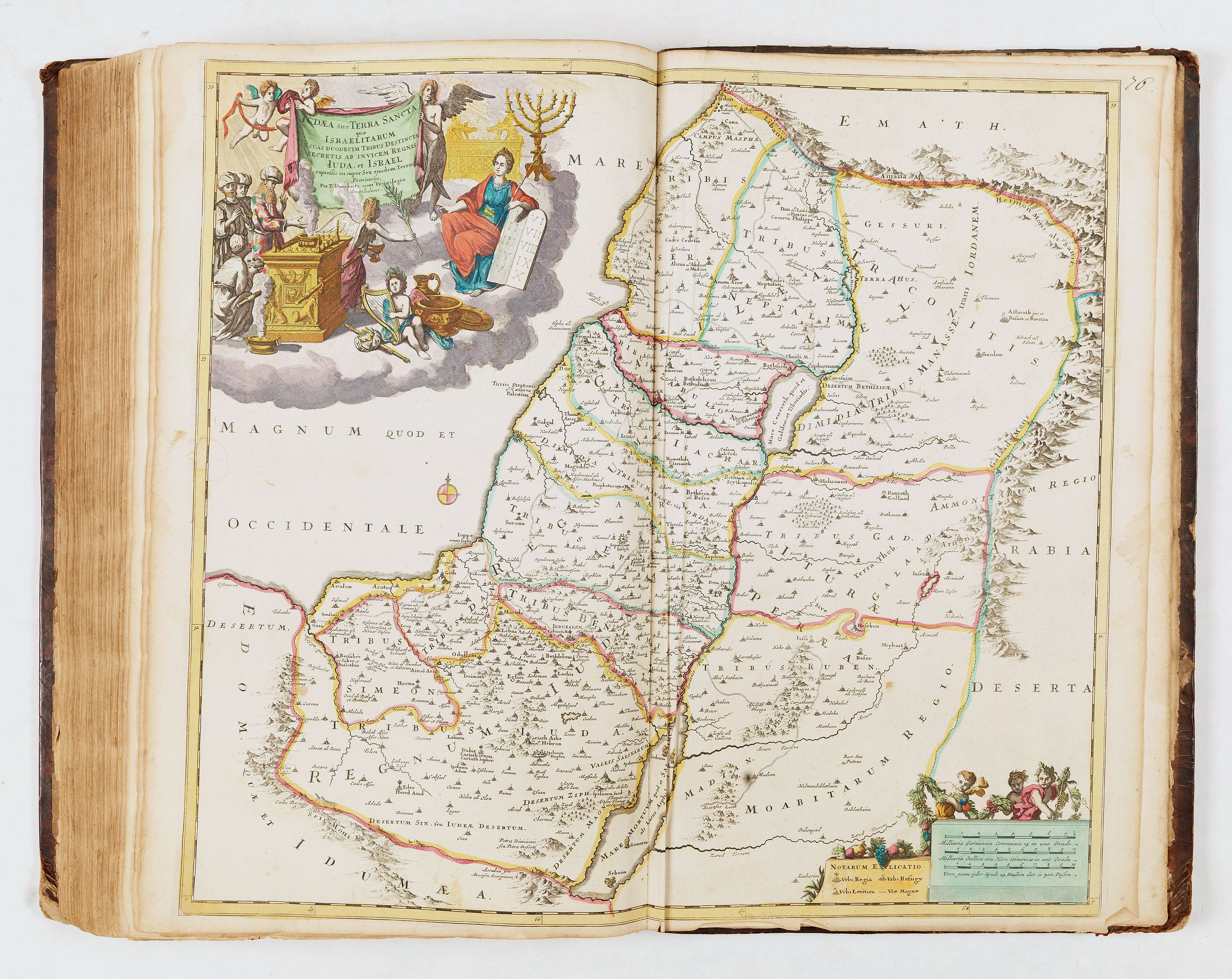
- 76, Iudea sive Terra sancta - T. Danckerts
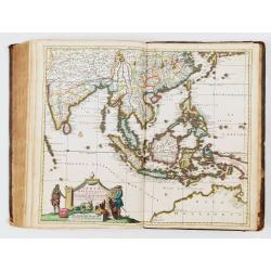
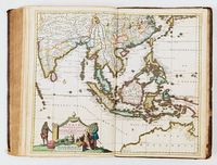
- 77, Indiæ orientalis - T. Danckerts
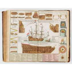
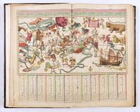
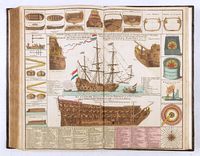
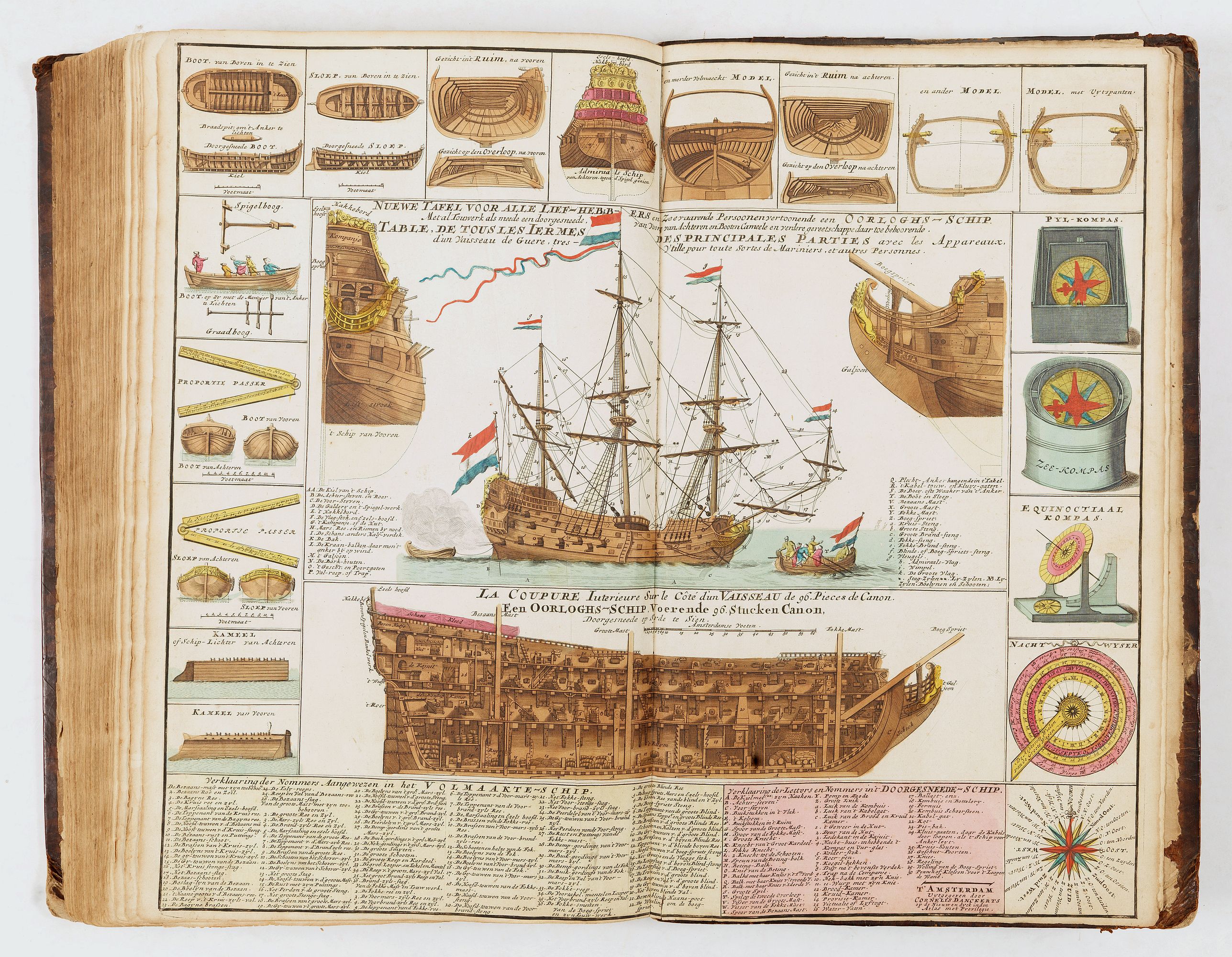
- [no number]Â Oorlogh's Schip - Tables de tous les termes des principales parties d'un vaisseau - Cornelis Danckerts
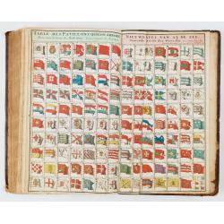
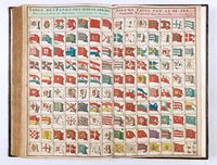
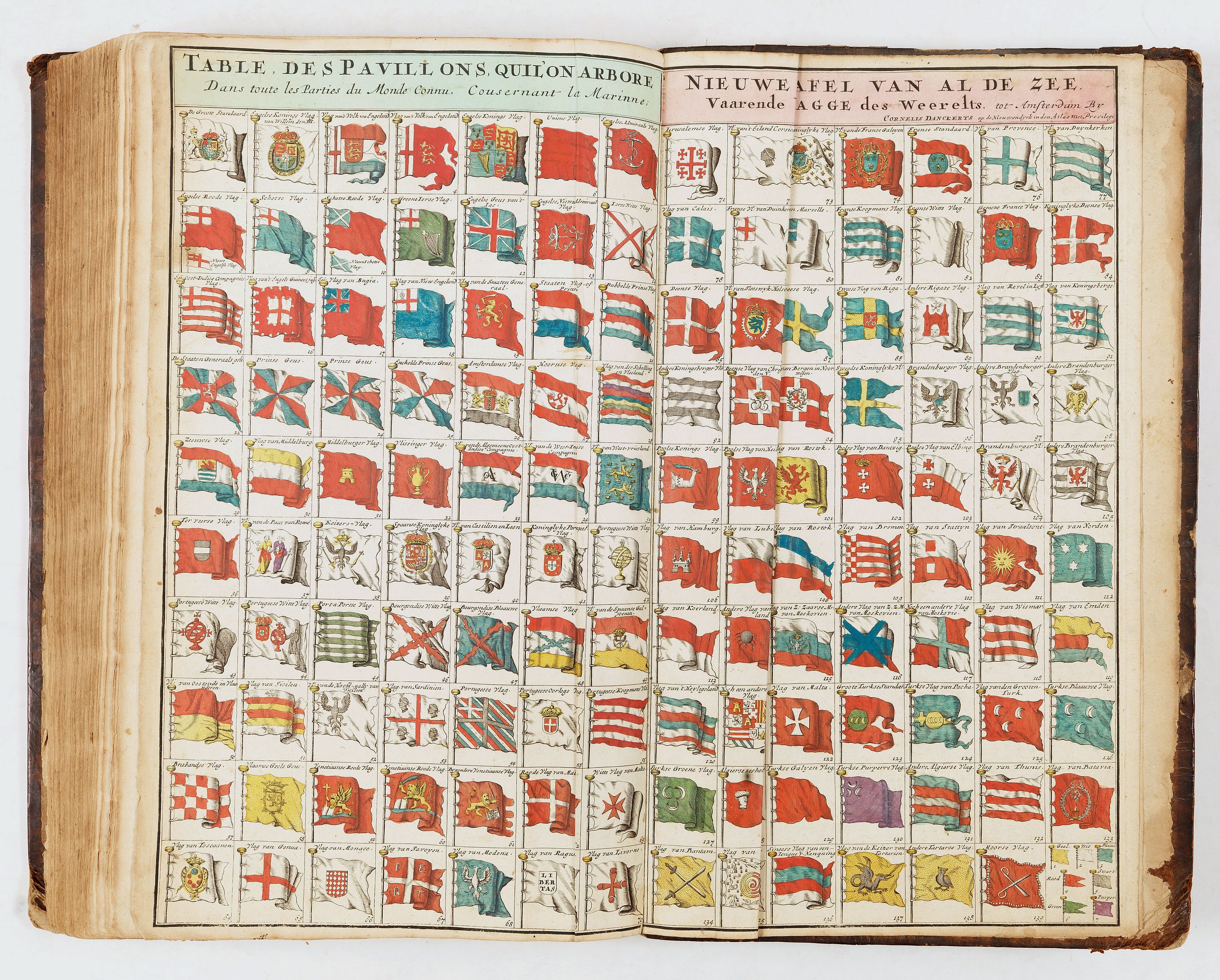
- [no number], Table des pavillons - Nieuwe tafel van al de zee - Cornelis Danckerts
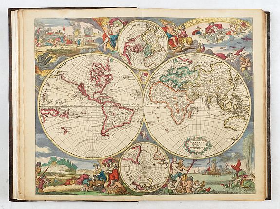
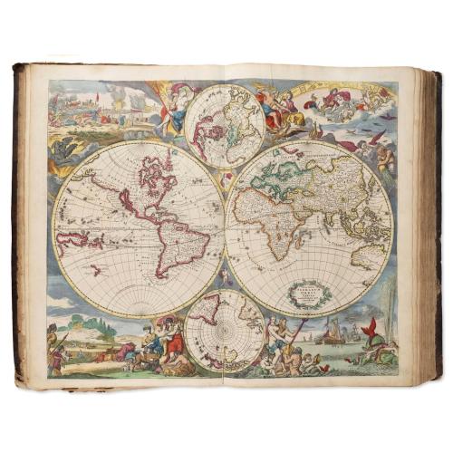
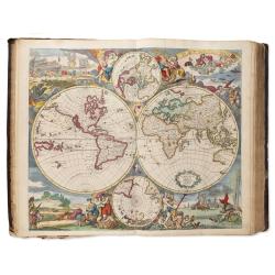
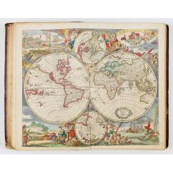
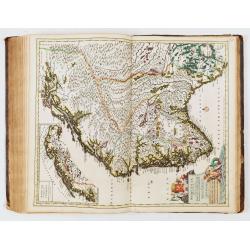
One of the most spectacular maps in this atlas is Justus Danckerts' classic ca. 1685 double-hemisphere map of the world, presented in its original, vibrant colors. Sometimes, after 1685, when a privilege was granted to the Danckerts firm, a new plate was engraved to replace the world map (Shirley, 495). Dancket's second plate can be distinguished from his first plate as it has added the names of the oceans up to the equator. The map combines the aesthetics of the Dutch Golden Age with updated cartography derived from the French authority Nicolas Sanson. Danckerts had, in 1680, produced a world map copied from Frederick De Wit's nautical map of 1668 Nova Totius Terrarum Orbis Tabula.
The vignettes in each corner of the map represent the four elements. However, the classical and pictorial elements employed in these images bring greater depth: each of the elements is invested with the meaning of its impact on man. The scene in the lower left is set amidst lush, forested hillsides and valleys abundant with grain. The mother goddess Cybele and the harvest goddess Demeter sit among fauns, cornucopias, and the fruits of a plentiful harvest. Shadowy figures at the left suggest the bloodier harvest of the hunt. These are images reflecting the element of Earth.
To the lower right, the sea god Poseidon presides over his element, Water, with his lover Venus draped decorously over his shoulder. Sea-putti and a merman attend the couple, blowing conches and adorning the goddess with strings of pearls. To the right, two nymphs wrangle a monstrous, spouting whale. In the background, warships press each other in battle.
In the upper left, still more war-like imagery attends the element of fire. The three-headed guard dog of Hades, Cerberus, growls and snaps while massed armies strive against a background of burning castles. To the right, Hades wrestles a struggling Persephone, an illustration of the king of hell abducting Demeter's daughter in a triumph of violence and death over the Earth's promise. Finally, in the upper right, the element of Air is represented. Under an arching Zodiac, the celestial gods congregate: Apollo of the Sun, Diana of the Moon, Mercury, Saturn, and Mars commune amongst the clouds. They are presided over by Jupiter - unhinged, brandishing a fistful of lightning bolts - and Juno, who appears to be gently restraining her husband with her distaff. Avatars of wind and rain are also depicted, and the skies are filled with birds in flight. The element of Air, more than all the others here, is portrayed as being beyond human command and the source of the unstoppable whims of the gods.
As noted above, these images appeared first on Frederic De Wit's 1668 map. The vignettes were composed and etched by Romeyn de Hooghe; they would later be copied by Danckerts in his earlier double-hemisphere world and are retained here.
Distinct from the De Wit original, Danckerts introduces an element of Christian imagery in the cruxes of the hemispheres. In the upper crux, a putto displays scripture in one hand and a cross in the other, basking in radiant light; in the lower crux, shrouded in dark clouds, another putto clutches an idol in its hands.
While starting from the base of the 1668 De Wit map, Danckerts' map incorporates elements drawn from Nicolas Sanson, as interpreted by Hubert Jaillot's cartography of 1674, and, in turn, advances that geographic model in several areas.
De Wit and Danckerts alike present California as an island, a well-established geographical concept by that time. The region to the northwest of that imaginary island differs sharply from De Wit: extending across the Pacific from Japan's Iedso is a massive Terra Esonis This element is derived from Jaillot's 1674 map of the world, which was, in turn, informed by Nicolas Sanson.
East of the sea, separating California from the mainland, is "Mexica Nova". Here, a river (a conflation of the Rio Grande with the Colorado) runs from a lake east of the ancient settlement of Acoma toward the southwest and the Gulf of California rather than to the Gulf of Mexico. The river's source, as depicted here, may result from reports of the Great Salt Lake from the Onate and Coronado expeditions.
De Wit had already adopted the French geography of the northeastern portions of North America, which was more authoritative and accurate than that of contemporaneous Dutch mapmakers.
Hudson Bay appears in recognizable form, albeit with openings to the west, suggestive of hoped-for connections with the Pacific. This mapping of the Great Lakes incorporated all five lakes, although the western reaches of Lakes Superior and Michigan were left unfinished, again suggesting the possibility of a navigable water route to the Pacific.
The Northeast is dominated by 'Canada sive Nova Francia,' and the claims of France's European rivals are only grudgingly acknowledged.
Some coastal cities (including New Amsterdam, Plymouth, and New London) are named along the coast. Virginia is acknowledged mainly by the Indigenous name 'Powhatan. Spanish Florida, which extends north to include most of the American Southeast, Lake Apalache or 'great freshwater'Â southeast, is shown but not named.
Explorers of South America throughout the late 16th and early 17th century (enthralled by Pizarro's conquests in Peru and tales of other gold-rich empires in the interior) actively sought El Dorado, which Sir Walter Raleigh placed in the mythical city of Manoa, on the shores of the Lake Parima, near modern-day Guyana, and Danckerts includes it here. Further south, a prominent (albeit unnamed) Laguna de Xarayes forms the northern terminus of the Paraguay River.
The apocryphal Laguna de Xarayes was often regarded as a southern gateway to the Amazon and the Kingdom of El Dorado.
Australia, New Zealand, and the South Pacific were virtually unknown to European explorers. The depiction of these lands on all maps from the mid-17th century until Cook's voyages is based on Abel Tasman's 1642 map. For over a century, only the western coast of Australia and New Zealand have appeared on maps. Danckerts introduced both massive guinea mysterious 'quiri regio,'Â
The discoveries around Australia made by Tasman on his first and second expeditions in 1642-44 are included. New Zealand is drawn only by one coastline, New Guinea is drawn as a large island and Danckerts added the names of the oceans.Â
In addition to the main hemispheres, the map includes two subordinate polar projections. Typically, these are seen bounded by the Arctic and Antarctic circles. Here, Danckerts has extended both the northern and southern projections to present entire hemispheres to the Equator, thus offering a different perspective on the entire globe rather than simply highlighting the polar regions.
Shirley dates the map to after 1684, based on the inclusion of Danckerts' privilege (obtained that year).Â
Reference: Shirley world (1984): Entry 529) Plate 372
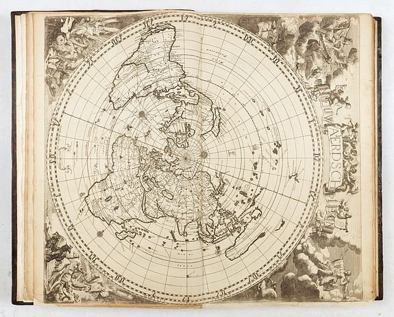
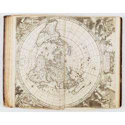
Cornelis Danckerts and his “Nieuw Aerdsch Pleyn”. A most decorative world map in an equidistant polar projection, inspired by Cassini's map of 1650. Based on Jacob Robyn and Hendrick Doncker's four-sheet world map, this edition was also likely devised by Andreas van Luchtenburg, with the surrounding allegorical scenes engraved by Jacob Harrewyn. This is the second state with Robyn's imprint replaced with that of Cornelis Danckerts. The map is presented in a circular form on the equidistant azimuthal projection created by Le Mayerne Turquet in 1648, in which the latitudes appear as equidistant concentric circles.
In North America, only one Great Lake is depicted, and Nieu Nederland appears on the East Coast as opposed to New York, as it was renamed in 1644. California is shown as an island with a flat northern coastline. In South America, the two mythical lakes Parime Lacus and Xarayes are depicted. Parts of New Zealand and Tasmania are also shown, and Australia is connected to New Guinea. References: Shirley #582.
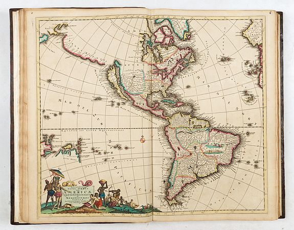
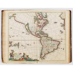
Novissima et Accuratissima Totius Americae Descriptio per I. Danckerts. Presents a richly detailed and decorative depiction of the Americas, engraved and published by Justus Danckerts in Amsterdam around 1696. It is a fine example of late 17th-century Dutch cartography, notable for both its geographic content and elaborate artistic embellishments.
The decorative elements are among the map's highlights. A large cartouche in the lower left features allegorical figures, native peoples, and exotic animals. The oceans are filled with sailing ships and sea monsters, adding to the visual interest and romantic allure typical of the period. These features make this map not only a document of early geographic knowledge but also an artistic representation of European imagination and ambition regarding the New World.Â
One of the most remarkable features is the depiction of California as an island. This cartographic misconception frequently appeared on maps of this period and was primarily influenced by Nicolas Sanson's model.
The map's cartography is derived entirely from that by Frederick de Wit, c.1675. Here he draws on the fifth state with the added place name in the Great Lakes. The only significant difference is that Danckerts, this time, removes the decorative cartouche top left. This enables him to include more of the Dutch explored lands of Terra Esonis, Yedso and Iaponiae.Â
The map includes five Great Lakes, with de Wit being the first Dutch cartographer to do so. However, the two western lakes of Michigan and Superior are left open to the west. (Burden)
The legendary Seven Cities of Cibola are depicted in the American Southwest, and the Mississippi River is shown in a vague and inaccurate course, placed far west of its actual mouth.
A large lake in the southeastern part of North America, first popularized by Le Moyne, is also retained here. South America is shown with a notably wide profile, and a possible Northwest Passage is suggested by an optimistic extension from Button’s Bay in the far north.
With New Guinea and "Quiri Regino" added in the lower left. It was Danckerts who introduced both the massive guinea and the mysterious 'quiri regio.
While maps of the Americas by Visscher and De Wit are more commonly encountered, this edition by Justus Danckerts is considerably rarer and especially prized by collectors of Dutch maps and early American cartography.

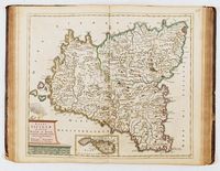
DANCKERTS, Theodore (1663-1729). Indiae Orientalis nec non Insularum Adiacentium Nova Descriptio. Amsterdam, ca 1685.
Engraved map of India, South East Asia, Japan and the north coast of Australia, fully colored in a contemporary hand, image 503 x 588 mm (528 x 623 mm sheet). Decorated with an allegorical cartouche. The map extends from India and the Maldives in the west to New Guinea and the southern coast of Japan in the east and is centered on the Straits of Malacca and the Malay Peninsula.
The treatment of Australia is of great interest, with numerous placenames on the Northern Coast, but only a tentative passage between Australia and New Guinea. Featuring a number of place names in "Nova Hollandia." The map was reissued at the beginning of the 18th century by Peter Schenk.
The Dutch discoveries in Australia include those of Carstensz in the Pera on Cape York in 1623, Tasman’s second voyage on the northern Australian coast in 1644, and those of van Colster in the Arnhem in 1623. After the two voyages of Abel Tasman in 1642-1644 and his subsequent reports, the VOC’s interest in the Australian coast was purely one of navigation. They no longer attempted to engage in trade with the indigenous population, as instructed by Tasman, nor did they further explore the coastline. Their charting was devoted solely to the updating of their existing charts. A superb decorative title cartouche is located at the lower left.Â
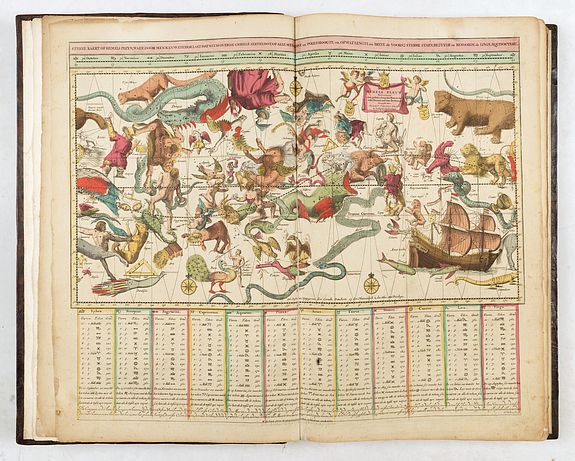
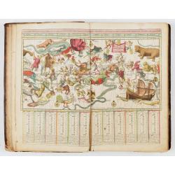
Sterre kaert of hemels pleyn, waer door men kan wete hoe laet dat het is over de gehele aertkloot... Mercator style projection of the entire night sky, showing all the heavenly bodies, and with panels of astrological notations below. Prepared by Remmet Teunisse Backeret et engraved by J. de Broen, it was originally published c.1684 by Johannes van Keulen. It was subsequently republished in the last edition by Elwe in 1792. The 1713 issue by Danckerts is uncommon. The plate includes a Phoenix, a water snake 'Hydrus', and a flying fish 'Piscis Volans'. Surrounded by cherubs, a small cartouche notes 'Sterre Kaert Hemels Pleyn', meaning Star Chart of the Heavenly Plane. Includes compass roses with north oriented toward the top of the sheet, latitudinal and longitudinal lines, and descriptive text.
Â


The Dankerts familyÂ
Gyuri DANKU and Zoltán SÜMEGHY wrote in "AN OUTLINE OF THE DANCKERTS ATLAS HISTORY" (2007) : Our knowledge on the production and publishing history of the Danckerts Atlas has been
rather incomplete. Only few records relating to the activity of the Danckerts firm and
to the life of the members of the family have survived (e.g. GREGORII, 1713;
KLEERKOOPER – VAN STOCKUM, 1914–1916; KEUNING, 1955; VAN EEGHEN,
1965–1978; KOEMAN, 1969; WALLER, 1974; DE VRIES, 1986; FRENCH, 1999; DANKU,
2004; VAN DER KROGT – DANKU, 2004).
As KOEMAN
(1969) notes: „It is very difficult to establish the year of publication as the younger
Danckertses never dated their maps and title pages.” This is primarily why we have
possessed quite a hazy and sketchy knowledge regarding even the most basic issues:
when the individual maps of the Atlas were made and by whom; how the Atlas has
developed and enlarged; how many types of the Atlas were actually published; what
sources the compilers and engravers-etchers of particular maps used.
Justus Danckerts (1635–1701), a book and print publisher in Amsterdam, who had previously been only a second-rate figure in map publishing, decided to produce an atlas consisting of his own maps in the first half of the 1680s.Several factors probably influenced this decision.
Probably the most important of these was the fact that his elder sons Theodorus I (1660/1663–ca. 1727 ?) and Cornelis II (1664–1717) reached adulthood in these years and learned the basics of map-making, especially copper engraving and etching, which were considered indispensable in commercial cartography at that time. Considering details
from the history of Amsterdam map- and atlas-making the decision of Justus I corresponds
to the tendency of that age; besides the two most significant major firms grown out of the
shadow of the two giants (the Hondius–Janssonius and the Blaeu) and already having an
own atlas in the market (the Visscher and the De Wit), in the 80’s other firms also started to
appear with more or less ambition in the field of geographical map and atlas publishing.Â
After the production of some maps in the beginning of the 80’s (e.g. Circulus Saxonicus,
Portugallia), which we could call experimental, the atlas maps of the Danckerts were made,
from ca. 1682–83, at an accelerating pace. Based on style investigations, it seems that
by dividing the tasks the firm managed to produce 22 maps by 1686–87. The privilege of
12 September 1684 (KLEERKOOPER – VAN STOCKUM, 1914–1916) seems to confirm
that by the middle of the 80’s the family felt itself prepared for long-term planning and
providing proper protection for its ready and future works, including maps for the next
15 years.
The volumes now kept in the Vienna and Budapest libraries have a title page and printed index, and, in addition to 20 and 21 own maps, they contain 5 and 4 others, respectively, which were created by other firms (one by Visscher and the others by De Wit) and are in accordance with the index.Â
The first 26-sheet geographical atlas of the firm, which contained only self-created maps, could have been completed by 1690 at the earliest.
The next atlas type containing 30 items was probably completed by 1690–1692, followed by a 37-sheet one in 1692–94, a 50-sheet one in 1694–1696, and a 60-sheet one in the last years of the century, between 1698 and 1700.
As for the period between 1696 and 1700, it seems inevitable that by the end of the 1690s the plates of the early maps had been in use for 10–15 years; thus, many of them, for instance, those of the continent maps, needed extensive reworking.
After 1701, a new era began in the history of atlas-making. Besides the death of Justus I and Johannes reaching adulthood, the new war, the War of the Spanish Succession, now extending to the whole of Europe (and some other parts of the world) may have played an essential part in this.Â
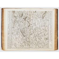
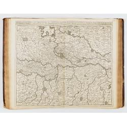
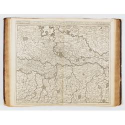
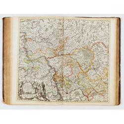
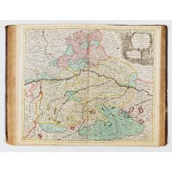
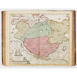
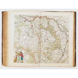
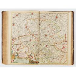
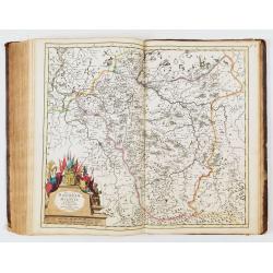
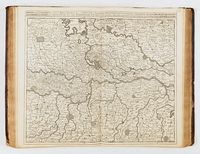
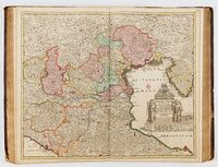
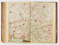
In the early years of the new century, maps of the Theatres of War (or areas that could be depicted as such) were created and published one after another. First, maps of the Italian states, the southern Netherlands, and then the German provinces were created.Â
In the case of maps made after ca. 1706 the signatures of Albert Schut’s style can be
identified on the engravings of some published under the name of Cornelis II. The fact
that Schut's name appeared on some of these maps indicates his increasing role in etching
and engraving. It seems that he had made his earliest maps (e.g. Polonia – Numbered 68, Stiria,
Norvegia) together with Johannes (and surely with Cornelis II) but around 1708–1712
he has already engraved also a few Danckerts maps alone (e.g. Provences).
In the years between 1700 and 1712 (approx. until the death of Johannes) the firm
managed to increase the number of atlas map sheets from 60 to 100. This is the explanation
for the atlases with 75 and 100 sheets getting finished still in the life of Johannes.
Several new prints from these years indicate the active initiative role of Cornelis II
in defining the atlases’ content, such as the complementary plates published under his
name (geographical-historical tables, flag and ship illustration prints). It was he who purchased Robijn and De Ram plates (world map and astronomical charts), which were then included in the atlases published by the family, also in those of Theodorus I, with a larger number of sheets.
The End
Biography sources indicate that in 1716–17, Theodorus I and in 1726, Theodorus II experienced financial difficulties (KLEERKOOPER – VAN STOCKUM, 1914–1916). In addition, several
tragedies affected the family's life during these years. After 1720 we only have biography
sources concerning Theodorus II. Being deep in debt, he had to hand over most of his stock
to a creditor, T. Rijswijk, as mortgage in the months before his death. After his demise in
the autumn, it was put up for auction for the benefit of the creditor on the orders of the
city council. The auction was managed by two renowned book traders from Amsterdam,
J. Oosterwijk and S. Schouten (KLEERKOOPER – VAN STOCKUM, 1914–1916). It was probably at this auction that other publishers (e.g., Ottens and Van Keulen) took possession of the map plates of the Danckerts atlas.
References
DANKU, Gyuri: Twaalf kaarten van Cornelis I Danckerts (1603–1656) in de Andreas Nagy atlas. 2004, Caert-Thresoor 23, Nr. 3, pp. 72–79.
DANKU, Gyuri – SÜMEGHY, Zoltán: The Danckerts Atlas. The Production and Chronology of
Its Maps. 2007, Imago Mundi 59, Part 1 pp. 43–77
EEGHEN, Isabella Henriëtte van: Amsterdamse boekhandel 1680–1725. Scheltema & Holkema-
Israel, Amsterdam, 1965–1978. Vol. 3 pp. 86–87, Vol. 4 p. 205, Vol. 5 p. 90, p. 120.
FRENCH, Josephine ed.: Tooley’s dictionary of mapmakers. Revised ed. Map Collector
Publications Ltd., Richerad Arkway Inc., London, 1999. Vol. 1 p. 329, p. 331.
GREGORII, Johann Gottfried: Curieuse Gedancken von den vornehmsten und accuratesten altund
-neuen Land-Charten nach ihrem ersten Ursprunge, Erfindung, Auctoribus und Scultoribus,
Gebrauch und Nutzen entworffen auch denen Liebhabern der Zeitungen zum VergnĂĽgen aus der
Geographie, Historie, Chronologie, Politica und Jure Publico erläutert und nebst kurtzen Lebens-
Beschreibungen der berĂĽhmtesten Geographorum ausgefertiget durch Johann Gottfried Gregorii
von Toba aus Thüringen. H. Ph. Ritschel, Franckfurt und Leipzig, 1713. pp. 72–75
KEUNING, Johannes: Cornelis Danckerts and his “Nieuw Aerdsch Pleyn”. Imago Mundi 12,
1955, pp. 136–139.
DANKU – SÜMEGHY: AN OUTLINE OF THE DANCKERTS ATLAS HISTORY
KLEERKOOPER, M. M. – STOCKUM, Wilhelm Peter van: De boekhandel te Amsterdam,
voornamelijk. in de 17de eeuw: Biographische en geschiedkundige Aanteekeningen. ’s-Gravenhage,
Vol. 1. 1914–1916, p. 169–173, Vol. 2 pp. 1251–1252.
KOEMAN, Cornelis. ed.: Atlantes Neerlandici. Bibliography of terrestial, maritime and celestial
atlases and pilot guides, published in the Netherland up to 1880. Theatrum Orbis Terrarum
Ltd., Amsterdam, 1969, Vol. 2 p.88–97., Vol. 3 p. 191.
KROGT, Peter van der: Advertenties voor kaarten, atlassen, globes e. d. in Amsterdamse kranten
1621–1811. HES Uitgevers, 1985, p. 83: 376
KROGT, Peter van der – DANKU, Gyuri: De Andreas Nagy atlas: een atlas factice uit circa
1660. Caert-Thresoor 23, Nr. 3. 2004 pp. 66–71.
SÜMEGHY, Zoltán – DANKU, Gyuri: Identifying an undescribed Danckerts Atlas. Acta
Universitatis Szegediensis 32–33, 1999, pp. 101–119.
TIELE, Pieter Anton: Nederlandsche Bibliographie van Land- en Volkenkunde. Amsterdam. 1884
(repr. Amsterdam, 1966).
VRIES, Dirk de: Danckerts (Familie). In: Kretschmer, I. – Dörflinger, J – Wawrik, F. eds.:
Lexikon zur Geschichte der Kartographie. Von den Anfangen bis zum ersten Weltkrieg.
Franz Deuticke, Wien, 1986, p. 150
WALLER, François Gerard: Biographisch woorderboek van noord nederlandsche graveurs.
Beheerders van het Wallerfonds en bewerkt W. R. Juynboll, B. M. Israël, Amsterdam, 1974,
pp. 74–75.
(DANKU – SÜMEGHY, 2007).
Large Folio. Contemporary brown calf, spine ribbed and decorated in gold. (restored). Engraved title page, seventy-seven maps, six plates, two spheres. There is no index.
The maps are signed by Justus, Theodorus, Johannes, or Cornelis Danckerts (except for one by Frederik de Wit and three without names).Â
Cornelis II published the atlas between 1712 and 1717. With its extensive content of 86 maps, it offers a unique opportunity to study and compare the maps from the different generations of the Danckerts family. Several maps are engraved and signed by Albert Schut for Cornelis Danckerts II. The atlas also contains a large group of the earlier engraved maps, and several of the copper plates are updated or reworked.
The Danckerts were a prominent print and map publishing family active in Amsterdam for almost 100 years. The founding member of the family business was Cornelis I (1603-1656), who started producing and publishing maps in the second part of the 1620s. His sons, Dancker (1634-1666) and Justus (1635-1701) were also active in the business.
Justus issued several atlases with his sons: Theodorus I (1663-c. 1727), Cornelis II (1664-1717), Johannes (?-1712), Eduard (?-after 1721), and his grandson Theodorus II (1701-1727).
Due to the use of the same first names by various family members, there is some confusion in the literature regarding the authorship of specific maps produced by the Danckerts.
As Koeman states (1967-71, II: 88), "Their cartographic work has, compared with that published by the Blaeus or Janssonius, attracted but little attention and has never received proper recognition."
A detailed study was conducted and published in 2007 by Gyuri Danku and Zoltán Sümeghy, who distinguish the engravers and dated the maps: "The Danckerts Atlas. The Production and Chronology of Its Maps", published in Imago Mundi, Vol. 59, No. 1 (2007), pp. 43-77.
Apart from the Atlas, the Danckerts are famous for several monumental and beautiful wall-maps and views. Like all self-respecting Amsterdam print-sellers, Justus Danckerts I owned a complete set of wall-maps of the continents, each in four sheets, with scrolls, views and figures in the borders.
The atlas production
The Danckerts family sold maps in Amsterdam from approximately 1680 until 1727, when the stock of maps in Theodorus II, Cornelis I's great-grandson's shop, was sold.
Their atlas production began with Justus I Danckerts around 1680. These first atlases, published between 1688 and 1689, contained 26 to 30 maps.
The family then expanded their collection until around 1700, reaching approximately ninety maps.Â
From 1701 onwards, all of Europe and new parts of the world were included: the Danckerts atlases then comprised approximately 120 maps.
Production of Danckerts atlases ceased in the 1720s, after two sales of the stock, in 1713 and 1727; a few plates and maps continued to circulate until the mid-18th century.
These atlases are complex to date, as neither the title pages nor the maps bear dates.Â
Koeman divides them into five categories (this atlas falls into the fourth); with a map count ranging from 74 to 90. "Very few complete copies have survived (…).Â
Koeman (Cornelis). Atlantes Neerlandici. Amsterdam, 1969. Vol. 2 pp. 88-97: similar to the atlas described under "Dan 4", p. 93: "after 1696".Â
List of maps in this atlas:
- - [no number], ATLAS : Title page after a design by Gerard van Houten and engraved by Petrus Schenk I.
- - [no number], Hemels Pleyn. Celestial chart after Backer. Repair of a small tear.
- - [no number], Neue ærdsch pleyn. World map in a polar projection. Uncolored.Â
- - [no number], Terrarum orbi tabula [double hemisphere world map - see below description] - I. Danckerts.
- 1, Europæ - J. Danckerts
- 2, Asiæ - T. Danckerts
- 3, Africæ - J. Danckerts
- 4, Americæ - J. Danckerts
- no n°, Tableau généalogique - Cornelius Danckerts
- 5, Hispaniæ - Justinium Danckerts
- 6, Regnum Castellæ veteris legionis et Gallæciæ - C. Danckerts
- 7, Regnum Castellæ novæ Andalusiæ - C. Danckerts
- 8, Cataloniæ - C. Danckerts
- 9, Galliæ - J. Danckerts
- 10, Normandiæ ducatus - Theodorum Danckerts
- 11, Britanniæ - Theodorum Danckerts
- 12, L'Isle de France, carte en noir, en français - C. Danckerts
- 13, Lotharingiæ - Theodorum Danckerts
- 14, Dauphinæ - C. Danckerts
- 15, Provence - C. Danckerts
- 16, Sevennes et Languedoc - C. Danckerts
- 17, Italiæ Corsicæ et Sardiniæ - Theodorum Danckerts.
- 18, Italia in qua sunt Ducatus Mediolanensis Mantuensis… - Justinum Danckerts [dépliante].
- 19, Ducatum Sabaudiæ - Justinum Danckerts
- 20, Italia in qua sunt Ducatus Mantuensis Modenensis - J. Danckerts
- 21, Ducatus Mediolanensis Mantuensis Modenensis Parmensis, en noir - Johannes Danckerts
- 22, Ducatus … Parmensis, Montisferrati - Iustinum Danckerts
- 23, Ducatus… Guastallæ, principatuum Castiglionæ Silverinæ… (uncolored) - J. Danckerts
- 24, Dominii Veneti - Cornelius Danckerts
- 25, Regnum Neapolis Siciliæ et Lipariæ insulæ - Justinum Danckerts
- [no number]Â Â Fortresse van Konyngrick Napels en Sisielie - Cornelius Danckerts
- 26, Regni Siciliæ et insulæ Maltæ - Theodorus Danckerts
- 27, Germaniæ - Justo Danckerts
- 28, Circuli Austriaci - Justinum Danckerts
- 29, Tirolis - Cornelium Danckerts
- 30, Bohemia, en noir - T. Danckerts
- 31, Ducatus Silesiæ - T. Danckerts
- 32, Circuli Saxoniæ superior pars meridionalis - Justinum Danckerts
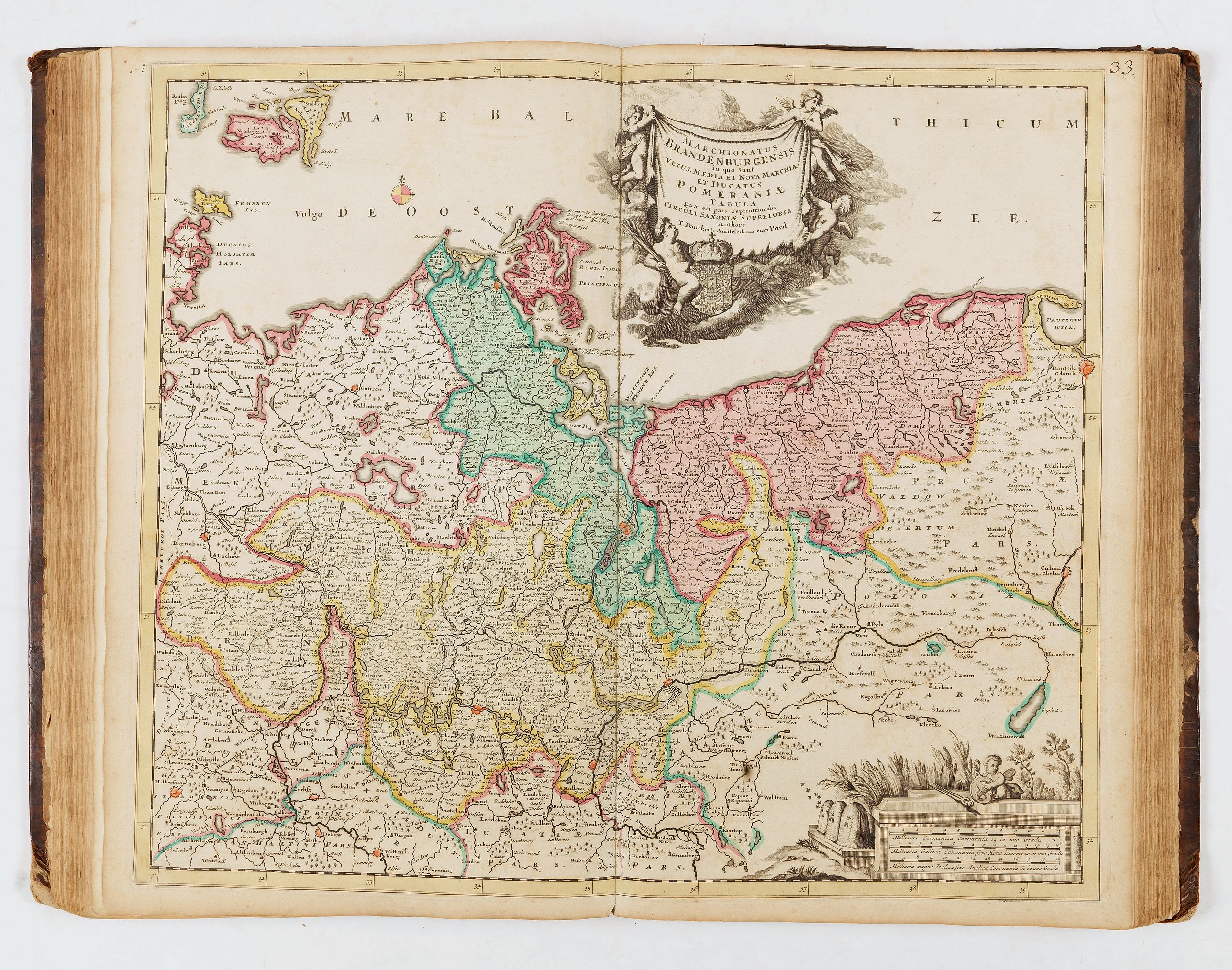
- 33, Marchionatus Brandenburgensis - T. Danckerts
- 34, Circulus Saxoniæ inferioris - Justinum Danckerts
- 35, Holsatiæ - Theodorum Danckerts
- 36, Ducatus Meklenburgicus - J. Danckerts
- 37, Ducatus Brunsuicensis - J. Danckerts
- 38, Circulus Franconicus - T. Danckerts
- 39, Circulus Bavaricus - Justinum Danckerts
- 40, Circulus Suevicus - Theodoris Danckerts
- 41, Ducatus Wirtenbergensis - Johannes Danckerts
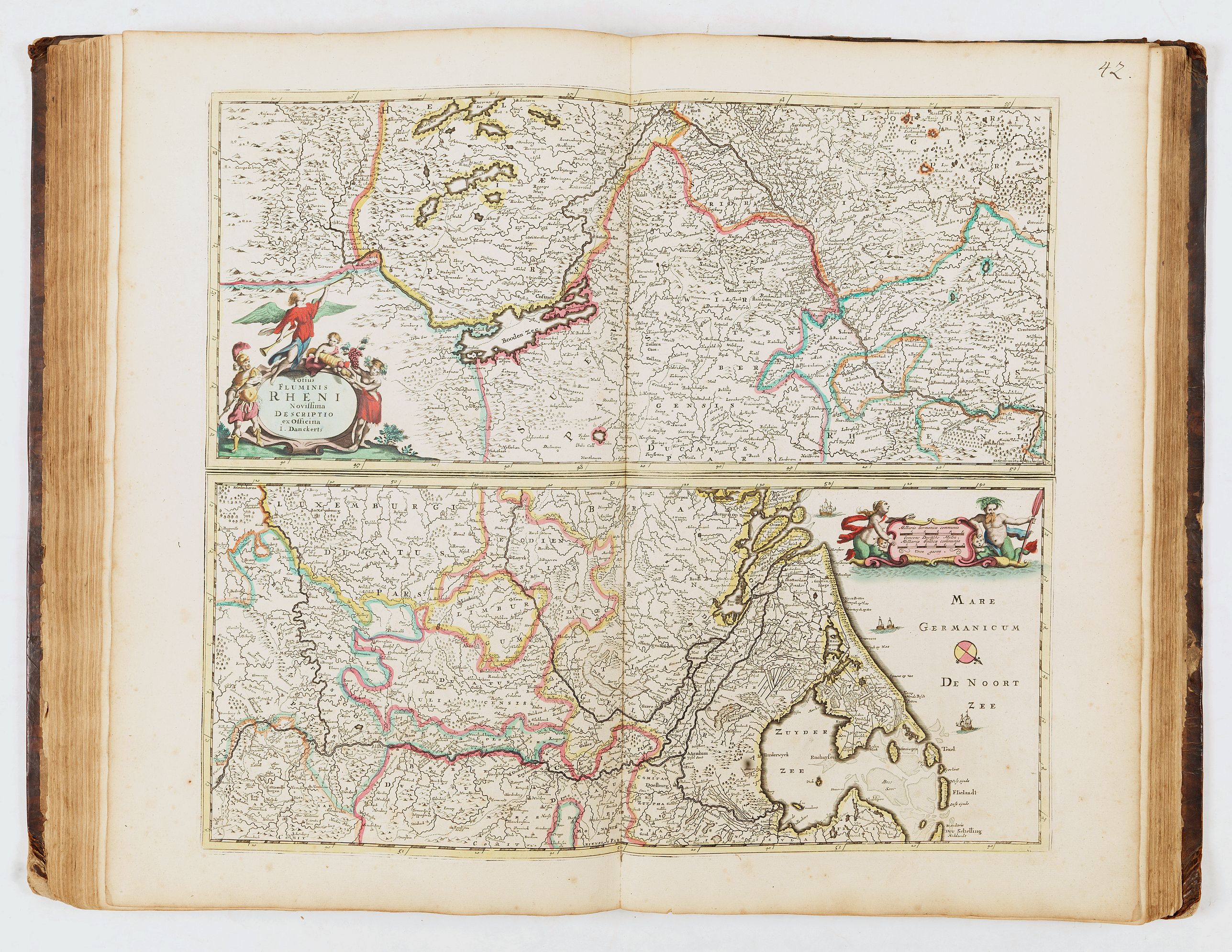
- 42, Totius Flumenis Rheni - J. Danckerts
- 43, Rheni superioris Mosæ et Mosellæ - Theodorum Danckerts
- 44, Rheni inferioris Mosæ et Mosellæ - Theodorum Danckerts
- 45, Electoratus et Palatinus ad Rhenum - Theodorus Danckerts
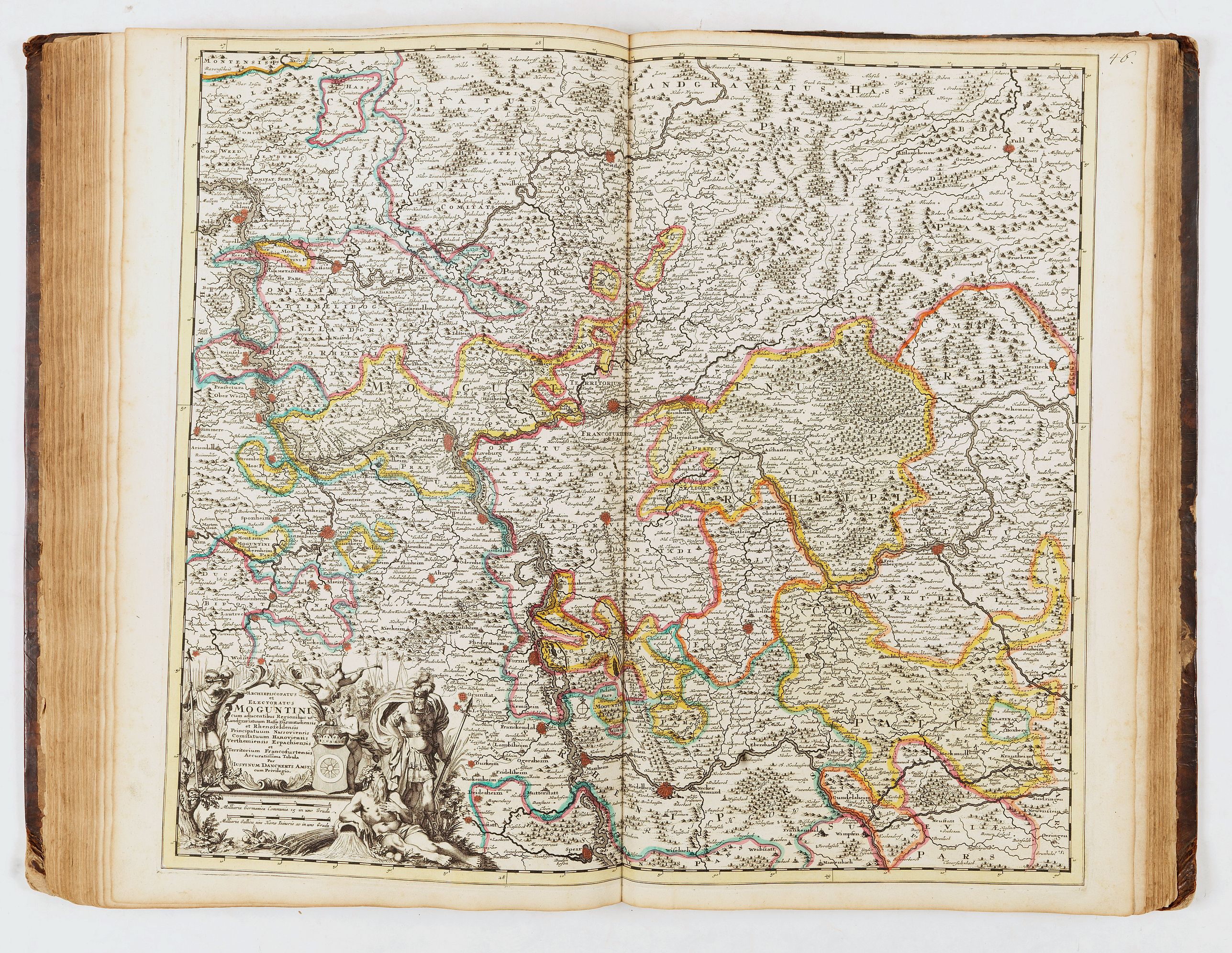
- 46, Archiepiscopatus et Electoratus Moguntini - Iustinum Danckerts
- 47, Archiepiscopatus et Electoratus Trevirensis - Theodorus Danckerts
- 48, Provinciæ Belgii regii - Iusto Danckerts
- 49, Mosellæ et Saræ Fluvii - Cornelius Danckerts
- 50, Circulus Westphaliæ - Justinum Danckerts
- 51, Episcopatuum Leodiensis et Coloniensis - T. Danckerts
- 52, Episcopatus Monasteriensis et Osnabrugensis - J. Danckerts
- 53, Ducatus Wirtenbergensis - Johannes Danckerts
- 54, Ducatus Brabantiæ - Johannes Danckerts
- 55, Brabantiæ par orientalis - Frederic de Witt
- 56, Quartæ partis Brabantiæ - not signed
- 57, Flandriæ comitatus - Theodorum Danckerts
- 58, Hannoniæ comitatus - Theodorum Danckerts
- 59, Namurci comitatus - Theodorum Danckerts
- 60, Canalis inter Angliæ et Galliæ - Theodorum Danckerts
- 61, Sueciæ, Daniæ et Norvegiæ - Justinum Danckerts
- 62, Dania regnum - J. Danckerts
- 63, Insularum Danicarum qua snt Zeelandiæ, Fionæ…- J. Danckerts
- 64, Nova Gothiæ Australis sive Scaniæ - Cornelius Danckerts
- 65, Norvegia regnum - C. Danckerts
- 66, Totius Russiæ vulgo Muscoviæ - Justo Danckerts
- 67, Regi Poloniæ et ducatus Lithuniæ - Cornelius Danckerts
- 68, Regi Poloniæ, ducatus Mazoviæ - Cornelius Danckerts
- 69, Lithuniæ - J. Danckerts
- 70, Totius Danubii fluvii - T. Danckerts
- 71, Totius Hungariæ - Justus Danckerts
- 72, Archipelagi et Græciæ - I. Danckerts
- - sans num., D'Voornaamste Fortressen van Moræa - Justus Danckerts
- 73, Occidentalioris districtus Maris Mediterranei - Justo Danckerts
- 74, Orientalioris districtus Maris Mediterranei - Justo Danckerts
- 75, Totius Turcici Imperii - T. Danckerts
- 76, Iudea sive Terra sancta - T. Danckerts
- 77, Indiæ orientalis - T. Danckerts
- [no number]Â Oorlogh's Schip - Tables de tous les termes des principales parties d'un vaisseau - Cornelis Danckerts
- [no number], Table des pavillons - Nieuwe tafel van al de zee - Cornelis Danckerts
The map combines the aesthetics of the Dutch Golden Age with updated cartography derived from the French authority Nicolas Sanson. Danckerts had, in 1680, produced a world map copied from Frederick De Wit's nautical map of 1668 Nova Totius Terrarum Orbis Tabula.
The vignettes in each corner of the map represent the four elements. However, the classical and pictorial elements employed in these images bring greater depth: each of the elements is invested with the meaning of its impact on man. The scene in the lower left is set amidst lush, forested hillsides and valleys abundant with grain. The mother goddess Cybele and the harvest goddess Demeter sit among fauns, cornucopias, and the fruits of a plentiful harvest. Shadowy figures at the left suggest the bloodier harvest of the hunt. These are images reflecting the element of Earth.
To the lower right, the sea god Poseidon presides over his element, Water, with his lover Venus draped decorously over his shoulder. Sea-putti and a merman attend the couple, blowing conches and adorning the goddess with strings of pearls. To the right, two nymphs wrangle a monstrous, spouting whale. In the background, warships press each other in battle.
In the upper left, still more war-like imagery attends the element of fire. The three-headed guard dog of Hades, Cerberus, growls and snaps while massed armies strive against a background of burning castles. To the right, Hades wrestles a struggling Persephone, an illustration of the king of hell abducting Demeter's daughter in a triumph of violence and death over the Earth's promise. Finally, in the upper right, the element of Air is represented. Under an arching Zodiac, the celestial gods congregate: Apollo of the Sun, Diana of the Moon, Mercury, Saturn, and Mars commune amongst the clouds. They are presided over by Jupiter - unhinged, brandishing a fistful of lightning bolts - and Juno, who appears to be gently restraining her husband with her distaff. Avatars of wind and rain are also depicted, and the skies are filled with birds in flight. The element of Air, more than all the others here, is portrayed as being beyond human command and the source of the unstoppable whims of the gods.
As noted above, these images appeared first on Frederic De Wit's 1668 map. The vignettes were composed and etched by Romeyn de Hooghe; they would later be copied by Danckerts in his earlier double-hemisphere world and are retained here.
Distinct from the De Wit original, Danckerts introduces an element of Christian imagery in the cruxes of the hemispheres. In the upper crux, a putto displays scripture in one hand and a cross in the other, basking in radiant light; in the lower crux, shrouded in dark clouds, another putto clutches an idol in its hands.
While starting from the base of the 1668 De Wit map, Danckerts' map incorporates elements drawn from Nicolas Sanson, as interpreted by Hubert Jaillot's cartography of 1674, and, in turn, advances that geographic model in several areas.
De Wit and Danckerts alike present California as an island, a well-established geographical concept by that time. The region to the northwest of that imaginary island differs sharply from De Wit: extending across the Pacific from Japan's Iedso is a massive Terra Esonis This element is derived from Jaillot's 1674 map of the world, which was, in turn, informed by Nicolas Sanson.
East of the sea, separating California from the mainland, is "Mexica Nova". Here, a river (a conflation of the Rio Grande with the Colorado) runs from a lake east of the ancient settlement of Acoma toward the southwest and the Gulf of California rather than to the Gulf of Mexico. The river's source, as depicted here, may result from reports of the Great Salt Lake from the Onate and Coronado expeditions.
De Wit had already adopted the French geography of the northeastern portions of North America, which was more authoritative and accurate than that of contemporaneous Dutch mapmakers.
Hudson Bay appears in recognizable form, albeit with openings to the west, suggestive of hoped-for connections with the Pacific. This mapping of the Great Lakes incorporated all five lakes, although the western reaches of Lakes Superior and Michigan were left unfinished, again suggesting the possibility of a navigable water route to the Pacific.
The Northeast is dominated by 'Canada sive Nova Francia,' and the claims of France's European rivals are only grudgingly acknowledged.
Some coastal cities (including New Amsterdam, Plymouth, and New London) are named along the coast. Virginia is acknowledged mainly by the Indigenous name 'Powhatan. Spanish Florida, which extends north to include most of the American Southeast, Lake Apalache or 'great freshwater'Â southeast, is shown but not named.
Explorers of South America throughout the late 16th and early 17th century (enthralled by Pizarro's conquests in Peru and tales of other gold-rich empires in the interior) actively sought El Dorado, which Sir Walter Raleigh placed in the mythical city of Manoa, on the shores of the Lake Parima, near modern-day Guyana, and Danckerts includes it here. Further south, a prominent (albeit unnamed) Laguna de Xarayes forms the northern terminus of the Paraguay River.
The apocryphal Laguna de Xarayes was often regarded as a southern gateway to the Amazon and the Kingdom of El Dorado.
Australia, New Zealand, and the South Pacific were virtually unknown to European explorers. The depiction of these lands on all maps from the mid-17th century until Cook's voyages is based on Abel Tasman's 1642 map. For over a century, only the western coast of Australia and New Zealand have appeared on maps. Danckerts introduced both massive guinea mysterious 'quiri regio,'Â
The discoveries around Australia made by Tasman on his first and second expeditions in 1642-44 are included. New Zealand is drawn only by one coastline, New Guinea is drawn as a large island and Danckerts added the names of the oceans.Â
In addition to the main hemispheres, the map includes two subordinate polar projections. Typically, these are seen bounded by the Arctic and Antarctic circles. Here, Danckerts has extended both the northern and southern projections to present entire hemispheres to the Equator, thus offering a different perspective on the entire globe rather than simply highlighting the polar regions.
Shirley dates the map to after 1684, based on the inclusion of Danckerts' privilege (obtained that year).Â
Reference: Shirley world (1984): Entry 529) Plate 372
In North America, only one Great Lake is depicted, and Nieu Nederland appears on the East Coast as opposed to New York, as it was renamed in 1644. California is shown as an island with a flat northern coastline. In South America, the two mythical lakes Parime Lacus and Xarayes are depicted. Parts of New Zealand and Tasmania are also shown, and Australia is connected to New Guinea. References: Shirley #582.
The decorative elements are among the map's highlights. A large cartouche in the lower left features allegorical figures, native peoples, and exotic animals. The oceans are filled with sailing ships and sea monsters, adding to the visual interest and romantic allure typical of the period. These features make this map not only a document of early geographic knowledge but also an artistic representation of European imagination and ambition regarding the New World.Â
One of the most remarkable features is the depiction of California as an island. This cartographic misconception frequently appeared on maps of this period and was primarily influenced by Nicolas Sanson's model.
The map's cartography is derived entirely from that by Frederick de Wit, c.1675. Here he draws on the fifth state with the added place name in the Great Lakes. The only significant difference is that Danckerts, this time, removes the decorative cartouche top left. This enables him to include more of the Dutch explored lands of Terra Esonis, Yedso and Iaponiae.Â
The map includes five Great Lakes, with de Wit being the first Dutch cartographer to do so. However, the two western lakes of Michigan and Superior are left open to the west. (Burden)
The legendary Seven Cities of Cibola are depicted in the American Southwest, and the Mississippi River is shown in a vague and inaccurate course, placed far west of its actual mouth.
A large lake in the southeastern part of North America, first popularized by Le Moyne, is also retained here. South America is shown with a notably wide profile, and a possible Northwest Passage is suggested by an optimistic extension from Button’s Bay in the far north.
With New Guinea and "Quiri Regino" added in the lower left. It was Danckerts who introduced both the massive guinea and the mysterious 'quiri regio.
While maps of the Americas by Visscher and De Wit are more commonly encountered, this edition by Justus Danckerts is considerably rarer and especially prized by collectors of Dutch maps and early American cartography.
DANCKERTS, Theodore (1663-1729). Indiae Orientalis nec non Insularum Adiacentium Nova Descriptio. Amsterdam, ca 1685.
Engraved map of India, South East Asia, Japan and the north coast of Australia, fully colored in a contemporary hand, image 503 x 588 mm (528 x 623 mm sheet). Decorated with an allegorical cartouche. The map extends from India and the Maldives in the west to New Guinea and the southern coast of Japan in the east and is centered on the Straits of Malacca and the Malay Peninsula.
The treatment of Australia is of great interest, with numerous placenames on the Northern Coast, but only a tentative passage between Australia and New Guinea. Featuring a number of place names in "Nova Hollandia." The map was reissued at the beginning of the 18th century by Peter Schenk.
The Dutch discoveries in Australia include those of Carstensz in the Pera on Cape York in 1623, Tasman’s second voyage on the northern Australian coast in 1644, and those of van Colster in the Arnhem in 1623. After the two voyages of Abel Tasman in 1642-1644 and his subsequent reports, the VOC’s interest in the Australian coast was purely one of navigation. They no longer attempted to engage in trade with the indigenous population, as instructed by Tasman, nor did they further explore the coastline. Their charting was devoted solely to the updating of their existing charts. A superb decorative title cartouche is located at the lower left.Â
Sterre kaert of hemels pleyn, waer door men kan wete hoe laet dat het is over de gehele aertkloot... Mercator style projection of the entire night sky, showing all the heavenly bodies, and with panels of astrological notations below. Prepared by Remmet Teunisse Backeret et engraved by J. de Broen, it was originally published c.1684 by Johannes van Keulen. It was subsequently republished in the last edition by Elwe in 1792. The 1713 issue by Danckerts is uncommon. The plate includes a Phoenix, a water snake 'Hydrus', and a flying fish 'Piscis Volans'. Surrounded by cherubs, a small cartouche notes 'Sterre Kaert Hemels Pleyn', meaning Star Chart of the Heavenly Plane. Includes compass roses with north oriented toward the top of the sheet, latitudinal and longitudinal lines, and descriptive text.
Â
The Dankerts familyÂ
Gyuri DANKU and Zoltán SÜMEGHY wrote in "AN OUTLINE OF THE DANCKERTS ATLAS HISTORY" (2007) : Our knowledge on the production and publishing history of the Danckerts Atlas has been
rather incomplete. Only few records relating to the activity of the Danckerts firm and
to the life of the members of the family have survived (e.g. GREGORII, 1713;
KLEERKOOPER – VAN STOCKUM, 1914–1916; KEUNING, 1955; VAN EEGHEN,
1965–1978; KOEMAN, 1969; WALLER, 1974; DE VRIES, 1986; FRENCH, 1999; DANKU,
2004; VAN DER KROGT – DANKU, 2004).
As KOEMAN
(1969) notes: „It is very difficult to establish the year of publication as the younger
Danckertses never dated their maps and title pages.” This is primarily why we have
possessed quite a hazy and sketchy knowledge regarding even the most basic issues:
when the individual maps of the Atlas were made and by whom; how the Atlas has
developed and enlarged; how many types of the Atlas were actually published; what
sources the compilers and engravers-etchers of particular maps used.
Justus Danckerts (1635–1701), a book and print publisher in Amsterdam, who had previously been only a second-rate figure in map publishing, decided to produce an atlas consisting of his own maps in the first half of the 1680s.Several factors probably influenced this decision.
Probably the most important of these was the fact that his elder sons Theodorus I (1660/1663–ca. 1727 ?) and Cornelis II (1664–1717) reached adulthood in these years and learned the basics of map-making, especially copper engraving and etching, which were considered indispensable in commercial cartography at that time. Considering details
from the history of Amsterdam map- and atlas-making the decision of Justus I corresponds
to the tendency of that age; besides the two most significant major firms grown out of the
shadow of the two giants (the Hondius–Janssonius and the Blaeu) and already having an
own atlas in the market (the Visscher and the De Wit), in the 80’s other firms also started to
appear with more or less ambition in the field of geographical map and atlas publishing.Â
After the production of some maps in the beginning of the 80’s (e.g. Circulus Saxonicus,
Portugallia), which we could call experimental, the atlas maps of the Danckerts were made,
from ca. 1682–83, at an accelerating pace. Based on style investigations, it seems that
by dividing the tasks the firm managed to produce 22 maps by 1686–87. The privilege of
12 September 1684 (KLEERKOOPER – VAN STOCKUM, 1914–1916) seems to confirm
that by the middle of the 80’s the family felt itself prepared for long-term planning and
providing proper protection for its ready and future works, including maps for the next
15 years.
The volumes now kept in the Vienna and Budapest libraries have a title page and printed index, and, in addition to 20 and 21 own maps, they contain 5 and 4 others, respectively, which were created by other firms (one by Visscher and the others by De Wit) and are in accordance with the index.Â
The first 26-sheet geographical atlas of the firm, which contained only self-created maps, could have been completed by 1690 at the earliest.
The next atlas type containing 30 items was probably completed by 1690–1692, followed by a 37-sheet one in 1692–94, a 50-sheet one in 1694–1696, and a 60-sheet one in the last years of the century, between 1698 and 1700.
As for the period between 1696 and 1700, it seems inevitable that by the end of the 1690s the plates of the early maps had been in use for 10–15 years; thus, many of them, for instance, those of the continent maps, needed extensive reworking.
After 1701, a new era began in the history of atlas-making. Besides the death of Justus I and Johannes reaching adulthood, the new war, the War of the Spanish Succession, now extending to the whole of Europe (and some other parts of the world) may have played an essential part in this.Â
In the early years of the new century, maps of the Theatres of War (or areas that could be depicted as such) were created and published one after another. First, maps of the Italian states, the southern Netherlands, and then the German provinces were created.Â
In the case of maps made after ca. 1706 the signatures of Albert Schut’s style can be
identified on the engravings of some published under the name of Cornelis II. The fact
that Schut's name appeared on some of these maps indicates his increasing role in etching
and engraving. It seems that he had made his earliest maps (e.g. Polonia – Numbered 68, Stiria,
Norvegia) together with Johannes (and surely with Cornelis II) but around 1708–1712
he has already engraved also a few Danckerts maps alone (e.g. Provences).
In the years between 1700 and 1712 (approx. until the death of Johannes) the firm
managed to increase the number of atlas map sheets from 60 to 100. This is the explanation
for the atlases with 75 and 100 sheets getting finished still in the life of Johannes.
Several new prints from these years indicate the active initiative role of Cornelis II
in defining the atlases’ content, such as the complementary plates published under his
name (geographical-historical tables, flag and ship illustration prints). It was he who purchased Robijn and De Ram plates (world map and astronomical charts), which were then included in the atlases published by the family, also in those of Theodorus I, with a larger number of sheets.
The End
Biography sources indicate that in 1716–17, Theodorus I and in 1726, Theodorus II experienced financial difficulties (KLEERKOOPER – VAN STOCKUM, 1914–1916). In addition, several
tragedies affected the family's life during these years. After 1720 we only have biography
sources concerning Theodorus II. Being deep in debt, he had to hand over most of his stock
to a creditor, T. Rijswijk, as mortgage in the months before his death. After his demise in
the autumn, it was put up for auction for the benefit of the creditor on the orders of the
city council. The auction was managed by two renowned book traders from Amsterdam,
J. Oosterwijk and S. Schouten (KLEERKOOPER – VAN STOCKUM, 1914–1916). It was probably at this auction that other publishers (e.g., Ottens and Van Keulen) took possession of the map plates of the Danckerts atlas.
References
DANKU, Gyuri: Twaalf kaarten van Cornelis I Danckerts (1603–1656) in de Andreas Nagy atlas. 2004, Caert-Thresoor 23, Nr. 3, pp. 72–79.
DANKU, Gyuri – SÜMEGHY, Zoltán: The Danckerts Atlas. The Production and Chronology of
Its Maps. 2007, Imago Mundi 59, Part 1 pp. 43–77
EEGHEN, Isabella Henriëtte van: Amsterdamse boekhandel 1680–1725. Scheltema & Holkema-
Israel, Amsterdam, 1965–1978. Vol. 3 pp. 86–87, Vol. 4 p. 205, Vol. 5 p. 90, p. 120.
FRENCH, Josephine ed.: Tooley’s dictionary of mapmakers. Revised ed. Map Collector
Publications Ltd., Richerad Arkway Inc., London, 1999. Vol. 1 p. 329, p. 331.
GREGORII, Johann Gottfried: Curieuse Gedancken von den vornehmsten und accuratesten altund
-neuen Land-Charten nach ihrem ersten Ursprunge, Erfindung, Auctoribus und Scultoribus,
Gebrauch und Nutzen entworffen auch denen Liebhabern der Zeitungen zum VergnĂĽgen aus der
Geographie, Historie, Chronologie, Politica und Jure Publico erläutert und nebst kurtzen Lebens-
Beschreibungen der berĂĽhmtesten Geographorum ausgefertiget durch Johann Gottfried Gregorii
von Toba aus Thüringen. H. Ph. Ritschel, Franckfurt und Leipzig, 1713. pp. 72–75
KEUNING, Johannes: Cornelis Danckerts and his “Nieuw Aerdsch Pleyn”. Imago Mundi 12,
1955, pp. 136–139.
DANKU – SÜMEGHY: AN OUTLINE OF THE DANCKERTS ATLAS HISTORY
KLEERKOOPER, M. M. – STOCKUM, Wilhelm Peter van: De boekhandel te Amsterdam,
voornamelijk. in de 17de eeuw: Biographische en geschiedkundige Aanteekeningen. ’s-Gravenhage,
Vol. 1. 1914–1916, p. 169–173, Vol. 2 pp. 1251–1252.
KOEMAN, Cornelis. ed.: Atlantes Neerlandici. Bibliography of terrestial, maritime and celestial
atlases and pilot guides, published in the Netherland up to 1880. Theatrum Orbis Terrarum
Ltd., Amsterdam, 1969, Vol. 2 p.88–97., Vol. 3 p. 191.
KROGT, Peter van der: Advertenties voor kaarten, atlassen, globes e. d. in Amsterdamse kranten
1621–1811. HES Uitgevers, 1985, p. 83: 376
KROGT, Peter van der – DANKU, Gyuri: De Andreas Nagy atlas: een atlas factice uit circa
1660. Caert-Thresoor 23, Nr. 3. 2004 pp. 66–71.
SÜMEGHY, Zoltán – DANKU, Gyuri: Identifying an undescribed Danckerts Atlas. Acta
Universitatis Szegediensis 32–33, 1999, pp. 101–119.
TIELE, Pieter Anton: Nederlandsche Bibliographie van Land- en Volkenkunde. Amsterdam. 1884
(repr. Amsterdam, 1966).
VRIES, Dirk de: Danckerts (Familie). In: Kretschmer, I. – Dörflinger, J – Wawrik, F. eds.:
Lexikon zur Geschichte der Kartographie. Von den Anfangen bis zum ersten Weltkrieg.
Franz Deuticke, Wien, 1986, p. 150
WALLER, François Gerard: Biographisch woorderboek van noord nederlandsche graveurs.
Beheerders van het Wallerfonds en bewerkt W. R. Juynboll, B. M. Israël, Amsterdam, 1974,
pp. 74–75.
(DANKU – SÜMEGHY, 2007).
FAQ - Guarantee - Shipping
Buying in the BuyNow Gallery
This item is available for immediate purchase when a "Add to Cart" or "Inquire Now" button is shown.
Items are sold in the EU margin scheme
Payments are accepted in Euros or US Dollars.
Authenticity Guarantee
 We provide professional descriptions, condition report (based on 45 years experience in the map business)
Paulus Swaen warrants the authenticity of our items and a certificate of authenticity is provided for each acquired lot.
Condition and Coloring
We indicate the condition of each item and use our unnique HiBCoR grading system in which four key items determine a map's value: Historical Importance, Beauty, Condition/Coloring and Rarity.
Color Key
We offer many maps in their original black and white condition. We do not systematically color-up maps to make them more sellable to the general public or buyer.
Copper engraved or wood block maps are always hand colored. Maps were initially colored for aesthetic reasons and to improve readability. Nowadays, it is becoming a challenge to find maps in their original colors and are therefor more valuable.
We use the following color keys in our catalog:
Original colors; mean that the colors have been applied around the time the map was issued.
Original o/l colors; means the map has only the borders colored at the time of publication.
Colored; If the colors are applied recently or at the end of the 20th century.
Read more about coloring of maps [+]
Shipping fee
A flat shipping fee of $ 30 is added to each shipment by DHL within Europe and North America. This covers : International Priority shipping, Packing and Insurance (up to the invoice amount).
Shipments to Asia are $ 40 and rest of the world $50
We charge only one shipping fee when you have been successful on multiple items or when you want to combine gallery and auction purchases.
Read more about invoicing and shipping
FAQ
Please have a look for more information about buying in the BuyNow gallery
Many answers are likely to find in the general help section.
Virtual Collection
![]()
With Virtual Collection you can collect all your favorite items in one place. It is free, and anyone can create his or her Virtual map collection.
Unless you are logged in, the item is only saved for this session. You have to be registed and logged-in if you want to save this item permanently to your Virtual Collection.
Read More[+]
Register here, it is free and you do not need a credit card.
Add this item to
Virtual Collection
or click the following link to see my Virtual Collection.
| Digital Image Download | |
|
Paulus Swaen maintains an archive of most of our high-resolution rare maps, prints, posters and medieval manuscript scans. We make them freely available for download and study. Read more about free image download |
Click the image for a free small image download. |


In accordance with the EU Consumer Rights Directive and habitually reside in the European Union you have the right to cancel the contract for the purchase of a lot, without giving any reason.
The cancellation period will expire 14 calendar days from the day after the date on which you or a third party (other than the carrier and indicated by you) acquires, physical possession of the lot. To exercise the right to cancel you must inform Paulus Swaen Inc, of your decision to cancel this contract by a clear statement (e.g. a letter sent by post, or e-mail (amsterdam@swaen.com).
To meet the cancellation deadline, it is sufficient for you to send your communication concerning your exercise of the right to cancel before the cancellation period has expired.
