Please login to see price!.
Subscribe to be notified if similar examples become available.


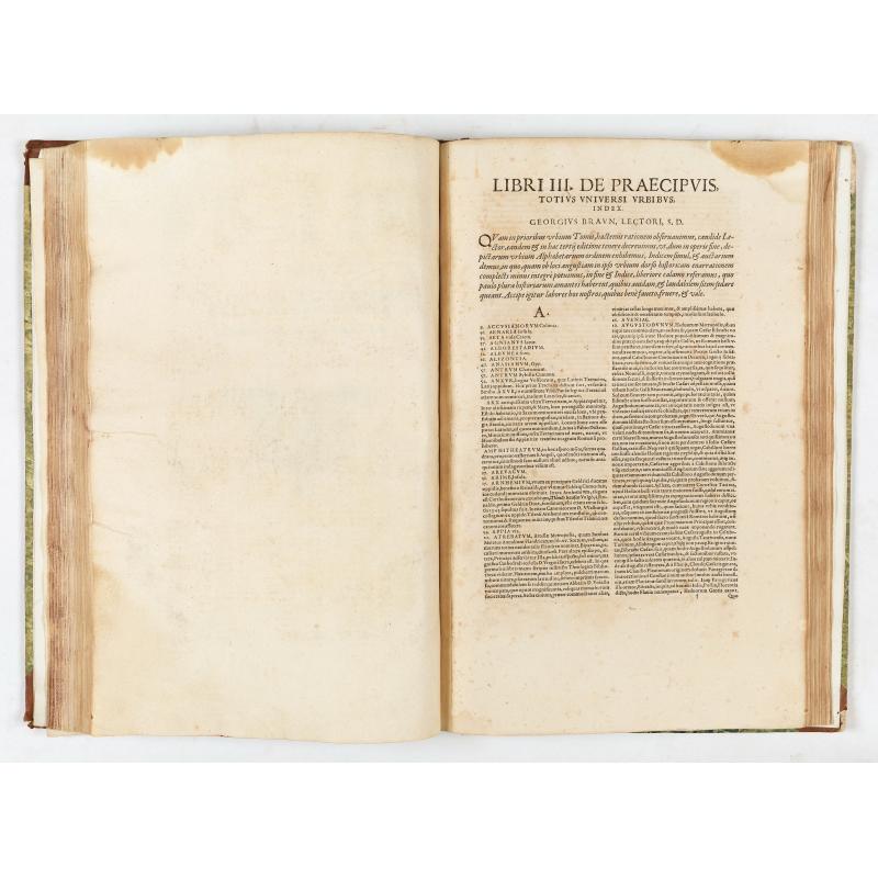
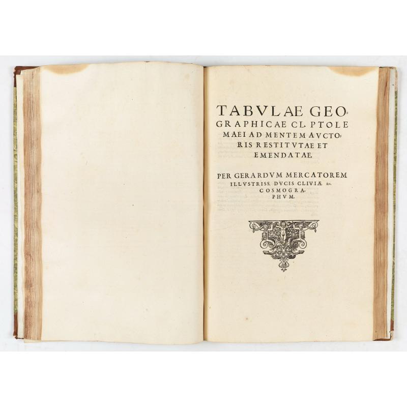


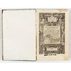
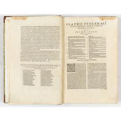
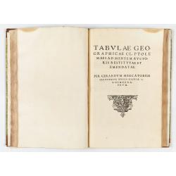

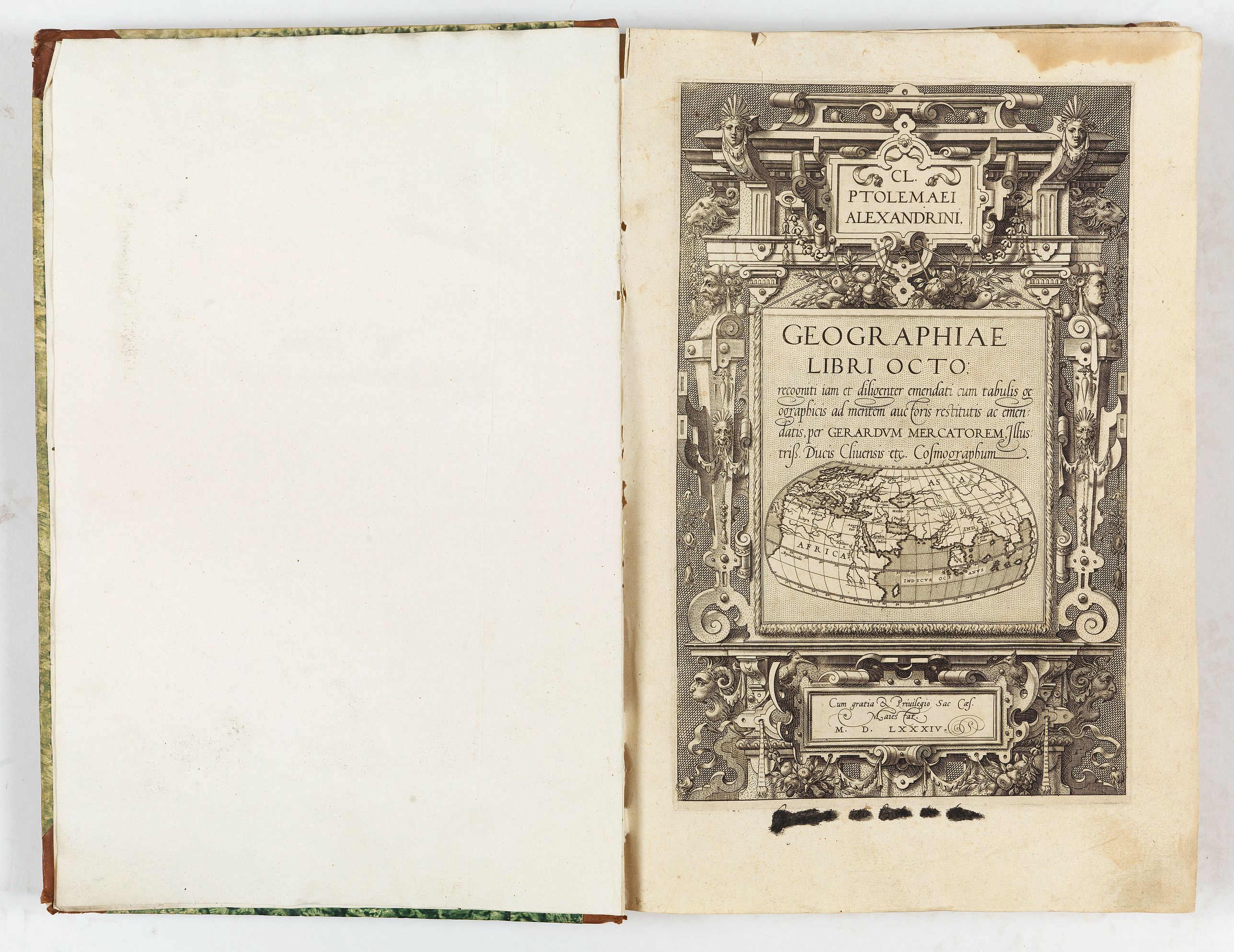
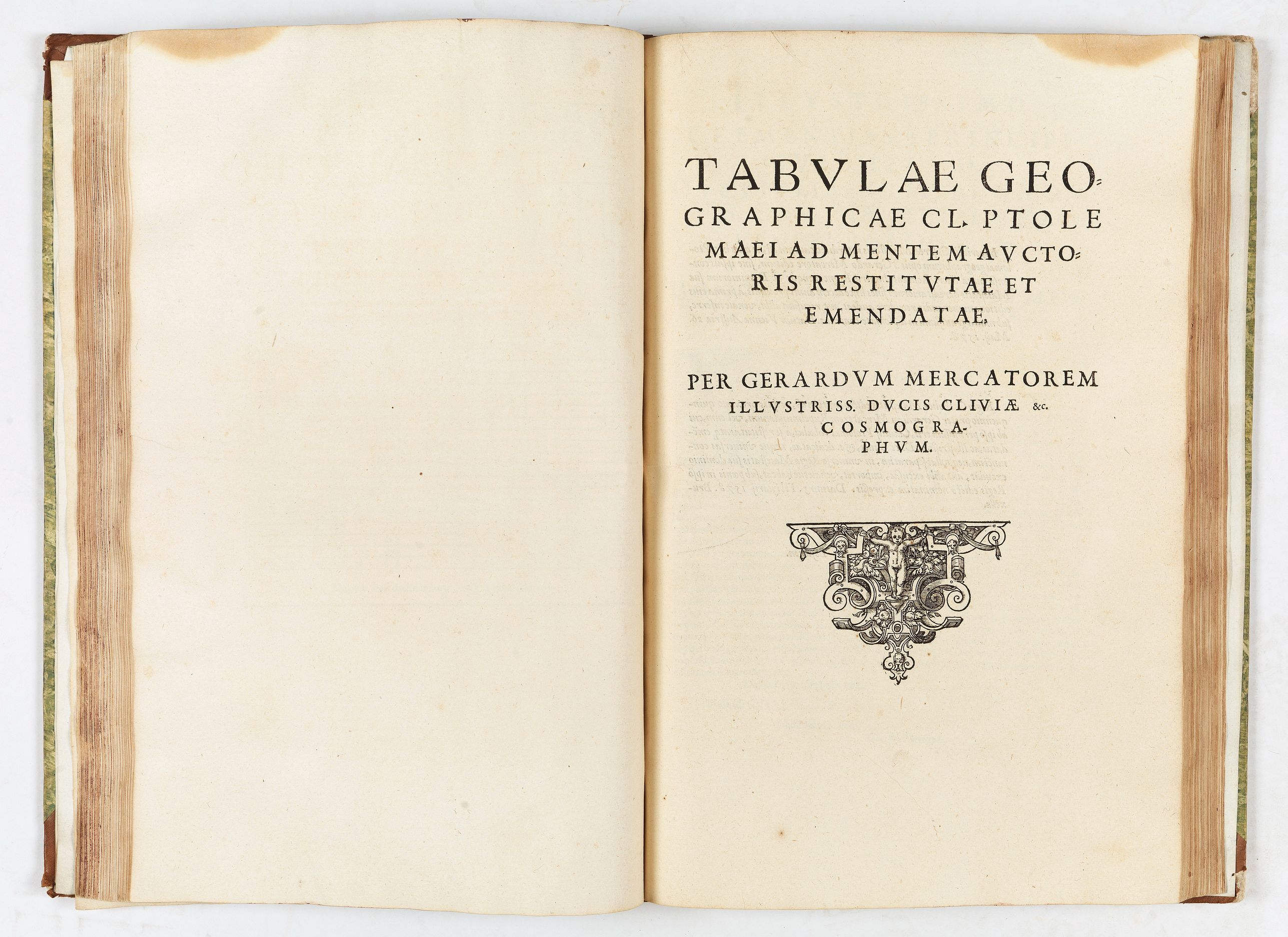
Geographiae libri octo... ac emendatis per Gerardum Mercatorem |
||||||||||||||||||||
|
||||||||||||||||||||
|
|
||||||||||||||||||||
|
|
Virtual Collection - Save and collect this or any of your favorite items in one place.
If you want to save the items permanently, please sign in or create account first. |
|||||||||||||||||||
Description
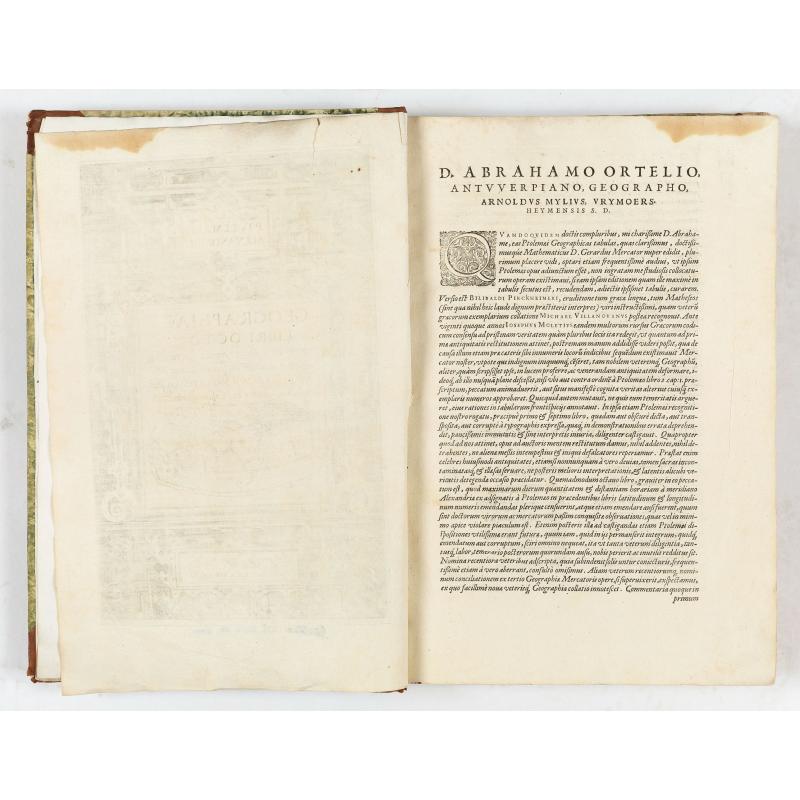
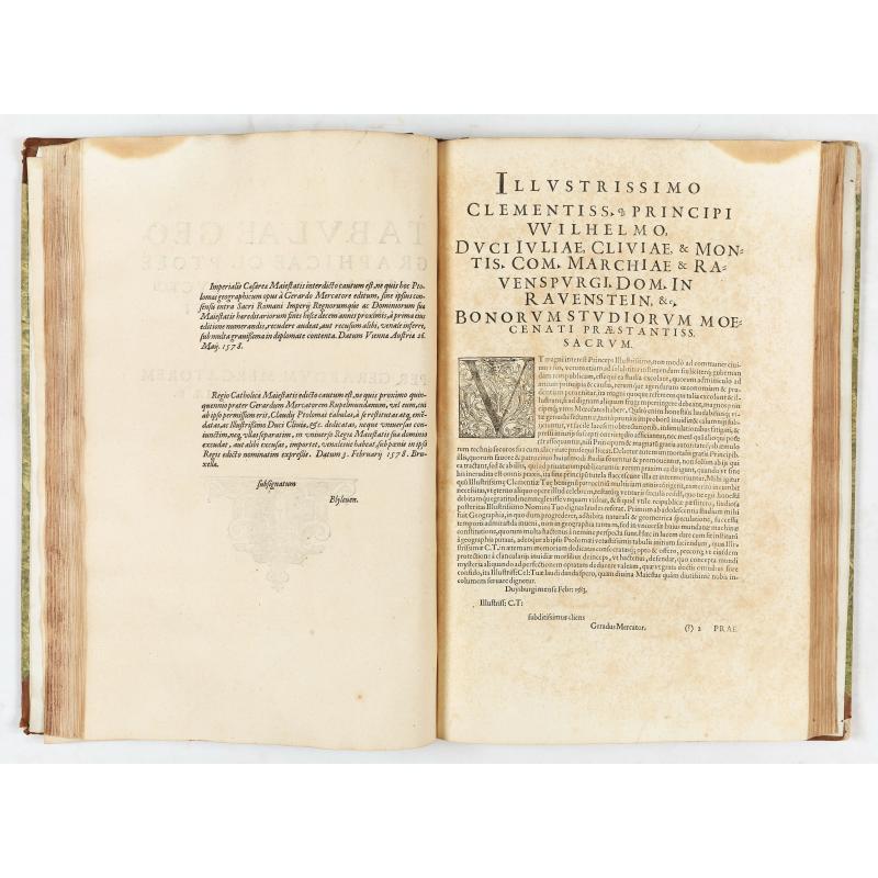
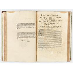
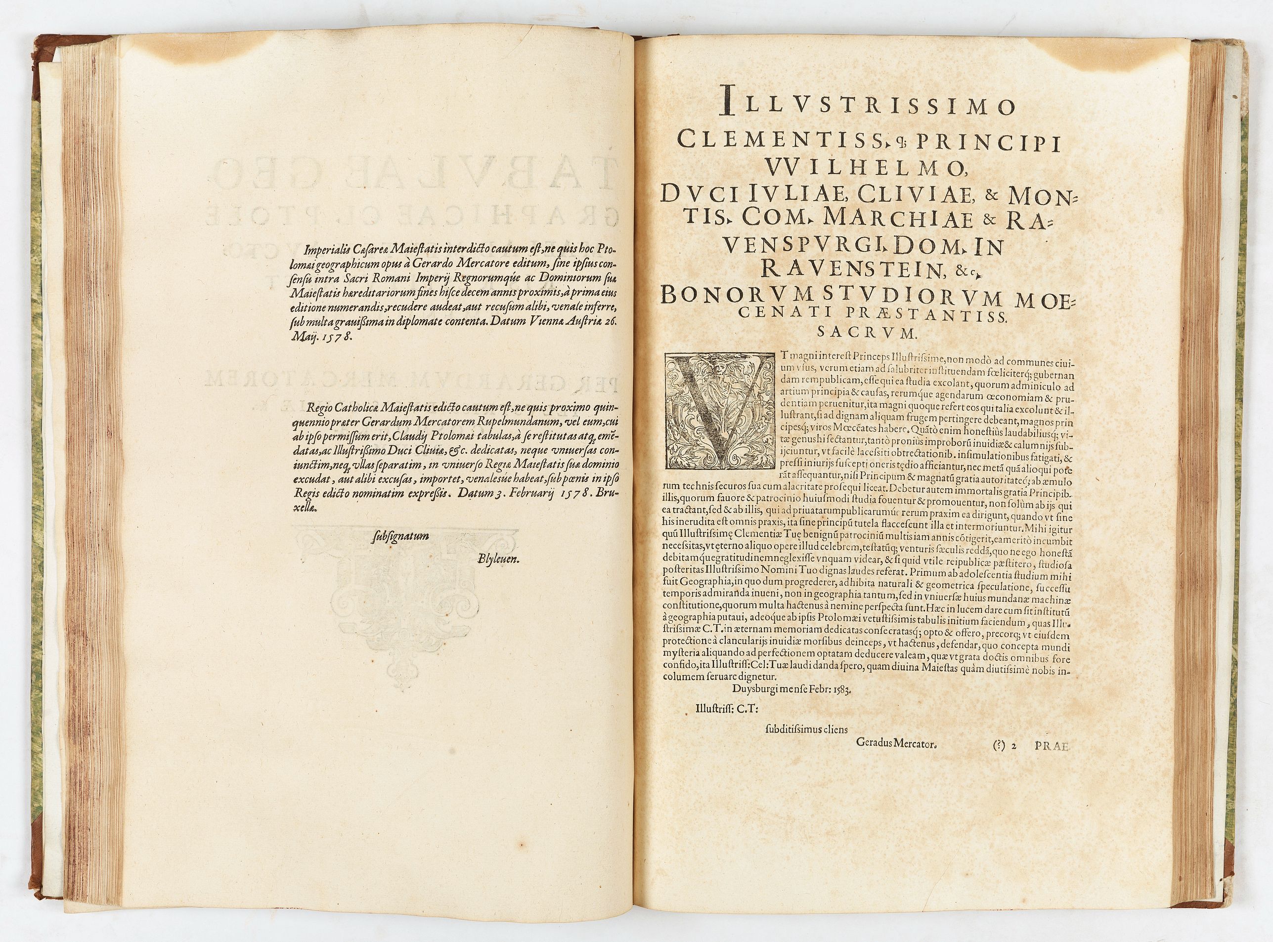
Rare second edition of Gerard Mercator's Cl Ptolemaei Alexandrini Geographiae Libri Octo:, printed from the 28 unaltered plates of the 1578 edition (the text on verso has been reset). The translation is that of Wilibald Pirkheimer, an esteemed humanist friend of Dürer, edited by Arnoldus Mylius, an essential publisher in Cologne, who dedicated the book to the famous cartographer Abraham Ortelius, a rival of Mercator but also his friend and admirer, so much so that he nicknamed him "the Ptolemy of our times".‘When Mercator's Ptolemaeus atlas was reprinted in 1584, this time with texts on verso, this text closely resembles the texts of Ortelius' Nomencalator Ptolemaicus. Mylius dedicates this second edition of Mercator's Ptolemy to Ortelius to express his gratitude and that of Mercator for Ortelius' help’ (M. van den Broecke in: A World of Innovation. Cartography in the Time of Gerhard Mercator, p.172).
Ortelius named Mercator as 'the Ptolemy of our time', and he engraved these copper plates as part of a cosmography which he planned to publish in five volumes. In the event, the Ptolemaic maps published here, and the four parts of the section of modern maps, were the only works Mercator published before he died in 1594.
Mercator began his ambitious project of describing the world in all its aspects, with the Ptolemaic maps forming part of one volume devoted to geography (together with sections on modern and historical maps).
The Geographia and four parts of the section of modern maps were the only works Mercator published before he died in 1594.
Mercator's Ptolemaic maps first appeared in Duisburg in 1578 as Tabulae Geographicae Cl: Ptoleme̜i ('The Geographical Tables of Cl. Ptolemy'). Karrow calls this a first edition. Still, as this printing lacked Ptolemy's text (the essence of any Ptolemy since no actual maps by Ptolemy survive), it should be considered a different book.
This edition of the book - Karrow's second edition, but the first edition to include the body of Ptolemy's work, translated by Pirckheimer and edited by Mylius - was printed in Cologne in 1584. The plates were later passed to Jodocus Hondius, his successor, who issued editions in the early 17th century. In 1694, the plates were auctioned to François Halma (1653 - 1722), who reworked them and published editions in 1695, 1698, and 1704. A final edition was published in 1730 by R. and J. Wetstein and G. Smith.
Some 20 examples of the 1584 Ptolemy are cataloged in institutional collections.
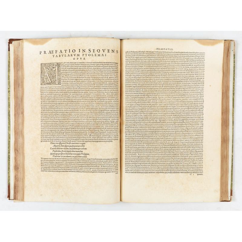
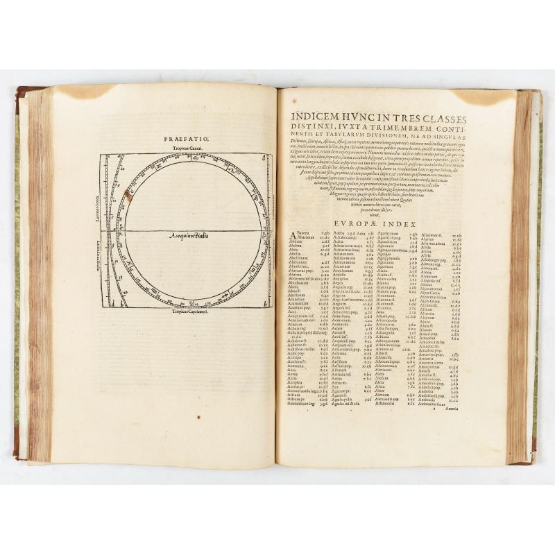
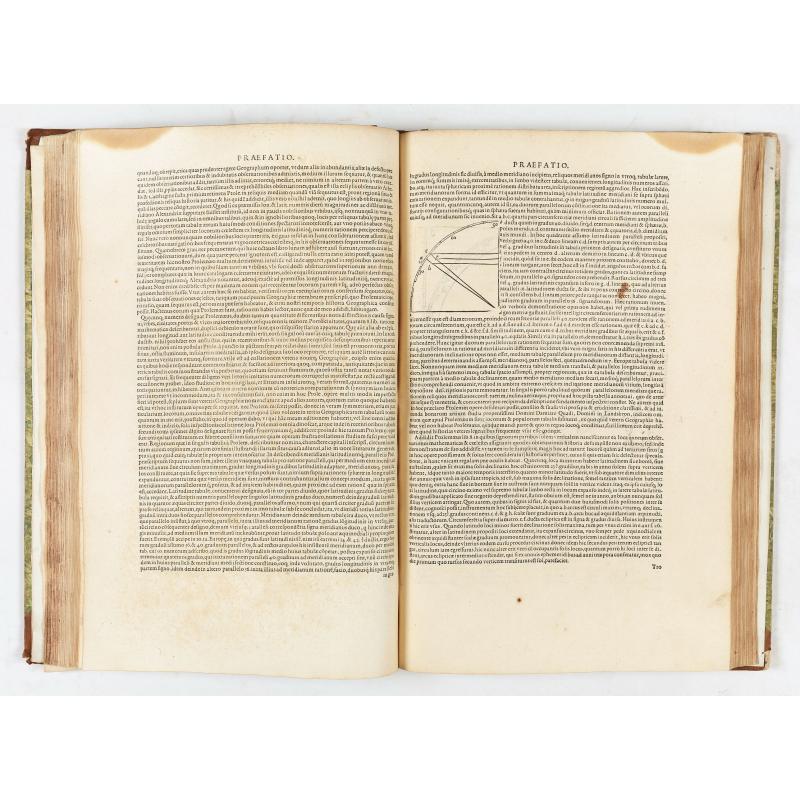
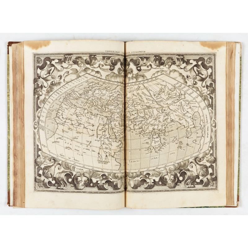
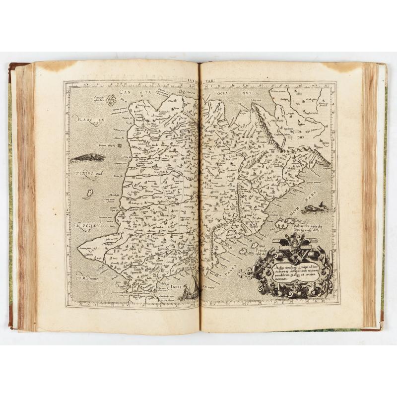
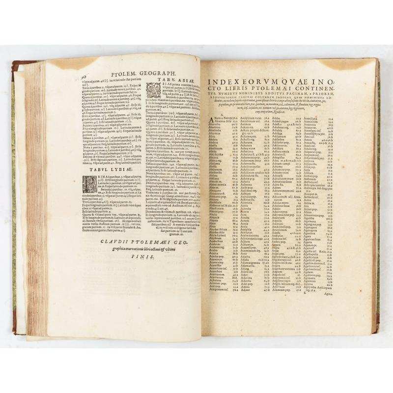
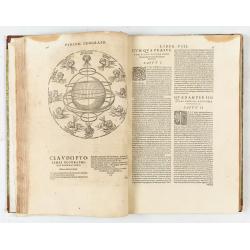
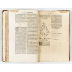
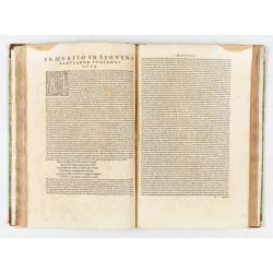
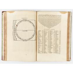
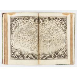
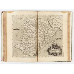
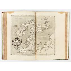
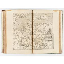
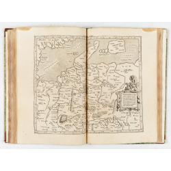
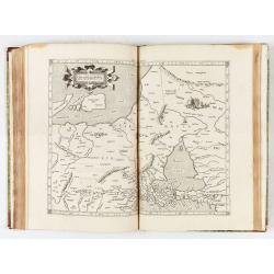
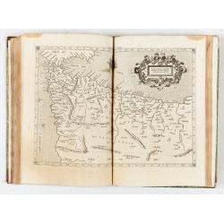
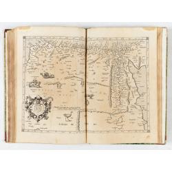
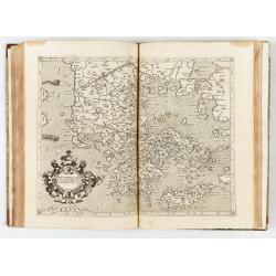
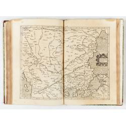
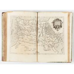
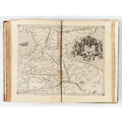
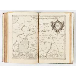
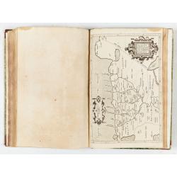
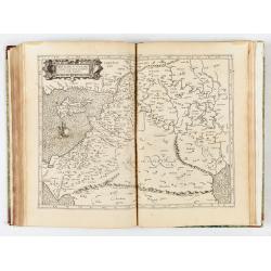
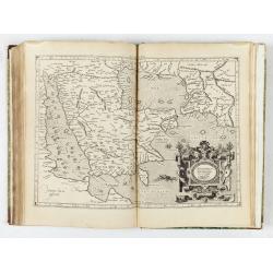
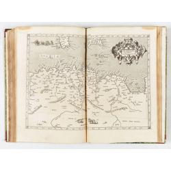
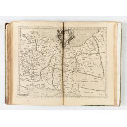
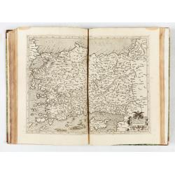
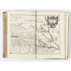
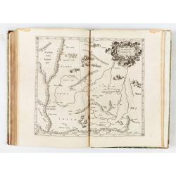
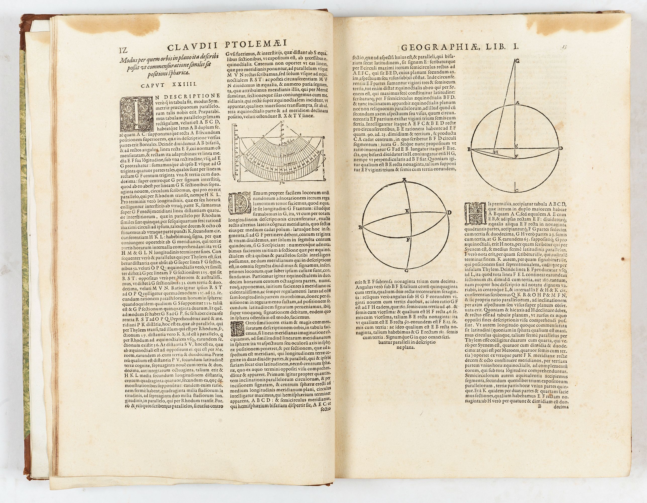
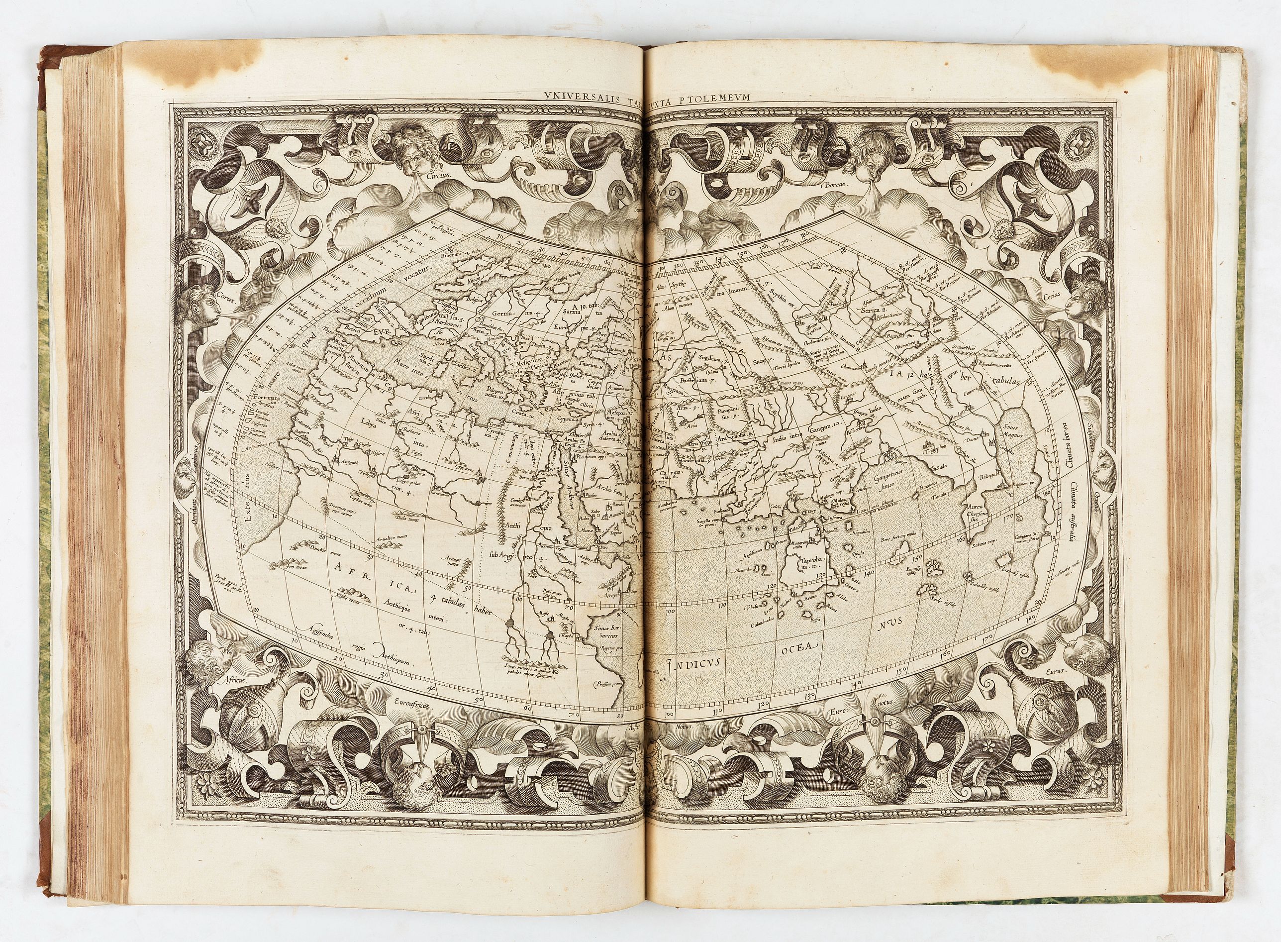
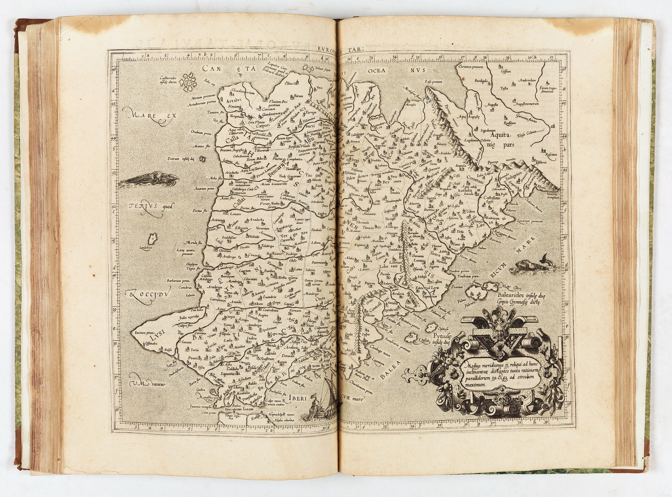
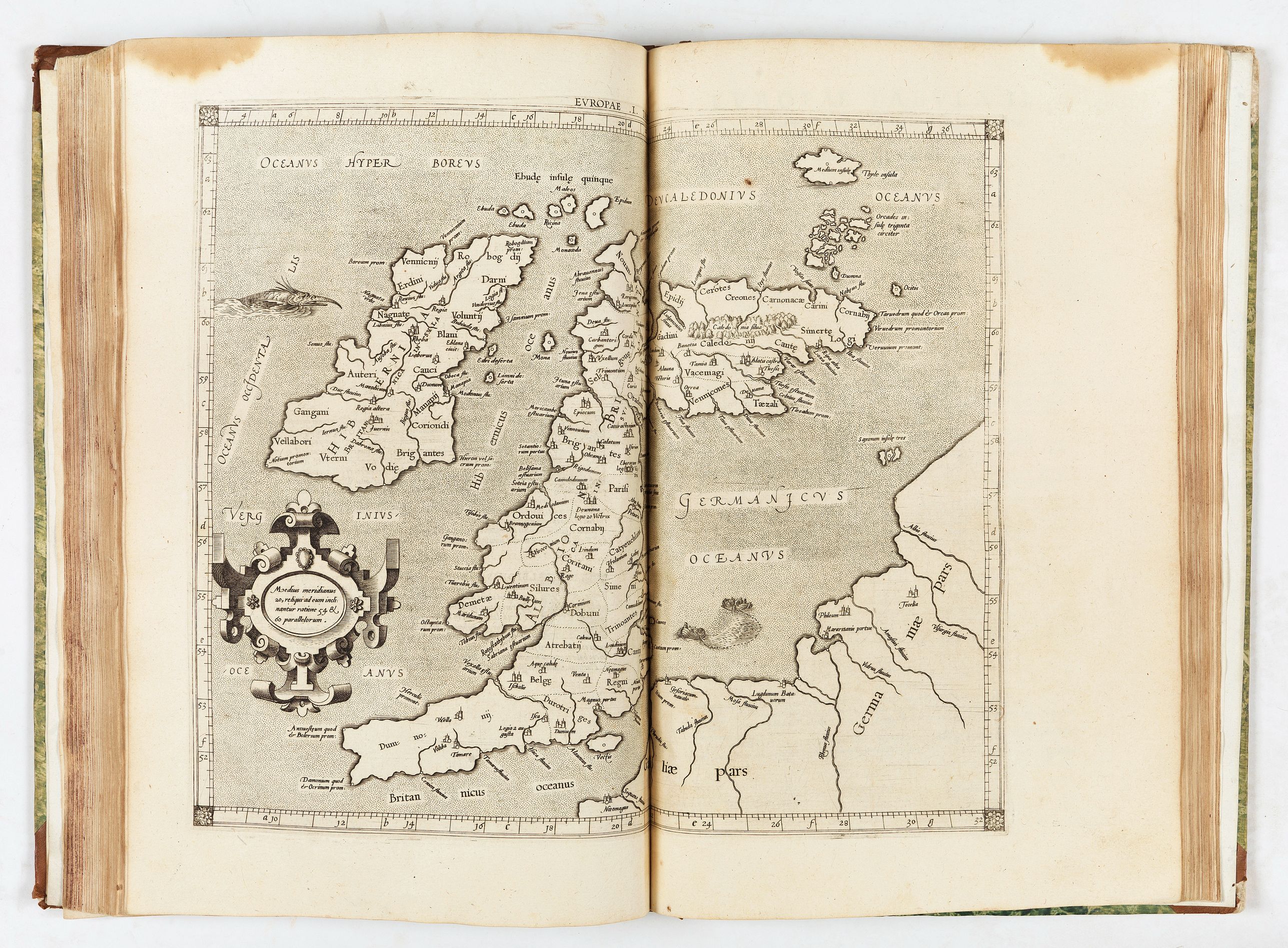
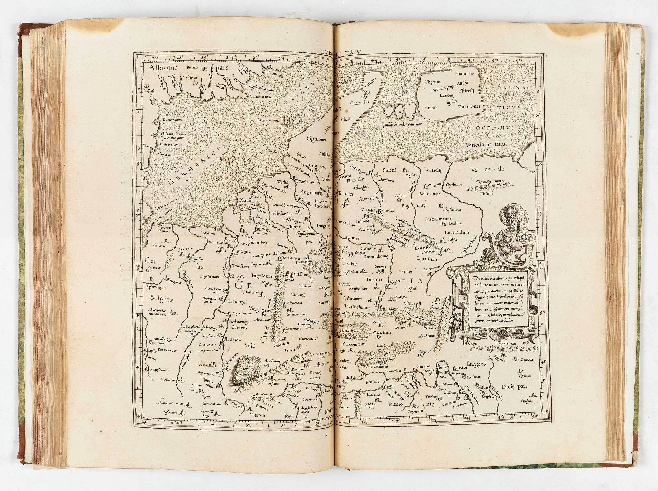
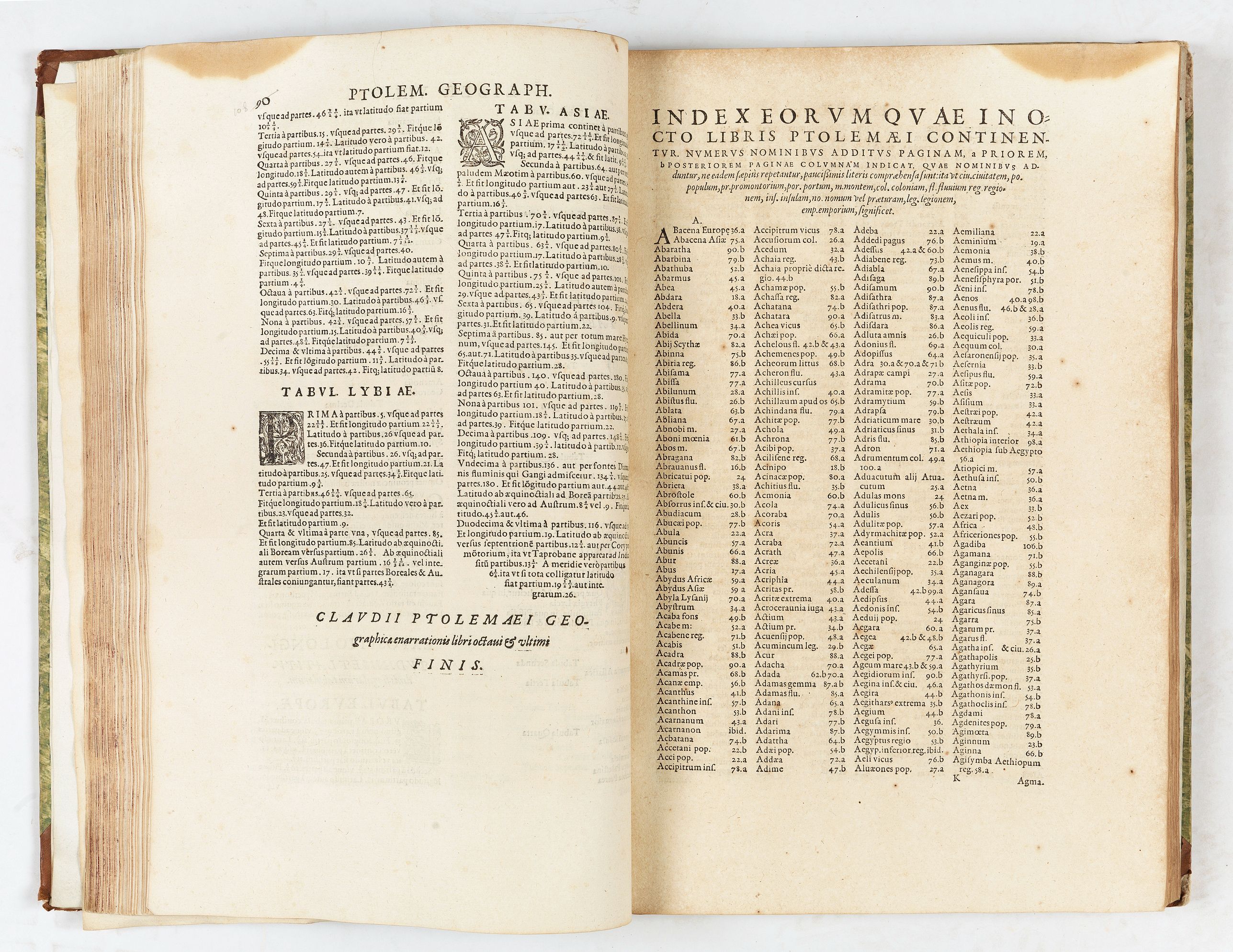
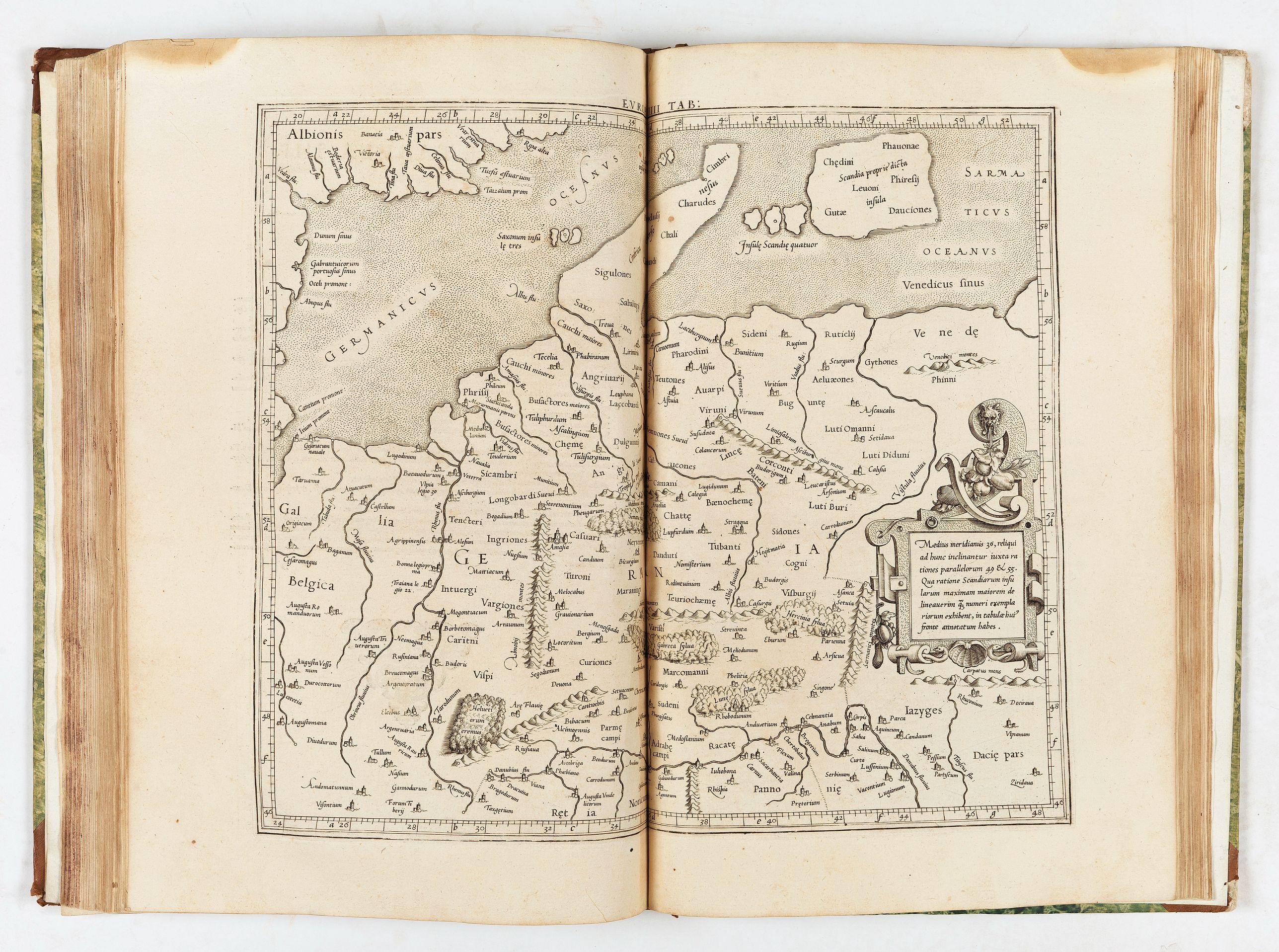
Engraved title with a world map, a letterpress dedication to Abraham Ortelius, 28 Ptolemaic maps, complete with the additional single-page map, woodcut initials, diagrams, and typographical ornaments. The map section opens with Mercator's fantastic double-page Ptolemaic world map, which presents the iconic image in a classically Dutch style with strapwork geometry surrounding the winds. This is followed by the traditional suite of ten European maps, five African maps (the Egyptian map is a single-page production), and twelve Asian maps. Descriptive text appears on the recto and sometimes on the verso of the map.
- Vniversalis tabvla ivxta Ptoemaevm. In qua tres continentis partes, Europa, Africa, & Asia, quatenus ipsius tempore innotuerant, delineatae sunt --
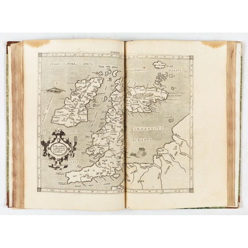
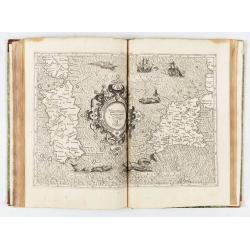
- Evropae tabvla I. In qua insulae Britannicae duae, Hibernia & Albion cum minoribus adiacentibus describuntur
- Evropae tabvla II. In qua describuntur Hispaniae, quam Graeci Iberiam vocant, tres prouinciae Baetica, Lusitania, & Tarraconensis
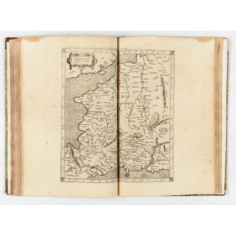
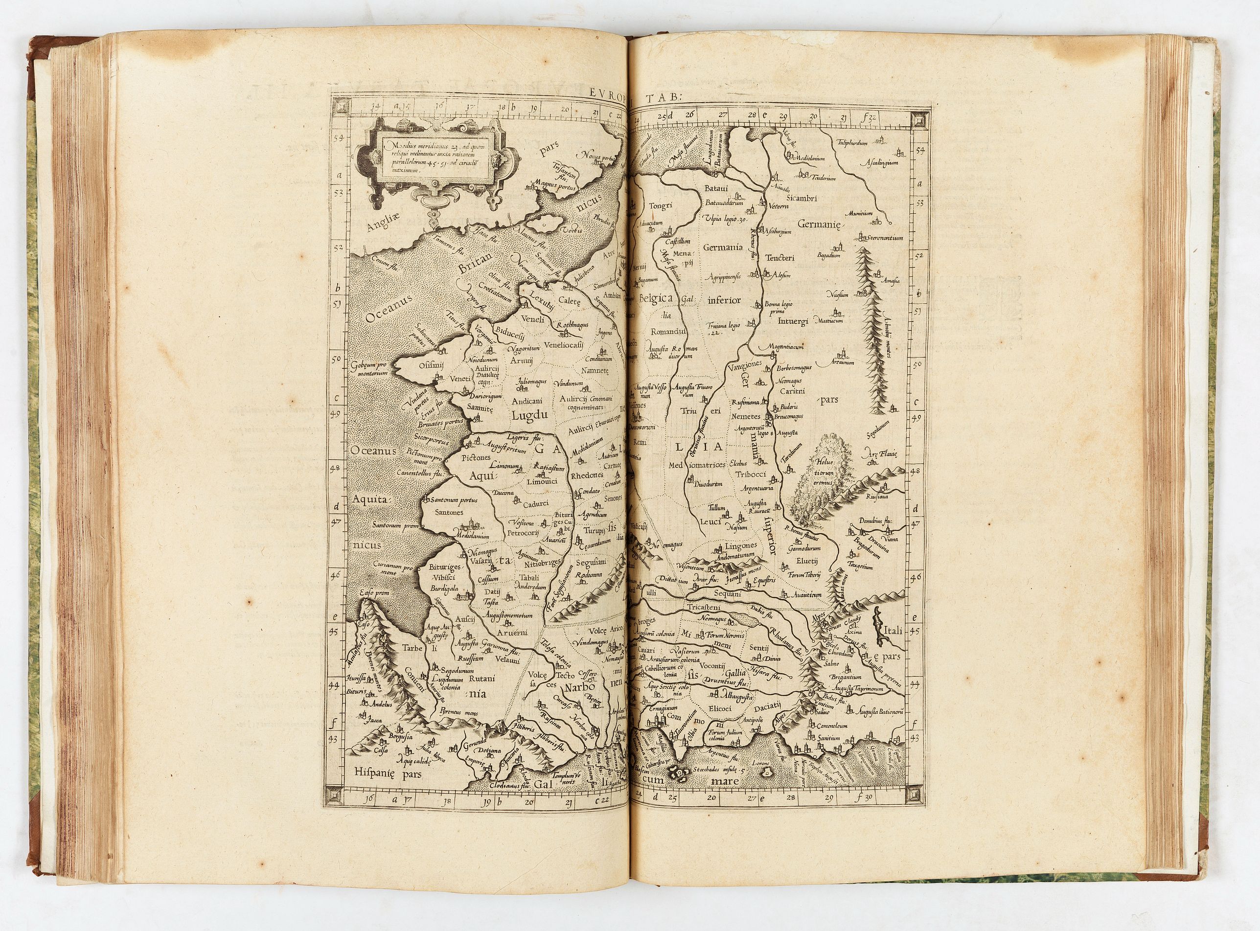
- Evropae tabvla III. Continet Galliae, Graecis Geltogalatiae, quatuor prouincias, Aquitaniam, Lugdunensem, Belgicam, & Narbonensem
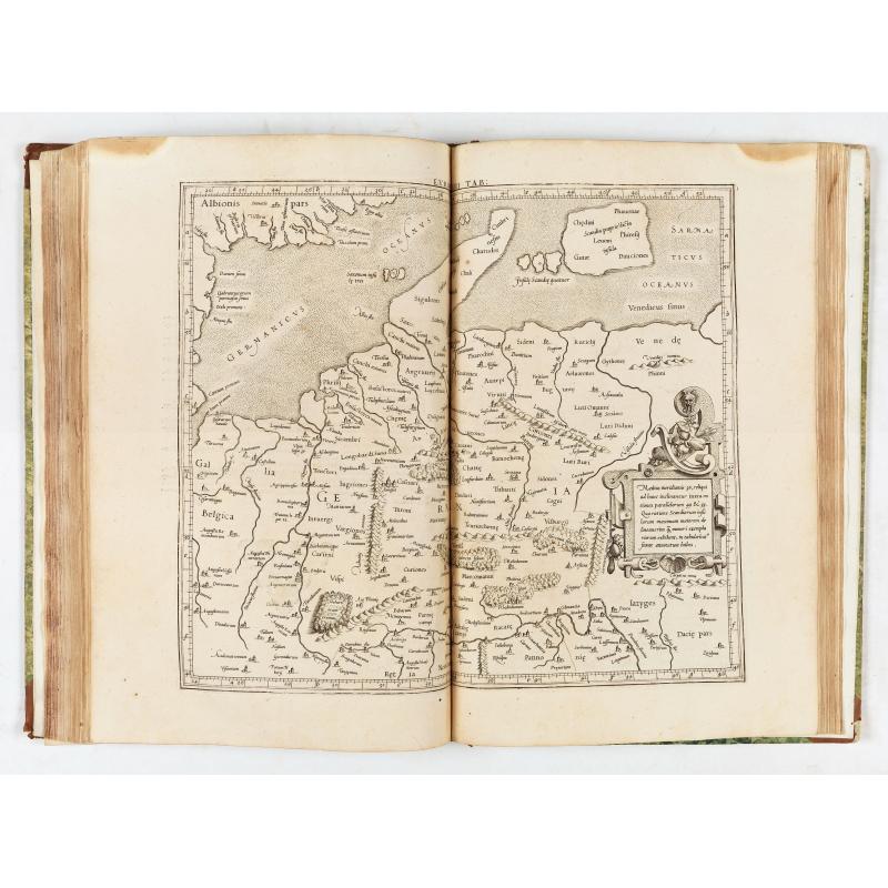
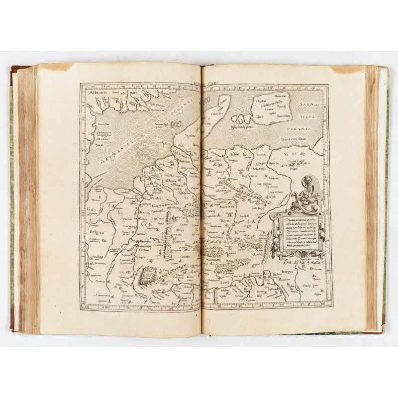
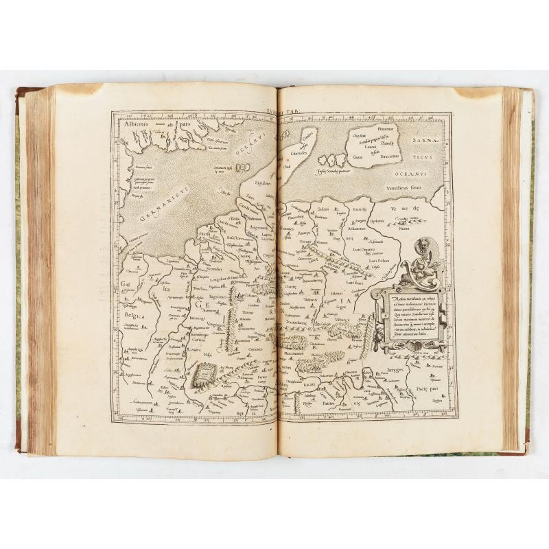
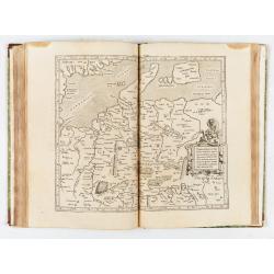
- Evropa tabvla IIII. Continet Germaniam magnam
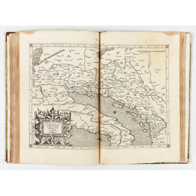
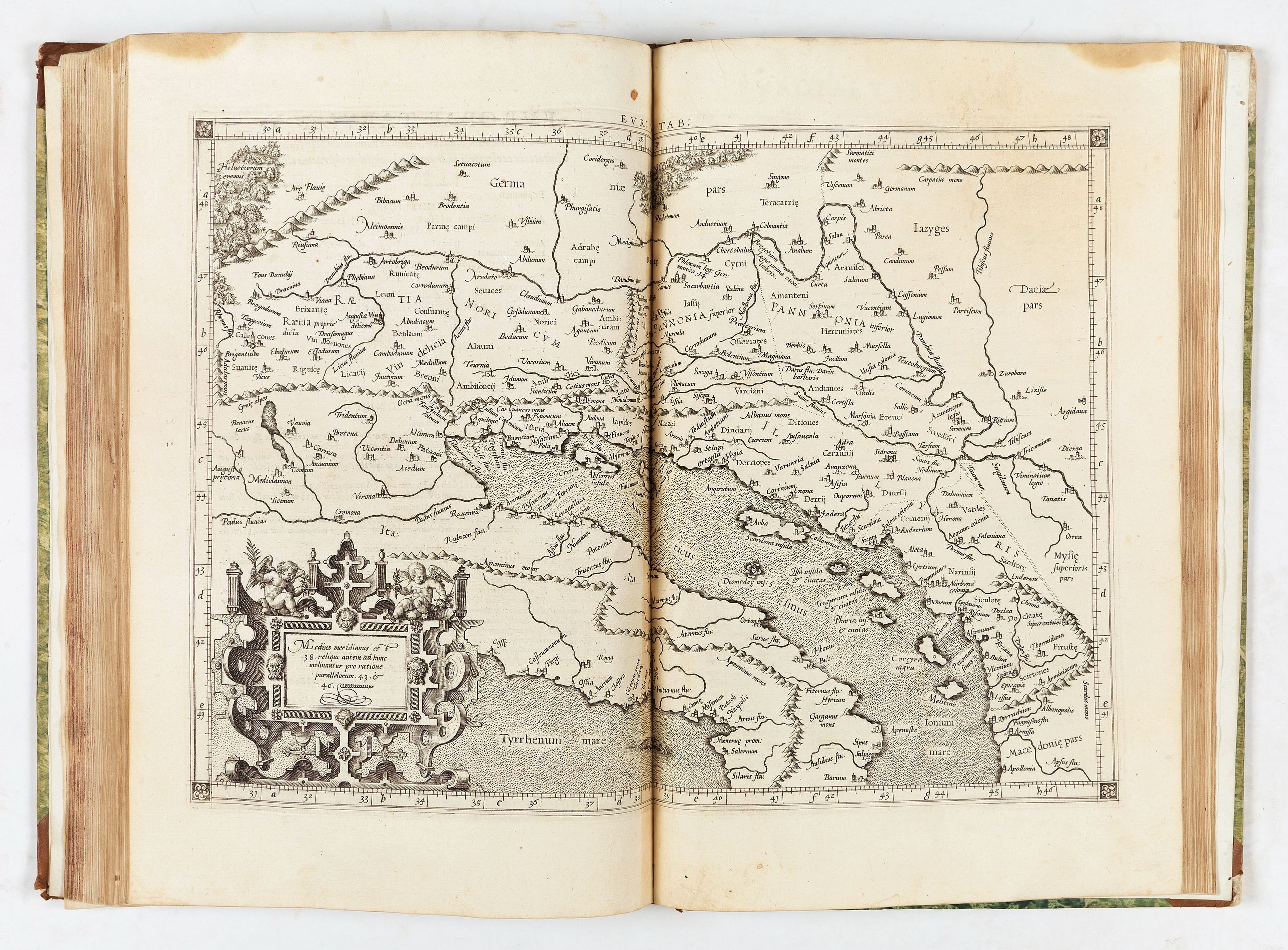
- Evropae tabvla V. Continet Raetiam, Noricum, vtramque Pannoniam & Illyricum
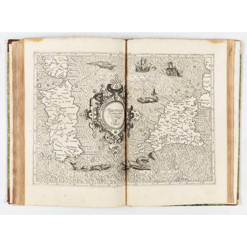
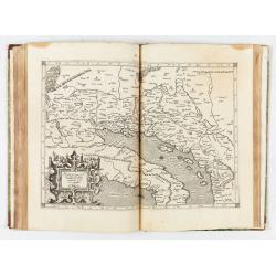
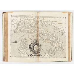
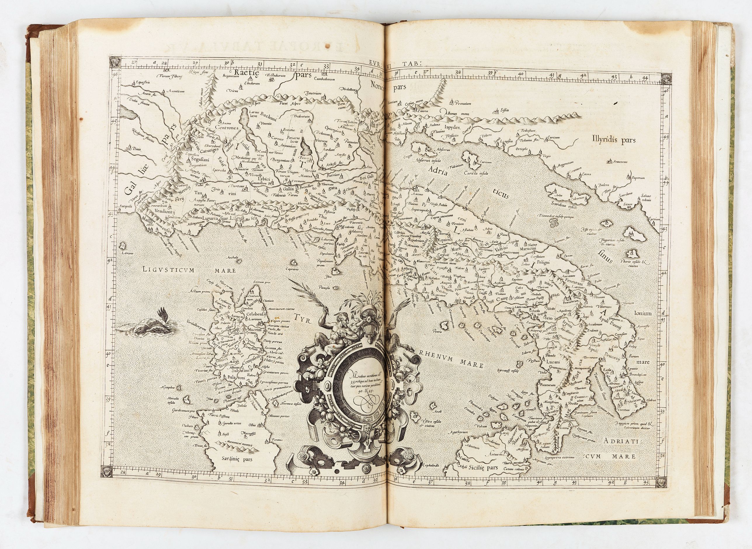
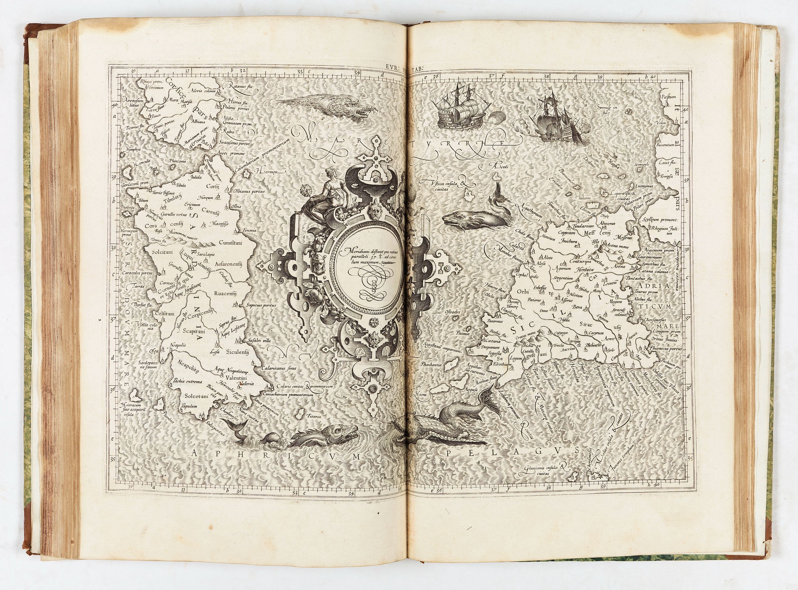
- Evropae tabvla VI. Continet Itialiam & Cyrnum siue Corsicam insulam
- Evropae tabvla VII. Continet Sardiniam & Siciliam insulas
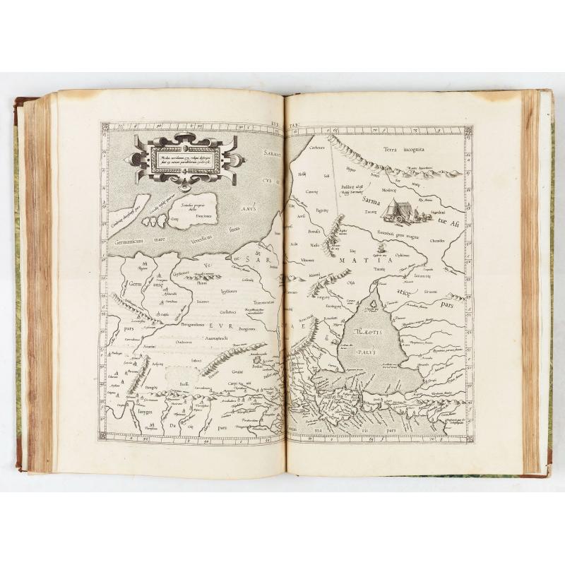
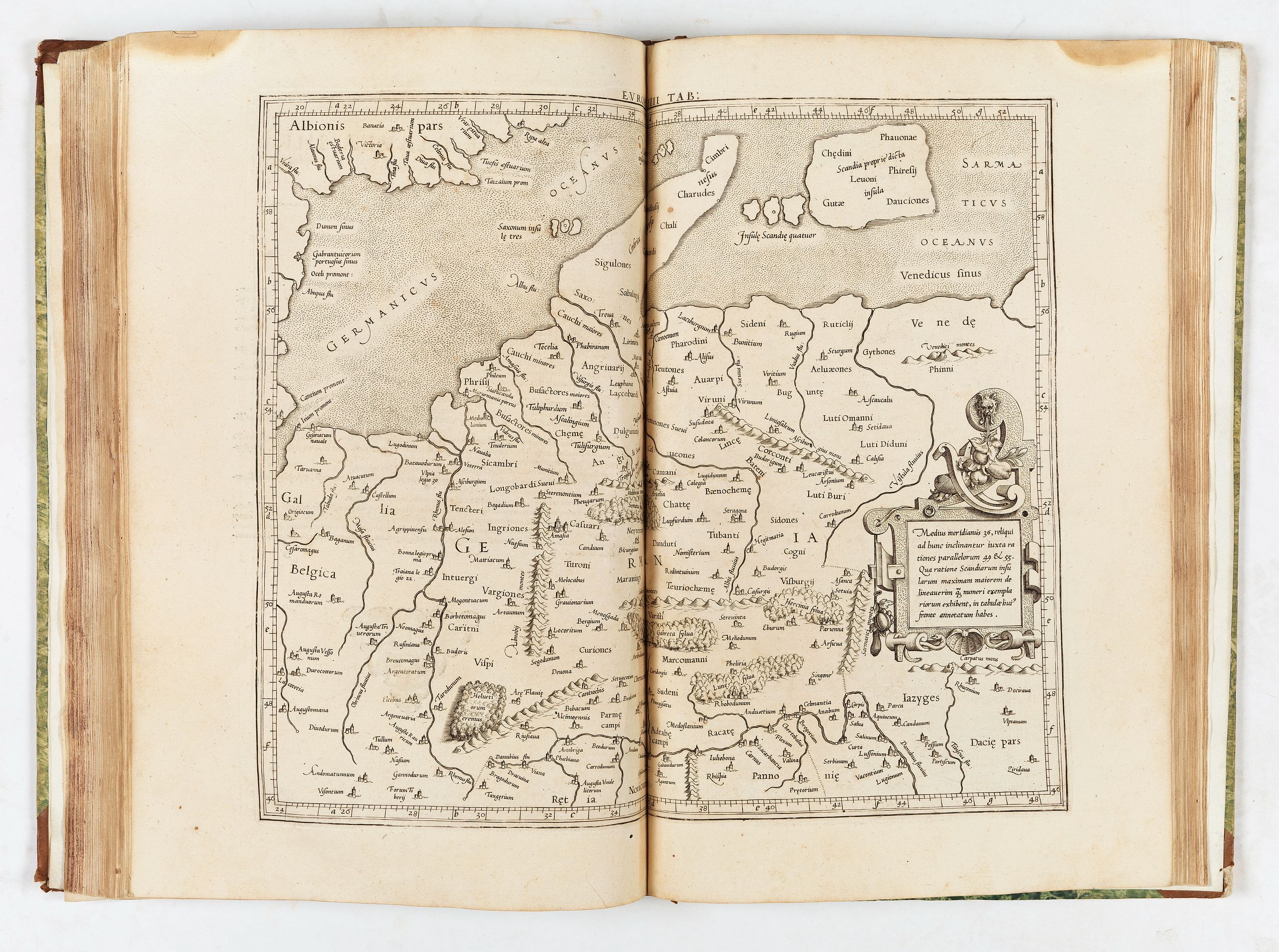
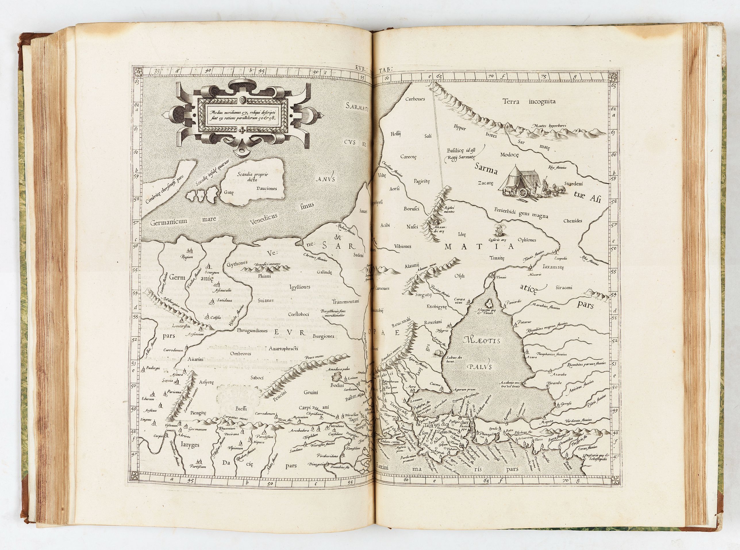
- Evropae tabvla VIII. Continet Samartiam Europae & Tauricum Chersonesum
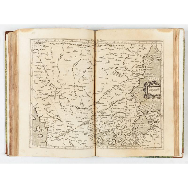
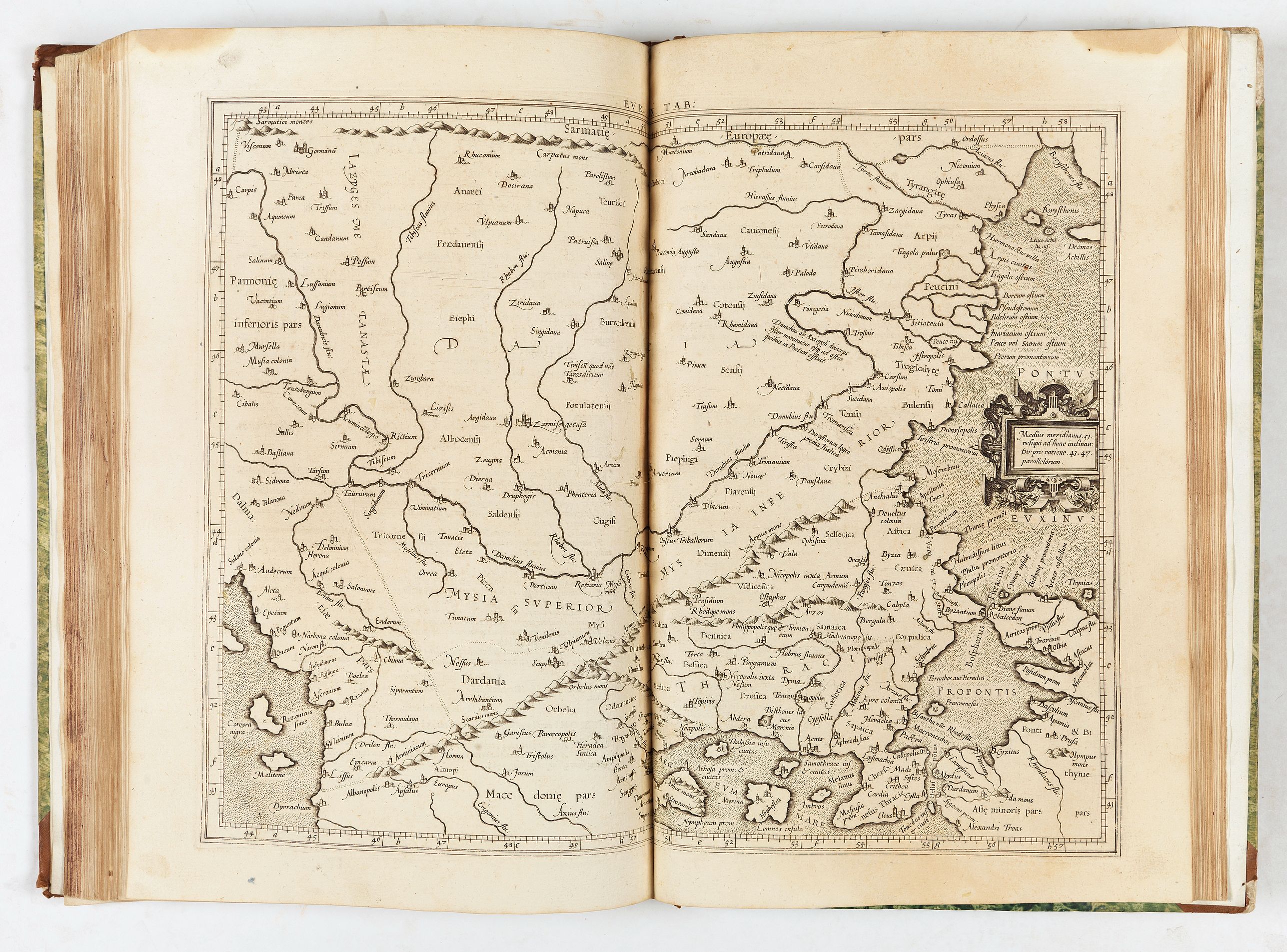
- Evropae tabvla IX. Continet Iazyges Metanastas, Daciam, Mysiam superiorem, Mysiam interiorem, & Thraciam
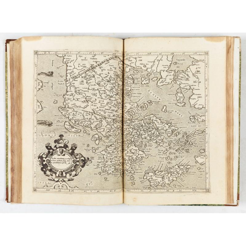
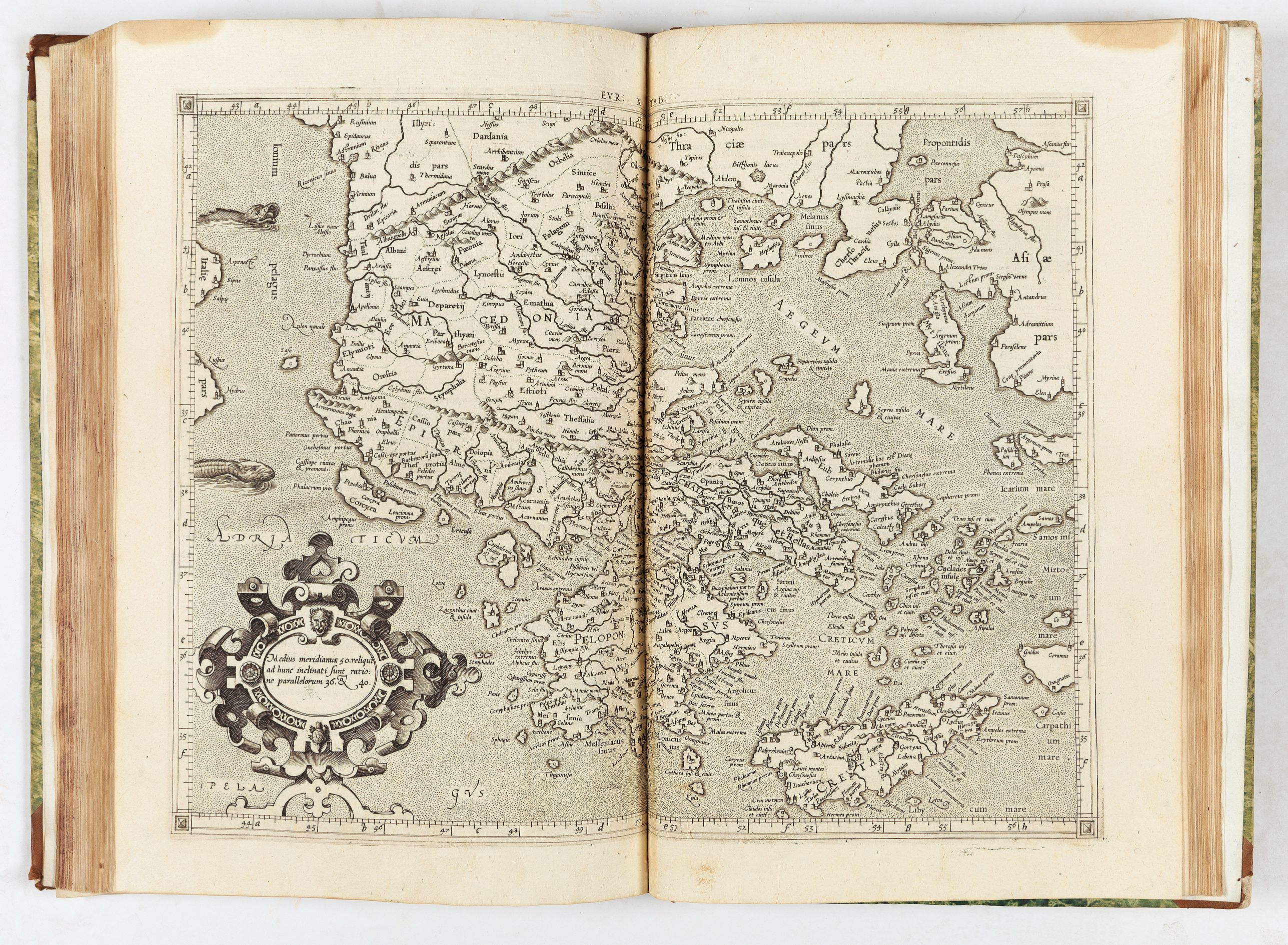
- Evropae tabvla X. Continens Macedoniam, Epirum, Achaiam cum Euboea insula, Peloponnesum & Cretam insulam
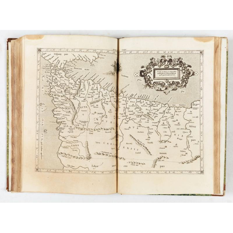
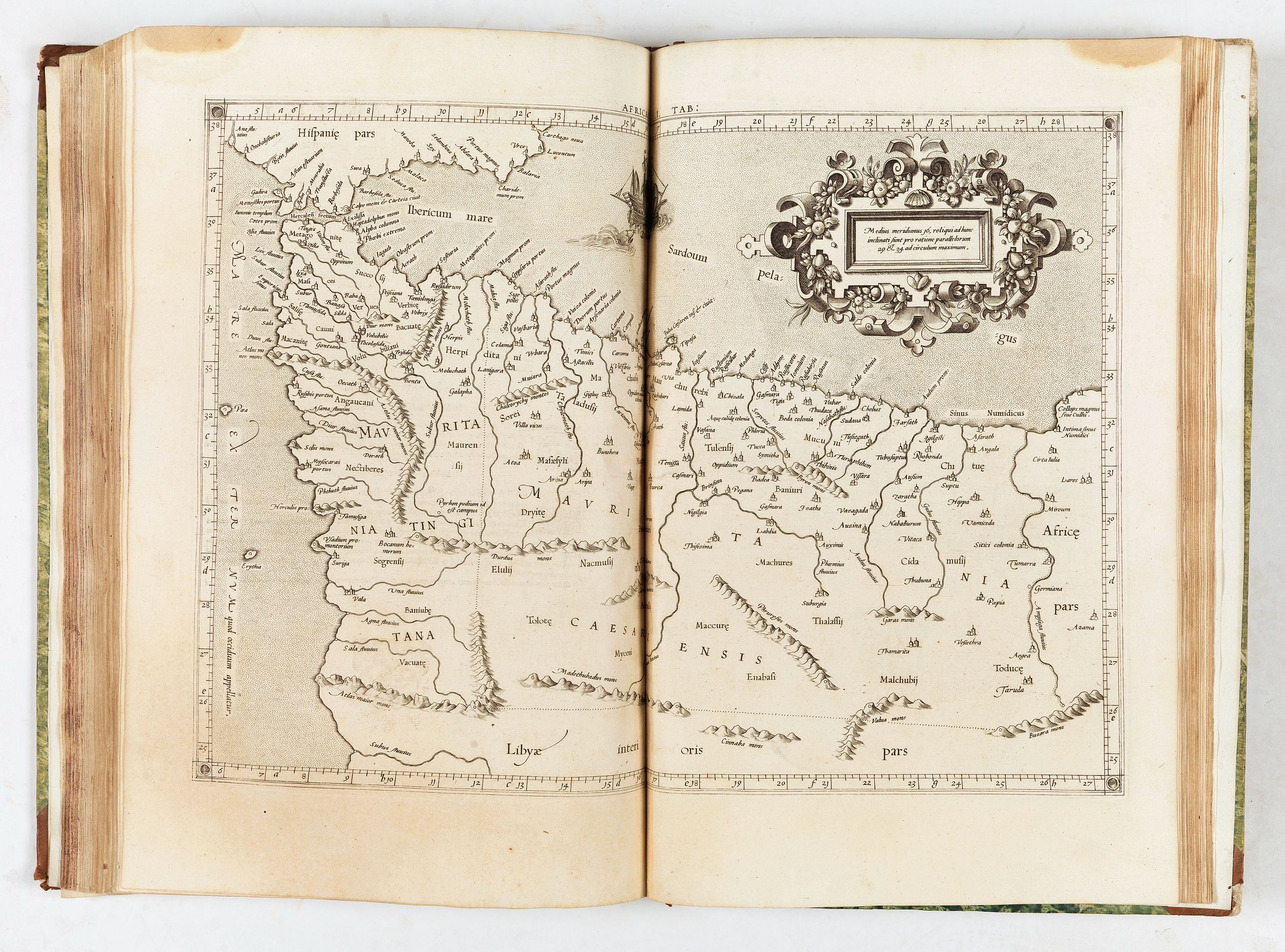
- Africae tabvla I. Continet ambas Mauritanias, Tingitanam & Caesariensem
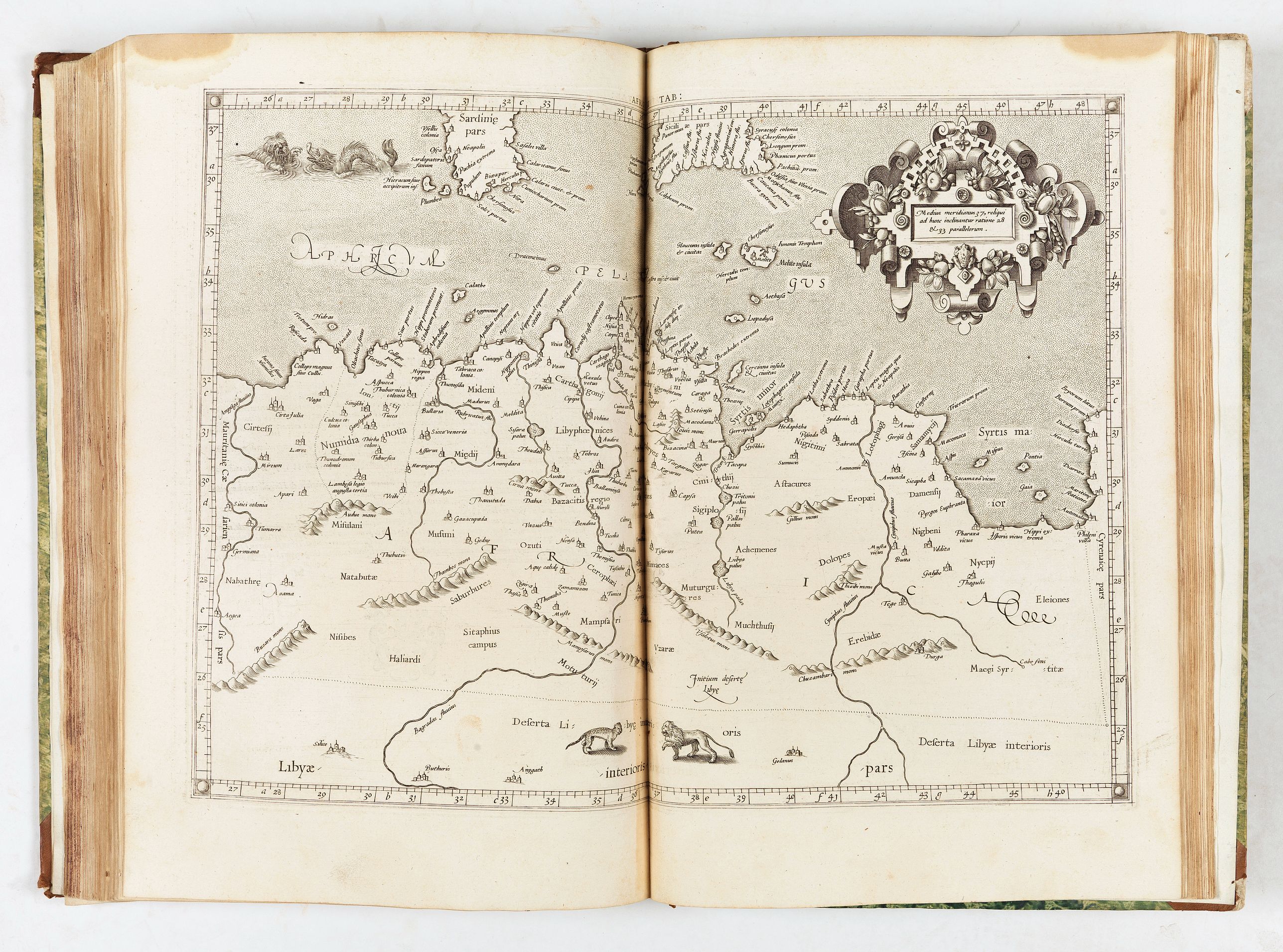
- Africae tabvla II. Continet Africam minorem
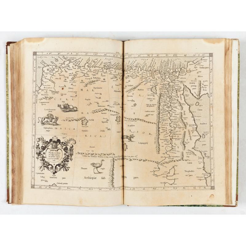
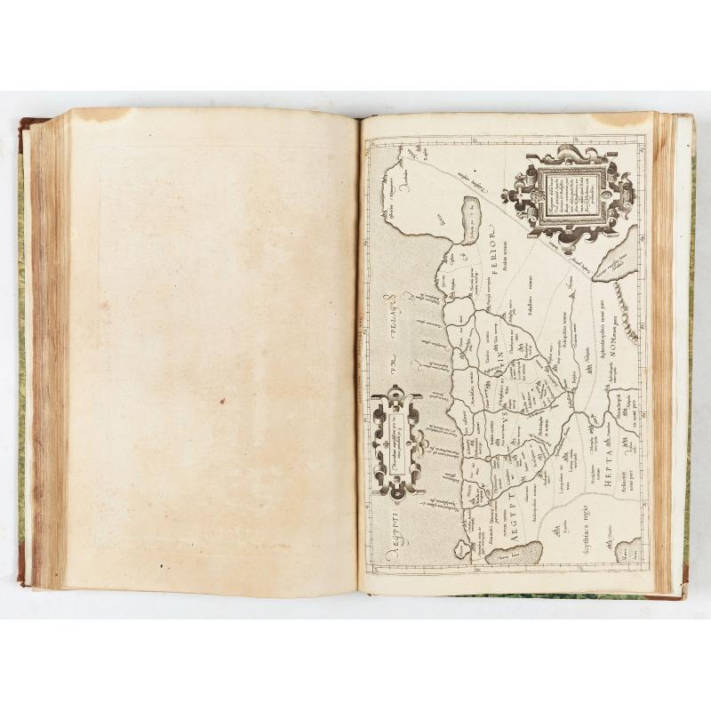
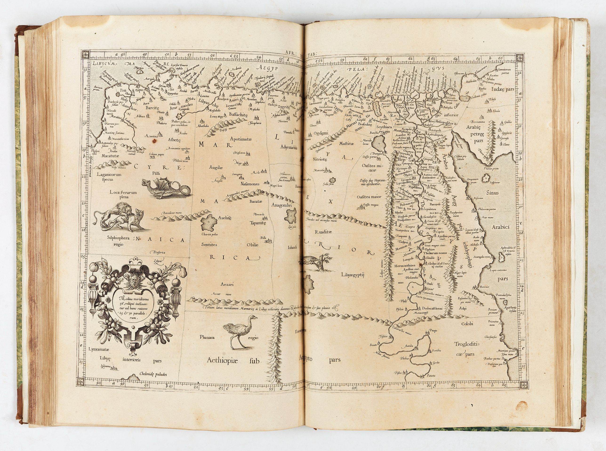
- Africae tabvla III. Continet Cyrenaicam & Aegyptum
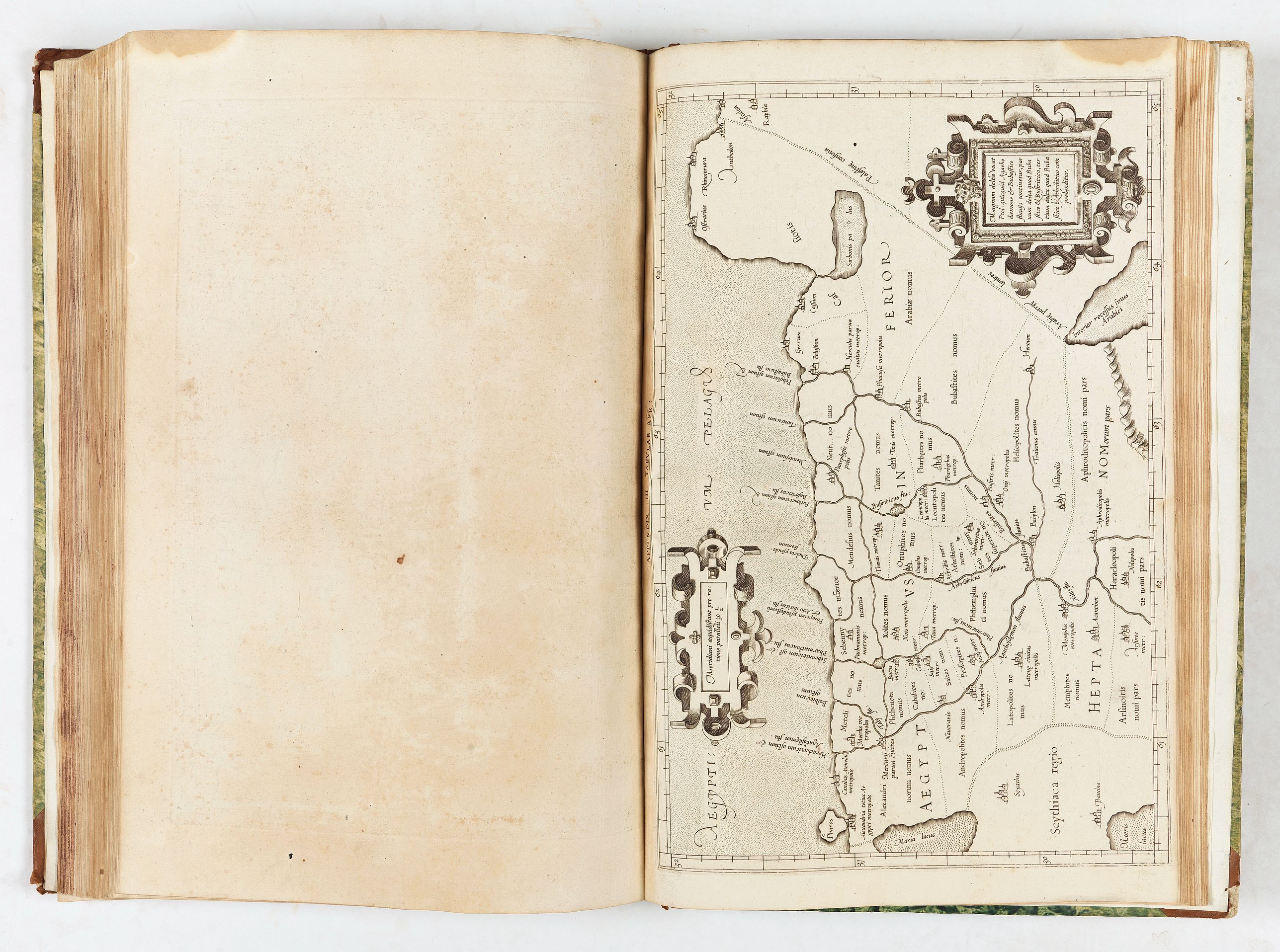
- Appendix III in tabvlae Afr: (showing the Nile Delta)
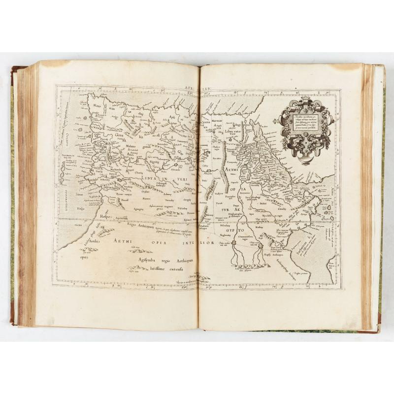
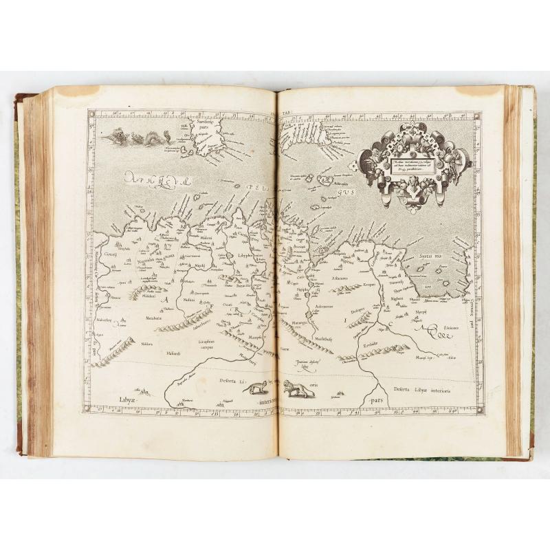
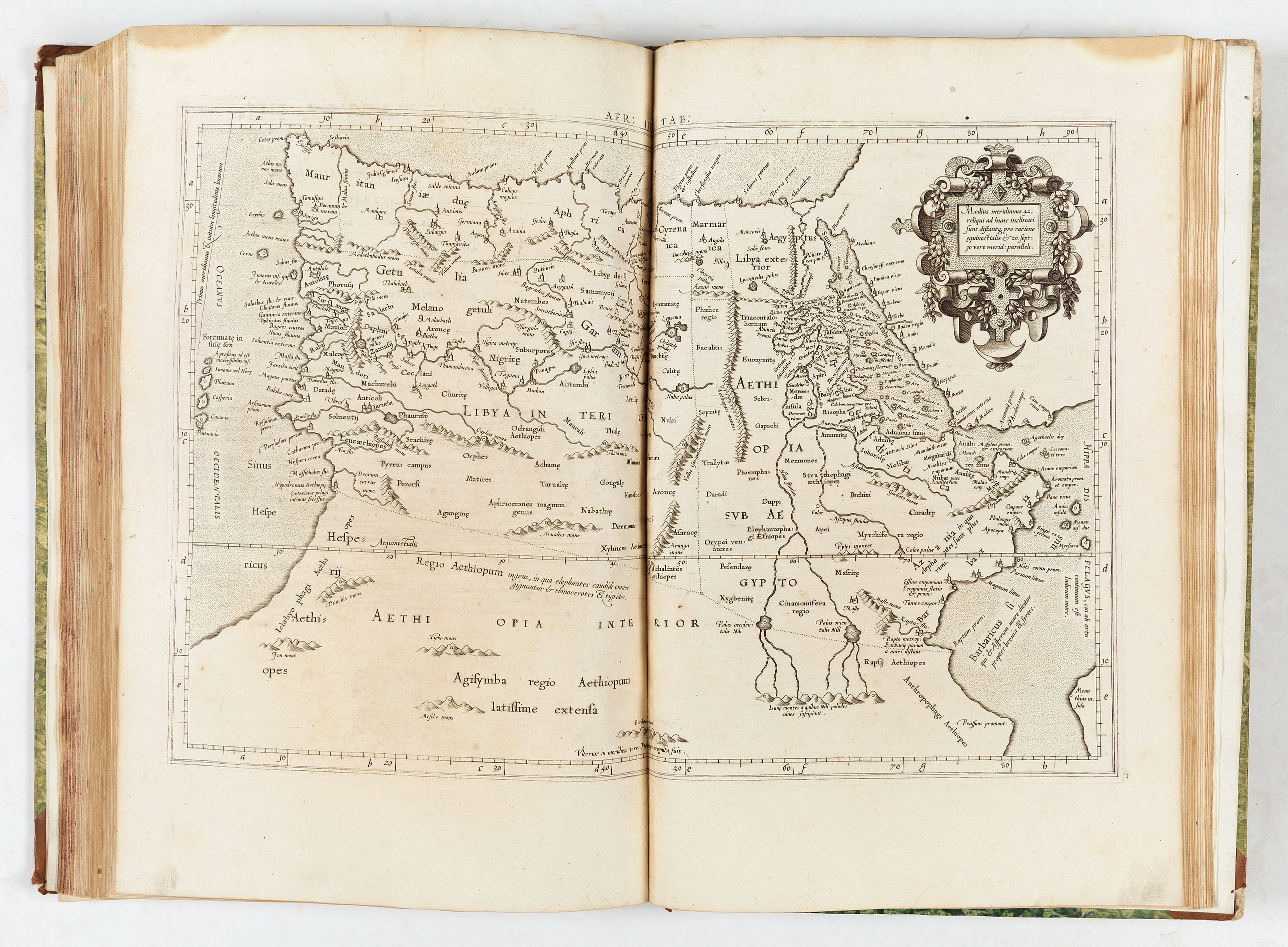
- Africae tabvla IIII. Continet Libyam interiorem, Aethiopiam quae sub Aegypto est, & Aethiopiam interiorem
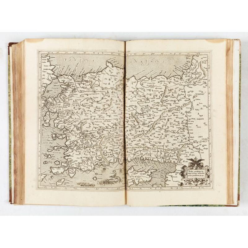
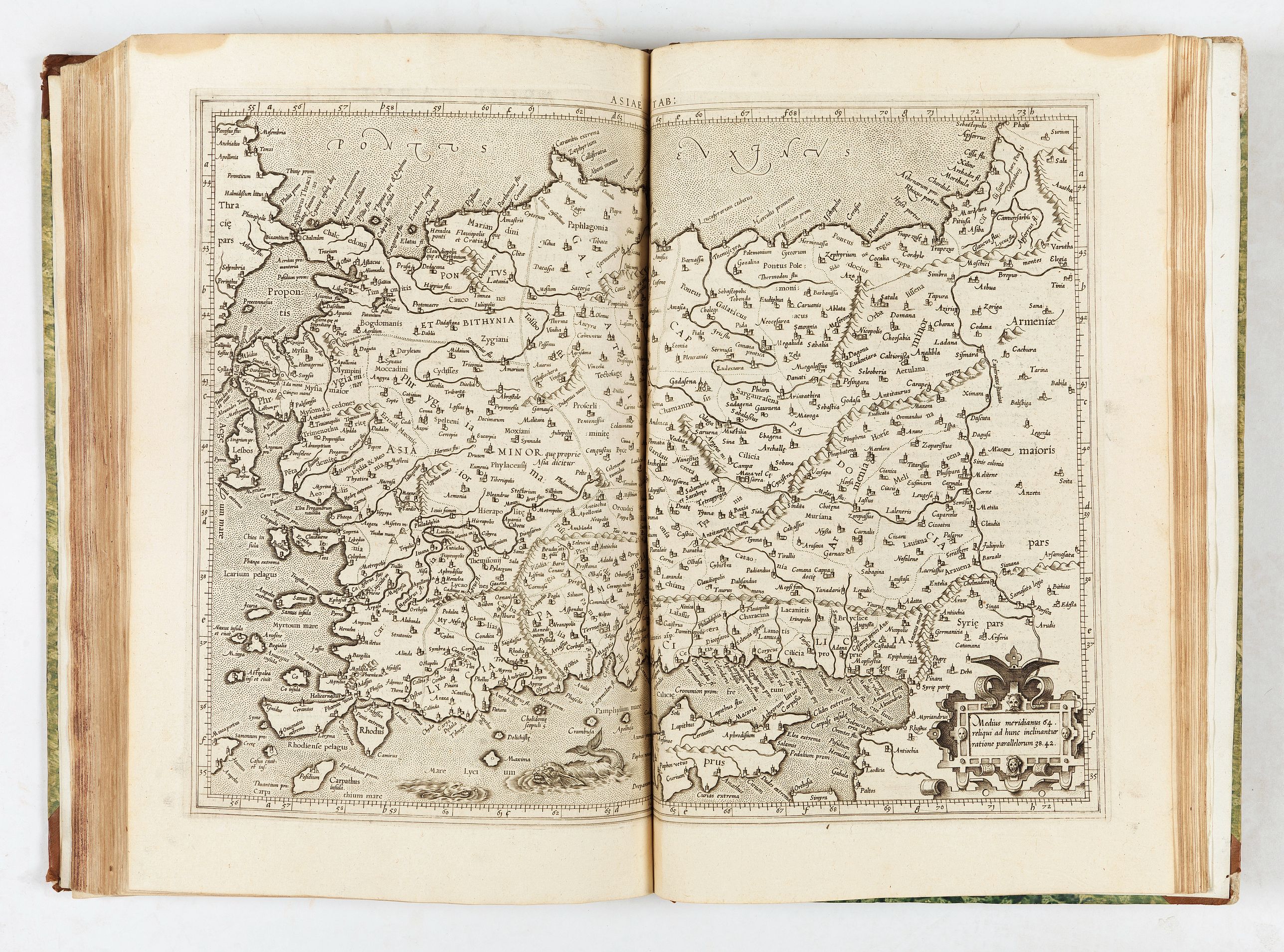
- Asiae tabvla I. Continet Pontum cum Bithynia, Asiam proprie[m] dictam, Lyciam, Galatiam, Pamphyliam, Cappadociam, Armeniam minorem, & Ciliciam
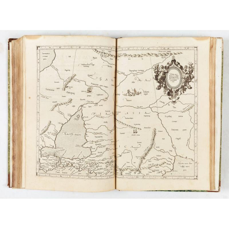
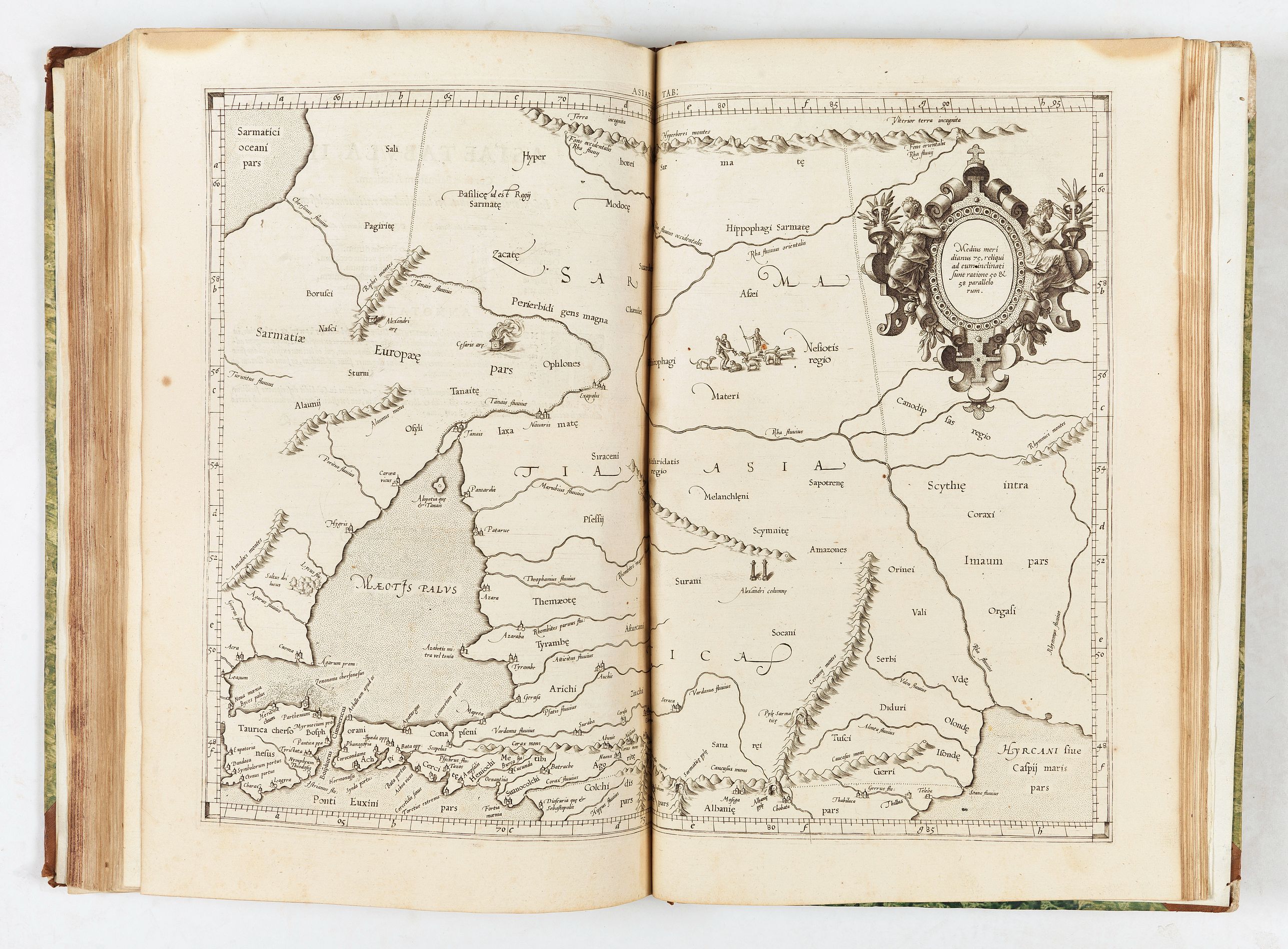
- Asiae tabvla II. Continet Sarmatiam Asiaticam
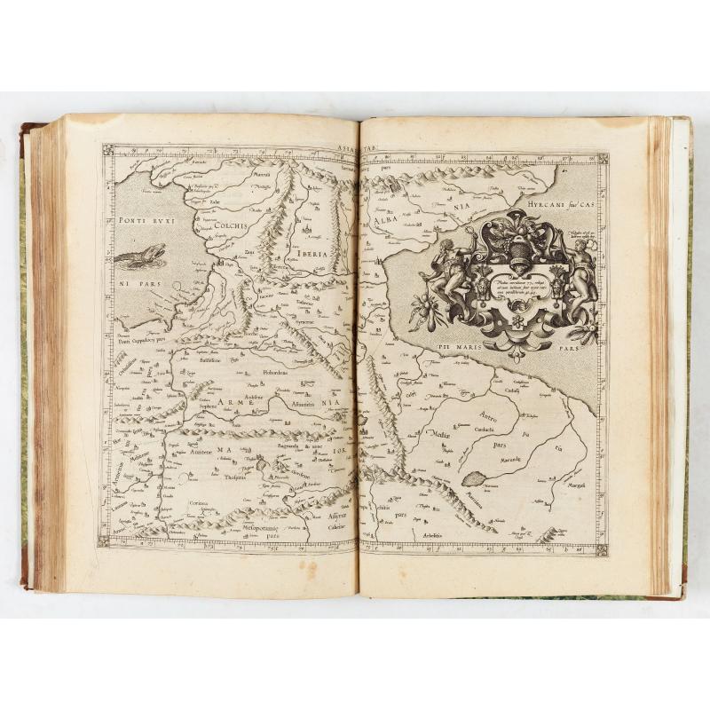
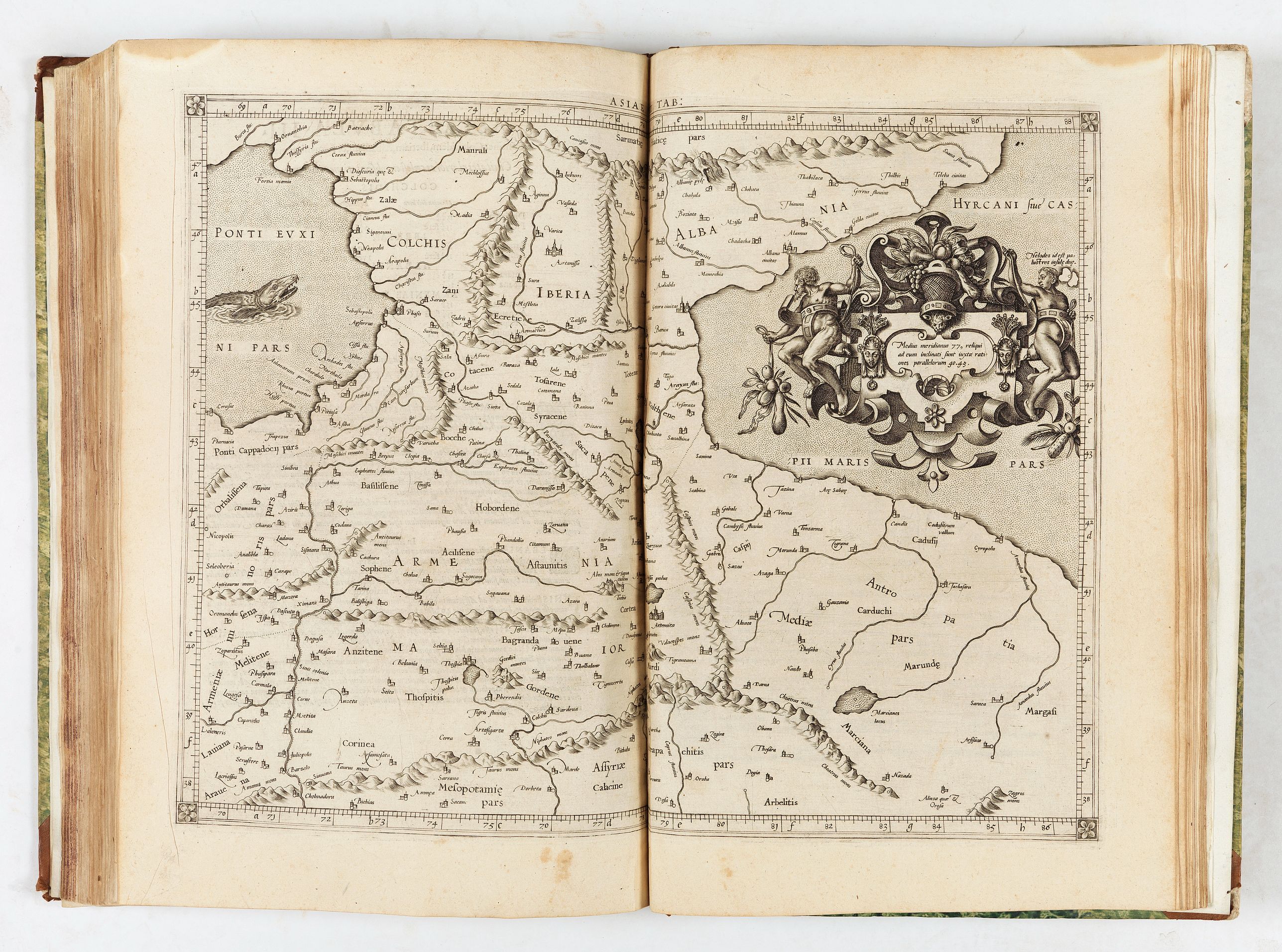
- Asiae tabvla III. Continet Colchidem, Iberiam, Albaniam, & Armeniam maiorem
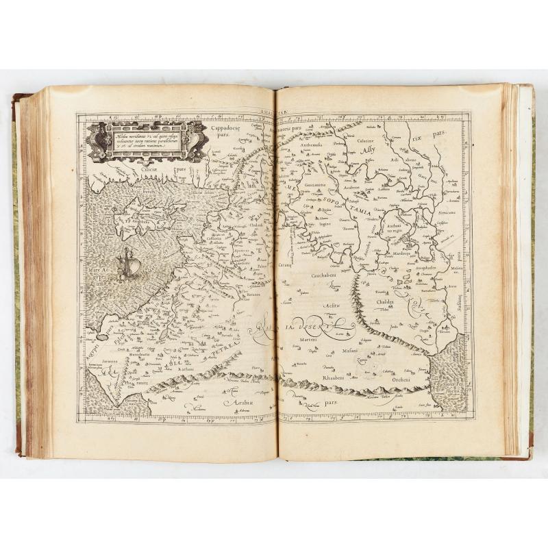
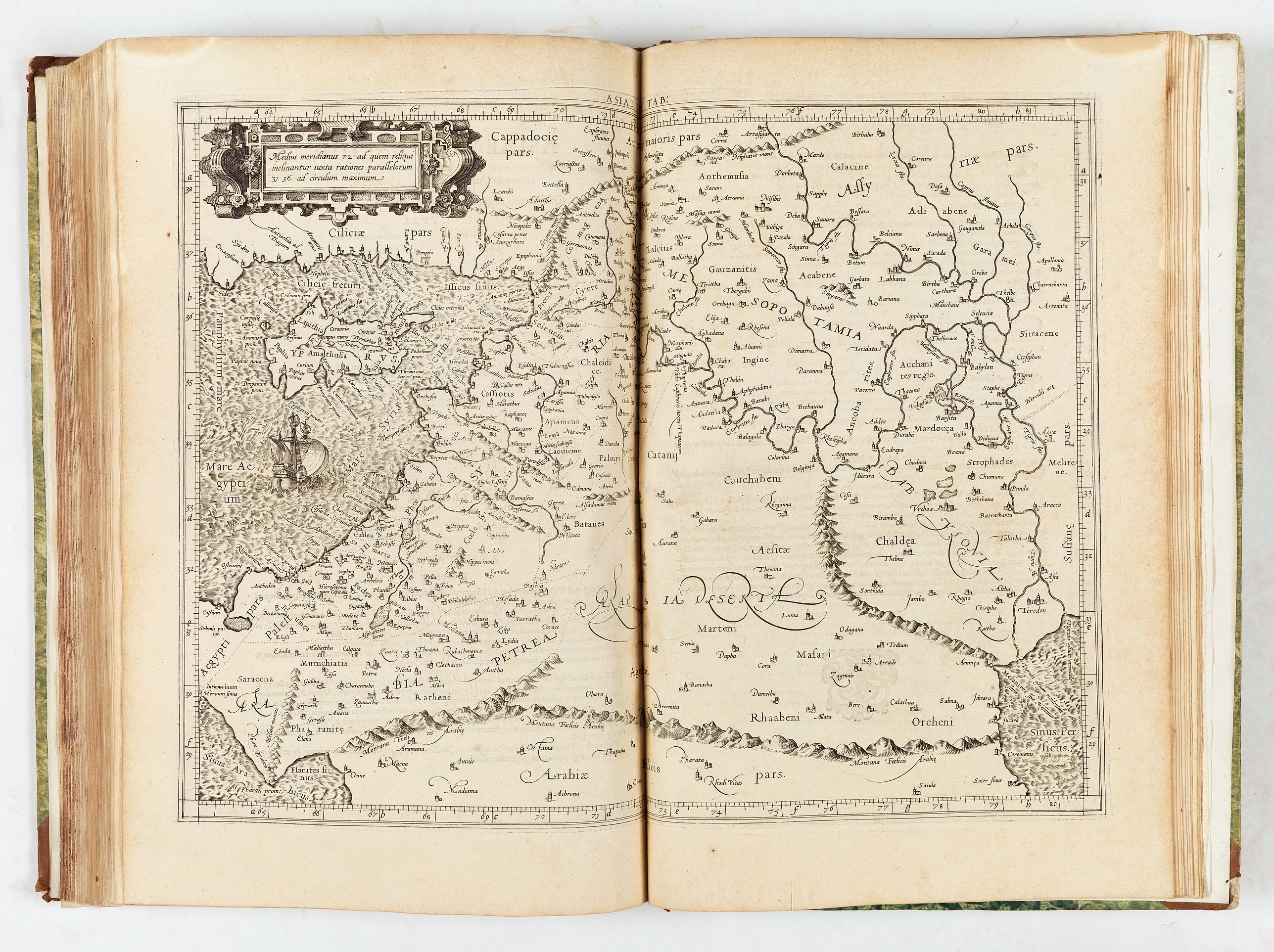
- Asiae tabvla IIII. Continet Cyprum, Syriam, cuius pars est Palestina, quae & Iudaea, Arabiam Petr[a]eam, Mesopotamiam, Arabiam desertam, Babyloniam
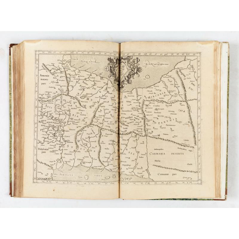
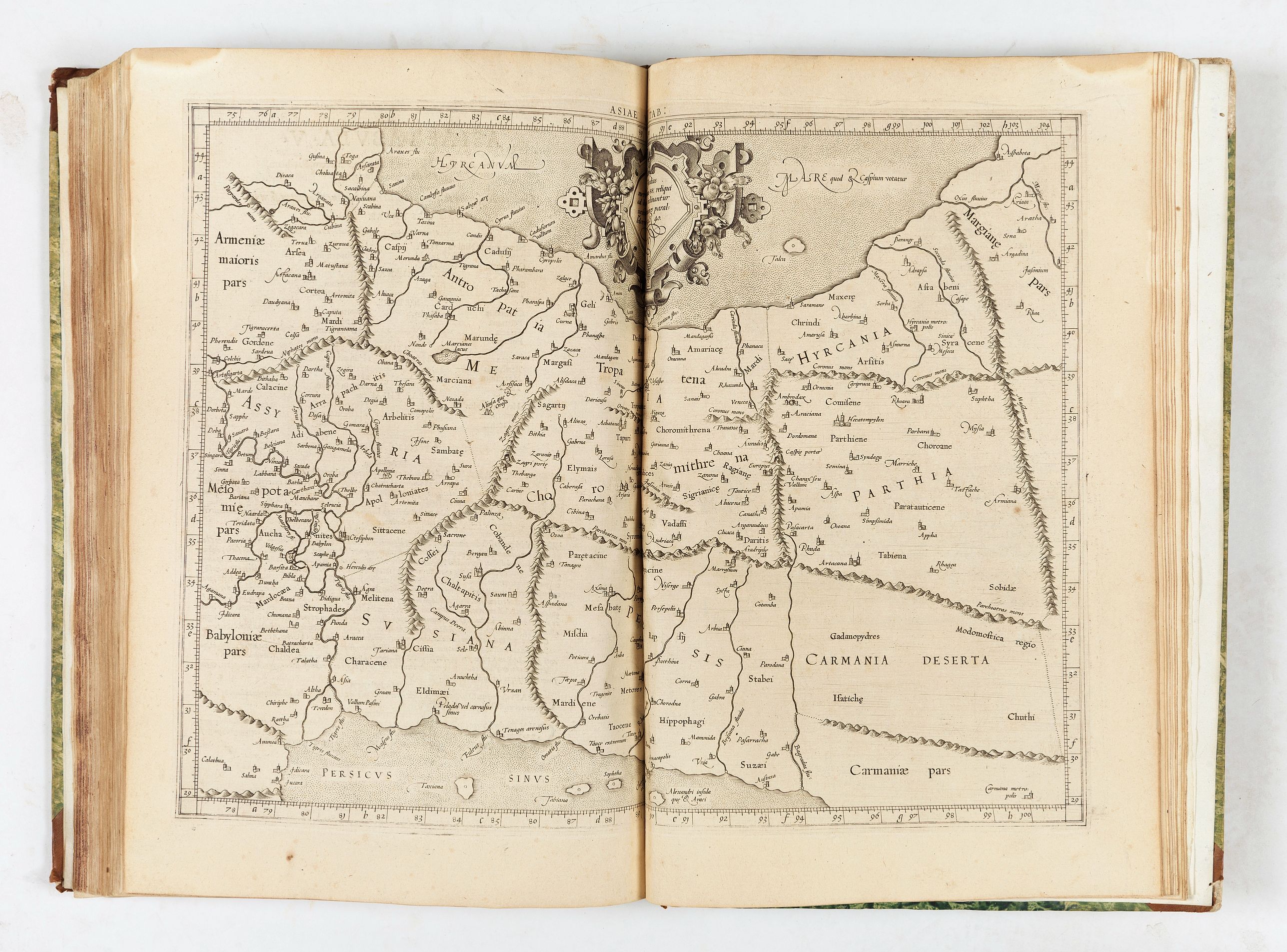
- Asiae tabvla V. Continet Assyriam, Mediam, Susianam, Persidem, Parthiam, Carmaniam desertam
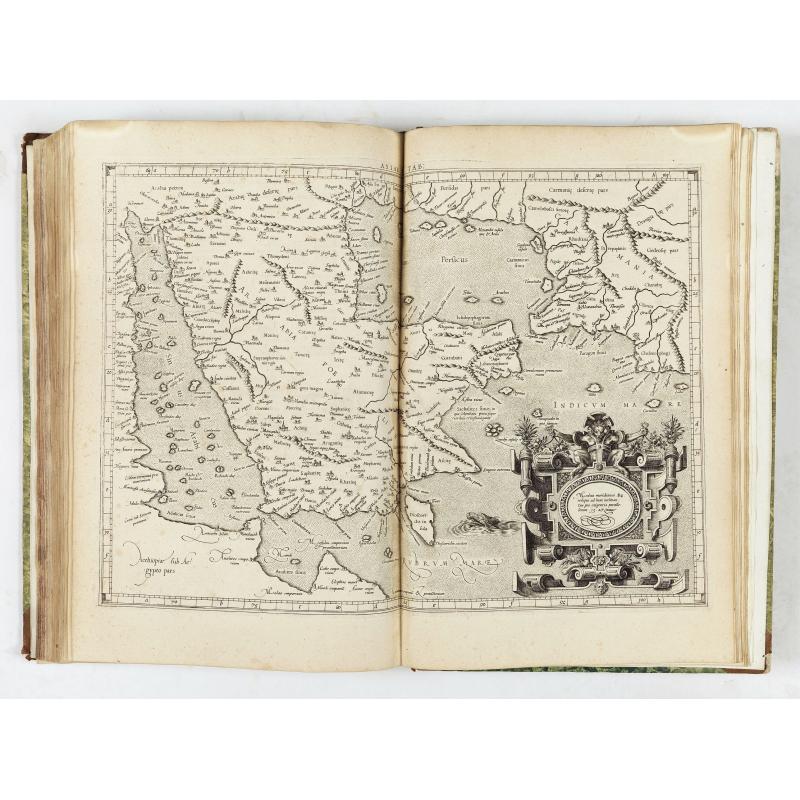
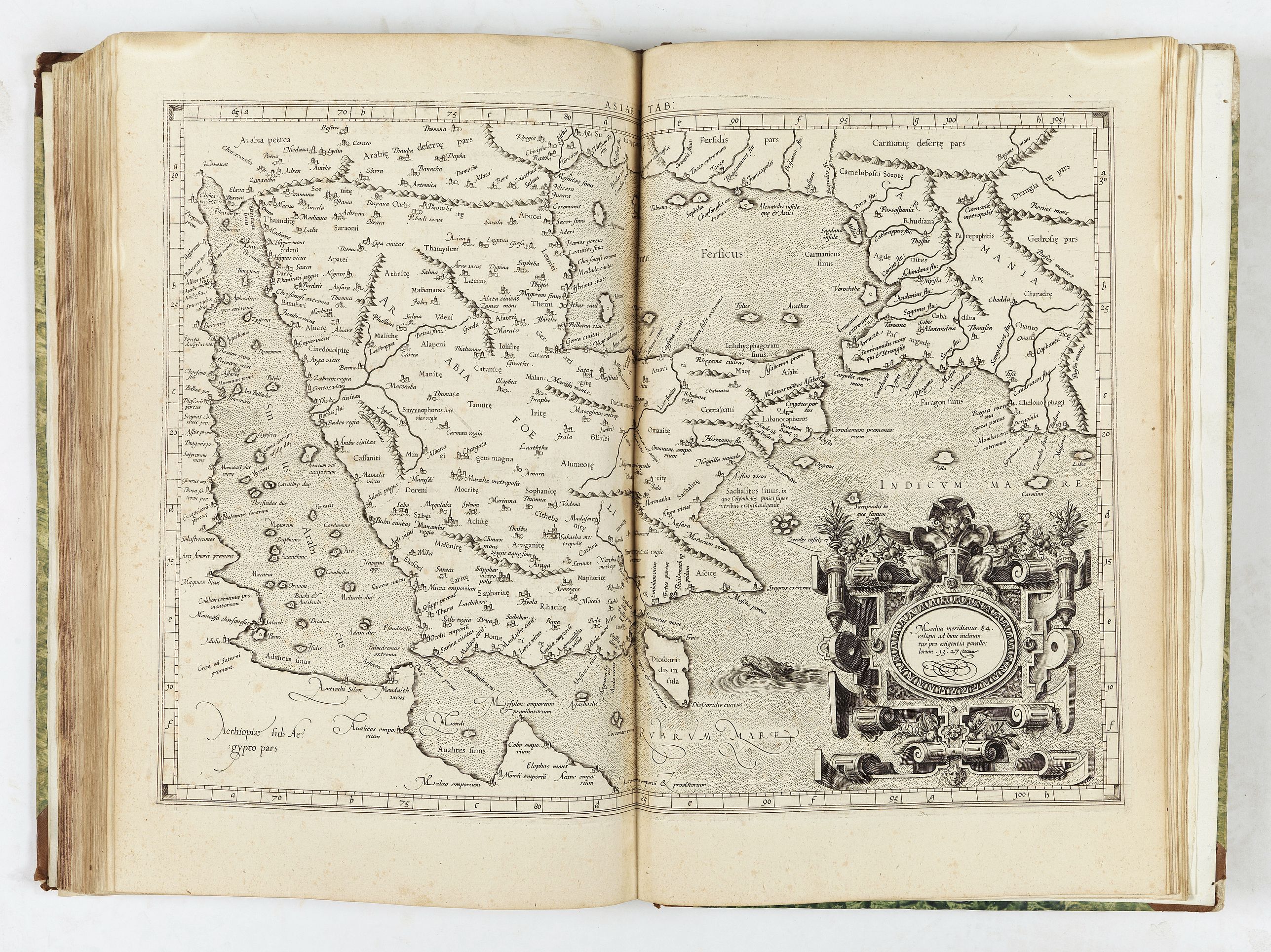
- Asiae tabvla VI. Continet Arabiam Foelicem & Carmaniam
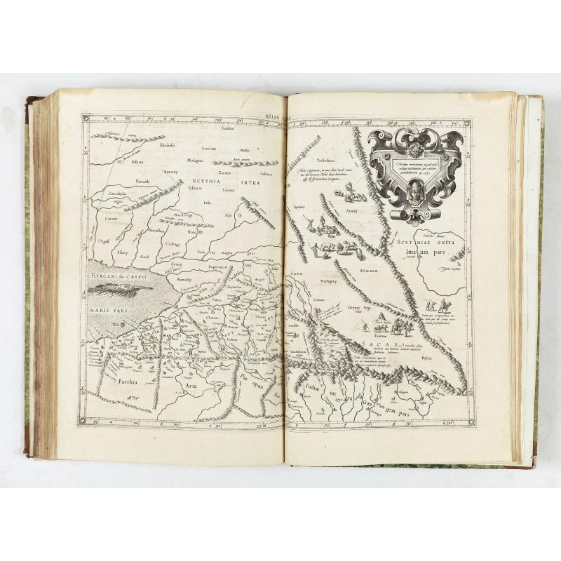
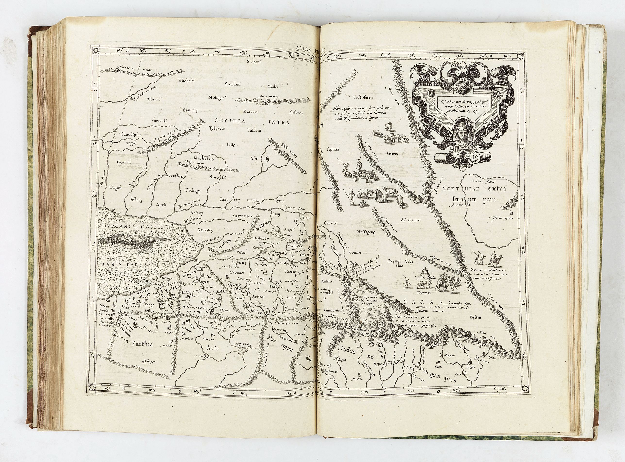
- Asiae tabvla VII. Continet Hyrcaniam, Margianam, Bactrianam, Sogdianam, Sacas, & Scythiam intra Imaum
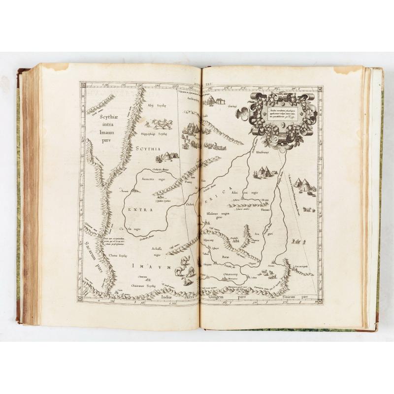
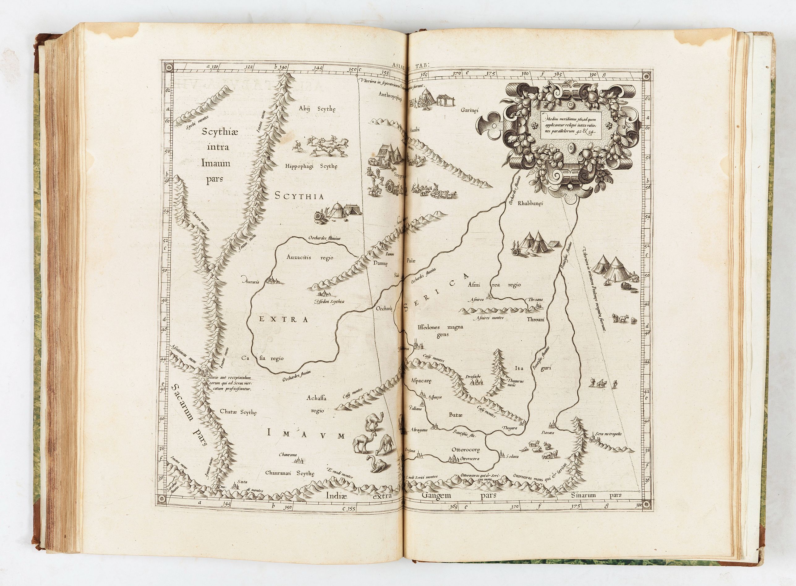
- Asiae tabvla VIII. Continet Scythiam extra Imaum montem & Sericam
- Asiae tabvla IX. Continet Ariam, Paropanisum, Drangianam, Arachosiam, & Gedrosiam
- Asiae tabvla X. In qua continentur India, intra Gangem fluuium
- Asiae tabvla XI. Continet Indiam extra Gangem & Sinas
- Asiae tabvla XII. Continet Taprobanam.
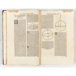
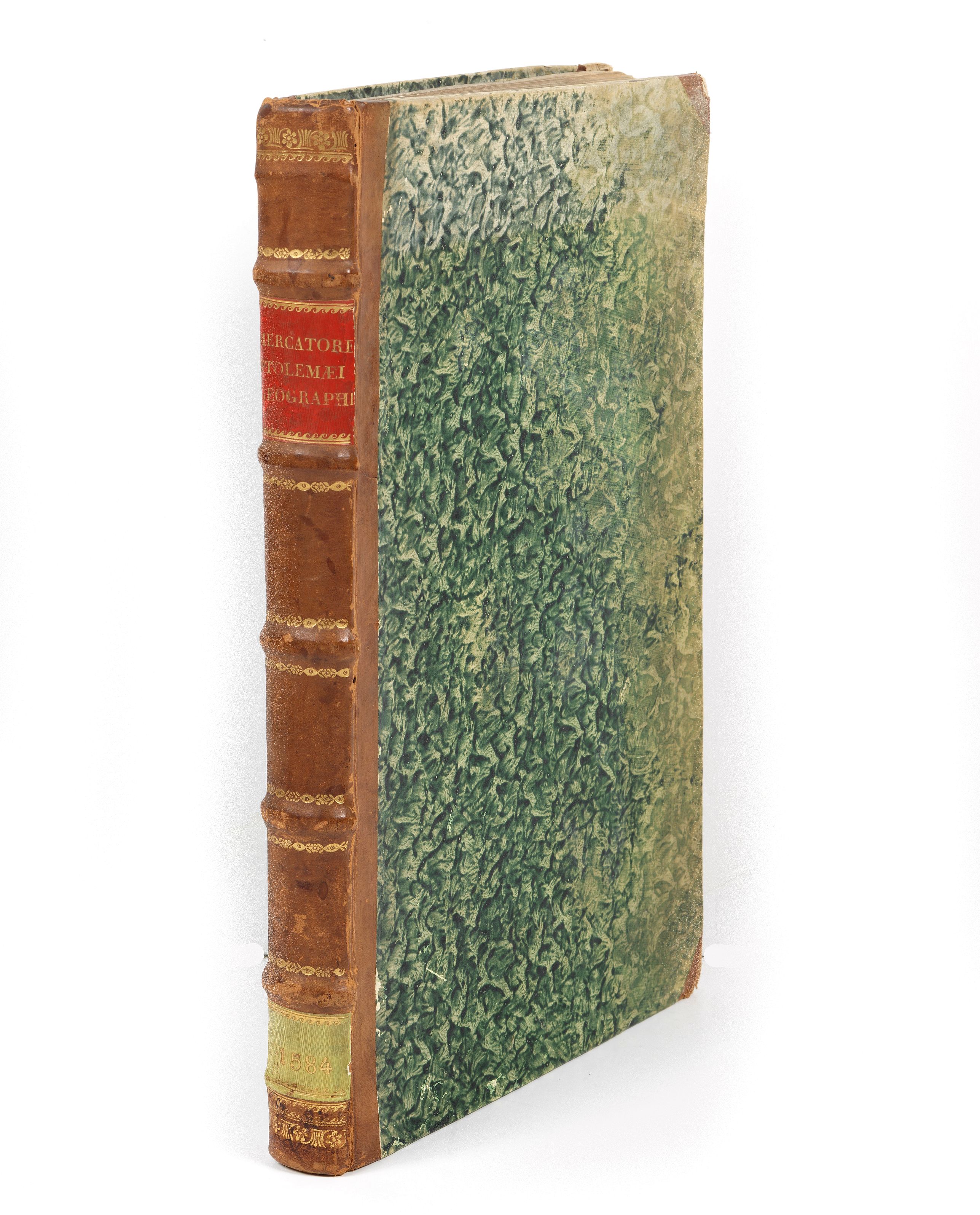
The atlas has an engraved title, seven text woodcuts, and 28 engraved maps, all double-page except one. Old name canceled on lower blank margin of title, small stain in upper outer blank margin throughout not touching text or engraved surface of maps, some foxing and light uniform toning of the paper, generally a good copy bound in 18th century half calf, spine in compartments with leather labels and gilt; corners slightly worn. Mercator's Geographia was first published by Gottfried von Kempen in 1576 without the text (but with the indices) and reissued by him in two 1584 editions, one with and one without the text.
Gerard Mercator (March 5, 1512 - December 2, 1594) was born near Antwerp as Gerard de Cremere in Rupelmonde. He studied Latin, mathematics, and religion in Rupelmonde before his Uncle, Gisbert, a priest, arranged for him to be sent to Hertogenbosch to study under the Brothers of the Common Life. There he was taught by the celebrated Dutch humanist Georgius Macropedius (Joris van Lanckvelt; April 1487 - July 1558). There, he changed his name, adapting the Latin term for 'Merchant', that is 'Mercator'.
He was one of the most outstanding geographers of the 16th century and was already highly appreciated by his contemporaries for his studies of cartography and the invention of a projection system that bears his name.
He went on to study at the University of Louvain. After some time, he left Louvain to travel extensively, but returned in 1534 to study mathematics under Gemma Frisius (1508 - 1555). Mercator was accused of heresy in 1552. His accusations were partially due to his Protestant faith and partly due to his travels, which aroused suspicion. After being released from prison with the support of the University of Louvain, he resumed his cartographic work. During this period, he became a close friend to English polymath John Dee (1527 - 1609), who arrived in Louvain in 1548 and maintained a lifelong correspondence with Mercator.
In 1552 Mercator set himself up as a cartographer in Duisburg and began work on his revised edition of Ptolemy's Geographia. He also taught mathematics in Duisburg from 1559 to 1562. In 1564, he became the Court Cosmographer to Duke Wilhelm of Cleve. During this period, he began to perfect the novel projection for which he is best remembered. The 'Mercator Projection' was first used in 1569 for a massive world map on 18 sheets.
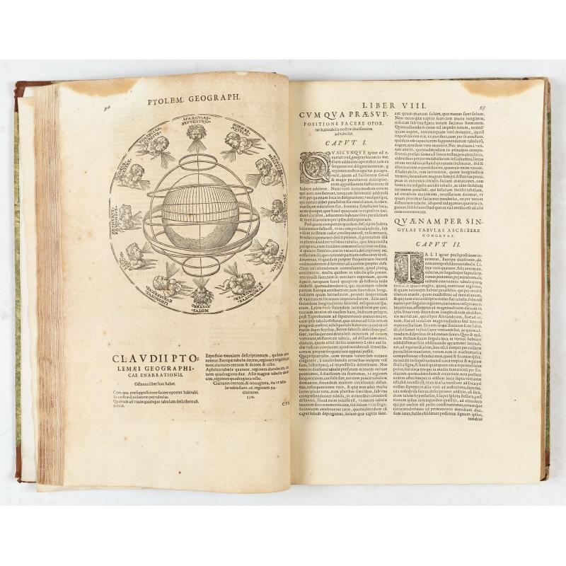
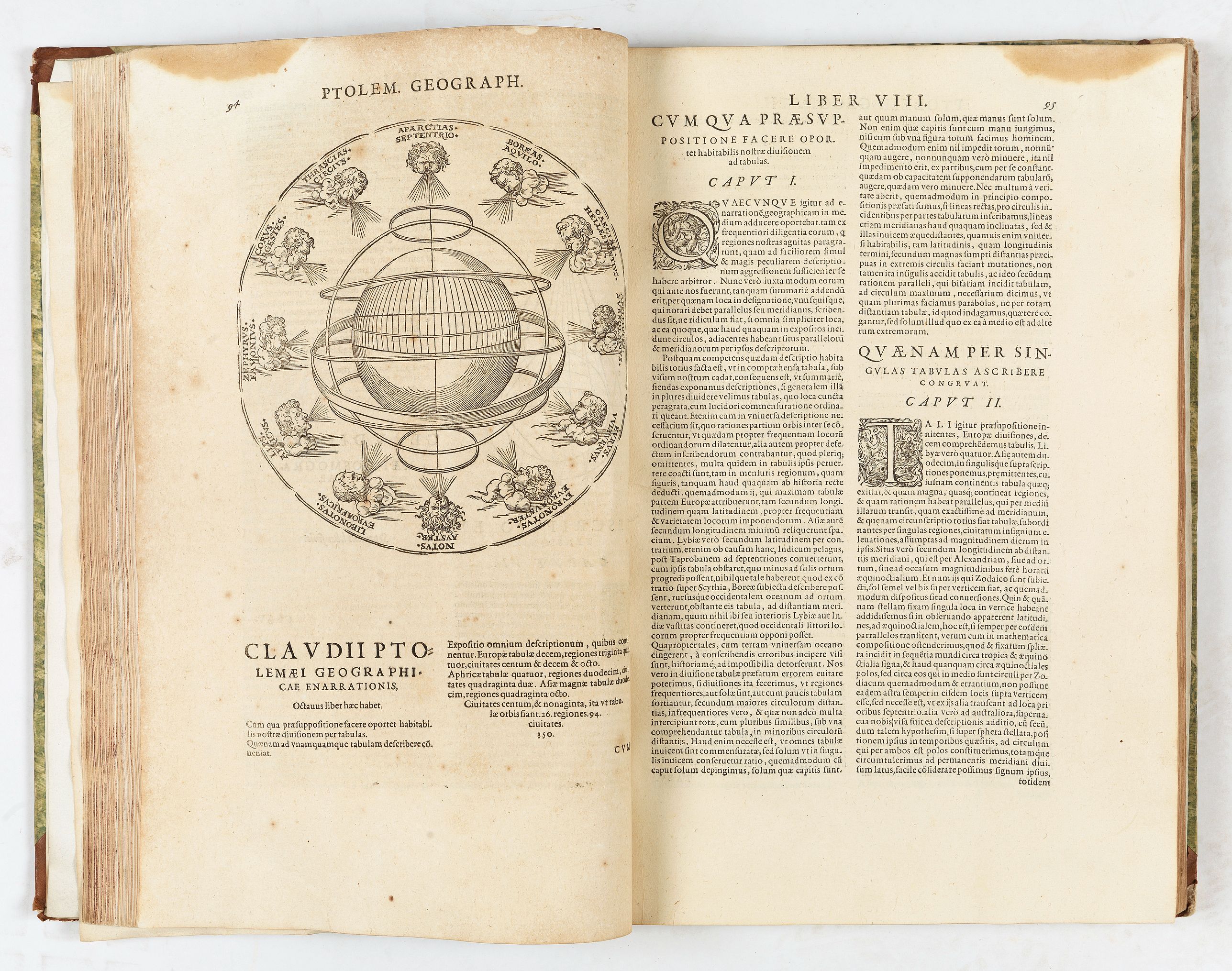
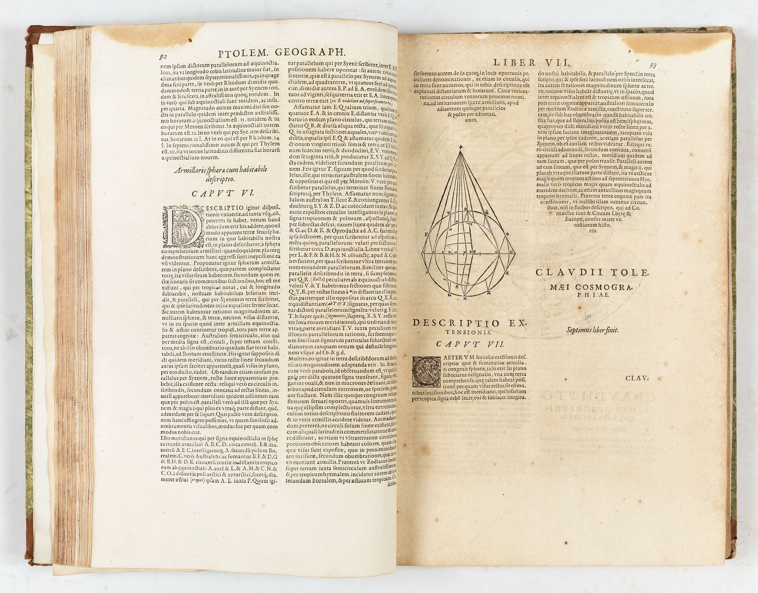
Claudius Ptolemy (83 - 161 AD) is the father of cartography. A native of Alexandria living at the height of the Roman Empire, Ptolemy was renowned as a student of Astronomy and Geography. His work as an astronomer, as published in his Almagest, held considerable influence over Western thought until Isaac Newton. His cartographic influence remains to this day.
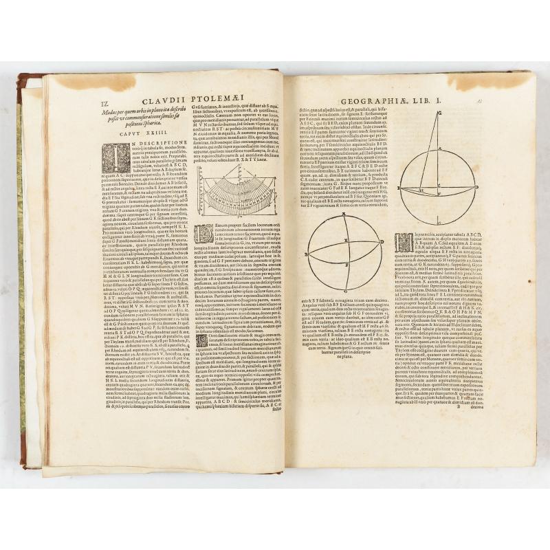
Ptolemy's text was lost to Western Europe in the Middle Ages, but survived in the Arab world and was passed along to the Greek world. Although the original text almost certainly did not include maps, the instructions in the text of Ptolemy's Geographiae allowed the execution of such maps.
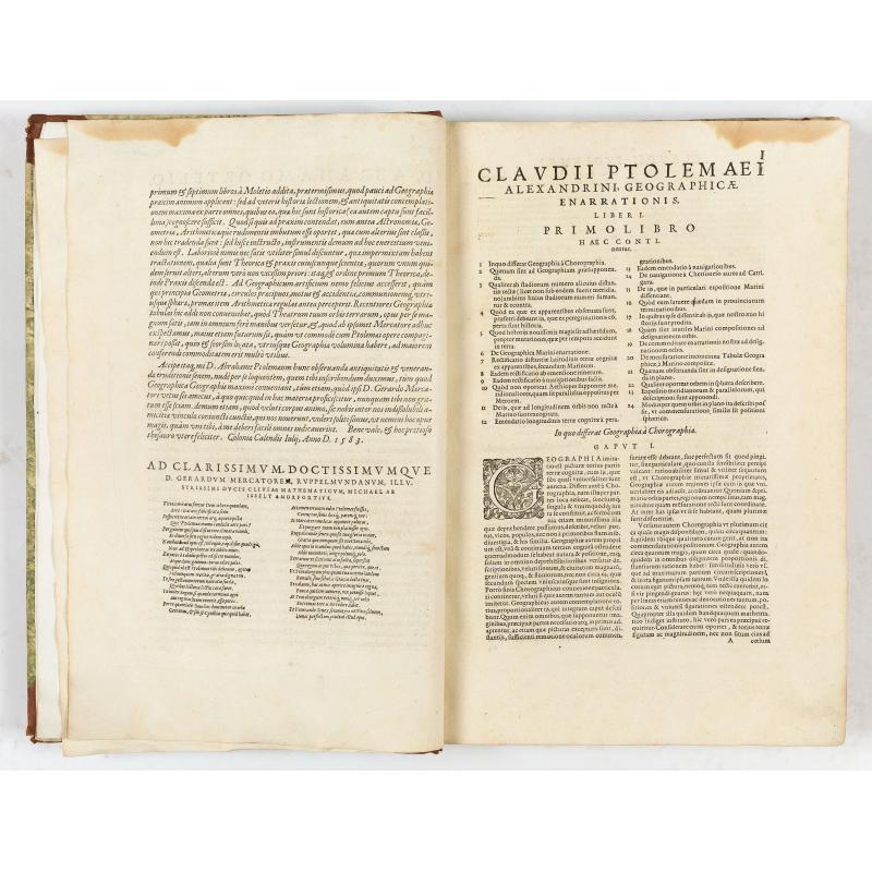
Willibald Pirckheimer (December 5, 1470 - December 22, 1530) was a German lawyer and humanist. He was close friends with artist Albrecht Dürer and theologian Erasmus. He became a member of a group of humanists that included Hartmann Schedel (he of the 1493 Liber Chronicarum). He translated an array of classical texts into German and produced an edition of Ptolemy's Geographia in 1525. (This would provide the basis for the text of Mercator's 1584 Ptolemy.
Reference: Sabin 66491. Koeman Me2. Van der Krogt 1:502.
‘When Mercator's Ptolemaeus atlas was reprinted in 1584, this time with texts on verso, this text closely resembles the texts of Ortelius' Nomencalator Ptolemaicus. Mylius dedicates this second edition of Mercator's Ptolemy to Ortelius to express his gratitude and that of Mercator for Ortelius' help’ (M. van den Broecke in: A World of Innovation. Cartography in the Time of Gerhard Mercator, p.172).
Ortelius named Mercator as 'the Ptolemy of our time', and he engraved these copper plates as part of a cosmography which he planned to publish in five volumes. In the event, the Ptolemaic maps published here, and the four parts of the section of modern maps, were the only works Mercator published before he died in 1594.
Mercator began his ambitious project of describing the world in all its aspects, with the Ptolemaic maps forming part of one volume devoted to geography (together with sections on modern and historical maps).
The Geographia and four parts of the section of modern maps were the only works Mercator published before he died in 1594.
Mercator's Ptolemaic maps first appeared in Duisburg in 1578 as Tabulae Geographicae Cl: Ptoleme̜i ('The Geographical Tables of Cl. Ptolemy'). Karrow calls this a first edition. Still, as this printing lacked Ptolemy's text (the essence of any Ptolemy since no actual maps by Ptolemy survive), it should be considered a different book.
This edition of the book - Karrow's second edition, but the first edition to include the body of Ptolemy's work, translated by Pirckheimer and edited by Mylius - was printed in Cologne in 1584. The plates were later passed to Jodocus Hondius, his successor, who issued editions in the early 17th century. In 1694, the plates were auctioned to François Halma (1653 - 1722), who reworked them and published editions in 1695, 1698, and 1704. A final edition was published in 1730 by R. and J. Wetstein and G. Smith.
Some 20 examples of the 1584 Ptolemy are cataloged in institutional collections.
Engraved title with a world map, a letterpress dedication to Abraham Ortelius, 28 Ptolemaic maps, complete with the additional single-page map, woodcut initials, diagrams, and typographical ornaments. The map section opens with Mercator's fantastic double-page Ptolemaic world map, which presents the iconic image in a classically Dutch style with strapwork geometry surrounding the winds. This is followed by the traditional suite of ten European maps, five African maps (the Egyptian map is a single-page production), and twelve Asian maps. Descriptive text appears on the recto and sometimes on the verso of the map.
- Vniversalis tabvla ivxta Ptoemaevm. In qua tres continentis partes, Europa, Africa, & Asia, quatenus ipsius tempore innotuerant, delineatae sunt --
- Evropae tabvla I. In qua insulae Britannicae duae, Hibernia & Albion cum minoribus adiacentibus describuntur
- Evropae tabvla II. In qua describuntur Hispaniae, quam Graeci Iberiam vocant, tres prouinciae Baetica, Lusitania, & Tarraconensis
- Evropae tabvla III. Continet Galliae, Graecis Geltogalatiae, quatuor prouincias, Aquitaniam, Lugdunensem, Belgicam, & Narbonensem
- Evropa tabvla IIII. Continet Germaniam magnam
- Evropae tabvla V. Continet Raetiam, Noricum, vtramque Pannoniam & Illyricum
- Evropae tabvla VI. Continet Itialiam & Cyrnum siue Corsicam insulam
- Evropae tabvla VII. Continet Sardiniam & Siciliam insulas
- Evropae tabvla VIII. Continet Samartiam Europae & Tauricum Chersonesum
- Evropae tabvla IX. Continet Iazyges Metanastas, Daciam, Mysiam superiorem, Mysiam interiorem, & Thraciam
- Evropae tabvla X. Continens Macedoniam, Epirum, Achaiam cum Euboea insula, Peloponnesum & Cretam insulam
- Africae tabvla I. Continet ambas Mauritanias, Tingitanam & Caesariensem
- Africae tabvla II. Continet Africam minorem
- Africae tabvla III. Continet Cyrenaicam & Aegyptum
- Appendix III in tabvlae Afr: (showing the Nile Delta)
- Africae tabvla IIII. Continet Libyam interiorem, Aethiopiam quae sub Aegypto est, & Aethiopiam interiorem
- Asiae tabvla I. Continet Pontum cum Bithynia, Asiam proprie[m] dictam, Lyciam, Galatiam, Pamphyliam, Cappadociam, Armeniam minorem, & Ciliciam
- Asiae tabvla II. Continet Sarmatiam Asiaticam
- Asiae tabvla III. Continet Colchidem, Iberiam, Albaniam, & Armeniam maiorem
- Asiae tabvla IIII. Continet Cyprum, Syriam, cuius pars est Palestina, quae & Iudaea, Arabiam Petr[a]eam, Mesopotamiam, Arabiam desertam, Babyloniam
- Asiae tabvla V. Continet Assyriam, Mediam, Susianam, Persidem, Parthiam, Carmaniam desertam
- Asiae tabvla VI. Continet Arabiam Foelicem & Carmaniam
- Asiae tabvla VII. Continet Hyrcaniam, Margianam, Bactrianam, Sogdianam, Sacas, & Scythiam intra Imaum
- Asiae tabvla VIII. Continet Scythiam extra Imaum montem & Sericam
- Asiae tabvla IX. Continet Ariam, Paropanisum, Drangianam, Arachosiam, & Gedrosiam
- Asiae tabvla X. In qua continentur India, intra Gangem fluuium
- Asiae tabvla XI. Continet Indiam extra Gangem & Sinas
- Asiae tabvla XII. Continet Taprobanam.
Gerard Mercator (March 5, 1512 - December 2, 1594) was born near Antwerp as Gerard de Cremere in Rupelmonde. He studied Latin, mathematics, and religion in Rupelmonde before his Uncle, Gisbert, a priest, arranged for him to be sent to Hertogenbosch to study under the Brothers of the Common Life. There he was taught by the celebrated Dutch humanist Georgius Macropedius (Joris van Lanckvelt; April 1487 - July 1558). There, he changed his name, adapting the Latin term for 'Merchant', that is 'Mercator'.
He was one of the most outstanding geographers of the 16th century and was already highly appreciated by his contemporaries for his studies of cartography and the invention of a projection system that bears his name.
He went on to study at the University of Louvain. After some time, he left Louvain to travel extensively, but returned in 1534 to study mathematics under Gemma Frisius (1508 - 1555). Mercator was accused of heresy in 1552. His accusations were partially due to his Protestant faith and partly due to his travels, which aroused suspicion. After being released from prison with the support of the University of Louvain, he resumed his cartographic work. During this period, he became a close friend to English polymath John Dee (1527 - 1609), who arrived in Louvain in 1548 and maintained a lifelong correspondence with Mercator.
In 1552 Mercator set himself up as a cartographer in Duisburg and began work on his revised edition of Ptolemy's Geographia. He also taught mathematics in Duisburg from 1559 to 1562. In 1564, he became the Court Cosmographer to Duke Wilhelm of Cleve. During this period, he began to perfect the novel projection for which he is best remembered. The 'Mercator Projection' was first used in 1569 for a massive world map on 18 sheets.
Claudius Ptolemy (83 - 161 AD) is the father of cartography. A native of Alexandria living at the height of the Roman Empire, Ptolemy was renowned as a student of Astronomy and Geography. His work as an astronomer, as published in his Almagest, held considerable influence over Western thought until Isaac Newton. His cartographic influence remains to this day.
Ptolemy's text was lost to Western Europe in the Middle Ages, but survived in the Arab world and was passed along to the Greek world. Although the original text almost certainly did not include maps, the instructions in the text of Ptolemy's Geographiae allowed the execution of such maps.
Willibald Pirckheimer (December 5, 1470 - December 22, 1530) was a German lawyer and humanist. He was close friends with artist Albrecht Dürer and theologian Erasmus. He became a member of a group of humanists that included Hartmann Schedel (he of the 1493 Liber Chronicarum). He translated an array of classical texts into German and produced an edition of Ptolemy's Geographia in 1525. (This would provide the basis for the text of Mercator's 1584 Ptolemy.
Reference: Sabin 66491. Koeman Me2. Van der Krogt 1:502.
FAQ - Guarantee - Shipping
Buying in the BuyNow Gallery
This item is available for immediate purchase when a "Add to Cart" or "Inquire Now" button is shown.
Items are sold in the EU margin scheme
Payments are accepted in Euros or US Dollars.
Authenticity Guarantee
 We provide professional descriptions, condition report (based on 45 years experience in the map business)
Paulus Swaen warrants the authenticity of our items and a certificate of authenticity is provided for each acquired lot.
Condition and Coloring
We indicate the condition of each item and use our unnique HiBCoR grading system in which four key items determine a map's value: Historical Importance, Beauty, Condition/Coloring and Rarity.
Color Key
We offer many maps in their original black and white condition. We do not systematically color-up maps to make them more sellable to the general public or buyer.
Copper engraved or wood block maps are always hand colored. Maps were initially colored for aesthetic reasons and to improve readability. Nowadays, it is becoming a challenge to find maps in their original colors and are therefor more valuable.
We use the following color keys in our catalog:
Original colors; mean that the colors have been applied around the time the map was issued.
Original o/l colors; means the map has only the borders colored at the time of publication.
Colored; If the colors are applied recently or at the end of the 20th century.
Read more about coloring of maps [+]
Shipping fee
A flat shipping fee of $ 30 is added to each shipment by DHL within Europe and North America. This covers : International Priority shipping, Packing and Insurance (up to the invoice amount).
Shipments to Asia are $ 40 and rest of the world $50
We charge only one shipping fee when you have been successful on multiple items or when you want to combine gallery and auction purchases.
Read more about invoicing and shipping
FAQ
Please have a look for more information about buying in the BuyNow gallery
Many answers are likely to find in the general help section.
Virtual Collection
![]()
With Virtual Collection you can collect all your favorite items in one place. It is free, and anyone can create his or her Virtual map collection.
Unless you are logged in, the item is only saved for this session. You have to be registed and logged-in if you want to save this item permanently to your Virtual Collection.
Read More[+]
Register here, it is free and you do not need a credit card.
Add this item to
Virtual Collection
or click the following link to see my Virtual Collection.
| Digital Image Download | |
|
Paulus Swaen maintains an archive of most of our high-resolution rare maps, prints, posters and medieval manuscript scans. We make them freely available for download and study. Read more about free image download |
Click the image for a free small image download. |

In accordance with the EU Consumer Rights Directive and habitually reside in the European Union you have the right to cancel the contract for the purchase of a lot, without giving any reason.
The cancellation period will expire 14 calendar days from the day after the date on which you or a third party (other than the carrier and indicated by you) acquires, physical possession of the lot. To exercise the right to cancel you must inform Paulus Swaen Inc, of your decision to cancel this contract by a clear statement (e.g. a letter sent by post, or e-mail (amsterdam@swaen.com).
To meet the cancellation deadline, it is sufficient for you to send your communication concerning your exercise of the right to cancel before the cancellation period has expired.

