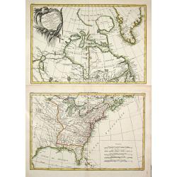
Browse Listings in America
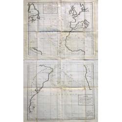
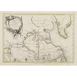
Carte Des Declinaisons Et Inclinaisons De L'Aiguille Aimantee Tables 1 and 2.
An important, very large chart of the Atlantic Ocean on two sheets, which can be joined, showing magnetic inclination and declination. Probably compiled from La Perouse's...
Date: Paris, ca 1780
Selling price: ????
Please login to see price!
Sold in 2023
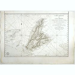
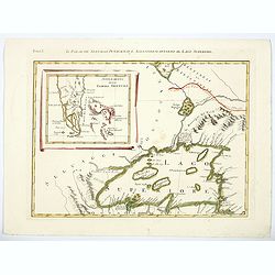
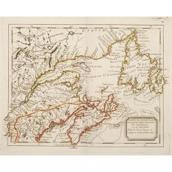
Plans particuliers dependans de l'Île Royale & Carte réduite de l'Île Royale...
Seven rare sea-charts on one large sheet. With the large and detailed chart of Île Royale and Île Saint-Jean (now known as Cape Breton Island and Prince Edward Island) ...
Date: Paris, 1780
Selling price: ????
Please login to see price!
Sold in 2015
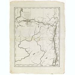
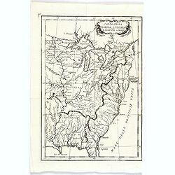
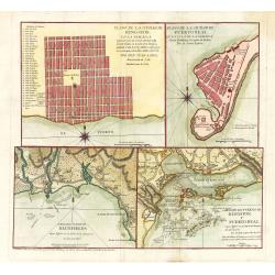
(Map showing the Albany-Oswego waterway)
Rare map of Upstate New York, showing the Albany-Oswego waterway. With Lake Oneida in the upper left part, showing towns as Sparte and Heurville, with land particions. &q...
Date: Paris, ca. 1780
Selling price: ????
Please login to see price!
Sold in 2015
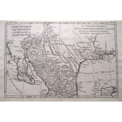
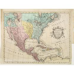
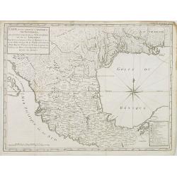
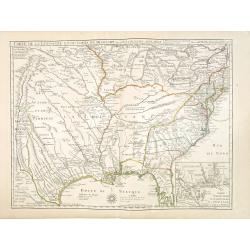
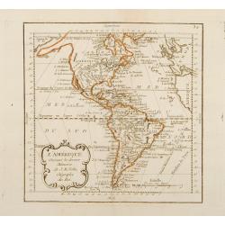
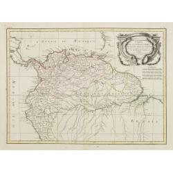
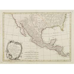
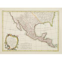
Le Nouveau Mexique, Avec La Partie Septentrionale De L'Ancien, ou De La Nouvelle Espagne.
Highly detailed map of the Southwest USA, from Baja California to West Florida, including parts of Mexico and a tip of Yucatan. With very interesting features: In Texas,...
Date: Paris, 1780
Selling price: ????
Please login to see price!
Sold in 2015
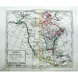
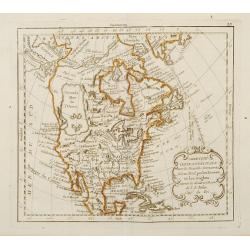
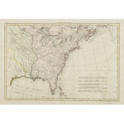
America Settentrionale Secondo le scoperte fatte dal Cap. Cook.
Uncommon italian map of North America. Outlining the United States east of the Mississippi river. With a large New Mexico, Maha Nation, and extensive blank areas in the N...
Date: ca. 1780
Selling price: ????
Please login to see price!
Sold in 2015
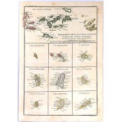
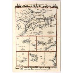
Supplement Pour Les Isles Antilles, Extract des Cartes Angloises
At the top of this interesting group of maps are the Virgin Islands, and below them are nine small maps of Barbuda, Barbados, St Vincent, St. Kitts, Antigua, Dominica, Sa...
Date: Paris, 1780
Selling price: ????
Please login to see price!
Sold in 2017
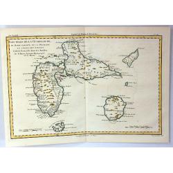
Les Isles de la Guadeloupe de Marei Galante, de la Desirade et Celles des Saintes.
A map of the French island of Guadeloupe with the islands in the vicinity. Many towns and forts are named, and some topographical details (mountains, rivers, lakes...), a...
Date: Paris, 1780
Selling price: ????
Please login to see price!
Sold in 2019
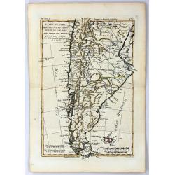
Carte du Chili Depuis le Sud du Perou Jusqu'au Cap Horn
A fine example of Rigobert Bonne and Guillaume Raynal's 1780 map of Chile. Covers modern day Chile, Argentina, Uruguay, the Falkland Islands, Tierra del Fuego, and Cape H...
Date: Paris, 1780
Selling price: ????
Please login to see price!
Sold in 2016
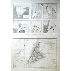
![Plans Particuliers dépendans de l'Isle-Royale. . . [5 inset charts on one sheet]](/uploads/cache/39159-250x250.jpg)
Plans Particuliers dépendans de l'Isle-Royale. . . [5 inset charts on one sheet]
Five sea charts on one sheet "Plan du port et des isles au juste au corps. Together with "Plan de la baie de Morienne", and "Plan de la rade et de la ...
Date: Paris, ca.1780
Selling price: ????
Please login to see price!
Sold in 2018
Carte réduite de L'Ile Royale, assujettie aux observations astronimiques et nautiiques. . . le Marquis de Chabert. . .
Sea chart of the rade of St.Anne. Published in "Neptune Americo-Septentrional" at the time of the American Revolution. According to the title prepared by Antoin...
Date: Paris, ca.1780
Selling price: ????
Please login to see price!
Sold in 2017
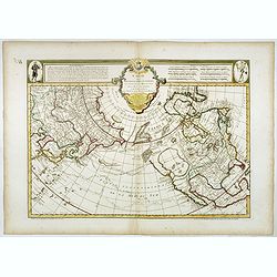
Carte des nouvelles decouvertes au Nord de la Mer du Sud.
The Dezauche edition of Joseph De L'Isle map concentrating on the northern Pacific and showing all of North America and Mexico. While the Russian coastline is shown with ...
Date: Paris, Dezauche, 1780
Selling price: ????
Please login to see price!
Sold in 2023
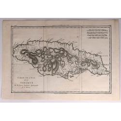
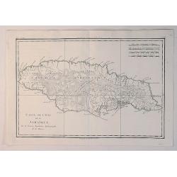
Carte de L'Isle de la Jamaique.
A fine map of the Island of Jamaica. A good example of Rigobert Bonne and Guilleme Raynal's 1780 map of Jamaica. Detailed, with towns, rivers, some topographical features...
Date: Paris, 1780
Selling price: ????
Please login to see price!
Sold in 2018
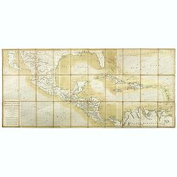
Carte des Isles Antilles et du Golfe du Mexique, avec la Majeure partie de la Nouvelle Espagne. Par M. Bonne, Inge´nieur Hydrographe de la Marine. Aoust 1780. . .
The first edition of this scarce large format map of Florida, the Gulf Coast, Texas (almost to Corpus Christi), Mexico, Baja California and Central America, northern Sout...
Date: Paris, 1780
Selling price: ????
Please login to see price!
Sold in 2022
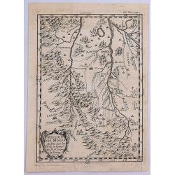
Missiion des Moxes Etablie par les PP de la Comp'e de Jesus dans le Perou.
A fine detailed map of Peru showing the topographical locations and details of the many Jesuit missions. It features an attractive title cartouche.
Date: Paris, 1780
Selling price: ????
Please login to see price!
Sold in 2017
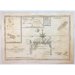
Isles de la Reine Charlotte.
An antique map showing the Queen Charlotte Islands after Captain Cook's voyages of 1778 and 1779, by Bonne in Paris, published in the 1787 Atlas Encyclopedique. Includes...
Date: Paris, 1780
Selling price: ????
Please login to see price!
Sold in 2018
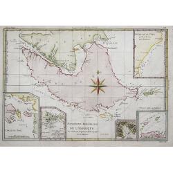
Extrémité Meridionale De Amérique.
Map shows Tierra del Fuego, with 5 inset maps of Canal de Noel, Terre de Feu, Bay Dubon, and the coast.Rigobert Bonne (1727–1795) was one of the most important cartogra...
Date: Paris, ca. 1780
Selling price: ????
Please login to see price!
Sold in 2018
L'America settentrionale divisa ne' suoi principali stati.
Rare map of North America, from "Atlante Novissimo ad uso Dei Giovani Studiosi Contenuto In Carte XXVII.", published by Giovanni Zempel in Rome, ca. 1780.The ma...
Date: Rome, 1780
Selling price: ????
Please login to see price!
Sold in 2019
![Carte de la côte N[ord] O[uest]. de l'Amérique et de la côte N. E. de l'Asie reconnues en 1778 et 1779. . .](/uploads/cache/43766-250x250.jpg)
Carte de la côte N[ord] O[uest]. de l'Amérique et de la côte N. E. de l'Asie reconnues en 1778 et 1779. . .
A map of the north Pacific with Alaska, engraved by André. With inset map "Plan de l'Entrée de Nootka. . ." This is the general map of the northwest coast fro...
Date: Paris, ca 1780
Selling price: ????
Please login to see price!
Sold in 2020
Carta Della Florida, Luigiana e Laghi del Canada.
A scarce Italian map of the United States, Florida, Louisiana and Canada, probably issued during the American Revolutionary War. The eastern US is called 'Province Unite'...
Date: Venice, ca 1780
Selling price: ????
Please login to see price!
Sold in 2020
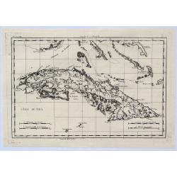
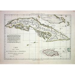
L'Isle de Cuba.
A highly detailed map of Cuba. Also shows a portion of the Bahamas and the Cayman Islands. By Bonne & Raynal in Paris in 1780.Rigobert Bonne (1727-1794) was an influ...
Date: Paris, 1780
Selling price: ????
Please login to see price!
Sold in 2021
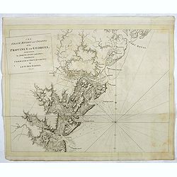
The coast, rivers and inlets of the Province of Georgia surveyed by Joseph Avery and others. . .
Chart of part of the Eastern Seaboard of the USA, with Port Royal Sound, the Savannah River, Warsaw Inlet (Wassaw Sound), Osebaw Inlet (Ossabaw Sound) and St Catherine's ...
Date: London, 1780
Selling price: ????
Please login to see price!
Sold in 2019
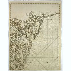
A chart of the coast of New York, New Jersey, Pensilvania, Maryland, Virginia, North Carolina, & c. . . .
A chart of A chart of the coast of New York, New Jersey, Pennsylvania, Maryland, Virginia, North Carolina, & c., taken from the "Atlantic Neptune", and mark...
Date: London, 1780
Selling price: ????
Please login to see price!
Sold in 2019
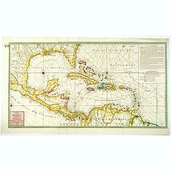
Carte du Golphe du Mexique et des Isles Antilles reduite de la grande Carte Anglois de Popple.
A good example of the 1780 Dezauche edition of Buache's most important map of the West Indies. Centered primarily on Cuba, this substantial map covers all of Central Amer...
Date: Paris, 1780
Selling price: ????
Please login to see price!
Sold in 2021
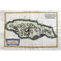
Carte de L'Isle de la Jamaique.
A fine example of Rigobert Bonne and Guilleme Raynal's 1780 map of Jamaica. Highly detailed, showing towns, rivers, some topographical features, political boundaries and ...
Date: Paris, 1780
Selling price: ????
Please login to see price!
Sold in 2020
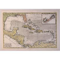
Les Isles Antilles et le Golfe du Mexique.
A fine Bonne / Raynal's 1780 highly desirable map of the West Indies, Gulf of Mexico, Antilles, and Caribbean. The map extends from Florida to the Spanish Main and from M...
Date: Paris, 1780
Selling price: ????
Please login to see price!
Sold in 2021
Kaart van het eiland Jamaika.
An uncommon and very attractive Dutch map of Jamaica. The island's mountains are boldly engraved and there is excellent detail of the various river systems provided. The ...
Date: Amsterdam, ca 1780
Selling price: ????
Please login to see price!
Sold in 2020
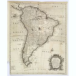
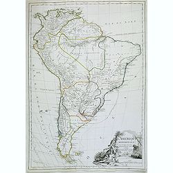
A Map of South America, With all the European Settlements. . .
A pleasant map of South America, showing great detail along the west coast, and the east coast of Brazil, however, the vast interior of Brazil and the Amazon is labelled ...
Date: London, 1780
Selling price: ????
Please login to see price!
Sold in 2020
Il Paese de Selvaggi Outauacesi e Kilistinesi Intorno al Lago Superiore.
This is one sheet from Antonio Zatta's version of John Mitchell's epic map. The whole map was titled "Le Colonie Unite dell' America Settentrle" and was publish...
Date: Venice, 1780
Selling price: ????
Please login to see price!
Sold in 2020
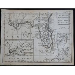
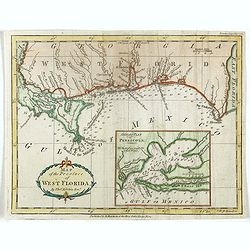
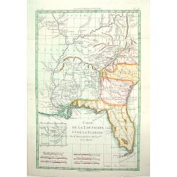
A Map of the New Governments of East & West Florida
Scarce early map of East & West Florida, shortly after the end of the French & Indian War.
Date: London, 1780
Selling price: ????
Please login to see price!
Sold in 2023
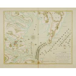
Carte de la partie de la Virginie ou l'armée combinée de France & des Etats-Nies de l'Amérique..
Extremely rare map of the lower Chesapeake Bay emphasizes the Revolutionary War naval battle that took place off the Virginia coast prior to General Charles Cornwalllis's...
Date: Paris, after 1781
Selling price: ????
Please login to see price!
Sold
Carte der Entdekungen Zwischen Sibirien und America bis auf das Jahr 1780
Very unusual map of Alaska and Kamchatka. Alaska is shown with only coastal detail according the reports of Capt. Cook. The Aleutian Islands stretch to within sight of th...
Date: Germany c.1781
Selling price: ????
Please login to see price!
Sold
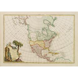
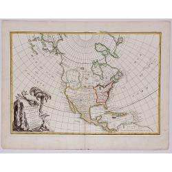
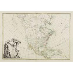
A New and accurate Map of North America, Laid down according to the latest and most approved Observations..
Attractive map of North America showing the claims of the English, French and Spanish distinguished by early hand color. English bias is evident as the border reaches to ...
Date: London 1747 -1781
Selling price: ????
Please login to see price!
Sold
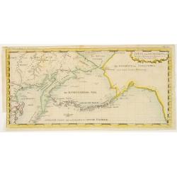
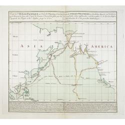
Carte de l'Océan Pacifique au Nord de l'Equateur.../Charte des Stillen Weltmeers...
Highly important map of the northern Pacific Ocean after Thomas Kitchin?s map of 1780. Showing the latest explorations, and the first map to show Cook?s third voyage, and...
Date: Augsburg, 1781
Selling price: ????
Please login to see price!
Sold in 2008
Carte de l\'Océan Pacifique au Nord de l\'Equateur.../Charte des Stillen Weltmeers...
Highly important map of the northern Pacific Ocean after Thomas Kitchins map of 1780. Showing the latest explorations, and the first map to show Captain Cooks third voy...
Date: Augsburg, 1781
Selling price: ????
Please login to see price!
Sold in 2008
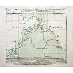
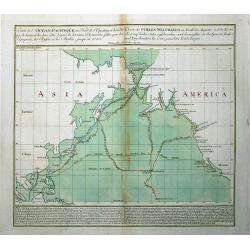
Carte de l'Océan Pacifique au Nord de l'Equateur... / Charte des Stillen Weltmeers. . .
The earliest folio-sized printed map of Cook's third voyage, on which he became the first European to discover Hawaii. On this voyage, he also explored the Northwest coas...
Date: Augsburg, 1781
Selling price: ????
Please login to see price!
Sold in 2018
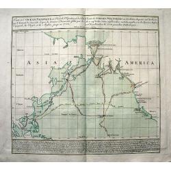
Carte de l'Océan Pacifique au Nord de l'Equateur.../Charte des Stillen Weltmeers...
Highly important map of the northern Pacific Ocean after Thomas Kitchins map of 1780. Extends from Asia (Siberia to Malaysia), and North America from Alaska to San Blas, ...
Date: Augsburg, 1781
Selling price: ????
Please login to see price!
Sold in 2011
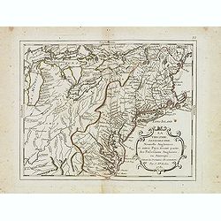
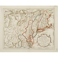
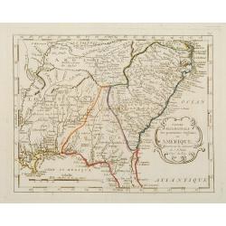
La Virginie, pennsilvanie, Nouvelle Angleterre. . .
Rare map including Virginia, Maryland and Pennsylvania. The map clearly delimits the British Colonies to the regions East of the Alleghany Mountains, based upon the Frenc...
Date: Paris, 1781
Selling price: ????
Please login to see price!
Sold in 2013
Partie méridionale des possessions Angloises en Amérique. . .
Scarce map of the East coast of North America, as far south as Louisiana and the northern half of Florida. Prepared by Nolin and published by L.J. Mondhare for his Atlas ...
Date: Paris, 1781
Selling price: ????
Please login to see price!
Sold in 2017
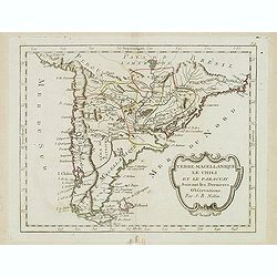
Terre Magellanique le Chili et le Paraguay. . .
Scarce map of southern most South America, prepared by Nolin and published by L.J. Mondhare for his Atlas Général a l'usage des colleges et maisons d'education.. Louis ...
Date: Paris, 1781
Selling price: ????
Please login to see price!
Sold in 2014
Plan De l'Isle d'Orléans ou Porto Condore. . .
Plan of New Orleans and it direct environs. From "Lettres Édifiantes et Curieuses. . Missionaires de la Compagnie de Jesus [Jesuit Letters]", 2nd Edition, Tome...
Date: Lyon, J. Vernarel and Et. Cabin et C., 1780/1781
Selling price: ????
Please login to see price!
Sold in 2019
Carte de la partie de la Virginie ou l'armée combinée de France & des Etats-Nies de l'Amérique..
Extremely rare map of the lower Chesapeake Bay emphasizes the Revolutionary War naval battle that took place off the Virginia coast prior to General Charles Cornwalllis's...
Date: Paris, after 1781
Selling price: ????
Please login to see price!
Sold in 2015
![[Untitled chart of Plymouth Bay]](/uploads/cache/39180-250x250.jpg)
[Untitled chart of Plymouth Bay]
Fine chart of Plymouth Bay in Massachusetts, showing the homesteads, roads, and topography in the vicinity of Plymouth. Taken from the "Atlantic Neptune", and m...
Date: London, 1781
Selling price: ????
Please login to see price!
Sold in 2017
Pictou Island & Port Luttrell, Nova Scotia, Canada
A large middle segment of a map featuring Pictou Island, Otter Pond, Duke Point, Port Luttrell or Margomish, Cumberland Beach, and King's Head.Pictou Island is a Canadian...
Date: London, ca 1781
Selling price: ????
Please login to see price!
Sold in 2017
Map of the Province of West Florida. By Tho.s Kitchin.
Scarce map of West Florida, from the May 1781 edition of the London Magazine. Includes a large detailed inset of Pensacola Harbor, including soundings and a not of the st...
Date: London, 1781
Selling price: ????
Please login to see price!
Sold in 2018
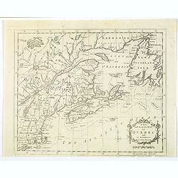
A New and Accurate Mapp of Quebec and its Boundaries, from a late Survey.
A scarce map of the province of Quebec, published in The Universal Magazine in London, September 1781. It shows from Long Island up through New England to Upper and Lower...
Date: London, 1781
Selling price: ????
Please login to see price!
Sold in 2019
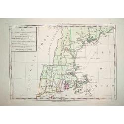
Cart de la Nouvelle Angleterre, Comprenant..
Complete title: ?Cart de la Nouvelle Angleterre, Comprenant les Etats de Massachusetts bay, N. Hamp Shire, Connecticut et Rhode Island?.An extremely scarce map of New Eng...
Date: Paris 1782
Selling price: ????
Please login to see price!
Sold
CARTE DES ISLES DE CUBA ET DE LA JAMAIQUE
Very detailed copper-engraved map of Cuba with the southern Bahamas, the Cayman Islands, Jamaica and a small part of Haiti. Many towns are named and some topographical de...
Date: Paris 1782
Selling price: ????
Please login to see price!
Sold
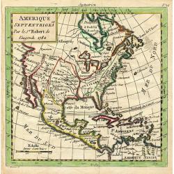
L'Amerique Septentrionale divisé en fes principaux.
A finely engraved map of North America, prepared by Janvier. The map is most notable for it's depiction of Mer de L'Quest or Sea of the West, a great sea, easily the size...
Date: Paris 1782
Selling price: ????
Please login to see price!
Sold
Amerique Septentrionale
Charming map of early North America including Central America and the West Indies. Filled with place names, Indian locations, and topographical information such as rivers...
Date: Paris 1782
Selling price: ????
Please login to see price!
Sold in 2008
Carte d\'une partie de l\'Amerique.. et de la Louisiane..
A handsome and seldom-seen map of the Spanish colonial period. Included in Voyages de Mr. de Pagés.De Pages, a French nobleman and Navy captain, crossed the \"Provi...
Date: Paris, 1782
Selling price: ????
Please login to see price!
Sold in 2008
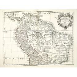
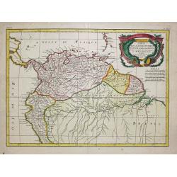
Carte de la Terre Ferme du Perou du Bresil et du Pays des Amazones.
A later issue of this detailed and surprisingly accurate map of the northern part of South America prepared by De l'Isle. It is filled with place names and notations spec...
Date: Paris, 1782
Selling price: ????
Please login to see price!
Sold in 2021
Carte De La Louisiane Et Du Cours Du Mississipi Avec Les Colonies Anglaises. Revue, Corrigee et considerablemt. Augmentee en 1782 . . . Par Guillaume De L'Isle. . .
Unrecorded state of De L'Isle's seminal map, substantially updated with information on the British Colonies at the conclusion of the Revolutionary War.Accurate map showin...
Date: Paris, 1782
Selling price: ????
Please login to see price!
Sold in 2013
Various Charts of Islands & c, in the Atlantic & Pacific Oceans
This plate shows five groups of islands including the New Northern Archipelago (Aleutian Islands), Azores, Canary Islands, Madeira and Cape Verde. The chart is decorated ...
Date: London, 1782
Selling price: ????
Please login to see price!
Sold in 2016
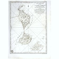
Carte particuliere des isles de St. Pierre et Miquelon Levé par M.Fortin . . . 1782.
Engraved of Saint Pierre and Miquelon, a self-governing territorial overseas collectivity of France, situated in the north-western Atlantic Ocean near the Newfoundland a...
Date: Paris, after 1782
Selling price: ????
Please login to see price!
Sold in 2017
L'AMERIQUE SEPTENTRIONALE divisee en ses principaux Etats.
A fine example of Janvier's map of North America to illustrate the sea of the west "Mer ou Baye de l'Ouest", prior to the incorporation of information from Cook...
Date: Paris, 1782
Selling price: ????
Please login to see price!
Sold in 2017
![L'AMERIQUE SEPTENTRIONALE divisee en ses principaux ETATS, 1782.[Great Western Sea]](/uploads/cache/82628-250x250.jpg)
L'AMERIQUE SEPTENTRIONALE divisee en ses principaux ETATS, 1782.[Great Western Sea]
A fine example of Janvier's map of North America to illustrate the sea of the west. "Mer ou Baye de l'Ouest", prior to the incorporation of information from Coo...
Date: Paris, 1782
Selling price: ????
Please login to see price!
Sold in 2019
Plano de la Ciudad de Puerto Real, En La Isla De La Jamaica Segun Bontein y la copia de Bellin: Por D. Juan Lopez
This scarce work features a set of four Spanish maps on one sheet depicting Spanish towns and harbor plans of important Jamaican ports.Spanish settlement of Jamaica began...
Date: Madrid, 1782
Selling price: ????
Please login to see price!
Sold in 2023
Carte de la Louisinae, et de Floride.
A handsome map of the American Southeast, including the Mississippi River Valley. The work covers from Charleston, South Carolina, extending west past New Orleans and nor...
Date: ca.1783
Selling price: ????
Please login to see price!
Sold
L' Amerique divisee par grands Etats.
Jean Lattré, Paris-based engraver and publisher. Worked with Robert de Vaugondy, J. Janvier and R. Bonne. "" Atlas Monderne', 1771, 1783 , 1793. Jean Janvier, ...
Date: Paris, 1783
Selling price: ????
Please login to see price!
Sold
L'Amérique méridionale.
Map of South America embellished with a figurative title cartouche.
Date: Paris, 1783
Selling price: ????
Please login to see price!
Sold in 2020
Amérique Septentrionale avec les Nouvelles Découvertes fait au Nord, par les Russes et les Anglois..
Rare map of North America, showing a remarkable NW Coast of America, including the recently discovered sea (by the Russians) of the West. The NW Coast and area near Canad...
Date: Paris, 1783
Selling price: ????
Please login to see price!
Sold
L'Amérique Suivant les dernier Mémoires de J.B.Nolin..
Map of the Western Hemispher after J.B.Nolin and published by Monhare for his Atlas Général a l'usage des colleges et maisons d'education.. Louis Joseph Mondhare publis...
Date: Paris, 1783
Selling price: ????
Please login to see price!
Sold in 2010
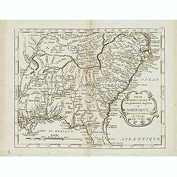
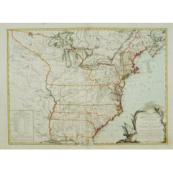
La Virginie, Pennsilvanie, Nouvelle Angleterre, et autres Pays fesant partie des Possessions Angloises, en Amérique..
Rare map, extending from Maine to the Chesapeake and west to include Lake Michigan. A boundary line confines the English colonies to the coast. F. Duquene is named along ...
Date: Paris, 1783
Selling price: ????
Please login to see price!
Sold
Partie Septentrional des Possessions Angloise En Amérique ou se trouvent l\'Isle de Terre-Neuve le Canada et la Nouvelle Ecosse.
Rare map of eastern Canada, showing the are from Montreal, Lake Champlain till New Foundland.The map is filled with place names, Indian villages, early forts, french garr...
Date: Paris, 1783
Selling price: ????
Please login to see price!
Sold in 2008
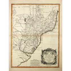
Partie Méridionale des possessions Angloises en Amérique..
Rare map of the South, showing the regions east of the Mississippi and extending North to Virginia and Kentucky. The map is filled with place names, Indian villlages, ear...
Date: Paris, 1783
Selling price: ????
Please login to see price!
Sold
CARTE DES ETATS-UNIS D'AMÉRIQUE, et du Cours du Mississipi..
First state of three with changed date and imprint. It was first published in 1783 by Desnos, then by Esnauts et Rapilly and was re-issued in 1787. This map composed by B...
Date: Paris 1783
Selling price: ????
Please login to see price!
Sold
Carte du Paraguay et partie des Pays adjacants.
Jean Lattré, Paris-based engraver and publisher. Worked with Robert de Vaugondy, J. Janvier and R. Bonne. " Atlas Monderne', 1771, 1783 , 1793. Rigobert Bonne (1727...
Date: Paris, 1783
Selling price: ????
Please login to see price!
Sold
Carte de la Terre Ferme, dela Guyane et du Pays des Amazones.
Jean Lattré, Paris-based engraver and publisher. Worked with Robert de Vaugondy, J. Janvier and R. Bonne. " Atlas Monderne', 1771, 1783 , 1793. Rigobert Bonne (1727...
Date: Paris, 1783
Selling price: ????
Please login to see price!
Sold
Partie de L'Amerique Septentrionale qui comprend le Canada, la Louisiana, le Labrador, le Groenland, les Etats-Unis et la Floride
Jean Lattré, Paris-based engraver and publisher. Worked with Robert de Vaugondy, J. Janvier and R. Bonne. " Atlas Monderne', 1771, 1783 , 1793. Rigobert Bonne (1727...
Date: Paris, 1783
Selling price: ????
Please login to see price!
Sold
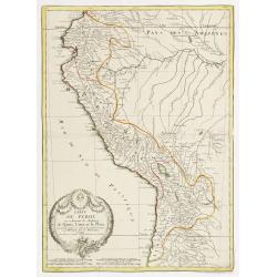
Carte du Perou ou se trouvent les Audiences de Quito, Lima et la Plata..
Attractive map centered on Peru, covering the northern half of the South American Pacific coast, from Ecuador to northern Chili.Boundaries outlined in hand color. Large o...
Date: Paris ca 1783
Selling price: ????
Please login to see price!
Sold
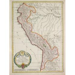
Carte Carte du Perou ou se trouvent les Audiences de Quito, Lima et la Plata.
Jean Lattré, Paris-based engraver and publisher. Worked with Robert de Vaugondy, J. Janvier and R. Bonne. " Atlas Monderne', 1771, 1783 , 1793. Rigobert Bonne (1727...
Date: Paris, 1783
Selling price: ????
Please login to see price!
Sold in 2019
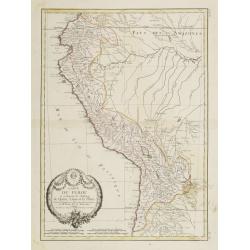
Carte du Perou ou se trouvent les Audiences de Quito, Lima et la Plata..
Attractive map centered on Peru, covering the northern half of the South American Pacific coast, from Ecuador to northern Chili.Boundaries outlined in hand color. Large o...
Date: Paris, ca 1783
Selling price: ????
Please login to see price!
Sold in 2012
Carte de la Terre Ferme, de la Guyane et du Pays des Amazones..
Attractive map centered on the Amazon drainage basin, covering the northern part of South America. Ornated with a rococo title cartouche. Boundaries outlined in hand colo...
Date: Paris, ca 1783
Selling price: ????
Please login to see price!
Sold
Carte Du Mexique ou de la Nlle. Espagne Contenant aussi le Nouveau Mexique, la Californie, avec une Partie des Pays adjecents . . . 1771
Attractive map centered on Mexico, covering the whole Central America and the southern part of the United States.Ornated with a rococo title cartouche. Includes excellent...
Date: Paris, ca 1783
Selling price: ????
Please login to see price!
Sold in 2020
Canada IIe. Feuille.
Attractive map covering the eastern half of the United States, from the gulf of Mexico as far as Canada. Boundaries outlined in hand color.From theAtlas moderne ou collec...
Date: Paris, ca 1783
Selling price: ????
Please login to see price!
Sold in 2013
L' Amerique Septentrionale divisée en ses principaux Etats... (Sea of the West)
Attractive map of North and Central America, ornated with a decorative title cartouche. Boundaries outlined in hand color.Showing the explorations of Verenrye with regard...
Date: Paris, 1771-1783
Selling price: ????
Please login to see price!
Sold in 2017
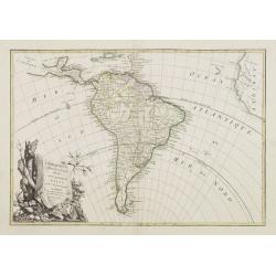
L' Amerique Meridionale divisée en ses principaux Etats..
Attractive map of South America, ornated with a decorative title cartouche. Boundaries outlined in hand color.Prepared by Le Sieur Janvier, Jean denis [Robert], French ge...
Date: Paris, ca 1783
Selling price: ????
Please login to see price!
Sold in 2012
Carte du Mexique ou de la Nlle. Espagne..
Attractive map centered on Mexico, covering the whole Central America and the southern part of the United States.Ornated with a rococo title cartouche. Boundaries outline...
Date: Paris, ca 1783
Selling price: ????
Please login to see price!
Sold in 2008
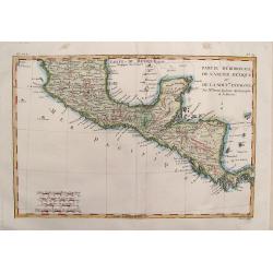
Partie Meridionale de L'Ancien Mexique .
Fine map of Southern Mexico & Central America from Bonne's "Atlas de Toutes les Parties Connues du Globe Terrestre". BONNE, RIGOBERT (1729-1795). Bonne was...
Date: Paris, 1783
Selling price: ????
Please login to see price!
Sold in 2014
Partie de l'Amérique Septentrionale qui comprend le Canada.. La Floride &c..
Attractive map centered on the Bay of Hudson, ornated with a rococo title cartouche. Boundaries outlined in hand color.From theAtlas moderne ou collection de cartes sur t...
Date: Paris, ca 1783
Selling price: ????
Please login to see price!
Sold