Browse Listings in America
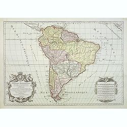
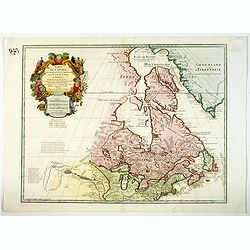
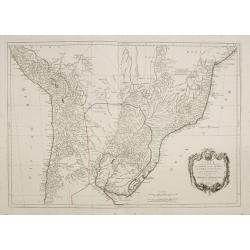
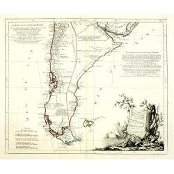
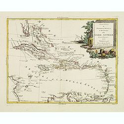
Amerique Meridionale divisée en ses principales parties ou sont distingués les uns des autres LES ETATS SUIVANTS qu'ils appartiennent presentement aux FRANCOIS, CASTILLANS, PORTUGAIS HOLLANDOIS etc. . .
Large map of South America, by Hubert Jaillot after Nicolas Sanson and updated by Desnos.
Date: Paris, after 1783
Selling price: ????
Please login to see price!
Sold in 2011
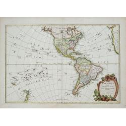
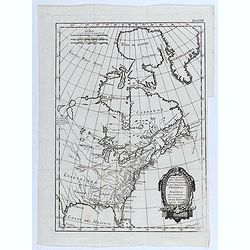
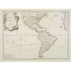
L'Amerique divisee Par Grand Etats by Jean Janvier.
Second edition of Janvier's map, reworked by Giovanni Antonio Rizzi-Zannoni.This is the later edition of this copper engraved map of the Americas with interesting norther...
Date: Paris, 1783
Selling price: ????
Please login to see price!
Sold in 2018
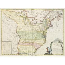
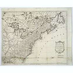
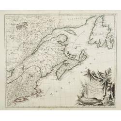
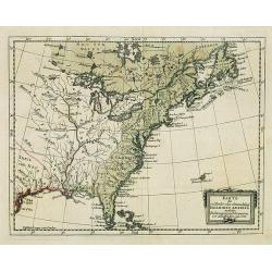
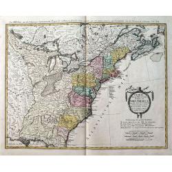
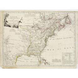
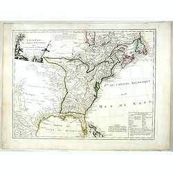
![[No title] East coast of US.](/uploads/cache/23469-250x250.jpg)
[No title] East coast of US.
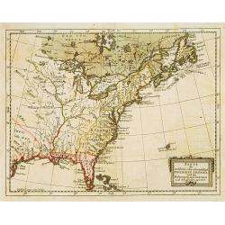
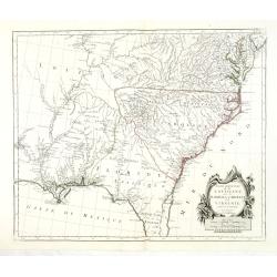
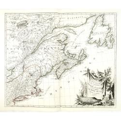
Covering the French Louisiana and the British Colonies with their western boundary on the Mississippi River.Nice detail, particularly of the French forts and Indian villa...
Date: Paris ca 1783
Selling price: ????
Please login to see price!
Sold in 2014
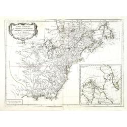
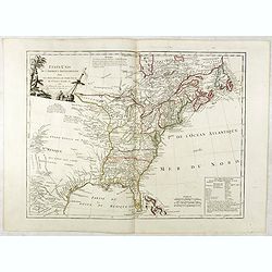
CARTE DES ETATS-UNIS D'AMERIQUE, et du Cours du Mississipi. . .
Separate publication. First state of three. First published in 1783 by Desnos, then by Esnauts et Rapilly and was re-issued in 1787. Louis Brion de la Tour was a military...
Date: Paris, 1783
Selling price: ????
Please login to see price!
Sold in 2013
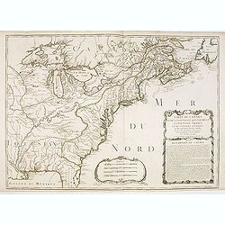
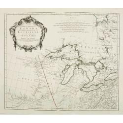
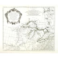
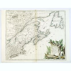
Carte Du Canada et de La Louisiane Qui Forment La Nouvelle France et Des Colonies Anglois . . . 1756
An important and rare pre-revolutionary French Indian war map by Nolin of Canada and the British Colonies, south to the Florida Peninsula, and from the eastern coastline ...
Date: Paris, 1783
Selling price: ????
Please login to see price!
Sold
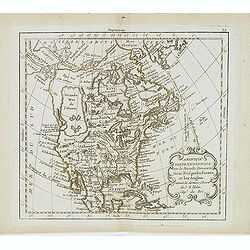
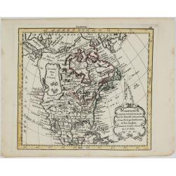
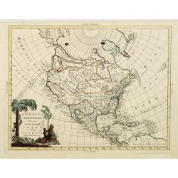
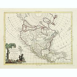
Amérique septentrionale avec les nouvelles découvertes. . .
Large Mer de L'Quest. Rare map of North America, showing a remarkable NW Coast of America, including the recently discovered sea (by the Russians) of the West. The NW Coa...
Date: Paris, 1783
Selling price: ????
Please login to see price!
Sold in 2019
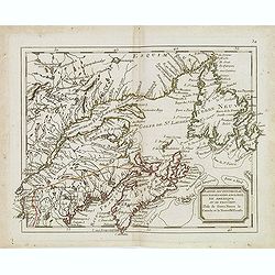
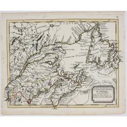
Partie septentrional des possessions angloise en Amerique. . .
Rare map of eastern Canada, showing the are from Montreal, Lake Champlain till New Foundland. The map is filled with place names, Indian villages, early forts, French gar...
Date: Paris, 1783
Selling price: ????
Please login to see price!
Sold in 2014
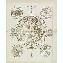
Hémisphère Oriental ou Nouveau Monde.
Scarce map of the eastern hemisphere with North and South America. The hemisphere is surrounded by the moon, sun, a sphere and celestial systems after Copernicus, Ptolemy...
Date: Paris, 1783
Selling price: ????
Please login to see price!
Sold in 2021
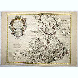
Carte du Canada, qui comprend la partie septentrionale..
A terrific example of Dezuache's re-issue of Guillaume De L'Isle's seminal map of Canada, the Great Lakes and Upper Midwes. This state is highly important, as it names th...
Date: Paris, 1703 / 1783
Selling price: ????
Please login to see price!
Sold in 2016
Map of the United States in North America: with the British, French and Spanish Dominions adjoining, according to the Treaty of 1783.
One of the earliest obtainable English Maps to name the newly independent United States of America.The map shows the United States extending to the Mississippi River, wit...
Date: London, 1783
Selling price: ????
Please login to see price!
Sold in 2017
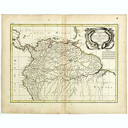
Carte de la Terre Ferme de la Guyane et du Pays des Amazones . . .
Attractive map of Guyana and Amazonia, ornated with a decorative title cartouche. Boundaries outlined in hand color.Prepared by Le Sieur Janvier, Jean Denis [Robert], Fre...
Date: Paris, ca 1783
Selling price: ????
Please login to see price!
Sold in 2019
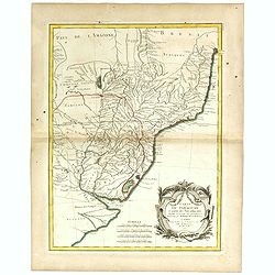
Carte du Paraguay et partie des Pays adjacants . . .
Attractive map of Paraguay and close countries.
Date: Paris, ca 1783
Selling price: ????
Please login to see price!
Sold in 2019
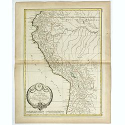
Carte du Perou ou se trouvent les audiences de Quito, Lima et la Plata . .
Attractive map of Peru, ornated with a decorative title cartouche. Boundaries outlined in hand color.Prepared by Le Sieur Janvier, Jean Denis [Robert], French geographer ...
Date: Paris, ca 1783
Selling price: ????
Please login to see price!
Sold in 2019
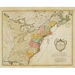
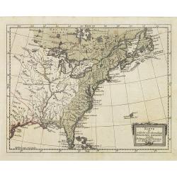
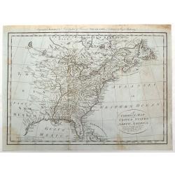
![ETATS-UNIS DE L'AMÉRIQUE divises en 13 Provinces... [early USA].](/uploads/cache/83012-250x250.jpg)
ETATS-UNIS DE L'AMÉRIQUE divises en 13 Provinces... [early USA].
Attractive map from Lamarche's Atlas Elementaire. Printed 3 years after the foundation of the New Republic. Lamarche was the successor to Vaugondy (often known as Delamar...
Date: Paris, 1783
Selling price: ????
Please login to see price!
Sold in 2019
Carte du Canada qui comprend la Partie Septentrionale des Etats Unis d'Amerique. . .
First issued by Guillaume Delisle in 1703, this richly detailed map provides the most accurate rendering of the Great Lakes of the time, with the lakes fully enclosed and...
Date: Paris, 1783
Selling price: ????
Please login to see price!
Sold in 2020
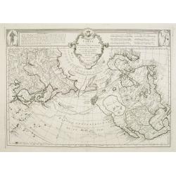
![AMERIQUE Septentrionale avec ses principales Divisions et leurs Capitales. [Mer de l'Ouest].](/uploads/cache/83552-250x250.jpg)
AMERIQUE Septentrionale avec ses principales Divisions et leurs Capitales. [Mer de l'Ouest].
An outlined colored map of north America , showing the Baye d'Hudson and the mythical 'Mer de l'Ouest'. With the names of cities, provinces and much more. With a numbered...
Date: Paris, 1783
Selling price: ????
Please login to see price!
Sold in 2020
Parte del Nord del America Settentrionale ad uso della storia filosofica e politica degli Stabilimenti e del Commercio degli Europei nelle due Indie.
Uncommon map of the eastern part of North America. Drawn by R. Bonne for an Italian version of Abbé Raynal's Histoire philosophique et politique".
Date: 1783
Selling price: ????
Please login to see price!
Sold in 2020
Amerique Septentrionale avec les Nouvelles Découvertes
The map of the North America in a quiet unusual shape.Comes from rarely seen Jean-Baptiste Nolin atlas “Atlas Général a l’usage des colleges et maisons d’educatio...
Date: Paris, 1783
Selling price: ????
Please login to see price!
Sold in 2022
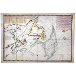
l'Isle de Terre Neuve le Canada et la Nouvelle Ecosse.
The map of North Eastern Canada, including Nova Scotia, Newfoundland and Labrador.Comes from rarely seen Jean-Baptiste Nolin atlas “Atlas Général a l’usage des coll...
Date: Paris, 1783
Selling price: ????
Please login to see price!
Sold in 2022
Carte réduite des Bancs et de l'Ile de Terre Neuve..
Detailed chart showing island Nova Scotia, the St Laurence Gulf, and Acadie.
Date: Paris, 1784
Selling price: ????
Please login to see price!
Sold
Karte des oestliehe oder ehemahlige ENGLISCHEN AMERIKA nach den Besitzungen und ..
Rare 18th century German map of eastern United States. From: Johan Jacob Moser, Nord-America nach den Friedenschlussen vom Jahr 1783,1784.A first state.
Date: Germany 1784
Selling price: ????
Please login to see price!
Sold
Charte uber die XIII vereingte Staaten von Nord-America..
Fine large map of the newly formed United States of America. The southern states are shown with their western boundaries on the Mississippi River, although the coloring s...
Date: Nuremberg ca. 1784
Selling price: ????
Please login to see price!
Sold
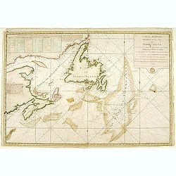
Carte des nouvelles decouvertes au Nord de la Mer du Sud.
Although concentrating on the northern Pacific, this map show all of North America and Mexico.A very interesting Northwest Passage is shown.While the Russian coastline is...
Date: Venice, 1776 - 1784
Selling price: ????
Please login to see price!
Sold in 2008
Partie Occidentale du Canada et Septentrionale de la Louisiane..
Fine copper engraved map of the Great Lakes region after d'Anville's, to whom Santini gives credit in the cartouche.The map extends from the upper Mississippi River valle...
Date: Venice, 1776 - 1784
Selling price: ????
Please login to see price!
Sold in 2022
Partie Orientale du Canada avec la Nouvelle Angleterre..
Fine map of the extremities of Canada after d'Anville's, to whom Santini gives credit in the cartouche.The map extends from New York northwards to include Lake Mistassini...
Date: Venice, 1776 - 1784
Selling price: ????
Please login to see price!
Sold
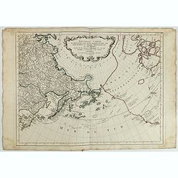
Nouvelle Carte des Decouvertes Faites par des Vaisseaux Russes aux Cotes Inconnues del' Amerique Septentrionale avec les Pais Adiancents..
Santini's version of Gerhard Muller's landmark map of 1754 showing the discoveries of Captains Bering and Tschirikow.Muller originally published his map in response to Jo...
Date: Venice, 1784
Selling price: ????
Please login to see price!
Sold in 2011
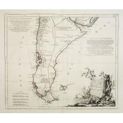
Carte du Chili Méridional, du Rio de la Plata, des Patagons, et du Détroit de Magellan. . .
Finely and crisply engraved map representing the southern tip of South America. It extends northwards as far as the river de la Plata estuary.Venetian edition of d\'Anvil...
Date: Venice, 1776 - 1784
Selling price: ????
Please login to see price!
Sold in 2008
Carte qui représente la Partie Méridionale du Brésil et du Perou..
Finely and crisply engraved map representing the central part of South America, including part of Brazil, Chile and Peru as well as Uruguay and Paraguay.It covers the Atl...
Date: Venice, 1776 - 1784
Selling price: ????
Please login to see price!
Sold in 2009
Karte des oestliehe oder ehemahlige ENGLISCHEN AMERIKA nach den Besitzungen und ..
Rare 18th century German map of eastern United States. From: Johan Jacob Moser, Nord-America nach den Friedenschlussen vom Jahr 1783.A first state.
Date: Germany, 1784
Selling price: ????
Please login to see price!
Sold in 2008
L'Amérique divisée en ses principaux Etats. . .
Uncommon map of the American continent after Janvier's, to whom Santini gives credit in the cartouche.This map is most notable for it's depiction of "Mer ou Baye de ...
Date: Venice, 1776 - 1784
Selling price: ????
Please login to see price!
Sold in 2012

(BOSTON TEA PARTY) Die Einwohner von Boston werfen den englisch-ostindischen Thee ins Meer am 18 December 1773
SCARCE print, showing the citizens of Boston, disguised as Indians, boarding ships in Boston Harbor and throwing 342 chests of tea overboard. One of twelve scenes depict...
Date: Germany, 1784
Selling price: ????
Please login to see price!
Sold in 2013
Karte des oestliehe oder ehemahlige ENGLISCHEN AMERIKA nach den Besitzungen und ..
Rare 18th century German map of eastern United States. From: Johan Jacob Moser, Nord-America nach den Friedenschlussen vom Jahr 1783.A first state.
Date: Germany, 1784
Selling price: ????
Please login to see price!
Sold in 2022
Carte du Chili Méridional, du Rio de la Plata, des Patagons, et du Détroit de Magellan. . .
Finely and crisply engraved map representing the southern tip of South America. It extends northwards as far as the river de la Plata estuary.Venetian edition of d'Anvill...
Date: Venice, 1776 - 1784
Selling price: ????
Please login to see price!
Sold in 2012
Partie Occidentale du Canada et Septentrionale de la Louisiane..
Fine copper engraved map of the Great Lakes region after d'Anville's, to whom Santini gives credit in the cartouche.The map extends from the upper Mississippi River valle...
Date: Venice, 1776 - 1784
Selling price: ????
Please login to see price!
Sold in 2013
Carte Générale du Canada, de la Louisiane, de la Floride, de la Caroline..
Map of the eastern part of the United States and Canada. With inset map of Hudson and Baffin bays. in the lower right corner.Venetian edition of d'Anville's map, from &qu...
Date: Venice, 1776 - 1784
Selling price: ????
Please login to see price!
Sold in 2013
Partie Méridionale de la Louisiane, avec la Floride, la Caroline et la Virginie..
Fine map of southeastern part of the United States after d'Anville's, to whom Santini gives credit in the cartouche.It covers the Atlantic coastline between the Chesapeak...
Date: Venice, 1776 - 1784
Selling price: ????
Please login to see price!
Sold in 2013
Partie Orientale du Canada avec la Nouvelle Angleterre. . .
Fine map of the extremities of Canada after d'Anville's, to whom Santini gives credit in the cartouche.The map extends from New York northwards to include Lake Mistassini...
Date: Venice, 1776 - 1784
Selling price: ????
Please login to see price!
Sold in 2013
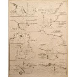
L'Anse a Chouchou; Le Port Paix; Mouillage de Jean- Rabel; La Baye Moustique; Baye de Tiburon; Baye des Gonayves; La Baye du Fond de la Grange; Port a l'Écu; rade de la Basse-Terre
Nine sea-charts on one sheet, showing various bays and harbors on Hispaniola and Tortuga. Engraved by Dela Haye for the Depot de la Marine. Each section shows depth sound...
Date: Paris, 1784
Selling price: ????
Please login to see price!
Sold in 2014
![Bowles's new pocket map of the following Independent States of North America : viz. Virginia, Maryland, Delaware, Pensylvania, New Jersey, NewYork, Connecticut & Rhode Island [. . .] by Lewis Evans.](/uploads/cache/34894-250x250.jpg)
Bowles's new pocket map of the following Independent States of North America : viz. Virginia, Maryland, Delaware, Pensylvania, New Jersey, NewYork, Connecticut & Rhode Island [. . .] by Lewis Evans.
Rare map, based on Evans' General Map of the Middle British Colonies In America (publ. as of 1755). The first map to eliminate "Middle British Colonies" and rep...
Date: London, 1784
Selling price: ????
Please login to see price!
Sold
A Correct Map of the United States of North America Including the British and Spanish Territories, Carefully Laid Down Agreeable to the Treaty of 1784
Fine early map of the United States with the Mississippi River as the Western Boundary. Created at the end of the American Resolution, after the Treaty of Paris. Publishe...
Date: London, 1784
Selling price: ????
Please login to see price!
Sold in 2017
Nouvelle carte des decouvertes faites. . .
Santini's version of Gerhard Muller's landmark map of 1754 showing the discoveries of Captains Bering and Tschirikow.Muller originally published his map in response to Jo...
Date: Venice, 1784
Selling price: ????
Please login to see price!
Sold in 2015
A Correct Map of the United States of North America Including the British and Spanish territories, Carefully Laid Down Agreeable to the Treaty of 1784
One of the first maps published after the American Revolution, after the TREATY of PARIS. The west of the U.S. was Louisiana and New Mexico and west of the Mississippi ma...
Date: London, 1784
Selling price: ????
Please login to see price!
Sold in 2015
Carte qui représente la Partie Méridionale du Brésil et du Perou..
Finely and crisply engraved map representing the central part of South America, including part of Brazil, Chile and Peru as well as Uruguay and Paraguay.It covers the Atl...
Date: Venice, 1776 - 1784
Selling price: ????
Please login to see price!
Sold in 2015
L`Amerique Divisee en Ses Principaux Etats Assujettie aux Observations Astronomiqes...
Copper engraved map; overall size 53 x 75 cm by Robert Janvier, published by Francesco Santini and Giuseppe Antonio Remondini. This is the 2nd state of the Italian editi...
Date: Venice, 1784
Selling price: ????
Please login to see price!
Sold in 2016
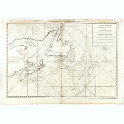
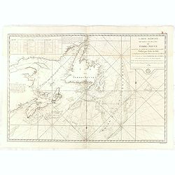
Carte Reduite de l'Ile de Terre-Neuve . . .
Fine large sea of Terre Neuve. Relief shown by hachures. Depths shown by soundings. Below engraved seal of Depot General de la Marine. Prepared under the direction of de...
Date: Paris, 1784
Selling price: ????
Please login to see price!
Sold in 2015
Partie Orientale du Canada avec la Nouvelle Angleterre. . .
A fine map of the extremities of Canada after d'Anville's work, to whom Santini gives credit in the cartouche.The map extends from New York northwards to include Lake Mis...
Date: Venice, 1776 - 1784
Selling price: ????
Please login to see price!
Sold in 2019
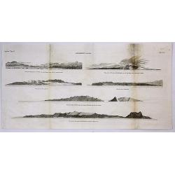
Sandwich Islands.
A copperplate engraving from the accounts of Cook’s third and final voyage. It features coastal profile views of the Hawaiian Islands, where Cook arrived in 1778. It in...
Date: London, 1784
Selling price: ????
Please login to see price!
Sold in 2017
Carte réduite de l'Ile de Terre-Neuve..
Revolutionary war sea of New Foundland .Relief shown by hachures. Depths shown by soundings. Below engraved seal of Depot General de la Marine. Prepared under the direct...
Date: Paris, 1784
Selling price: ????
Please login to see price!
Sold in 2018
Carte réduite des Bancs et de l'Ile de Terre-Neuve..
Revolutionary war sea of New Foundland.Relief shown by hachures. Depths shown by soundings. Below engraved seal of Depot General de la Marine. Prepared under the directi...
Date: Paris, 1784
Selling price: ????
Please login to see price!
Sold in 2018
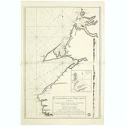
Plan des Côtes de Terre-Neuve, IV ème Feuille..
Revolutionary war sea of New Foundland.Relief shown by hachures. Depths shown by soundings. Below engraved seal of Depot General de la Marine. Prepared under the directi...
Date: Paris, 1784
Selling price: ????
Please login to see price!
Sold in 2018
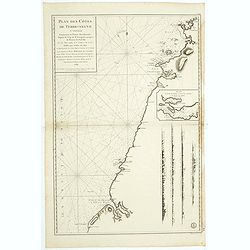
Plan des Côtes de Terre-Neuve, V ème Feuille..
Revolutionary war sea of New Foundland.Relief shown by hachures. Depths shown by soundings. Below engraved seal of Depot General de la Marine. Prepared under the directi...
Date: Paris, 1784
Selling price: ????
Please login to see price!
Sold in 2018
Carte réduite des Bancs et de l'Ile de Terre-Neuve..
Revolutionary war sea of New Foundland .Relief shown by hachures. Depths shown by soundings. Below engraved seal of Depot General de la Marine. Prepared under the direct...
Date: Paris, 1784
Selling price: ????
Please login to see price!
Sold in 2018
![L'Anse a Chouchou [with] Le Port Paix [with] Mouillage de Jean- Rabel [with] La Baye Moustique [with] Baye de Tiburon [with] Baye des Gonayves [with] La Baye du Fond de la Grange [with] Port a l'Écu [with] rade de la Basse-Terre. ( 9 plans).](/uploads/cache/36433-250x250.jpg)
L'Anse a Chouchou [with] Le Port Paix [with] Mouillage de Jean- Rabel [with] La Baye Moustique [with] Baye de Tiburon [with] Baye des Gonayves [with] La Baye du Fond de la Grange [with] Port a l'Écu [with] rade de la Basse-Terre. ( 9 plans).
Nine revolutionary war sea on one sheet, showing various bays and harbors on Hispaniola and Tortuga. Engraved by Dela Haye for the Depot de la Marine. Each section shows...
Date: Paris, 1784
Selling price: ????
Please login to see price!
Sold in 2020
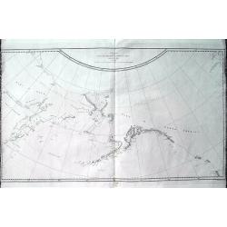
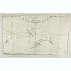
Chart of the N.W. Coast of America and N.E. Coast of Asia explored in the Years 1778 & 1779. . .
A scarce edition of Captain James Cook's discoveries in the Pacific Northwest, Alaska, and the Behring Strait. The map shows the northeast parts of Asia and the northwest...
Date: London, ca 1784
Selling price: ????
Please login to see price!
Sold in 2019
Charte über die XIII. vereinigte Staaten von Nord-America, Entworfen duch F.L. Güssefeld. . .
A large map of the 13 United States, shortly after the American Revolutionary War or the American War of Independence, which ended in 1783. A very detailed map with many ...
Date: Nuremberg, 1784
Selling price: ????
Please login to see price!
Sold in 2019
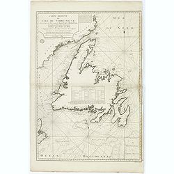
Carte Reduite des Bancs et de L'Ile de TERRE-NEUVE avec les Cotes du Golfe de St. Laurent et de l'Acadie.
A detailed chart showing the island of Nova Scotia, the St Laurence Gulf, and Acadie. With a fully colored key and numerous rhumb lines, published by the French Hydrograp...
Date: Paris, 1784
Selling price: ????
Please login to see price!
Sold in 2020
Kaart van het Noordlijk gedeelte van Bresil.
Uncommon and attractive map of most of Brazil. The directions of the trade winds are shown. Very nice detail of the river systems, mines, forts, missions, and villages. A...
Date: Amsterdam 1785
Selling price: ????
Please login to see price!
Sold
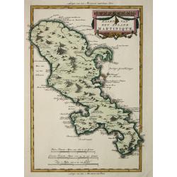
Kaart van het eiland Martinique.
Willem Albert Bachiene (1712-1783), Dutch geographer in Maastricht. Most important work ' Heilige Geographie', a work on the Holy Land. Mathijs Schalenkamp published in 1...
Date: Amsterdam, 1785
Selling price: ????
Please login to see price!
Sold
ETATS-UNIS / DE L'AMÉRIQUE SEPTENTRIONALE / Avec / LES ISLES ROYALE, DE TERRE NEUVE, / DE S.T JEAN, L'ACADIE, &c. / 1785. / Supplement a l'Atlas de M. Robert de Vaugondy. / a Paris Ches Boudet Ingenieur du Roi.
Rare early map of the newly created United States with the variant imprint of Boudet. The map is highly detailed, extending to the Rio Grande and including notes on the S...
Date: Paris 1785
Selling price: ????
Please login to see price!
Sold
Kaart van Peru, Met een gedeelte van de Landen ten oosten gelegen.
Willem Albert Bachiene (1712-1783), Dutch geographer in Maastricht. Most important work ' Heilige Geographie', a work on the Holy Land. Mathijs Schalenkamp published in 1...
Date: Amsterdam, 1785
Selling price: ????
Please login to see price!
Sold in 2008
America settentrionale divisa ne'suoi principali stati.
Decorative and detailed map of North America, with some Contemp. manuscript notations in the Pacific.The map includes a notation of a Chinese Colony Fou Sang, based upon ...
Date: Venise, 1785
Selling price: ????
Please login to see price!
Sold in 2012
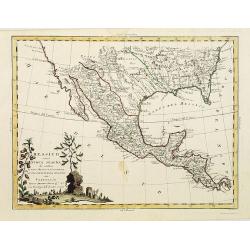
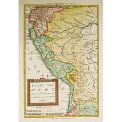
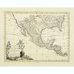
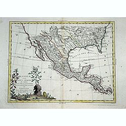
Messico ouvero Nuova Spagna che contiene Il Nuova Messico La California con una Parte de Paesi Adjacenti. . .
Decorative and detailed map of the southern part of the United States, Mexico and Central America. The map is filled with remarkable detail throughout, particularly in Te...
Date: Venise, 1785
Selling price: ????
Please login to see price!
Sold in 2019
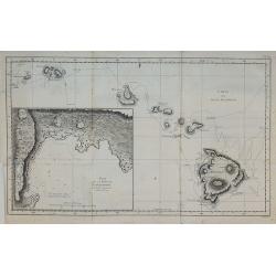
Carte des Isles Sandwich.
From the French edition of James Cook's third voyage entitled Troisième Voyage de Cook, ou Voyage à l'Océan Pacifique, ordonné par le Roi d'Angleterre, pour faire des...
Date: Paris, 1785
Selling price: ????
Please login to see price!
Sold in 2010
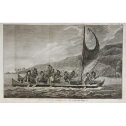
Pirogue des Isles Sandwich, avec les rameurs masqués.
From the French edition of James Cook's third voyage entitled Troisième Voyage de Cook, ou Voyage à l'Océan Pacifique, ordonné par le Roi d'Angleterre, pour faire des...
Date: Paris, 1785
Selling price: ????
Please login to see price!
Sold in 2010

Homme masqué de l'Isle Sandwich.
From the French edition of James Cook's third voyage entitled Troisième Voyage de Cook, ou Voyage à l'Océan Pacifique, ordonné par le Roi d'Angleterre, pour faire des...
Date: Paris, 1785
Selling price: ????
Please login to see price!
Sold in 2010
America settentrionale divisa ne\'suoi principali stati.
Decorative and detailed map of North America, with some Contemp. manuscript notations in the Pacific.The map includes a notation of a Chinese Colony Fou Sang, based upon ...
Date: Venise, 1785
Selling price: ????
Please login to see price!
Sold in 2011
Messico ouvero Nuova Spagna che contiene Il Nuova Messico La California con una Parte de Paesi Adjacenti. . .
Decorative and detailed map of the southern part of the United States, Mexico and Central America. The map is filled with remarkable detail throughout, particularly in Te...
Date: Venise, 1785
Selling price: ????
Please login to see price!
Sold in 2011
Stabilimenti de Francesi, Inglesi, E Spagnuoli nelle Isole Antille. . .
Uncommon map of Caribbean, including Florida, Bahamas and coast of Venezuela, including Curacao, Artiba I, Buenayre , etc. Engraved by G.Pitteri.
Date: Venice, 1785
Selling price: ????
Please login to see price!
Sold in 2022
Messico ouvero Nuova Spagna che contiene Il Nuova Messico La California con una Parte de Paesi Adjacenti. . .
Decorative and detailed map of the southern part of the United States, Mexico and Central America. The map is filled with remarkable detail throughout, particularly in Te...
Date: Venise, 1785
Selling price: ????
Please login to see price!
Sold in 2014
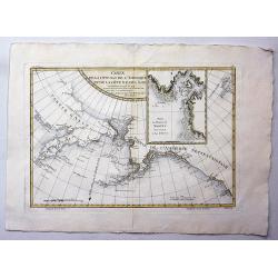
Carte de la Cote N.O. de L'Amerique et de la Cote N.E. de l' Asie.
Map of the north Pacific with Alaska, engraved by André. This is the general map of the Northwest Coast from the atlas volume of the first French edition of Cook's third...
Date: Paris, 1785
Selling price: ????
Please login to see price!
Sold in 2021
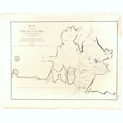
Plan de la Baye de St. Lunaire a la Cote du Nord-Est de Terre-Neuve Leve Geometriquement en 1784 . . .
Fine sea of the northeast coast of Newfoundland. The chart was drawn by and shows the surveys of Capt. Granchain, Capitaine des Vaisseaux du Roi.Relief shown by hachures...
Date: Paris, 1785
Selling price: ????
Please login to see price!
Sold in 2016
ETATS-UNIS DE L'AMÉRIQUE SEPTENTRIONALE Avec LES ISLES ROYALE, DE TERRE NEUVE...
Scarce early map of the newly created United States, with a note which includes 10 new proposed states proposed by Thomas Jefferson--Silvania, Michigania, Chersonesus, Ar...
Date: Paris, 1785
Selling price: ????
Please login to see price!
Sold in 2020
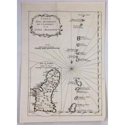
Carta Dell Arcipelago di s. Lazzaro ov. le Isole Marianne.
One of the oldest know maps of Guam and the Mariana Islands by the cartographer Bellin, published in Paris in 1785. It is from the Italian edition. It features a decorati...
Date: Paris, 1785
Selling price: ????
Please login to see price!
Sold in 2019
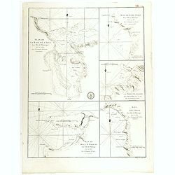
Plan de la Baye de l'Acul ( 5 plans on one sheet).
Revolutionary war sea chart with 5 plans of harbours at Santa Domingo in the Caribbean.Relief shown by hachures. Depths shown by soundings. Below engraved seal of Depot G...
Date: Paris, 1785
Selling price: ????
Please login to see price!
Sold in 2020
Carte de L' ile de Fogo à la Cote Orientale de Terre-Neuve. . .
Revolutionary war sea of Fogo Island, the largest of the offshore islands of Newfoundland and Labrador, Canada. It lies off the northeast coast of Newfoundland. Fogo Isl...
Date: Paris, 1785
Selling price: ????
Please login to see price!
Sold in 2018
A Map of the United States of America Agreeable to the Peace of 1783.
An unusual map of the United States issued shortly after the end of the American Revolutionary War. The map depicts the United States according to the 1783 Treaty of Pari...
Date: London, 1785
Selling price: ????
Please login to see price!
Sold in 2018
Carte de la partie septentrionale de la Mer du Sud, comprise entre la Californie, les Isles Sandwich, le Japon et le Détrt. de Behring.
An unusual map of the northern Pacific, based upon the explorations of James Cook during his third voyage. Hawaii (Sandwich Islands) are shown, as is the coasts of the No...
Date: Paris, ca 1785
Selling price: ????
Please login to see price!
Sold in 2019
(Russian map showing UNITED STATES, after Janvier).
An exceptionally rare, Russian map showing the eastern portion of the United States, after the popular map by Janvier. Text/imprint in Russian.
Date: St. Petersburg, 1785
Selling price: ????
Please login to see price!
Sold in 2020
Carte de la Cote N.O. de l'Amerique et de la Cote N.E. de l'Asie, Reconnues en 1778 et 1779. Les parties de la Cote d'Asie qui ne sont pas ombrees sont tirees d'une Carte Manuscrite que nous donnerent les Russes.
Map of the North Pacific and contiguous coastlines of Alaska and Russia, published in the first French edition of the official account of James Cook's Third Voyage. The ...
Date: Paris, 1785
Selling price: ????
Please login to see price!
Sold in 2022