Browse Listings
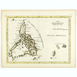
Isles Philippines.
1756 LE ROUGE, G.L. - Isles Philippines.
Date: Paris, 1756
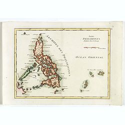
Isles Philippines.
1756 LE ROUGE, G.L. - Isles Philippines.
Date: Paris, 1756
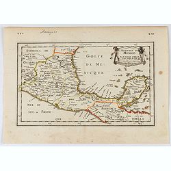
Audience de Mexico.
1756 SANSON, N. / MARIETTE, P. - Audience de Mexico.
Date: Paris, 1756
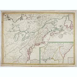
Carte des Possessions Françoises et Angloises dans le Canada, et partie de la Louisiane.
1756 LONGCHAMPS, le Sieur. - Carte des Possessions Françoises et Angloises dans le Canada, et partie de la Louisiane.
Date: Paris, 1756
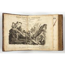
Introduction a la Geographie
1756 LE ROUGE, G.L - Atlas with 91 double-page engraved maps
Date: Paris, 1756
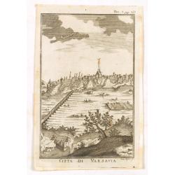
Citta di Varsavia.
1756 ALBRIZZI, G.A. - Citta di Varsavia.
Date: Venice, 1740-1756
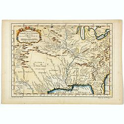
Carte de la Floride, de la Louisiane, et Pays Voisins. . .
1757 BELLIN, J.N. - Carte de la Floride, de la Louisiane, et Pays Voisins. . .
Date: Paris, 1757
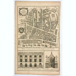
Tower Street Ward with their Divisions into Parishes according to a New Survey.
1757 W. MAITLAND / B. COLE. - Tower Street Ward with their Divisions into Parishes according to a New Survey.
Date: London, 1757
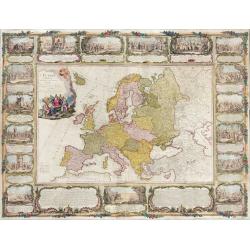
L'Europe divisée en tous ses états, dressée sur les nouveaux mémoires et suivant les dernières observations.
1757 LONCHAMPS ET JANVIER - L'Europe divisée en tous ses états, dressée sur les nouveaux mémoires et suivant les dernières observations.
Date: Paris, 1757
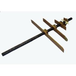
RESTORED CROSSTAFF SEGMENT
1757 VAN KEULEN II, J. - RESTORED CROSSTAFF SEGMENT
Date: Amsterdam, 1757
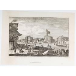
Pars Canalis Magni De Extendens A Laeva…
1757 MARIESCHI, M.G. - Pars Canalis Magni De Extendens A Laeva…
Date: Venice, after 1757
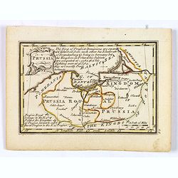
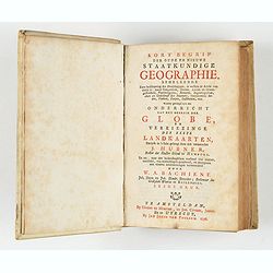
Kort begrip der oude en nieuwe staatkundige Geographie: behelzende eene beschryving der heerschappyen, in welken de aarde verdeeld is, haare gelegenheid. . .
1758 HUBNER, J. / BACHIENE, W. A. - Kort begrip der oude en nieuwe staatkundige Geographie: behelzende eene beschryving der heerschappyen, in welken de aarde verdeeld ...
Date: Amsterdam, Covens / Mortier, Utrecht, Poolsum, 1758
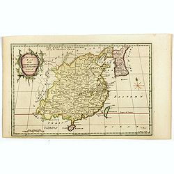
A new & accurate map of the Empire of China from the Sieur Robert's Atlas. With improvements.
1759 DE VAUGONDY, G. R. / GIBSON, J. - A new & accurate map of the Empire of China from the Sieur Robert's Atlas. With improvements.
Date: London, 1759
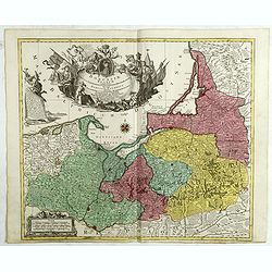
Borussiae Regnum compectens Circulos Sambiensem, Natangiensem, et Hockerlandiae Nee non Borussia Polonica, exhibens Palatinatus Culmiensem. . .
1759 LOTTER, T.C. - Borussiae Regnum compectens Circulos Sambiensem, Natangiensem, et Hockerlandiae Nee non Borussia Polonica, exhibens Palatinatus Culmiensem. . .
Date: Augsburg, 1759
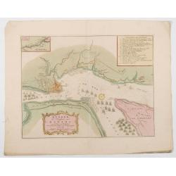
Quebek de hoofdstad van Kanada.
1759 TIRION, I. - Tirion's detailed plan of the Siege of Quebec in 1759, at the outset of the French & Indian War
Date: Amsterdam, 1759
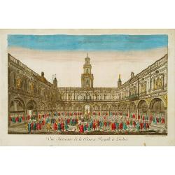
Vue Interieure de la Bourse Royale à Londres.
1760 DAUMONT, J. F. - Vue Interieure de la Bourse Royale à Londres.
Date: Paris, 1760
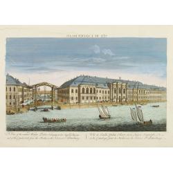
Vuë de l'ancien Palais d'hiver de sa Majesté Imperiale et du Canal qui Joint la Moika avec la Neva, a St. Petersburg.
1760 ANONYMOUS - Vuë de l'ancien Palais d'hiver de sa Majesté Imperiale et du Canal qui Joint la Moika avec la Neva, a St. Petersburg.
Date: Paris, 1760
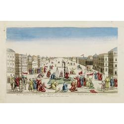
La Feste du Poids au Mogol qui se célebre chez ses Peuples avec grande vénération.
1760 MONDHARE, L.J. - La Feste du Poids au Mogol qui se célebre chez ses Peuples avec grande vénération.
Date: Paris, 1760
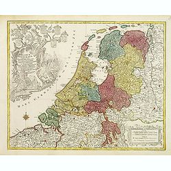
Belgica Foederata. . .
1760 LOTTER, T.C. - Belgica Foederata. . .
Date: Augsburg, ca.1760
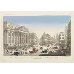
39e Vüe d'Optique Representant L'Hotel du Lord Maire de Londre.
1760 DAUMONT, J. F. - 39e Vüe d'Optique Representant L'Hotel du Lord Maire de Londre.
Date: Paris, 1760
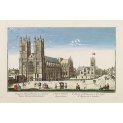
26e Vüe d'Optique Representant L'Abbaye de Westminster et de l'Eglise Ste. Marguerite à Londres.
1760 DAUMONT, J. F. - 26e Vüe d'Optique Representant L'Abbaye de Westminster et de l'Eglise Ste. Marguerite à Londres.
Date: Paris, 1760
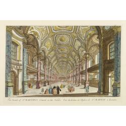
Vuë du dedans de l'Eglise de St. MARTIN à Londre.
1760 ANONYMOUS - Vuë du dedans de l'Eglise de St. MARTIN à Londre.
Date: Paris, 1760
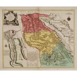
Le cours entier du grand et Fameux Nil. . .
1760 LOTTER, C.T. - Le cours entier du grand et Fameux Nil. . .
Date: Augsburg, 1760
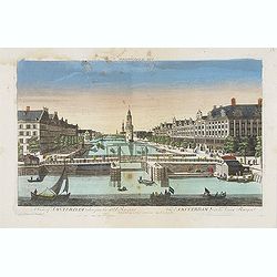
A view of Amsterdam taken from the Old Rampart.
1760 MONDHARE, L.J. - A view of Amsterdam taken from the Old Rampart.
Date: Paris, ca. 1760
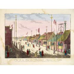
Vue de la Rue des Marchands Chinoises a Nankin.
1760 - OPTICAL PRINT - Illustrating a street in 18th-century Nanjing, one of China’s most important historic capitals.
Date: Augsburg, 1760
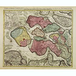
Zeelandiae Comitatus. . .
1760 LOTTER, T.C. - Zeelandiae Comitatus. . .
Date: Augsburg, c.1760
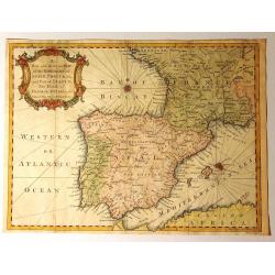
A New and Accurate Map of the Kingdoms of Spain, Portugal and Part of France, The Islands of Majorca, Minorca &c.
1760 SEALE, R.W. - A New and Accurate Map of the Kingdoms of Spain, Portugal and Part of France, The Islands of Majorca, Minorca &c.
Date: London, ca. 1760
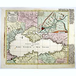
Nova Mappa Maris Nigris et Freti Constantinopolitani...
1760 LOTTER, T.C. - A fine and decorative map of the Black Sea, Crimea and Constantinople
Date: Augsburg, ca. 1760
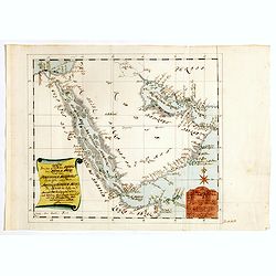
Karte von den Kusten von Arabien . . .
1760 ANONYMOUS - Karte von den Kusten von Arabien . . .
Date: Germany, ca. 1760
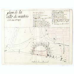
[Madras, now Chennai] Plan de la ville de Madras et de ses attaques.
1760 ANONYMOUS - An uncommon original manuscript document on the French siege of Madras, combining colonial history, military cartography, and the Anglo-French struggl...
Date: Paris, ca 1760
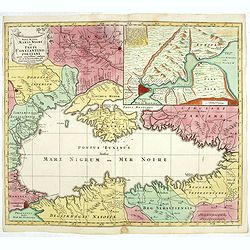
Nova Mappa Maris Nigri et Freti Constantino Politani. . .
1760 LOTTER, T.C. - Nova Mappa Maris Nigri et Freti Constantino Politani. . .
Date: Augsburg, ca. 1760
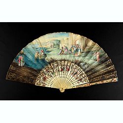
A folding fan showing Cleopatra at the Gates of Alexandria, circa 1750-1760.
1760 ANONYMOUS - A folding fan showing Cleopatra at the Gates of Alexandria, circa 1750-1760.
Date: English, ca. 1750-1760

Ch'onha chido.[Atlas of all under Heaven]
1760 ANONYMOUS - Ch'onha chido.[Atlas of all under Heaven]
Date: Korea, ca. 1760
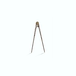
Steel compass with a gilded radiating pattern.
1760 ANONYMOUS - Steel compass with a gilded radiating pattern.
Date: ca. 1760

Gesigt van den Vermaakelyken Overtoom ... der stad Amsterdam....
1760 SCHENK, L. - A view of the Overtoom. Etching on two joined sheets of paper, after A.Rademaker.
Date: Amsterdam, 1760
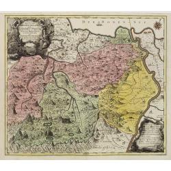
Pagus Helvetiae Abbatiscellanus .. Valle Rhenana. . .
1760 SEUTTER, M. - Pagus Helvetiae Abbatiscellanus .. Valle Rhenana. . .
Date: Augsbourg, 1760
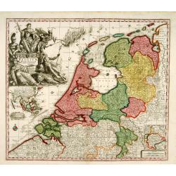
Belgium Foederatum auctius et emendatius edit..
1760 SEUTTER, M. - Belgium Foederatum auctius et emendatius edit..
Date: Augsburg 1760
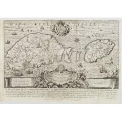
Pianta Geografia delle Isole di Malta, e Gozo della Sagra Religione Gerosolimitana di S. Giovanni delineata, ed incisa in quest anno 1761.
1761 BOVA, A. - Pianta Geografia delle Isole di Malta, e Gozo della Sagra Religione Gerosolimitana di S. Giovanni delineata, ed incisa in quest anno 1761.
Date: Bova Ant., Palermo, 1761
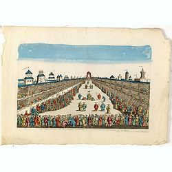
Vue perspective de la grande Ceremonie du Couronnement de l'Empereur de la Chine.
1761 MONDHARE, L.J. - Vue perspective de la grande Ceremonie du Couronnement de l'Empereur de la Chine.
Date: Paris, 1761
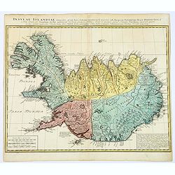
Insula Islandiae delineatio. . .
1761 HOMANN HEIRS - Insula Islandiae delineatio. . .
Date: Nuremberg, 1761
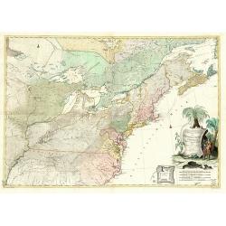
Theatrum belli in America Septentrionali. II. foliis comprehensum jussu Acad. Reg. Scient. et Eleg. Litt. exhibet I. C. Rhode Ac: Geogr.
1761 RHODE, I.C. - Two-sheet map of the northeastern part of the United States and Eastern Canada from the Mississippi Valley to the Atlantic Seaboard, published during ...
Date: Berlin, 1761
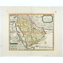
Carta nuova dell' Arabia fatta in Amsterdam per Isauc Tirion.
1762 ALBRIZZI, G.A. - Carta nuova dell' Arabia fatta in Amsterdam per Isauc Tirion.
Date: Napels, Francesco Ricciardo, 1738 -1762
Selling price: ????
Please login to see price!
Sold in 2026
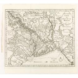
Nouvelle carte du royaume de Bengale.
1763 BELLIN, J.N. / ARKSTEE / MERKUS - Nouvelle carte du royaume de Bengale.
Date: Amsterdam, Leipzig, 1763
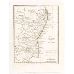
Theatre de la guerre sur la coste de Coromandel.
1763 BELLIN, J.N. / ARKSTEE / MERKUS - Theatre de la guerre sur la coste de Coromandel.
Date: Amsterdam, Leipzig, 1763
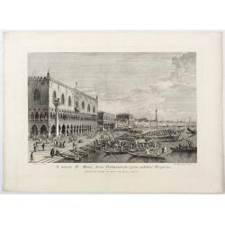
A minore D: Marci Area Dalmatarum ripam.
1763 BRUSTOLON, G.B. / CANALETTO - A minore D: Marci Area Dalmatarum ripam.
Date: Venice, c. 1763
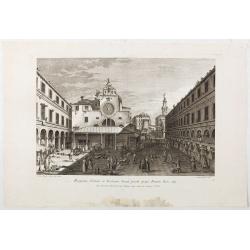
Prospectus Plateae et Ecclesiae Sancti Jacobi prope Pontem Rivi alti.
1763 BRUSTOLON, G.B. / CANALETTO - Prospectus Plateae et Ecclesiae Sancti Jacobi prope Pontem Rivi alti.
Date: Venice, c. 1763
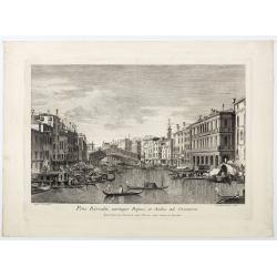
Pons Rivoalti, utriumqque Ripae, et Aedes ad Orientem.
1763 BRUSTOLON, G.B. / CANALETTO - Pons Rivoalti, utriumqque Ripae, et Aedes ad Orientem.
Date: Venice, 1763
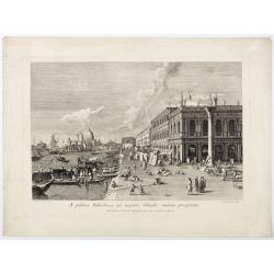
A publica Bibliotheca ad majoris Canalis initium prospectus.
1763 BRUSTOLON, G.B. / CANALETTO - A publica Bibliotheca ad majoris Canalis initium prospectus.
Date: Venice, 1763
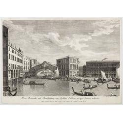
Pons Rivoalti ad Occidentem, cum Aedibus Publicis utrique Lateri adjectis.
1763 BRUSTOLON, G.B. / CANALETTO - Pons Rivoalti ad Occidentem, cum Aedibus Publicis utrique Lateri adjectis.
Date: Venice, 1763
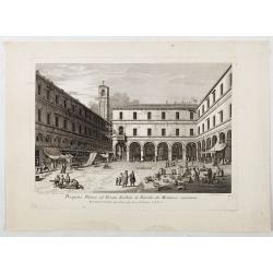
Prospectus Plateae ad Divum Iacobum de Rivoalto ubi Mercatores conveniunt.
1763 BRUSTOLON, G.B. / CANALETTO - Prospectus Plateae ad Divum Iacobum de Rivoalto ubi Mercatores conveniunt.
Date: Venice, c. 1763
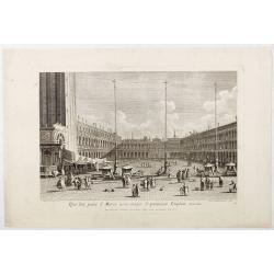
Qua late patet S. Marci area major novum Regim Palatium versus.
1763 BRUSTOLON, G.B. / CANALETTO - Qua late patet S. Marci area major novum Regim Palatium versus.
Date: Venice, 1763
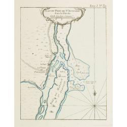
Plan du Port de St Augustin dans la Floride.
1764 BELLIN, J.N. - Plan du Port de St Augustin dans la Floride.
Date: Paris, 1764
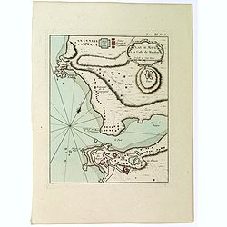
Plan de Maye a la Coste de Malabar.
1764 BELLIN, J.N. - Plan de Maye a la Coste de Malabar.
Date: Paris, 1764
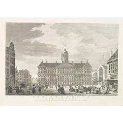
Het stadhuis, van vooren.
1765 De BAKKER, F. - Het stadhuis, van vooren.
Date: Amsterdam, 1765
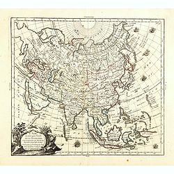
L'Asie, dressée pour l'étude de la Géographie . . .
1765 DESNOS, L.-C. / BRION DE LA TOUR - L'Asie, dressée pour l'étude de la Géographie . . .
Date: Paris, 1765
Selling price: ????
Please login to see price!
Sold in 2023
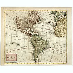
Nieuwe kaart van America.
1765 TIRION, I. - Nieuwe kaart van America.
Date: Amsterdam, 1765
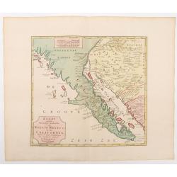
Kaart van het Westelyk Gedeelte van Nieuw Mexico en van California. . . MDCCLXV ..
1765 TIRION, I. - An essential map for Baja, Arizona and Southern California collectors.
Date: Amsterdam, 1765
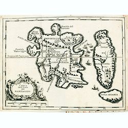
Carta Topografica dell' Isola Del Maritaggio di Monsieur le Boble per la prima volta. Tradotta dal francese in italiano.
1766 LE NOBLE, E. - Carta Topografica dell' Isola Del Maritaggio di Monsieur le Boble per la prima volta. Tradotta dal francese in italiano.
Date: Cosmopoli, 1766
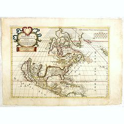
America settentrionale. . .
1766 PETRINI, P. - America settentrionale. . .
Date: Napels, 1766
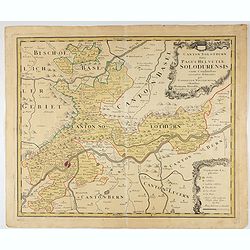
Canton Solothurn sive pagus Helvetiae Solodurensis cum confinibus recenter delineatus per Gabrielem Walserum.
1766 HOMANN HEIRS - Canton Solothurn sive pagus Helvetiae Solodurensis cum confinibus recenter delineatus per Gabrielem Walserum.
Date: Augsbourg, 1766
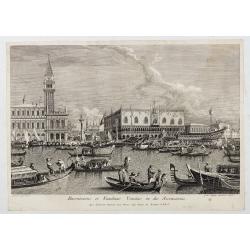
Canalis majoris caput qua Venetias ingreditur.
1766 BRUSTOLON, G.B. / CANALETTO - Canalis majoris caput qua Venetias ingreditur.
Date: Venice, c. 1766
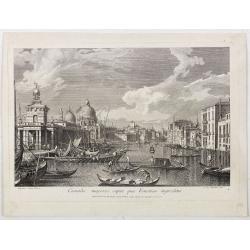
Canalis majoris caput qua Venetias ingreditur.
1766 BRUSTOLON, G.B. / CANALETTO - Canalis majoris caput qua Venetias ingreditur.
Date: Venice, c. 1766
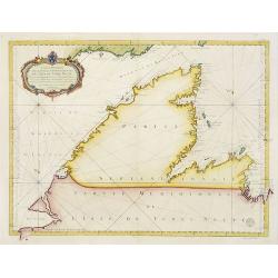
Carte Réduite De La Partie Septentrionale De L'' Isle De Terre Neuve..
1767 BELLIN, J.N. - Carte Réduite De La Partie Septentrionale De L'' Isle De Terre Neuve..
Date: Paris, 1767

The Coast of New Found Land From Salmon Cove to Cape Bonavista. . . [together with] The Coast of New Found Land from Cape-Raze to Cape St-Francis.
1767 MOUNT & PAGE, T. / BOULTER GRIERSON - The Coast of New Found Land From Salmon Cove to Cape Bonavista. . . [together with] The Coast of New Found Land ...
Date: Dublin, 1767
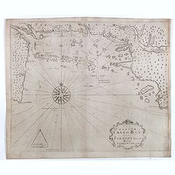
The Harbour of Casco Bay and Islands Adjacent Bt Capt. Cyprian Southicke.
1767 MOUNT and PAGE, T. / BOULTER GRIERSON - The earliest printed chart of Casco Bay, an inlet of the Gulf of Maine on the southern coast of Maine, New England.
Date: Dublin, 1767
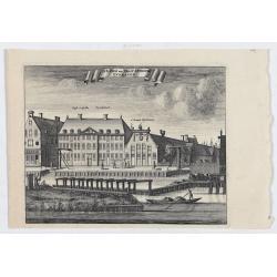
s'Lands en Oost-Indische Lynbanen.
1767 WAGENAAR, J. - s'Lands en Oost-Indische Lynbanen.
Date: Amsterdam, 1760-1767
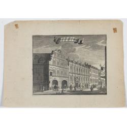
t'Oost-Indisch-Huys.
1767 WAGENAAR, J. - t'Oost-Indisch-Huys.
Date: Amsterdam, 1760-1767
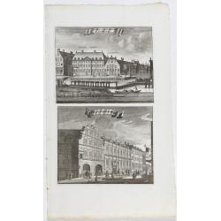
s'Lands en Oost-Indische Lynbanen. & t'Oost-Indisch-Huys.
1767 WAGENAAR, J. - s'Lands en Oost-Indische Lynbanen. & t'Oost-Indisch-Huys.
Date: Amsterdam, 1760-1767
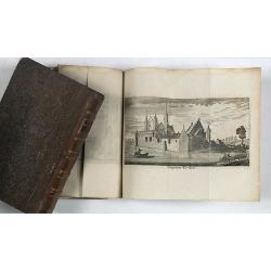
Vermakelykheden van Brabant, en deszelfs onderhoorige Landen... (2 volumes)
1768 DE CANTILLON - Vermakelykheden van Brabant, en deszelfs onderhoorige Landen... (2 volumes)
Date: Amsterdam, P.J. Entrop, 1768

[manuscript plan] Siège de Schweidnitz en Silésie fait par les trouppes Imperial es commandées par Mr. le de Nadasti ...
1769 RUEL de BELLISLE, N.Th. - [manuscript plan] Siège de Schweidnitz en Silésie fait par les trouppes Imperial es commandées par Mr. le de Nadasti ...
Date: France, 1769
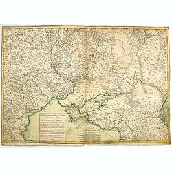
Nouveau théâtre de la guerre entre les Russes les turcs et les polonois confédérés.
1769 LONGCHAMPS, le Sieur. - A very rare separately published map of the Crimea region, showing the situation in 1769 during the Russo-Turkish War of 1768–1774.
Date: Paris, 1769
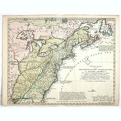
Nieuwe Kaart van de Grootbrittannische Volkplantingen in Noord America waar in Tevens de Fransche Bezittingen en de Landen tuschen die Beide Volken. . .
1769 TIRION, I. - Nieuwe Kaart van de Grootbrittannische Volkplantingen in Noord America waar in Tevens de Fransche Bezittingen en de Landen tuschen die Beide Volken. ...
Date: Amsterdam, 1769
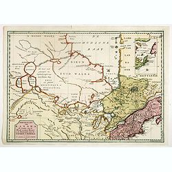
Nieuwe kaart van Kanada . . .
1769 TIRION, I. - Nieuwe kaart van Kanada . . .
Date: Amsterdam, 1769
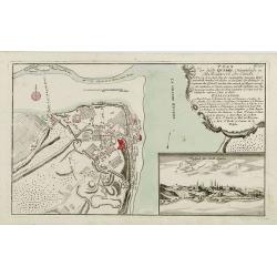
Plan der Stadt Quebec Haupstadt in Neu Franckreich oder Canada.
1770 RASPISCHE BUCHHANDLUNG - Plan der Stadt Quebec Haupstadt in Neu Franckreich oder Canada.
Date: Nurnberg, 1770
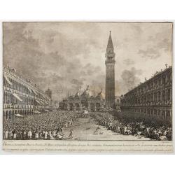
Habita a Serenissimo Duce in Basilica D.Marci ad populum allocutione…
1770 BRUSTOLON, G.B. / CANALETTO - Habita a Serenissimo Duce in Basilica D.Marci ad populum allocutione…
Date: Venice, c. 1766-1770
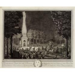
Réjouissances du Peuple près de la Pyramide d'Illumination, élévée sur l'Esplanade de la Porte de Mars et Distribution de Vivres, fontaines de Vin , sous les Ordres de Mrs. Du Conseil de la Ville, à Reims le 27 Aoust 1765.
1771 MOREAU LE JEUNE. - Réjouissances du Peuple près de la Pyramide d'Illumination, élévée sur l'Esplanade de la Porte de Mars et Distribution de Vivres, fontaines de ...
Date: Paris, 1771
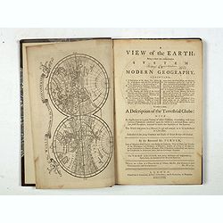
A view of the earth : being a short but comprehensive system of modern geography graphy ...
1771 TURNER, R. - A view of the earth : being a short but comprehensive system of modern geography graphy ...
Date: London, S. Crowder and S. Gamidge, 1771
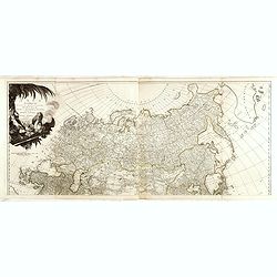
(upper sheets only) Asia According to the Sieur D'Anville Divided into its Empires, Kingdoms and States Showing the European Settlements in the East Indies and all the New Discoveries . . . 1772
1772 SAYER, R. - (upper sheets only) Asia According to the Sieur D'Anville Divided into its Empires, Kingdoms and States Showing the European Settlements in the East I...
Date: London, 1772
Selling price: ????
Please login to see price!
Sold in 2026
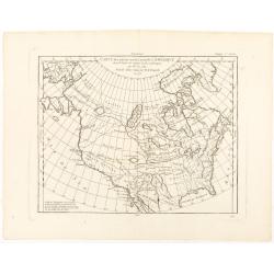
Carte des parties nord et ouest de L' Amerique. . .
1772 DIDEROT, D. / VAUGONDY, D.R. de - Carte des parties nord et ouest de L' Amerique. . .
Date: Paris, 1772
