Browse Listings
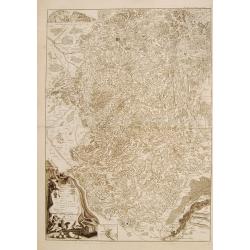
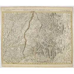
Le cours du Rhin de Bale à Hert près Philisbourg contenant L\'Alsace et partie du Brisgau..
The first map of the Rhine valley on such a large scale. To the lower left a scale cartouche and a small inset of Basle.With fine title cartouche upper rightLe Rouge (171...
Date: Paris, 1745
Selling price: ????
Please login to see price!
Sold in 2008
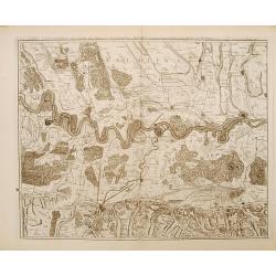
![[2 maps] Le cours du Rhin de Constance a Bale : en deux feuilles contenant le Fricqthal les Quatre Ville Forrestieres et partie de la Souabe / verifié sur les lieux par l'auteur.](/uploads/cache/17795-250x250.jpg)
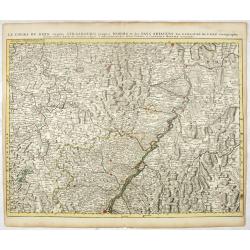
[2 maps] Le cours du Rhin de Constance a Bale : en deux feuilles contenant le Fricqthal les Quatre Ville Forrestieres et partie de la Souabe / verifié sur les lieux par l'auteur.
Two maps forming an early map of the Rhine valley on such a large scale.1:100 000 Le Rouge (1712-1778) was born in Hanover and may have spent his youth there, though his ...
Date: Paris, 1745
Selling price: ????
Please login to see price!
Sold in 2011
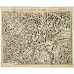
Carte topographique du cours du Rhin de Philisbourg a Mayence. . .
Early map of the Rhine valley on such a large scale.1:100 000. Including towns as Mainz, Manheim, Worms, Spier, Heidelberg, Philisbourg.Le Rouge (1712-1778) was born in H...
Date: Paris, 1745
Selling price: ????
Please login to see price!
Sold in 2011
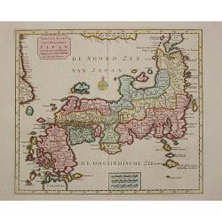
Nieuwe Kaart van t Keizerryk Japan.
Izaak Tirion (d. 1769) Amsterdam publisher. His ' Nieuwe en beknopte handatlas' saw 6 editions between before 1740 and after 1784. Also ' Tegenwoordige staat van alle vol...
Date: Amsterdam, c. 1745
Selling price: ????
Please login to see price!
Sold in 2015
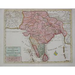
Nieuwe Kaart van t Keyzer Ryk van den Grooten Mogol.
Izaak Tirion (d. 1769) Amsterdam publisher. His ' Nieuwe en beknopte handatlas' saw 6 editions between before 1740 and after 1784. Also ' Tegenwoordige staat van alle vol...
Date: Amsterdam, c. 1745
Selling price: ????
Please login to see price!
Sold
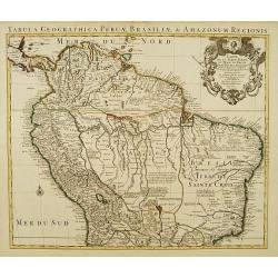
Carte de la Terre Ferme du Perou, du Bresil et du Pays des Amazones.
Large, graphic map of the northern part of South America. It is filled with place names and notations speculating about the Indian tribes and the tributaries to the Amazo...
Date: Amsterdam c. 1745
Selling price: ????
Please login to see price!
Sold
Carte de L' Isle de la Martinique Colonie Francoise de l'une des Isles Antilles de l'Amerique..
A very well executed plan of the island after Delisle. Excellent detail throughout includes realistic depictions of bays, mountains, islets, lagoons, forests, etc., which...
Date: Amsterdam c. 1745
Selling price: ????
Please login to see price!
Sold
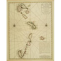
Carte des Antilles Francoises et des Isles Voisines..
Superb detailed map of the Lesser Antilles from Guadeloupe to Grenada, prepared by De L'Isle and reissued by Covens & Mortier.The map is from a Dutch edition of De L'...
Date: Amsterdam c. 1745
Selling price: ????
Please login to see price!
Sold
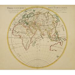
Orbis veteribus noti Tabula nova.
Very decorative map of the eastern hemisphere: Australia is shown without its eastern coastline while Japan is almost attached to mainland Asia.The map is from a Dutch ed...
Date: Amsterdam c. 1745
Selling price: ????
Please login to see price!
Sold
![Theatrum Historicum pars Occidentalis.. pars Orientalis. [3 sheets]](/uploads/cache/21433-250x250.jpg)
Theatrum Historicum pars Occidentalis.. pars Orientalis. [3 sheets]
Uncommon map finely engraved with a profusion of details. The first sheet shows western Europe and the northern Mediterranean basin as far as Crete. The southern Mediterr...
Date: Amsterdam c. 1745
Selling price: ????
Please login to see price!
Sold
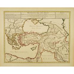
Retraite des Dix Mille..
Very decorative map of the Near East: it represents the area which was the theatre of the Ten Thousand's march to the Battle of Cunaxa and back to Greece (401 BC-399 BC),...
Date: Amsterdam c. 1745
Selling price: ????
Please login to see price!
Sold
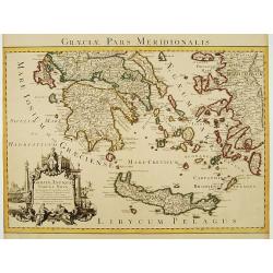
Graeciae Pars Meridionalis..
Very decorative map illustrating the southern part of Greece and a small part of Turkey. It represents the Aegean Islands and Crete as well as some islands in the Ionian ...
Date: Amsterdam c. 1745
Selling price: ????
Please login to see price!
Sold
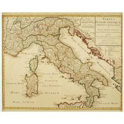
Tabula Italiae Antiquae..
Very decorative map of the Italian peninsula.The map is from a Dutch edition of De L'Isle's work entitled, Atlas Nouveau, Contenant Toutes Les Parties Du Monde, Ou sont e...
Date: Amsterdam c. 1745
Selling price: ????
Please login to see price!
Sold
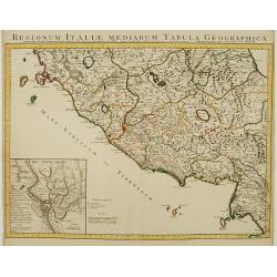
Regionum Italiae Mediarum Tabula Geographica.
Very decorative map of the central Italy showing Rome at the centre of the sheet. An interesting inset on lower left corner of the map illustrates topographical features ...
Date: Amsterdam, c. 1745
Selling price: ????
Please login to see price!
Sold in 2014
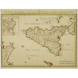
Siciliae Antiquae quae et Sicania et Trinacria dicta tabula geographica.
Detailed map of Sicily in outline color. Shows forests, a smoking Mount Etna, etc. Covers also Malta and Lipari Islands. Relief shown pictorially. Inset map: Veterum Syra...
Date: Amsterdam c. 1745
Selling price: ????
Please login to see price!
Sold
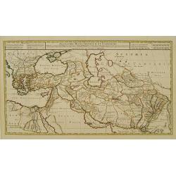
Alexandri Magni Imperium et Expeditio.
The map represents the theatre of Alexander the Great's conquests between the Black Sea and Indus River, today's Armenia, Iraq, Iran, Afghanistan, etc.The map is from a D...
Date: Amsterdam c. 1745
Selling price: ????
Please login to see price!
Sold
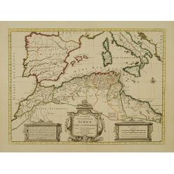
In Notitiam Ecclesiasticam Africae Tabula Geographica.
Very decorative copper-engraved map of the northern coast of Africa, Spain, Italy and the Mediterranean with the islands of Sardinia, Corsica, Majorca, Minorca etc. Sicil...
Date: Amsterdam, c. 1745
Selling price: ????
Please login to see price!
Sold in 2008
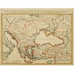
Imperii Orientalis et Circumjacentium Regionum. .
Very decorative copper-engraved map representing the extent of Constantine VII Porphyrogenitos' empire.The map is from a Dutch edition of De L'Isle's work entitled, Atlas...
Date: Amsterdam c. 1745
Selling price: ????
Please login to see price!
Sold
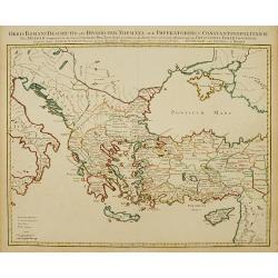
Orbis Romani Descriptio seu Divisio per Themata. .
Covens and Mortier's Map of the Roman World is a copperplate engraving based on an earlier map by Guillelmo De L'Isle (1675-1726), Geographer to the King of France. The s...
Date: Amsterdam c. 1745
Selling price: ????
Please login to see price!
Sold
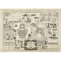
Krygs Ingenieurs en Artillerie Tafel, in welke de voornaamste benamingen zoo wel der Meetkunde, Vestingbouw, Oorlogsgereedschappen, Vuurwerken; als ook ...
Highly decorative explanatory plate illustrating the main geometrical figures and instruments, elements of light and heavy artillery, tools as well as some examples of fo...
Date: Amsterdam c. 1745
Selling price: ????
Please login to see price!
Sold in 2015
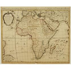
Carte d'Afrique Dressée pour l'usage du Roy..
Detailed copper-engraved map covering the whole of Africa including southern Europe and the whole of the Middle East. Geographical knowledge in Africa was mostly garnered...
Date: Amsterdam c. 1745
Selling price: ????
Please login to see price!
Sold
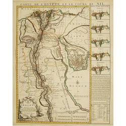
Carte de l'Egypte et le cours du Nil.
Large copper-engraved map illustrating the part of Egypt where the Nile River flows. 5 insets on left margin depicting the river outfall according to Herodotum, Strabonem...
Date: Amsterdam c. 1745
Selling price: ????
Please login to see price!
Sold
Land-Charte des Chur-Fürstenthums Brandenburg.
Highly detailed copper-engraved map of Brandenburg. After von Gundling, this was the most accurate map of the region at the time. Centered on Berlin, the map also include...
Date: Amsterdam c. 1745
Selling price: ????
Please login to see price!
Sold
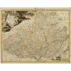
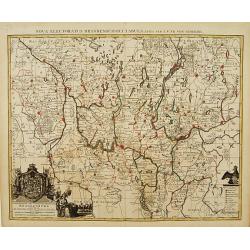
Carte Générale du Marquisat de Moravie Divisée en six Cercles
Detailed copper-engraved map representing Moravia divided in districts. With decorative title cartouche and legend cartouche on upper left and lower right corners. Shows ...
Date: Amsterdam c. 1745
Selling price: ????
Please login to see price!
Sold
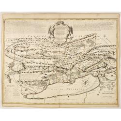
Carte de la Souverainité de Neuchatel et Vallangin.
Fine ornamental map representing the lake of Neufchatel. With explanatory text on both sides of the decorative title cartouche which is situated at the centre of the map....
Date: Amsterdam, c. 1745
Selling price: ????
Please login to see price!
Sold in 2012
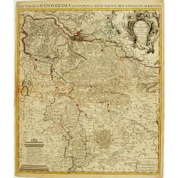
L'Electorat de Hannover ou les Domaines du Roi de la Grande Bretagne..
Detailed copper-engraved map representing the Electorate of Hanover with the Duchies of Lunenburg, Bremen, Ferden etc. With decorative title cartouche on upper right corn...
Date: Amsterdam c. 1745
Selling price: ????
Please login to see price!
Sold in 2009
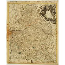
Le Cercle de Baviere Divisée en touts les Estats qui le Composent &c.
Highly detailed copper-engraved map of Bavaria. With decorative title cartouche on upper right corner and scale of miles cartouche. Includes illustrated topography with t...
Date: Amsterdam c. 1745
Selling price: ????
Please login to see price!
Sold in 2009
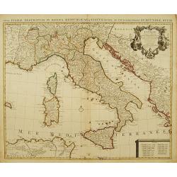
L' Italie, Dressee sur les Observations de Mrs. De L' Academie Royale des Sciences..
A large, highly detailed map of the Italian peninsula and the surrounding parts of France and the Balkans. Includes Sardinia and Corsica. Decorated with a fine title cart...
Date: Amsterdam c. 1745
Selling price: ????
Please login to see price!
Sold
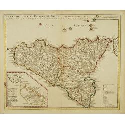
Carte de l'Isle et Royaume de Sicile.
Large, highly detailed map of Sicily. Shows illustrated topography with fortresses, churches, abbeys, ancient ruins, and aqueducts. The most prominent feature is the larg...
Date: Amsterdam c. 1745
Selling price: ????
Please login to see price!
Sold
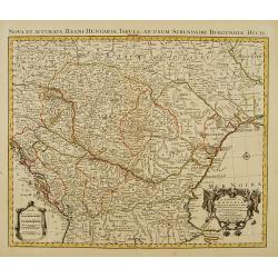
Le Royaume de Hongrie et des pays qui en dependoient autrefois..
Detailed copper-engraved map of Hungary with its neighbouring countries. The map is also improved after the observations by Marsigli, who published an important descripti...
Date: Amsterdam c. 1745
Selling price: ????
Please login to see price!
Sold
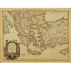
Carte de la Grece dressée sur un grand nombre de memoires..
Detailed copper-engraved map of Greece with its neighbouring countries, including southern Italy and part of Cyprus. Relief shown pictorially. With large decorative title...
Date: Amsterdam c. 1745
Selling price: ????
Please login to see price!
Sold
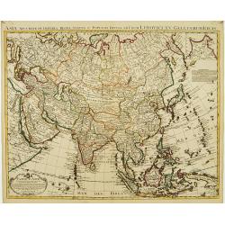
Carte d'Asie dressée sur les Mémoires..
Highly detailed map of Asia, based upon earlier maps by De L'Isle. With charming title cartouche and inset of the north easternmost part of Russia.The map is from a Dutch...
Date: Amsterdam c. 1745
Selling price: ????
Please login to see price!
Sold
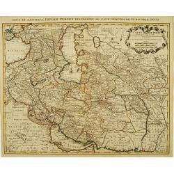
Carte de Perse dressée pour l'usage du Roy..
Detailed map of Persia embellished with a title cartouche featuring the French crown and coat of arms. Relief shown pictorially.The map is from a Dutch edition of De L'Is...
Date: Amsterdam, c. 1745
Selling price: ????
Please login to see price!
Sold in 2008
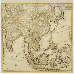
Carte des Indes et de la Chine Dressée..
Large and attractive map of the East Indes, India and China.The map is from a Dutch edition of De L'Isle's work entitled, Atlas Nouveau, Contenant Toutes Les Parties Du M...
Date: Amsterdam c. 1745
Selling price: ????
Please login to see price!
Sold
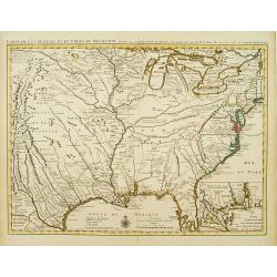
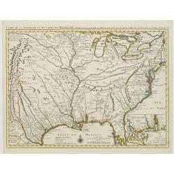
Carte de la Louisiane et du Cours du Mississipi Dressée sur un grand nombre de Memoires..
Covens & Mortier's issue of Delisle's influential map of the French possession of Louisiana. Updated to include New Orleans. When originally published in 1718, it was...
Date: Amsterdam c. 1745
Selling price: ????
Please login to see price!
Sold
Carte du Piemont et du Monferrat Dressée sur plusieurs Cartes..
Large, detailed map of Valle d'Aosta and most part of Piedmont. Includes illustrated topography with notations about towns, roads, passes, mountains, etc. Relief shown pi...
Date: Amsterdam, c. 1745
Selling price: ????
Please login to see price!
Sold in 2008
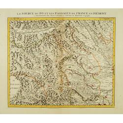
La Source du Po, et les passages de France en Piémont.
First of 5 detailed maps illustrating the flow of the river Po, in northern Italy, this maps depicts the mountainous area at the border between Italy and France. Relief s...
Date: Amsterdam c. 1745
Selling price: ????
Please login to see price!
Sold

Le Cours du Po dans le Piemont et le Montferrat.
Second of 5 detailed maps illustrating the flow of the river Po, in northern Italy, this maps depicts the stretch of river flowing through the Piedmont and the Monferrato...
Date: Amsterdam c. 1745
Selling price: ????
Please login to see price!
Sold
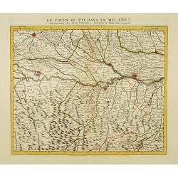
Le Cours du Po dans le Milanez.
Third of 5 detailed maps illustrating the flow of the river Po, in northern Italy, this maps depicts the stretch of river marking the natural border between Lombardy and ...
Date: Amsterdam c. 1745
Selling price: ????
Please login to see price!
Sold
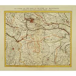
Le Cours du Po dans le Duche de Mantoue.
Fourth of 5 detailed maps illustrating the flow of the river Po, in northern Italy, this maps depicts the stretch of river flowing through the province of Mantua as far a...
Date: Amsterdam c. 1745
Selling price: ????
Please login to see price!
Sold
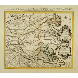
Le Cours du Po dans le Duché de Ferrare et les Etats de Venise..
Last of 5 detailed maps illustrating the flow of the river Po, in northern Italy, this maps depicts the last stretch of river from Ravalle as far as its delta into the Ad...
Date: Amsterdam c. 1745
Selling price: ????
Please login to see price!
Sold
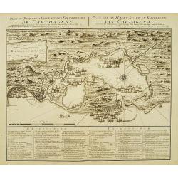
Plan du Port de la Ville et des Forteresses de Carthagène..
Highly decorative plan of the bay and fortifications of Cartagena in Colombia during the siege by the British fleet. Table of explanations in French and Dutch below. Nort...
Date: Amsterdam c. 1745
Selling price: ????
Please login to see price!
Sold

Atlas Novus ad Usum Serenissimi Burgundiae Ducis.
Title page of the homonymous atlas by Iean Covens and Corneille Mortier. Blank verso. Soldiers, savages and other individuals are shown approaching a queen seated on her ...
Date: Amsterdam c. 1745
Selling price: ????
Please login to see price!
Sold
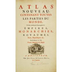
Title page: Atlas nouveau, contenant toutes les parties du monde..
In lower part title page a decorative copper engraving "Socio ditata Labore" (80x120mm), made by J. Wandelaar.The map is from a Dutch edition of De L'Isle's wor...
Date: Amsterdam c. 1745
Selling price: ????
Please login to see price!
Sold
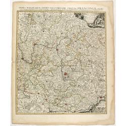
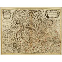
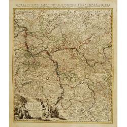
Partie Orientale du Cercle de Francofonie dressée sur les Mémoires..
Large, detailed map of Eastern Franconia. Includes illustrated topography with notations about towns, roads, fortresses, abbeys and monasteries, etc. Relief is shown pict...
Date: Amsterdam c. 1745
Selling price: ????
Please login to see price!
Sold in 2023
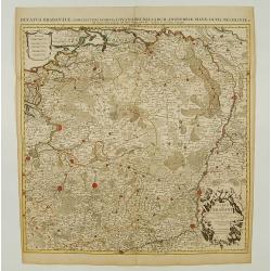
L'Electorat de Mayence, le Bas Palatinat et une Partie du Pays de Hesse..
Large, detailed map of Rhenish Franconia. Includes illustrated topography with notations about towns, roads, fortresses, abbeys and monasteries, etc. Relief shown pictori...
Date: Amsterdam c. 1745
Selling price: ????
Please login to see price!
Sold in 2009
Carte du Comté du Brabant, Dressée sur plusieurs Cartes particulières..
Map of the old Duchy of Brabant, which covers parts of the Netherlands and Belgium largely between the Meuse or Maas River and the North Sea. Highly detailed with depicti...
Date: Amsterdam c. 1745
Selling price: ????
Please login to see price!
Sold
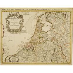
Carte des Provinces Unies des Pays Bas..
Very fine large decorative early 18th century engraved folio sheet map of the Netherlands with original outline hand color. Highly detailed with depictions of topography...
Date: Amsterdam c. 1745
Selling price: ????
Please login to see price!
Sold
Carte exacte des Postes et Routes de l' Empire d' Allemagne divisee en ses Cercles..
Richly engraved and highly detailed map showing the postal routes and roads in Germany, Bohemia, Austria and Switzerland. Much additional information including topography...
Date: Amsterdam c. 1745
Selling price: ????
Please login to see price!
Sold
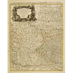
Le Gouvernement General de Languedoc Divisé..
Detailed map of the Southwest of France centred on Toulouse. The map is densely engraved with information with particular emphasis on the fortified cities, which are coll...
Date: Amsterdam c. 1745
Selling price: ????
Please login to see price!
Sold
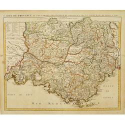
Carte de Provence et des Terres Adjacentes.
Topographically detailed map of the region of Provence in south-eastern France. Relief shown pictorially.The map is from a Dutch edition of De L'Isle's work entitled, Atl...
Date: Amsterdam c. 1745
Selling price: ????
Please login to see price!
Sold
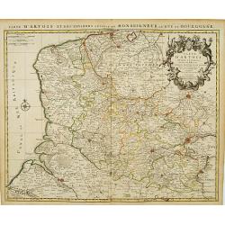
Carte D'Artois ET Des Environs..
Topographically detailed regional map of the Artois region in northern France. The map extends from Dunkirk and Abeville in the West to Doui, Cambrai and Lille in the Eas...
Date: Amsterdam c. 1745
Selling price: ????
Please login to see price!
Sold
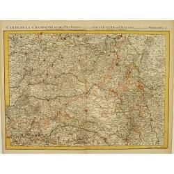
Carte De La Champagne et des Pays Voisins.. Chalons.. Soissons &c.
Very detailed, topographical map of Champagne and surrounding regions of Chalons and Soissons, Reims, Vedun, Mouzon, Sean, Charlemont, etc. Showing fortified cities, road...
Date: Amsterdam c. 1745
Selling price: ????
Please login to see price!
Sold
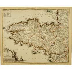
Duché et gouvernement General de Bretagne Divisé..
Highly detailed map of Brittany, in north-western France. Beautifully engraved with a decorative title cartouche depicting Poseidon and Hermes, a compass rose and table o...
Date: Amsterdam c. 1745
Selling price: ????
Please login to see price!
Sold
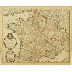
Carte De France Dressée pour l'usage du Roy..
Beautifully engraved, detailed general map of France, illustrating towns, roads, rivers, forests, etc. Embellished by 2 decorative cartouches: a title cartouche surmounte...
Date: Amsterdam c. 1745
Selling price: ????
Please login to see price!
Sold
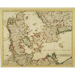
Carte Du Royaume De Danemarc..
Beautifully engraved, highly decorative map showing all of Denmark and southern Sweden, extending north to Warberg.The map is from a Dutch edition of De L'Isle's work ent...
Date: Amsterdam c. 1745
Selling price: ????
Please login to see price!
Sold
![Cartes Des Courones Du Nord Qui Comprend les Royaumes de Danemark, Suede & Nowege, &c.. [and] Seconde Carte des Courones du Nord..](/uploads/cache/21528-250x250.jpg)
Cartes Des Courones Du Nord Qui Comprend les Royaumes de Danemark, Suede & Nowege, &c.. [and] Seconde Carte des Courones du Nord..
Large, highly detailed two sheet map of Scandinavia. Beautifully engraved with a decorative title cartouche and 2 compass roses.Shows illustrated topography with roads, r...
Date: Amsterdam, c. 1745
Selling price: ????
Please login to see price!
Sold in 2009
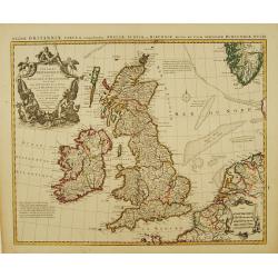
Les Isles Britanniques ou sont le Royaumes d'Angleterre.. d'Ecosse.. d'Irlande..
Beautifully engraved, decorative map of the British Isles. Detailed to show towns, roads, rivers, lakes, counties, etc. Embellished with a decorative distance scale and a...
Date: Amsterdam c. 1745
Selling price: ????
Please login to see price!
Sold
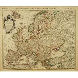
Carte d'Europe Dressée pour l'Usage du ROY..
Beautifully engraved map of Europe. Detailed to show towns, roads, rivers, lakes, counties, etc. Embellished with a decorative title cartouche surmounted by the French cr...
Date: Amsterdam c. 1745
Selling price: ????
Please login to see price!
Sold
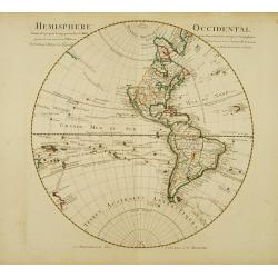
Hemisphere occidental Dresse en 1720..
Beautifully engraved, large map of the Western Hemisphere. Navigators' tracks and many south Pacific islands shown, less details in north Pacific. New Zealand is shown wi...
Date: Amsterdam c. 1745
Selling price: ????
Please login to see price!
Sold
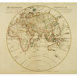
Hemisphere oriental Dressé en 1720..
Beautifully engraved, large map of the Eastern Hemisphere. Shows the tracks of the voyages of Halley and Abel Tasman.The map is from a Dutch edition of De L'Isle's work e...
Date: Amsterdam, c. 1745
Selling price: ????
Please login to see price!
Sold
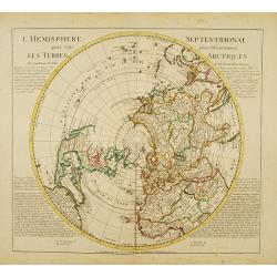
L'Hemisphere Septentrional pour voir plus distinctement les Terres Arctiques.
Decorative map depicting from the northern pole to the Equator with good detail, and showing all the political divisions. California is correctly shown as a peninsula wit...
Date: Amsterdam, c. 1745
Selling price: ????
Please login to see price!
Sold
Le Cours du Rhin au dessus de Strasbourg et les Païs Adjacens.
Large, detailed map illustrating part of the flow of the river Rhine. It particularly depicts the stretch of river marking the natural border between Switzerland, France ...
Date: Amsterdam c. 1745
Selling price: ????
Please login to see price!
Sold in 2016
Le Cours du Rhin depuis Strasbourg jusqu'à Worms et les Païs Adjacens.
Large, detailed map illustrating part of the flow of the river Rhine. It particularly depicts the stretch of river from Strasbourg in the South as far as Worms in the Nor...
Date: Amsterdam c. 1745
Selling price: ????
Please login to see price!
Sold in 2021
Le Cours du Rhin depuis Worms jusqu'à Bonne, et les Païs Adjacens.
Large, detailed map illustrating part of the flow of the river Rhine. It particularly depicts the stretch of river from Worms in the South as far as Bonn in the North Wes...
Date: Amsterdam c. 1745
Selling price: ????
Please login to see price!
Sold in 2021
![Carte du Bourdelois du Perigord.. [and] Carte Du Bearn de La Bigorre de L'Armagnac.. (2 sheets)](/uploads/cache/21538-250x250.jpg)
Carte du Bourdelois du Perigord.. [and] Carte Du Bearn de La Bigorre de L'Armagnac.. (2 sheets)
Large, detailed map of South-western France, encompassing the Aquitaine région (first sheet) and extending to the Spanish Border and Toulouse (second sheet).The map is f...
Date: Amsterdam c. 1745
Selling price: ????
Please login to see price!
Sold
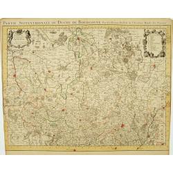
Partie Septentrionale du Duche de Bourgogne..
Large, detailed map of northern Burgundy, covering the region from Bar-sur-Seine in the North to Dijon and Auxonne in the South East. Shows illustrated topography with ma...
Date: Amsterdam c. 1745
Selling price: ????
Please login to see price!
Sold
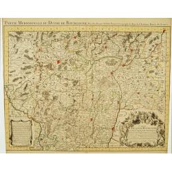
Partie Meridionale du Duche de Bourgogne..
Large, detailed map of northern Burgundy, covering the region from Autun and Dole in the North to Charolles and Mâcon in the South. Shows illustrated topography with man...
Date: Amsterdam c. 1745
Selling price: ????
Please login to see price!
Sold
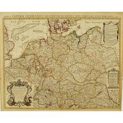
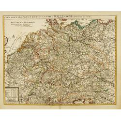
L' Allemagne, Dressee sur les Observations de Tycho-Brahe, de Kepler, de Snellius, sur celles de Messieurs de l' Academie Royale des Sciences &c..
Large, highly detailed map of Germany, including the Netherlands and Belgium. Based on the geography of Nicolas Sanson and Guillaume Delisle, and the observations of Tych...
Date: Amsterdam c. 1745
Selling price: ????
Please login to see price!
Sold
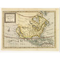
A new map of North America according to the newest observations..
A very fine map of North America, including the West Indies and northern South America.With Straits of Anian and Mozeemlek to north and Gulf of California to east., the B...
Date: London 1745
Selling price: ????
Please login to see price!
Sold
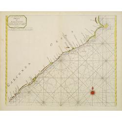
A new chart of the coast of ORIXA and GALCONDA. Carefully corrected and compared with the French charts.
Interesting and detailed navigational chart of southern part of India.
Date: London 1745
Selling price: ????
Please login to see price!
Sold
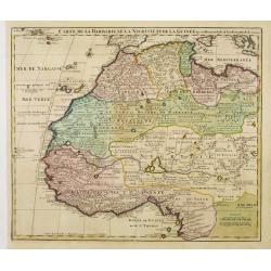
Carte de la Barbarie de la Nigritie et de la Guinée..
Richly engraved map of North and West Africa, based upon the earlier maps of De L'Isle. Richly annotated throughout and with excellent regional detail. It includes the Ca...
Date: Amsterdam c. 1745
Selling price: ????
Please login to see price!
Sold
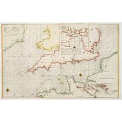
A new and correct chart of the channel between England & France..
The chart includes the South Coast of England from North of the Bristol Channel and of the Thames Estuary, there are insets for Plymouth Sound and the Isle of Wight.
Date: London 1745
Selling price: ????
Please login to see price!
Sold
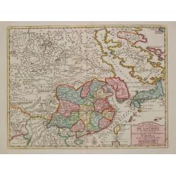
Nouvelle Carte de l'Empire de la Chine et les Païs circomvoisins.
A map of China by Izaak Tirion, also showing Korea and Japan.Isaak Tirion (d. 1769) Amsterdam publisher. His "Nieuwe en beknopte handatlas" saw 6 editions betwe...
Date: Amsterdam, c. 1745
Selling price: ????
Please login to see price!
Sold in 2019
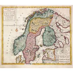
Niewe Kaart van het Koninkrijk Zweden.
Izaak Tirion (d. 1769) Amsterdam publisher. His ' Nieuwe en beknopte handatlas' saw 6 editions between before 1740 and after 1784. Also ' Tegenwoordige staat van alle vol...
Date: Amsterdam, c. 1745
Selling price: ????
Please login to see price!
Sold in 2018
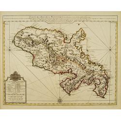
Partie Meridionale du Piemont et du Monferrat..
Map covering the southern part of the Piedmont and the "Riviera di ponente", the sea coast at the east of Genoa. It includes par of France and the Principality ...
Date: Paris 1745
Selling price: ????
Please login to see price!
Sold
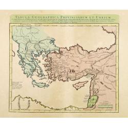
Tabula Geographica Provinciarum et Urbium Colonia Romana..
Covens and Mortier's Map of the Roman World is a copperplate engraving based on an earlier map by Guillelmo De L'Isle (1675-1726)Engraved map in outline color. Relief sho...
Date: Amsterdam c. 1745
Selling price: ????
Please login to see price!
Sold in 2012
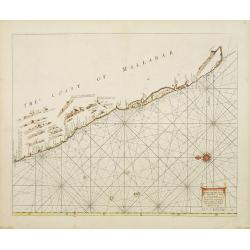
A Large Draught of the Mallabar Coast..
Important chart of the coast centred on Calcutta. From the East India Pilot . Detailed map with compass roses and system of rhumb lines, soundings and anchorage's. Many p...
Date: London 1745
Selling price: ????
Please login to see price!
Sold
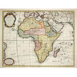
Carte d' Afrique Dressée pour l' usage du Roy?1722.
Guillaume de l' Isle (1675-1724), Royal Geographer, was the most influential French cartographer of the first quarter of the 18th century. ' Atlas de Géographie' (1700-1...
Date: Paris, Ph.Buache, 1745
Selling price: ????
Please login to see price!
Sold in 2008
Carte de la Louisiane et du Cours du Mississipi Dressée sur un grand nombre de Memoires..
Covens & Mortier's issue of Delisle's influential map of the French possession of Louisiana. Updated to include New Orleans.When originally published in 1718, it was ...
Date: Amsterdam c. 1745
Selling price: ????
Please login to see price!
Sold