Browse Listings in Asia
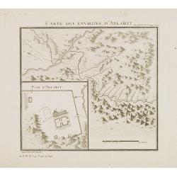
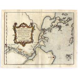
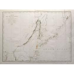
Carte des environs d'Ablaïkit.
Map from a second French edition of Peter Simon Pallas' Voyages du Professeur Pallas, dans Plusieurs Provinces de l’Empire de Russie et dans l’Asie Septentrionale, en...
Date: Paris, Maradan, 1794
Selling price: ????
Please login to see price!
Sold in 2012
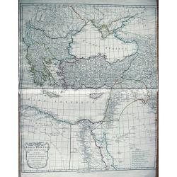
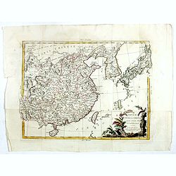
Orbis Romani pars Orientalis
Large map of the Eastern Roman Empire. Extends from Greece to Babylonia, Arabia and Armenia. Includes Thebes in Egypt, the eastern part of the Mediterranean, and the Blac...
Date: London, 1794
Selling price: ????
Please login to see price!
Sold in 2013
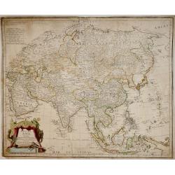
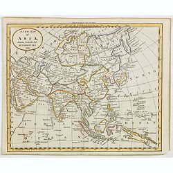
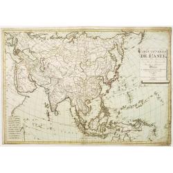
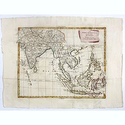
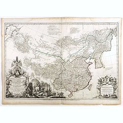
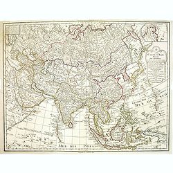
Mapa de Asia : Dividido según la extensión de sus Estados : Formado con los mejores Mapas y documentos nacionales, y sujeto a las observaciones Astronomicas / Por D. Tomás Lopez, Geografo de los Dominios de S.M. de la Academia de S. Fernando
Rare highly detailed map of Asia by Tomás López, from Arabia to tip of Canada and from Russia to Indonesia. In lower left corner, ornate baroque cartouche with animals ...
Date: Madrid, 1794
Selling price: ????
Please login to see price!
Sold in 2013
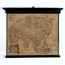
Mapa de Asia Dividido según la extensión de sus Estados : Formado con los mejores Mapas y documentos nacionales, y sujeto a las observaciones. . .
Fine wall map of Asia from the Black Sea and Arabia to Japan including part of New Guinea. Includes scales. Note: "Se hallará este con las otras partes del Mundo, e...
Date: Madrid, 1794
Selling price: ????
Please login to see price!
Sold in 2016
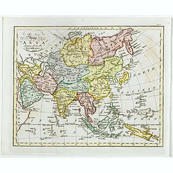
A New Map of Asia, Drawn from the best Authorities 1791.
Attractive map of Asia from "The General Gazetteer or Compendious Geographical Dictionary" by R. Brookes.The map is of interest for the use of Sea of Korea, for...
Date: London, 1794
Selling price: ????
Please login to see price!
Sold in 2015
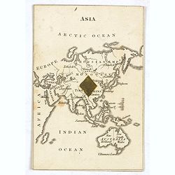
ASIA. (with Australia - Cartographic playing card)
A very rare cartographic playing card (sold as a single, individual card only) featuring an engraved map of Asia and Australia, being the ‘1 of Diamonds’, with one Di...
Date: London, 1794
Selling price: ????
Please login to see price!
Sold in 2015
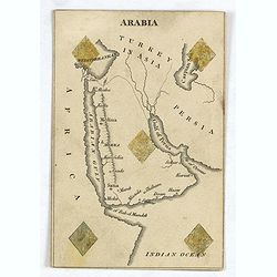
ARABIA ( Cartographic playing card)
A very rare cartographic playing card (sold as a single, individual card only) featuring an engraved map of Arabia, being the ‘5 of Diamonds’, with five Diamonds sten...
Date: London, 1794
Selling price: ????
Please login to see price!
Sold in 2016
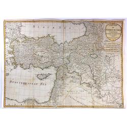
A New Map of Turkey in Asia...
A stunning large format, double page map of Turkey in Asia from Anatolia in the west to Persia in the east, by the French cartographer and geographer J. B. d'Anville. Th...
Date: Paris, 1794
Selling price: ????
Please login to see price!
Sold in 2016
The Bay of Tricoenmale or Trinkili-Male, on the East Coast of Ceylon. (together with) Plan of Venlos Bay, on the East Coast of Ceylon.
Nautical chart of the Tricoenmale or Trinkili-Male (Trincomalee) Bay and the Venlos (Vandelous) Bay on the east coast of Sri Lanka or Ceylon.Two charts on a single sheet,...
Date: London, 1794
Selling price: ????
Please login to see price!
Sold in 2016
Calpentyn Road, on the West Coast of Ceylon. The East Coast of Ceylon, from Venlos Bay to Batecalo, with the Banks, Rocks, Soundings & ca.
Two nautical charts on one sheets, originally prepared by the Dutch publisher Van Keulen. The upper chart of Calpentyn Road, on the West Coast of Ceylon. (255x257mm.)The ...
Date: London, 1794
Selling price: ????
Please login to see price!
Sold in 2020
Asia, divided into its principal states and regions, with all the islands and the new discoveries made by the English and the Russians in the eastern parts.
A detailed map of Asia.The map is of interest for the use of Gulf of Corea, for the sea between Korea and Japan.
Date: London, 1794
Selling price: ????
Please login to see price!
Sold in 2016
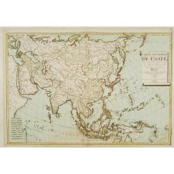
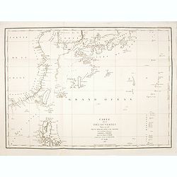
Carte générale de Asie, ou se trouvent le Découvertes des Isles, de Bougainville, surville et Dampierre..
Rare map of Asia, prepared by Hérisson after R.Bonne. Showing the tracks of Captain James Cook, and improvements after Bougainville and Dampier.
Date: Paris 1795
Selling price: ????
Please login to see price!
Sold
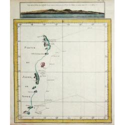
Gedeelt van Japan of Nipon / Gezigt van de Kust van Japan.
Captain James Cook (1728-79), explorer, circumnavigator and hydrographer. Three voyages, 1768-71, 1772-75 and 1776-79. From 1778 on printed editions of ' Captain Cook's T...
Date: Amsterdam, 1795
Selling price: ????
Please login to see price!
Sold in 2019
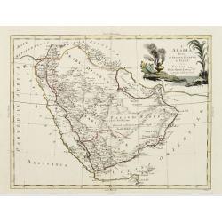
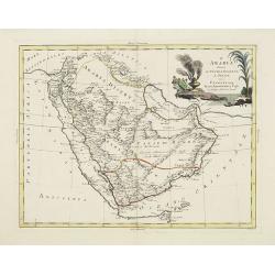
L'Arabia divisa in Petrea, Deserta e Felice.
A very striking map of the Arabian Peninsular, engraved by G.Pitteri embellished with an colored pictorial title cartouche. This edition with the date 1795.Antonio Zatta ...
Date: Venice, 1795
Selling price: ????
Please login to see price!
Sold
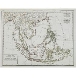
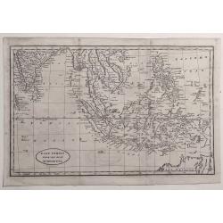
Presqu\'Île au dela du Gange et Archipel de l\'Inde.
Detailed map of Indonesia.
Date: Paris, ca 1795
Selling price: ????
Please login to see price!
Sold in 2008
L'Arabia divisa in Petrea, Deserta e Felice.
A very striking map of the Arabian Peninsular, engraved by G.Pitteri embellished with an colored pictorial title cartouche.
Date: Venice, 1795
Selling price: ????
Please login to see price!
Sold in 2014
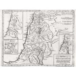
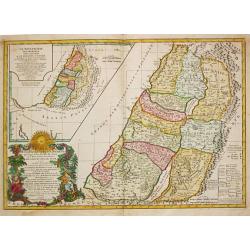
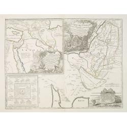
Palaestina.
Highly detailed map of the Holy Land with insert of Tribus and Jerusalem and distance scale.
Date: London, 1795
Selling price: ????
Please login to see price!
Sold in 2012
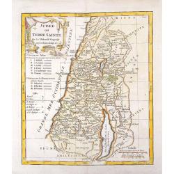
Judee ou Terre Sainte.
Copper engraved, hand-colored map of present day Istael and Jorden. It shows the 12 tibes, the six provinces under Herod and the 3 Roman provinces. The map was engraved b...
Date: Paris, 1795
Selling price: ????
Please login to see price!
Sold in 2017
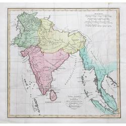
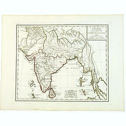
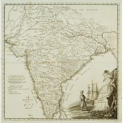
India Antiqua, auctore D'Anville...
Large scale map of India and Siam, extending to the Strait of Malacca and the area of today's Singapore. With several place names, rivers, islands, and mountain ranges sh...
Date: London, c1795
Selling price: ????
Please login to see price!
Sold in 2016
Carte de la Baye d'Hocsieu et des Entres de la Riviere de Chang Situees dans la Province de Fokyen.
Detailed regional map of China. A detailed little chart of the estuary of the Chiang River at present-day Fu-chou in the province of Fukien, adjacent to the island of Ta...
Date: Amsterdam, 1795
Selling price: ????
Please login to see price!
Sold in 2016
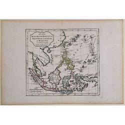
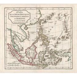
Les Isles de la Sonde, Moluques, Philippines, Carolines et Marianes Par Robert de Vaugondy.
From the atlas Nouvel Atlas Portatif destiné principalement à la jeunesse d'après la Géographie Moderne de l'Abbé Delacroix, published by Felix Delamarche, in Paris....
Date: Paris, 1795
Selling price: ????
Please login to see price!
Sold in 2017
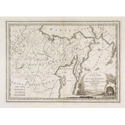
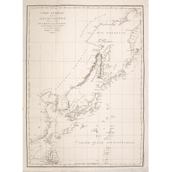
La Parte Orientale della Russia Asiatica Delineata Sulle Ultime Osservazioni. . .
Uncommon map of Tartary and Bering Street with western Alaska, includes Aleutians, but lacking detail. With page number Volume 2, No. 66 in upper right corner. From Cassi...
Date: Rome, 1796
Selling price: ????
Please login to see price!
Sold in 2015
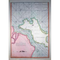
Plan of the Straits of Banca...
Rare nautical from "The country East-India Pilot" published in 1799 by Laurie & Whittle.A fantastic copper engraved map of Isle of Banca and part of Sumatr...
Date: London, 1796
Selling price: ????
Please login to see price!
Sold in 2011
Les Isles de la Sonde, Moluques, Philippines, Carolines, et Mariannes.
Map of East Asia and Indonesia.
Date: Paris, 1796
Selling price: ????
Please login to see price!
Sold in 2011
Karte des Arabischen Meerbusens oder der Rotten Meeres. . .
An attractive map of the Red Sea with insets of the north-west arm of the Red Sea and the port of Suez.. Engraved by H. Benedict.Franz Johann Josef von Reilly (Vienna 18 ...
Date: Vienna, 1796
Selling price: ????
Please login to see price!
Sold in 2018
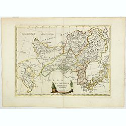
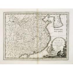
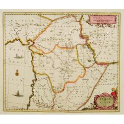
La Tartaria Chinese. Siena 1796 Presso Pazzini Carli.
Rare map of Tartary, with Korea and Japan published by Carli Pazzini in Siena and included in " Atlante Geografico, prima stesura delle opera dell’abate Bartolomeo...
Date: Siena, 1796
Selling price: ????
Please login to see price!
Sold in 2015
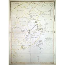
Carte de la Route que l'ambassade Anglais a Suive en Allant de Hang-Tchou-fou a Qhang-Tchou-Fou ou canton en Chine
A copper engraved map of a journey from Hang-Tchoo-Foo to Quang-Tchoo-Foo. Published in Stauton's "AN AUTHENTIC ACCOUNT OF AN EMBASSY FROM THE KING OF GREAT BRITAIN ...
Date: Paris, 1796
Selling price: ????
Please login to see price!
Sold in 2018
Impero delle China colle isole del Giappone. . .
A very striking map of China, Korea, Taiwan and Japan embellished with an colored pictorial title cartouche flanked by flowers and a bird. This is the uncommon edition wi...
Date: Venice, 1795-1796
Selling price: ????
Please login to see price!
Sold in 2016
Le Indie Orientali E Il Loro Arcipelago . . .
Striking map of the region from the Gulf of Bengal to Hainan, centered on the Malay Peninsula, Straits of Malacca, Sumatra, Java and Philippines.This is the uncommon edit...
Date: Venise, 1794-1796
Selling price: ????
Please login to see price!
Sold in 2017
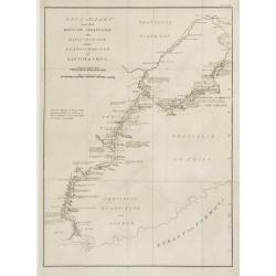
Sketch of A Journey from Hang-Tchoo-Foo ...
A detailed map taken from, from Staunton's 'An Authentic Account of an Embassy from the King of Great Britain to the Emperor of China'.
Date: London, 1796
Selling price: ????
Please login to see price!
Sold in 2018
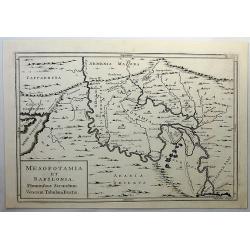
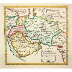
Mesopotamia et Babylonia, Fluminibus Secondum. . .
A fine copperplate map of present day Iran, Iraq, Afghanistan, Armenia and Arabia by Cellarius in 1796. It shows details including mountains. Engraved by W.H. Toms.Andrea...
Date: Amsterdam, 1796
Selling price: ????
Please login to see price!
Sold in 2019
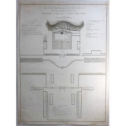
Plan of the Hall of Audience and the Adjacent Courts in the Emperor's Gardens at Yuen-min-Yuen.
A striking copper engraving from an important eighteenth century series on China by William Alexander. From Sir George Leonard Staunton's An Authentic Account of an Emba...
Date: London, 1796
Selling price: ????
Please login to see price!
Sold in 2019
A Chart, on Mercator's Projection, Containing the Track and Soundings of the Lion, the Hindostan and Tenders, from Turon-Bay in Cochin-China. . .
A chart engraved by Baker and published by Nichol, this large chart traces the routes of the Lion, Hindostan, and Tenders with considerable detail. The chart was part of...
Date: London, 1796
Selling price: ????
Please login to see price!
Sold in 2020
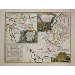
TERRE de CHANAAN ou Terre Promisse a Abraham Et sa Posterité./ CARTE des VOIAGES D' ABRAHAM
Charles François Delamarche (1740-1817), Paris-based geographer and publisher, successor to Didier Robert de Vaugondy after his death in 1786.A map of Palestine and a ma...
Date: Paris, 1797
Selling price: ????
Please login to see price!
Sold
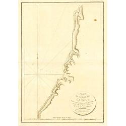
Plan de la Baie de Langle, situee a la partie Ouest de l' Isle de Choka
Jean François Galoup, Comte de la Pérouse (1741-88), outstanding French explorer and hydrographer. ' Voyage autour du Monde?Atlas', 1797.A map of the bay of Langle on C...
Date: Paris, 1797
Selling price: ????
Please login to see price!
Sold in 2009
CARTE DE LA TERRE DES HEBREUX ou ISRAELITES / LA MONARCHIE DES HEBREUX SOUS SALOMON.
Charles François Delamarche (1740-1817), Paris-based geographer and publisher, successor to Didier Robert de Vaugondy after his death in 1786.A map of Palestine as divid...
Date: Paris, 1797
Selling price: ????
Please login to see price!
Sold
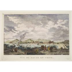
Vue de Macao en Chine.
Jean François Galoup, Comte de la Pérouse (1741-88), outstanding French explorer and hydrographer. ' Voyage autour du Monde?Atlas', 1797.An attractive view of Macao.
Date: Paris, 1797
Selling price: ????
Please login to see price!
Sold
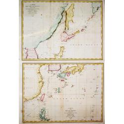
Carte des découvertes Faites en 1787 dans les Mers de Chine et de Tartarie, 1e Feuille/ 2e Feuille.
Two charts together depicting the waters of East Asia. By Jean François Galoup, Comte de la Pérouse (1741-88), outstanding French explorer and hydrographer, who publish...
Date: Paris, 1797
Selling price: ????
Please login to see price!
Sold in 2016
Carte des découvertes.. 1787.. Et Manille..
La Pérouse's important large-scale chart of Northern Japan, Hokkaido, the Kuriles and the tip of Korea and Kamschatka.Published in the Atlas volume that accompanied the ...
Date: Paris 1797
Selling price: ????
Please login to see price!
Sold in 2010
Terre de Chanaan, ou Terre promise à Abraham et à sa Posterité . . .
Two maps on one sheet. With a map of Palestine and a map of the Near Eas with a title cartouche "Carte des voiages d'Abraham faits par l'ordre de Dieu, en Asie et en...
Date: Paris, ca. 1797
Selling price: ????
Please login to see price!
Sold in 2010
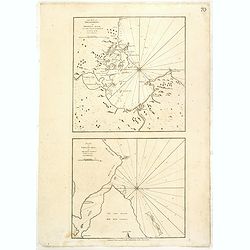
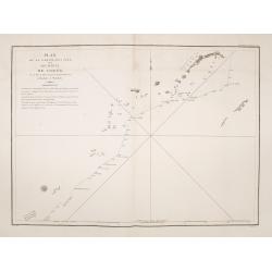
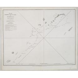
Plan de la partie de l'ile de quelpaert. . . / Plan de l'ile Hoapinsu. . . / Plan de l'ile Dagelet. . . / Plan de la partie de l'ile de Botol. . . / Plan de l'ile de Kumi. . .
Five plans on a folio sheet. These charts include Cheju Do, Korea (Quelpaert Is.), Kume-Shiwa, Okinawa (Kumi), and Ullung Do (Dagelet).Including one of the earliest maps ...
Date: Paris, 1797
Selling price: ????
Please login to see price!
Sold in 2011
Carte Generale des Decouvertes Faites en 1787 dans les Mers de Chine et de Tartarie ou depuis Manille jusqu'a Avatsch. . .
La Pérouse's important depicting his track from the northern tip of the Philippines along China, Taiwan, Korea, Japan, Hokkaido, the Kuriles and the tip of Kamtschatka....
Date: Paris, 1797
Selling price: ????
Please login to see price!
Sold in 2014
Carte des decouvertes, faites en 1787 dans les mers de Chine et de Tartarie, par les Fregates Francaises la Boussole et l'Astrolabe, depuis leur depart de Manille jusqu'à leur arrivee au Kamtschatka. 1ere. feuille.
La Pérouse's important chart depicting the discoveries he made in 1787 in the seas of China and Tartary. The travels are charted from the Philippines to the south of Tai...
Date: Paris, 1797
Selling price: ????
Please login to see price!
Sold in 2015
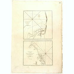
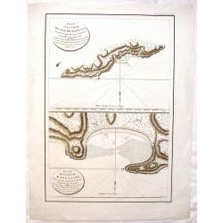
Plan de la partie des iles, ou archipel de Coree, vue au mois de Mai 1787 par les Fregates Francaises la Boussole et l'Astrolabe. . . .
Showing the track of La Perouse along the southern most tip of Korea, with Quelpaerts Islands (now-a-days called Jeju, with the vulcano Halla-san (Halla Mountain) clearly...
Date: L'Imprimerie de la Republique, An V, 1797
Selling price: ????
Please login to see price!
Sold in 2014
Plan D'une Partie de l'Isle de Maouna & Plan de L'Anse du Massacre.
Two chart maps on one page featuring areas of Anerican Samoa. It is from "ATLAS DU VOYAGE DE LA PEROUSE". Perouse set sail from France in 1785 to continue the d...
Date: Paris, 1797
Selling price: ????
Please login to see price!
Sold in 2017
Carte des découvertes, faites en 1787 dans les mers de Chine et de Tartarie, par les Fregates Francaises la Boussole et l'Astrolabe, depuis leur depart de Manille jusqu'à leur arrivee au Kamtschatka. 2e. Feuille
Important large sea chart of eastern Russia with a part of Korea, Hokkaido, Sakhalinsk, the Kuril Islands, and the Sea of Okhotsk. Shows the route and dates of the explor...
Date: Paris, 1797
Selling price: ????
Please login to see price!
Sold in 2015
Plan de la partie des Îles, ou Archipel de Corée, Vue au Mois de Mai 1787 par les Frégates Francaises la Boussole et l'Astrolabe.
La Pérouse's important and detailed sea-chart showing the route of his ships the Boussoule & Astrolabe between the South Korean island of Jeju (here called Ile Quelp...
Date: Paris, 1797
Selling price: ????
Please login to see price!
Sold in 2016
A New Map of Asia, Drawn from the Best Authorities 1797.
Attractive and uncommon map of Asia published by Thomas Cadell (1742–1802) who was a successful 18th-century English bookseller, who published works by some of the most...
Date: London, 1797
Selling price: ????
Please login to see price!
Sold in 2020
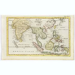
East Indies.
A lovely little late nineteenth century copperplate map of the East Indies.
Date: London, ca. 1797
Selling price: ????
Please login to see price!
Sold in 2017
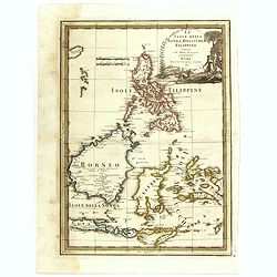
Le Isole della Sonda, Molluche, e Filippine delineate sulle ultima osservazioni.
First edition on laid paper. Cassini’s splendid early map of Philippines, Brunei, Celebes, Moluccas, Java and Timor, with large decorative title cartouche.This is one o...
Date: Rome, 1797
Selling price: ????
Please login to see price!
Sold in 2018
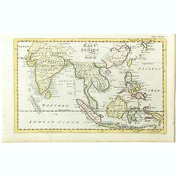
East Indies.
A lovely little late nineteenth century copperplate map of the East Indies. Showing India, Burma, Thailand, Cambodia, Laos, Malaysia, Indonesia, Borneo, Papua New Guinea,...
Date: London, ca. 1797
Selling price: ????
Please login to see price!
Sold in 2018
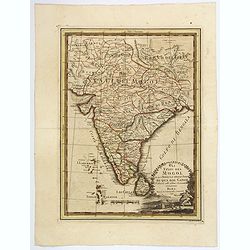
Gli Stati del Mogol e la Penisola delle Indie di qua dal Gange.
Cassini's lovely map of the Mogol States in India, published in: Nuovo atlante geografico universale delineato sulle ultime osservazioni in Rome. As well as a strong, dec...
Date: Rome, 1797
Selling price: ????
Please login to see price!
Sold in 2018
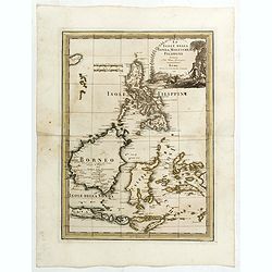
Le Isole della Sonda, Molluche, e Filippine delineate sulle ultima osservazioni.
First edition on laid paper. Cassini’s splendid early map of Philippines, Brunei, Celebes, Moluccas, Java and Timor, with large decorative title cartouche.This is one o...
Date: Rome, 1797
Selling price: ????
Please login to see price!
Sold in 2020
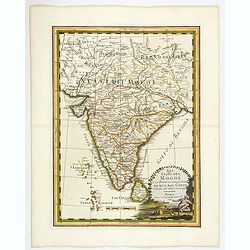
Gli Stati del Mogol e la Penisola delle Indie di qua dal Gange.
Cassini's large and lovely map of the Mogul States of India, published in: Nuovo atlante geografico universale in Rome. As well as a strong, decorative title cartouche, t...
Date: Rome, 1797
Selling price: ????
Please login to see price!
Sold in 2019
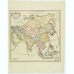
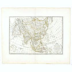
Present Asia.
A fully colored map of the continent of Asia from An Universal Atlas Consisting of a Complete Set of Maps, peculiarly adapted to illustrate and explain ancient and modern...
Date: London, 1797
Selling price: ????
Please login to see price!
Sold in 2019
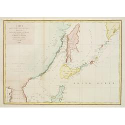
Carte des Découvertes Faites en 1787 dans les Mers de Chine et de Tartarie par les Frégates Françaises la Boußole et l'Astrolabe depuis leur Départ de Manille. . .
A nice large chart of the Asian coast, with parts of Korea, the Russian coast, the Sea of Okhotsk, the Sea of Japan, Hokkaido with unfinished coastline, Sakhalin, and of ...
Date: Paris, 1797
Selling price: ????
Please login to see price!
Sold in 2022
La Cina delineata sulle ultime osservazioni. Roma presso la Calcografia Cam.le, 1798.
Uncommon map of China, Taiwan and Korea, from Giovanni Maria Cassini's "Nuovo Atlante Geografico Universale delineato sulle ultime osservazioni". The Yellow Sea...
Date: Venice, 1798
Selling price: ????
Please login to see price!
Sold in 2009
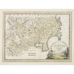
La Tartaria Cinese delineata sulleultime osservazioni.
Uncommon 1798 edition of this map of Chinese Tartary (present-day Mongolia and Manchuria) and Korea by Giovanni Maria Cassini.The map includes good detail of the cities a...
Date: Rome, 1798
Selling price: ????
Please login to see price!
Sold in 2010
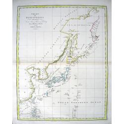
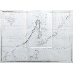
CHART OF DISCOVERIES made in 1787 in the Seas of China & Tartary between Manilla and Avatcha...
Attractive chart showing the area from Kamchatka to the Philippines, including Japan and Korea. With early geography of the islands and coasts, lined with numerous place-...
Date: London, 1798
Selling price: ????
Please login to see price!
Sold in 2010
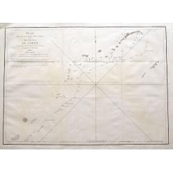
Plan of part of the Islands or Archipelago of Corea.
Showing the track of La Perouse along the southern most tip of Korea, with Quelpaerts Islands (now-a-days called Jeju, with the vulcano Halla-san (Halla Mountain) clearly...
Date: London, G.G. and J.Robinson, 1798
Selling price: ????
Please login to see price!
Sold
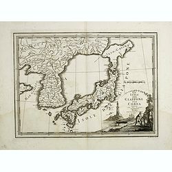
Le Isole del Giappone e la Corea. . .
Japan and Korea, from the "Nuovo Atlante Geografico Universale". With unusual shape of Hokkaido here called "Jeso-Gasima", the semi-mythical island to...
Date: Rome, 1798
Selling price: ????
Please login to see price!
Sold in 2014
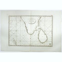
Carte de la partie Méridionale dela presque'isle de L'Inde qui comprend L'Isle de Ceylan. . . 1798.
Large focused on southern part of India and Sri Lanka. Showing villages, banks, isles and soundings made in meters.Chart was prepared by Vice Admiral Rosili and publishe...
Date: Paris, after 1798
Selling price: ????
Please login to see price!
Sold in 2017
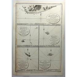
Part of the Island of Quelpaert, Hoapinsu, Dagelet, Botol & Kumi.
A fine copper engraved chart with inserts of the Islands of Quelpaert, Hoapinsu, Dagelet, Botol & Kumi. From Ls Perouse’s ATLAS DU VOYAGE DE LA PEROUSE. Published ...
Date: London, 1798
Selling price: ????
Please login to see price!
Sold in 2018
East Indies from the Best Authorities.
Striking map of the East indies extending from India to the Philippines, including Malaysia, Java, Sumatra, Borneo and the north of New Holland (Australia). Engraved by R...
Date: London, 1798
Selling price: ????
Please login to see price!
Sold in 2021
L' Armenie & Medie.
A map depicting Arabia in ancient times.
Date: London, 1799
Selling price: ????
Please login to see price!
Sold
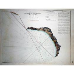
A Plan of the Bay on the South West Side of Pulo Auore...
VERY RARE from "The country East-India Pilot" published in 1799 by Laurie & Whittle. Important copper engraved map of the Bay on this island near Singapor...
Date: London, 1799
Selling price: ????
Please login to see price!
Sold in 2011
Inde Ancienne.
Map of ancient India in attractive out-line color. Shows from modern day Pakistan eastwards and southwards down to Thailand, the Nicobar and the Andaman Islands, includes...
Date: Paris, 1799
Selling price: ????
Please login to see price!
Sold in 2017
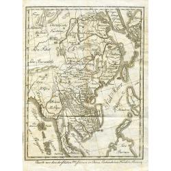
Carte la plus generale et qui comprend la Chine, la Tartarie chinoise et le Tibet. . .
With a quite elaborately pictorial cartouche, engraved by Guelard, the map was engraved by the master engraver Guillaume-Nicolas de la Haye (1727 -1802). Very detailed ma...
Date: Paris, Dezauche, 1789–1799
Selling price: ????
Please login to see price!
Sold in 2018
Syriae sive soriae.
A fine map of Syria showing the Anatolian Mountains to the north, the coastline with Alexandria, Tripoli, Antioch and Tyro in the south. The map extends inland to show th...
Date: Amsterdam 17th
Selling price: ????
Please login to see price!
Sold
Charte von Indostan.
Rare map of India, with imposing title cartouche lower right. Engraved by Gustav Georg Endner (1754-1824).
Date: Leipzig 1800
Selling price: ????
Please login to see price!
Sold
Reis-kaart van het Britsche gezantschap van Hang-choe-foe naar Quang-choe-foe of Kanton in China.
Uncommon map of eastern part of China, showing a journey of the English Embassy from Hangzhou (south of Shanghai) to Guangzhou (Canton). The maps is giving a wealth of in...
Date: Netherlands c.1800
Selling price: ????
Please login to see price!
Sold
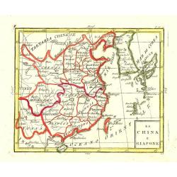
La China e Giapone.
Uncommon map of China, Korea, Japan and Taiwan (I.Formosa), only one town labelled, Tayoan. Very strange shape for Japan.
Date: Italy c. 1800
Selling price: ????
Please login to see price!
Sold
![Vue du sperbe Temple de St.Sophie [. . .] a Constantinople.](/uploads/cache/02982-250x250.jpg)
Vue du sperbe Temple de St.Sophie [. . .] a Constantinople.
A fanciful depiction of the Aya Sofya in Istanbul. In the eighteenth and nineteenth centuries there were many popular speciality establishments in Paris, Augsburg and Lon...
Date: Paris, 1800
Selling price: ????
Please login to see price!
Sold in 2014
![[ A manuscript map of the Arabian Peninsula. ]](/uploads/cache/30264-250x250.jpg)
[ A manuscript map of the Arabian Peninsula. ]
Detailed manuscript map of the Arabian Peninsula, including Bahrain, Oman, etc. To the left the River Nile.The map follows closely the outline by D'Anville, but with an i...
Date: Germany, c. 1800
Selling price: ????
Please login to see price!
Sold
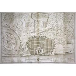
PLAN DE LA VILLE DE PONDICHERI DEDIÉ A LA MÉMOIRE DE Mr. DUPLEIX...
Very large and unusual plan of the city of Pondichéry in India. The map depicts the famous hold-off of the British Navy by Dupleix during the siege in 1748. Large scale...
Date: Paris, ca.1800
Selling price: ????
Please login to see price!
Sold in 2009
Charte von den christlichen Missionen in China, Cochinchina, Tunkin, Siam, etc.
Unusual German map of South-East Asia showing Korea, Japan, China, Taiwan, the Philippines, Borneo, Malaysia, Thailand, Vietnam, Laos, Cambodia, and Myanmar. Most of them...
Date: probably Germany around 1800
Selling price: ????
Please login to see price!
Sold in 2009
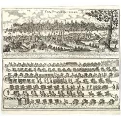
Constantinopolis.
Copper engraving with in top a panoramic view of Constantinople with a numbered key (1-27) and in lower part a the diplomatic convoy of Graf Damian Hugo von Virmondt ente...
Date: Zittau, 1798-1800
Selling price: ????
Please login to see price!
Sold in 2011
Carte de Asie dresse´e pour l'instruction . . . par Guil. Delisle et Phil. Buache ... nouvellement revue et augmentee´ par Dezauche.
Map of Asia. Relief shown pictorially. Small inset map on the upper right corner. Published by Dezauche. Dated 1800.Notable for depiction of Hokkaido, here called "I...
Date: Paris, 1800
Selling price: ????
Please login to see price!
Sold in 2013
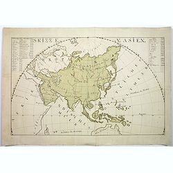
Skizze v. Asien.
A large manuscript map of Asia, includes top of Australia eastern Africa and parts of Europe. With German text. Signed "Katusch", only one other manuscript map,...
Date: ca 1800
Selling price: ????
Please login to see price!
Sold in 2017