Browse Listings in Asia > Near / Middle East
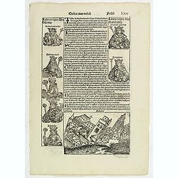
Quinta Etas Mudi. Folium.LXV (Babylon)
The Latin text page is illustrated with an imaginary of the Ancient City of Babylon (Dim. H : 138 mm W : 223 mm).VERSO are portraits of poets and teachers.Page from the ...
Date: Nuremberg, 12 July 1493
Selling price: ????
Please login to see price!
Sold in 2011
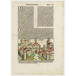
Secunda Etas Mundi. Ninive Folio XX. (With view of city of Ninive, in the northern part of Iraq.)
A imaginary but very nice presentation of the city of Ninive, in the northern part of Iraq. Verso, a genealogy of Nachorve, Job, Bethuel, Rebecca, Caleth, etc. Page from ...
Date: Nuremberg, 12 July 1493
Selling price: ????
Please login to see price!
Sold in 2020
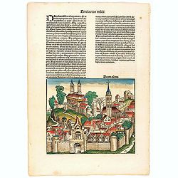
Tercia Etas Mundi. Foliu XXIII. [Damascus and Trier)
The Latin text page is illustrated with a depiction of Damascus in Syria; some have suggested it could represent London (192 x 223mm.) and on recto, a view of the German ...
Date: Nuremberg, 12 July 1493
Selling price: ????
Please login to see price!
Sold in 2023
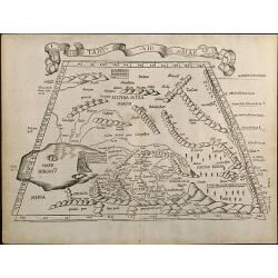
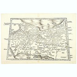
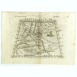
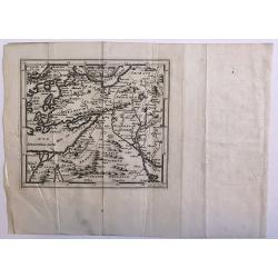
Tabu. VII Asiae
Trapezoidal Ptolemaic woodcut map showing the area around the Caspian Sea. A reduced version of Martin Waldseemullers Ptolemy map from 1513. From the 1525 Strasbourg Edit...
Date: Strasbourg, 1525
Selling price: ????
Please login to see price!
Sold in 2010
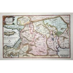
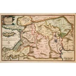
ASIAE TABULA quinta continentur Assyria...
This map covers the territory delimited by the Tigris and the Euphrates rives, the so called Mesopotamia.It extends as far as the borders with Iran, the eastern part of T...
Date: Vienne, 1541
Selling price: ????
Please login to see price!
Sold
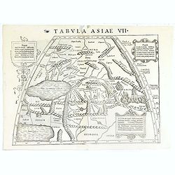
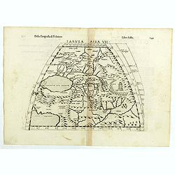
Tabula Asiae VII.
Attractive woodblock map, depicting to the left Persian Gulf and Caspian Sea according to Ptolemy. The mountain ranges are depicted in the manner of the early Ptolemaic f...
Date: Basle, 1542
Selling price: ????
Please login to see price!
Sold in 2019
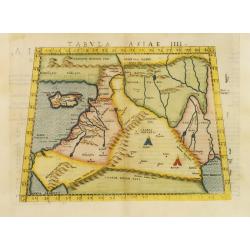
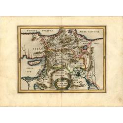
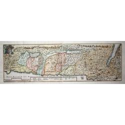
Tabula Asiae IIII.
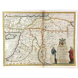
Uncommon first edition of this classical map of the Holy Land, including Cyprus. The map is an enlarged version of Giacomo Gastaldi's published in 1548Girolamo Ruscelli's...
Date: Venice, 1561
Selling price: ????
Please login to see price!
Sold in 2011
![[untitled] Judaea, Chaldaea, Syria, Mesopotamia, Asia Minor, Dioscurias, Mecha, Arabia Felix, Saba et al](/uploads/cache/85878-250x250.jpg)
[untitled] Judaea, Chaldaea, Syria, Mesopotamia, Asia Minor, Dioscurias, Mecha, Arabia Felix, Saba et al
Johannes Honter was a Protestant reformer from Transylvania, mentioned in 1570 by Abraham Ortelius in his ground-breaking atlas. Honter’s 'Rudimentorum Cosmographicorum.....
Date: Zurich, 1564
Selling price: ????
Please login to see price!
Sold in 2021
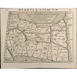
Tabula Asiae V
Woodcut map showing Persia between Persian Gulf and Caspian Sea. From the Latin 1571 edition of Strabo's Geographia with maps of Sebastian Munster which appeared in Ptole...
Date: Basle, 1571
Selling price: ????
Please login to see price!
Sold in 2013
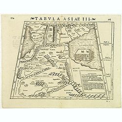
Tabula Asiae III
Attractive woodblock Ptolemaic map, depicting Armenia and in the Right part of the Caspian Sea with Noes Arch. The mountain ranges are depicted in the manner of the early...
Date: Basle, Strabo, 1571
Selling price: ????
Please login to see price!
Sold in 2012
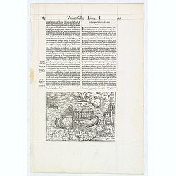
(Arch of Noah.)
Wood block engraved print of the Arch of Noah, from "La Cosmographie Universelle de Tout le Monde", the French and most extended edition of Sebastian Münster's ...
Date: Paris, Nicolas Chesneau, 1575
Selling price: ????
Please login to see price!
Sold in 2014
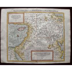
Syria, Cypern, Palestina, Mesopotamia, Babylonia, zwey Arabia mit Bergen, Waesseren und Stetten.
A famous woodblock map of the Near East, including Cyprus, Palestine, Iran, Iraq, etc. From his 'Cosmographia,' that great compendium of Renaissance knowledge. In 1588, n...
Date: Basle, S.H. Petrie, 1588
Selling price: ????
Please login to see price!
Sold in 2014
![[Lot of 11 maps of Persia] Reyno de Persia, o imperia de los Sophies/ Pereici sive Sophorum Regni Ypus](/uploads/cache/18512-(3)-250x250.jpg)
[Lot of 11 maps of Persia] Reyno de Persia, o imperia de los Sophies/ Pereici sive Sophorum Regni Ypus
Abraham Ortelius( 1527-98), Dutch cartographer and publisher of the first modern atlas, ' Theatrum Orbis Terrarum' in 1570. Editions till 1612. Also an atlas of ancient c...
Date: Antwerp, c. 1590
Selling price: ????
Please login to see price!
Sold in 2022
![[Set of 5 maps of the Holy Land: Paradise, Canaan, Israel & Egypt, the Eastern Mediterranean. . .]](/uploads/cache/48407-250x250.jpg)
[Set of 5 maps of the Holy Land: Paradise, Canaan, Israel & Egypt, the Eastern Mediterranean. . .]
A lovely set of biblical maps of the Holy Land and its surrounds and, the Eastern Mediterranean by Cloppenburg, and engraved by Baptista Deuticum. The first map is an ear...
Date: Amsterdam, ca 1590
Selling price: ????
Please login to see price!
Sold in 2022
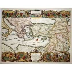
Primae Partis Asiae.
Includes the eastern part of the Mediterranean with Cyprus and Holy Land and the Black Sea with Turkey in between, the northern part of Egypt, Arabia Persia and Afghanist...
Date: Antwerp 1593
Selling price: ????
Please login to see price!
Sold
Natoliam Moderni dicunt tam partem quam Asiam minrem appelauere veteres. (with Cyprus).
Engraved by Van Deutecum, this is a spectacular example of the 1593 edition of the very rare De Jode's map of the Eastern Mediterranean and Asia Minor. It has two title c...
Date: Antwerp, 1593
Selling price: ????
Please login to see price!
Sold in 2014
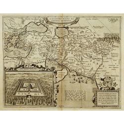
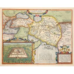
Alexandri Magni Maredonis Expeditio.
Handsomely engraved map of Alexander the Great's Empire at full flower, with a large inset depicting the Temple of the Oracle of Jupiter Amman, supposedly situated in pre...
Date: Antwerp 1595
Selling price: ????
Please login to see price!
Sold
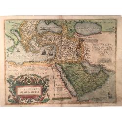
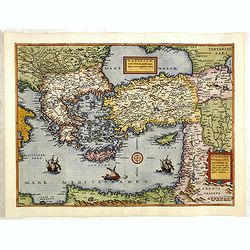
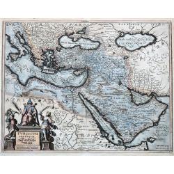
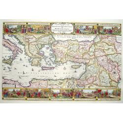
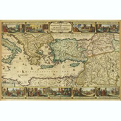
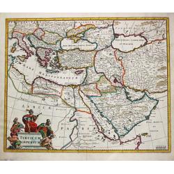
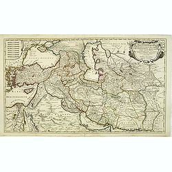
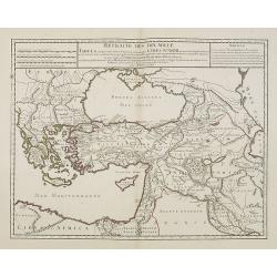
Turcici Imperii Descriptio
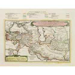
This is the second map by Ortelius depicting the Turkish Empire, based on Ortelius' own map of Asia, derived from the work of Giacomo Gastaldi of 1561. It features the Ar...
Date: Antverpen, ca 1595
Selling price: ????
Please login to see price!
Sold in 2023
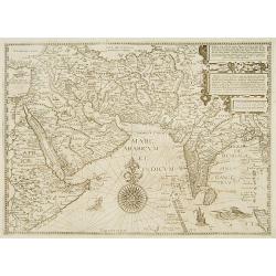
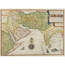
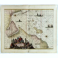
Afbeeldinge der custen van Abex, der engte van Mecha..
A highly decorative and distinctive map showing eastern Africa, Arabia, Persia and India. Around India several manuscript annotations in brown ink. With rhumb lines and d...
Date: Amsterdam 1596
Selling price: ????
Please login to see price!
Sold
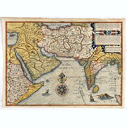
Afbeeldinge der custen van Abex, der engte van Mecha..
A highly decorative and distinctive chart showing eastern Africa, Arabia, Persia and India, with rhumb lines and decorative compass roses in sea areas. A lion, elephant a...
Date: Amsterdam, 1596
Selling price: ????
Please login to see price!
Sold in 2008
Afbeeldinge der custen van Abex, der engte van Mecha..
A highly decorative and distinctive map showing eastern Africa, Arabia, Persia and India, with rhumb lines and decorative compass roses in sea areas. A lion, elephant and...
Date: Amsterdam, after 1596
Selling price: ????
Please login to see price!
Sold in 2014
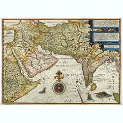
Afbeeldinge der custen van Abex, der engte van Mecha..
A highly decorative and distinctive map showing eastern Africa, Arabia, Persia and India. Around India several manuscript annotations in brown ink. With rhumb lines and d...
Date: Amsterdam, 1596
Selling price: ????
Please login to see price!
Sold in 2017
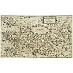
Tabula Asiae III.
The third state of Ruscelli's map of the region between the Black Sea and Caspian Sea extending south to include all of Armenia Maior and part of Armenia Minoris, based u...
Date: Venice, 1598
Selling price: ????
Please login to see price!
Sold in 2018
Tabula Asiae VII.
The third state of Ruscelli's map the region north and east of the Black Sea and Caspian Sea, extending to the Imaus Mountains, based upon Claudius Ptolemy. Showing Caspi...
Date: Venice, 1598
Selling price: ????
Please login to see price!
Sold in 2018
Alexandri Magni Marcedonis Expeditio.
Handsomely engraved map of Alexander the Great's Empire at full flower, with a large inset depicting the Temple of the Oracle of Jupiter Amman, supposedly situated in pre...
Date: Antwerp 1603
Selling price: ????
Please login to see price!
Sold
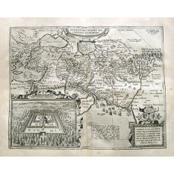
Alexandri Magni Macedonis Expeditio
Detailed map of Alexander the Great's expedition to the Middle East and Persia. The map extends from Greece until east of the Indus river.With a large inset: Iovis Ammoni...
Date: Antwerp, 1603
Selling price: ????
Please login to see price!
Sold in 2019
![[Babylon]](/uploads/cache/90737-250x250.jpg)
[Babylon]
Rare woodcut view of the Tower of Babel, Babylon. From "Parvum Theatrum Urbium sive Urbium Praecipuarum totius orbis Brevis & Methodica Descriptio" by Adria...
Date: Frankfurt, 1608
Selling price: ????
Please login to see price!
Sold in 2009
Alexandri Magni Expeditio.
Early map of travels of Alexander the Great. Including the Near East and a small inset of Eastern part of Turkey.From the first French-text edition of Jodocus Hondius' At...
Date: Amsterdam, 1608
Selling price: ????
Please login to see price!
Sold in 2010
Mesopotamia Syrie.
This scarce map of the Eastern Mediterranean region extends throughout the Middle East and Egypt. Cyprus and the Levantine coasts are clearly detailed with particular att...
Date: Hannover 1611
Selling price: ????
Please login to see price!
Sold
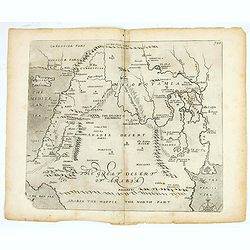
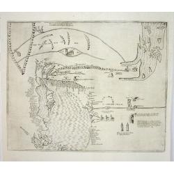
(The great dessert of Arabia)
William Hole's map of the Middle East issued for Sir Walter Raleigh's Historie of the World. The map covers from the Mediterranean and Cyprus to the Persian Gulf and from...
Date: London, 1614
Selling price: ????
Please login to see price!
Sold in 2025
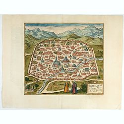
Damascus – Urbs Nobilissima ad Libanum Montem, Totius Syriae Metropolis.
Striking town plan of Damascus shows the fortified walls of the City and various buildings, public squares and other places of interest, with costumed locals and camels i...
Date: Cologne, 1618
Selling price: ????
Please login to see price!
Sold in 2023
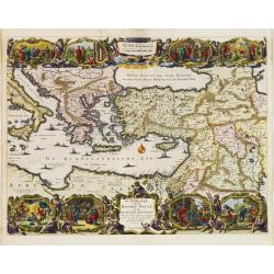
Lumen Historiarum per Orientem.
The Rare Ortelius Middle East map from the 'Parergon.' In the upper right corner is an inset with a world map.The map is surrounded by letterpress explanatory text with p...
Date: Antwerp, 1624
Selling price: ????
Please login to see price!
Sold in 2009
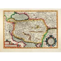
Persici vel Sophorum Regni typus
Hand colored copper map of Persia by G. Mercator. With two beautiful colored cartouche. Covering the area of today Iran with the Caspian Sea and the Persian Gulf. From a ...
Date: Amsterdam, 1628
Selling price: ????
Please login to see price!
Sold in 2011
Turcicum Imperium.
Merian's map of the Turkish Empire, showing the area from Sicily and Italy until the Caspian Sea, the Gulf of Aden, the Red Sea, Socotra Island, and Saudi Arabia.
Date: Frankfurt, ca.1636
Selling price: ????
Please login to see price!
Sold in 2021
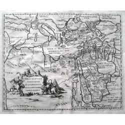
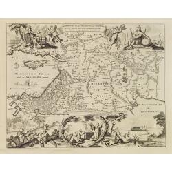
Descriptio terrarum in quasdispersi sunt structores turris Babel.
SCARCE early map of the Mediterranean, the Middle East, and northern Africa. Many areas and coast lines distorted! The Near East is highly detailed with numerous ancient ...
Date: Amsterdam, after1646
Selling price: ????
Please login to see price!
Sold in 2015
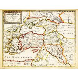
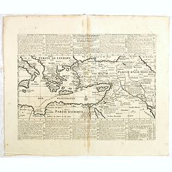
Les Estats de l' Empire des Turqs en Asie.
Nicolas Sanson (1600-67), ' father of the French cartography' and founder of the Sanson firm. Atlas ' Cartes générales de toutes les parties du Monde', 1658-70 and a pock...
Date: Paris, Pierre Mariette, c.1650
Selling price: ????
Please login to see price!
Sold in 2008
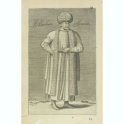
Marchant Armenien (34)
Sought-after copper engraved plate Plate from Laonikos Chalcocondyle’s "L'histoire de la décadence de l'empire grec et establissement de celuy des Turcs." by Th...
Date: Paris, Mathieu Guillemot, 1650
Selling price: ????
Please login to see price!
Sold in 2012
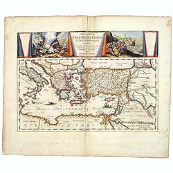
Descriptio Peregrinationis D. Pauli, Apostoli. . .
A striking map of the Mediterranean Sea and its surrounding areas. It depicts the travels of the Apostle St. Paul.The pair of decorative cartouches, presented in a curtai...
Date: Amsterdam, 1650
Selling price: ????
Please login to see price!
Sold in 2017
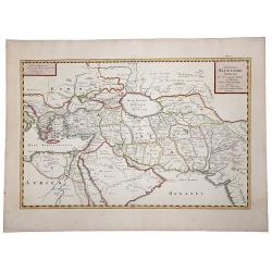
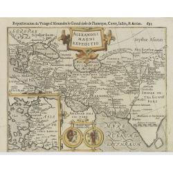
EXPEDITIONS ALEXANDRI MAGNI Per Europam, Assiam et Africam, Tabula Geographica.
A detailed outlined hand-colored map of the region bounded by the Eastern Mediterranean in the West and India in the east, centered on the Arabian Peninsula, Persia and I...
Date: Paris, 1654
Selling price: ????
Please login to see price!
Sold in 2019
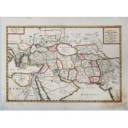
Expeditionis ALEXANDRI MAGNI Per Europa, Asiam et Africam.
Detailed, colored map of the region bounded by the Eastern Mediterranean in the West and India in the east, centered on the Arabian Peninsula, Persia and Iraq.
Date: 1654
Selling price: ????
Please login to see price!
Sold in 2019
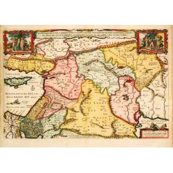
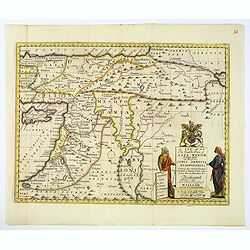
Armenia Syria, Mesopotamia etc.
This little map covers the region between the Black and Caspian Seas in the north, and from Egypt to the Persian Gulf in the south. It is finely engraved to show mountain...
Date: Amsterdam, 1661
Selling price: ????
Please login to see price!
Sold in 2008
Geographifche Beschryvinghe van de Wandeling..
Title: "Geographifche Beschryvinghe van de Wandeling der Apostelen ende De Reysen Pauli"This is an original map from a Dutch bible of 1663 made by Visscher. col...
Date: Amsterdam 1663
Selling price: ????
Please login to see price!
Sold
Geographische Beschryvinghe van de Wandeling der Apostelen ende De Reysen Pauli. . .
A decorative map of the eastern Mediterranean from Rome through Asia Minor and the Holy Land, depicting the route of Apostle Paul, including Italy, Sicily, Cyprus, Turkey...
Date: Amsterdam, 1663
Selling price: ????
Please login to see price!
Sold in 2012
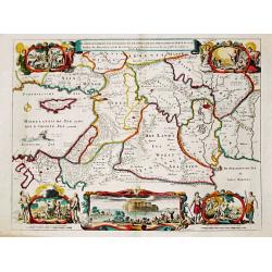
De Gelegenheyt van 't Paradys en 't Landt Canaan, mitsgaders de eerste bewoonde landen der Patriarchen? door Nicolaes Visscher.met Privilege vande Groot Mog: Heeren van Hollandt en West-Frieslandt voor 15 Jaaren. Broeck sculpsit.
Dutch so-called ' Staten' bibles, published between 1637 and c. 1760, contained 5 maps: The World, ' Paradise', The Perigrinations, The Promised Land Canaan, The Travels ...
Date: Amsterdam, 1664
Selling price: ????
Please login to see price!
Sold
Nova Persiae Armeniae Natoliae et Arabiae.
Decorative map of Persia with Cyprus.
Date: Amsterdam, 1670
Selling price: ????
Please login to see price!
Sold in 2010
![[Lot of 2 maps] Perigrinatie ofte Veertich-Jarige Reyse der Kinderen Israëls.](/uploads/cache/20401-(2)-250x250.jpg)
[Lot of 2 maps] Perigrinatie ofte Veertich-Jarige Reyse der Kinderen Israëls.
Perigrinatie ofte Veertich-Jarige Reyse der Kinderen Israëls, Uyt Egypten door de Roode Zee, ende Woestyne, tot in 't Beloofde Land Canaan.Middelantsche Zee in den Bijbel...
Date: Amsterdam, c. 1670
Selling price: ????
Please login to see price!
Sold in 2023
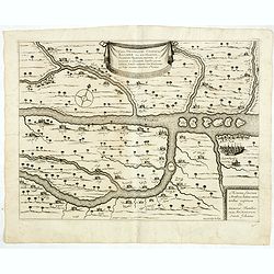
Vera delineatio civitatis Bassoræ : Nec non Fluviorum, Insularum Oppidorum pagorum et terrarum ei adiacentium, inquibus passim habitant familiæ sabaorum Siue Mendaiorum, qui vulgo vocantur christiani sti. Joannis.
Rare map of the Tigris and Euphrates rivers in the area surrounding modern-day Basra published from 1672 onwards in "Relations de Divers Voyages Curieux" by the...
Date: Paris, 1672
Selling price: ????
Please login to see price!
Sold in 2015
Occidentalior Tractus Indiarum Orientalium.
Decorative chart showing the coastlines of the Arabian peninsula with both the Red Sea and Persian Gulf shown in full. Africa from the Cape of Good Hope to Cape Comorin i...
Date: Amsterdam, 1675
Selling price: ????
Please login to see price!
Sold in 2018
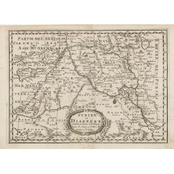
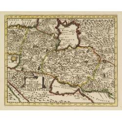
Syrien en Diarbeek verdeelt in hunne Scheidingen.
Engraved map of the Near East, including Cyprus, Palestine, Syria, Iraq, bordered by Greece, Turkey and Iran. The map shows great detail of towns, cities and topography, ...
Date: Utrecht, 1680
Selling price: ????
Please login to see price!
Sold in 2016
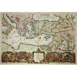
De Beschrijvingh van de Reysen Pauli..
Decorative map with 8 insets depicting the wanders of Paulus and the Apostles. Dutch text on verso. Covers the territory from Sicily in the Mediterranean Sea to the Persi...
Date: Amsterdam 1682
Selling price: ????
Please login to see price!
Sold
Beschryvinge van den Oorsprong der Volkeren, Uit de drie..
A very decorative map of the region from the Mediterranean through to the Persian Gulf, including Cyprus.The map depicts the Garden of Eden, Abraham's route from Ur, and ...
Date: Amsterdam, 1687
Selling price: ????
Please login to see price!
Sold
Turcicum Imperium.
Frederick de Wit (1610-1698) became after the closing of the Blaeu firm one of the most important Amsterdam-based publishers. He published several atlases, Atlas Minor (1...
Date: Amsterdam, 1690
Selling price: ????
Please login to see price!
Sold
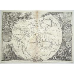
![[Globe gore of the Black Sea, with Russia, Georgia, Cyprus and Gulf of Bassora]](/uploads/cache/29159-250x250.jpg)
[Globe gore of the Black Sea, with Russia, Georgia, Cyprus and Gulf of Bassora]
Half-gore from his 110 centimetres in diameter globe of 1688 with Cyprus, part of Egypt, Saudi Arabia, Crimea, Russia including Ukraine and Moscow. Some of the half-gores...
Date: Venice, 1696
Selling price: ????
Please login to see price!
Sold in 2010
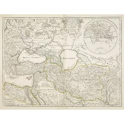
Persia sive Sophorum regnum cum Armenia Assyria Mesopotamia et Babylonia.
Uncommon map of the Near East, including Cyprus, Holy Land, Armenia, etc.
Date: Amsterdam, 1700
Selling price: ????
Please login to see price!
Sold in 2008
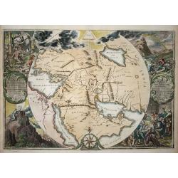
Orbis Per Creationem Institutus.
This is a very unusual map depicting the region from Asia Minor to India and including all of the Arabian Peninsula within a circle. The Garden of Eden is prominently dis...
Date: Amsterdam, 1700
Selling price: ????
Please login to see price!
Sold in 2009
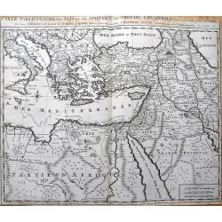
Carte Particuliere des Pais ou Les Apotres ont Preche l'Euan Gile; des Lieux les Plus Renommez de Leurs Voyages, et de la Route de St. Paul a Rome.
Detailed map of the Mediterranean and Middle East, illustrating the travels of St. Paul as he journeyed from Jerusalem to Rome. Very detailed, with numerous place names...
Date: Amsterdam, c1700
Selling price: ????
Please login to see price!
Sold in 2013
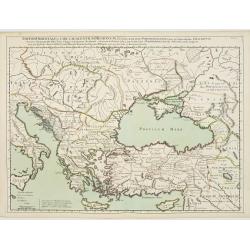
Theatrum Historicum.. Tu Imperii Romani.. Pars Orientalis..
Showing the Eastern part of the Roman Empire, extending from Greece and Cyprus to India and centered on Armenia and the Black and Caspian Seas. Prepared by G. de l'Isle, ...
Date: Paris, 1705
Selling price: ????
Please login to see price!
Sold in 2009
Reys-togt door Thomas Coryat van Jerusalem te Land gedaan na Asmere de Ho-Stadt des Grooten Mogols in Oostindien.
Pieter van der Aa was a prolific publisher. He published a.o. ' Naaukeurige versameling der gedenkwaardigste zee- en land-reysen', a series of accounts of voyages (1706-0...
Date: Leiden, 1707
Selling price: ????
Please login to see price!
Sold
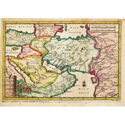
Descriptio Paradisi..
Nice map of the Middle East from the Mediterranean Sea to the Persian Gulf. The Garden of Eden is located in present-day Iraq, near the city of Babylon. Abraham's journey...
Date: Utrecht, 1709
Selling price: ????
Please login to see price!
Sold in 2009
Tabula Geographica Terrae Sanctae Auctore J. Bonfrerio Societa Jesu.
This uncommon map of Israel is by the Flemish theologian, Jacques Bonfrere. Oriented with north at top left, it is divided into the Twelve Tribes with a key at bottom. Th...
Date: Utrecht, 1709
Selling price: ????
Please login to see price!
Sold in 2009
Descriptio Paradisi..
Nice map of the Middle East from the Mediterranean Sea to the Persian Gulf. The Garden of Eden is located in present-day Iraq, near the city of Babylon. Abraham's journey...
Date: Utrecht 1709
Selling price: ????
Please login to see price!
Sold in 2009
Untitled
A rare map of the Middle East region by Medrano. Engraved by Debruslins. Sheet size: 26.9cm x 19.5cm. Map size: 14.9cm x 13cm.
Date: 1709
Selling price: ????
Please login to see price!
Sold in 2016
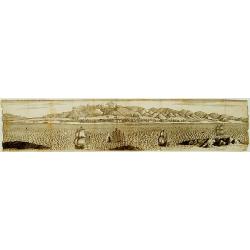
No title.
A fine and rare panoramic view of a town in the Near East. With extensive shipping on the foreground. From the Voyage de M. le Chevalier Chardin en Perse, et autres lieux...
Date: Paris,1710
Selling price: ????
Please login to see price!
Sold in 2012
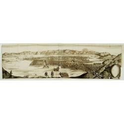
No title.
From the Voyage de M. le Chevalier Chardin en Perse, et autres lieux de l'Orient.Panoramic view of a city in the Near East.
Date: Paris, 1710
Selling price: ????
Please login to see price!
Sold in 2012
A New Map of The Eastern Parts of Asia Minor. . .
A very pleasant map showing eastern Turkey, Cyprus, the Holy Land, Armenia, Lebanon, Syria, and Iraq. Map features a decorative title cartouche, and the heraldic arms of ...
Date: Oxford, ca. 1712
Selling price: ????
Please login to see price!
Sold in 2018
De Beschryvingh van de Reysen Pauli.
Title: De Beschryvingh van de Reysen Pauli en van de andere apostelen.This is an original map from a Dutch Keur bible of 1714. colorful map of the eastern Mediterranean f...
Date: Amsterdam 1714
Selling price: ????
Please login to see price!
Sold
Orbis Per Creationem Institutus. . .
An uncommon Dutch Bible map of the Middle East and Holy Land, including a map of Paradise, a map of the Exodus, a map of Israel divided among the Tribes, a map of Canaan,...
Date: 1715
Selling price: ????
Please login to see price!
Sold in 2010
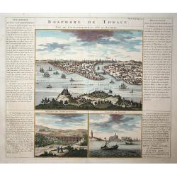
Bosphore de Thrace
This handsome folio sheet present three views of the strategically important Bosporus. At top is a large decorative bird's-eye view of Istanbul as viewed from across the ...
Date: Amsterdam, 1719
Selling price: ????
Please login to see price!
Sold in 2009
The Travels of st. Paul ..
Around 1655 Moxon (1627-1700 ) visited Amsterdam, probably to learn from the Dutch if there was a northern passage to the Indies. In Amsterdam he met father Claes and son...
Date: London 1720
Selling price: ????
Please login to see price!
Sold
De Beschryving van de Rysen Pauli..
Highly decorative map of the eastern part of the Mediterranean. At the bottom are a cartouche and four vignettes with episodes from the travels of the Apostle Paul.
Date: Amsterdam, 1720
Selling price: ????
Please login to see price!
Sold
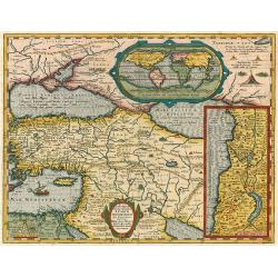
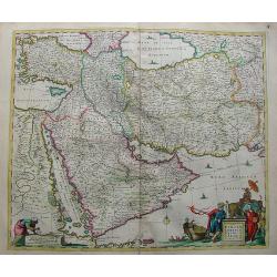
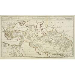
Regnum Persicum Imperium Turcicum in In Asia Russorum Provinciae ad Mare Caspium . . .
Striking map of the region bounded by Cyprus and the Eastern Mediterranean, the Nile, Medina, the Persian Gulf and the Indus River in the south and the Black Sea, Circass...
Date: Amsterdam, 1720
Selling price: ????
Please login to see price!
Sold in 2012
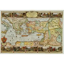
Carte historique et géographique pour servir à l'Histoire Sainte et à la Vocation de Saint Paul, avec quelques remarques curieuses pour servir à l'Histoire des Antiquités judaïques.
Interesting sheet with a map of the travels of Saint Paul, including eastern part of Europe, Asian continent and part of north Africa, with descriptive French text, from ...
Date: Amsterdam, 1720
Selling price: ????
Please login to see price!
Sold in 2016
Imperii Orientalis Circumjacenttium..Constantiono..
Including Greece, Cyprus, Ukraine, Moldavia and the Black Sea.
Date: Paris, 1722
Selling price: ????
Please login to see price!
Sold in 2008
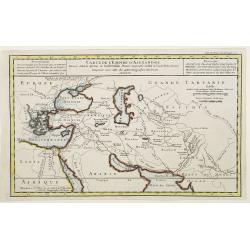
Retraite des Dix Mille Tabula conspectum exhibens Regionum omnium quas Cyrus Junior, Artaxerxi fratibellum illaturus ac Cyro in acie caeso. . .
Depicting ancient Turkey and Greece, including Cyprus, Black Sea, Iraq and Persia.
Date: Paris, 1723
Selling price: ????
Please login to see price!
Sold in 2008
De Gelegentheyt van t' Paradys en t' Landt Canaan, mitsgaders d' eerst bewoonde Landen der Patriarchen.
Dutch so-called ' Staten' bibles, published between 1637 and c. 1760, contained 5 maps: The World, ' Paradise', The Perigrinations, The Promised Land Canaan, The Travels ...
Date: Amsterdam, Pieter en Jacob Keur, 1729
Selling price: ????
Please login to see price!
Sold
Carte de l'Empire d'Alexandre dressée Selon le Systeme de Guill. Delisle..
Fine map showing the territory conquered by Alexander the Great.
Date: Paris 1731
Selling price: ????
Please login to see price!
Sold
Alexandri Magni Imperium et Expeditio..
Uncommon map of the Empire and travels of Alexander the Great. .The map is printed from two sheets.
Date: Paris, 1731
Selling price: ????
Please login to see price!
Sold in 2009
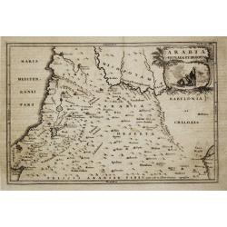
Arabia Petraea et Deserta.
Christoph Cellarius (1638-1707). Geographia Antiqua, 1686
Date: Leipzig, Gledisch, 1732
Selling price: ????
Please login to see price!
Sold
A New Map of the Eastern Parts of Asia Minor. Largely taken: As also of Syria, Armenia, Mesopotamia & c.
An interesting map of the Ottoman region from Eastern Turkey to the western shore of the Caspian Sea, and south to the Arabian Desert and Persian Gulf. Includes the moder...
Date: London, 1738
Selling price: ????
Please login to see price!
Sold in 2016
Typus Aetiologicus II.
Map covering the Middle East from the Eastern Mediterranean to the borders of India. Outline coloring shows the political division of the region under Seleucos I.
Date: Nuremberg 1739
Selling price: ????
Please login to see price!
Sold in 2008
