Browse Listings in Europe
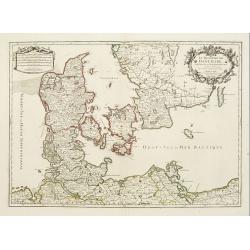
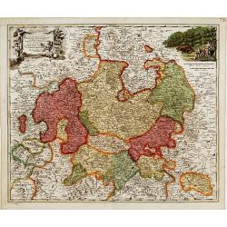
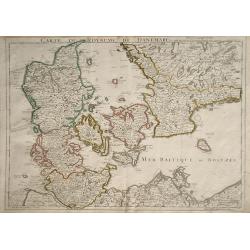
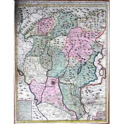
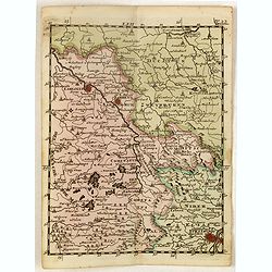
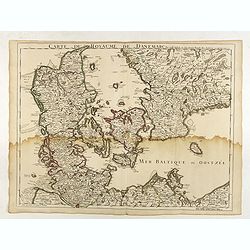
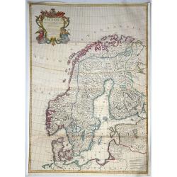
Le Royaume de Danemark subdivisé en ses Principales Provinces..
Handsome map of Denmark and part of Sweden. The map is extremely detailed with rivers, forests, cities and villages. The map is adorned with a striking cartouche flanked ...
Date: Paris, 1709
Selling price: ????
Please login to see price!
Sold in 2008
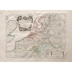
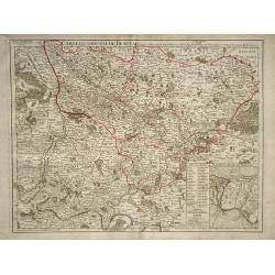
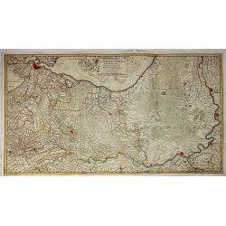
Les Dix-Sept Provinces des Pays-Bas, suivant qu\'elles sont possedees par les Roys de France et d\'Espagne et les Estates Generaux des Provinces-Unies
Map of the 17 provinces of the Low Countries, the territories grouped by the dukes of Burgundy and Emperor Charles V in the early 16th century, includes present day Belgi...
Date: Paris, 1709
Selling price: ????
Please login to see price!
Sold in 2010
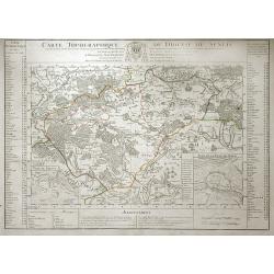
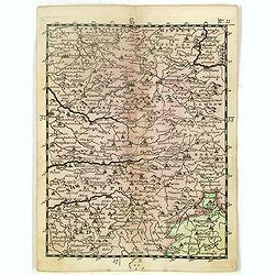
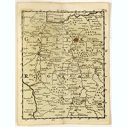
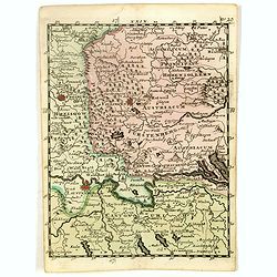
Carte Topographique du Diocese de Senlis.
Map of region surrounding the medieval town of Senlis, in the Picardy region of north-central France. Senlis is an ancient city going back to Roman times, and the monarch...
Date: Paris, 1709
Selling price: ????
Please login to see price!
Sold in 2010
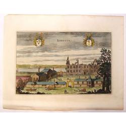
Idingsta.
Fine hand-colored, copper engraving of Idingsta, Sweden.Jan van den Aveele or Aveelen (1650 - 1727) was a Dutch etcher and engraver. With compatriot Willem Swidde, he mad...
Date: Stockholm, 1709
Selling price: ????
Please login to see price!
Sold in 2013

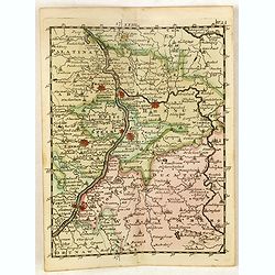
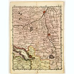
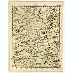
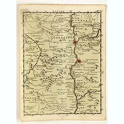
Carte du Duche de Bourgogne et des Comtez en Dependans.
An attractive 1709 map of Burgundy (Bourgogne), France, the popular wine producing region, covering the southern part of the region from Dole south as far as Pont-de-Veyl...
Date: Paris, 1709
Selling price: ????
Please login to see price!
Sold in 2023
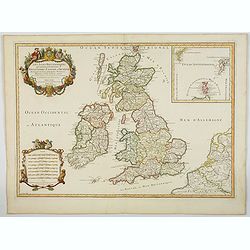
Les Isles Britanniques qui contienuent les Royaumes d'Angleterre, Escosse, et Irlande. . .
This is the 1709 Hubert Jaillot map of the British Isles. The map highlights the region from the Atlantic Ocean to the North Sea, and from the Orkney Islands to the Pas d...
Date: Paris, 1709
Selling price: ????
Please login to see price!
Sold in 2023
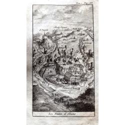
Les Bains d'Abano.
A small but detailed view of Abano Terme, with buildings, landscape, streets and people. From "Les Delices de l'Italie." by Alexandre de Rogissart.
Date: Leiden, 1709
Selling price: ????
Please login to see price!
Sold in 2021
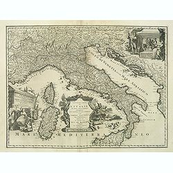
Nouvelle carte de l'Italie ou sont exactement marquez les postes et les chemins. . .
Map of Italy, with depiction of the most important post routes. To the left the islands of Corsica and Sardine. Prepared by Cantelli, Giacomo Cantelli (1643-1695). With t...
Date: Leiden, c. 1710
Selling price: ????
Please login to see price!
Sold
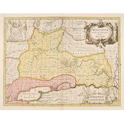
Moscovia pars Australis.
Prepared by Isaac Massa, a Dutch map-maker who travelled to Russia, returning to Holland in 1609, bringing with him a large amount of original cartographic manuscript mat...
Date: Amsterdam 1710
Selling price: ????
Please login to see price!
Sold in 2011
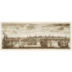
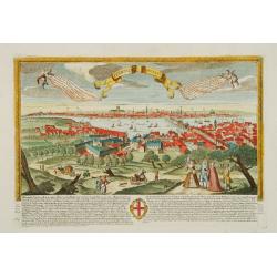
Amsterdam
A panoramic view of Amsterdam seen from 't IJ. A very decorative print with extensive shipping.From "Les Délices de la Hollande.. Ouvrage Nouveau sur le p...
Date: The Hague 1710
Selling price: ????
Please login to see price!
Sold
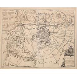
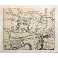
Plan de la Bateille de Turin..
Extremely fine and detailed plan by Huchtenburg depicting the siege of Turin (Italy) by Price Eugene on September 7th 1706.
Date: Brussels 1710
Selling price: ????
Please login to see price!
Sold
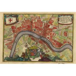
Londres.
Nice little plan of London, with 3 cartouches with coat of arms.
Date: Amsterdam 1710
Selling price: ????
Please login to see price!
Sold
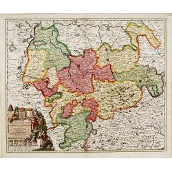
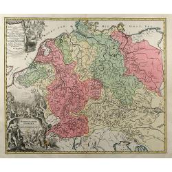
Ducatus Brunsuicensis..
"Showing the area of Hildesheim, Gottingen, Wolfenbuttel, etc. Lower left splendid title cartouche.The map is painted in strong and a somewhat impressionistic way. C...
Date: Nurenberg, 1710
Selling price: ????
Please login to see price!
Sold in 2013
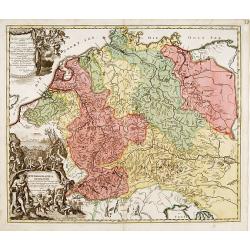
Archiepiscopatus et electoratis Coloniensis..
"Detailed map covering the area in-between Maastricht, Weert, Nijmegen, Dü'sseldorf, Cologne and Bonn. Upper right splendid title cartouche.The map is painte...
Date: Nurenberg 1710
Selling price: ????
Please login to see price!
Sold
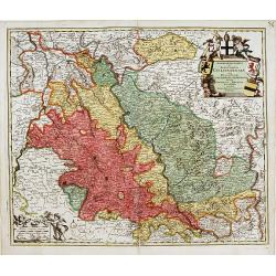
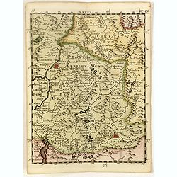
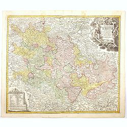
Landgraviatus Thuringae tabula generalis. . .
Detailed map centered on Gotha and Erfurt. Lower right splendid title cartouche.The map is painted in strong colors. Clearly from an show-piece atlas produced for a wealt...
Date: Nurenberg, 1710
Selling price: ????
Please login to see price!
Sold in 2018
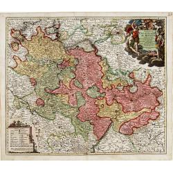
Exactissima Palatinatus ad Rhenum..
Covering southern part of the river Rhine. Including the towns of Frankfurt, Heidelberg, Neustadt, Saarbrücken, Mainz, etc.. Upper right splendid title cartouche.The map...
Date: Nurenberg, 1710
Selling price: ????
Please login to see price!
Sold in 2018
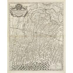
Hydrographia Germaniae..
Showing the river system of western Europe. Upper and lower left corner splendid title cartouches with Neptune and other mythological figures.The map is painted in strong...
Date: Nurenberg 1710
Selling price: ????
Please login to see price!
Sold
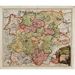
Landgraviatus Hassiae Inferioris..
"Detailed map centered on Kassel Upper left and right splendid title cartouches.The map is painted in strong colors. Clearly from an show-piece atlas produced for a ...
Date: Nurenberg 1710
Selling price: ????
Please login to see price!
Sold
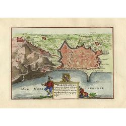
Barcelonne.
Nice little plan of Barcelona, with a nice cartouche with coat of arms.
Date: Amsterdam 1710
Selling price: ????
Please login to see price!
Sold
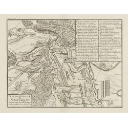
Plan de la Bataille de Malplaquet Donnée entre l'armée du Roy et celle des alliés le 11. Sept. 1709.
Extremely fine and detailed plan depicting the siege of de Malplaquet over Price Eugéne on September 11th 1709. With key list in the upper right corner. Engrav...
Date: Paris, 1710
Selling price: ????
Please login to see price!
Sold in 2009

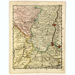
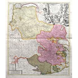
Les Duchés de Clèves, de Iuliers et de Limbourg..
Including Cleve, Wesel, Emmerich,
Date: Paris, ca. 1710
Selling price: ????
Please login to see price!
Sold
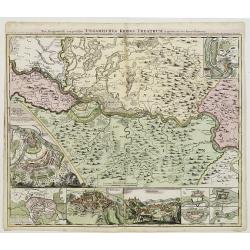
Neu Geographisch vorgestelltes Ungarisches Kriegs -Theatrum. . .
A rare map centered on Belgrade, including two plans of the battle of Belgrade and Temeswar in 1717 : underneath the map, two views of Belgrade and the Serbian city of Sm...
Date: Nuremberg, ca 1710
Selling price: ????
Please login to see price!
Sold in 2020
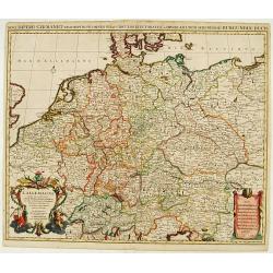
Novi Imperii Germanici ? L'Allemagne Dressé sur les observations ..
Fine map of Germany, Low countries, Switzerland, Austria and Poland. Pierre Mortier copied the map of Nicolas Sanson and de L'Isle. Sanson was to bring about the rise of ...
Date: Amsterdam, 1710
Selling price: ????
Please login to see price!
Sold in 2008
Hydrographia Germaniae qua Geographiae Naturalis
colored map of the river system of Germany from J. B. Homann. With two beautiful cartouches. From "Grosser Atlas".
Date: Nuremberg, 1710
Selling price: ????
Please login to see price!
Sold in 2009
Legazione di Bologna . . .
A uncommon map of part of the Bologna region in northern Italy, in the Po Valley, between the Po River and the Apennines, exactly between the Reno River and the Sàvena R...
Date: Rome, ca. 1710
Selling price: ????
Please login to see price!
Sold in 2009
![Theatre de la Guerre en Espange et en Portugal. . . Presenté à Philippe V Roy d'Espagne, et de Indes. . . [four sheets]](/uploads/cache/01579-250x250.jpg)
Theatre de la Guerre en Espange et en Portugal. . . Presenté à Philippe V Roy d'Espagne, et de Indes. . . [four sheets]
The map is exceptionally detailed, but the most remarkable feature of the engraving is the enormous, superbly detailed and designed title-piece. A dedication to Philip V ...
Date: Amsterdam, 1710
Selling price: ????
Please login to see price!
Sold in 2009
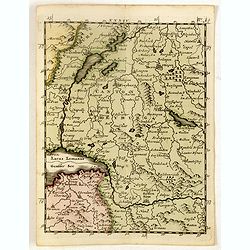
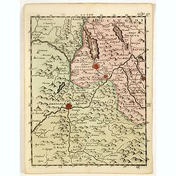
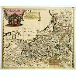
Carte du Royaume de Danemarc
Detailed map of Denmark, also including southern Sweden and northern Germany, showing the city of Copenhagen (Copenhague).
Date: Paris, 1710
Selling price: ????
Please login to see price!
Sold in 2010
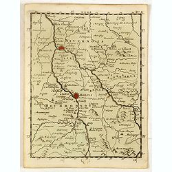
Carte du Diocese de Beauvais.
Map of the Roman Catholic Diocese of Beauvais, in north central France. The town of Beauvais, the seat of the seat of the Diocese, and home to the beautiful gothic cathed...
Date: Paris, 1710
Selling price: ????
Please login to see price!
Sold in 2010
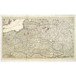
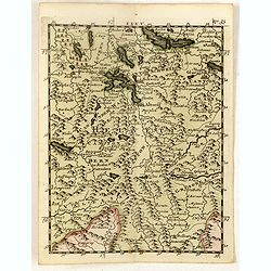
Reipublicae et status generalis Poloniae nova Tabula comprehendens Maioris et minoris Poloniae Regni.
Large map of Poland, reaching in the east as far as the Crimea. Engraved by Jacob Keyser.Joachim Ottens (1663 - 1719) and his sons Renier and Joshua were prominent Dutch ...
Date: Amsterdam, ca. 1710
Selling price: ????
Please login to see price!
Sold in 2010
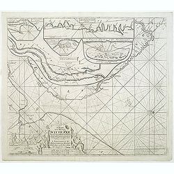
Paskaart van de Mont van de Witte Zee,. Beginnende van Tiepena tot Pelitza, als mede van C. Cindenoes tot Catsnoes.
Fine sea chart of the southern part of the Barents Sea, oriented to the West. With 5 inset maps: - Swetenoes, de Kust van Laplandt, Lombascho, ''T Vaste Landt van Lapland...
Date: Amsterdam, c.1710
Selling price: ????
Please login to see price!
Sold in 2011
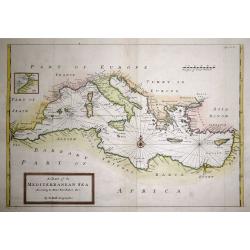
A Chart of the Mediterranean Sea According to Monsr. Berthelot &c.
An attractive map of the Mediterranean with the information taken from Monsieur Berthelot. Very accurate shows the whole of the Mediterranean centered on a Compass rose a...
Date: London, 1710
Selling price: ????
Please login to see price!
Sold in 2015
Carte nouvelle de Bergamasco, faisant partie des Etats de la Republique de Venise
Rare large scale map of the area around Bergamo, northern Italy, including the Lake Iseo (Lago d'Iseo). Very detailed map showing also mountain passes in the Alps! A ta...
Date: Amsterdam, c1710
Selling price: ????
Please login to see price!
Sold
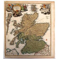
Magnae Britannia Pars Septentrionalis qua Regnum Scotiae.
Large,detailed and decorative map of Scotland with two superb cartouches. They are surrounded by mythical and allegorical figures, five putti, and Royal & Scottish ar...
Date: Nuremberg, 1710
Selling price: ????
Please login to see price!
Sold in 2014
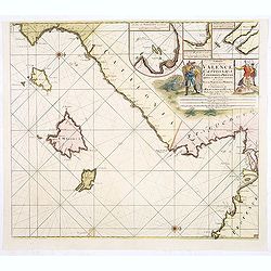
Paskaart van de Zee-kusten van Valence Catalonien Languedocq. . .
Fine sea chart showing the coast of Valencia, Catalonia, Languedoc, and Provence, and the islands of Majorca, Minorca and Ibiza.Title flanked by figures, topped by inset ...
Date: Amsterdam, c.1710
Selling price: ????
Please login to see price!
Sold in 2013
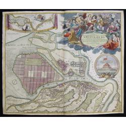
Topographische Vorstellung der Neuen Russischen Haupt-Residenz und See- Stadt St. Petersburg sammt ihrer zu erst aufgerichten Festung
Map shows a city map of St. Petersburg ,a beautiful cartouche, a location map of St. Petersburg and Chroncastle .
Date: Nuremberg, 1710
Selling price: ????
Please login to see price!
Sold in 2014
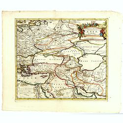
Tabula Altera Quae Continet Potissima Asiae et Reliqua Europae ac Africae.
Uncommon map covering a broad region centered on the Black and Caspian Seas. This was a region long disputed between the Christian and Islamic empires and the title carto...
Date: Amsterdam, 1710
Selling price: ????
Please login to see price!
Sold in 2015
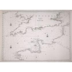
Carte de la Manche.
A large detailed sea chart of the English Channel has the coast of England from Cornwall round to Suffolk and South Wales. Below is the coast of France from La Baie de Do...
Date: Amsterdam, 1710
Selling price: ????
Please login to see price!
Sold in 2016
Principatus Cataloniae nec non Comitatum. . .
Detailed map centered on Catalonia. Lower right splendid title cartouche.Maps published in Germany during the 18th century are usually in body colors, with uncolored cart...
Date: Nurenberg, 1710
Selling price: ????
Please login to see price!
Sold in 2016
(Münster, Ravensberg, Lemgow, Westaphalia, etc.)
Rare miniature map including the towns of Münster, Ravensberg, Lemgow, Westaphalia, etc.. From "Le theatre De Bellone, Contenant 48. nouvelles Cartes Geographiques,...
Date: Amsterdam, 1710
Selling price: ????
Please login to see price!
Sold in 2023
(Sarlouis, Saarbrucke, Strassburg, etc.)
Rare miniature map including the towns of Sarlouis, Saarbrucke, Strassburg,, etc. From "Le theatre De Bellone, Contenant 48. nouvelles Cartes Geographiques, Des Paï...
Date: Amsterdam, 1710
Selling price: ????
Please login to see price!
Sold in 2016
(Heidelberg, Manheim, Wurtemberg, etc.)
A rare miniature map including the towns of Heidelberg, Manheim, Wurtemberg, etc. From "Le theatre De Bellone, Contenant 48. nouvelles Cartes Geographiques, Des Paï...
Date: Amsterdam, 1710
Selling price: ????
Please login to see price!
Sold in 2016
(Brisach, Basel, Montbelgard, etc.)
Rare miniature map including the towns of Brisach, Basel, Montbelgard,, etc. From "Le theatre De Bellone, Contenant 48. nouvelles Cartes Geographiques, Des Païs-Bas...
Date: Amsterdam, 1710
Selling price: ????
Please login to see price!
Sold in 2016
(Sens, Auxerre, Montargis, etc.)
Rare miniature map including the towns of Sens, Auxerre, Montargis, etc. From "Le theatre De Bellone, Contenant 48. nouvelles Cartes Geographiques, Des Païs-Bas Esp...
Date: Amsterdam, 1710
Selling price: ????
Please login to see price!
Sold in 2016
(Freiburg, Schafhausen, Villiengen, Lauffenburg, etc.)
Rare miniature map including the towns of Freiburg, Schafhausen, Villiengen, Lauffenburg, etc. From "Le theatre De Bellone, Contenant 48. nouvelles Cartes Geographiq...
Date: Amsterdam, 1710
Selling price: ????
Please login to see price!
Sold in 2019
(Neyers, Moulins, Mont Morillon, etc.)
Rare miniature map including the towns of Neyers, Moulins, Mont Morillon, etc. From "Le theatre De Bellone, Contenant 48. nouvelles Cartes Geographiques, Des Païs-B...
Date: Amsterdam, 1710
Selling price: ????
Please login to see price!
Sold in 2016
(Ulm, Memmingen, Lindau, etc.)
Rare miniature map including the towns of Ulm, Memmingen, Lindau, etc. With BodenSee in lower left corner. From "Le theatre De Bellone, Contenant 48. nouvelles Carte...
Date: Amsterdam, 1710
Selling price: ????
Please login to see price!
Sold in 2016
(Cisteaux, Challon sur Saone, Charolles, etc.)
Rare miniature map including the towns of Cisteaux, Challon sur Saone, Charolles, etc. From "Le theatre De Bellone, Contenant 48. nouvelles Cartes Geographiques, Des...
Date: Amsterdam, 1710
Selling price: ????
Please login to see price!
Sold in 2018
(Neuenburg, Bern, Sitten Sion, etc.)
Rare miniature map of part of Switzerland, with Lake Geneva in lower left corner, including the towns of Neuenburg, Bern, Sitten Sion, etc. From "Le theatre De Bello...
Date: Amsterdam, 1710
Selling price: ????
Please login to see price!
Sold in 2017
(Canton Schweiz, Canton Bern, Canton Grisonne, etc.)
Rare miniature map of part of Switzerland, including the towns of Schweinfurt, Reineck, Hirschfeld, etc. From "Le theatre De Bellone, Contenant 48. nouvelles Cartes ...
Date: Amsterdam, 1710
Selling price: ????
Please login to see price!
Sold in 2017
(Chur, Worms, Cleven, etc.)
Rare miniature map of part of Switzeerland including the towns of Chur, Worms, Cleven, etc. From "Le theatre De Bellone, Contenant 48. nouvelles Cartes Geographiques...
Date: Amsterdam, 1710
Selling price: ????
Please login to see price!
Sold in 2016
(Lyon, Vienne, Valence, etc.)
Rare miniature map including the towns of Lyon, Vienne, Valence, etc. From "Le theatre De Bellone, Contenant 48. nouvelles Cartes Geographiques, Des Païs-Bas Espagn...
Date: Amsterdam, 1710
Selling price: ????
Please login to see price!
Sold in 2018
(Chambery, Mon Melian, Grenoble, etc.)
Rare miniature map including the towns of Chambery, Mon Melian, Grenoble, etc. From "Le theatre De Bellone, Contenant 48. nouvelles Cartes Geographiques, Des Païs-B...
Date: Amsterdam, 1710
Selling price: ????
Please login to see price!
Sold in 2018
(Lake Maggiore, Arona, Novara, Monferrato, Valence, etc.)
Rare miniature map including Lake Maggiore and the towns of Arona, Novara, Monferrato, Valence, etc. From "Le theatre De Bellone, Contenant 48. nouvelles Cartes Geog...
Date: Amsterdam, 1710
Selling price: ????
Please login to see price!
Sold in 2016
(Brinaçon, Susa, Turin, etc.)
Rare miniature map including the towns of Brinaçon, Susa, Turin, etc. From "Le theatre De Bellone, Contenant 48. nouvelles Cartes Geographiques, Des Païs-Bas Espag...
Date: Amsterdam, 1710
Selling price: ????
Please login to see price!
Sold in 2019
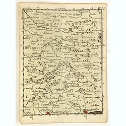
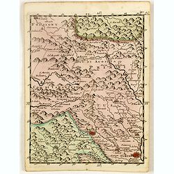
(Les Sevennes, Montpellier, Pezenas, etc.)
Rare miniature map including the towns of Les Sevennes, Montpellier, Pezenas, etc. From "Le theatre De Bellone, Contenant 48. nouvelles Cartes Geographiques, Des Pa�...
Date: Amsterdam, 1710
Selling price: ????
Please login to see price!
Sold in 2020
(Embrun, Gap, Sisteron, etc.)
Rare miniature map including the towns of Embrun, Gap, Sisteron, etc. From "Le theatre De Bellone, Contenant 48. nouvelles Cartes Geographiques, Des Païs-Bas Espagn...
Date: Amsterdam, 1710
Selling price: ????
Please login to see price!
Sold in 2020
(Pinerolo, Brueil, Antibe, Monaco, etc.)
Rare miniature map including the towns of Pinerolo, Brueil, Antibe, Monaco, etc. From "Le theatre De Bellone, Contenant 48. nouvelles Cartes Geographiques, Des Païs...
Date: Amsterdam, 1710
Selling price: ????
Please login to see price!
Sold in 2020
The South Part of Great Britain, Called, England and Wales. Containing All ye Cities, Market Towns, Boroughs: And whatever Places have ye Election of Members of Parliament
A large and finely detailed, copper engraved map featuring hundreds of villages, towns, mountains and much more. In the title, the "South Part" of Great Britain...
Date: London, 1710
Selling price: ????
Please login to see price!
Sold in 2016

(La Duché de Bourgogne, Troyes, Dion, etc.)
Rare miniature map of La Duché de Bourgogne, including the towns of Troyes, Dion, etc. From "Le theatre De Bellone, Contenant 48. nouvelles Cartes Geographiques, De...
Date: Amsterdam, 1710
Selling price: ????
Please login to see price!
Sold in 2017
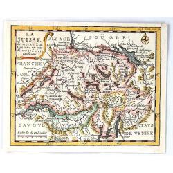
La Suisse Divisee en XIII Cantons en Ses Alliez et Sujets par Inselin
A fine little map of Switzerland and its thirteen Cantons. Features a simple cartouche and a compass rose. Engraved by Inselin.Charles Inselin (Inslain), was a French eng...
Date: Paris, ca 1710
Selling price: ????
Please login to see price!
Sold in 2017
Plan de la Bataille D'Oudenaerde.
A plan of the Battle of Oudenaerde fought on July 11th 1708. A finely engraved plan with excellent detail of the fortifications of Oudenaerde in Belgium. With a decorativ...
Date: Amsterdam, 1710
Selling price: ????
Please login to see price!
Sold in 2018
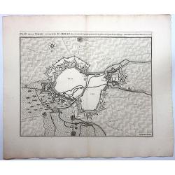
Plan de la Ville et Citadelle D'Arras.
A detailed plan of the town and citadelle of Arras. Arras is the capital of the Pas-de-Calais department of France, which forms part of the region of Hauts-de-France. Ar...
Date: Amsterdam, 1710
Selling price: ????
Please login to see price!
Sold in 2020
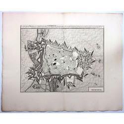
Plan de la Ville et Citadelle de Cambray.
A detailed plan of the town and Citadelle of Cambray. Cambrai, (old spelling Cambray) is a commune in the Nord department and in the Hauts-de-France region of France on ...
Date: Amsterdam, 1710
Selling price: ????
Please login to see price!
Sold in 2019
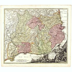
Les Estats De Savoye, Piemont, et le Comte de Nice.
An attractive folio map of northern Italy (Piemonte and Torino) and Savoie. Extends from Lake Geneva until Nice and Monaco. Large decorative cartouche with the coat of ar...
Date: Amsterdam, ca. 1710
Selling price: ????
Please login to see price!
Sold in 2018
Tabula Nova Provinciae UltraJectinae. . .
This striking map was prepared by Nicolas Visscher, now published by Petrus Schenk. It shows the land development in Gelderland, Holland, near the Zuyder Zee and it shows...
Date: Amsterdam, 1710
Selling price: ????
Please login to see price!
Sold in 2020
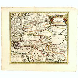
Tabula Altera Quae Continet Potissima Asiae et Reliqua Europae ac Africae.
Uncommon map covering a broad region centered on the Black and Caspian Seas. This was a region long disputed between the Christian and Islamic empires and the title carto...
Date: Amsterdam, 1710
Selling price: ????
Please login to see price!
Sold in 2019
Carte du Royaume de Danemarc.
Guillaume de l'Isle's (1675-1726) well deserved reputation as one of the foremost geographers of the 18th century meant that his maps were influential for many years afte...
Date: Paris, 1710
Selling price: ????
Please login to see price!
Sold in 2022
Totius Danubii Nova & Accuratiss. Tabula, Universam Simul Turciam Europaeam Hungarium Magnam Germaniae Partem...
A very rare, large map depicting Italy, Sicily, Sardinia, Corsica, Greece, part of Turkey, Hungary and part of the Balkans region. Originally from France, the family de l...
Date: Amsterdam, 1710
Selling price: ????
Please login to see price!
Sold in 2018

New Map of Ancient Gaul or Gallia Transalpina.
A fine map of Ancient France engraved by Robert Spofforth, and published by Wells for "A New Sett of Maps Both of Ancient and Present Geography". This map was d...
Date: London, 1710
Selling price: ????
Please login to see price!
Sold in 2023
Carte de Geographie des Differents Etats de la Republique de Venise. . .
An attractive and detailed engraving of the Gulf of Venice and adjacent Italian and Dalmatian coastlines. The main map runs diagonally across the sheet with inset detail ...
Date: Amsterdam, 1710
Selling price: ????
Please login to see price!
Sold in 2019
Regni Prussici Accuratissima Delineatio Studio Opera.
A striking map of Prussia covering Danzig, (Poland) Marienburg, Elbing, Braunsberg, Konigsberg (Russia) and up into modern-day Lithuania and Memel. The map has a remarkab...
Date: Amsterdam, ca 1710
Selling price: ????
Please login to see price!
Sold in 2019
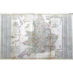
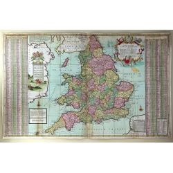
The South Part of Great Britain, called Engalnd and Wales.
Herman's Moll's magnificently detailed large scale map of England and Wales. Including a part of Ireland. Filled with cities, roads showing the distances between towns, r...
Date: London, ca 1710
Selling price: ????
Please login to see price!
Sold in 2019
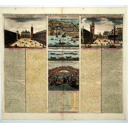
Carte du Gouvernement Civil et Politique de l a Republique de Venise ses Differens Conseils de Palais de St Marc et Celui des procurateurs.
This impressive engraving is a wonderful example of Chatelain's elegant plates. It provides a detailed description of the infrastructure of the Venetian government. Ornam...
Date: Amsterdam, 1710
Selling price: ????
Please login to see price!
Sold in 2020
![[German liberty heroes tree] Trophee Eleve a la Gloire des Premiers Heros de la Liberte Germanique et a celle de leurs decendants.](/uploads/cache/83599-250x250.jpg)
[German liberty heroes tree] Trophee Eleve a la Gloire des Premiers Heros de la Liberte Germanique et a celle de leurs decendants.
An elaborate tree featuring 41 coats of arms and family crests and pictures of the hero's of german history. The base of the tree comes from a large tankard adorned by se...
Date: Paris, 1710
Selling price: ????
Please login to see price!
Sold in 2020
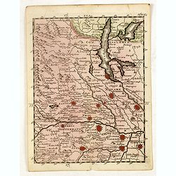
Sweden Corrected from the Observations Communicated to the Royal Society in London and the Royal Academy in Paris. . .
A large-scale general map of Scandinavia. In addition to Sweden, it shows Norway, Denmark and Finland. The new city of St. Petersburg (founded 1703) is shown at the head ...
Date: London, 1710
Selling price: ????
Please login to see price!
Sold in 2020
Exactissima Palatinatus ad Rhenum. . .
A nice detailed map covering the southern part of the river Rhine. Including the towns of Frankfurt, Heidelberg, Neustadt, Saarbrucken, Mainz, etc. Embellished with a lov...
Date: Nuremberg, 1710
Selling price: ????
Please login to see price!
Sold in 2020
Londinum - London
A rare and beautifully engraved and richly detailed panoramic view of London. With in lower part description of London in German and Latin. Published by Joseph Friederich...
Date: Augsburg 1711
Selling price: ????
Please login to see price!
Sold
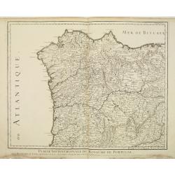
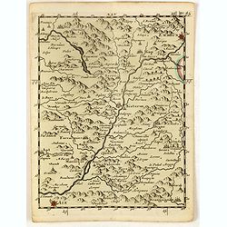
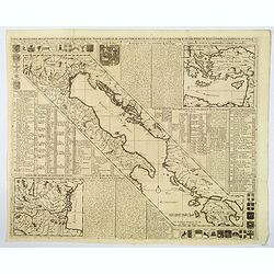
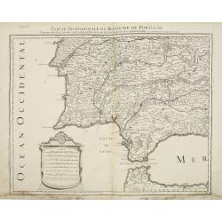
Partie Septentrionale du Royaume de Portugal.
Detailed map of the northern part of Portugal and the northern tip of Morocco. Complementing with lot 08314.
Date: Paris, 1711
Selling price: ????
Please login to see price!
Sold in 2011
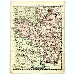
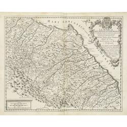
Partie Meridionale du Royaume de Portugal. . .
Detailed map of the southern part of Portugal and the northern tip of Morocco. Fine-scale cartouche. Complementing with lot 08315.
Date: Paris, 1711
Selling price: ????
Please login to see price!
Sold in 2011
La Marca Anconitana, e Fermana . . .
A uncommon map of part of the March regions in the province of Ancon in central Italy. Based on the reports of Giacomo Cantelli da Vignola and published in Roma in Giacom...
Date: Rome, ca. 1711
Selling price: ????
Please login to see price!
Sold in 2009