Browse Listings in Europe
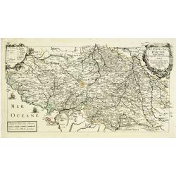
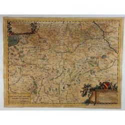
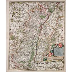
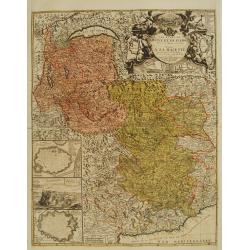
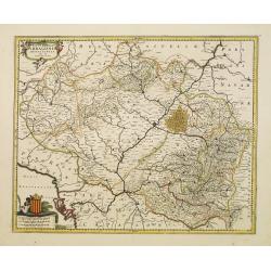
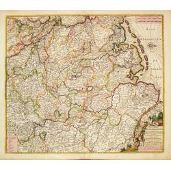
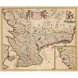
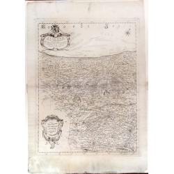
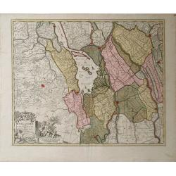
Le Haut et Bas Poictou. . .
Uncommon centered map of French province Poitou with fine title cartouche upper right.More about [+]
Date: Paris, 1689
Selling price: ????
Please login to see price!
Sold in 2012
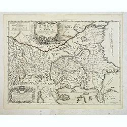
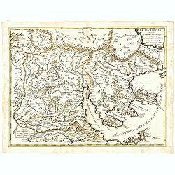
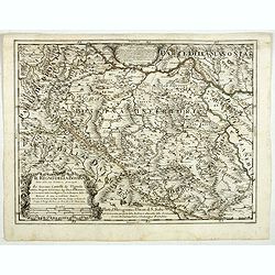
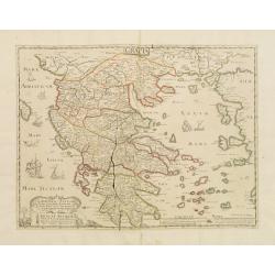
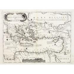
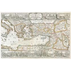
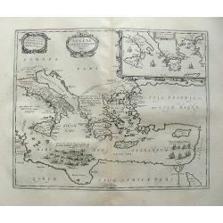
La Bulgaria ela Romania con Parte di Marcedonia. . .
Scarce map of the region along Danube River and to the south. Extends to include part of the Sea of Azov and the northern extreme of the Aegean Sea. Elaborate military-th...
Date: Rome, 1689
Selling price: ????
Please login to see price!
Sold in 2012
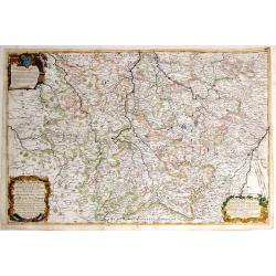
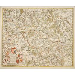
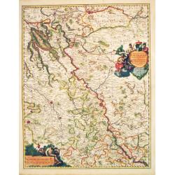
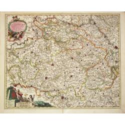
Il Ducato Dibar - Il Ducato Lorena.
A truly remarkable, large map with three decorative cartouches. It features a high degree of detail of the Duchies of Bar and Lorena in France.Giacomo Cantelli da Vignola...
Date: Rome, 1689
Selling price: ????
Please login to see price!
Sold in 2013
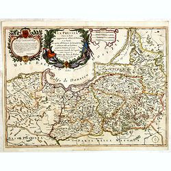
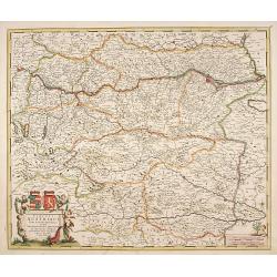
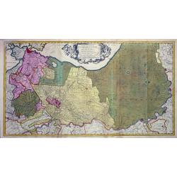
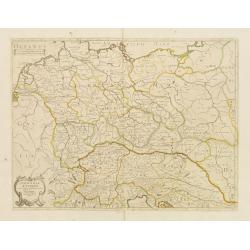
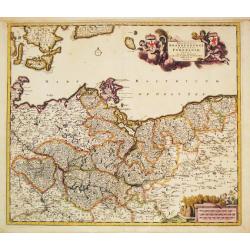
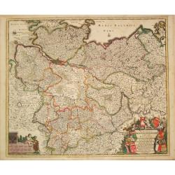
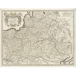
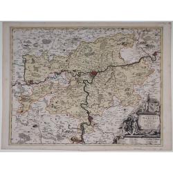
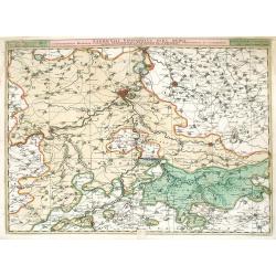
La Prussia Divisa in Reale Che Appartiene al Ré Di Polonia et in Ducale Che Spetta all'Elettore Di Brandeburgo. Da Giacomo Cantelli Da ...
In upper left hand corner a large title cartouche with dedication to Cardinal Denhoff. The map is dated 1689.The cartographer was Giacomo Cantelli (1643-1695) who was act...
Date: Rome, 1689
Selling price: ????
Please login to see price!
Sold in 2014
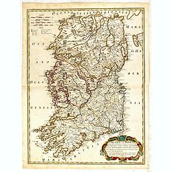
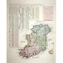
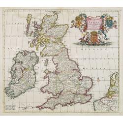
L\'Irlanda o uero Hibernia...
Giacomo Rossi's fine late 17th century map of Ireland. Issued in Il Mercurio geografico In lower right a tittle cartouche.The cartographer was Giacomo Cantelli da Vignola...
Date: Rome, 1689
Selling price: ????
Please login to see price!
Sold in 2015
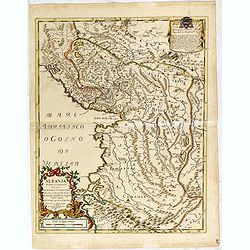
Albania propria ouero superiore...
Scarce Vignola's map of Albania, with decorative cartouches for the title (bottom left) and dedication (top right). The well educated humanist Giacomo Cantelli da Vignola...
Date: Rome, 1689
Selling price: ????
Please login to see price!
Sold in 2015
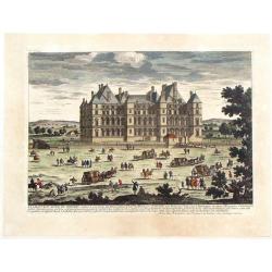
Le Chateau Royal de Madrid.
Highly detailed, hand-colored copper engraving of the royal palace in Spain. By the Perelle family of France. From "Vues de France" published in 1689.
Date: Paris, 1689
Selling price: ????
Please login to see price!
Sold in 2017
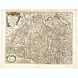
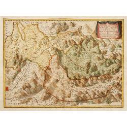
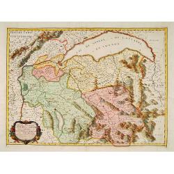
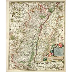
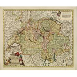
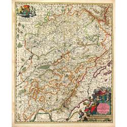
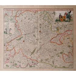
L'Helvetia . . .
A uncommon late 17th century map of part of Switzerland, including the Savoie region of France, based on the reports of Giacomo Cantelli da Vignola and published in Rome ...
Date: Rome, ca. 1689
Selling price: ????
Please login to see price!
Sold in 2015
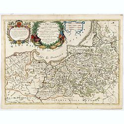
La Prussia Divisa in Reale Che Appartiene al Ré Di Polonia et in Ducale Che Spetta all'Elettore Di Brandeburgo. Da Giacomo Cantelli Da ...
In upper left hand corner a large title cartouche with dedication to Cardinal Denhoff. The map is dated 1689.The cartographer was Giacomo Cantelli (1643-1695) who was act...
Date: Rome, 1689
Selling price: ????
Please login to see price!
Sold in 2016
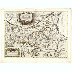
La Bulgaria ela Romania con Parte di Marcedonia. . .
Scarce map of the region along Danube River and to the south. Extends to include part of the Sea of Azov and the northern extreme of the Aegean Sea. Elaborate military-th...
Date: Rome, 1689
Selling price: ????
Please login to see price!
Sold in 2018
Il Regno Della Servia..
Rossi's map of the kingdom of Serbia, bordered by Hungary to the north, Albania and Macedonia to the south, and Wallachia (present-day Romania) to the northeast. Borders,...
Date: Rome, 1689
Selling price: ????
Please login to see price!
Sold in 2016
Il regno della Bossima diviso nelle ...
Rossi's map of Bosnia, based upon Sanson's map.
Date: Rome, 1689
Selling price: ????
Please login to see price!
Sold in 2016
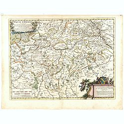
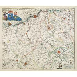
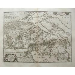
Paese d'Eiffel nel quale sono parte del ducato di Iuliers, il principato d'Arenberg, li stati di conti di Manderscheit. . .
Rossi's map of Eiffel region in Germany, based upon Sanson's map, but with revised Italian nomenclature. From his 'Mercurio Geografico...'. The engraver was Pietra Santa....
Date: Rome, 1689
Selling price: ????
Please login to see price!
Sold in 2015
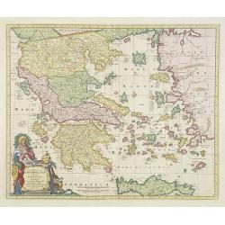
La Macedonia. . . (Northern Greece)
Rossi's map of Northern Greece with Thessaloniki, based upon Sanson's map, but with revised Italian nomenclature. The engraver was Francesco Donia Messis.Issued in a seco...
Date: Rome, 1689
Selling price: ????
Please login to see price!
Sold in 2016
![[4 sheet map] Le Diecisette Provincie de Paesi Bassi. . .](/uploads/cache/36418-250x250.jpg)
[4 sheet map] Le Diecisette Provincie de Paesi Bassi. . .
Scarce map of the Low Countries. Elaborate heraldic title cartouche. The engraver was A Barbey.
Date: Rome, 1689
Selling price: ????
Please login to see price!
Sold in 2016
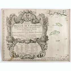
Diocese de Coutances, divisé en ses quatre archidiaconés . . .
Lower left sheet of this rare 4-sheet wall map, showing mainly a title cartouche with the islands of Minquiers and Banes Grélets to the right. In top right tip of Britan...
Date: Paris, ca. 1689
Selling price: ????
Please login to see price!
Sold in 2017
Paese d'Eiffel.
A map of Germany by Rossi in Rome in 1689. From the Atlas La Guida Del Mercurio. Featuring a floral title cartouche and a second cartouche with three putti and a family ...
Date: Rome, 1689
Selling price: ????
Please login to see price!
Sold in 2018
Il regno della Bossima diviso nelle sue provincie principali. . .
Rossi's map of Bosnia, based upon Sanson's map, but with revised Italian nomenclature. From a second edition of his 'Mercurio Geografico...'. The engraver was Cl. Botzot....
Date: Rome, 1689
Selling price: ????
Please login to see price!
Sold in 2019
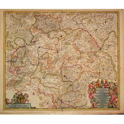
Archiepiscopatus et Electoratus Moguntini..
Centred on Frankfurt, Mainz and Heidelberg.
Date: Amsterdam, 1690
Selling price: ????
Please login to see price!
Sold in 2022
Circuli Austriaci pars Septentrionalis in qua Archiducatus.
Decorative and detailed map of Austria.
Date: Amsterdam, 1690
Selling price: ????
Please login to see price!
Sold in 2023
Partie Meridionale des Estats de Savoye..
"Map of Savoie. With original or early outline hand-color. Numerous place-names of counties, cities, towns, physical features. Prepared by N.Sanson.This edition carr...
Date: Paris 1690
Selling price: ????
Please login to see price!
Sold in 2009
Isle et Royaume d'Irlande..
"Detailed map of Ireland, including also a list of all the counties and main towns and their location. With the address "" A Paris chez le Sr. N. De Fer, d...
Date: Paris 1690
Selling price: ????
Please login to see price!
Sold
Haga Comitis Vulgo 'sGraven-Hage.
Bird-eye view of the town. Copied after Blaeu. From the rare work by G.Letie. Teatro Belgico.. , printed by Willem de Jonge.RARE.
Date: Amsterdam 1690
Selling price: ????
Please login to see price!
Sold
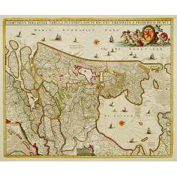
Comitatus Hollandiae tabula pluribus..
West to the top. Lower left inset of the Wadden Islands, Texel, Vlieland, Terschelling and part of Ameland.
Date: Amsterdam 1690
Selling price: ????
Please login to see price!
Sold
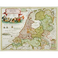
Les Provinces Unies ou la Partie Septentrionale..
RARE map of The Netherlands. A visually stunning map with a large title cartouche. This large one-sheet map was produced by the Venetian cosmographer Vincenzo Coronelli w...
Date: Paris 1690
Selling price: ????
Please login to see price!
Sold
Partie Septentrionale des Estats de Savoye..
Map of Savoy. With original or early outline hand-color. Numerous place-names of counties, cities, towns, physical features. Prepared by N.Sanson.This edition carries the...
Date: Paris 1690
Selling price: ????
Please login to see price!
Sold
Totius Alsatiae Novissima Tabula qua simul Sundgovia, Brisigavia, Ortenavia maxima pars Marchionatus Badensis.
Frederik de Wit (1610-98), Amsterdam-based cartographer and publisher of 'Atlas minor', 1670, 'Zee-Atlas', 1675, 'Atlas Major', 1690. Nicolaas Visscher (1618-1679), son o...
Date: Amsterdam, F.de Wit, c.1690
Selling price: ????
Please login to see price!
Sold in 2014
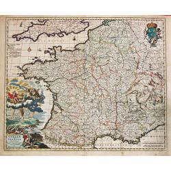
Galliae seu Francia Tabula.
Frederik de Wit (1610-98), Amsterdam-based cartographer and publisher of 'Atlas minor', 1670, 'Zee-Atlas', 1675, 'Atlas Major', 1690.A very attractive map of France. Embe...
Date: Amsterdam, F. de Wit, c.1690
Selling price: ????
Please login to see price!
Sold
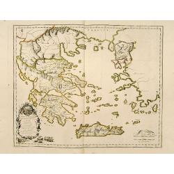
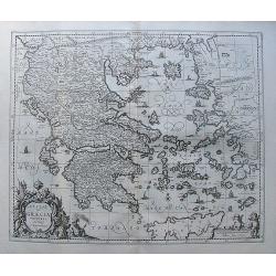
Graeciae Foederata.
A fine map of Ancient Greece.This edition carries the date 1690.Nicolas Sanson was to bring about the rise of French cartography, although the fierce competition of the D...
Date: Paris, 1690
Selling price: ????
Please login to see price!
Sold
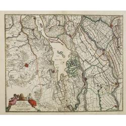
Tabula nova Provinciae Ultrajectinae quam jussu Nob: hujus Dominij Ordinum Emensus esat Bernardus du Roy?.
Large and highly detailed map showing the area between Amsterdam, Gouda, Arnheim and Zutphen including Utrecht and Amersfoort. Many towns, streets (some with names!), riv...
Date: Amsterdam, c1690
Selling price: ????
Please login to see price!
Sold
Les Etats de Savoye et de Piemont..
With a panoramic inset view of Chambery, and insets of plans of Yvrée, Montmelian, Nice, Turin, Verrue, Vercelli. Showing the Mediterranean coastline from Antibe, Nice t...
Date: Paris, 1690
Selling price: ????
Please login to see price!
Sold
Flandriae Comitatus.
Frederik de Wit (1610-98), Amsterdam-based cartographer and publisher. ' Atlas minor', 1670, ' Zee-Atlas', 1675, ' Atlas Major', 1690.Nicolaas Visscher's attractive map o...
Date: Amsterdam, c.1690
Selling price: ????
Please login to see price!
Sold in 2013
Regionum Coloniensis Electoratu et Archiepiscopatu Tabula.
Nicolaas Visscher's attractive map of Nordrhein-Westfalen. Embellished with a title-cartouch and a cartouche with scales.From Frederick de Wit's' Atlas Maior'. Frederik d...
Date: Amsterdam, F. de Wit, c.1690
Selling price: ????
Please login to see price!
Sold in 2021
Novissima Arragoniae regni tabula.
Shows cities of Saragossa and Pamplona.
Date: Amsterdam, 1690
Selling price: ????
Please login to see price!
Sold in 2010
Totius Alsatiae Novissima Tabula qua simul Sundgovia, Brisigavia, Ortenavia maxima pars Marchionatus Badensis.
Frederik de Wit (1610-98), Amsterdam-based cartographer and publisher. ' Atlas minor', 1670, ' Zee-Atlas', 1675, ' Atlas Major', 1690. Nicolaas Visscher (1618-1679), son ...
Date: Amsterdam, F.de Wit, c.1690
Selling price: ????
Please login to see price!
Sold in 2018
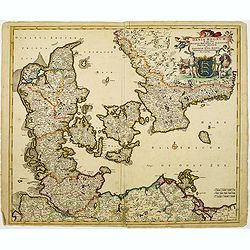
Dania Regnum In quo sunt Ducatus Holsatia et Slesvicum..
An attractive map centred on Denmark. Very ornamented title cartouche in the upper right-hand corner.
Date: Amsterdam, 1690
Selling price: ????
Please login to see price!
Sold
Germania Antiqua.
A fine map of ancient Germany, Poland and the Netherlands.This edition carries the date 1690 in manuscript.Nicolas Sanson was to bring about the rise of French cartograph...
Date: Paris, 1690
Selling price: ????
Please login to see price!
Sold in 2010
Graeciae Antiquae.
A fine map of Ancient Greece prepared by Sanson. A later impression of the copper plate as a large crack in the plate is shown.This edition carries the address of Pierre ...
Date: Paris 1690
Selling price: ????
Please login to see price!
Sold
Exactissima Helvetiae Rhaetiae, Valesiae Cieterorumq, Confaederatorum ut et finitimorum Populorum Regionum Tabula.
Very detailed map of Switzerland graphically depicting the mountainous region. Hundreds of tiny villages are named. Decorated with two cartouches, a scale of miles, and a...
Date: Amsterdam, 1690
Selling price: ????
Please login to see price!
Sold in 2009
Novissima et Accuratissima Totius Angliae Scotiae..
Rare issue of Justus Danckert's attractive map of Great-Britain. With the imprint of Justus in place of Theo in the title. The plate is also been retouched in several pla...
Date: Amsterdam, 1690
Selling price: ????
Please login to see price!
Sold in 2013
Dominii Veneti in Italia in Partes Accurate..
Rare issue of Cornelis Danckert's attractive map of northern part of Italy, including, Venice, Bologne, Parma, Vicenza, Verona, Ravenna, etc. Decorative title cartouche l...
Date: Amsterdam 1690
Selling price: ????
Please login to see price!
Sold
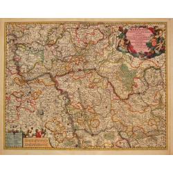
Circulus Franconia in quo sunt Episcopatus Wurtzburg, Bamberg et Aichstet.Ducatus Coburgensis, Marchionatus Cullembach et Onspach Comitatus Henneberg, Wertheim, Holach, Reinec, Papenheim, Erpach, Schwartzenberg, et Castel. Sensheim et Terr. Norinbergense.
Frederik de Wit (1610-98), Amsterdam-based cartographer and publisher. ' Atlas minor', 1670, ' Zee-Atlas', 1675, ' Atlas Major', 1690.An attractive map of the Fränkische...
Date: Amsterdam, c.1690
Selling price: ????
Please login to see price!
Sold in 2010
Moguntini Archipiscopat' et electorat nec non Commitatum Utriusque Cattimeliboci Verhemensis & Erpachiensi.
Nicolaas Visscher's attractive map of the southern part of Rheinland-Pfalz, Hessen and Wertheim. Embellished with a very cartouche.Frederik de Wit (1610-98), Amsterdam-ba...
Date: Amsterdam, F.de Wit, c.1690
Selling price: ????
Please login to see price!
Sold in 2018
Regiae Celsitudinis Sabaudicae Status consistens Sabaudiae ac Montisferrati Ducatus, Pedemontii principatum, nec non Nicaeensem Comitatum.
An attractive map of Savoye. Embellished with a very large title-cartouche in beautiful coloring.From Frederick de Wit's' Atlas Maior'.
Date: Amsterdam, F. de Wit, 1690
Selling price: ????
Please login to see price!
Sold
Carte Particulire du terroir et des Environs de Paris qui est la plus grande partie de L' Isle de France.
Frederik de Wit (1610-98), Amsterdam-based cartographer and publisher. 'Atlas minor', 1670, 'Zee-Atlas', 1675, ' Atlas Major', 1690.Nicolas Visscher's attractive map of I...
Date: Amsterdam, Wit, F. de, 1690
Selling price: ????
Please login to see price!
Sold in 2020
Comitatus Burgondiae.
Frederik de Wit (1610-98), Amsterdam-based cartographer and publisher. ' Atlas minor', 1670, ' Zee-Atlas', 1675, 'Atlas Major', 1690.An attractive map of Burgondy. Embell...
Date: Amsterdam, F. de Wit, c.1690
Selling price: ????
Please login to see price!
Sold in 2014
Parte Orientale del Mediterraneo..
A beautiful map depicting the eastern part of the Mediterranean Basin, including a nice representation of Cyprus. With decorative title cartouche and scale cartouche.Hist...
Date: Venice 1690
Selling price: ????
Please login to see price!
Sold
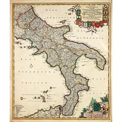
Regnum Neapolis.
Frederik de Wit (1610-98), Amsterdam-based cartographer and publisher. ' Atlas minor', 1670, ' Zee-Atlas', 1675, ' Atlas Major', 1690.An attractive map of the Knigdom of ...
Date: Amsterdam, 1690
Selling price: ????
Please login to see price!
Sold
Marchionatus Brandenburgi et Ducatus Pomeraniae Tabula.
Frederik de Wit (1610-98), Amsterdam-based cartographer and publisher. ' Atlas minor', 1670, ' Zee-Atlas', 1675, ' Atlas Major', 1690.An attractive map of Brandenburg and...
Date: Amsterdam, c.1690
Selling price: ????
Please login to see price!
Sold in 2008
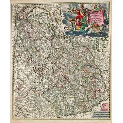
Circulus Westphalicus in quo sunt Episcopatus Monarsteriensis Paderbornensis et Osnabrugiensis, Ducatus Iuliasnensis, Clivensis, et Montensis, Principatus Mindensis, Ferdensis et Frisiae Orientalis, Comitatus Marchiae &c.
Frederik de Wit (1610-98), Amsterdam-based cartographer and publisher. ' Atlas minor', 1670, ' Zee-Atlas', 1675, ' Atlas Major', 1690.An attractive map of Rheinland-Westf...
Date: Amsterdam, c.1690
Selling price: ????
Please login to see price!
Sold in 2017
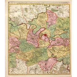
Ciculis Saxoniae Inferioris in quo sunt Ducatus Holsatiae Mecklenburgi, Lauwenburgi, Luneburgi, Brunsuigi, Bremae et Ferdae, Comitatus Dannebergi, Archiepiscopatus Maegdenburgensis, Episcopatus Hildesiae et Halberstad.
An attractive map of Niedersachsen and Hamburg-Holstein. Embellished with a title-cartouche with the coats-of-arms and a cartouche with scales. From Frederick de Wit's &q...
Date: Amsterdam, c.1690
Selling price: ????
Please login to see price!
Sold in 2019
Ducatus Lutzenburgi Novissima et accuratissima Delineatio
Frederik de Wit (1610-98), Amsterdam-based cartographer and publisher. ' Atlas minor', 1670, ' Zee-Atlas', 1675, ' Atlas Major', 1690.Nicolaas Viischer's attractive map o...
Date: Amsterdam, F. de Wit, c.1690
Selling price: ????
Please login to see price!
Sold in 2011
Tabula ducatus Limburch et comitatus Valckenburch. . .
The map describes the southern part of Limburg and reaches into Belgium (Liége, Verviers) and Germany. With two very decorative cartouches.
Date: Amsterdam, 1690
Selling price: ????
Please login to see price!
Sold in 2021
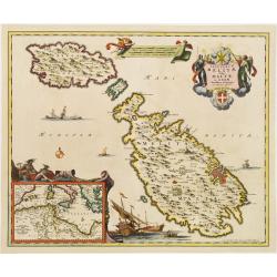
Insularum Melitae vulgo Maltae et Gozae. . .
A very attractive example of this detailed map of Malta and Gozo with inset map of the Western Mediterranean. Sailing ships and a large title cartouche with the Coat of A...
Date: Amsterdam, 1690
Selling price: ????
Please login to see price!
Sold in 2008
Nova atque emendata descriptio Suydt Hollandiae edita a Frederico de Wit.
Detailed map covering the area around the Biesbos, including Breda, Willemstad, Dordrecht, Culembourg, Gorichem and Gouda.The map is oriented with west at the top. Superb...
Date: Amsterdam, 1690
Selling price: ????
Please login to see price!
Sold in 2011
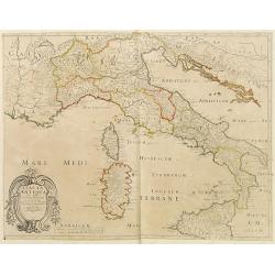
Italia Antiqua.
A fine map of Ancient Italy. This edition carries the date 1690, in manuscript.Nicolas Sanson was to bring about the rise of French cartography, although the fierce compe...
Date: Paris, 1690
Selling price: ????
Please login to see price!
Sold in 2023
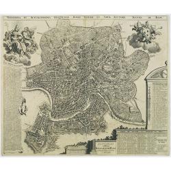
Novissima et accuratissima delineatio Romae veteris et noavae auctore Joanne de Ram.
A very detailed and decorative bird's-eye view of the town copied after J.B.Falda (1670). Two decorative cartouches and key insets to churches (1-266), Grave tombes(267-3...
Date: Amsterdam, 1690
Selling price: ????
Please login to see price!
Sold in 2009
Geographische Beschryvinghe van de Wandeling der Apostelen ende De Reysen Pauli, ...
Bible map of the Eastern part of the Mediterranean Sea. A somewhat under valuated "carte à figures" map !
Date: Amsterdam, ca. 1690
Selling price: ????
Please login to see price!
Sold in 2010
Exactissima totius Archipelagi nec non Graeciae tabula.
Key map of the Greek Islands, the Aegean, Crete and part of Asia Minor.
Date: Amsterdam, 1690
Selling price: ????
Please login to see price!
Sold in 2009
Accurata Scaniae Blekingae, et Hallandiae . . .
With an inset showing the coast from Gothenburg till Warberg.
Date: Amsterdam, 1690
Selling price: ????
Please login to see price!
Sold in 2011
Tabula nova totius regni Poloniae..
Map of Poland, Lithuania, Latvia, Belarus and Ukraine with decorative cartouche in the upper left corner.Published by Nicolaas Visscher after N. Sanson.
Date: Amsterdam, 1690
Selling price: ????
Please login to see price!
Sold in 2009
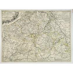
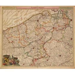
La partie Meridionale des Pays-Bas, Connue sous le nom de FLANDRE divisée en plusieurs Provinces. . .
Although the title cartouche states Flanders, or the Spanish part of the 17 provinces of the Low Countries, the map shows present-day Belgium. Title cartouche on the uppe...
Date: Paris, 1690
Selling price: ????
Please login to see price!
Sold in 2022
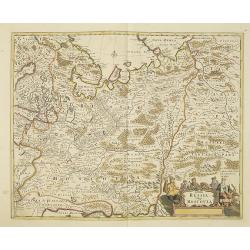
Tabula Russia Vulgo Moscovia.
A detailed map including all western Russia and most of Finland. With very decorative title cartouche.
Date: Amsterdam, 1690
Selling price: ????
Please login to see price!
Sold in 2011
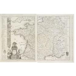
La Francia Antica, e Moderna Dedicata.
A beautiful and rare map in two sheets showing France. To the left coats of arms of the different provinces. With a dedication to Michael Sagramoso. The remarkable Vincen...
Date: Venice, 1690
Selling price: ????
Please login to see price!
Sold in 2012
Comitatus Namurci Tabula.
Carol Allard map of Belgium, shows the city of Namur in the center.
Date: Amsterdam, 1690
Selling price: ????
Please login to see price!
Sold in 2010
Leodiensis Episcopatus Pars Media, Comprehendens Hasbania Comitatum, Franchimontis Marchionatum, Stabulensem Principatum et Condrustum.
Fine map of the Liege region of Belgium including rivers, towns, and cities. The cities of Leige, Huy and Limburg are depicted.
Date: Amsterdam, 1690
Selling price: ????
Please login to see price!
Sold in 2010
Fiandra parte occidentale: dedicata all\'illustrissimo et eccelententissimo S. Giorgio Cocco, senatore meritissimo. . .
Map of the northern part of Flanders divided between France and Belgium. From the North Sea south, including major cities along the coast such as Dunkerque, France and Oo...
Date: Venice, c. 1690
Selling price: ????
Please login to see price!
Sold in 2010
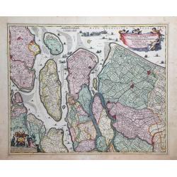
Delflandia, Schielandia et circumjacentes Insulae ut Voorna, Overflackea, Goerea, Yselmonda et aliae.
Detailed map of Southern Holland, which includes the cities of The Hague (Gravenhag), Rotterdam, Willemstad, Gouda and Delft (Delet). Ships and naval battles are shown th...
Date: Amsterdam, 1690
Selling price: ????
Please login to see price!
Sold in 2010
Comitatus Hnnoniae et Episcopatus Cambresis Descriptio.
Map of the Belgium province of Hainault or Henegouwen by Frederick De Witt depicting major cities such as Arte, Chimay and Philippeville and major rivers and forests in t...
Date: Amsterdam, 1690
Selling price: ????
Please login to see price!
Sold in 2010
Hollandiae Pars Meridionalior Vulgo Zuyd-Holland.
A regional map of Holland by Nicholas Visscher depicting major cities such as Breda, Gouda and Gorcum and major river systems and bodies of water. A very detailed cartouc...
Date: Amsterdam, circa 1690
Selling price: ????
Please login to see price!
Sold in 2010
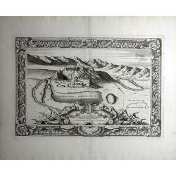
Chnin/Fortezza nella Dalmatia. Conqustata alla SS. Republica di Venetia. Dall eccellenza del sig. Cau: proc: Girolamo Corner/Generale De Dalmatia et Albania etc: Dedicata/ All' Illustrissimo Sig: Catarino Primogenita Suo.
Vincenzo Coronelli was both cleric and encyclopedist, with a particular interest in geography and cartography. He joined the Franciscan Order in Venice in 1665 and six ye...
Date: Venice, 1690
Selling price: ????
Please login to see price!
Sold in 2010
Hellas seu Graecia universa.
From the Hornius edition of the atlas of the Ancient World by Janssonius. No text on verso.After J. Laurenbergio / Nicholas Visscher.
Date: Amsterdam, ca 1690
Selling price: ????
Please login to see price!
Sold in 2012
Attica Megarica.
From the Hornius edition of the Ancient Atlas with Janssonius. No text on verso.Fine copperplate engraving of Attica and the surrounding regions with the cities of Athens...
Date: Amsterdam, ca 1690
Selling price: ????
Please login to see price!
Sold in 2010
Aeneae Troiani navigatio.
From the Hornius edition of the Ancient Atlas by Janssonius. No text on verso
Date: Amsterdam ca 1690
Selling price: ????
Please login to see price!
Sold in 2010
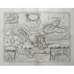
Argonautica.
Petrus Kaerius coelavit
Date: Amsterdam, ca 1690
Selling price: ????
Please login to see price!
Sold in 2012
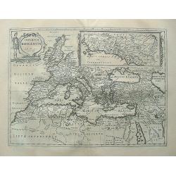
Imperium Romanum. Auth. Phil. Briet e Societ Iesu.
From the Hornius edition of the Ancient Atlas by Janssonius. No text on verso
Date: Amsterdam, ca 1690
Selling price: ????
Please login to see price!
Sold in 2010
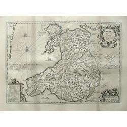
Cambriae typus, Auctore Humfredo Lhuydo.
From the Hornius edition of the Ancient Atlas by Janssonius. No text on verso.Engraved by Petrus Kaerius.
Date: Amsterdam, ca 1690
Selling price: ????
Please login to see price!
Sold in 2013
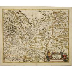
Tabula Russia Vulgo Moscovia.
A detailed map including all western Russia and most of Finland. With very decorative title cartouche.
Date: Amsterdam, 1690
Selling price: ????
Please login to see price!
Sold in 2010
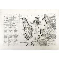
Isola D'oleron Nelle Piaggie Occidentali della Francia, Dedicata Dal P. Maestro Coronelli, coscmografo et Lettore Publico all Illustrisimo, et Eccellentissimo Sig. Polo Dona...
A beautiful map showing the isle of Oleron, located in the Bay of Biscay off the coast of France, from Vincenzo Coronelli's Corso Geografico Universale. A numbered key of...
Date: Venice, 1690
Selling price: ????
Please login to see price!
Sold in 2010
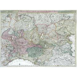
De Sotel Des Oorlogs in Italien, Waar in Vertoont Werden De Staat Van Milano, De Republicen Van Venetien en Genoua, De Landen Van Parma, Mantoua, Modena, Ferrara ...
Large, highly detailed map of the Duchy (state) of Milan, the republics of Venice and Genoa, and the regions of Parma, Mantua, Modena and Ferrara of northern Italy by Nic...
Date: Amsterdam, c. 1690
Selling price: ????
Please login to see price!
Sold in 2010