Browse Listings in Europe
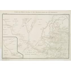
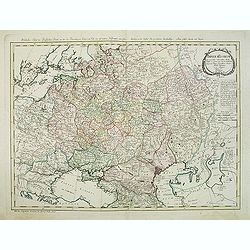
Carte des Monts Altaisk et des deserts salins qui avoisinent.
Map of the Altai Mountains in Central Russia, from a second French edition of Peter Simon Pallas' Voyages du Professeur Pallas, dans Plusieurs Provinces de l'Empire de Ru...
Date: Paris, Maradan, 1794
Selling price: ????
Please login to see price!
Sold in 2010
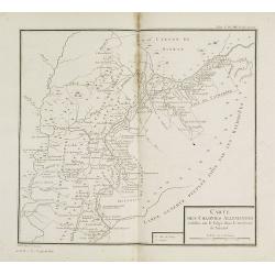
Carte des colonies Allemandes établies sur le Volga dans le territoire de Saratof.
Map of south west of Russia around Saratof. Map from a second French edition of Peter Simon Pallas' Voyages du Professeur Pallas, dans Plusieurs Provinces de l'Empire de ...
Date: Paris, Maradan, 1794
Selling price: ????
Please login to see price!
Sold in 2010
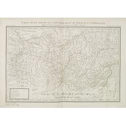
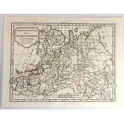
Carte d'une partie des gouvernemens de Tobolsk et d'Irkoutsk. . .
Map of the region around Lake Baikal. Map from a second French edition of Peter Simon Pallas' Voyages du Professeur Pallas, dans Plusieurs Provinces de l'Empire de Russie...
Date: Paris, Maradan, 1794
Selling price: ????
Please login to see price!
Sold in 2010
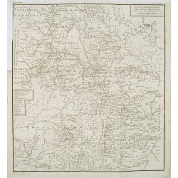
Carte mineralogique des Monts Ouralsks depuis la source de la Bielaia jusqu'à la Sosva.
Map from a second French edition of Peter Simon Pallas' Voyages du Professeur Pallas, dans Plusieurs Provinces de l'Empire de Russie et dans l'Asie Septentrionale, engrav...
Date: Paris, Maradan, 1794
Selling price: ????
Please login to see price!
Sold in 2010
A New Map of the Kingdom of Poland with all its Divisions and The Dismember'd Provinces by Samuel Dunn, Mathematician
A finely detailed map of the "Kingdom of Poland" by created by Samuel Dunn and published by the Laurie and Whittle firm of London. The map includes the regions ...
Date: London, 1794
Selling price: ????
Please login to see price!
Sold in 2010
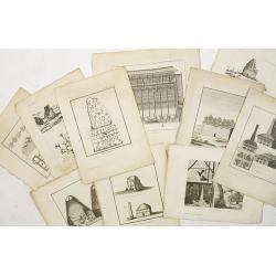
10 engravings of architecture prints : Ancien batiment à Bolgari, et Monnoies. . .
10 Engravings of buildings and structures in Russia from a second French edition of Peter Simon Pallas' Voyages du Professeur Pallas, dans Plusieurs Provinces de l’Empi...
Date: Paris, Maradan, 1794
Selling price: ????
Please login to see price!
Sold in 2010
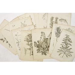
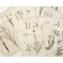
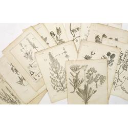
12 engravings of botanical prints : pyrus salicifolia. . .
12 Engravings from a second French edition of Peter Simon Pallas' Voyages du Professeur Pallas, dans Plusieurs Provinces de l’Empire de Russie et dans l’Asie Septentr...
Date: Paris, Maradan, 1794
Selling price: ????
Please login to see price!
Sold in 2019
12 engravings of botanical prints: Hedisarum grandiflorum. . .
12 Botanical engravings from the second French edition of Peter Simon Pallas' Voyages du Professeur Pallas, dans Plusieurs Provinces de l’Empire de Russie et dans l’A...
Date: Paris, Maradan, 1794
Selling price: ????
Please login to see price!
Sold in 2018
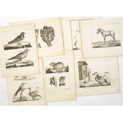
7 animals engravings prints : Alauda tatarica. . .,cheval sauvage, piège pour les oiseaux, lepus alpinus. . .,grue blanche. . .,fringilla calcarata, fourneau pour la préparation des cuirs. . .,
7 engravings from a second French edition of Peter Simon Pallas' Voyages du Professeur Pallas, dans Plusieurs Provinces de l’Empire de Russie et dans l’Asie Septentri...
Date: Paris, Maradan, 1794
Selling price: ????
Please login to see price!
Sold in 2015
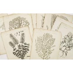
10 engraving of botanical prints : astragalus melilotoides. . .
10 Engravings from a second French edition of Peter Simon Pallas' Voyages du Professeur Pallas, dans Plusieurs Provinces de l’Empire de Russie et dans l’Asie Septentr...
Date: Paris, Maradan, 1794
Selling price: ????
Please login to see price!
Sold in 2015
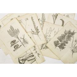
9 engravings of botanical prints: Cucubalus fruticosus. . .
9 Engravings from a second French edition of Peter Simon Pallas' Voyages du Professeur Pallas, dans Plusieurs Provinces de l’Empire de Russie et dans l’Asie Septentri...
Date: Paris, Maradan, 1794
Selling price: ????
Please login to see price!
Sold in 2022
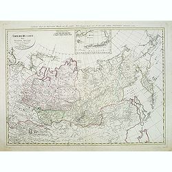
Imperium Russicum, cum regionibus adiacentibus duabus Tabulis ex optima quae A. 1784 tribus foliis comparavit Mappa geographica, aliisque subsidiis delineatum a C. Mannert, Tabula Ima. . .
A detailed map of the European part of the Russian Empire. Very rare map. Copper etching by C. Mannert and edited by Adam Gottlieb Schneider and Johann Christoph Weigel. ...
Date: Nuremberg, 1794
Selling price: ????
Please login to see price!
Sold in 2011
Imperii Russici Pars Orientem Spectans Tab. II da. ex optimis subsidiis delineata a. C. Mannert Norimberge Prostat in Officina A. G. Schneideriana. . .
The Russian empire eastward from the Dvina River, indicating some still unexplored coastlines in Nova Zemlya and northeastern Siberia. Includes an inset with a portion of...
Date: Nurnburg, 1794
Selling price: ????
Please login to see price!
Sold in 2011
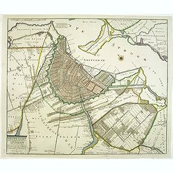
Nieuwe kaart van de Wydberoemde Koopstat Amsteldam . . .
Rare and detailed town-plan of Amsterdam, originally published by P.Mol and 1770, this is the later edition by J. Covens and son, published between 1778 and 1794.Titel in...
Date: Amsterdam, 1778 - 1794
Selling price: ????
Please login to see price!
Sold in 2012
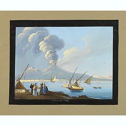
Canera del 1794
Very fine, highly detailed gouache depicting a busy Bay of Naples. Finely executed with boats in the harbor and figures on the shoreline watching the dramatic, fiery erup...
Date: Italy, c.1794
Selling price: ????
Please login to see price!
Sold in 2012
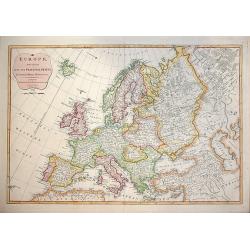
EUROPE, Divided into Principal States. . .
Decorative and highly detailed map of Europe by the famous mathematician Samuel Dunn and published by Laurie & Whittle, 53 Fleet Street London
Date: London, 12th May, 1794
Selling price: ????
Please login to see price!
Sold in 2015
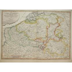
The Catholic Netherlands, or The Low Countries. Comprehending The Provinces of Brabant, Gelderland, Limburg, Luxemburg, Haynaut, Namur, Flanders, Cambre Sis & Artois by Samuel Dunn Mathematician.
A highly detailed map of the Netherlands by Samuel Dunn Published by R. Laurie & J. Whittle No 53 Fleet Street May 1794.
Date: London, 1794
Selling price: ????
Please login to see price!
Sold in 2014
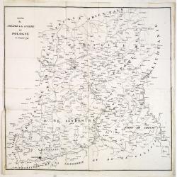
Partie du Théatre de la guerre en Pologne de l'année 1794.
Rare copper engraved map of Poland during the Greater Poland Uprising of 1794. The map is very detailed and also includes battle fields.
Date: Paris, after 1794
Selling price: ????
Please login to see price!
Sold in 2014
12 engravings of botanical prints : astragalus dasyanthus. . .
12 Engravings from a second French edition of Peter Simon Pallas' Voyages du Professeur Pallas, dans Plusieurs Provinces de l’Empire de Russie et dans l’Asie Septentr...
Date: Paris, Maradan, 1794
Selling price: ????
Please login to see price!
Sold in 2015
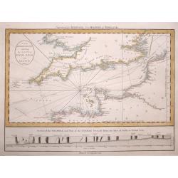
The British Channel including the Coasts of England and France.
The British Channel including the Coasts of England and France by The British Channel including the Coasts of England and France by Thomas Jefferys, published in 1794.T...
Date: London, 1794
Selling price: ????
Please login to see price!
Sold in 2014
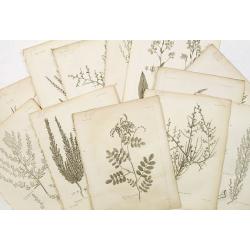
12 engravings of botanical prints : Salicorna Foliata. . .
12 Engravings from a second French edition of Peter Simon Pallas' Voyages du Professeur Pallas, dans Plusieurs Provinces de l’Empire de Russie et dans l’Asie Septentr...
Date: Paris, Maradan, 1794
Selling price: ????
Please login to see price!
Sold in 2015
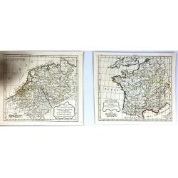
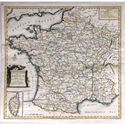
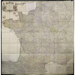
(2 Maps) La Gaule & Partie de L'Empire Francais Royaumes de Hollande, de Westphalie, grand duche de Berg
Two maps of France at different times during their history. They are by Delamarche, the successor of Robert de Vaugondy.
Date: Paris, 1794
Selling price: ????
Please login to see price!
Sold in 2017
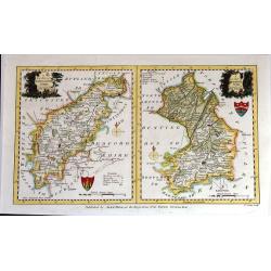
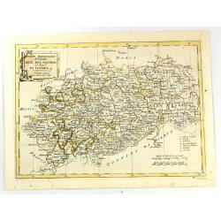
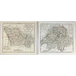
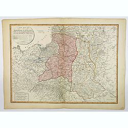
A New Map of Northhamptonshire & Cambridgeshire Drawn from the latest Authorities (Two maps on one page)
Two attached charming and detailed 18th Century county maps engraved by Thomas Condor for “The New And Complete English Traveller” in London. Published by Alexander H...
Date: London, 1794
Selling price: ????
Please login to see price!
Sold in 2016
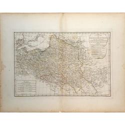
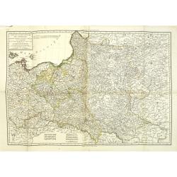
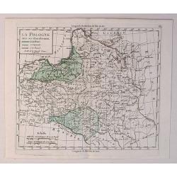
Royaume de Pologne. Par Robert de Vaugondy
Map of Poland and Lithuania by C. F. Delamarche, successor of Robert de Vaugondy, Geographer. With a color key to Russian, Prussian and Austrian possessions.C.F. Delamarc...
Date: Paris, 1794
Selling price: ????
Please login to see price!
Sold in 2015
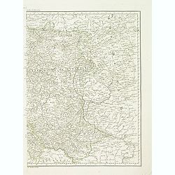
Partie Septenttrionale de la Russie Europeenne par Robert de Vaugondy
Map of European Russia by C. F. Delamarche, successor of Robert de Vaugondy, Geographer. With a color key to Russian, Prussian and Austrian possessions.C.F. Delamarche wa...
Date: Paris, 1794
Selling price: ????
Please login to see price!
Sold in 2019
A New and Accurate Map of France, divided into Departments, Districts....
A fine map of France from Spencer's 'History of England'. The title cartouche features the French flag and a military helmet.There is an insert of the Island of Corsica.
Date: London, 1794
Selling price: ????
Please login to see price!
Sold in 2016
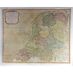
Seat of War in the Seven United Provinces, Comprehending Holland, Zeeland, Utrecht, Gelders, Over-Yssel, Frieseland and Groningen; with the Land of Drant; also Dutch Flanders and Dutch Brabant
An extraordinary 1794 map of the Netherlands, or Holland, by Laurie and Whittle. It features the entire region in extraordinary detail, offering both topographical and po...
Date: London, 1794
Selling price: ????
Please login to see price!
Sold in 2018
Parte Meridionale del Circolo Dell' Alta Sassonia ....
The Southern Part of the Circle of Upper Saxony with Lusatia etc. The map comes from the rare geographical atlas that was published in Siena by Pazzini Carli between 1798...
Date: Siena, 1794
Selling price: ????
Please login to see price!
Sold in 2016
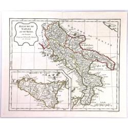
Royaume de Naples et de Sicile ...
The Kingdom of Naples is the southernmost portion of the Italian peninsular. The map features include a decorative title cartouche and an inset map of Sicily. Each separa...
Date: Paris, 1794
Selling price: ????
Please login to see price!
Sold in 2016
(2 Maps) La Republique Helvetique & Poitou, Aunis, Saintonge et Angoumous. La Marche, Limosen et Auvergne.
Two detailed maps by Delamarche, a worthy successor to R. de Vaugondy. ~One map is of Switzerland, and the other is of several provinces of France.
Date: Paris, 1794
Selling price: ????
Please login to see price!
Sold in 2016
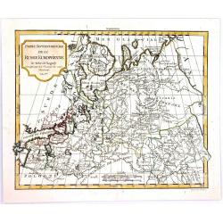
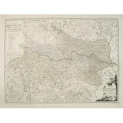
Partie Septentrionale de la Russie Europeenne.
A highly detailed map of the Northwestern part of Russia, from the Gulf of Finland and Poland, to the western part of Asian Russia, by Charles Francois Delamarche, the su...
Date: Paris, 1794
Selling price: ????
Please login to see price!
Sold in 2016
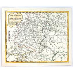
Partie Meridionale de la Russie Europeenne, tartarie Russienne, Petit Tartatie.
A highly detailed map of middle Russia, from Poland to Siberia, by Charles Francois Delamarche, the successor to Robert de Vaugondy.Charles François Delamarche, (1740–...
Date: Paris, 1794
Selling price: ????
Please login to see price!
Sold in 2016
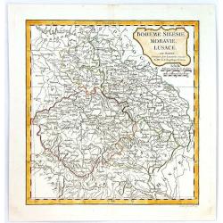
Boheme, Silesie, Moravie, Lucace.
A highly detailed map of Bohemia, Silesia, Moravia and Lusace, by Charles François Delamarche, the successor to Robert de Vaugondy.Charles Francois Delamarche, (1740–1...
Date: Paris, 1794
Selling price: ????
Please login to see price!
Sold in 2016
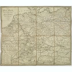
Map of the Empire of Germany, Including All the States Comprehended Under that Name: With the Kingdom of Prussia, &c.
A huge, striking, two panel wall map of Germany, Austria, Bohemia (Czech Republic), Poland, Lithuania, Prussia, Switzerland, Holland (the Netherlands), Belgium and Denmar...
Date: London, 1794
Selling price: ????
Please login to see price!
Sold in 2016
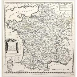
A New & Accurate Map of France, Divided Into Departments, districts & c. as Decreed by the National Assembly.
A highly detailed map of France, published by John Cary, the founder of the famous English cartographic firm. Detail is copious and precisely delineated, including mounta...
Date: London, 1794
Selling price: ????
Please login to see price!
Sold in 2019
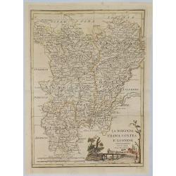
La Borgogna Franca Contea E Lionese.
A pleasant map of the Borgogna, Franca Contea and Lionese regions of France, by Carli Pazzini in Sienna in 1794. The map features a cartouche with a peasant leading cattl...
Date: Siena, 1794
Selling price: ????
Please login to see price!
Sold in 2019
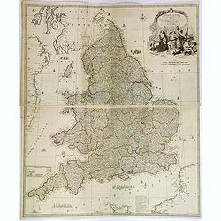
England and Wales drawn from the most accurate Surveys. . .
A delightful, large four sheet map of England and Wales, published in London towards the end of the eighteenth century. This impressive large-scale map was drawn by Rocqu...
Date: London, ca 1794
Selling price: ????
Please login to see price!
Sold in 2018
A New Map of the Kingdom of Poland, with its Dismembered Provinces and the Kingdom of Prussia.
This important 1794 map by Thomas Kitchin shows the Kingdom of Poland during the very brief transitional period between the second and third partitions. Map extent is fro...
Date: London, 1794
Selling price: ????
Please login to see price!
Sold in 2019
Die Insel Jura.
A decorative map of Jura Island in western Scotland, from Von Reilly's remarkable atlas published in 1794.Austrian born Franz Johann Joseph von Reilly (1766-1820) produce...
Date: Austria, 1794
Selling price: ????
Please login to see price!
Sold in 2020
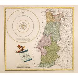
Karte von dem Konigreiche Portugal.
An attractive map of Portugal, including a representation of the solar system in the upper left-hand corner. With a charming title cartouche held by a cherub in the lower...
Date: Vienna, 1795
Selling price: ????
Please login to see price!
Sold in 2016
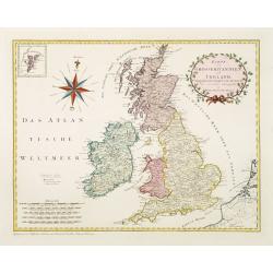
Karte von Grossbritannien und Ireland.
An attractive large sized map of Great Britain, including and inset map of the Shetland Islands in the upper left-hand corner. With a decorative title cartouche in the up...
Date: Vienna, 1795
Selling price: ????
Please login to see price!
Sold in 2011
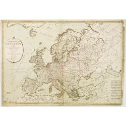
Carte générale de Europe, ou L'on voit le départ et le retour du Captaine Cook, dans ses différens Voyages.
Uncommon map of Europe, prepared by Hérisson after R.Bonne. Showing the departure and return tracks of Captain James Cook.
Date: Paris 1795
Selling price: ????
Please login to see price!
Sold
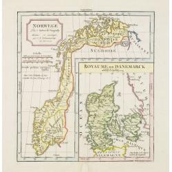
Norwege.. Royaume de Danemarck.
Attractive double page map of Norway and with a large inset map of Denmark.Original outline colors with later coulor addition.
Date: Paris 1795
Selling price: ????
Please login to see price!
Sold
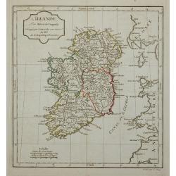
L'Irlande.
Map of Ireland, corrected by Lamarche with the mention of the year in a new cartouche : An. III.e De la République Française.
Date: Paris, 1795
Selling price: ????
Please login to see price!
Sold in 2011
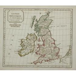
Les Isles Britanniques.
Map of the British Isles, corrected by Lamarche with the mention of the year in a new cartouche : l'an 3.me de la République Française
Date: Paris, 1795
Selling price: ????
Please login to see price!
Sold in 2011
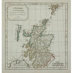
L'Ecosse.
Map of Scotland, corrected by Lamarche with the mention of the year in a new cartouche : L'An III.me de la République Française
Date: Paris, 1795
Selling price: ????
Please login to see price!
Sold in 2011
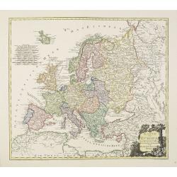
Karte von Europa.
An attractive oversized map of Europe. With a decorative title cartouche in the lower right-hand corner. Engraved by Kil. Ponheimer.Franz Johann Josef von Reilly (Vienna ...
Date: Vienna, 1795
Selling price: ????
Please login to see price!
Sold in 2012
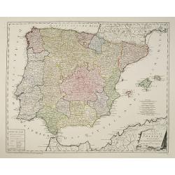
Karte von dem Konigreiche Spanien.
An attractive oversized map of Spain and Portugal. With a decorative title cartouche in the lower right-hand corner and a legend on the left side.Franz Johann Josef von R...
Date: Vienna, 1795
Selling price: ????
Please login to see price!
Sold in 2010
Carte de France divisée en LXXXIII departements Reduitte en neuf Feuilles égalles aux 24 Petittes de Illustre CASSINI. . .
Rare wall map of France published by Johann Michael Probst the younger (1757-1809). Prepared by Cassini.In 1747 Louis XV asked Caesar-Francois Cassini (Cassini III) to cr...
Date: Augsburg, 1795
Selling price: ????
Please login to see price!
Sold
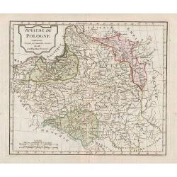
Carte de l'ancien royaume de Pologne partage entre la russie la prusse et l'Autriche. . .
Detailed map of Poland prepared by Pierre-Gilles Chanlaire (1758-1817). According to the tile the map is showing the old Kingdom of Poland, divided between the Russian, P...
Date: Paris, 1795
Selling price: ????
Please login to see price!
Sold in 2011
Carte de l'ancien royaume de Pologne partage entre la russie la prusse et l'Autriche. . .
Detailed map of Poland prepared by Pierre-Gilles Chanlaire (1758-1817). According to the tile the map is showing the old Kingdom of Poland, divided between the Russian, P...
Date: Paris, 1795
Selling price: ????
Please login to see price!
Sold in 2012
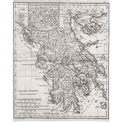
Graeciae Antiquae.
Graeciae Antiquae 1795 by Samuel John Neele. Published May 10th 1795 by Cadell & Davies of the Strand London.Highly detailed small map.
Date: London, 1795
Selling price: ????
Please login to see price!
Sold in 2012
Neue post karte von teutschland.
Uncommon post road maps and commercial roads of Germany, the Low Countries, Poland, Switzerland, Austria and Northern Italy, published by the well-known map makers and ma...
Date: Frankfurt am Main, 1795
Selling price: ????
Please login to see price!
Sold in 2013
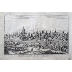
Prospect der Stadt London in England.
Rarely seen view of London from across the Thames. With many detailed buildings, including the London Bridge. A horse carriage and horsemen in the foreground. By Somnmer ...
Date: Vienna, c1795
Selling price: ????
Please login to see price!
Sold in 2013
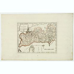
Vorstellung der zwischen der Wolga und dem Ural-Fluss gelegnen Wüsten, Steppe und der benachbarten Gegenden
Rare and detailed map of European Russia between the Volga and Ural rivers. From "Allgemeine Geschichte der neuesten Entdeckungen ... in vielen Gegenden des russisch...
Date: Bern, der typographischen Gesellschaft, 1777 or 1795
Selling price: ????
Please login to see price!
Sold in 2014
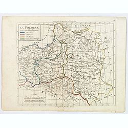
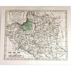
La Pologne avec ses demenbremens.
An interesting map of Poland with her borders at 1795, with original color showing the Prussian, Austrian and Russian parts. Mileage scales and explanation box. Map from ...
Date: Paris, 1795
Selling price: ????
Please login to see price!
Sold in 2020
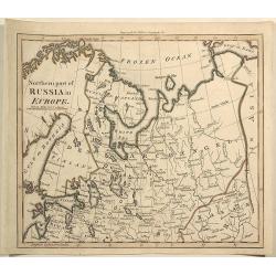
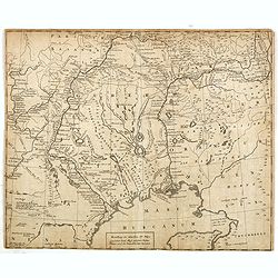
Northern Part of Russia in Europe.
Interesting antique map of the northern part of western Russia including Saint Petersburg, Novogorod, Russian Lapland, and the area stretching to the Gulf of Kara and the...
Date: London, 1795
Selling price: ????
Please login to see price!
Sold in 2019
Das Departement des Canals La Manche.
Manche is one of the original 83 departments created during the French Revolution on March 4, 1790. It was created from part of the province of Normandie. The first capit...
Date: Vienna, ca 1795
Selling price: ????
Please login to see price!
Sold in 2021
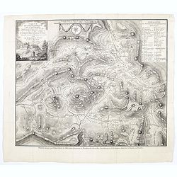
Carte pétrographique du St. Gothard : cette portion de la chaine centrale des Alpes comprend les Monts St. Gothard. . .
Rare detailed Petrographic map of St. Gothard, showing the central chain of the Alps including the St. Gothard and Fourche mountains, the sources of the Rhône, the Rhin,...
Date: Mechem, 1795
Selling price: ????
Please login to see price!
Sold in 2021
![Carte de l'ancien royaume de Pologne partage entre la Russie la Prusse et l'Autriche. . . [two sheet map]](/uploads/cache/45093-250x250.jpg)
Carte de l'ancien royaume de Pologne partage entre la Russie la Prusse et l'Autriche. . . [two sheet map]
Detailed map of Poland prepared by Pierre-Gilles Chanlaire (1758-1817). According to the tile the map is showing the old Kingdom of Poland, divided between the Russian, P...
Date: Paris, 1795
Selling price: ????
Please login to see price!
Sold in 2022
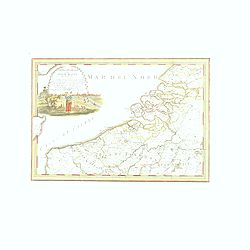
Carta Generale de Paesi Bassi Terzo Foglio. . .
This is one sheet of a six sheet map on the Low Countries, each with its own decorative cartouche and separate borders. This map encompasses the northwestern portion of B...
Date: Rome, 1795
Selling price: ????
Please login to see price!
Sold in 2020
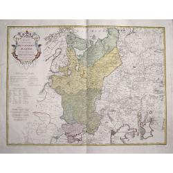
La Pologne avec ses Demenbremens.
A fine map of Poland and Lithuania by Delamarche in 1795. He has the Baltic Sea to the north and Hungary to the south.Charles Francois Delamarche (1740-1817) founded the ...
Date: Paris, 1795
Selling price: ????
Please login to see price!
Sold in 2020
Karte von dem Erzherzogthum Oesterreich.
An attractive oversized map of Austria. With a decorative title cartouche in the lower right-hand corner and a legend on the left side.Franz Johann Josef von Reilly (Vien...
Date: Vienna, 1796
Selling price: ????
Please login to see price!
Sold in 2012
Royaume de Pologne.
Map of Poland.
Date: Paris, 1796
Selling price: ????
Please login to see price!
Sold in 2011
Karte von dem Ruschischen Reiche in Europa.
Map shows the west part of Russia.
Date: Vienna, 1796
Selling price: ????
Please login to see price!
Sold in 2015
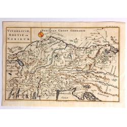
Vindelicie, Rhetie en Norikum.
Striking copper engraved original map of Greece, Bulgaria, Romania, and Macedonia. Christopher Cellarius (C. Keller) (1638-1707) was a geography professor who held positi...
Date: London, 1796
Selling price: ????
Please login to see price!
Sold in 2017
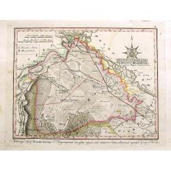
Moson Varmegye (Comitatus Mosoniensis).
A rare map on a large scale of the area of Moson county centered on Magyaróvár and Moson. It includes a section of today's Austria, with the northern part of Lake Neusi...
Date: Vienna, 1796
Selling price: ????
Please login to see price!
Sold in 2017
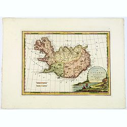
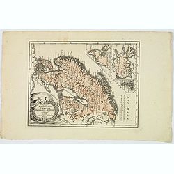
L'Isola d'Islanda Delineata Sulle ultime osservazioni.
Cassini’s splendid map depicts Iceland at the end of the eighteenth century. Though Iceland was geographically isolated from the European continent, for centuries it wa...
Date: Rome, 1796
Selling price: ????
Please login to see price!
Sold in 2019
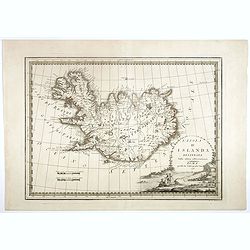
L'Isola d'Islanda Delineata Sulle ultime osservazioni.
Cassini’s splendid map depicts Iceland at the end of the eighteenth century. Though Iceland was geographically isolated from the European continent, for centuries it wa...
Date: Rome, 1796
Selling price: ????
Please login to see price!
Sold in 2018
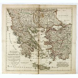
Griechenland, der Archipelagus, Albanien, Macedonien, Romanien und ein Theil von Anadoli: nach De la Rochette, Le Clerc etc ... Schneider & Weigel, 1796.
Nice map of Greece, Albania, Macedonia and Romania by Weigel.
Date: Augsburg, 1796
Selling price: ????
Please login to see price!
Sold in 2019
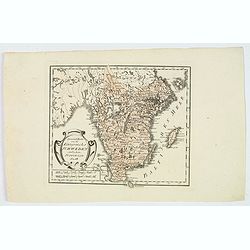
Spezial Karte vom des Konigreichs Schweden sudlichen Provinzen. . .
Map shows the southern most part of Sweden, Götaland. The area includes the ten historical provinces, also called "Landscapes", Småland, Öland, Västergötla...
Date: Vienna, 1796
Selling price: ????
Please login to see price!
Sold in 2020
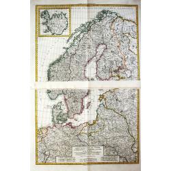
General Karte von den Konigreichen Schweden Daenemark u Norwegen mit Gronland und den Inseln Island und Foeroer.
Von Reilly's map of Scandinavia, together with insets of Iceland, Greenland and the Faroe islands. Elaborate title cartouche facing to the east of the map. With some good...
Date: Vienna, 1796
Selling price: ????
Please login to see price!
Sold in 2019
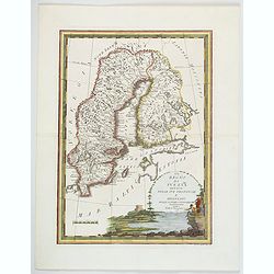
Il Regno di Svezia divisio nelle sue provincie e delineato. . .
This delightful map of Sweden and Finland highlights rivers, lakes, mountains and towns. The decorative title cartouche depicts a man fishing with small ships sailing in ...
Date: Rome, 1796
Selling price: ????
Please login to see price!
Sold in 2020
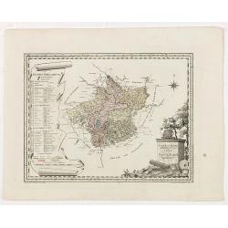
Natur und Kunst Producten karte von Oestreich Obderens.
Rare map that shows the locations of the factories or growing areas of "natural products". The title cartouche at the bottom right, the explanations of symbols ...
Date: Vienna, 1796
Selling price: ????
Please login to see price!
Sold in 2020
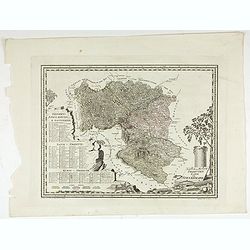
Natur und Producten Karte von Kaernten.
Nature and products map of Carinthia. Map of J.W. Engelmann after H.W. von Blum, taken from "Natur und Kunst Producten Atlas der Oesterreichischen, deutschen Staaten...
Date: Viena, 1796
Selling price: ????
Please login to see price!
Sold in 2022
Natur und Producten Karte von Steyermark.
Nature and products map of Styria. Map of J.W. Engelmann after H.W. von Blum, taken from "Natur und Kunst Producten Atlas der Oesterreichischen, deutschen Staaten&qu...
Date: Viena, 1796
Selling price: ????
Please login to see price!
Sold in 2022
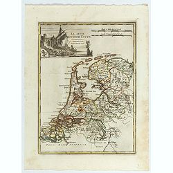
Le Sette Provincie Unite.
A rare and detailed map of the seven provinces of the Low Countries by Pazzini, Carli (1707-1769) and Bartolomeo Borghi (1750-1821). Features decorative title cartouche....
Date: Siena, 1796
Selling price: ????
Please login to see price!
Sold in 2023
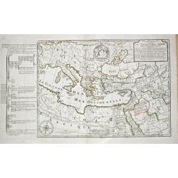
Carte de la Geographie Sacree pour L ' Ancien Testament. 1716.
Pierre Moullart-Sanson, grandson of Nicolas Sanson Sr., succeeded by his nephew Gilles Robert de Vaugondy. Charles François Delamarche (1740-1817), successor to Didier R...
Date: Paris, 1797
Selling price: ????
Please login to see price!
Sold
![[I. Dago] [I. Wormso]](/uploads/cache/22199-250x250.jpg)
[I. Dago] [I. Wormso]
Extremely rare sea chart centered on Hiiumaa (Dago) and Vormsi (Wormso) Islands, off the coast of Estonia.
Date: Amsterdam, 1797
Selling price: ????
Please login to see price!
Sold in 2008
LES COURONNES DU NORD, le Danemarck, la Norwège, l' Islande, et la Suède. partie de la Russie d' Europe, de la Pologne, la Prusse, partie de l' Allemagne et des Frontières de la France.
Charles François Delamarche (1740-1817), Paris-based geographer and publisher, successor to Didier Robert de Vaugondy after his death in 1786.Two maps together depicting...
Date: Paris, 1797
Selling price: ????
Please login to see price!
Sold in 2009