Browse Listings in Europe
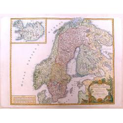
Les Royaumes de Suede et de Norwege.
Detailed, large map of Scandinavia published in Vaugondy's "Atlas Universel," one of the best-selling French atlases of the 1700s. It has a large, fancy title c...
Date: Paris, 1756
Selling price: ????
Please login to see price!
Sold in 2013
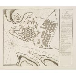
Plan de la Ville et du Port Mahon et du Fort St. Philippe.
Scarce separately issued map of the fort and town St.Philippe and port Mahon in a first state. In upper left corner the title and a key in French (A-Z, Aa-Bb) and a key i...
Date: Paris, ca. 1756
Selling price: ????
Please login to see price!
Sold in 2013
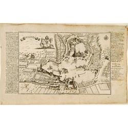
Plan du Fort St. Philippe et de ses Environs : Situés à l'entrée du Port Mahon dans l'Isle de Minorque / Envoyés par Mgr le Marechal Duc de Richelieu. . .
Separately published print of Fort Philippe with numbered key [key: 1-51] to the right. Published on 24 May 1756 by R.J. Julien à l'Hotel de Soubise in Paris. According ...
Date: Paris, ca. 1756
Selling price: ????
Please login to see price!
Sold in 2013
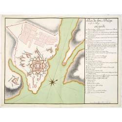
Plan du fort St. Philipe en l'isle de Minorque. . .
Manuscript plan of Fort Philippe with a lettered key [key: A-Z a-h] to the right. This manuscript plan is very similar to the separately published plan by R.J. Julien of...
Date: Paris, ca. 1756
Selling price: ????
Please login to see price!
Sold in 2016
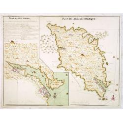
Plan de Lisle de Minorque. / Plan du port Mahon.
Manuscript map of the island of Minorca. The left hand part shows the Bay of Mahon with the town of Mahon and Fort Philippe with a lettered key [A-Z &].The map is fil...
Date: Paris, ca. 1756
Selling price: ????
Please login to see price!
Sold
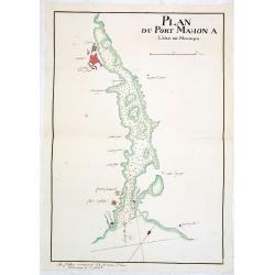
Plan du Port Mahon à l'isle de Minorque.
Uncommon early French manuscript map of the bay and town-planof port Mahón. The entrance of the bay is blocked by "Staccades". St. Philip's Castle still in it ...
Date: Minorca ? / France, ca. 1756
Selling price: ????
Please login to see price!
Sold
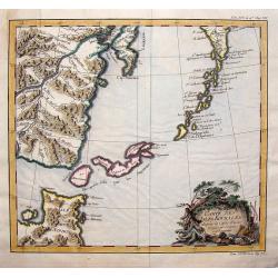
Carte des Isles Kouriles D'apres la Carte Russe.
A striking map of the Kuril Islands off the shore of Japan. The ownership of these volcanic islands has been in contention between Russia and Japan. The southern part of ...
Date: Paris, 1756
Selling price: ????
Please login to see price!
Sold in 2019
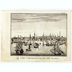
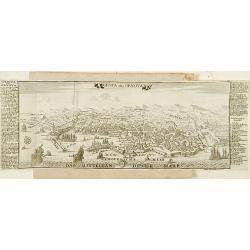
La Citta d'Amsterdam Capitale della Olanda.
Fine panoramic view of Amsterdam seen from the Y, taken from Storia moderna di tutti I popoli del mondo , edited by Thomas Salmon. A Italian edition of this famous work, ...
Date: Venice, 1740-1756
Selling price: ????
Please login to see price!
Sold in 2019
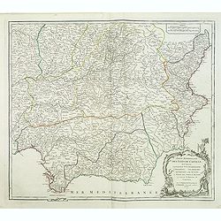
Partie occidentale de la Lombardie. . .
Detailed map of region of north of Italy from his "Atlas Universel".Gilles Robert de Vaugondy (1688–1766), also known as Le Sieur or Monsieur Robert, and his ...
Date: Paris, 1756
Selling price: ????
Please login to see price!
Sold in 2016
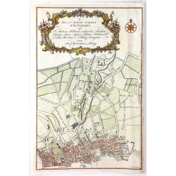
A New and Accurate Survey of the Parishes of St. Andrew's Holburn....
A fine, detailed hand-colored map of the Charterhouse Liberty area. From Maitland's "THE HISTORY AND SURVEY OF LONDON" published by Osborne & Shipton in Lon...
Date: London, 1756
Selling price: ????
Please login to see price!
Sold in 2016
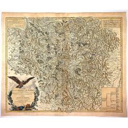
Carte de la Lorraine et du Barbois ....
Striking 1756 map of the French wine making region of Lorraine by Robert de Vaugondy. It covers the north east portion of France along with parts of neighboring Germany f...
Date: Paris , 1756
Selling price: ????
Please login to see price!
Sold in 2017
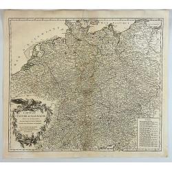
Carte de L'Empire D'Allemagne Divise en Ses Dix Cercles.
A detailed map of Germany, including the Low Countries, Bohemia and Poland. It shows political divisions, numerous place names, rivers and topography. It is decorated by ...
Date: Paris, 1756
Selling price: ????
Please login to see price!
Sold in 2017
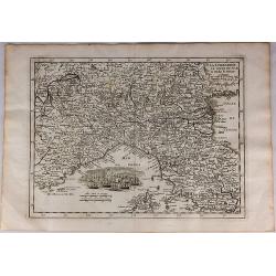
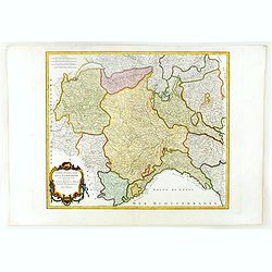
La Lombardie le Cours du Po & le Duche de Toscane...
A fine map of northern Italy with a decorative cartouche illustrating some vessels in the gulf of Genoa. With manuscript notes in right margin giving some historical info...
Date: Paris, 1756
Selling price: ????
Please login to see price!
Sold in 2018
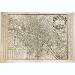
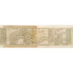
Plan de Paris divisé en seize quartiers. . .
Large decorative plan with lettered key to the streets, parishes, colleges, hospitals and communities. The end of the address has been erased, state not cited by Vallée.
Date: Paris, 1756
Selling price: ????
Please login to see price!
Sold in 2021
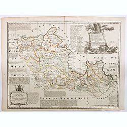
An Accurate Map of Berkshire divided into its Hundreds . . .
A good clean copy of by far the most important eighteenth-century English atlas to be published before the appearance of John Cary's new English atlas in 1787 (Hodson). T...
Date: London ca 1756
Selling price: ????
Please login to see price!
Sold in 2023
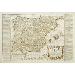
L'Espagne divisée en ses Royaumes et .. avac le Royaumes de Portugal.
RARE map of Spain and Portugal prepared by J.B.Nolin and published by Daumont. A visually stunning map with a large title cartouche. To the left and right text boxes with...
Date: Paris 1757
Selling price: ????
Please login to see price!
Sold

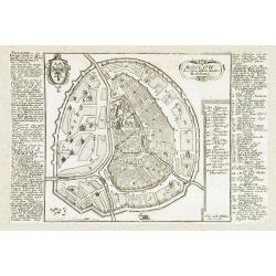
Lucca.
Very rare bird's-eye plan of Lucca. To the sides a historical description and a numbered key.George Christophe Kilian (1709-1780) active as engraver of Augsburg published...
Date: Augsburg 1757
Selling price: ????
Please login to see price!
Sold
Lausanna.
Very rare bird's-eye plan of Lausanne. To the sides a historical description and a lettered key.George Christophe Kilian (1709-1780) active as engraver of Augsburg publis...
Date: Augsburg 1757
Selling price: ????
Please login to see price!
Sold
Londen.
Very rare bird's-eye plan of London. To the sides a historical description and a numbered key.George Christophe Kilian (1709-1780) active as engraver of Augsburg publishe...
Date: Augsburg 1757
Selling price: ????
Please login to see price!
Sold
Genua oder Genova.
Very rare bird's-eye plan of Genova. To the sides a historical description and a numbered key.George Christophe Kilian (1709-1780) active as engraver of Augsburg publishe...
Date: Augsburg 1757
Selling price: ????
Please login to see price!
Sold
![Plan Alt und Neuer Fortificatizon von Malta gelegen auf der Insul gleiches Namens. [Valletta]](/uploads/cache/17369-250x250.jpg)
Plan Alt und Neuer Fortificatizon von Malta gelegen auf der Insul gleiches Namens. [Valletta]
Very rare bird's-eye plan of town and harbor of Valletta on Malta. To the sides a historical description and a numbered key.George Christophe Kilian (1709-1780) active as...
Date: Augsburg 1757
Selling price: ????
Please login to see price!
Sold
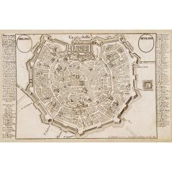
Milano - Meyland.
Very rare bird's-eye plan of Milan. To the sides a historical description and a numbered key.George Christophe Kilian (1709-1780) active as engraver of Augsburg published...
Date: Augsburg 1757
Selling price: ????
Please login to see price!
Sold
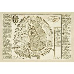
Moscow.
Very rare bird\'s-eye plan of Moscow. To the sides a historical description and a numbered key.George Christophe Kilian (1709-1780) active as engraver of Augsburg publish...
Date: Augsburg 1757
Selling price: ????
Please login to see price!
Sold
München.
Very rare bird's-eye plan of Munich. To the sides a historical description and a numbered key.George Christophe Kilian (1709-1780) active as engraver of Augsburg publishe...
Date: Augsburg 1757
Selling price: ????
Please login to see price!
Sold
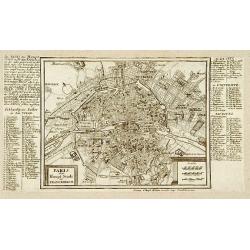
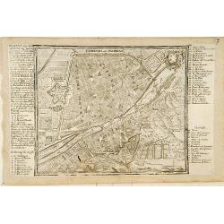
Paris.
Very rare bird's-eye plan of Paris. To the sides a historical description and a numbered key.George Christophe Kilian (1709-1780) active as engraver of Augsburg published...
Date: Augsburg 1757
Selling price: ????
Please login to see price!
Sold
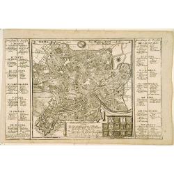
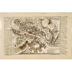
Roma.
Very rare bird's-eye plan of Rome. To the sides a historical description and a numbered key.George Christophe Kilian (1709-1780) active as engraver of Augsburg published ...
Date: Augsburg 1757
Selling price: ????
Please login to see price!
Sold
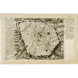
Bologna.
Very rare bird's-eye plan of Bologna. To the sides a historical description and a numbered key.George Christophe Kilian (1709-1780) active as engraver of Augsburg publish...
Date: Augsburg 1757
Selling price: ????
Please login to see price!
Sold
Fiorenza oder Florenz.
Very rare bird's-eye plan of Florence. To the sides a historical description and a numbered and lettered key.George Christophe Kilian (1709-1780) active as engraver of Au...
Date: Augsburg 1757
Selling price: ????
Please login to see price!
Sold
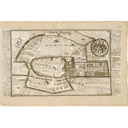
Saltzburg.
Very rare bird's-eye plan of Salzburg. To the sides a historical description and a numbered key.George Christophe Kilian (1709-1780) active as engraver of Augsburg publis...
Date: Augsburg 1757
Selling price: ????
Please login to see price!
Sold
Stutgart.
Very rare bird's-eye plan of Stuttgart. To the sides a historical description and a numbered key.George Christophe Kilian (1709-1780) active as engraver of Augsburg publi...
Date: Augsburg 1757
Selling price: ????
Please login to see price!
Sold
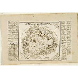
Wien.
Very rare bird's-eye plan of Vienna. To the sides a historical description and a numbered and lettered key.George Christophe Kilian (1709-1780) active as engraver of Augs...
Date: Augsburg 1757
Selling price: ????
Please login to see price!
Sold
![Cölln. [Cologne]](/uploads/cache/17380-250x250.jpg)
Cölln. [Cologne]
Very rare bird's-eye plan of Cologne. To the sides a historical description and a numbered key.George Christophe Kilian (1709-1780) active as engraver of Augsburg publish...
Date: Augsburg 1757
Selling price: ????
Please login to see price!
Sold
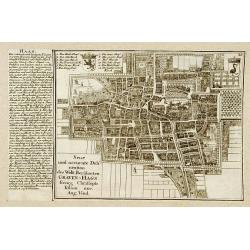
Haag.
Very rare bird's-eye plan of Den Haag. To the left side a historical description.George Christophe Kilian (1709-1780) active as engraver of Augsburg published his Kleiner...
Date: Augsburg 1757
Selling price: ????
Please login to see price!
Sold
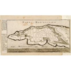
Malta ad Vallette.
Very rare bird's-eye plan of Valetta. To the left side a historical description and a lettered key.George Christophe Kilian (1709-1780) active as engraver of Augsburg pub...
Date: Augsburg 1757
Selling price: ????
Please login to see price!
Sold
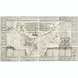
Nova illustrissimi principatus Pomeraniae descrptio.. .
"Only a small number of copies were printed and so this edition is a very rare object today" (Scharfe). THE MOST IMPORTANT EARLY MAP OF POMERANIA, the region on...
Date: Amsterdam, 1618-1757
Selling price: ????
Please login to see price!
Sold in 2015
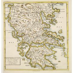
Oud Griekenland zo als 't eerste in Koninkrijken..
Very unusual map of ancient Greece. In upper left margin V. Deel Bladz.275.
Date: Utrecht c.1757
Selling price: ????
Please login to see price!
Sold
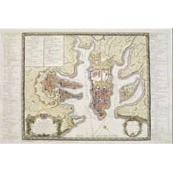
Plan general de la Ville capitale de Malta..
Attractive large scale plan of Valetta on Malta. With numbered key to the principal places of interest.The print has unfortunately some reinforcements of missing parts, c...
Date: Paris 1757
Selling price: ????
Please login to see price!
Sold
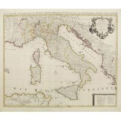
l''Italie.
Large map of Italy, Sicily, Sardinia, Corsica, part of the Balkan, France and northern Africa. Dressee sur les observations de Mrs de l'Academie royale etc. Originally de...
Date: Amsterdam, 1757
Selling price: ????
Please login to see price!
Sold in 2008
D' Reyse des Apostels Pauli na Roomen.
Dutch so-called 'Staten' bibles, published between 1637 and c. 1760, contained 5 maps: The World, 'Paradise', The Perigrinations, The Promised Land Canaan, The Travels of...
Date: Amsterdam / Leiden, R. & J. Wetstein / W. Smith / S. Luchtmans, 1757
Selling price: ????
Please login to see price!
Sold
Spatiosissimum Imperium Russiae Magnae juxta recentissimas Observationes Mappa Geographica . . .
Decorative map of Russia, from Livonia to Kamchatka, China, Tibet, and part of Japan Filled with place names, a nomadic tent encampments in Mongolia.Kamchatka in a curi...
Date: Augsburg, 1757
Selling price: ????
Please login to see price!
Sold in 2013
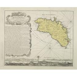
Carte topographique de l'isle Minorque dediée et presentée au roy par le chevalier de Beaurain. . . et communiquée au public par les Heritiers de Homan en l'an 1757.
A rare map depicting the island of Minorca. The upper left is decorated with a stunning title cartouche.The German text on the left side contains a lengthy description of...
Date: Nuremberg, 1757
Selling price: ????
Please login to see price!
Sold in 2010
Carte des grandes routes d'Angleterre, d'Ecosse.. Irlande.
Decorative map of British Isles with Rococo title cartouche. Engraved by Delahaye.
Date: Paris, 1757
Selling price: ????
Please login to see price!
Sold in 2009
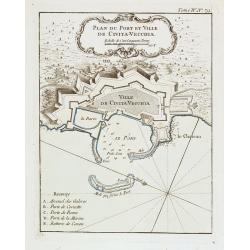
Plan du Port et Ville de Civita-Vecchia.
A military chart of Civita-Vecchia's fortifications and fort in the province of Rome. With a key : A-E.Jacques Nicolas Bellin (1703-1772) was one of the most important an...
Date: Paris, 1757
Selling price: ????
Please login to see price!
Sold in 2020
Moscow.
Very rare bird's-eye plan of Moscow. To the sides a historical description and a numbered key.George Christophe Kilian (1709-1780) active as engraver of Augsburg publishe...
Date: Augsburg 1757
Selling price: ????
Please login to see price!
Sold in 2009
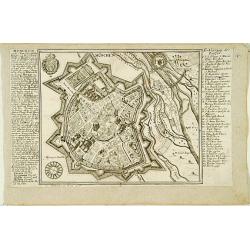
Plan de Breslau et du Siége de S.M. le R. de Pr. depuis le commencem. iusqu'au 18. de decemb. 1757. jour de la capitul
A rare plan of Breslau (today Wroclaw) during the siege 1757. It shows the day of the capitulation 18. December 1757. Engraved by J.C. Back. With a key below the title.
Date: 1757
Selling price: ????
Please login to see price!
Sold in 2011
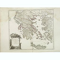
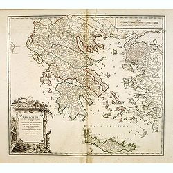
Graecia Vetus ex schardis Sansonianis desumpta. . .
Decorative map of ancient Greece and neighboring Islands in the Ionian and Aegean Seas, with a large decorative cartouche. Also shows a fair amount of Turkish Asia, along...
Date: Paris, 1757
Selling price: ????
Please login to see price!
Sold in 2012
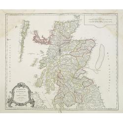
Le Royaume d'Ecosse.
Detailed map of Scotland, from and early edition of DeVaugondy's Atlas Universel. Includes towns, mountains, rivers, lakes and a host of other details. Decorative Cartouc...
Date: Paris, 1757
Selling price: ????
Please login to see price!
Sold in 2013
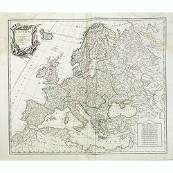
L'Europe divisée en ses principaux Etats,. . .
Detailled map of Europe from his "Atlas Universel".Gilles Robert de Vaugondy (1688–1766), also known as Le Sieur or Monsieur Robert, and his son, Didier Rober...
Date: Paris, ca.1757
Selling price: ????
Please login to see price!
Sold in 2011
Partie Meridionale des Etats de Castille où se trouvent l'Andalousie et le Roy.me de Grenade.
Decorative and highly detailed map of Southwestern Spain and including a decorative cartouche from his "Atlas Universel".Gilles Robert de Vaugondy (1688–1766)...
Date: Paris, 1757
Selling price: ????
Please login to see price!
Sold in 2011
Graecia Vetus ex schardis Sansonianis desumpta. . .
Decorative map of ancient Greece and neighboring Islands in the Ionian and Aegean Seas, with a large decorative cartouche. Also shows a fair amount of Turkish Asia, along...
Date: Paris, 1757
Selling price: ????
Please login to see price!
Sold in 2012
Kaart van de Stad Utrecht..
Detailed map of the town of Utrecht. Including several town along the river Vecht: Maarsen, Zuylen, Amelisweert, etc.Isaac Tirion was born in Utrecht ca. 1705. He came to...
Date: Amsterdam, 1757
Selling price: ????
Please login to see price!
Sold in 2013
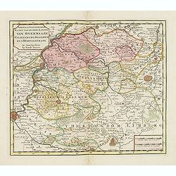
Nieuwe en naukeurige kaart van de drie landen van Overmaaze Valkenburg, Daalhem en s'Hertogenrade.
Detailed map of southern part of Limburg, including and east of Maastricht.Isaac Tirion was born in Utrecht ca. 1705. He came to Amsterdam ca. 1725. Tirion published a nu...
Date: Amsterdam, 1757
Selling price: ????
Please login to see price!
Sold in 2013
Nieuwe kaart van de Baronie van Breda. . .
Detailed map of western part of Brabant.
Date: Amsterdam, 1757
Selling price: ????
Please login to see price!
Sold in 2013
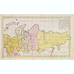
Russiae Imperium.
Scarce map of greater Russia, extending from Livonia in the west to Kamchatka. To the south it runs from Georgia (not shown as part of Russia) across the Caspian and Uzbe...
Date: Augsburg, 1757
Selling price: ????
Please login to see price!
Sold in 2013
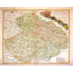
Carte Generale du Royaume de Boheme du Duche de Silesie et des Marquisats de Moravie et de Lusace. . .
Lovely copper engraved map shows Bohemia, Lustia & Silesia with high detail of cities, towns, rivers, lakes, mountains & forests. Features beautiful, ribboned, he...
Date: Nuremberg, 1757
Selling price: ????
Please login to see price!
Sold in 2013
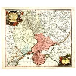
Theatrum belli Russorum Victoriis illustratum sive Nova et accurata Turcicarum et Tartaricum. . .
Uncommon and decorative map of Ukraine, showing the theatre of the Russo-Turkish War in the Ukraine in 1735-1739. The map gives detailed information of the fortifications...
Date: Nuremberg, ca. 1757
Selling price: ????
Please login to see price!
Sold in 2013
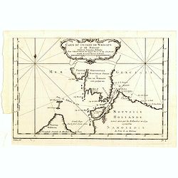
Carte Du Detroit de Waeigats ou De Nassau...
Detailed regional map of the Strait of Waeigats in the Arctic Sea. Includes a decorative title cartouche. One of the maps produced by Nichlas Bellin for Prevost d'Exiles ...
Date: Paris, 1757
Selling price: ????
Please login to see price!
Sold in 2020
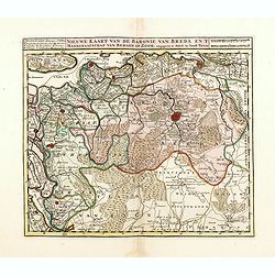
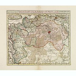
Nieuwe kaart van de Baronie van Breda en 't Markgraafschap van Bergen op Zoom. . .
Detailed map of western part of Brabant, centered on Breda.Isaac Tirion was born in Utrecht ca. 1705. He came to Amsterdam ca. 1725. Tirion published a number of importan...
Date: Amsterdam, 1757
Selling price: ????
Please login to see price!
Sold in 2016
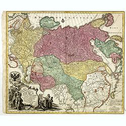
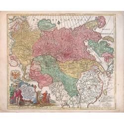
Spatiosissimum Imperium Russiae Magnae juxta recentissimas Observationes Mappa Geographica . . .
Decorative map of greater Russia, extending from Livonia in the west to Kamchatka, China, Tibet, Taiwan, Korea and part of Japan in the east. To the south it runs from Ge...
Date: Augsburg, 1757
Selling price: ????
Please login to see price!
Sold in 2014
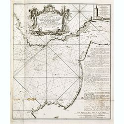
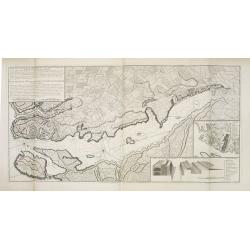
Carte géométrique de l'Entrée de la Rivière de Loire Représentée de Basse Mer dans les grandes Marées des Nouvelles et Pleines Lunes
Right hand part of a two sheet chart of the exit of the River Loire, prepared and published by Nicolas Magin (1663-1742). Engraved by Dheulland.
Date: Paris, 1757
Selling price: ????
Please login to see price!
Sold in 2015
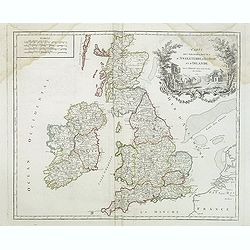
Carte des grandes routes d'Angleterre, d'Ecosse et d'Irlande.
Decorative map of British Isles with Rococo title cartouche. Engraved map by Delahaye. Relief shown pictorially.
Date: Paris, 1757
Selling price: ????
Please login to see price!
Sold in 2015
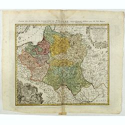
Mappa Geographica Regni Poloniae ex novissimis quotquot sunt mappis specialibus composita et al L.L. Stereographicae projectionis revocata a Tob. Mayero. . . .
Decorative map of Poland after Tobias Mayer who was based on Barnikel's map of Curland (1747) and Jan Nieprzecki's map of Lithuania (1749).Poland extends from Glogau and ...
Date: Nuremberg, 1757
Selling price: ????
Please login to see price!
Sold in 2020
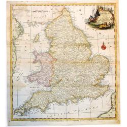
A New and Accurate Map of that District of Great Britain called England & Wales.
A very detailed map of Great Britain by Thomas Kitchin, from Walpoole's New & Complete British Traveller, published in 1784.Thomas Kitchin was among the most producti...
Date: London, 1757
Selling price: ????
Please login to see price!
Sold in 2015
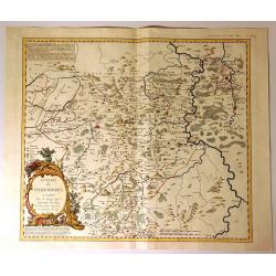
Evache de Paderborn.
Fine large map of the Archdiocese of Paderborn. It is an Archdiocese of the Latin Rite of the Roman Catholic Church in Germany. It was a diocese from its foundation in 79...
Date: Paris, 1757
Selling price: ????
Please login to see price!
Sold in 2020
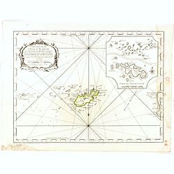
Carte reduite de l'isle d'Aurigni et des isles et roches voisines dressée au Depost des Cartes et Plans . . .
Sea of Guernsey.Relief shown by hachures. Depths shown by soundings. It shows soundings, anchorage's, channels, shoals, navigational sightings.
Date: Paris, 1757
Selling price: ????
Please login to see price!
Sold in 2015
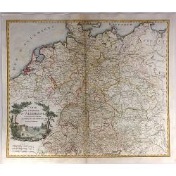
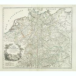
Carte de l'Empire d'Allemagne ou sont marquees exactement les routes des postes.
A stunning, scarce 1757 map of the German Empire by Robert de Vaugondy. It covers from Dunkirk in the east of France to Elblag in Poland, and south as far as the Gulf of ...
Date: Paris, 1757
Selling price: ????
Please login to see price!
Sold in 2019
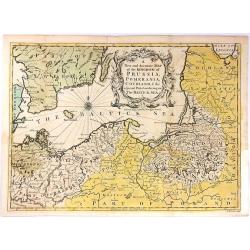
A New and Accurate Map of the Kingdom of Prussia,...
A pleasing and a detailed map of the Kingdom of Prussia
Date: London, 1757
Selling price: ????
Please login to see price!
Sold in 2016
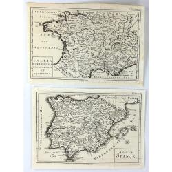
(2 Maps) Aloud Spanje & Gallia Narbonensis Lugdunensis et Aquitania
Two unusual maps of Ancient Europe by H. Besseling in Utrecht ca. 1757. One is of Ancient Spain (Aloud Spanje), and the other is of Ancient France, (Gallia Narbonensis et...
Date: Utrecht, 1757
Selling price: ????
Please login to see price!
Sold in 2018
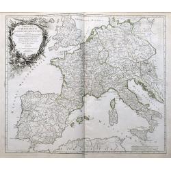
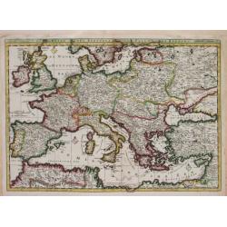
Imperium Caroli Magni Occidentis Imperatoris...
An attractive and detailed map of Charlemagne's empire, from England to the Mediterranean Sea. Includes the Low Countries, Germany, France, Spain, Switzerland, Austria, I...
Date: Paris, 1757
Selling price: ????
Please login to see price!
Sold in 2016
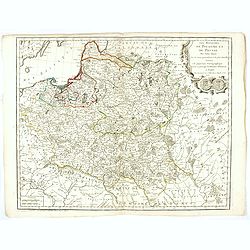
Les Royaumes De Pologne Et De Prusse Par Tobias Mayer . . . Chez Daumont . . . 1757
Rare map of Poland, Prussia, Russia and surrounding regions, based upon the map of Tobias Mayer.Published by Jean-Francois Daumont, who was active in Paris between approx...
Date: Paris, 1757
Selling price: ????
Please login to see price!
Sold
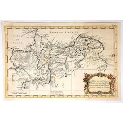
Eine Karte Von Dem Orenburger.
Fine detailed engraved map of the Orenburg region of Russia. It has a lovely Baroque cartouche. It was by Jonas Hanway in 1754.Orenburg is the administrative center of Or...
Date: Frankfurt, 1757
Selling price: ????
Please login to see price!
Sold in 2019
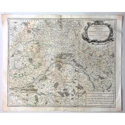
Gouvernement General D'Orleanois.
A beautiful 1753 de Vaugondy map of the Orleans Region in Central France. It covers from Corbeil-Essonnes south to Vatan in the north and from Tours east as far as Sens a...
Date: Paris, 1757
Selling price: ????
Please login to see price!
Sold in 2019
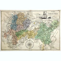
Charte Braunscheweigisch Luneburgischen Communion Hartze . . .
Manuscript drawn by L.F. Knorre in 1757 after information provided by J.H. Eggers. Showing part of the Duchy of Brunswick-Luneburg in what is now northern Germany.The map...
Date: Germany, 1757
Selling price: ????
Please login to see price!
Sold
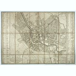
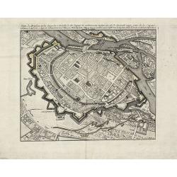
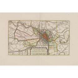
Plan de la ville de Berlin capitale de l'Électorat de Brandebourg et la résidence ordinaire du roi de Prusse. Berlin et Amsterdam, Sr. Neaulm, 1757.
Superb and very rare planof Berlin, reduced after a 4 sheet plan made under the direction of the Count of Schmettau. The map was co-published in Amsterdam and Berlin by J...
Date: Berlin, Amsterdam, 1757
Selling price: ????
Please login to see price!
Sold in 2017
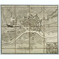
Plan de Cassel vérifié par Léopold capitaine ingénieur.
Beautiful town-plan of Kassel in Bavaria, reviewed by the captain engineer Johann Christian Leopold.Below right, an inset map of Kassel and its surroundings. The north is...
Date: Paris, 1757
Selling price: ????
Please login to see price!
Sold in 2017
![[detail from] Nova illustrissimi principatus Pomeraniae descrptio.. .](/uploads/cache/41152-250x250.jpg)
[detail from] Nova illustrissimi principatus Pomeraniae descrptio.. .
"only a small number of copies were printed and so this edition is a very rare object today" (Scharfe).
Date: Amsterdam, 1618-1757
Selling price: ????
Please login to see price!
Sold in 2018
Carte de l'empire d'Allemagne. . .
Detailed map of Germany from his "Atlas Universel".Gilles Robert de Vaugondy (1688–1766), also known as Le Sieur or Monsieur Robert, and his son, Didier Rober...
Date: Paris, 1757
Selling price: ????
Please login to see price!
Sold
![[detail from] Nova illustrissimi principatus Pomeraniae descrptio.. .](/uploads/cache/43600-250x250.jpg)
[detail from] Nova illustrissimi principatus Pomeraniae descrptio.. .
One sheet from THE MOST IMPORTANT EARLY MAP OF POMERANIA, the region on the south coast of the Baltic shared between Germany and Poland, from the Recknitz River near Stra...
Date: Amsterdam, 1618-1757
Selling price: ????
Please login to see price!
Sold in 2019
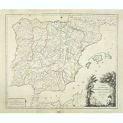
Carte des Royaumes d'Espagne et de Portugal.
Detailed map of Spain, Portugal and Baleares islands. Showing also southwestern part of France and north Africa from his "Atlas Universel".Gilles Robert de Vaug...
Date: Paris, 1757
Selling price: ????
Please login to see price!
Sold in 2019
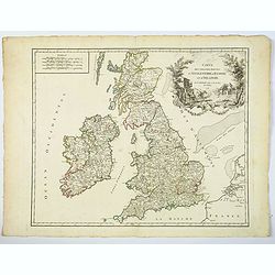
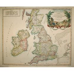
Carte des Grandes Routes d'Angleterre, d'Ecosse, et d'Irlande.
This is a delightful 1757 map of the British Isles by Robert de Vaugondy. The map extent is all of England, Wales, Scotland and Ireland, and it notes several important ro...
Date: London, 1757
Selling price: ????
Please login to see price!
Sold in 2021