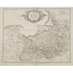
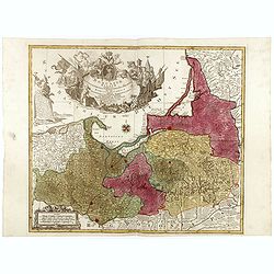
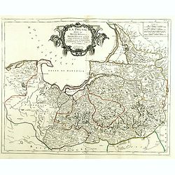
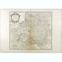
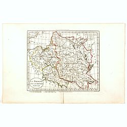
La Prusse divisée en Prusse Royale et Prusse Ducale. . .
Finely and crisply engraved map of Prussia including The Bay of Danzig. Folio map by Giles Didier Robert De Vaugondy.Ornamental title cartouche in the upper part of the m...
Date: Paris, 1751
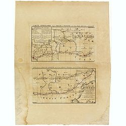
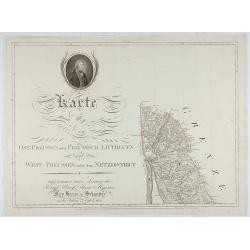
Polnische Reise Karte uber die vornehmsten Passagen von Dresden nach Warschau auf zweyerley Wegen I) uber Breslau, Peterkau und II) uber Lissa, Kaliez . . . 1751
Scarce strip-style road map showing two roads from Dresden via Glogau or Breslau to Warsaw.A key identifies villages, markets and post offices along the routes. Printed i...
Date: Nurember, 1751
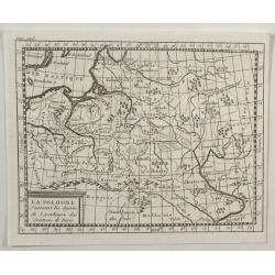
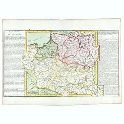
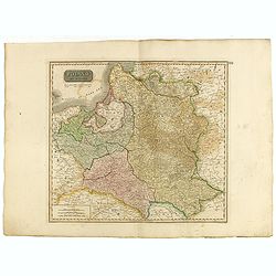
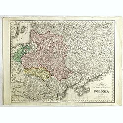
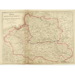
La Pologne.
An unusual 1752 Buffier copper engraved map of Poland. The map also covers Lithuania, part of Russia, Hungary, a portion of Ukraine, as well as a part of Romania. A decor...
Date: Paris, 1753
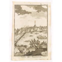
Citta di Varsavia.
Fine city view engraving of Warsaw, Poland by Thomas Salmon. Published in Rome by Giambattista Albrizzi in 1740. Giambattita Albrizzi was a famous Venetian publisher and ...
Date: Venice, 1740-1756
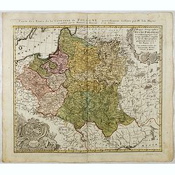
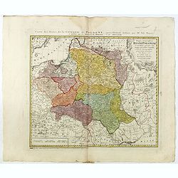
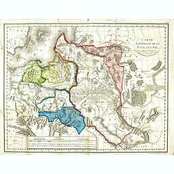
Mappa Geographica Regni Poloniae ex novissimis quotquot sunt mappis specialibus composita et al L.L. Stereographicae projectionis revocata a Tob. Mayero. . . .
Decorative map of Poland after Tobias Mayer who was based on Barnikel's map of Curland (1747) and Jan Nieprzecki's map of Lithuania (1749).Poland extends from Glogau and ...
Date: Nuremberg, 1757
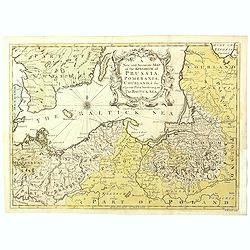
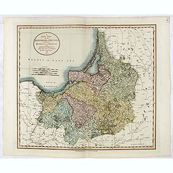
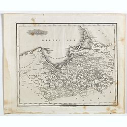
A New and Accurate Map of the Kingdom of Prussia, Pomerania, Courland & the Adjacent Parts Bordering on the Baltick Sea.
Attractive uncommon detailed map of the Kingdom of Prussia and the neighbouring regions, showing much of modern day Poland. Published in 'Universal Magazine', and well en...
- $750 / ≈ €659
Date: London, 1757
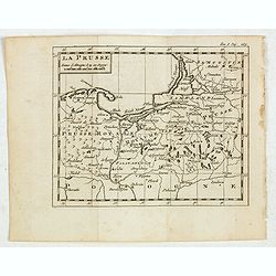
La Prusse.
Fine miniature map of Prussia, likely published by Claude Buffier. In upper right corner "Tom.I. Pag. 283.
Date: Paris, ca. 1759
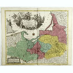
Borussiae Regnum compectens Circulos Sambiensem, Natangiensem, et Hockerlandiae Nee non Borussia Polonica, exhibens Palatinatus Culmiensem. . .
Decorative map covering northern Poland with Prussia, Pomerania, Hockerlandia, Warmiaermelandia, Natanglensis, Galindia, Nandrovia, Sclavonia, and the Baltic Sea. Include...
Date: Augsburg, 1759
![Partie septentrionale du cercle de Haute Saxe [...] Brandebourg.](/uploads/cache/64110-250x250.jpg)
Partie septentrionale du cercle de Haute Saxe [...] Brandebourg.
Finely and crisply engraved map of north eastern part of Germany, including part of Poland. With inset map of Brandenburg. Map by Giles Didier Robert De Vaugondy with era...
Date: Paris, c. 1760
![Partie septentrionale du cercle de Haute Saxe [...] Brandebourg.](/uploads/cache/33211-250x250.jpg)
Partie septentrionale du cercle de Haute Saxe [...] Brandebourg.
Finely and crisply engraved map of north eastern part of Germany, including part of Poland. With inset map of Brandenburg. Map by Giles Didier Robert De Vaugondy with era...
Date: Paris, c. 1760
Borussiae Regnum compectens Circulos Sambiensem, Natangiensem, et Hockerlandiae Nee non Borussia Polonica, exhibens Palatinatus Culmiensem. . .
Decorative map covering northern Poland with Prussia, Pomerania, Hockerlandia, Warmiaermelandia, Natanglensis, Galindia, Nandrovia, Sclavonia, and the Baltic Sea. Include...
- $400 / ≈ €352
Date: Augsburg, ca. 1760
![[Mer Baltique]](/uploads/cache/37796-250x250.jpg)
[Mer Baltique]
Detailed map of Northern part of Poland with Danzig, from his "Atlas moderne ou collection de cartes...".map N° 15.
- $300 / ≈ €264
Date: Paris, 1762
Royaume de Pologne.
Fine map of Lithuania, Prussia and Poland with an explicatif text to both sides. From Jean Baptiste Louis Clouet (1730-1790) influential "Géographie Moderne" fi...
Date: Paris, ca. 1767
![[manuscript plan] Siège de Schweidnitz en Silésie fait par les trouppes Imperial es commandées par Mr. le de Nadasti ...](/uploads/cache/39893-250x250.jpg)
[manuscript plan] Siège de Schweidnitz en Silésie fait par les trouppes Imperial es commandées par Mr. le de Nadasti ...
This fine manuscript shows the layout of the city of Swidnica with its surrounding defence wall, its advanced bastions and suburbs, roads and two nearby villages. In lowe...
- $2750 / ≈ €2417
Date: France, 1769
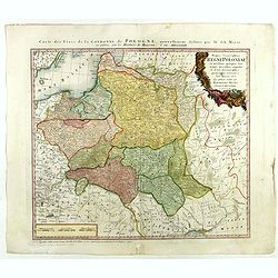
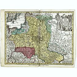
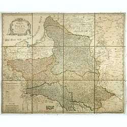
Mappa Geographica Regni Poloniae ex novissimis quotquot sunt mappis specialibus composita et al L.L. Stereographicae projectionis revocata a Tob. Mayero. . . .
Late Tobias Mayer detailed map Polish edition, updated in order to show the borders of the kingdom of year 1772 after the division of the territory.Mayer's map extends fr...
- $750 / ≈ €659
Date: Nuremberg, 1773
Mappa Geographica Regni Poloniae ex novissimis quot quot sunt mappis. . .
A map of Poland, Lithuania and Belarus, first published in 1750 by Homann Heirs, and now re-issued in 1773. Coastline includes all between Riga and Gdansk. Map is based o...
Date: Nuremberg, 1773
Lubomeriae Et Galliciae Regni Tabula Geographica: Cum Priv. Sac. Caes. Maiestatis Impensis Homannianorum Haeredum . . .
Rare map of the Kingdom of Galicia and Lodomeria prepared by F.L. Güssefeld, (1744-1808), who was a cartographer from Osterburg, studied at Brandenburg, worked in Weimar ...
Date: Nuremberg, 1775
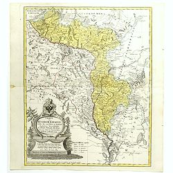
Charte von Russisch Litauen, welche die von Polen an Russland Abgetretene Woiewodschaften, Liefland, Witepsk, Mscislaw, und einem Theil der Woiewodschaften Polock und Minsk Enthalt.
An uncommon map of Belarus, together with parts of the Ukraine and Lithuania. Shows the rivers Dnieper and Dwiner from Liefland to Mscislaw and Woiwodschaft.. With the to...
- $500 / ≈ €439
Date: Nuremberg, 1775
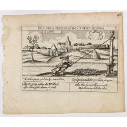
St. Cruis ( in eastern Poland.)
A very nice view of Kloster Heiligkreuz (Swiety Krzyz), in eastern Poland. In the foreground, a man climbing up a column is depicted. With a verse in two languages undern...
- $50 / ≈ €44
Date: Frankfurt, 1623-1778
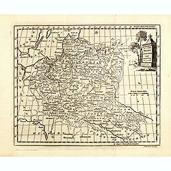
Polonia regnum ut et magni Ducat Lithuania. . .
Miniature map of Poland, a reduction of the appropriate part of Seutter's folio map. Engraved by Tobias Conrad Lotter.From Atlas Minor, here published by Johann Martin Wi...
- $450 / ≈ €395
Date: Augsburg, J.M.Will, 1778
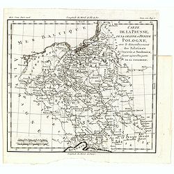
Carte de la Prusse, de la Grande et Petite Pologne, avec le démembrement des Palatinats de Cracovie et Sandomirz, faisant aujour d'hui partie de la Lodomerie.
A map of the Polish territories by Louis Brion de la Tour, from the work "Histoire universelle depuis le commencement du monde jusqu a present" published in Par...
Date: Paris, 1779
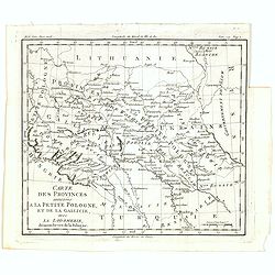
Carte des provinces annexées à la petite Pologne, et de la Gallicie, avec la Lodomerie, démembrées de la Pologne.
A map of the southern provinces of Poland by Louis Brion de la Tour, from the work "Histoire universelle depuis le commencement du monde jusqu a present" publis...
Date: Paris, 1779

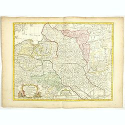
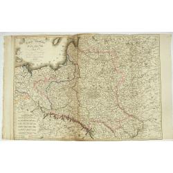
La Pologne Dressée sur ce qu'en ot donné Starovolsk, Beauplan, Hartnoch. . .
Large map of Poland, Lithuania, Belarus and part of Ukraine. The map is filled with detail and decorated with a title cartouche flanked by mythological figures.According ...
Date: Paris, 1773 - 1780
Poland Lithuania and Prussia.
Uncommon miniature map of Poland, Lithuania and the Ukraine, engraved by Thomas Kitchin - with his signature in lower right bottom.
Date: London, 1782
![[No title] Northern part of Poland.](/uploads/cache/24263-250x250.jpg)
[No title] Northern part of Poland.
Attractive map centered on the northern part of Poland, including northern part of Eastern Germany.Prepared by Giovanni Antonio Bartolomeo Rizzi Zannoni, one of the leadi...
Date: Paris, ca 1783
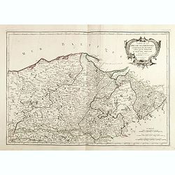
Carte De La Prusse Occidentale ou sont tracees les Provinces cedees Par la Pologne au Roi De Prusse . . . 1775
Finely and crisply engraved map of Western Prussia, now part of Poland on the Baltic Sea, including the Bay of Danzig. With ornamental title cartouche and noteworthy topo...
- $375 / ≈ €330
Date: Venice, 1776 - 1784
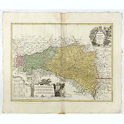
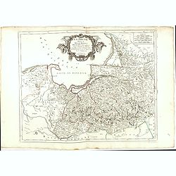
La Prusse divisée en Prusse Royale et Prusse Ducale.
The map extends from Memem, Danzig and Rosienne in the North to Novigrod in the southeast and Thorn on the Wessel in the southwest. Shows the Gulf of Danzig and part of P...
Date: Venice, 1776 - 1784
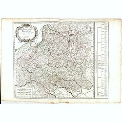
Royaume de Pologne.
Detailed map encompassing present-day Poland.Venetian edition of the map by R. de Vaugondy, to whom Santini gives credit in the cartouche.From "Atlas Universel"...
Date: Venice, 1776 - 1784

Carte de la Pologne Autrichienne contenant La Russie Rouge et la partie méridionale du Palatinat de Cracovie . . .
Detailed map with Krakow, including the areas of Malopolskie and Podkarpackie and including present-day Ukraine.Santini gives credit to Homann Heirs in the cartouche. Mal...
Date: Venise 1776-1784
La Prusse divisée en Prusse Royale et Prusse Ducale.
The map extends from Memem, Danzig and Rosienne in the North to Novigrod in the southeast and Thorn on the Wessel in the southwest. Shows the Gulf of Danzig and part of P...
Date: Venice, 1776 - 1784
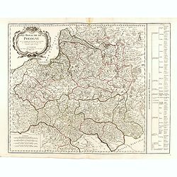
Royaume de Pologne.
Detailed map encompassing present-day Poland. The table provides a breakdown of the sub-regions of the Polish Crown.Venetian edition of the map by R. de Vaugondy, to whom...
- $350 / ≈ €308
Date: Venice, 1776 - 1784

Carte De La Prusse Occidentale ou sont tracees les Provinces cedees Par la Pologne au Roi De Prusse . . . 1775
Finely and crisply engraved map of Western Prussia, now part of Poland on the Baltic Sea, including the Bay of Danzig. With ornamental title cartouche and noteworthy topo...
Date: Venice, 1776 - 1784
Carte générale de la Pologne : avec ses différens démembremence par les puissances partageantes en 1773 et 1795 / dessinée et dressée par Mariaval. . .
Very rare map of Poland, engraved by Tardieu l’Ainé, active at rue de Sorbonne 385.
Date: Paris, ca. 1795
Le Royaume De Pologne, divise selon les Partages faits en 1772, 1793 et 1795, etnre la Russie, la Prusse et l'Autriche . . .
The uncommon later edition of this detailed map of Poland, showing the lands lost to Russia, Prussia and Austria in 1772, 1793 and 1795. with a color key added underneath...
Date: Paris, ca. 1796
Karte von Polen.
An attractive map of Poland. With a decorative title cartouche in the upper left-hand corner. Engraved by Ant. Amon. Franz Johann Josef von Reilly (Vienna 18 august 1766 ...
- $950 / ≈ €835
Date: Vienna, 1796
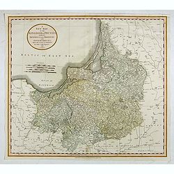
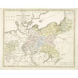
A New Map of the Kingdom of Prussia with its Divisions Into Provinces and Governments . . .
Highly detailed regional map of Prussia, including the Baltic regions and part of Poland, from Cary's Universal Atlas, one of the finest atlases of the period.
- $275 / ≈ €242
Date: London, 1799
La Pologne avec le dernier partage.
Uncommon map of Poland and Lithuania. Engraved by Alexandre Blondeau (1799-1828), with Brezesci in the center of the map.From "Atlas universal pour la géographie de ...
- $200 / ≈ €176
Date: Paris, Hyacinthe Langlois, 1799
Karte von Ost-Preussen nebst Preussisch Litthauen und West-P
The title section of this important multi-sheet map of Prussia, Lithuania and Poland, showing territories of present Lithuania. With a medallion representing the King of ...
Date: Berlin, 1802
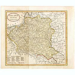
Poland from the best authorities.
Detailed map of Poland from "A New Geographical, Historical, and Commercial Grammar", by William Guthrie. William Guthrie (later engraver for Carey) London, UK....
Date: London, 1805
La Pologne Dressée sur ce qu'en ont donné Starovolsk, Beauplan, Hartnoch. . .
This is a late edition of the De L'Isle copper plate with a date of 1806. The copper plate was used many times and has several erased addresses. This one with address &qu...
- $750 / ≈ €659
Date: Paris, 1806
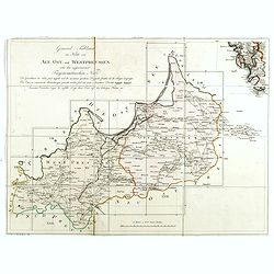
(Index sheet) General Tableau zur Karte von Alt Ost und West Preussen nebst dem aufgenommenen Trigonometrischen Netz. . .
Index sheet of this important multi-sheet map of Prussia, Lithuania, and Poland.Section XXIV of the rare first edition of this important 25-sheet map prepared by Friedric...
Date: Berlin, 1802-1810
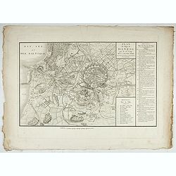
Accueil Consultation Plan du Siège de Danzig par le 10me. Corps de la Grande Armée, Avec les travaux des Français, tels qu'ils étaient le 25 Avril 1807.
A map of the siege of Danzig, 19 March-24 May 1807, showing the positions of the French siege works as they stood on 23 April. Napoleonic Wars (1803-15). Oriented with so...
Date: Paris, after 1810

Carte von West=Gallizien welche auf allerhöchsten Befehl Seiner Kaiserlich oesterreichischen und Königlich apostolischen Majestät in den Jahren 1801 bis 1804. . .
Important early map of Western Galicia, as given to Austria by the third Partition of Poland (1795). Due to its lengthy development period, a rare map rich in detail depi...
Date: Vienna, (1808) after 1811
A New Map of the Kingdom of Prussia with its Divisions Into Provinces and Governments. . .
A fine map by John Cary of Prussia, in what is now northern Poland and Lithuania. John Cary was considered "the most representative, able and prolific of English car...
- $250 / ≈ €220
Date: London, 1811
Poland As Divided.
This map covers Poland following Napoleonic Wars and the treaties of the 1815 Congress of Vienna.This map was first published in Thomson's New General Atlas of 1814. John...
Date: Edinburgh, 1817
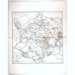
![[Untitled map of a part of Poland and Prussia].](/uploads/cache/25710-250x250.jpg)
[Untitled map of a part of Poland and Prussia].
Large folding map, being upper right part of a multi-sheet map, showing the northern part of Poland with good detail around Gdansk. Published by Jean Claude Dezauche (17...
- $400 / ≈ €352
Date: Paris, ca. 1816-1824

Province de Pologne contenant 22 Col. une M.on Prof 5 Pen. 2 Nov. 6 Rés. 30 Maisons 1050 Jésuites.
Rare map of Poland from "Atlas Universel indiquant les établissemens des Jésuites: avec la manière dont ils divisent la terre, suivi desévénemens remarquables de leu...
Date: Paris, Ambroise Dupont , 1826
Part of Prussia.
Attractive example of the scarce 1828 Malte-Brun map of modern day Poland and Lithuania. Published by Samuel Walker in 1828 as part of the American edition of Conrad Malt...
- $100 / ≈ €88
Date: Boston, 1828
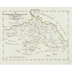
Oesterreich. B. Galizische Erbstaaten Koenigr: Galizien Kreis 1. Lemberg 2. Zloczow 3. Zolkiew.
Map depict the area north of the Black Sea, including the cities of Lemberg, Zolkiew, Brody.From "W. E. A. von Schliebens Atlas von Europa nebst Kolonien für Geschäf...
Date: Leipzig, G. J. Göschen, ca 1825-1830
Carte du pays compris entre Vistule et la Pregel.
Map of Poland regions, including Warsaw, part of Russia and Danzig bay, prepared by Auguste Henri Dufour (1798-1865). Engraved by Ch. Dyonnet.
- $75 / ≈ €66
Date: Paris, 1830
Carta del Teatro della Guerra in Polonia - 1831.
Oversized rare 1831 war map of Poland and Lithuania published during the Polish - Russian War in 1831, published by Presso l'incisore Stanislao Stucchi. Stucchi, was born...
Date: Milan, 1831
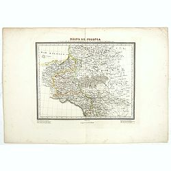
Reino de Polonia ò sea la parte unida a la Rusia por el repartimiento de 1795 que conserva el nombre de aquel antiguo reino.
Uncommon Spanish map of Poland from "Coleccion de mapas geograficos antiguos y modernos de autores clascicos", published by José Torner in Barcelona in 1831.R. ...
Date: José Torner, Barcelona, 1831
Carte des Etats de Pologne et du Grand Duché de Lithunanie.
Uncommon map of Poland prepared by Sanson and revised by Eustache Hérisson (1759-18.. ) and engraved by Cordier. The map was published by the last family member of the Je...
Date: Paris, Jean, 1831
Carte Routière de la Pologne indiquant les partages de ce Royaume…
Carte Routière de la Pologne indiquant les partages de ce Royaume qui ont été faits depuis 1772, 1795 &a". Map prepared by Hérisson and published by Basset. Incl...
Date: Paris, Basset, 1831
Karta öfver Preussiska riket.
An very rare map of Eastern part of Germany, with Pomerania and part of present-day Poland with Swedish text. This is an updated version of his map of 1820 and is now dat...
Date: A. Wiborgs förlag, Stockholm, ca. 1848
![Bataille de Pultusk, le 26 Decembre 1806. [manuscript map]](/uploads/cache/38810-250x250.jpg)
Bataille de Pultusk, le 26 Decembre 1806. [manuscript map]
Manuscript map of the siege of Pultusk (located on the west bank of the River Narew approximately 50 kilometres (31 mi) north of Warsaw), on 26 December 1806. With a colo...
- $1750 / ≈ €1538
Date: Breda, 1849
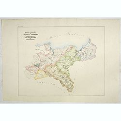
Provincia ecclesiastica di Gnesna e Posnania nella Prussia Vicar.ti apost.cl di Sassonia e Dei Ducati Analtini (Tav LXXXII)
A large-format map of western Poland with its different dioceses. The map is finely engraved and beautifully colored and was prepared by Girolamo Petri, a lawyer who serv...
- $500 / ≈ €439
Date: Rome, 1858
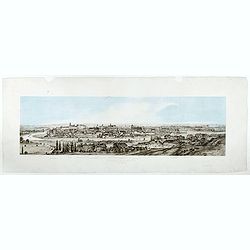
Widok Krakowa od Podgonza.
Bird's-eye view of Krakow city, with underneath the names of thirteen important buildings. Lithographed by J.Brydak after a photo by W. Rzewuskriego. Published by Czasu W...
- $750 / ≈ €659
Date: Krakow, ca. 1865

Mapa Polski i Krajów Osciennych - Wydanie trzecie. Opracowal Stanislaw Max. Wydani M. Arcta.
‘The Birth of Modern Poland on a map’ - an excellent wall map of Poland and surrounding regions, published in Warsaw near the end of World War I, when Poland’s fate was u...
Date: Warsaw, [H. Sklodowski], 1918

Langwasser Stanislau Neu Brandenburg Mei 1942 Juni 1945
Map met reproducties van crayontekeningen van Krijgsgevangenschap in Langwasser, Stanislau en Neu-Brandenburg, Mei 1942 -juni 1945.Uitgegeven april 1948 door het Minister...
Date: Den Haag, April 1948
