Browse Listings in Europe
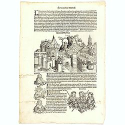
Tercia Etas Mundi. Foliu. XXVIII (with a view of the city of Lacedaemon or Sparta)
The Latin text page is illustrated with depictions of Kings, Noble men and women and scientists, including Atlas. RECTO : In the first panel, at the left, are some of the...
- $150 / ≈ €129
Date: Nuremberg, 12 July 1493
(EUROPE).
The map of Europe has been identified as the work of Hieronimus Münzer (1437-1508), a Nuremberg physician who supplied the geographical contents of the chronicle. The Eu...
Date: Nuremberg, 1493
Quarta Etas Mndi. Carvilium / Aquileya. [Carovilli and Aquileia]
A lovely presentation of Carovilli, in the province of Cremona. Recto, a view of the town of Aquileya in Italy, centered on the castle and the high walls. Aquileia is an ...
Date: Nuremberg, 12 July 1493
Madeburga [ Maagdenburg Folio CLXXX ]
Double-page panoramic view of Magdeburg. A imaginary view, however the earliest obtainable view of this period.Two page from the richest illustrated Incunable, the famous...
Date: Nuremberg, 12 July 1493
Terta Etas Mundi. Foliu CX [With view of Metz]
The Latin text page is illustrated with a depictions of Kings, Noble men and women and scientists, among Eustace (Eustachius) a Roman soldier and martyr, appears as a bea...
- $450 / ≈ €386
Date: Nuremberg, 12 July 1493
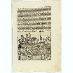
CCLXXV.
The Latin text page is illustrated with an imaginary view of a town in Macedonia (195 x 225mm.) The Nuremberg Chronicle, published the year that Columbus returned to Euro...
Date: Nuremberg, 12 July 1493
[Page with imaginary towns in Hungary. ] CCLXVIII
Page with imaginary towns in Hungary (230x225mm.) This leaf is from an edition of Hartmann Schedel's Liber chronicarum or Nuremberg Chronicle. The Chronicle was published...
Date: Nuremberg, 1493
Sexta Etas Mundi. Ratisbonna. [Ratisbonne]
A very fine presentation of the city of Ratisbon, in Germany, centered on the cathedral (Dim. : 191 mm W : 525 mm).Overleaf a very nice view of Vienna, with two swans on ...
Date: Nuremberg, 12 July 1493
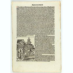
Sexta etas mudi CCXXXIX.
The Latin text page is describing the crusade against the Bohemian heretics in the time of emperor Sigismund Nuremberg Chronicle, published the year that Columbus returne...
Date: Nuremberg, 12 July 1493
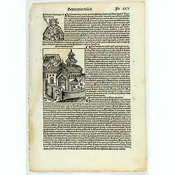
Sexta etas muidi Fo CCV.
The Latin text page is illustrating Baldwin (Baldvinus), the fourth of this name, seventh king of Jerusalem, and son of the aforesaid Amalric, reigned six years after his...
- $75 / ≈ €64
Date: Nuremberg, 12 July 1493
Ulma Folio CXCI [With view of Ulm.]
Double-page panoramic view of Ulm.An imaginary view, however, is the earliest obtainable view of this period.Two pages from the richest illustrated Incunabel, the famou...
Date: Nuremberg, 12 July 1493
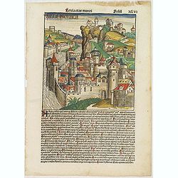
Tercia Etas Mundi. Folium.XLVI (A English town view)
Large woodcut depicting an imaginary English town (235x223mm.) and on verso the genealogy of King David.Page from the richest illustrated Incunable, the famous: Chronicle...
Date: Nuremberg, 12 July 1493
Basilae [ Basle, CCXLIIII ]
A very fine view of Basle (253x520 cm). Verso showing the councils of Florence and Basle and two portraits.Page from the richest illustrated Incunabel, the famous: Nuremb...
Date: Nuremberg, 12 July 1493
Venecie. [Venice] Foliu XLIIII
A very fine of Venice (192x525mm.) Verso a view of Padua. Schedel's view of Venice is one of the earliest obtainable views of the city. The view is based on the view of ...
Date: Nuremberg, 12 July 1493
Sexta Etas Mundi. Bressla. [Breslau or Wrocław] CCXXXIIII.
A very fine presentation of the city of Bresslau / Wrocław (230 x 520mm.), in Poland, centered on the cathedral (Dim. : 232 mm W : 520 mm).Overleaf, the kings Wenceslaw ...
Date: Nuremberg, 12 July 1493
Parisius & Maguncia. [Paris & Munich] Folio XXXIX
Imaginary view of Paris and on verso Munich : however the earliest obtainable views of this period.In the forground a large vessel, who was the symbol of the powerful cor...
Date: Nuremberg, 12 July 1493
PATAVIA (Passau, Germ)
From the first Latin text edition, 1493. The view of PATAVIA (nowadays the city of Passau, Southern Germany) was part of the Liber Chronicarum cum figuris et ymagibus ...
Date: Nuremberg, Germany, 1493
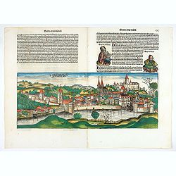
Sexta Etas Mundi. Constancia. [Constance CCXLI ]
A very fine town view of Constance, in Germany, centered on the cathedral (198 x 520 mm).VERSO, seven insets of scientists, noblemen and Popes.Page from the richest illus...
Date: Nuremberg, 12 July 1493
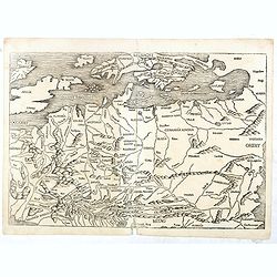
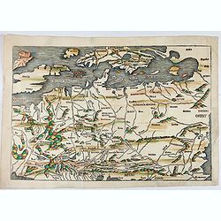
No title: Scandinavia/ Central Europe/ British Isles.
Map of Northern Europe from Nuremberg Chronicle . German text on verso. Printed by Anton Koberger. The map has been identified as the work of Hieronimus Münzer (1437-150...
Date: Nuremberg, 12 July 1493
Bamberga. Folium CLXXV [Bamberg]
Double page panoramic view of Bamberg. One of the earliest obtainable views of this period.Two pages from the richest illustrated Incunable, the famous Nuremberg Chronic...
Date: Nuremberg, 12 July 1493
[Text page with imaginary towns in Westphalia and Hesse. CCLXXXIIII ].
On recto, an imaginary view of towns in Westphalia (230x225mm.). Verso of towns in the province Hesse.Page from the richest illustrated Incunabula, the famous: Nuremberg ...
- $200 / ≈ €172
Date: Nuremberg, 12 July 1493
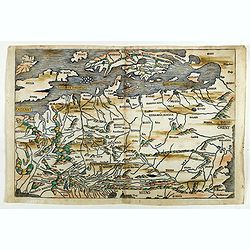
(EUROPE).
A woodcut colored map of northern and central Europe. The first modern map of the area. Second printed map of the North, after the woodcut map published in the 'Ulm' Ptol...
Date: Nuremberg, 1493
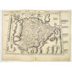
Tabula Secunda Europe (Spain & Portugal)
Wood block printed large-format Ptolemaic map of the Iberian Peninsula from the 1513 edition of Waldseemüller's Geographia.This Ptolemaic map comes from the first so cal...
Date: Strasburg, 1513
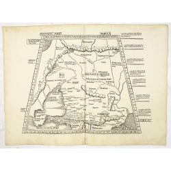
Secunda Asiae Tabula (Ukraine and Russia)
Woodblock printed a large-format Ptolemaic map showing Russia, Ukraine, and the Black Sea region. From the 1513 edition of Waldseemüller's Geographia.One of the earliest...
Date: Strasburg, 1513
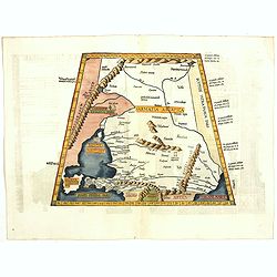
Tabula III Asiae. [Caucass and Armenia.]
Ptolemaic map of the region south of the Caucasus Mountains and between the Caspian Sea as far south as the headwaters of the Tigris River in the south and the Black Sea,...
- $750 / ≈ €644
Date: Lyons, M. Servetus, 1525
Tabula II Asiae.
A striking example of this wood-cut map depicts north of the Black Sea and west of the Caspian Sea (Ukraine, Russia, Georgia and Armenia). Ptolemy collected his data arou...
- $550 / ≈ €472
Date: Lyons, 1535
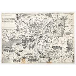
La dimostratione del luogo dove al presente sitrova l'armat di Barbarossa, et de Christiani detto il golfo dell 'Artha anti ch amente il sino ambracio…
The title cartouche at the top left reads: "La Dimostratione Del Luogo Dove Al Presente Sitrova L'Armat Di Barbarossa, et De Christiani Detto Il Golfo Dell' Artha An...
Date: Rome, c. 1540
.[Georgia (Republic), Sarmatia, Ukraine]
Wood block printed map and one of earliest printed representation of Georgia (Republic), Sarmatia, Ukraine prepared by Martin Waldseemüller. Based on the slightly larger...
Date: Vienna, Trechsel, G., 1525 -1541
[Albania, Bulgaria, Europe, Eastern, Greece, Hungary, Macedonia, Romania]
Wood block printed map and one of earliest printed representation of Albania, Bulgaria, Europe, Eastern, Greece, Hungary, Macedonia, Romania prepared Martin Waldseemülle...
Date: Vienna, Trechsel, G., 1525 -1541
[Europe, Eastern, Sarmatia, Ukraine]
Wood block printed map and one of the earliest printed representations of European Sarmatia, generally the region between the Baltic and Black Sea and Sea of Azov. Includ...
Date: Vienna, Trechsel, G., 1525 -1541
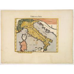
.Tabula nova Italiae. (Modern Italy)
Wood block printed modern map of Italy, prepared by Lorenz Fries and one of the earliest modern maps of Italy and environs. Based on the slightly larger map from 1513 pub...
Date: Vienna, 1525 -1541
.[Germany and Poland]
Wood block printed map and one of earliest printed representation of Germany, Poland, The Low Countries, Austria and Switzerland prepared by Martin Waldseemüller. Based ...
Date: Vienna, Trechsel, G., 1525 -1541
.[Balkan region with Austria, Croatia, Slovenia, Switzerland, etc]
Wood block printed map and one of earliest printed representation of Balkan with Austria, Croatia, Slovenia, Switzerland, etc prepared Martin Waldseemüller. Based on the...
Date: Vienna, 1525 -1541
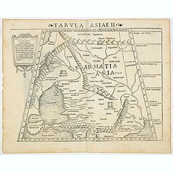
Tabula Asiae II (Black Sea and Caspian Sea).
The first edition of Münster's map of Ukraine and the region north of the Black Sea, based upon Claudius Ptolemy which appeared in his "Geographia Universalis"...
- $400 / ≈ €344
Date: Basel, Heinrich Petri, 1545
Tabula Asiae II (Black Sea and Caspian Sea)
The first edition of Munster's map of Ukraine and the region north of the Black Sea, based upon Claudius Ptolemy which appeared in his "Geographia Universalis",...
- $500 / ≈ €429
Date: Basel, Heinrich Petri, 1545
Opus Praxitelis, Opus Fidiae.
Opus Praxitelis, Opus Fidiae [Work of Praxiteles, Work of Fidias]. With the Lafreri's imprint and date. Published in the "Speculum Romanae Magnificentiae" (The ...
Date: Rome, Antonio Lafreri, 1546
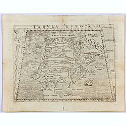
Tabula Europae II. (Spain and Portugal)
Gastaldi's map showing Spain and Portugal, based upon Ptolemy.It is one of the earliest obtainable maps of the region.From Giacomo Gastaldi's Atlas of 1548 which has been...
- $375 / ≈ €322
Date: Venice, 1548
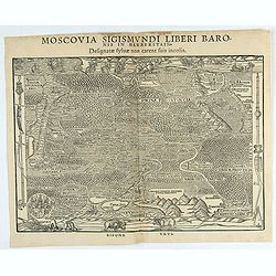
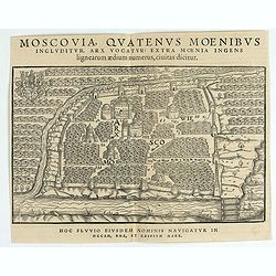
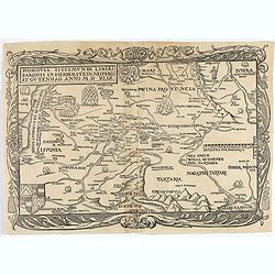
Moscovia Sigismundi Liberi Baronis In Herberstein, Neiperg et Gutehnag Anno M.D XLIX
First Modern Map of Russia. A rare and important cornerstone map for Russia collections.Sigismund von Herberstein made two visits to Russia. In 1517-18 he travelled as a ...
Date: Vienna, 1549
Moscovia Sigismundi Liberi Baronis In Herberstein, Neiperg et Gutehnag Anno M.D XLIX
The forst modern plan of Moscow. A rare and important cornerstone map for Russia collections.Sigismund von Herberstein made two visits to Russia. In 1517-18 he travelled ...
Date: Vienna, 1549
Equitum in Quirinali, aversa parte, marmorei colossi Romae; absolutissima Praxitelis et Fidiae manu.
Back view of the Dioscuri (or horse tamers, or Alexander and Bucephalus), formerly attributed to Pheidias and Praxiteles, with two figures nearby, one seated on a stone, ...
Date: Rome, Antonio Lafreri, 1550
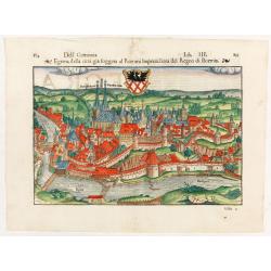
Dell Germania Egrana.
Early woodcut view of the city of Egra (Cheb) in the Czech Republic. From the 1552 Latin text edition of Münster's Cosmographia, which is a short and complete summary of...
Date: Basel, 1552
[Lot of 6 leaves] Civitas Augustana olim Vindelica…/Sueviae et Bavariae Descriptio/ Franckfordiae ad Oderam imago…/Franckofordianae civitatis…/Erdfordia magnifica …Thuringoru urbs…Fuldensis civitatis… / Lubecum una ex praeclarioribus. . .
Six text leaves with wood block printed views and maps of Augsburg, Frankfurt /Oder, Frankfurt am Main, Erfurt and Fulda, Lübeck and a map of Swabia and Bavaria. From th...
Date: Basel, 1552
[Lot of 205 leaves of Germany, Austria, Switzerland, Alsace and Brabant].
205 text leaves illustrated with views and maps relating to Germany, Austria, Switzerland, Alsace and Brabant from the 1552 Latin text edition of Münster's Cosmographia...
Date: Basel, 1552
[Lot of 8 leaves of Great Britain, Edinburgh]
Eight text leaves with woodblock illustrations relating to Great Britain and Edinburgh, featuring small maps and views, from the 1552 Latin text edition of Münster's Cos...
Date: Basel, 1552
[Lot of 5 leaves] Noerdlinga civitas imperialis…/ Nemetum civitatis…Spiram appellant / Situs & figura… Trevirensis / Situs civitatis Confluentinae… / Civitas Lunaeburgensis…
Five text leaves with woodblock-printed early bird's-eye views of Nördlingen, Speyer, Trier, Koblenz, and Lüneburg, from the 1552 Latin text edition of Münster's Cosmo...
Date: Basel, 1552
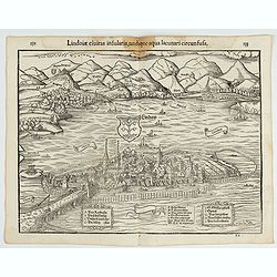
Lindoiae civitas insularis, undique aqua lacunari circunsusa.…
A wood block printed early bird's-eye view of Lindau on Lake Constance (Germany). A lettered key A-O in the plate. From the 1552 Latin text edition of Münster's Cosmogra...
- $70 / ≈ €60
Date: Basel, 1552
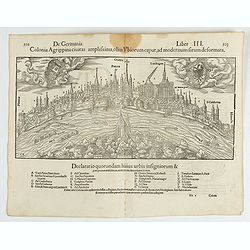
Colonia Agrippina civitas…
A wood block printed early panoramic view of Cologne (Germany). A lettered key A-Z beneath the view. The 1552 Latin text edition of Münster's Cosmographia is a short and...
- $70 / ≈ €60
Date: Basel, 1552
[Lot of 7 leaves] Curiensis civitas, Rhetorum…/Valesia/Solothurensis/Clarissimae civitatis/Genevensis/Basiliensis/Ursina…Bernensis/Sedunensis/Designatio …Badensis.
Seven text leaves illustrated with wood block bird's-eye views of Chur, Solothurn, Geneva, Basel, Bern, Sitten, Baden and one single sheet map of the Valais. From the 155...
Date: Basel, 1552
[Lot of 25 leaves of France, Brabant, Netherlands, Luxemburg]
Twenty-five text leaves with wood block illustrations relating to France, Brabant, the Netherlands, Luxemburg. From the 1552 Latin text edition of Münster's Cosmographia...
Date: Basel, 1552
[Lot of 2 leaves] Vienna Austriae metropolis, urbs…
A wood block printed early panoramic view of Vienna (Austria). From the 1552 Latin text edition of Münster's Cosmographia, which is a short and complete summary of Renai...
Date: Basel, 1552
[Lot of 2 leaves] Rubeaquum cum arce Isenburgo…/ Wyssenburg…
Two wood block printed early bird's-eye views of Rouffach (lies along the Alsatian wine route) and Wissembourg (Alsace). From the 1552 Latin text edition of Münster's Co...
Date: Basel, 1552
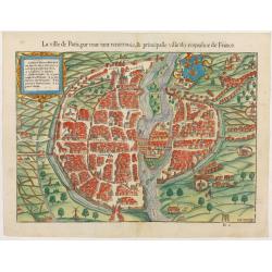
La ville de Paris, par tout tant renommée & principalle ville du royaulme de France.
Very early birds-eye view of Paris. From his Cosmographia, that great compendium of Renaissance knowledge. An exciting print.Engraved by Hans Rudolf Manuel-Deutsch(1525-1...
Date: Bâle, H. Petri, 1552
Panthei Fidelissime Dimensi Exterior et Interior…
The print features the Pantheon in Rome, broken away to show the interior. Complete title : " Panthei Fidelissime Dimensi Exterior et Interior pars ex antiquo romano...
Date: Rome, Antonio Lafreri, 1553
Moscovia Sigismundi Liberi Baronis In Herberstein, Neiperg et Gutehnag Anno M.D XLIX
First Modern Map of Russia. A rare and important cornerstone map for any Russian collection.One of two maps of Russia compiled by Herberstein, who was ambassador from the...
Date: Basle, 1556
[Toscana / Tuscany] En, candidi lectores, elegantioris Italiae partis, Tusciae scilicet, topographiam. aenis nris formis excussam in hac Tabella vobis denuo damus. . .
A rare map of Tuscany, including the islands of Elba, Giglio, Giannutri and part of Corsica, and covering the whole of Tuscany, part of Liguria, Lombardy, Emilia, Umbria,...
- $5000 / ≈ €4294
Date: Rome, ca 1557
Amphitheatri Veronen[sis] diligens et accurata delineatio…
The print features the Amphitheater of Verona, it comes from "Speculum Romanae Magnificentiae" (The Mirror of Roman Magnificence). Example of the first state of...
- $900 / ≈ €773
Date: Rome, Antonio Lafreri, ca. 1560
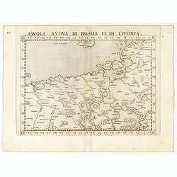
Tavola nuova di Prussia et di Livonia.
Uncommon first edition of this early map of the region from Pomerania to Livonia, includes a portion of Estonia, and coastal detail on the Baltic Sea with a small section...
Date: Venice, Vincenzo Valgrisi, 1561
Fiandra Brabantia et Holanda nvova
Fiandra Brabantia et Holanda nvovaDella Fiandra Brabantia, et Olanda quinta nvova tavola d’EuropaThis map is the first known map of the Netherlands as a whole. It comes...
Date: Venetië, 1561
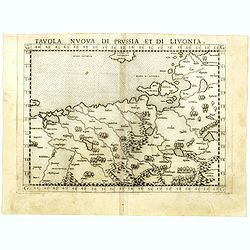
Tavola nuova di Prussia et di Livonia.
Uncommon first edition of this early map of the region from Pomerania to Livonia, includes a portion of Estonia, and coastal detail on the Baltic Sea with a small section...
- $400 / ≈ €344
Date: Venice, Vincenzo Valgrisi, 1561
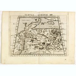
Tabula Europae IIII.
The scarce FIRST edition of this classical map depicting Northern Europe, Denmark and the Baltic. Includes engravings of a number of interesting animals in the right-hand...
- $450 / ≈ €386
Date: Venice, 1561
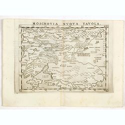
Moschovia nuova tavola.
Scarce FIRST edition of this map centered on Moscow. In the lower left Crimea and the Sea of Azov. The map is filled with small tents to represent Tartar camps.Girolamo R...
- $300 / ≈ €258
Date: Venice, 1561
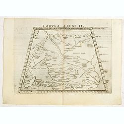
Tabula Asiae II.
Scarce FIRST edition of this map of the ancient region of Asiatic Sarmatia - now Southern Russia and part of Ukraine, around the Azov seaGirolamo Ruscelli's edition of Pt...
- $300 / ≈ €258
Date: Venice, 1561
Groeninga MDLXXIII. [Groningen]
RECTO: A panoramic view of the city of Groningen dated 1573.VERSO: a woodcut of a cow, a bull and their calf.Taken from Sebastian Munster's encyclopedic work, the "C...
Date: Basle, ca. 1564
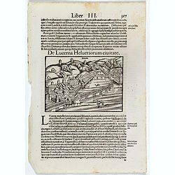
De Lucerna Helvetiorum Civitate. (Luzern)
One Latin text page with a wood cut bird's-eye view of Luzern (147x157mm). From Münster's Cosmographia Universalis. The Cosmographia by Sebastian Münster from 1544 is t...
- $50 / ≈ €43
Date: Basle, ca. 1564
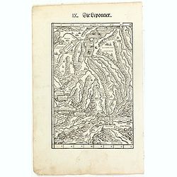
IX. Die Lepontier.
Very early wood cut printed regional map of Switzerland.Originally engraved in 1548. The map was prepared by Johannes Stumpf (1500-1576). Included in "Landtaflen. Hi...
Date: Zurich, Christoffel Froschover, 1548,1552-1566
[Two plates on one sheet] Ordinanza Turchesa alla presa di Zigeth in Ongaria l’anno 1566 / Ordinanza Turchesca sotto Viena, contra lo Invictißimo Imperatore Carlo quinto l'anno 1550.
Ordinanza Turchesca sotto Viena, contra lo Invictißimo Imperatore Carlo quinto l'anno 1550". C. 1560. This extremely rare plate depicts the order of battle and for...
Date: Venice, 1550/ 1566
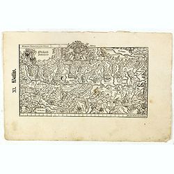
XI. Wallis.
Very early wood cut printed regional map of Switzerland with Wallis region.Originally engraved in 1548. The map was prepared by Johannes Stumpf (1500-1576). Included in &...
Date: Zurich, Christoffel Froschover, 1548,1552-1566
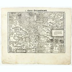
I Europa / Das dritteil der Welt.
Very early wood cut printed map of Europe with South to the top. In the lower-left corner we see Poland, Livonia and parts of England and Ireland in the lower right corne...
Date: Zurich, Christoffel Froschover, 1548,1552-1566
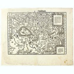
( II Germania) / Tütschland.
Very early wood cut printed map of Germany, Poland, The Low Countries, Alsace and part Europe with of Switzerland, Croatia. Originally engraved in 1548. Included in "...
Date: Zurich, Christoffel Froschover, 1548,1552-1566
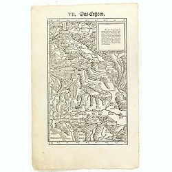
VII. Das Ergow.
Very early wood cut printed regional map of Switzerland centered on Ergow.Originally engraved in 1548. The map was prepared by Johannes Stumpf (1500-1576). Included in &q...
Date: Zurich, Christoffel Froschover, 1548,1552-1566
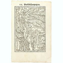
VIII. Das Wiflispurgergow.
Very early wood cut printed regional map of Switzerland with Lake Geneva.Originally engraved in 1548. The map was prepared by Johannes Stumpf (1500-1576). Included in &qu...
Date: Zurich, Christoffel Froschover, 1548,1552-1566
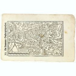
XII. Laurater Basler gelegenheit.
Very early wood cut printed regional map of Switzerland with Basel region.Originally engraved in 1548. The map was prepared by Johannes Stumpf (1500-1576). Included in &q...
Date: Zurich, Christoffel Froschover, 1548,1552-1566
La descrittione di Belgica con le sve frontiere (maps of the Seventeen Provinces)
La descrittione di Belgica con le sve frontiere Omnis Belgica intra Rhenum, marronam, Sequana[m] ac Oceanum, ... This is one of the earliest printed maps of the Sev...
Date: Antwerp, 1567
DESCRIPTION DE TOUT LE PAIS BAS Autrement dict La Germanie Inferieure, ou Basse-Allemaigne…
First French edition. Illustrated with a coat of arms and portrait of Philips II, with a folding map of The Netherlands and maps and views of Brabant, Louvain, Brussel, A...
- $4500 / ≈ €3865
Date: Anvers. Guillaume Silvius, 1567
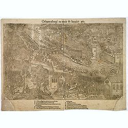
Orleans assiegé au mois de Janvier. 1563.
Rare copper engraved view of the siege of Orleans in January 1563, engraved by Jean Jacques Perrissin, (1536 - before 1611).Print from the suite "The Wars, Massacres...
- $100 / ≈ €86
Date: Geneva, ca. 1570
[Euboe].
Woodcut Ptolemaic-style map by Sebastian Münster figuring Euboea Island, published in the edition of Strabo by Henri Petri in 1571."Strabonis rerum geographicarum&q...
Date: Basle, Henri Petri, 1571
Lutetia, vulgari nomine Paris, urbs Gallia. . .
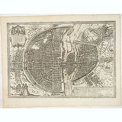
Beautiful and early town-plan of Paris with title cartouche and figures in the foreground. The Bastille is shown at the upper center of the engraving and the Notre-Dame c...
Date: Cologne, ca. 1572
Disegno dove al presente si ritrova l'armata della santa legha contro la turchesca, nel promontorio della Morea dirincontro a Modon, dove l'armata nemica si è retirata… VI.Ottobre.1572.
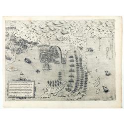
Disegno dove al presente si ritrova l'armata della santa legha contro la Turchesca, nel promontorio della Morea dirincontro a Modon dove l'armata nemica si e retirata, lu...
Date: Rome, 1572
Castello Sancto Angelo di Roma.
The print features the Castello Sant' Angelo in Rome, bound in an album, perhaps from the "Speculum Romanae Magnificentiae." Copper engraving and published by A...
Date: Rome, Antonio Lafreri, ca. 1573
Basiliensis territorii descriptio nova.
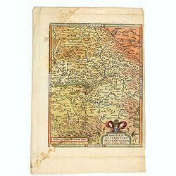
Left hand map centered on Basle, east to top. With credit to Sebastian Münster in title cartouche.
- $200 / ≈ €172
Date: Antwerp, 1573
![Quarta Etas Mndi. Carvilium / Aquileya. [Carovilli and Aquileia]](/uploads/cache/13525-250x250.jpg)
![Madeburga [ Maagdenburg Folio CLXXX ]](/uploads/cache/12338-250x250.jpg)
![Terta Etas Mundi. Foliu CX [With view of Metz]](/uploads/cache/46260-250x250.jpg)
![[Page with imaginary towns in Hungary. ] CCLXVIII](/uploads/cache/26932-250x250.jpg)
![Sexta Etas Mundi. Ratisbonna. [Ratisbonne]](/uploads/cache/13549-250x250.jpg)
![Ulma Folio CXCI [With view of Ulm.]](/uploads/cache/29713-250x250.jpg)
![Basilae [ Basle, CCXLIIII ]](/uploads/cache/29714-250x250.jpg)
![Venecie. [Venice] Foliu XLIIII](/uploads/cache/29716-250x250.jpg)
![Sexta Etas Mundi. Bressla. [Breslau or Wrocław] CCXXXIIII.](/uploads/cache/33138-250x250.jpg)
![Parisius & Maguncia. [Paris & Munich] Folio XXXIX](/uploads/cache/29718-250x250.jpg)
![Sexta Etas Mundi. Constancia. [Constance CCXLI ]](/uploads/cache/33141-250x250.jpg)
![Bamberga. Folium CLXXV [Bamberg]](/uploads/cache/47606-250x250.jpg)
![[Text page with imaginary towns in Westphalia and Hesse. CCLXXXIIII ].](/uploads/cache/37487-250x250.jpg)
![Tabula III Asiae. [Caucass and Armenia.]](/uploads/cache/47571-250x250.jpg)
![.[Georgia (Republic), Sarmatia, Ukraine]](/uploads/cache/33870-250x250.jpg)
![[Albania, Bulgaria, Europe, Eastern, Greece, Hungary, Macedonia, Romania]](/uploads/cache/33868-250x250.jpg)
![[Europe, Eastern, Sarmatia, Ukraine]](/uploads/cache/33854-250x250.jpg)
![.[Germany and Poland]](/uploads/cache/33862-250x250.jpg)
![.[Balkan region with Austria, Croatia, Slovenia, Switzerland, etc]](/uploads/cache/33858-250x250.jpg)



![[Lot of 6 leaves] Civitas Augustana olim Vindelica…/Sueviae et Bavariae Descriptio/ Franckfordiae ad Oderam imago…/Franckofordianae civitatis…/Erdfordia magnifica …Thuringoru urbs…Fuldensis civitatis… / Lubecum una ex praeclarioribus. . .](/uploads/cache/48258-250x250.jpg)
![[Lot of 205 leaves of Germany, Austria, Switzerland, Alsace and Brabant].](/uploads/cache/48263-250x250.jpg)
![[Lot of 8 leaves of Great Britain, Edinburgh]](/uploads/cache/48262-250x250.jpg)
![[Lot of 5 leaves] Noerdlinga civitas imperialis…/ Nemetum civitatis…Spiram appellant / Situs & figura… Trevirensis / Situs civitatis Confluentinae… / Civitas Lunaeburgensis…](/uploads/cache/48259-250x250.jpg)
![[Lot of 7 leaves] Curiensis civitas, Rhetorum…/Valesia/Solothurensis/Clarissimae civitatis/Genevensis/Basiliensis/Ursina…Bernensis/Sedunensis/Designatio …Badensis.](/uploads/cache/48278-250x250.jpg)
![[Lot of 25 leaves of France, Brabant, Netherlands, Luxemburg]](/uploads/cache/48264-250x250.jpg)
![[Lot of 2 leaves] Vienna Austriae metropolis, urbs…](/uploads/cache/48268-250x250.jpg)
![[Lot of 2 leaves] Rubeaquum cum arce Isenburgo…/ Wyssenburg…](/uploads/cache/48269-250x250.jpg)

![[Toscana / Tuscany] En, candidi lectores, elegantioris Italiae partis, Tusciae scilicet, topographiam. aenis nris formis excussam in hac Tabella vobis denuo damus. . .](/uploads/cache/47717-250x250.jpg)
![Amphitheatri Veronen[sis] diligens et accurata delineatio…](/uploads/cache/49136-250x250.jpg)
![Groeninga MDLXXIII. [Groningen]](/uploads/cache/27192-250x250.jpg)
![[Two plates on one sheet] Ordinanza Turchesa alla presa di Zigeth in Ongaria l’anno 1566 / Ordinanza Turchesca sotto Viena, contra lo Invictißimo Imperatore Carlo quinto l'anno 1550.](/uploads/cache/49073-250x250.jpg)
-250x250.jpg)
![[Euboe].](/uploads/cache/41989-250x250.jpg)
