Sign In or Sign Up
1641 JANSSONIUS, J. - Ducatus silasiae Wolanus. . .
Ducatus silasiae Wolanus. . . |
||||||||||||||||||||
|
||||||||||||||||||||
|
|
||||||||||||||||||||
$550 / ≈ €489
This item is available for immediate sale
|
My Collection +
Add this or any of your favorite items in one place. If you want to save the items permanently, you have to sign in or create an account first.   Add/Remove
 |
|||||||||||||||||||


Description
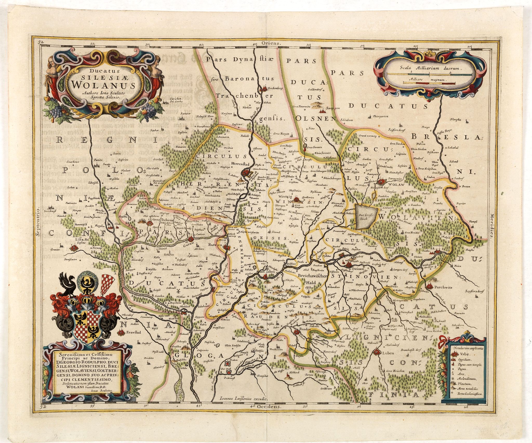
An engraved 17th-century map of the Duchy of Wohlau in Poland with four cartouches in the corners. Orientated with east at the top.
The decorative cartouche displaying the title is attributed to the Silesian cartographer Jonas Scultetus (1603-1644). There are three other decorative cartouches displaying dedication, scales, and explanation.
At the bottom of the map is the Oder River. In the lower right corner is Luben on the Kaltenbach River. Above the coat of arms in the lower left is the town of Lissa (Leszno). At the top of the map are the Horla and Bartsch rivers and the town of Trachtenberg.
The towns of Wintzig and Herrenstadt are near the upper center of the map. Text in German on half of the backside of the map.
Map of the Duchy of Wołów (Wolaw), engraved by Henricus Hondius after Scultetus; prototype, was published in Amsterdam with Hondius; imprint (after 1634). In 1641 its 2nd state appeared, with Joannes Janssonius; address, in "Novi Atlantis Anhang" (KAN 2925:1 notes only this 2nd state).
The map of Wołów features a few interesting details. One of these is the remnants of the primeval forest, partly existing to this day, located close to Leubus (Lubiąż) and contained within a bend of the Odra river. A conspicuous square-shaped pond just west of Wolaw (Wołów), and a couple of smaller ones, were places of intensive fish farming and a source of fresh fish to nearby Wrocław.
The map also shows the location of earthworks built during the Thirty Years' War military operations on the Duchy territory (1632-1634). The earthworks, without a representative sign in the legend, can be seen as small rectangles, either separate, as just off Steinaw (Ścinawa), or connected with signatures of some towns; see Herrnstadt (Wąsosz) or Rutzen (Ryczeń). (Information kindly supplied by Zbigniew Paprotny)
FAQ - Guarantee - Shipping
This item is available for immediate purchase when a "Add to Cart" or "Inquire Now" button is shown.
Items are sold in the EU margin scheme
Payments are accepted in Euros or US Dollars.
Authenticity Guarantee
 We provide professional descriptions, condition report (based on 45 years experience in the map business)
Paulus Swaen warrants the authenticity of our items and a certificate of authenticity is provided for each acquired lot.
Condition and Coloring
We indicate the condition of each item and use our unnique HiBCoR grading system in which four key items determine a map's value: Historical Importance, Beauty, Condition/Coloring and Rarity.
Color Key
We offer many maps in their original black and white condition. We do not systematically color-up maps to make them more sellable to the general public or buyer.
Copper engraved or wood block maps are always hand colored. Maps were initially colored for aesthetic reasons and to improve readability. Nowadays, it is becoming a challenge to find maps in their original colors and are therefor more valuable.
We use the following color keys in our catalog:
Original colors; mean that the colors have been applied around the time the map was issued.
Original o/l colors; means the map has only the borders colored at the time of publication.
Colored; If the colors are applied recently or at the end of the 20th century.
Read more about coloring of maps [+]
Shipping fee
A flat shipping fee of $ 30 is added to each shipment by DHL within Europe and North America. This covers : International Priority shipping, Packing and Insurance (up to the invoice amount).
Shipments to Asia are $ 40 and rest of the world $50
We charge only one shipping fee when you have been successful on multiple items or when you want to combine gallery and auction purchases.
Read more about invoicing and shipping
FAQ
Please have a look for more information about buying in the BuyNow gallery
Many answers are likely to find in the general help section.
My Collection+

With My Collection+ you can collect all your favorite items in one place. It is free, and anyone can create his or her virtual collection.
Unless you are logged in, the item is only saved for this session. You have to be registed and logged-in if you want to save this item permanently to My Collection+. Read More[+]
Register here, it is free and you do not need a credit card.
Add this item to My Collection+ or click the following link to see My Collection+.
|
Digital Image Download Paulus Swaen maintains an archive of most of our high-resolution rare maps, prints, posters and medieval manuscript scans. We make them freely available for download and study. Read more about free image download |
Click the image for a free small image download. |
YOUR RIGHT TO CANCEL THE PURCHASE OF A LOT
In accordance with the EU Consumer Rights Directive and habitually reside in the European Union you have the right to cancel the contract for the purchase of a lot, without giving any reason.
The cancellation period will expire 14 calendar days from the day after the date on which you or a third party (other than the carrier and indicated by you) acquires, physical possession of the lot. To exercise the right to cancel you must inform Paulus Swaen Inc, of your decision to cancel this contract by a clear statement (e.g. a letter sent by post, or e-mail.
To meet the cancellation deadline, it is sufficient for you to send your communication concerning your exercise of the right to cancel before the cancellation period has expired.
