Subscribe to be notified if similar examples become available.
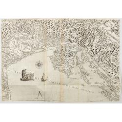
Golfo di Venetia overo Mare Adriatico. |
||||||||||||||||||||
|
||||||||||||||||||||
|
|
||||||||||||||||||||
|
|
My Collection + - Save and collect this or any of your favorite items in one place.
If you want to save the items permanently, please sign in or create account first. |
|||||||||||||||||||
Description
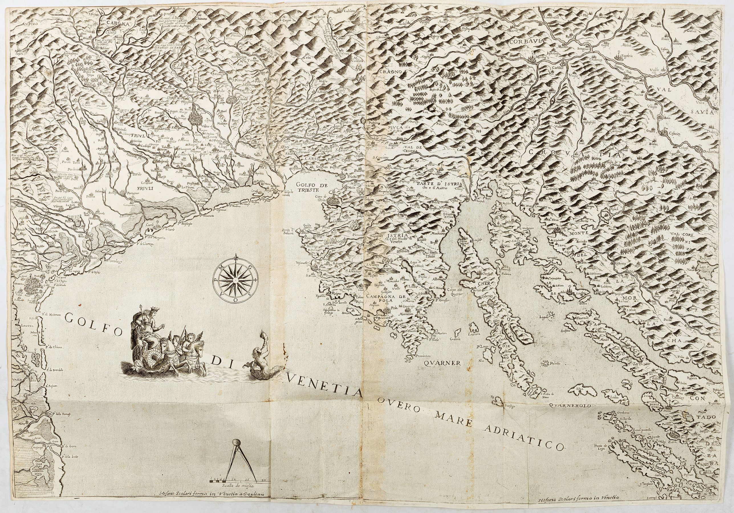
Extremely rare map of the Gulf of Venice, or the Adriatic Sea, published in Venice by Stefano Scolari : Stefano Scolari formin in Venetia a Szulian. The Scale is approximately 1:440,000.
Depicts the Gulf of Venice, Friuli, the Gulf of Trieste, Istria, Slovenia, and Croatia. Adorned with Neptune’s chariot, Triton, a compass rose, and a scale topped by a compass.
See below the article devoted to this map published in "Early Modern Nautical Charts of the Adriatic Sea":
"Of an entirely different nature are the so-called Carte da terra, also referred to as Carte dello Stato da terra e da mar (maps of the land and maritime state), which were intended for the political-economic management of the Adriatic and its neighbouring territories. This latter designation reveals how the Venetian possessions were inseparably linked to the sea.
The Serenissima’s dominion was geographically organized into three entities: the Dogado, or the metropolitan territory of the Republic of Venice, encompassing the lagoons between Loreo and Grado, up to the mouth of the Isonzo; the Stato da terra or Dominio di Terraferma (Mainland Dominion), which included Veneto, Friuli, and parts of Lombardy, with boundaries extending to the Po, the Adda, the Alps, and the Karst Plateau; and the Stato da mar or Dominio marittimo (Maritime Dominion), a diverse array of possessions stretching from the Adriatic to the eastern Mediterranean, which included Istria, Dalmatia, Corfu, Morea, the Aegean Islands, and Crete (Cessi 1946, 1981). In their various aspects, the control and management of the territories within the Mainland Dominion and the Dogado inevitably led to the creation of countless maps and drawings. Despite their variety, these artefacts assert the political capacity for intervention exercised by the Dominant power.
Even within Carte da terra, however, it is possible to distinguish two distinct phases of production, differentiated by the scale of representation, which influenced both their conceptualization and symbolic value.
Examples produced at what could be termed a ‘regional’ scale sought to delineate a politically defined territory and to convey pragmatic information (boundaries, cities, geographical names, etc.), presenting an institutionalized image of the Venetian Dominion. On the contrary, at smaller scales, micro-area maps, characterized by their precision and richness of detail, were of a predominantly instrumental nature. They served as tools for administration and territorial understanding under public authority or were aimed at the management of private property (Sereno 2007).
In its dual public and private dimensions, this terrestrial cartography introduced a revolution in Venetian cartographic metrics: a shift from recording linear space—focused exclusively on the coastline—to areal metrics—representing the territory in its entirety. This transition marked the emergence of a new spatial perception tied to the evolving political role of the territory within the Dominions and the necessity of understanding the regions of the Mainland under the Venetian administration.
The transformation in representation reflected a broader geopolitical paradigm shift, where the maritime dimension (the sea) was increasingly integrated with the terrestrial component (the land), transitioning from maritime dominance to territorial control.
Several surviving examples attest to this pivotal transition. Among them is STEFANO SCOLARI’s map, which prominently highlights the boundaries of Venetian possessions and the geopolitical configuration of the northern Adriatic at the border with Austrian (Habsburg) territory (Fig. 4.4). This map is an exceptionally rare and aesthetically striking artefact. It delineates the shores of the upper Adriatic, from the mouth of the Po to the Dalmatian islands facing Zadar, and encompasses a territorial scope stretching from the Carnic tributaries of the Tagliamento to the Canal Valley, Ljubljana, and the mountains north of Zagreb. Even upon initial examination, the “political” nature of this document is immediately evident. It aims to depict the Serenissima’s dominions and celebrate its prominence. A […] line clearly demarcates Venetian territories, while the inscriptions “Italy ends here” emphasize a cultural boundary between Venetian lands and Austrian domains. Additionally, within the sea, the map features a sumptuous allegorical representation of Ducal Venice, placed alongside the grand inscription GOLFO DI VENETIA OVERO MARE ADRIATICO.
This inscription almost serves as an official declaration, emphasizing the natural continuity of jurisdiction between land and sea (Salgaro 2007)"
Stefano Scolari
Stefano Scolari was active between 1644 and 1687. He was a designer, engraver and editor from Brescia, although he practiced his trade in Venice. His shop, in S. Zulian under the sign of the Three Virtues, was one of the best known in seventeenth-century Venice. He engraved, printed, and traded in prints, particularly, maps. He specialized in the re-issue of important maps including Gastaldi's map of Lombardy and the 12-sheet map of Italy by Greuter.
Read more about the Lafreri School [+]
Reference: Josip Faričić - Tome Marelić Editors, Department of Geography, University of Zadar Zadar, Croatia. Early Modern Nautical Charts of the Adriatic Sea.
FAQ - Guarantee - Shipping
Buying in the BuyNow Gallery
This item is available for immediate purchase when a "Add to Cart" or "Inquire Now" button is shown.
Items are sold in the EU margin scheme
Payments are accepted in Euros or US Dollars.
Authenticity Guarantee
 We provide professional descriptions, condition report (based on 45 years experience in the map business)
Paulus Swaen warrants the authenticity of our items and a certificate of authenticity is provided for each acquired lot.
Condition and Coloring
We indicate the condition of each item and use our unnique HiBCoR grading system in which four key items determine a map's value: Historical Importance, Beauty, Condition/Coloring and Rarity.
Color Key
We offer many maps in their original black and white condition. We do not systematically color-up maps to make them more sellable to the general public or buyer.
Copper engraved or wood block maps are always hand colored. Maps were initially colored for aesthetic reasons and to improve readability. Nowadays, it is becoming a challenge to find maps in their original colors and are therefor more valuable.
We use the following color keys in our catalog:
Original colors; mean that the colors have been applied around the time the map was issued.
Original o/l colors; means the map has only the borders colored at the time of publication.
Colored; If the colors are applied recently or at the end of the 20th century.
Read more about coloring of maps [+]
Shipping fee
A flat shipping fee of $ 30 is added to each shipment by DHL within Europe and North America. This covers : International Priority shipping, Packing and Insurance (up to the invoice amount).
Shipments to Asia are $ 40 and rest of the world $50
We charge only one shipping fee when you have been successful on multiple items or when you want to combine gallery and auction purchases.
Read more about invoicing and shipping
FAQ
Please have a look for more information about buying in the BuyNow gallery
Many answers are likely to find in the general help section.
My Collection+
![]()
With My Collection+ you can collect all your favorite items in one place. It is free, and anyone can create his or her virtual collection.
Unless you are logged in, the item is only saved for this session. You have to be registed and logged-in if you want to save this item permanently to My Collection+.
Read More[+]
Register here, it is free and you do not need a credit card.
Add this item to
My Collection+
or click the following link to see My Collection+.
| Digital Image Download | |
|
Paulus Swaen maintains an archive of most of our high-resolution rare maps, prints, posters and medieval manuscript scans. We make them freely available for download and study. Read more about free image download |
Click the image for a free small image download. |
In accordance with the EU Consumer Rights Directive and habitually reside in the European Union you have the right to cancel the contract for the purchase of a lot, without giving any reason.
The cancellation period will expire 14 calendar days from the day after the date on which you or a third party (other than the carrier and indicated by you) acquires, physical possession of the lot. To exercise the right to cancel you must inform Paulus Swaen Inc, of your decision to cancel this contract by a clear statement (e.g. a letter sent by post, or e-mail (amsterdam@swaen.com).
To meet the cancellation deadline, it is sufficient for you to send your communication concerning your exercise of the right to cancel before the cancellation period has expired.