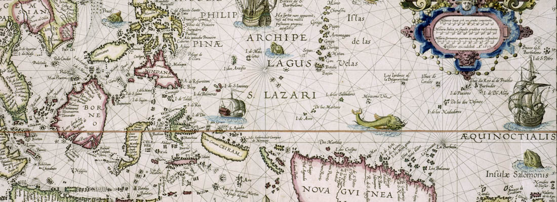
Swaen BuyNow CATALOG
Our BuyNow-catalog offers immediate sale items, and no commission is charged. The catalog includes old maps of the World - America - Asia - Europe - Africa - Medieval Manuscripts - Nuremberg Chronicle - Prints - Posters, atlases, globes, etc.
Our stock is updated weekly, and our most recent additions are conveniently displayed in our "Latest Listings".
Have a look at our Gallery highlights or see our Curated Collection of carefully selected old and rare maps, which are all graded with 8-10 stars in the HiBCoR grading system.
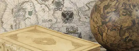
About Paulus Swaen
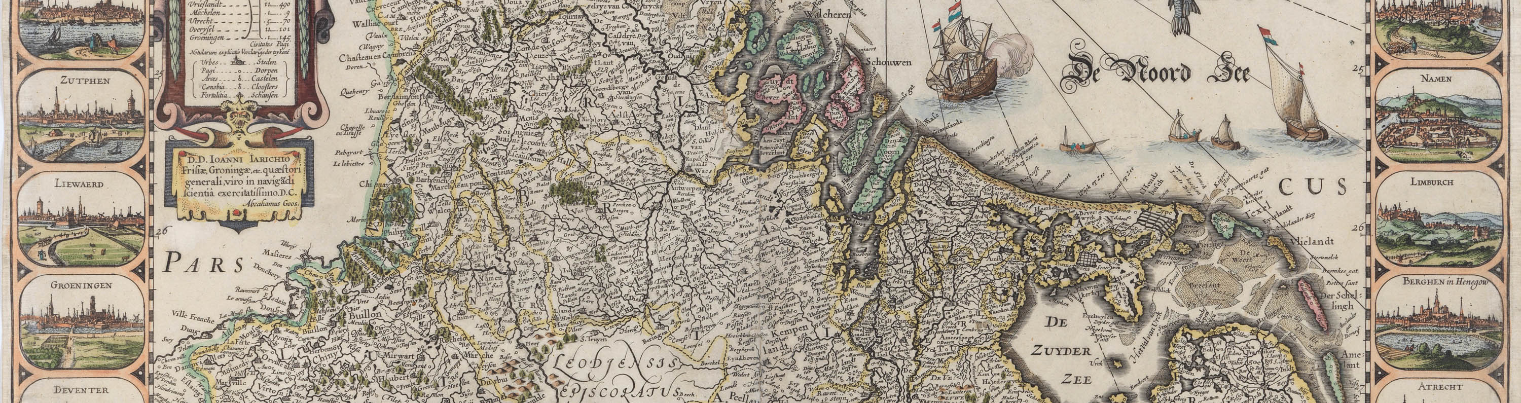
Paulus swaen is a leading dealer in antique and rare maps, atlases, prints. The firm was founded by Pierre Joppen in 1978 in the Netherlands and relocated to Florida in 1996, where we began selling online.Currently, we have thousands of high-quality maps, atlases, globes, and Medieval manuscripts for sale.
We participate at map fairs in Amsterdam, Venice, Paris, Milan and London.
Or Chat on WhatsApp or call USA+1 727 687 3298 / Amsterdam +31 6 51384297
Latest Listings
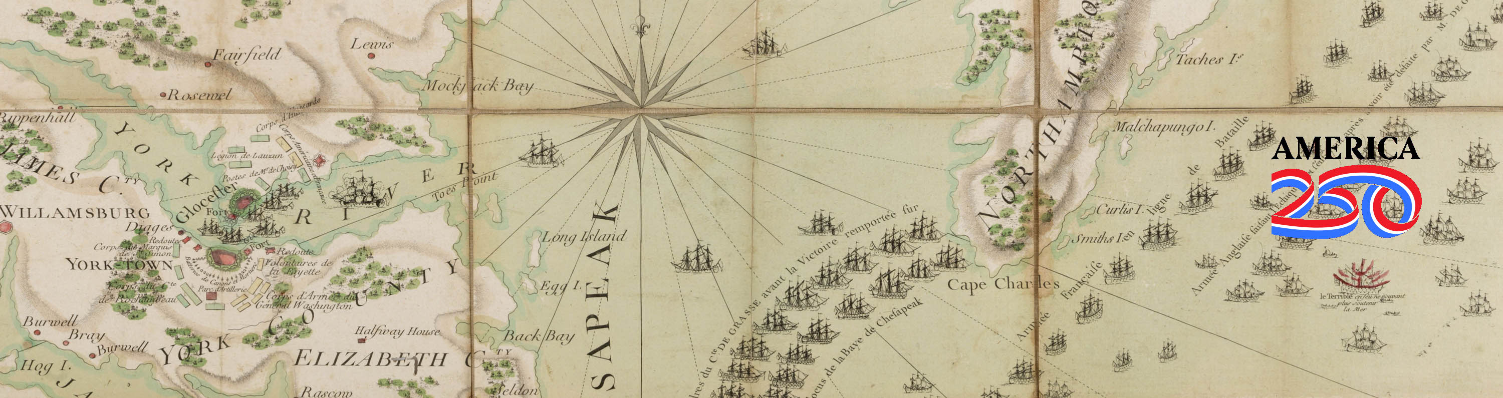
You can always check our latest listings page. It is updated daily and you see what we’ve recently added. Let's take a look at some rare maps we've recently acquired. Join our newsletter and be the first to be notified of new acquisitions and get exclusive offers.
Mapmakers and explorers
Sometimes, maps become more famous than their makers. Many cartographers only become famous after they’ve created a masterpiece.
Still, others make a famous map, then disappear from history forever.
The Mapping of...
We have created some short articles about the mapping of Arabia, Australia, Canada, China, Hungary, the Invasion of Minorca, Japan, Korea, Malta, Mer de l'Ouest, Northwest Passage, Poland, Russia, South East Asia, Taiwan and Ukraine.
The Mapping of . . .
We have created some short articles about the mapping of Arabia, Australia, Canada, China, Hungary, the Invasion of Minorca, Japan, Korea, Malta, Mer de l'Ouest, Northwest Passage, Poland, Russia, South East Asia, Taiwan and Ukraine.

Catalog Archive
Paulus Swaen maintains an archive of sold items, including HR images. Most map images are not restricted by copyright and can be used freely, as most are in the public domain. These historically achieved prices can help understand the pricing development of old maps.
Read our short articles
If you are interested in the backgrounds of antique maps, prints, mapmakers, etc. then you should read our short but informative articles >>>>
Or other subjects such as posters, old prints, Nuremberg Chronicle, optical prints, medieval manuscripts, etc.
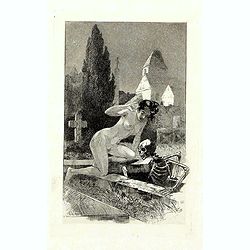
A rare suite of 12 original etchings by Martin van Maele to the famous work by Edmond Haracourt.
A rare suite of 12 original etchings by Martin van Maele to the famous work by Edmond Haracourt. The series was published anonymously in a small edition. These etchings a...
Date: Nevers, Brussels, 1882,1883

Nova Totius Terrarum Orbis Geographica ac Hydrographica Tabula.
A beautifully decorative world map taken from the 'English Atlas' by Moses Pitt and Steven Swart, based on an earlier engraved world map by Pieter van den Keere ca. 1630,...
Date: Oxford, 1680
![[Anti capitalism Soviet Union propaganda poster]](/uploads/cache/47032-250x250.jpg)
[Anti capitalism Soviet Union propaganda poster]
Propaganda mini anti-capitalism poster published in Russia during The Cold War. By the 1960’s and 1970’s, outrageous practices in Soviet bureaucracy flourished. Poor ...
Date: Leningrad, 1974

The Soviet Political Poster. - a portfolio collection of 32, full-color posters.
An attractive large portfolio set of 32 reproductions published in Leningrad in 1976 by Aurora Art Publishers, containing various Soviet Union political posters from 1919...
Date: Leningrad, Aurora Art Publishers, 1976
![CH'ONHA CHIDO [Atlas of all under Heaven]](/uploads/cache/33625-250x250.jpg)
CH'ONHA CHIDO [Atlas of all under Heaven]
The Ch’onha chido [Atlas of all under Heaven] is a late 18th century copy of the traditional Korean atlas produced in the early Choson dynasty (1392-1910). One of the m...
Date: Korea, ca. 1790

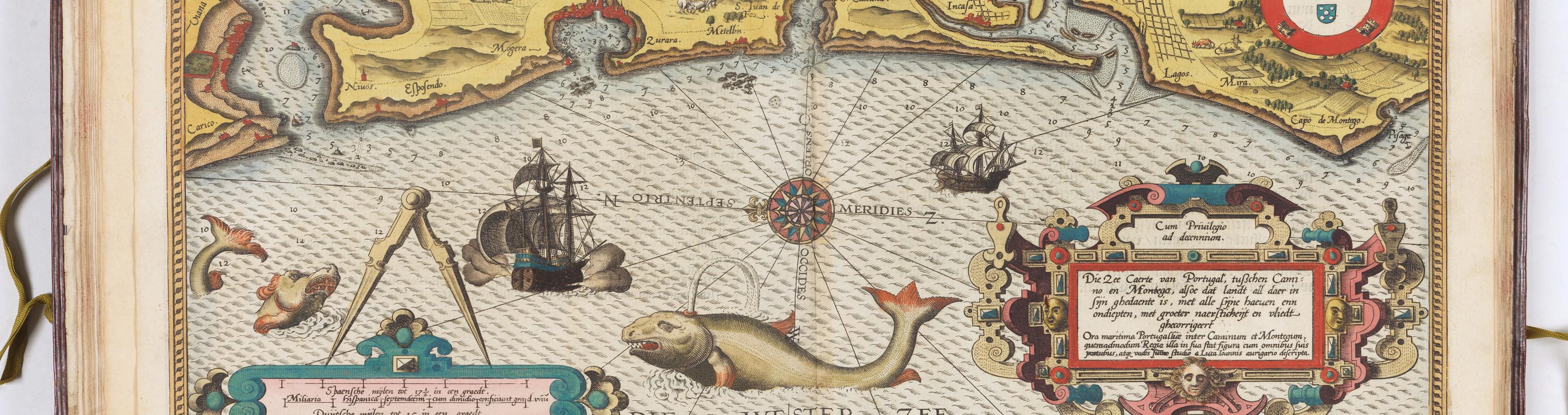
Cochin (today: Ernakulam)
Small but charming 18th water color on paper depicting Cochin (today : Ernakulam) was from 1500, when the first Portuguese fleet called on its port, a firm ally of the Po...
Date: India? c.1750
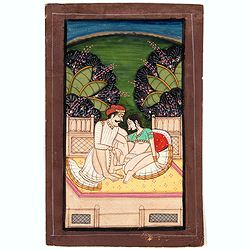
Indian painting on paper.
Fine miniature, presenting a couple in love making position, set on a balcony with in a landscape in the background. The miniature has been painted in India in late 19th ...
Date: India, ca. 1900

Nova Totius Terrarum Orbis Geographica..
The first of four states of the map. French text on verso. One of the most beautiful world maps ever engraved and one of the most influential in promulgating the Californ...
Date: Amsterdam, 1630-1633
![[ LANDSKROON ]. Oranda Fune no zu [= Depiction of a Dutch Ship].](/uploads/cache/28003-250x250.jpg)
[ LANDSKROON ]. Oranda Fune no zu [= Depiction of a Dutch Ship].
A very large and extremely detailed Japanese drawing on rice paper of a Dutch ship at the artificial island Deshima, the VOC's outpost in Nagasaki harbour. In the drawing...
Date: Japan, Kansei 4, 2nd month, 9th day, 30 March? 1792

Nouvelle et exacte description du globe terrestre reveue corrigée et augmente´e suivant les derniéres relations des Anglais et Hollandois. Par Guillaume Blaeu 1645.
Extremely rare and decorative "carte a figures" world map published by Anthoine de Fer. The double hemisphere world map is surrounded by constellations of the A...
Date: Paris, 1645
![[Russian Agitprop propaganda poster for 9 May]](/uploads/cache/42073-250x250.jpg)
[Russian Agitprop propaganda poster for 9 May]
Soviet propaganda poster celebrating Victory Day (Thursday 9 May). Showing a star with USA, English, French flags partly overlapped with Soviet flag and inscription in Ru...
Date: Moskow, 1988

Carte générale de L'Empire Ottoman en Europe et en Asie dressée par Henri Kiepert . . .
Large School wall map of Turkish Empire printed in chromo-lithography. Published by Dieter Reimer and printed by Ferdind Barth in Berlin. This rare map has two insets in ...
Date: Berlin, Verlag von Dietrich Reimer, 1867
![.Taprobana Ins. Tabula XII Asiae. [Sri Lanka.]](/uploads/cache/27928-250x250.jpg)
.Taprobana Ins. Tabula XII Asiae. [Sri Lanka.]
Ptolemy's mythical island of Taprobana originally became associated with Sri Lanka although it was sometimes confused with Sumatra. Taprobana, as it was called on most ea...
Date: Lyons, M. Servetus, 1535

SETTSU MEISHO ZUE. Illustrations of famous places in Settsu.
Settsu Meisho Zue was printed in two series of 8 and 4 volumes. The principal illustrator was Takehara Shunchosai, but many illustrations in the 4 volumes supplement are ...
Date: Osaka, Yanagiwara Kibei, Kansei 8-10 or 1796-1798

An embassy from the East-India Company of the United Provinces, to the Grand Tartar Cham, Emperor of China deliver'd by their excellencies, Peter de Goyer and Jacob de Keyzer, at his imperial city of Peking. . .
Very rare first English text edition of this most important and early resource on China and the Chinese. Three parts in one folio by John Macock for the author.Part I: An...
Date: London : Printed by the Author at his house in White-Friers, 1669
![Aou, Tōkei. Kokugun Zenzu [Atlas of Provinces and Counties of Japan]. (volume 1 only)](/uploads/cache/63619-250x250.jpg)
Aou, Tōkei. Kokugun Zenzu [Atlas of Provinces and Counties of Japan]. (volume 1 only)
First edition. Very attractive early Japanese Atlas of detailed maps of Japanese regions compiled by six Japanese civilians in the eighth year (1837) of the Tenpō era (...
Date: [Nagoya]: Tōheidō, Tenpō 8 = 1837

Plan commercial de la Région Saïgon-Cholon.
Decorative publicity plan of Ho Chi Minh City, also known by its former name of Saigon and Cholon, prepared by Ngo-Trinh, surrounded by advertisements of local stores. Th...
Date: Saigon, 1948

LA RUSSIE ROUGE ou POLONOISE qui Comprend les PROVINCES DE LA RUSSIE ROUGE de VOLHYNIE et de PODOLIE divisées en leurs Palatinats Vulgairement Connües sous le Nom D'VKRAINE ou PAYS DES COSAQUES.
A very rare Sanson map of Ukraine and so-called Russie Rouge, stretching from Lublin in the west to Kherson Oblast in the east (here called "Confin de La Petite Tart...
Date: Paris, 1706
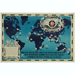
British Empire Trade Map WWII Eric Fraser.
Original vintage World War Two period British Empire trade map poster with the stylised text in Spanish reading: For more than two centuries the British fleets have kept ...
Date: England, 1941

Orbis Terrae Compendiosa Descriptio.
Gerard Mercator's great world map of 1569 was condensed into double hemispherical form by his son Rumold. It first appeared in 1587 in Casaubon's edition of Strabo's Geog...
Date: Amsterdam, 1595-1609
![Venecie. [Venice] Foliu XLIIII](/uploads/cache/29716-250x250.jpg)
Venecie. [Venice] Foliu XLIIII
A very fine of Venice (192x525mm.) Verso a view of Padua. Schedel's view of Venice is one of the earliest obtainable views of the city. The view is based on the view of ...
Date: Nuremberg, 12 July 1493

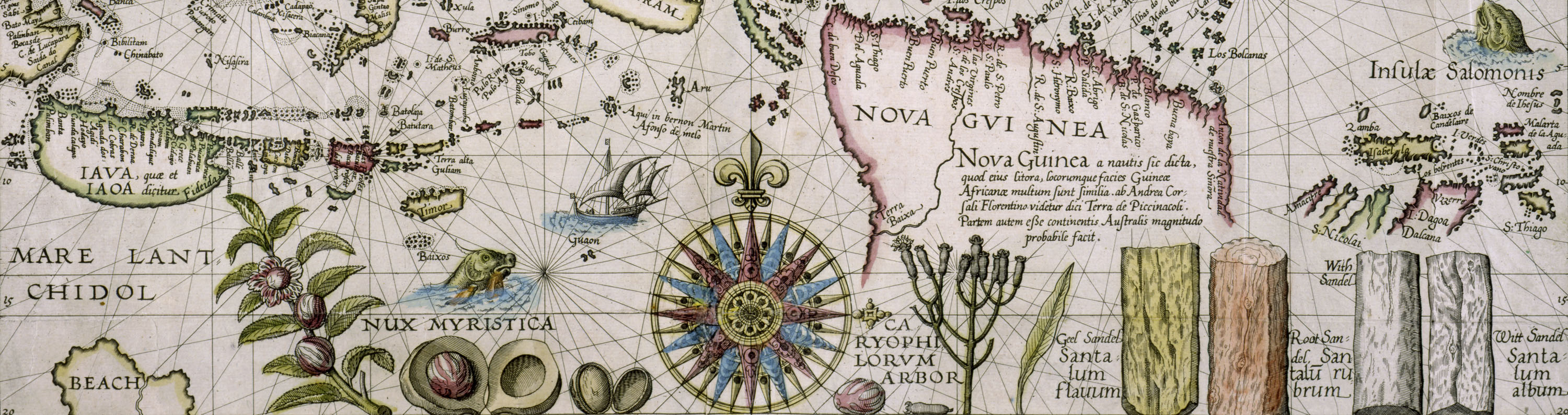
Mapa De la parte de la Isla Formosa sa perteneciente al Emperadotde la China sacado por Ord. De S.M.
Extremely rare map of the west coast of Taiwan, the Punghu or Pescadore Islands, and the Fokien or Fujian coast of China. Several ancient Taiwanese cities are noted, incl...
Date: Manilla, Seminario Conciliar, y Real de San Carlos, 1788-1792

Carte des Isles du Japon Esquelles est remarque la Route..
This uncommon map of Japan, on a reasonably large scale, includes comments on the country's nature. For instance, Ocsaqui (Okazaki, near Nagoya) is said to have the most ...
Date: Paris 1679
![Claudii Ptolemaei Alexandrini mathematicor[um] ...Octo libri Geographie. . .](/uploads/cache/62656-250x250.jpg)
Claudii Ptolemaei Alexandrini mathematicor[um] ...Octo libri Geographie. . .
Third edition of "Géographie" by Ptolemy and published in Strasbourg. Illustrated with 50 maps engraved in wood. One of the more important maps shows the earli...
Date: Strasbourg, J. Grüninger, 1522

