Browse Listings
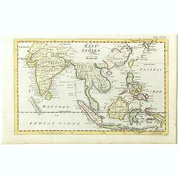
East Indies.
A lovely little late nineteenth century copperplate map of the East Indies. Showing India, Burma, Thailand, Cambodia, Laos, Malaysia, Indonesia, Borneo, Papua New Guinea,...
Place & Date: London, ca. 1797
Selling price: $100
Sold in 2018
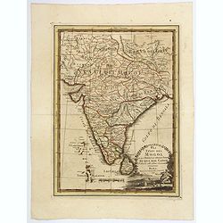
Gli Stati del Mogol e la Penisola delle Indie di qua dal Gange.
Cassini's lovely map of the Mogol States in India, published in: Nuovo atlante geografico universale delineato sulle ultime osservazioni in Rome. As well as a strong, dec...
Place & Date: Rome, 1797
Selling price: $100
Sold in 2018
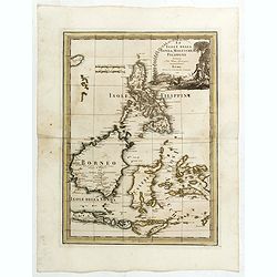
Le Isole della Sonda, Molluche, e Filippine delineate sulle ultima osservazioni.
First edition on laid paper. Cassini’s splendid early map of Philippines, Brunei, Celebes, Moluccas, Java and Timor, with large decorative title cartouche.This is one o...
Place & Date: Rome, 1797
Selling price: $1250
Sold in 2020
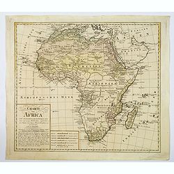
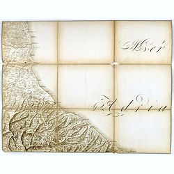
Charte von Africa.
An uncommon late eighteenth-century map of the continent of Africa, prepared by Güssefeld, based on earlier work done by Sayer and Rennel. Gussefeld worked for the Homan...
Place & Date: Nuremberg, 1797
Selling price: $91
Sold in 2021
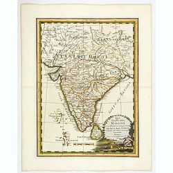
Gli Stati del Mogol e la Penisola delle Indie di qua dal Gange.
Cassini's large and lovely map of the Mogul States of India, published in: Nuovo atlante geografico universale in Rome. As well as a strong, decorative title cartouche, t...
Place & Date: Rome, 1797
Selling price: $195
Sold in 2019
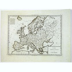
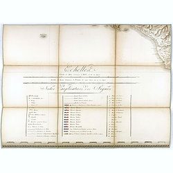
Carte Generale et Politique de L'Europe.
Engraved by Tardieu for Mentelle's "Atlas Universel de Géographie Physique et Politique, Ancienne et Moderne, Présenté a l'Instruction des Écoles Centrales, Pour...
Place & Date: Paris, ca 1797
Selling price: $40
Sold in 2019
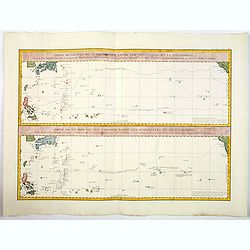
Partie de la Mer du Sud comprise entre les Philippines et la Californie d'apres de Carte Espagnole trouvee sur le Galion pris par l'Amiral Anson en 1743. . .
Two large sea charts on one sheet. Each from the Philippines to California one of the route of the Spanish galleons from Manilla to Acapulco with recent discoveries, and ...
Place & Date: Paris, 1797
Selling price: $110
Sold in 2019
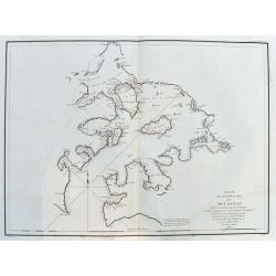
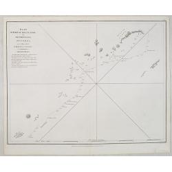
Plan de l'Entree du Port de Bucarelli sur la Cote du Nord-Ouest de l'Amérique. . .
A large chart of Bucareli Bay which is part of the Alexander Archipelago in the southeastern portion of Alaska. Highly detailed with coasts, islands, small rocks, and dep...
Place & Date: Paris, ca.1797
Selling price: $110
Sold in 2020
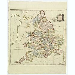
Present Britain.
A fully colored map of England and Wales from An Universal Atlas Consisting of a Complete Set of Maps, peculiarly adapted to illustrate and explain ancient and modern geo...
Place & Date: London, 1797
Selling price: $12
Sold in 2021
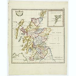
Present Scotland.
A fully colored map of Scotland, with the usual inset of the Shetland Islands from An Universal Atlas Consisting of a Complete Set of Maps, peculiarly adapted to illustra...
Place & Date: London, 1797
Selling price: $45
Sold in 2020
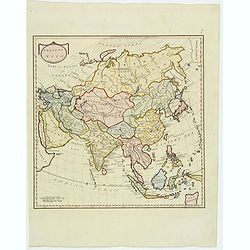
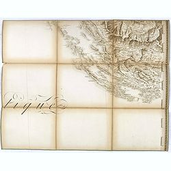
Present Asia.
A fully colored map of the continent of Asia from An Universal Atlas Consisting of a Complete Set of Maps, peculiarly adapted to illustrate and explain ancient and modern...
Place & Date: London, 1797
Selling price: $50
Sold in 2019
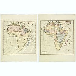
Africa Antiqua / Present Africa.
A fully colored pair of maps of the continent of Africa, both ancient and new, from An Universal Atlas Consisting of a Complete Set of Maps, peculiarly adapted to illustr...
Place & Date: London, 1797
Selling price: $65
Sold in 2020
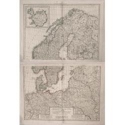
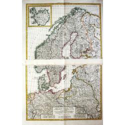
Les Cournonnes du Nord, le Danemarck, la Norwege, L'Islande et la Suede...
Huge two part map of northern Europe including Denmark, Norway, Sweden, European Russia, Poland, Germany. France, with an insert of Iceland. Charles-François Delamar...
Place & Date: Paris, 1797
Selling price: $381
Sold in 2019
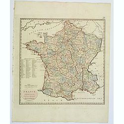
France, exhibiting at one view its former & present Divisions.
A fully colored map of France from An Universal Atlas Consisting of a Complete Set of Maps, peculiarly adapted to illustrate and explain ancient and modern geography, S.J...
Place & Date: London, 1797
Selling price: $6
Sold in 2021
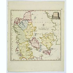
Denmark.
A fully colored map of Denmark from An Universal Atlas Consisting of a Complete Set of Maps, peculiarly adapted to illustrate and explain ancient and modern geography, S....
Place & Date: London, 1797
Selling price: $17
Sold in 2021
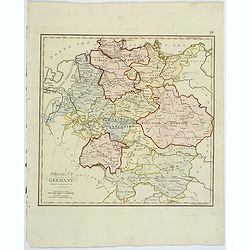
Present Germany.
A fully colored map of (the then) Germany from An Universal Atlas Consisting of a Complete Set of Maps, peculiarly adapted to illustrate and explain ancient and modern ge...
Place & Date: London, 1797
Selling price: $20
Sold in 2021
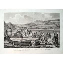
Costumes des habitans de la Baie de Langle.
From the important 1797 French edition. A fine engraved view showing local people and sailors near today's Tomari Bay, Sakhalin. Dessine par Duche-de Vancy. Grave par Cat...
Place & Date: Paris, 1797
Selling price: $21
Sold in 2019
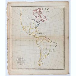
A plain map of America, according to the method of the Abbe Gaultier by Mr. Wauthier, his pupil. 1797.
Engraved map. Hand colored. Outline map showing boundaries and unnamed rivers, mountains, cities, etc. Prime meridian: Ferro.
Place & Date: Philadelphia, 1797
Selling price: $50
Sold in 2020
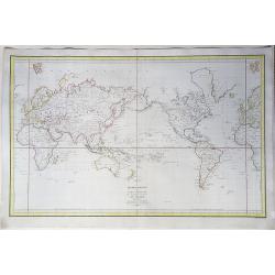
Mappemonde ou carte reduite des parties connues du globe pour servir au Voyage de La Perouse, fait dans les annees 1785 . . .
A striking example of La Perouse's map of the World on Mercator's projection. A map of the world showing the route of Jean-François de La Pérouse's voyage at the reques...
Place & Date: Paris, 1797
Selling price: $490
Sold in 2020
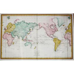
Mappemonde ou Carte Reduite des Parties Connues du Globe pour servir au Voyage de La Perouse fait dans les Annees 1785. . .
A detailed world map on Mercator's projection, high-lighting La Perouse's voyages from France to Africa, Hawaii to the NW Coast of America, across the Pacific to China vi...
Place & Date: Paris, 1797
Selling price: $950
Sold in 2021
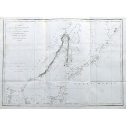
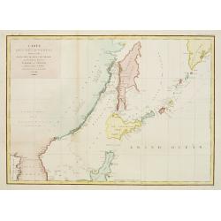
Carte des Découvertes Faites en 1787 dans les Mers de Chine et de Tartarie par les Frégates Françaises la Boußole et l'Astrolabe depuis leur Départ de Manille. . .
A nice large chart of the Asian coast, with parts of Korea, the Russian coast, the Sea of Okhotsk, the Sea of Japan, Hokkaido with unfinished coastline, Sakhalin, and of ...
Place & Date: Paris, 1797
Selling price: $200
Sold in 2022
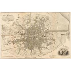
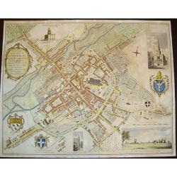
Plan of the City of Dublin Surveyed for Use of the Division of Justices, to Which have been Added Plans of the Canal Harbor and its Junction with the Grand Canal...
This is a rare separately issued map of Dublin, Ireland as it was at the end of what can be considered a rather prosperous century for the nation's capital and largest ci...
Place & Date: London, 1797
Selling price: $1600
Sold in 2023
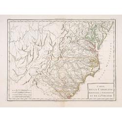
Carte de la Caroline Méridionale et Septentrionale..
An attractive map of Virginia, North and South Carolina.Very finely engraved by André and P.F.Tardieu.
Place & Date: Paris c.1797
Selling price: $500
Sold
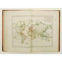
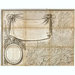
Atlas élémentaire de géographie physique et politique, ancienne et moderne,
Interesting and uncommon atlas with printed title page, 4 world maps, maps of the continents, many countries have a modern map, supplemented with an ancient of physical m...
Place & Date: Paris 1797
Selling price: $1800
Sold
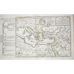
Carte de la Geographie Sacree pour L ' Ancien Testament. 1716.
Pierre Moullart-Sanson, grandson of Nicolas Sanson Sr., succeeded by his nephew Gilles Robert de Vaugondy. Charles François Delamarche (1740-1817), successor to Didier R...
Place & Date: Paris, 1797
Selling price: $150
Sold
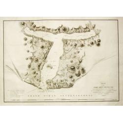
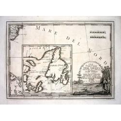
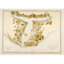
Plan du Port des Francais sur la Côte du Nord-Ouest de l' Amerique.
By Jean François Galoup, Comte de la Pérouse (1741-88), an outstanding French explorer and hydrographer. From Voyage autour du Monde?Atlas', 1797."Chart of the ent...
Place & Date: Paris, 1797
Selling price: $215
Sold
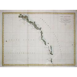
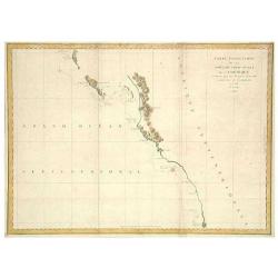
Carte particulaiere de la Côte du Nord-Ouest de l\'Amerique, 1e Feuille.
Jean François Galoup, Comte de la Pérouse (1741-88), outstanding French explorer and hydrographer. Voyage autour du Monde?Atlas', 1797.A large chart from La Pérouse's ...
Place & Date: Paris, 1797
Selling price: $225
Sold in 2009
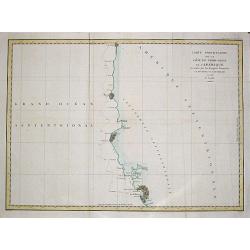
Carte particulaire de la Côte du Nord-Ouest de l\'Amerique, 3e Feuille.
Jean François Galoup, Comte de la Pérouse (1741-88), outstanding French explorer and hydrographer. Voyage autour du Monde?Atlas', 1797.A large chart from La Pérouse's ...
Place & Date: Paris, 1797
Selling price: $225
Sold in 2009
TERRE de CHANAAN ou Terre Promisse a Abraham Et sa Posterité./ CARTE des VOIAGES D' ABRAHAM
Charles François Delamarche (1740-1817), Paris-based geographer and publisher, successor to Didier Robert de Vaugondy after his death in 1786.A map of Palestine and a ma...
Place & Date: Paris, 1797
Selling price: $225
Sold
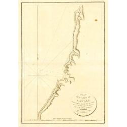
Plan de la Baie de Langle, situee a la partie Ouest de l' Isle de Choka
Jean François Galoup, Comte de la Pérouse (1741-88), outstanding French explorer and hydrographer. ' Voyage autour du Monde?Atlas', 1797.A map of the bay of Langle on C...
Place & Date: Paris, 1797
Selling price: $70
Sold in 2009
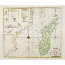
A chart of the Inner passage between the coast of Africa..
Detailed chart of the inner passage between the coast of Africa and the isle of Madagascar. In upper left hand corner inset of Comoros Islands. Another inset with the bay...
Place & Date: London 1797
Selling price: $400
Sold
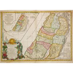
CARTE DE LA TERRE DES HEBREUX ou ISRAELITES / LA MONARCHIE DES HEBREUX SOUS SALOMON.
Charles François Delamarche (1740-1817), Paris-based geographer and publisher, successor to Didier Robert de Vaugondy after his death in 1786.A map of Palestine as divid...
Place & Date: Paris, 1797
Selling price: $325
Sold
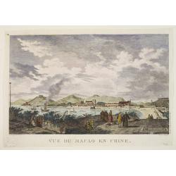
Vue de Macao en Chine.
Jean François Galoup, Comte de la Pérouse (1741-88), outstanding French explorer and hydrographer. ' Voyage autour du Monde?Atlas', 1797.An attractive view of Macao.
Place & Date: Paris, 1797
Selling price: $350
Sold
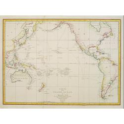
Carte du Grand Ocean ou Mer du Sud. Voyage de Decouvertes la Bousole et l'Astrolabe.
Jean François Galoup, Comte de la Pérouse (1741-88), outstanding French explorer and hydrographer.Important map of the Pacific, illustrating the voyages made by La Pero...
Place & Date: Paris, 1797
Selling price: $1000
Sold in 2011
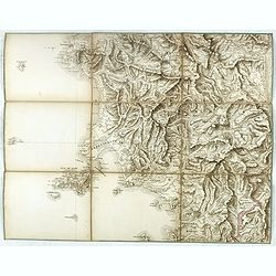
![[I. Dago] [I. Wormso]](/uploads/cache/22199-250x250.jpg)
[I. Dago] [I. Wormso]
Extremely rare sea chart centered on Hiiumaa (Dago) and Vormsi (Wormso) Islands, off the coast of Estonia.
Place & Date: Amsterdam, 1797
Selling price: $300
Sold in 2008
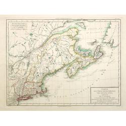
Gli Stati Uniti Dell' America...sesto foglio...parte della Carolina...Terra Nuova...S.Lorenzo
This unusual chart centers on a large inset map of the Gulf of Saint Lawrence and Newfoundland. Outside of the inset it shows the coast of Carolina with the city of Charl...
Place & Date: Rome 1797
Selling price: $250
Sold
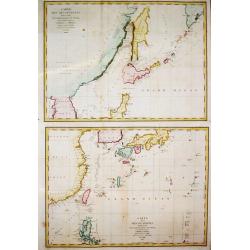
Carte des découvertes Faites en 1787 dans les Mers de Chine et de Tartarie, 1e Feuille/ 2e Feuille.
Two charts together depicting the waters of East Asia. By Jean François Galoup, Comte de la Pérouse (1741-88), outstanding French explorer and hydrographer, who publish...
Place & Date: Paris, 1797
Selling price: $600
Sold in 2016
LES COURONNES DU NORD, le Danemarck, la Norwège, l' Islande, et la Suède. partie de la Russie d' Europe, de la Pologne, la Prusse, partie de l' Allemagne et des Frontières de la France.
Charles François Delamarche (1740-1817), Paris-based geographer and publisher, successor to Didier Robert de Vaugondy after his death in 1786.Two maps together depicting...
Place & Date: Paris, 1797
Selling price: $475
Sold in 2009
Carte des découvertes.. 1787.. Et Manille..
La Pérouse's important large-scale of Northern Japan, Hokkaido, the Kuriles and the tip of Korea and Kamschatka.Published in the Atlas volume that accompanied the impor...
Place & Date: Paris 1797
Selling price: $1100
Sold in 2010
Carte particulaiere de la Côte du Nord-Ouest de l\'Amerique, 2e Feuille.
Jean François Galoup, Comte de la Pérouse (1741-88), outstanding French explorer and hydrographer. ' Voyage autour du Monde?Atlas', 1797.A large detailed chart from La ...
Place & Date: Paris, 1797
Selling price: $225
Sold in 2009
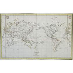
Mappemonde ou Carte reduite des Parties Connues du Globe pour servir au Voyage de La Perouse en 1785, 86, 87 et 88.
Jean François Galoup, Comte de la Pérouse (1741-88), outstanding French explorer and hydrographer. ' Voyage autour du Monde?Atlas', 1797.A worldmap in Mercator projecti...
Place & Date: Paris, 1797
Selling price: $725
Sold in 2011
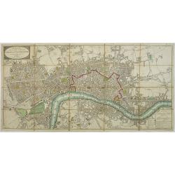
Wallis\'s Plan of the Cities of London and Westminster 1797.
First edition of this folding map covering Pentonville, Stepney, Lambeth and Hyde Park. Hand colored sections laid down on linen. Title on oval at top left. Explanation o...
Place & Date: London, 1797
Selling price: $450
Sold in 2009
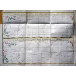
Partie de la Mer du Sud comprise entre les Philippines et la Californie d\'apres de Carte Espagnole trouvee sur le Galion pris par l\'Amiral Anson en 1743, qui represente l\'etat des connaissances a cette epoque, et les routes que suivaient ordinairement
Two large sea charts on one sheet. Each from the Philippines to California; one of the route of the Spanish galleons from Manilla to Acapulco with recent discoveries, and...
Place & Date: Paris, 1797
Selling price: $150
Sold in 2009
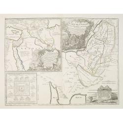
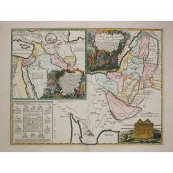
Terre de Chanaan, ou Terre promise à Abraham et à sa Posterité . . .
Two maps on one sheet. With a map of Palestine and a map of the Near Eas with a title cartouche "Carte des voiages d'Abraham faits par l'ordre de Dieu, en Asie et en...
Place & Date: Paris, ca. 1797
Selling price: $100
Sold in 2010
A Chart of the Islands to the Southward of Tschu-San on the Eastern Coaft of China....
Map of the First Official Account of the First English embassy to China- the Macartney mission of 1793-1794.
Place & Date: London, c. 1797
Selling price: $95
Sold in 2010
Carte de la partie septentrionale des Estats Unis. . .
An attractive map of North Americas east coast north of Long Island. Including St.Laurence River as far south as Lake Ontario.Engraved by André and P.F.Tardieu.
Place & Date: Paris c.1797
Selling price: $250
Sold in 2015
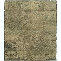
Neu vermehrte post charte der chur Braunschweigischen und angrenzenden lande. . . Von Friedrich Wilhelm Ohsen, ... privatim entworfen im Jahre 1774, verbessert 1777 und 1797.
post road maps map of North-Western Germany, centered on Braunsschweig, including Schaumburg, Grafsch, Lune, Brandenburg.Prepared by Friederich Wilhelm Ohsen in 1774 and ...
Place & Date: Hannover, 1797
Selling price: $100
Sold in 2011
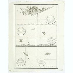
Plan de la partie de l'ile de quelpaert. . . / Plan de l'ile Hoapinsu. . . / Plan de l'ile Dagelet. . . / Plan de la partie de l'ile de Botol. . . / Plan de l'ile de Kumi. . .
Five plans on a folio sheet. These charts include Cheju Do, Korea (Quelpaert Is.), Kume-Shiwa, Okinawa (Kumi), and Ullung Do (Dagelet).Including one of the earliest maps ...
Place & Date: Paris, 1797
Selling price: $350
Sold in 2011

Le Isole di Sandwich delineate sulle osservazioni del Cap Cook.
FIRST EDITION on laid paper. Cassini’s splendid map depicts Sandwich islands, old name for Hawaii islands, at the end of the eighteenth century. The splendid cartouche ...
Place & Date: Rome, 1798
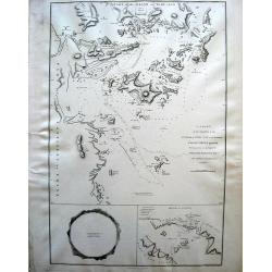
Plan du Port des Français sur la cote des Français ...
"Chart of the entrance of ""Bassin de L'Quest"", visited on July 2nd 1786 by La Perouse. On many 18th century maps we find a depiction of Mer de ...
Place & Date: Paris 1798
Selling price: $650
Sold

Tilburg (Market place)
Extremely rare print of Market place of Tilburg from Reizen door de Mayorij by Hanewinkel.
Place & Date: Amsterdam 1798
Selling price: $170
Sold
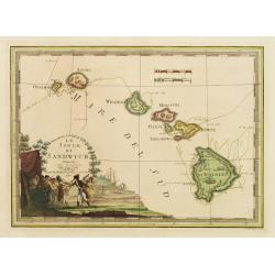
Le Isole di Sandwich..
Scare map of Hawaii. Embellished with a decorative cartouche imaginatively illustrating the death of Captain Cook on the island of Hawaii in 1779. The map itself is quite...
Place & Date: Rome 1798
Selling price: $3100
Sold
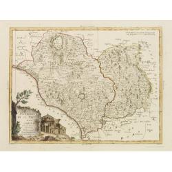
Campagna di Roma Di nuova Projezione. . .
A very striking map of the area south east of Rome, engraved by G.Pitteri embellished with an colored pictorial title cartouche.
Place & Date: Venice, 1798
Selling price: $200
Sold in 2015
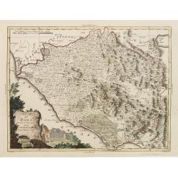
Il Patrimonio di S.Pietro e la Sabina. . .
A very striking map of the area north of Rome, engraved by G.Pitteri embellished with an colored pictorial title cartouche.
Place & Date: Venice, 1798
Selling price: $250
Sold in 2015
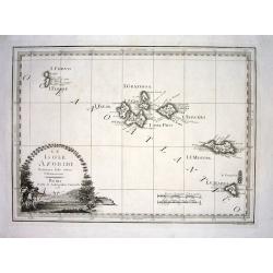
Le Isole Azoridi delineate fulle ultime Osservazioni
Rare Italian map of the Azores. Large scale and very detailed with much of topographical information. Big and decorative title cartouche illustrating a native hunting sce...
Place & Date: Rome, 1798
Selling price: $300
Sold
A Plan of the City of Canterbury & the adjoining Suburbs...
A beautiful, sought after plan of Canterbury as seen towards the end of the eighteenth century. The work contains four insets: 1) "The North View of St. Augustine's ...
Place & Date: London, dated 1798
Selling price: $325
Sold in 2008
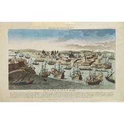
Vue de la Prise de l'Isle de Malthe.
A so-called optical print. A very decorative and extremely rare view of the siege of Valetta by Napoleon Bonaparte in 1797. French rule lasted only two years, for in 1800...
Place & Date: Paris, 1798
Selling price: $800
Sold in 2008
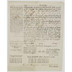
(Very rare share in the Swedish East India Company.) N° 1089
Very rare share in Swedish East India Company for Michael Jean Anthoine Knijff for 200 Riksdaelders. With a printed translation in French in the left hand margin.
Place & Date: Gotheborg 1798
Selling price: $1125
Sold in 2008
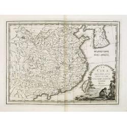
La Cina delineata sulle ultime osservazioni. Roma presso la Calcografia Cam.le, 1798.
Uncommon map of China, Taiwan and Korea, from Giovanni Maria Cassini's "Nuovo Atlante Geografico Universale delineato sulle ultime osservazioni". The Yellow Sea...
Place & Date: Venice, 1798
Selling price: $1100
Sold in 2009
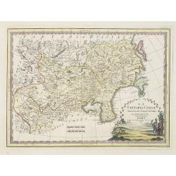
La Tartaria Cinese delineata sulleultime osservazioni.
Uncommon 1798 edition of this map of Chinese Tartary (present-day Mongolia and Manchuria) and Korea by Giovanni Maria Cassini.The map includes good detail of the cities a...
Place & Date: Rome, 1798
Selling price: $500
Sold in 2010
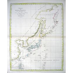
CHART OF DISCOVERIES made in 1787 in the Seas of China & Tartary between Manilla and Avatcha...
Attractive chart showing the area from Kamchatka to the Philippines, including Japan and Korea. With early geography of the islands and coasts, lined with numerous place-...
Place & Date: London, 1798
Selling price: $250
Sold in 2010
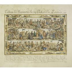
Tableau des Decouvertes du Cap.ne Cook, & de la Pérouse.
Three series of figures of natives with key below, surrounded by narrow pictorial border. The print is in original state, as issued, never folded into a book and never in...
Place & Date: Paris, 1798
Selling price: $2000
Sold in 2021
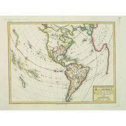
Carte générale et Politique de l'Amérique.
Copper-engraved map, hand-colored in outline. Well-engraved and attractive map of North and South America, from the French Atlas National, dated An VI, No. 155 in upper l...
Place & Date: Paris, 1798
Selling price: $190
Sold in 2014
Plan of part of the Islands or Archipelago of Corea.
Showing the track of La Perouse along the southern most tip of Korea, with Quelpaerts Islands (now-a-days called Jeju, with the vulcano Halla-san (Halla Mountain) clearly...
Place & Date: London, G.G. and J.Robinson, 1798
Selling price: $360
Sold
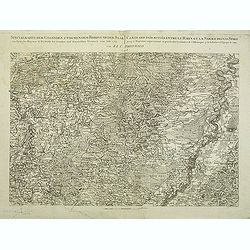
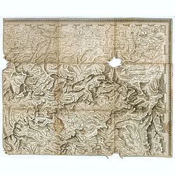
Specialkarte der Gegenden zwischen dem Rhein und der Saar. . . / Carte des pais situes entre le rhin et la sarre depuis spire. . .
Map of the frontier between Germany and France. Beautiful map showing the relief. Engraved by B.F. Leizelt.
Place & Date: Augsburg, 1798
Selling price: $75
Sold in 2014
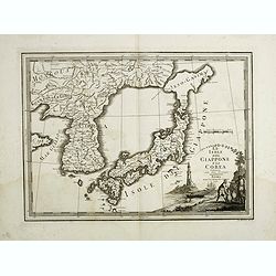
Le Isole del Giappone e la Corea. . .
Japan and Korea, from the "Nuovo Atlante Geografico Universale". With unusual shape of Hokkaido here called "Jeso-Gasima", the semi-mythical island to...
Place & Date: Rome, 1798
Selling price: $1000
Sold in 2014
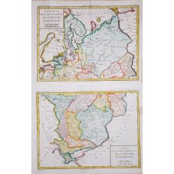
Carte de la Partie Septentrionale/ Meridionale de la Russie Euopéenne.
Two maps together depicting European Russia. From Brunet's 'Histoire Universelle, depuis le commencement du monde jusqu'a present'.Louis Brion de la Tour (1756-1823), Fre...
Place & Date: Paris, 1790-1798
Selling price: $110
Sold in 2020
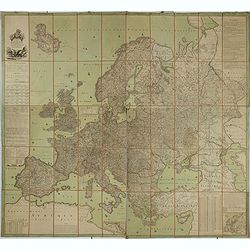
Carte de l'Europe dediée a Son Altesse royale Monseigneur Charles Louis archiduc d'Autriche, prince royal de Hongrie et de Bohéme, chevalier de la Toison d'Or, Grand-Croix de l'ordre militaire de Marie-Thérése . . .
Wall map of Europe during the regime of Napoleon. Engraved by Joannes Berken. With a dedication to Archduke Charles of Austria, ( 5 September 1771 – 30 April 1847) who ...
Place & Date: Paris / Vienna 1798
Selling price: $1000
Sold in 2015
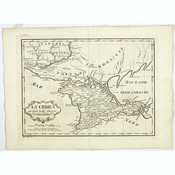
La Crimea con alcuni luoghi adiacenti Siena presso Pazzini Carli - Ago: Costa inc.
Detailed map of Crimea from a rare atlas which is published in Siena by Pazzini Carli between 1798 and 1800. The map most likely prepared by L ' abbot Bartolomeo Borghi (...
Place & Date: Siena, ca. 1798
Selling price: $450
Sold in 2015
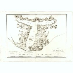
Plan du Port des Français sur la cote du nord ouest. . .
Chart of the entrance of Bassin de L'Quest , visited on July 2nd 1786 by La Perouse. On many 18th century maps we find a depiction of Mer de L'Quest or Sea of the West a ...
Place & Date: Paris, 1798
Selling price: $60
Sold in 2018
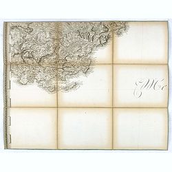
(Separate sheet from ) Carte générale du théâtre de la guerre en Italie et dans les Alpes.
The complete title of the map is "Carte générale du théâtre de la Guerre en Italie et dans les Alpes depuis le passage du Var le 29 septembre 1792 jusqu'à l'ent...
Place & Date: Milan, 1798
Selling price: $30
Sold in 2017
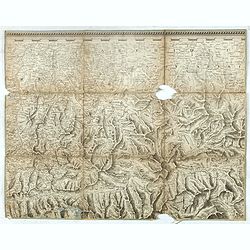
(Separate sheet from ) Carte générale du théâtre de la guerre en Italie et dans les Alpes.
The complete title of the map is "Carte générale du théâtre de la Guerre en Italie et dans les Alpes depuis le passage du Var le 29 septembre 1792 jusqu'à l'ent...
Place & Date: Milan, 1798
Selling price: $30
Sold in 2018
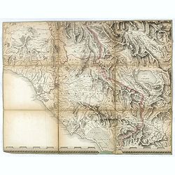
(Separate sheet from ) Carte générale du théâtre de la guerre en Italie et dans les Alpes.
The complete title of the map is "Carte générale du théâtre de la Guerre en Italie et dans les Alpes depuis le passage du Var le 29 septembre 1792 jusqu'à l'ent...
Place & Date: Milan, 1798
Selling price: $30
Sold in 2017
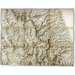
(Separate sheet from ) Carte générale du théâtre de la guerre en Italie et dans les Alpes.
The complete title of the map is "Carte générale du théâtre de la Guerre en Italie et dans les Alpes depuis le passage du Var le 29 septembre 1792 jusqu'à l'ent...
Place & Date: Milan, 1798
Selling price: $35
Sold in 2016
(Separate sheet from ) Carte générale du théâtre de la guerre en Italie et dans les Alpes.
The complete title of the map is "Carte générale du théâtre de la Guerre en Italie et dans les Alpes depuis le passage du Var le 29 septembre 1792 jusqu'à l'ent...
Place & Date: Milan, 1798
Selling price: $20
Sold in 2017
(Separate sheet from ) Carte générale du théâtre de la guerre en Italie et dans les Alpes.
The complete title of the map is "Carte générale du théâtre de la Guerre en Italie et dans les Alpes depuis le passage du Var le 29 septembre 1792 jusqu'à l'ent...
Place & Date: Milan, 1798
Selling price: $20
Sold in 2018
(Separate sheet from ) Carte générale du théâtre de la guerre en Italie et dans les Alpes.
The complete title of the map is "Carte générale du théâtre de la Guerre en Italie et dans les Alpes depuis le passage du Var le 29 septembre 1792 jusqu'à l'ent...
Place & Date: Milan, 1798
Selling price: $20
Sold in 2017
(Separate sheet from ) Carte générale du théâtre de la guerre en Italie et dans les Alpes.
The complete title of the map is "Carte générale du théâtre de la Guerre en Italie et dans les Alpes depuis le passage du Var le 29 septembre 1792 jusqu'à l'ent...
Place & Date: Milan, 1798
Selling price: $20
Sold in 2017
(Separate sheet from ) Carte générale du théâtre de la guerre en Italie et dans les Alpes.
The complete title of the map is "Carte générale du théâtre de la Guerre en Italie et dans les Alpes depuis le passage du Var le 29 septembre 1792 jusqu'à l'ent...
Place & Date: Milan, 1798
Selling price: $30
Sold in 2017
(Separate sheet from ) Carte générale du théâtre de la guerre en Italie et dans les Alpes.
The complete title of the map is "Carte générale du théâtre de la Guerre en Italie et dans les Alpes depuis le passage du Var le 29 septembre 1792 jusqu'à l'ent...
Place & Date: Milan, 1798
Selling price: $35
Sold in 2017