Browse Listings

Homme de l'Isle de Ste Christine.
Hand-colored mezzotints of Native Americans drawn by Labrousse and engraved by Laroque after Jacques Grasset de Saint-Sauveur.
Place & Date: Paris,1796
Selling price: $30
Sold in 2010

Sauvage Iroquois.
Hand-colored mezzotints of Native Americans drawn by Labrousse and engraved by Laroque after Jacques Grasset de Saint-Sauveur.
Place & Date: Paris,1796
Selling price: $35
Sold in 2011

Jongleur Iroquois.
Hand-colored mezzotints of Native Americans drawn by Labrousse and engraved by Laroque after Jacques Grasset de Saint-Sauveur.
Place & Date: Paris,1796
Selling price: $25
Sold in 2011

Femme de l'Isle Ste Christine.
Hand-colored mezzotints of Native Americans drawn by Labrousse and engraved by Laroque after Jacques Grasset de Saint-Sauveur.
Place & Date: Paris,1796
Selling price: $30
Sold in 2010

Paysannes du Pérou.
Hand-colored mezzotints of Native Americans drawn by Labrousse and engraved by Laroque after Jacques Grasset de Saint-Sauveur.
Place & Date: Paris,1796
Selling price: $25
Sold in 2010

Guerriers Peruviens, Ancien et Moderne.
Hand-colored mezzotints of Native Americans drawn by Labrousse and engraved by Laroque after Jacques Grasset de Saint-Sauveur.
Place & Date: Paris,1796
Selling price: $25
Sold in 2010
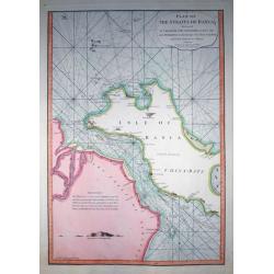
Plan of the Straits of Banca...
Rare nautical from "The country East-India Pilot" published in 1799 by Laurie & Whittle.A fantastic copper engraved map of Isle of Banca and part of Sumatr...
Place & Date: London, 1796
Selling price: $111
Sold in 2011

1. Le Râle Huppé, de Caienne éspéce nouvelle. / 2. La petite Marouette de la Guyanne.
Last production, and his most refined, of François Nicolas Martinet's famous birds. The plates are smaller than the ones he made for Buffon or Brisson.From Histoire des ...
Place & Date: Paris, 1790-1796
Selling price: $75
Sold in 2011

(Title page) Voyage pittoresque de la France ouvrage national dédié au roi. Frontispice pour la province du Dauphiné.
Beautiful title page for the region of the Dauphine. Print showing 3 women with a baby, putti and the royal arms (3 fleurs de lys).From "Description générale et pa...
Place & Date: Paris, Lamy, 1781-1796
Selling price: $120
Sold in 2012
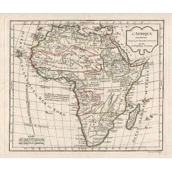
L\'Afrique.
General map of Africa.
Place & Date: Paris, 1796
Selling price: $60
Sold in 2012
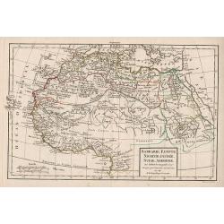
Barbarie, Egypte, Nigritte, Guinée, Nubie, Abissinie.
Map of the northern part of Africa.
Place & Date: Paris, 1796
Selling price: $50
Sold in 2011
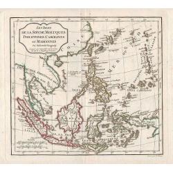
Les Isles de la Sonde, Moluques, Philippines, Carolines, et Mariannes.
Map of East Asia and Indonesia.
Place & Date: Paris, 1796
Selling price: $80
Sold in 2011
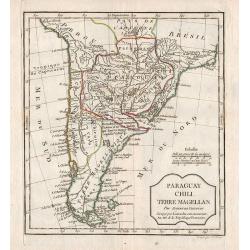
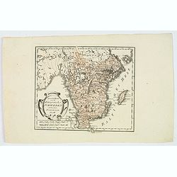
Paraguay, Chili, Terre Magellan.
Map of the southern part of South America.
Place & Date: Paris, 1796
Selling price: $105
Sold in 2012
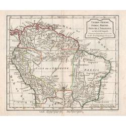
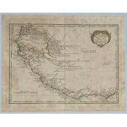
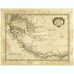
Terre-Ferme, Perou, Brésil, Pays de l\'Amazone.
Map of the northern part of South America.
Place & Date: Paris, 1796
Selling price: $45
Sold in 2012
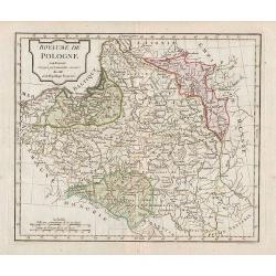
Royaume de Pologne.
Map of Poland.
Place & Date: Paris, 1796
Selling price: $75
Sold in 2011
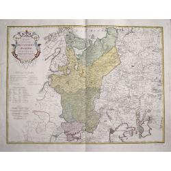
Karte von dem Ruschischen Reiche in Europa.
Map shows the west part of Russia.
Place & Date: Vienna, 1796
Selling price: $36
Sold in 2015
Karte des Arabischen Meerbusens oder der Rotten Meeres. . .
An attractive map of the Red Sea with insets of the north-west arm of the Red Sea and the port of Suez.. Engraved by H. Benedict.Franz Johann Josef von Reilly (Vienna 18 ...
Place & Date: Vienna, 1796
Selling price: $150
Sold in 2018

Here Justice Triumphs in His Elbow Chair.
Copper engraving of William Hogarth's "Here Justice Triumphs in His Elbow chair", from the Cook Edition from 1796. This print shows a pregnant woman pleading wi...
Place & Date: London, 1796
Selling price: $97
Sold in 2018
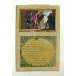
Henry VI Taken Prisoner by the Earls of Warwic & Marche.
Hand-colored engraving published by R. Bowyer in "HISTORIC GALLERY" in London in 1796. Robert Bowyer (1758-1834), Miniature painter and publisher. Robert Bowye...
Place & Date: London, 1796
Selling price: $15
Sold in 2017
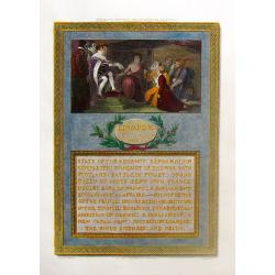
Edward VI Granting the Charter for Hospitals.
Hand-colored engraving published by R. Bowyer in "HISTORIC GALLERY" in London in 1796. Robert Bowyer (1758-1834), Miniature painter and publisher. Robert Bowye...
Place & Date: London, 1796
Selling price: $79
Sold in 2016
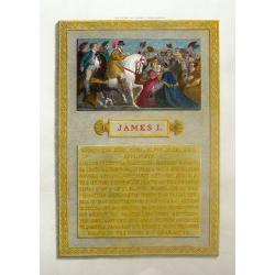
The Entry of James I Into London.
Hand-colored engraving published by R. Bowyer in "HISTORIC GALLERY" in London in 1796. Robert Bowyer (1758-1834), Miniature painter and publisher. Robert Bowyer...
Place & Date: London, 1796
Selling price: $16
Sold in 2017
The Convocation at Oxford.
Hand-colored engraving published by R. Bowyer in "HISTORIC GALLERY" in London in 1796. Robert Bowyer (1758-1834), Miniature painter and publisher. Robert Bowye...
Place & Date: London, 1796
Selling price: $40
Sold in 2017

Lewis VII, King of France Before Beckett's Tomb.
Hand-colored engraving published by R. Bowyer in "HISTORIC GALLERY" in London in 1796. Robert Bowyer (1758-1834), Miniature painter and publisher. Robert Bowye...
Place & Date: London, 1796
Selling price: $14
Sold in 2018

The Briton.
Hand-colored engraving published by R. Bowyer in "HISTORIC GALLERY" in London in 1796. Robert Bowyer (1758-1834), Miniature painter and publisher. Robert Bowye...
Place & Date: London, 1796
Selling price: $13
Sold in 2016

93752
Hand-colored engraving published by R. Bowyer in "HISTORIC GALLERY" in London in 1796. Robert Bowyer (1758-1834), Miniature painter and publisher. Robert Bowye...
Place & Date: London, 1796
Selling price: $23
Sold in 2017

Shephard Boy & Six Cameos.
Hand-colored engraving published by R. Bowyer in "HISTORIC GALLERY" in London in 1796. Robert Bowyer (1758-1834), Miniature painter and publisher. Robert Bowye...
Place & Date: London, 1796
Selling price: $16
Sold in 2018

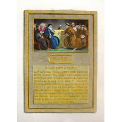
Queen Elizabeth Appointing Her Successor.
A fine copper engraving featuring Queen Elizabeth on her deathbed, choosing her successor. The print comes form "HISTORIC GALLERY", published by R. Bowyer in Lo...
Place & Date: London, 1796
Selling price: $12
Sold in 2018
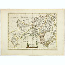
La Tartaria Chinese. Siena 1796 Presso Pazzini Carli.
Rare map of Tartary, with Korea and Japan published by Carli Pazzini in Siena and included in " Atlante Geografico, prima stesura delle opera dell’abate Bartolomeo...
Place & Date: Siena, 1796
Selling price: $190
Sold in 2015
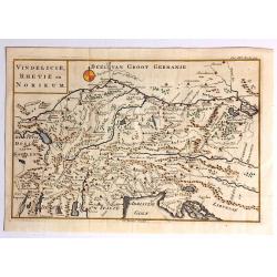
Vindelicie, Rhetie en Norikum.
Striking copper engraved original map of Greece, Bulgaria, Romania, and Macedonia. Christopher Cellarius (C. Keller) (1638-1707) was a geography professor who held positi...
Place & Date: London, 1796
Selling price: $64
Sold in 2017
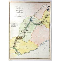
Carte de la Route que l'ambassade Anglais a Suive en Allant de Hang-Tchou-fou a Qhang-Tchou-Fou ou canton en Chine
A copper engraved map of a journey from Hang-Tchoo-Foo to Quang-Tchoo-Foo. Published in Stauton's "AN AUTHENTIC ACCOUNT OF AN EMBASSY FROM THE KING OF GREAT BRITAIN ...
Place & Date: Paris, 1796
Selling price: $51
Sold in 2018
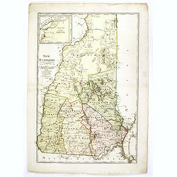
New Hampshire entworfen von D.F. Sotzmann. Hamburg bey Carl Ernst Bohn 1796 . . . No. II.
Extremely rare map of New Hampshire prepared by Daniel Friedrich Sotzmann for Christopher Ebeling's "Erdbeschreibung von Amerika", a project ended after only te...
Place & Date: Hamburg, Carl Ernst Bohn, 1796
Selling price: $4950
Sold in 2016
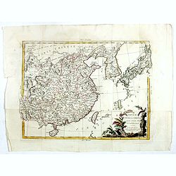
Impero delle China colle isole del Giappone. . .
A very striking map of China, Korea, Taiwan and Japan embellished with an colored pictorial title cartouche flanked by flowers and a bird. This is the uncommon edition wi...
Place & Date: Venice, 1795-1796
Selling price: $500
Sold in 2016
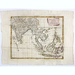
Le Indie Orientali E Il Loro Arcipelago . . .
Striking map of the region from the Gulf of Bengal to Hainan, centered on the Malay Peninsula, Straits of Malacca, Sumatra, Java and Philippines.This is the uncommon edit...
Place & Date: Venise, 1794-1796
Selling price: $450
Sold in 2017
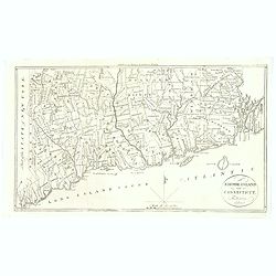
Rhode-Island and Connecticut.
Published in Boston by Thomas and Andrews before the end of the eighteenth century, for the Rev J. Morse in his "The American Universal Geography". The map was ...
Place & Date: Boston, 1796
Selling price: $65
Sold in 2018
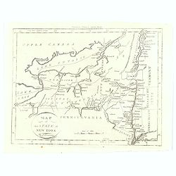
Map of the State of New York.
Published in Boston by Thomas and Andrews before the end of the eighteenth century, for the Rev J. Morse in his "The American Universal Geography". The map show...
Place & Date: Boston, 1796
Selling price: $60
Sold in 2016
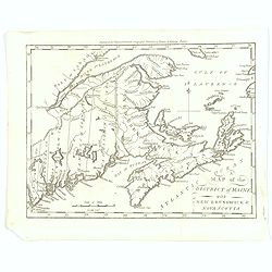
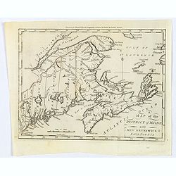
Map of the District of maine with New Brunswick & Nova Scotia.
Published in Boston by Thomas and Andrews before the end of the eighteenth century, for the Rev J. Morse in his "The American Universal Geography".A map showing...
Place & Date: Boston, 1796
Selling price: $60
Sold in 2016
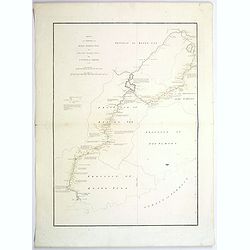
Sketch of A Journey from Hang-Tchoo-Foo ...
A detailed map taken from, from Staunton's 'An Authentic Account of an Embassy from the King of Great Britain to the Emperor of China'.
Place & Date: London, 1796
Selling price: $110
Sold in 2018
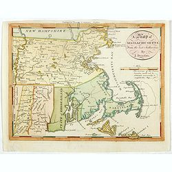
A map of Massachusetts from the best Authorities by J.Denison.
The map highlights Martha's Vineyard and Nantucket Island. The "Proposed Canal" is located near Sandwich. Beneath the oval title cartouche and distance scale is...
Place & Date: Boston, 1796
Selling price: $200
Sold in 2021
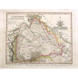
Moson Varmegye (Comitatus Mosoniensis).
A rare map on a large scale of the area of Moson county centered on Magyaróvár and Moson. It includes a section of today's Austria, with the northern part of Lake Neusi...
Place & Date: Vienna, 1796
Selling price: $100
Sold in 2017
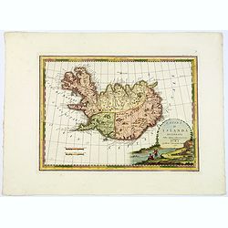
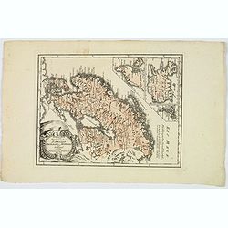
L'Isola d'Islanda Delineata Sulle ultime osservazioni.
Cassini’s splendid map depicts Iceland at the end of the eighteenth century. Though Iceland was geographically isolated from the European continent, for centuries it wa...
Place & Date: Rome, 1796
Selling price: $600
Sold in 2019
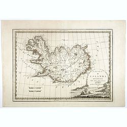
L'Isola d'Islanda Delineata Sulle ultime osservazioni.
Cassini’s splendid map depicts Iceland at the end of the eighteenth century. Though Iceland was geographically isolated from the European continent, for centuries it wa...
Place & Date: Rome, 1796
Selling price: $425
Sold in 2018
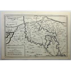
Mesopotamia et Babylonia, Fluminibus Secondum. . .
A fine copperplate map of present day Iran, Iraq, Afghanistan, Armenia and Arabia by Cellarius in 1796. It shows details including mountains. Engraved by W.H. Toms.Andrea...
Place & Date: Amsterdam, 1796
Selling price: $47
Sold in 2019
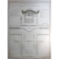
Plan of the Hall of Audience and the Adjacent Courts in the Emperor's Gardens at Yuen-min-Yuen.
A striking copper engraving from an important eighteenth century series on China by William Alexander. From Sir George Leonard Staunton's An Authentic Account of an Emba...
Place & Date: London, 1796
Selling price: $21
Sold in 2019

Plan, Section and Elevation of the Poo-Ta-La or Temple of the Lama at Zhe-Hol in Tartary.
A striking copper engraving from an important eighteenth century series on China by William Alexander. From Sir George Leonard Staunton's An Authentic Account of an Emba...
Place & Date: London, 1796
Selling price: $13
Sold in 2023
Le Coste Dell' Alta Guinea.
A rare and detailed outline map of the coast of West Africa.
Place & Date: Sienna, 1796
Selling price: $12
Sold in 2018
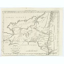
Map of the State of New York.
A nice post revolutionary war map of the state of New York by James Denison, published in Boston by Thomas and Andrews. Map shows rivers, mountains, roads, state boundari...
Place & Date: Boston, 1796
Selling price: $30
Sold in 2019
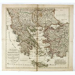
Griechenland, der Archipelagus, Albanien, Macedonien, Romanien und ein Theil von Anadoli: nach De la Rochette, Le Clerc etc ... Schneider & Weigel, 1796.
Nice map of Greece, Albania, Macedonia and Romania by Weigel.
Place & Date: Augsburg, 1796
Selling price: $170
Sold in 2019
Map of the District of Maine with New Brunswick & Nova Scotia.
Published in Boston by Thomas and Andrews before the end of the eighteenth century, for the Rev J. Morse in his "The American Universal Geography".A map showing...
Place & Date: Boston, 1796
Selling price: $75
Sold in 2019
Spezial Karte vom des Konigreichs Schweden sudlichen Provinzen. . .
Map shows the southern most part of Sweden, Götaland. The area includes the ten historical provinces, also called "Landscapes", Småland, Öland, Västergötla...
Place & Date: Vienna, 1796
Selling price: $45
Sold in 2020
General Karte von den Konigreichen Schweden Daenemark u Norwegen mit Gronland und den Inseln Island und Foeroer.
Von Reilly's map of Scandinavia, together with insets of Iceland, Greenland and the Faroe islands. Elaborate title cartouche facing to the east of the map. With some good...
Place & Date: Vienna, 1796
Selling price: $80
Sold in 2019
Le Coste Dell' Alta Guinea.
A rare and detailed outline map of the coast of West Africa beginning with the Gold Coast to the west and to Senegal to the north. Many slaves were exported from this reg...
Place & Date: Siena, 1796
Selling price: $100
Sold in 2019
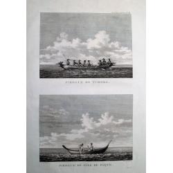
Pirogue de Tchoka. & Pirogue de l'Ile de Paque.
Striking views of Pirogues of Sakhalin (Russia) and the Easter Islands. Published in the atlas volume of the official account of the voyage of La Perouse around the wor...
Place & Date: Paris, 1797
Selling price: $38
Sold in 2012
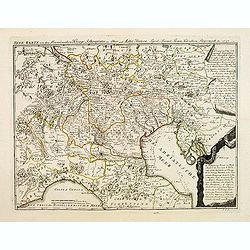
Neue karte von den Franzosischen kriegs Schauplatze in ober and Mittel Italien, . . .
Scarce map of northern part of Italy, with Austra showing campaigns of 1797 in the French Revolutionary Wars. The map indicated the different battle places with dates in ...
Place & Date: Leipzig, 1797
Selling price: $100
Sold in 2018
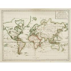
Mappe-Monde suivant la projection des cartes. . .
An attractive Mercator projection map of the world up-dated following Cook's and Bougainville's expeditions. Van Diemen's land joint to Australia's mainland.The map is mo...
Place & Date: Paris c.1797
Selling price: $350
Sold
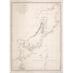
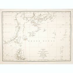
Carte Generale des Decouvertes Faites en 1787 dans les Mers de Chine et de Tartarie ou depuis Manille jusqu'a Avatsch. . .
La Pérouse's important depicting his track from the northern tip of the Philippines along China, Taiwan, Korea, Japan, Hokkaido, the Kuriles and the tip of Kamtschatka....
Place & Date: Paris, 1797
Selling price: $350
Sold in 2014
Carte des decouvertes, faites en 1787 dans les mers de Chine et de Tartarie, par les Fregates Francaises la Boussole et l'Astrolabe, depuis leur depart de Manille jusqu'à leur arrivee au Kamtschatka. 1ere. feuille.
La Pérouse's important depicting the discoveries he made in 1787 in the seas of China and Tartary. The travels are charted from the Philippines to the south of Taiwan a...
Place & Date: Paris, 1797
Selling price: $500
Sold in 2015
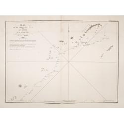
Plan de la partie des iles, ou archipel de Coree, vue au mois de Mai 1787 par les Fregates Francaises la Boussole et l'Astrolabe. . . .
Showing the track of La Perouse along the southern most tip of Korea, with Quelpaerts Islands (now-a-days called Jeju, with the vulcano Halla-san (Halla Mountain) clearly...
Place & Date: L'Imprimerie de la Republique, An V, 1797
Selling price: $500
Sold in 2014
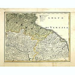
(Untitled map of east central Italy)
Including the towns of Bologna, Ravenna, Rimini, Ancona and the River Arno with Florence in lower left corner. One page from his multi sheet map "Carta del Territori...
Place & Date: Florence, 1797
Selling price: $160
Sold
![Plan du Port De St. Diego en Californie. . . 1782 [with] Plan Du Port et du Departement de San Blas . . . 1777.](/uploads/cache/34838-250x250.jpg)
Plan du Port De St. Diego en Californie. . . 1782 [with] Plan Du Port et du Departement de San Blas . . . 1777.
Two engraved maps on one page of the harbors of San Diego (ca. 1:100,000) in California and St. Blas (ca. 1:105,000) in Mexico . Depths by soundings. Engraved by L. Auber...
Place & Date: Paris, 1797
Selling price: $300
Sold in 2014
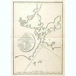
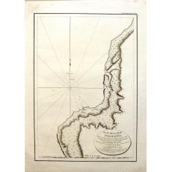
Plan du Port De St. François Situé sur la côte de la CALIFORNIE Septentrionale . . . (San Francisco Bay)
The earliest obtainable printed map of San Francisco Bay, from the La Perouse's Voyages. Depths by soundings. Engraved by L. Aubert. The map includes 21 place names, incl...
Place & Date: Paris, 1797
Selling price: $475
Sold in 2014
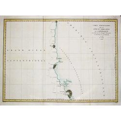
Carte particulaire de la Côte du Nord-Ouest de l'Amerique, 3e Feuille.
Jean François Galoup, Comte de la Pérouse (1741-88), outstanding French explorer and hydrographer. ' Voyage autour du Monde…Atlas', 1797.A large chart from La Pérous...
Place & Date: Paris, 1797
Selling price: $220
Sold in 2016
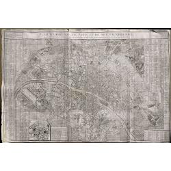
Plan Geometral De Paris Et De Ses Fauxbourgs...
This exceptionally large, rare plan de Paris is a revision of De Vaugondy's smaller plan of 1783. This print was published by Delamarche who was the successor of Vaugondy...
Place & Date: Paris, 1797
Selling price: $290
Sold in 2019
Plan de la Baie d'Estaing.
Large map of the Bay of D'Estaing on the coast of Tchoka in the Uglegorsk Region of Russia. It is from "ATLAS DU VOYAGE DE LA PEROUSE". Perouse set sail from Fr...
Place & Date: Paris, 1797
Selling price: $99
Sold in 2015
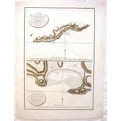
Plan D'une Partie de l'Isle de Maouna & Plan de L'Anse du Massacre.
Two chart maps on one page featuring areas of Anerican Samoa. It is from "ATLAS DU VOYAGE DE LA PEROUSE". Perouse set sail from France in 1785 to continue the d...
Place & Date: Paris, 1797
Selling price: $15
Sold in 2017
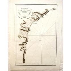
Plan de la Baie de Ternai.
A crisp clear map of the Bay of Ternai in Tartary (Russian Provinces). It is from "ATLAS DU VOYAGE DE LA PEROUSE". Perouse set sail from France in 1785 to conti...
Place & Date: Paris, 1797
Selling price: $75
Sold in 2015
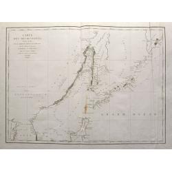
Carte des découvertes, faites en 1787 dans les mers de Chine et de Tartarie, par les Fregates Francaises la Boussole et l'Astrolabe, depuis leur depart de Manille jusqu'à leur arrivee au Kamtschatka. 2e. Feuille
Important large sea chart of eastern Russia with a part of Korea, Hokkaido, Sakhalinsk, the Kuril Islands, and the Sea of Okhotsk. Shows the route and dates of the explor...
Place & Date: Paris, 1797
Selling price: $150
Sold in 2015
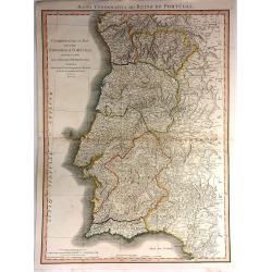
Chorographical Map of the Kingdom of Portugal divided into its Grand Provinces
A very large, pleasant map of Portugal, with roads, provinces, settlements and towns published by William Faden in 1797, Filled with detail including mountains.William Fa...
Place & Date: London, 1797
Selling price: $40
Sold in 2016
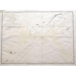
Plan de la partie des Îles, ou Archipel de Corée, Vue au Mois de Mai 1787 par les Frégates Francaises la Boussole et l'Astrolabe.
La Pérouse's important and detailed sea-chart showing the route of his ships the Boussoule & Astrolabe between the South Korean island of Jeju (here called Ile Quelp...
Place & Date: Paris, 1797
Selling price: $55
Sold in 2016
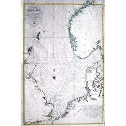
Charta öfver Nordsjön...
Very rare and large Swedish sea-chart of the North Sea between the British Isles, Norway, Denmark, and the Netherlands. Includes Trondheim, Christiania (Oslo), Fredriksta...
Place & Date: Stockholm, 1797
Selling price: $201
Sold in 2016
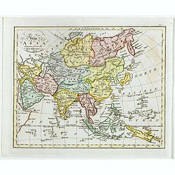
A New Map of Asia, Drawn from the Best Authorities 1797.
Attractive and uncommon map of Asia published by Thomas Cadell (1742–1802) who was a successful 18th-century English bookseller, who published works by some of the most...
Place & Date: London, 1797
Selling price: $200
Sold in 2020
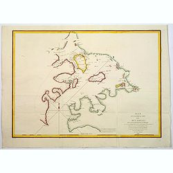
Plan de l'Entrée du Port de Bucarelli sur la cote du Nord-Ouest de l'Amerique.
The Port Bucarelli is a harbour in Alaska, discovered in 1775 by two Spaniards, La Quadra & Maurelle, at Latitude 55N the furthest north that Spanish explorers got.Th...
Place & Date: Paris, 1797
Selling price: $35
Sold in 2017
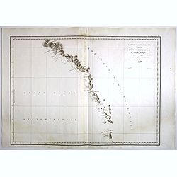
Carte Particuliere de la Cote du Nord-Ouest de l'Amerique reconnue par les Fregates Francaises la Boussole et l' Astrolabe en 1786 1e. Feuille.
Attractive chart of the Alaskan coast from Mount St.Elie south to Bay de ClonardThis chart was engraved by Bouclet for La Pérouse's 'Voyage autour du Monde'.Jean Francoi...
Place & Date: Paris, 1797
Selling price: $36
Sold in 2018
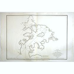
Plan de l'Entree du Port de Bucarelli sur la Cote du Nord-Ouest de l'Amerique, par 55°15' de Latitude Nord et 136°15' de Longitude a l'Ouest de Paris . . .
Attractive chart of Bucareli Bay which is part of the Alexander Achipelago in the southeastern portion of AlaskaThis chart was engraved by Bouclet for La Pérouse's 'Voya...
Place & Date: Paris, 1797
Selling price: $34
Sold in 2018
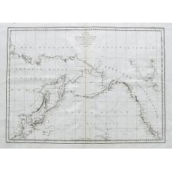
Carte Des Cotes De L'Amérique Et De L'Asie depuis la Californie jusqu'à Macao...1786 et 1787...
A large map showing La Perouse's expedition in the northern Pacific. Extends from Baja California to Alaska, and the east coast of Asia from Tartary to Canton, including ...
Place & Date: Paris, 1797
Selling price: $220
Sold in 2017
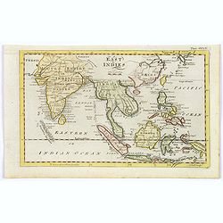
East Indies.
A lovely little late nineteenth century copperplate map of the East Indies.
Place & Date: London, ca. 1797
Selling price: $75
Sold in 2017
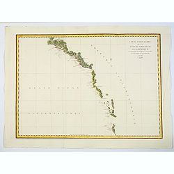
Carte Particuliere de la Cote du Nord-Ouest de l'Amerique reconnue par les Fregates Francaises la Boussole et l' Astrolabe en 1786 1e. Feuille.
An attractive chart of the Alaskan coast from Mount St. Elie, south to Bay de Clonard.This chart was engraved by Bouclet for La Pérouse's 'Voyage autour du Monde'.Jean F...
Place & Date: Paris, 1797
Selling price: $12
Sold in 2020
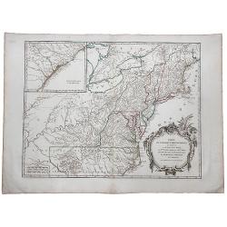
Partie de l'Amerique Septentrionale qui comprend Le Cours de l'Ohio, La Nlle Angleterre, la Nlle York, le New Jersey, La Pensylvanie, le Maryland La Virginie, La Caroline
A copperplate border colored map or the eastern United States, with inlet titled "Supplement pour la Caroline". First issued in 1755 ,here later state without d...
Place & Date: Paris 1797
Selling price: $250
Sold in 2019
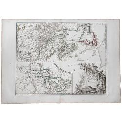
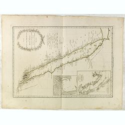
Partie de L'Amerique Septent. Qui comprend La Nouvelle France ou le Canada.
A decorative and highly detailed map of New England and part of Canada, extending east to Newfoundland, with a large inset map of the Great Lakes.One of the best large fo...
Place & Date: Paris, 1797
Selling price: $180
Sold in 2019
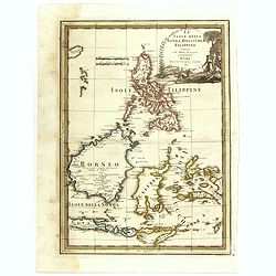
Le Isole della Sonda, Molluche, e Filippine delineate sulle ultima osservazioni.
First edition on laid paper. Cassini’s splendid early map of Philippines, Brunei, Celebes, Moluccas, Java and Timor, with large decorative title cartouche.This is one o...
Place & Date: Rome, 1797
Selling price: $1200
Sold in 2018
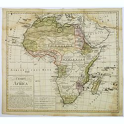
Charte von Africa.
An uncommon late eighteenth-century map of the continent of Africa, prepared by Güssefeld, based on earlier work done by Sayer and Rennel. Gussefeld worked for the Homan...
Place & Date: Nuremberg, 1797
Selling price: $50
Sold in 2018