Browse Listings in Europe > Eastern Europe
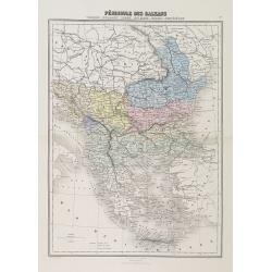
Péninsule des Balkans. Turquie -Roumanie - Serbie -Bulgarie - Bosnie - Monténégro.
A decorative map of the Balkan States (Romania, Serbia, Bulgaria, Bosnia and Montenegro) from Géographie Universelle, Atlas Migeon, published by J. Migeon.From one of th...
Date: Paris, 1874
Selling price: ????
Please login to see price!
Sold in 2010
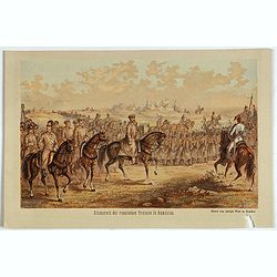
Einmarsch der russischen truppen in Romänien.
Showing the Russian arriving in Romaniia during the Russian-Turkish War (1828-1829) . Russian troops occupied Wallachia and Moldova for a few years.
Date: Dresden, 1880
Selling price: ????
Please login to see price!
Sold in 2023
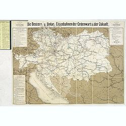
Die Österreichisch & Ungarischen Eisenbahnen der Gegewart und der Zukunst.
Rare rail-way folding map of Austria, Hungary and Galicia (centered on Lviv, or Lemberg ). Published in Vienna, by Artaria & Co. The firm was founded by the cousins C...
Date: Vienna, 1881
Selling price: ????
Please login to see price!
Sold in 2013
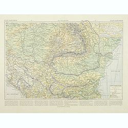
Etats Danubiens. . .
Map of east of Europe, showing Hongriae, Serbia, Bulgaria, Romania, Bosnia and part of the Black Sea up to Odessa. Text in French in lower part.This publication is in fac...
Date: Paris, E.Capiomont,1894
Selling price: ????
Please login to see price!
Sold in 2014
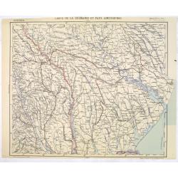
Carte de la Roumanie et Pays limitrophes. Balta. ODESSA.
Very detailed (1:750.000) map centered on Odessa and Moldova and Ukraine territory. Made after an Austrian map. The French Service géographique des armées was founded i...
Date: Paris, 1912
Selling price: ????
Please login to see price!
Sold in 2014
![Mer Adriatique. Environs de Raguse (Dubrovnik). Troisième Feuille. Gravosa-Raguse-Breno.. [278]](/uploads/cache/23474-250x250.jpg)
Mer Adriatique. Environs de Raguse (Dubrovnik). Troisième Feuille. Gravosa-Raguse-Breno.. [278]
Large scale coastal chart showing a stretch of Dalmatian coast centered on Dubrovnik and covering the area from Verbitza as far as Cavtat.With 2 large inset plans illustr...
Date: Paris [1820] 1932
Selling price: ????
Please login to see price!
Sold in 2023
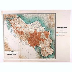
Karta Federativne Narodne Republike Jugoslavije.
Rare map of Yugoslavia. With color key. The map was made in the year of the 1941 invasion of Yugoslavia, also known as the April War was a German-led attack on the Kingdo...
Date: Yugoslavia, 1946
Selling price: ????
Please login to see price!
Sold in 2021
