Browse Listings in Europe > Eastern Europe > Eastern Europe
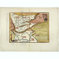
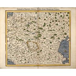
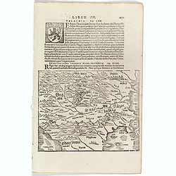
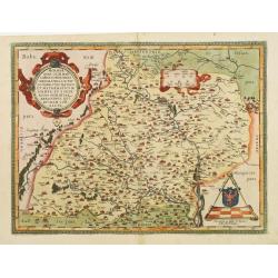
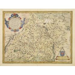
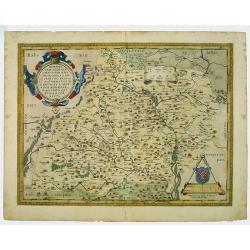
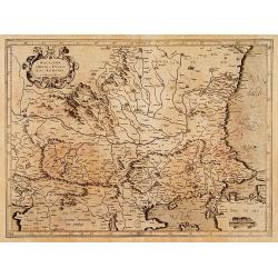
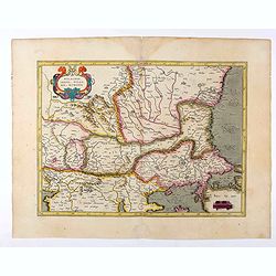
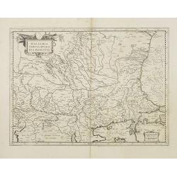
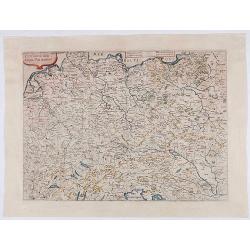
(Untitled map) Prussie et Lituanie Pars, Polonia, Russia, Transilvania, . . .
Early woodcut map of the area of Eastern Europe from Lithuania and Prussia in the north to Hungary and Valachia in the south. It also includes Transylvania, Russia. Polan...
Date: Strasbourg, 1522
Selling price: ????
Please login to see price!
Sold in 2018
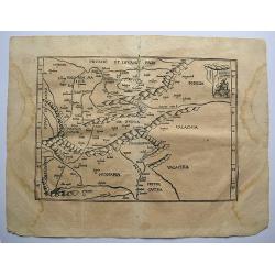
Tabu Moderna Hungariae, Poloniae, Russiae, Prussiae, et Valachiae.
A wood cut engraved map of modern day Hungary, Poland, Russia, Prussia and Romania on Ptolemaic projection from "Geographia", with maps by Laurens Fries and the...
Date: Strassburg, 1522 -1525
Selling price: ????
Please login to see price!
Sold in 2019
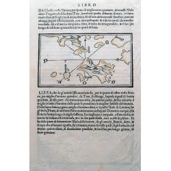
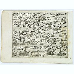
(Istria, Lošinj, Krk, Cres, Rab; Vis)
One of the earliest maps showing Croatian (Dalmatian) islands in the Adriatic Sea. Wood cut with italian text on both sides, and with a map on each side. One map, with a ...
Date: Venice, c1534
Selling price: ????
Please login to see price!
Sold in 2015
![Europae Tabula quarta continet. [Central Europe]](/uploads/cache/15350-250x250.jpg)
Europae Tabula quarta continet. [Central Europe]
The earliest printed representation of Germany, Poland and central Europe.
Date: Vienne 1541
Selling price: ????
Please login to see price!
Sold in 2008
![[Albania, Bulgaria, Europe, Eastern, Greece, Hungary, Macedonia, Romania]](/uploads/cache/33868-250x250.jpg)
[Albania, Bulgaria, Europe, Eastern, Greece, Hungary, Macedonia, Romania]
Wood block printed map and one of earliest printed representation of Albania, Bulgaria, Europe, Eastern, Greece, Hungary, Macedonia, Romania prepared Martin Waldseemülle...
Date: Vienna, Trechsel, G., 1525 -1541
Selling price: ????
Please login to see price!
Sold in 2026
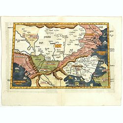
Europae Tabula Decima continent (Title on verso)
Attractive woodblock Ptolemaic map showing south east Europe from the Adria to the black sea with Albania, Mazedonia, North-Greece to the Bosporus. Some detail of Turkey ...
Date: Strasbourg 1541
Selling price: ????
Please login to see price!
Sold in 2019
Landtafel des Ungerlands / Polands / Reussen / Littaw / Walachey und Bulgarey
Early, attractive colored woodcut map showing the area between Poland, Austria and Croatia in the West and from Moscow to Istanbul (Constantinople)in the East. From a Ger...
Date: Basle, 1550
Selling price: ????
Please login to see price!
Sold in 2008
![Tabula Asiae VII. [Central Asia and Russia]](/uploads/cache/29552-250x250.jpg)
Tabula Asiae VII. [Central Asia and Russia]
Wood block printed map with letter press on verso. A Ptolemaic map of the region north and east of the Black Sea and Caspian Sea, extending to the Imaus Mountains.Münste...
Date: Basle, c.1550
Selling price: ????
Please login to see price!
Sold in 2010
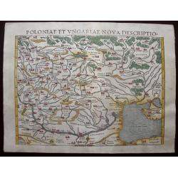
Poloniae Et Ungariae XV Nova Descriptio.
Early edition Munster's map of Poland, Lithuania, the Ukraine, Moscovy and the Balkans, extending from Prussia, Vilna and Smolensky in the north to Bosnia, Bulgaria, Cons...
Date: Basle, 1550
Selling price: ????
Please login to see price!
Sold in 2014
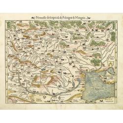
Nouvelle description de Poloigne & Hongrie.
Munster's map of Poland, Lithuania, the Ukraine, Muscovy and the Balkans, extending from Prussia, Vilna and Smolensk in the north to Bosnia, Bulgaria, Constantinople and ...
Date: Basle, 1552
Selling price: ????
Please login to see price!
Sold in 2010
![[Lot of 31 leaves] Solothurensis civitatis effigies…](/uploads/cache/48272-250x250.jpg)
[Lot of 31 leaves] Solothurensis civitatis effigies…
Thirty-one text pages with several wood block prints with maps and views relating to Hungary, Serbia, Bulgaria, Poland and Russia. Taken from the 1552 Latin text edition ...
Date: Basel, 1552
Selling price: ????
Please login to see price!
Sold in 2022
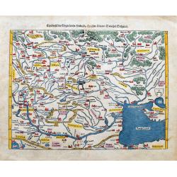
Landtafel des Ungerlands / Polands / Reussen / Littaw / Walachei / Bulgarei.
Early woodcut map from Münster's Cosmographia, one of the most influential geographical works of the 16th Century. It shows the area from Prussia to Constantinople and...
Date: Basle, ca. 1560
Selling price: ????
Please login to see price!
Sold in 2023
Transsylvania Ungarici Regni Provincia.
One text page with a map of Hungary, Moravia and Macedonia (150 x 190 mm). On verso Latin text page with a small wood cut of a monastery on a mountain.From Münster's Cos...
Date: Basle, ca. 1564
Selling price: ????
Please login to see price!
Sold in 2016
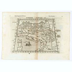
Tabula Europae V.
Early map of the Balkans. Girolamo Ruscelli first published the map in his "La Geographi di Claudio Tolomeo" (Venice, 1561). In 1574 a new plate was used which ...
Date: Venice, 1564
Selling price: ????
Please login to see price!
Sold in 2020
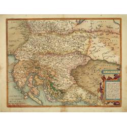
Descritione dell Austria, et Ongheria, Transsilvania. . .
Rare war map showing Austria, Hungary, Croatia, Slovakia, Venice, and other regions as the battlefield of Christian Imperial forces vs. Ottoman forces, from Vienna to Bud...
Date: Venice, Zaltieri, (1567) 1568
Selling price: ????
Please login to see price!
Sold in 2025
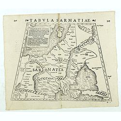
Tabula Sarmatiae. (Eastern Europe including Poland and Black sea region)
Double-page woodcut Ptolemaic-style map by Sebastian Münster figuring Eastern Europe including Poland, Lihuania and Black sea region, published in the edition of Strabo ...
Date: Basle, Henri Petri, 1571
Selling price: ????
Please login to see price!
Sold in 2018
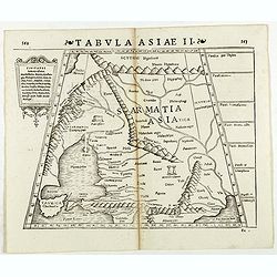
Tabula Asiae II. (Ukraine)
Double-page woodcut Ptolemaic-style map by Sebastian Münster figuring Ukraine, published in the edition of Strabo by Henri Petri in 1571."Strabonis rerum geographic...
Date: Basle, Henri Petri, 1571
Selling price: ????
Please login to see price!
Sold in 2018
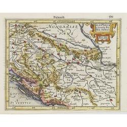
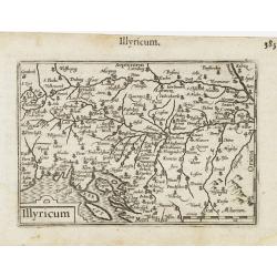
Illyricum.
Finely colored map of of Istria, Slovenia and Croatia by Abraham Ortelius. As noted in the lower right cartouche, this map was by Johann Sambucus in1572. Accompanying La...
Date: Antwerp, 1572
Selling price: ????
Please login to see price!
Sold in 2010
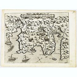
Provincia Di Albania.
An uncommon map of Albania, from Giovanni Francesco Camocio's rare " Isole Famose porti, fortezze, e terre maritime . . ." This plate was made by Giovanni Franc...
Date: Venice, 1572
Selling price: ????
Please login to see price!
Sold in 2012
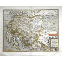
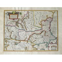
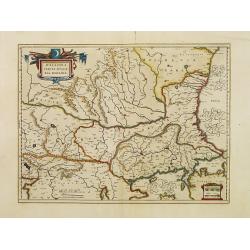
Moraviae, qvae olim Marcomannorvm sedes, corographia,..
Early map of Slovakia prepared by Paul Fabritius in 1569. From Theatrum Orbis Terrarum. [Atlas of the Whole World] with Latin text on verso.
Date: Antwerp 1574
Selling price: ????
Please login to see price!
Sold
Moraviae, qvae olim Marcomannorvm sedes, corographia,..
Early map of Slovakia prepared by Paul Fabritius in 1569. From 'Theatrum Orbis Terrarum [Atlas of the Whole World] with Latin text on verso.
Date: Antwerp, 1574
Selling price: ????
Please login to see price!
Sold in 2009
Zarra et Contado citta principale della Dalmatia posta sul mare adriatico loco Ihr.me Sri. Venetiani al pnte molestata aa Turchi.
Uncommon map of the Dalmatian coast with the town of Zadar in Croatia, with Turkish and Venetian warships in the foreground, from Giovanni Francesco Camocio's rare "...
Date: Venice, D.Bertelli, ca.1574
Selling price: ????
Please login to see price!
Sold in 2012
![[Citta Di Ragusi]-[Citta Di Cataro]](/uploads/cache/32474-250x250.jpg)
[Citta Di Ragusi]-[Citta Di Cataro]
Uncommon map of the coast of Montenegro with the bay and town of Kotor (citta di Cataro) and Dubrovnik (cita di Ragusi) with Venetian war ships in the foreground. From Gi...
Date: Venice, D.Bertelli, ca.1574
Selling price: ????
Please login to see price!
Sold in 2025
Moraviae, qvae olim Marcomannorvm sedes, corographia,..
Early map of Slovakia prepared by Paul Fabritius in 1569. From Theatrum Orbis Terrarum. [Atlas of the Whole World] with Latin text on verso.
Date: Antwerp 1579
Selling price: ????
Please login to see price!
Sold
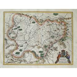
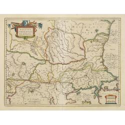
Moraviae, quae olim Marcomannorum Sedes, Corographia, A.D. Pavlo Fabritio Medico et Mathematico Descripta, et a Generosis Moraviae Baronibus Quibusdam corecta.
A beautiful full-color map of Moravia, Slovakia, prepared by Paul Fabritius in 1569. Showing fortified cities, towns, rivers, etc. With a fine Renaissance strapwork carto...
Date: Antwerp, 1579
Selling price: ????
Please login to see price!
Sold in 2019
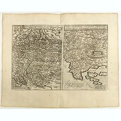
Turingiae Noviss. Descript per Iohannem Mellinger Halens. / Misniae et Lusatiae Tabula.
A pair of maps of central Europe by Abraham Ortelius. The first map on the left is of the region of Eastern Germany, and shows the cities and towns of Erfurt (Erfurdt), ...
Date: Antwerp, 1584
Selling price: ????
Please login to see price!
Sold in 2010
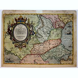
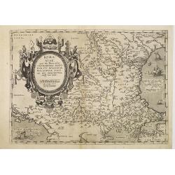
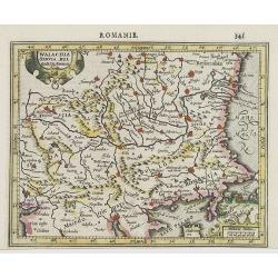
Romaniae..
Map of South East Europe. Prepared by Jacob Gastaldi. Including Romania, Bulgaria and in lower right Istanbul. With imposing title cartouche.
Date: Antwerp, 1588
Selling price: ????
Please login to see price!
Sold in 2018
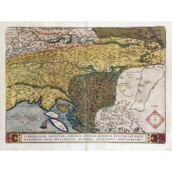
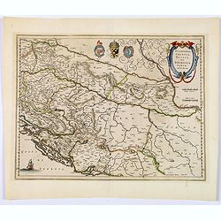
Schlavoniae, Croatiae, Carniae, Istriae, Bosniae, Finitimarumque Regionum Nova Descriptio, Auctore Augustino Hirsvogellio
Fine map of the Balkan region by Ortelius. Map is centered on the Sava River, and shows the current countries of Croatia, Bosnia and Herzegovina, Serbia and Slovenia.
Date: Antwerp, c. 1590
Selling price: ????
Please login to see price!
Sold in 2010
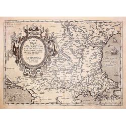
Romaniae, (quae olim Thracia dicta) ..
Very fine map centered on the Danube area. The map is based on the double sheet map by Jacob Gastaldi. Abraham Ortelius (1527-1598) was a cartographer and publisher, who ...
Date: Antwerp 1598
Selling price: ????
Please login to see price!
Sold
Romaniae, (quae olim Thracia dicta) ..
An early impression, without text on verso. Very fine map centered on the Danube area. The map is based on the double sheet map by Jacob Gastaldi. Abraham Ortelius (1527-...
Date: Antwerp, before 1598
Selling price: ????
Please login to see price!
Sold in 2010
Rhetiae alpestris descriptio, . . . Goritiae, Karstii, . . .
Two maps from 'Theatrum Orbis Terrarum [Atlas of the Whole World]':published in Antwerp.Dare to go in Black. All early maps are printed in black and white and many were k...
Date: Antwerp, 1598
Selling price: ????
Please login to see price!
Sold in 2020
Illyricum.
Early map of Istria and Slovenia. Prepared by Johann Sambucus 1572. Abraham Ortelius (1527-1598) was a cartographer and publisher, who is born and died in Antwerp. Publis...
Date: Antwerp, 1598
Selling price: ????
Please login to see price!
Sold in 2018
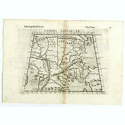
Europae tabula IX.
The third state of Ruscelli's map of The Balkans region, based upon Claudius Ptolemy. Showing the Balkans and Turkey. Girolamo Ruscelli first published the map in his &qu...
Date: Venice, 1598
Selling price: ????
Please login to see price!
Sold in 2018
![Polla/Viaggio Da Venetia [Pola in Istria] Rare 1st edition](/uploads/cache/84452-250x250.jpg)
Polla/Viaggio Da Venetia [Pola in Istria] Rare 1st edition
Very rare view of the City of Pola in Istria. From the rare first edition of "Viaggio da Venetia, a Costantinopoli. Per Mare, e per Terra, & infieme quello di Te...
Date: Venice, Giacomo Franco, 1598
Selling price: ????
Please login to see price!
Sold in 2021
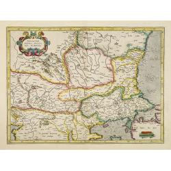
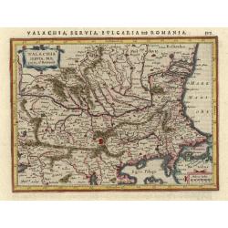
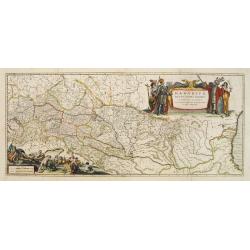
Walachia, Servia, Bulgaria, Romania.
Map of the Eastern Balkans.Mercator was born in Rupelmonde in Flanders and studied in Louvain under Gemma Frisius, Dutch writer, astronomer and mathematician. The excelle...
Date: Amsterdam 1606
Selling price: ????
Please login to see price!
Sold
Slavonia, Croatia Bosnia, Dalmat.
Detailed and early map focusing specifically on the embattled nations of the former Yugoslavia.From the first French-text edition of Jodocus Hondius'' Atlas Minor.Shortly...
Date: Amsterdam, 1608
Selling price: ????
Please login to see price!
Sold
Walachia Servia, Bulgaria, Roman.
Charming example of the Mercator-Hondius map of the region centered on the Lower Danube, Bulgaria, Romania, Serbia and Macedonia.From the first French-text edition of Jod...
Date: Amsterdam, 1608
Selling price: ????
Please login to see price!
Sold in 2009
Illyricum.
A miniature map of Istria and Slovenia. Title cartouche on the lower left corner.First published in 1598 in his Caert-Thresoor, the plates were executed by the most famou...
Date: Amsterdam / Frankfurt, 1609
Selling price: ????
Please login to see price!
Sold in 2023
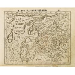
Livonia.
Finely engraved small map of the Baltic states Estonia and Latvia filled with forests, rivers and lakes. Latin text on verso.Embellished with a strap work title cartouche...
Date: Amsterdam, 1610
Selling price: ????
Please login to see price!
Sold in 2008
Illyricum
Very decorative map of Slovenia and Croatia, engraved in 1572 after Johann Sambucus.
Date: Antwerp, 1612
Selling price: ????
Please login to see price!
Sold
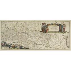
Walachia Servia, Bulgaria, Romania.
Map of the region centered on the Lower Danube, Bulgaria, Romania, Serbia and Macedonia.Mercator was born in Rupelmonde in Flanders and studied in Louvain under Gemma Fri...
Date: Amsterdam, 1630
Selling price: ????
Please login to see price!
Sold in 2010
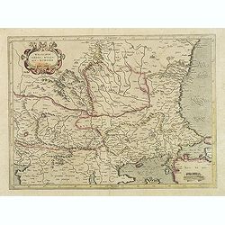
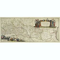
Walachia Servia, Bulgaria, Romania.
Map of the region centered on the Lower Danube, Bulgaria, Romania, Serbia and Macedonia.Mercator was born in Rupelmonde in Flanders and studied in Louvain under Gemma Fri...
Date: Amsterdam, 1630
Selling price: ????
Please login to see price!
Sold in 2014
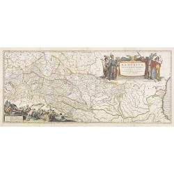
Walachia, Servia, Bulgaria, Romania.
Nice map of the Eastern Balkans. Mercator was born in Rupelmonde in Flanders and studied in Louvain under Gemma Frisius, Dutch writer, astronomer and mathematician. The e...
Date: Amsterdam, 1630
Selling price: ????
Please login to see price!
Sold in 2021
Walachia Servia, Bulgaria, et Romania.
Small map of the Eastern Balkans centered on Bulgaria. Includes the Bosphorus and Constantinople. Adorned with decorative title and distance scale cartouches. German text...
Date: Amsterdam, 1631
Selling price: ????
Please login to see price!
Sold
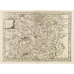
Lithuania.
Early map of Lithuania. With French text on verso. Engraved by Petrus Kaerius.
Date: Amsterdam, 1632
Selling price: ????
Please login to see price!
Sold in 2008
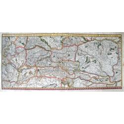
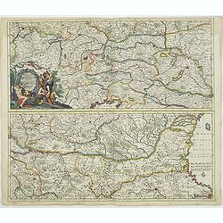
Tractus Danubii, Fluminis in Europa Maximi, A Fontibus, Per Germaniam...
This is Blaeu’s first map of the Danube and surrounding regions. The Danube River runs through the map from the top left with its headwaters in the German Black Forest...
Date: Amsterdam, 1634
Selling price: ????
Please login to see price!
Sold in 2011
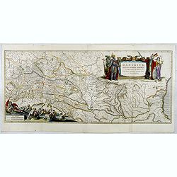
WALACHIA SERBIA BULGARIA ROMANIA ... Guiljelmus Blaeu excudebat.
A highly decorative, well-prepared map of southeast Europe. This map, from the 1634 German edition of the Blaeu atlas, is its first appearance in an atlas. Willem Janszo...
Date: Amsterdam, 1634
Selling price: ????
Please login to see price!
Sold in 2012
TRANSYLVANIA Sibenburgen ... Apud Guiljelmum et Ioannem Blaeu.
A highly decorative, well-prepared map of Transylvania in southeast Europe. This particular map, from the 1634 German edition of the Blaeu atlas, is its first appearance ...
Date: Amsterdam, 1634
Selling price: ????
Please login to see price!
Sold in 2012
Danubius Fluvius Europae Maximus, a Fontibus ad Ostia..
Depicts the course of the river Danube and the surrounding countries from the place where it rises to the Black Sea.Because of the dimensions the map was printed from two...
Date: Amsterdam, 1635
Selling price: ????
Please login to see price!
Sold
Danubius Fluvius Europae Maximus, a Fontibus ad Ostia..
Depicts the course of the Danube River, from its sources in the Alps to the Black Sea..Because of the dimensions the map was printed from two copper plates.With two very ...
Date: Amsterdam, 1635
Selling price: ????
Please login to see price!
Sold in 2009
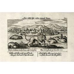
Parens, in Orient
Cooper engraved view of Porec in Croatia from D. Meisner "Sciographia Cosmica" printed 1638 in Nuremberg. With Latin and German aphorism.
Date: Nuremberg, 1638
Selling price: ????
Please login to see price!
Sold in 2009
Sclavonia, Croatia, Bosnia cum Dalmatiae parte.
An attractive map of the recently troubled Balkan countries of Bosnia, Croatia & Slovenia, by Blaeu after Gerard Mercator. It was quite unusual for Blaeu to credit Me...
Date: Amsterdam, 1640
Selling price: ????
Please login to see price!
Sold in 2018
![Danubius Fluvius Europae Maximus, a Fontibus ad Ostia. [2 sheets]](/uploads/cache/16220-250x250.jpg)
Danubius Fluvius Europae Maximus, a Fontibus ad Ostia. [2 sheets]
2 sheets. Because of the dimensions the map was printed from two copper plates. Depicts the course of the river Danube and the surrounding countries from the place where ...
Date: Amsterdam 1639-1644
Selling price: ????
Please login to see price!
Sold
Walachia, Servia, Bulgaria, Romania.
Striking map of the region centered on the Lower Danube, Bulgaria, Romania, Serbia and Macedonia. Includes decorative cartouche, coat of arms, etc. Latin text on verso.Th...
Date: Amsterdam, 1644
Selling price: ????
Please login to see price!
Sold in 2017
Danubius Fluvius Europae Maximus, a Fontibus ad Ostia. . .
This very large map depicts the course of the Danube River, from its sources in the Alps to the Black Sea..Because of the dimensions the map was printed from two copper p...
Date: Amsterdam, 1644
Selling price: ????
Please login to see price!
Sold in 2017
Danubius Fluvius Europae Maximus, a Fontibus ad Ostia. . .
Depicts the course of the Danube River, from its sources in the Alps to the Black Sea..Because of the dimensions the map was printed from two copper plates.With two very ...
Date: Amsterdam, 1645
Selling price: ????
Please login to see price!
Sold in 2010
Danubius Fluvius Europae Maximus, a Fontibus ad Ostia. . .
Depicts the course of the Danube River, from its sources in the Alps to the Black Sea..Because of the dimensions the map was printed from two copper plates.With two very ...
Date: Amsterdam, 1645
Selling price: ????
Please login to see price!
Sold in 2013
Walachia, Servia, Bulgaria, Romania.
Striking map of the region centered on the Lower Danube, Bulgaria, Romania, Serbia and Macedonia. Includes decorative cartouche, coat of arms, etc. Latin text on verso.Th...
Date: Amsterdam 1647
Selling price: ????
Please login to see price!
Sold
Walachia, Servia, Bulgaria, Romania.
Striking map of the region centered on the Lower Danube, Bulgaria, Romania, Serbia and Macedonia. Includes decorative cartouche, coat of arms, etc. Latin text on verso.Th...
Date: Amsterdam 1647
Selling price: ????
Please login to see price!
Sold
Walachia Servia, Bulgaria, Romania.
The cartographer of this map was Gerard Mercator, but published by the Blaeu family. Map of the region centered on the Lower Danube, Bulgaria, Romania, Serbia and Macedon...
Date: Amsterdam, 1650
Selling price: ????
Please login to see price!
Sold in 2014
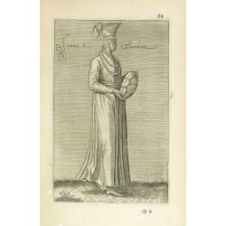
Femme de Marcedoine. (54)
Sought-after copper engraved plate of a woman from Macedonia. Plate from Laonikos Chalcocondyle’s "L'histoire de la décadence de l'empire grec et establissement ...
Date: Paris, Mathieu Guillemot, 1650
Selling price: ????
Please login to see price!
Sold in 2011
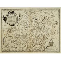
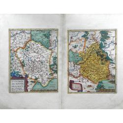
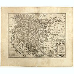
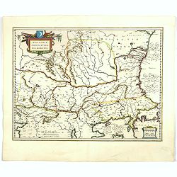
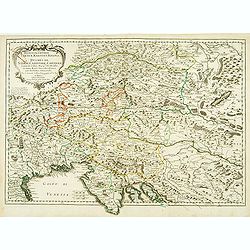
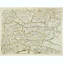
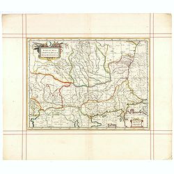
Provinces Unies, et Incorporees a la Couronne de Boheme, qui sont les Duche de Silesie, Marq sats de Moravie, et Lusace.
Two maps on one sheet. A fine map of East Poland & Lithuania. With Breslaw in the center.Nicolas Sanson was to bring about the rise of French cartography, although th...
Date: Paris 1654
Selling price: ????
Please login to see price!
Sold
Hertzogthuber Steyer, Karnten, Krain
Covering southern part of Austria, northern part of the Gulf of Venice and part of former Yugoslavia. Nicolas Sanson was to bring about the rise of French cartography, al...
Date: Paris, 1657
Selling price: ????
Please login to see price!
Sold
Cours du Danube, depuis Belgrade.. Transilvanie. . .
Eastern part of the River Danube, including parts of Macedonia, Bulgaria, Romania, Yugoslavia. Belgrade to the west. With original or early outline hand-color. Numerous p...
Date: Paris, 1665
Selling price: ????
Please login to see price!
Sold in 2010
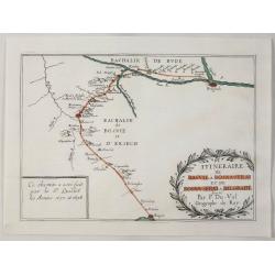
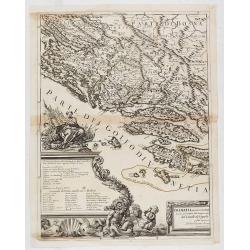
Itineraire de Raguse a Bosna - Serai et de Bosna - Serai a Belgrade.
A map illustrating the route between Belgrade, Serbia and Ragusa on the Adriatic, by way of Bosna-Serai by Sieur Quiclet done during his travels to and from Constantinop...
Date: Paris, 1669
Selling price: ????
Please login to see price!
Sold in 2020
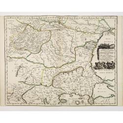
Le Cours du Danube ou sont la Baviere, l'Austriche et la Boheme. . .
A detailed and scarce map showing the river Danube from Hungary until its source in Germany. In lower part the Gulf of Trieste with Venice.
Date: Paris, 1676
Selling price: ????
Please login to see price!
Sold in 2013
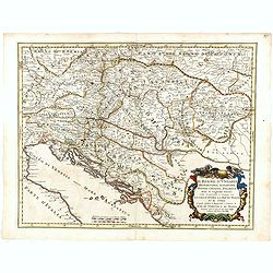
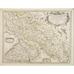
Il Regno d'Ungaria Transilvania, Schiavonia, Bosnia, Croatia, Dalmatia. . .
A uncommon late 17th century map of part of Balkans, based on the reports of Giacomo Cantelli da Vignola and published in Rome in Giacomo de Rossi's world atlas "Mer...
Date: Rome, after 1679
Selling price: ????
Please login to see price!
Sold in 2015
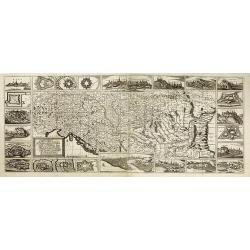
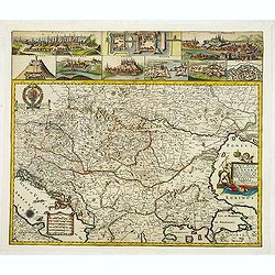
Ungarn, Siebenbürgen, Wallach, Moldau. . .
Rare map of the Danube River. Surrounded by panoramic views of Vienna, Istanbul, Raab, Hermanstat, Temeswar, Gran, etc. Including Istria, and the coast of former Yugoslav...
Date: Nurenberg, c. 1680
Selling price: ????
Please login to see price!
Sold in 2010
Exactissima Totius DANUBII FLUVII. Tabula et . . .
Two maps on one sheet, showing the course of the River Danube. With Constantinople in the lower right corner. Published by Th. Danckerts. The upper part has a nice origin...
Date: Amsterdam, c.1680
Selling price: ????
Please login to see price!
Sold in 2018
Walachia, Servia, Bulgaria, Romania.
Striking map of the region centered on the Lower Danube, Bulgaria, Romania, Serbia and Macedonia. Includes decorative cartouche, coat of arms, etc. Latin text on verso.Th...
Date: Oxford, 1680
Selling price: ????
Please login to see price!
Sold in 2015
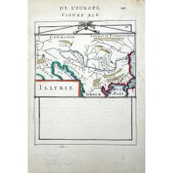
Illyrie.
Small scale map of the Balkan region by Allain Manesson Mallet's Description de L'Univers. Accompanying French text on verso. Allain Manesson Mallet (1630-1706) began his...
Date: Paris, 1683
Selling price: ????
Please login to see price!
Sold in 2010
Carta Generale di tutta Alemagna, e Paesi circonuicini.
Rare map of central Europe with Poland, Germany, the Low Countries, Switzerland, Austria and Northern Italy. By Galeazzo Gualdo Priorato (1606-1678), known for his Schau-...
Date: Vienna, 1673-1683
Selling price: ????
Please login to see price!
Sold in 2020
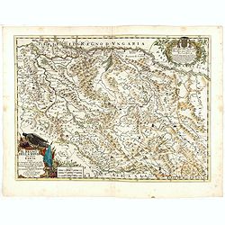
A New Mapp of the Kingdom of Hungary and the States that have been Subject to it, which are at Present the Northern Parts of Turkey in Europe
Rare map of Hungary published by Philip Lea. In upper left corner a dedication to George Prince of Denmark and Norway by Richard Palmer. Engraved by R. Palmer, signed low...
Date: London, 1686
Selling price: ????
Please login to see price!
Sold in 2012
![[Two sheet map] Dalmatia maritima occidentale, Dalmatia maritima orientale descritta sù l'esemplare delle carte piú esatte e divisa. . .](/uploads/cache/36376-250x250.jpg)
[Two sheet map] Dalmatia maritima occidentale, Dalmatia maritima orientale descritta sù l'esemplare delle carte piú esatte e divisa. . .
Rossi's two sheet map of Balkans region is south eastern Europe. The engraver was Giorgio Widman.Issued in Il Mercurio geografico In lower right corner a tittle cartouche...
Date: Rome, 1677-1688
Selling price: ????
Please login to see price!
Sold in 2015
Macedonia Epiro Livadia Albania e Ianna / divise nelle sue parti principali da Giacomo Cantelli da Vignola. . .
Second edition of Rossi's map of Eastern Adriatic Coast, Macedonia, and extending to Negroponte and the Gulf of Lopanto, based upon Sanson's map, but with revised Italian...
Date: Rome, 1688
Selling price: ????
Please login to see price!
Sold in 2015
Dalmatia maritima occidentale, . . .
Left hand part of Rossi's two sheet map of Balkans region is south eastern Europe. The engraver was Giorgio Widman.Issued in Il Mercurio geografico In lower right corner ...
Date: Rome, 1677-1688
Selling price: ????
Please login to see price!
Sold in 2020
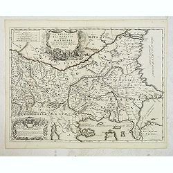
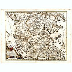
La Bulgaria ela Romania con Parte di Marcedonia. . .
Scarce map of the region along Danube River and to the south. Extends to include part of the Sea of Azov and the northern extreme of the Aegean Sea. Elaborate military-th...
Date: Rome, 1689
Selling price: ????
Please login to see price!
Sold in 2012
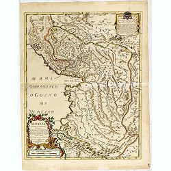
Albania propria ouero superiore...
Scarce Vignola's map of Albania, with decorative cartouches for the title (bottom left) and dedication (top right). The well educated humanist Giacomo Cantelli da Vignola...
Date: Rome, 1689
Selling price: ????
Please login to see price!
Sold in 2015
Il Regno Della Servia..
Rossi's map of the kingdom of Serbia, bordered by Hungary to the north, Albania and Macedonia to the south, and Wallachia (present-day Romania) to the northeast. Borders,...
Date: Rome, 1689
Selling price: ????
Please login to see price!
Sold in 2016
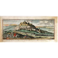
Nitria (Slovakia)
Fine bird's eye view of the city of Nitra, Slovakia. Etched in about 1690 by Gaspar Bouttats (1640-1695). The Antwerp based publisher, Jacques Peeters, published ca. 1690...
Date: Antwerp, 1690
Selling price: ????
Please login to see price!
Sold in 2018
