Browse Listings in Europe
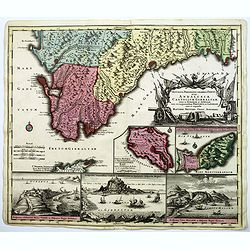
Accurata Designatio Celebris Freti prope Andalusiae Castellum Gibraltar, inter in Europam et Africam, eum circumjacentibus... Portubus, et Castellis cura et impensis. . .
An attractive map by Mattheus Seutter, showing Gibraltar in great detail. With an impressive military style title cartouche, and five beautifully engraved insets of the i...
Date: Augsburg, 1740
Selling price: ????
Please login to see price!
Sold in 2017
![Haga Comitum, [Germ. Graven-Haag, Gall. la Haye] sedes ordinum Belgii foederati ichnographica...](/uploads/cache/38667-250x250.jpg)
Haga Comitum, [Germ. Graven-Haag, Gall. la Haye] sedes ordinum Belgii foederati ichnographica...
A beautiful and detailed plan of Den Haag (The Hague), in The Netherlands, with fine striking prospect of the town, as it was in the mid eighteenth century, below the pla...
Date: Nurenberg, ca. 1740
Selling price: ????
Please login to see price!
Sold in 2017
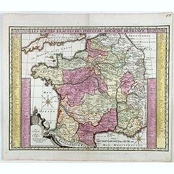
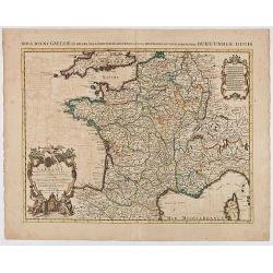
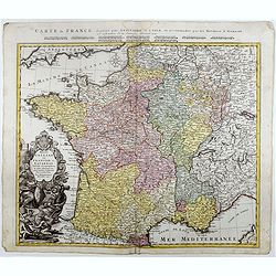
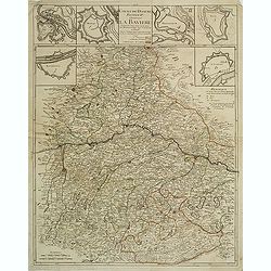
Les routes exactes des Postes du Royaume de France.
post road maps map of France. Seutter the elder (1678-1757) was apprenticed to Johann Baptist Homann in the last years of the seventeenth century in Nuremberg, however, a...
Date: Augsburg, 1740
Selling price: ????
Please login to see price!
Sold in 2016
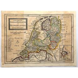
A New Map of the United Provinces of Netherlands.
Detailed map showing towns and cities, rivers, topography and the coastline and canals. An inset at lower right shows Limburg, the southern-most portion of present-day Ne...
Date: London, 1740
Selling price: ????
Please login to see price!
Sold in 2017
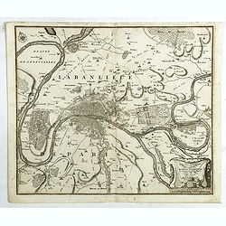
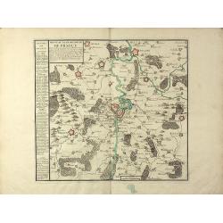
Environs de Paris Levés géométriquement par M. l'Abbé De La Grive. . .
Nine detailed maps of the environs of Paris, including Versailles and Saint-Cloud, each map is on a double sheet with its original centerfold. This remarkable collection ...
Date: Paris, 1740
Selling price: ????
Please login to see price!
Sold in 2017
Francofurtum ad Moenum - Franckfurt am Mayn.
Decorative town-plan of Frankfurt, with title in Latin and German. The lower part is decorated with a panorama of the city with two vignettes, one representing the empero...
Date: Ausburg, ca. 1740
Selling price: ????
Please login to see price!
Sold in 2017
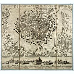
Die kays. Residentz u. Haubt Stadt Wien, nebst den vorstætten in einem accuraten Plan u. Prospect.
Beautiful and rare town-plan of Vienna, accompanied by a panorama of the city in the lower part, showing the buildings from the Löwel Bastei to the Bastey auf der Keller...
Date: Nuremberg, ca. 1740
Selling price: ????
Please login to see price!
Sold in 2017
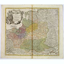
Regni Poloniae magnique ducatus Lithuaniae. . .
A fine map of Poland, Lithuania, Latvia, Estonia, and the western part of Russia, with decorative title cartouche.Johann Baptist Homann was born in Kammlach (1663). He wa...
Date: Nurenberg, 1740
Selling price: ????
Please login to see price!
Sold in 2017
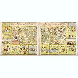
Regnum Bosnia, cum finitimis Croatiae, Dalmatiae. . ./ Regni Serviae pars, una cum finitimis Valechiae and Bulgariae. . .
A lovely pair of maps of Croatia, Dalmatia, and Serbia, Walachia, and part of Bulgaria. The first map 8 small inset maps of Ussitza, Brodt, Wihaz, Zwornek, ratscha, Sabat...
Date: Nuremberg, 1740
Selling price: ????
Please login to see price!
Sold in 2018
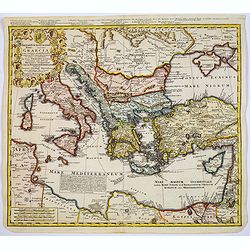
Imperii Turcici Europaei Terra, in primis Graecia. . .
An unusual map showing the Turkish Empire, extending from Corsica and Sardinia in the west, to Asia Minor, Cyprus and the Black Sea in the east. Parts of North Africa als...
Date: Nuremberg, 1740
Selling price: ????
Please login to see price!
Sold in 2017

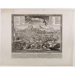
Messina mitt der Neuen Cittadell.
An old birds-eye view of Messina in Sicily. Shows the city from the seaside, with its harbour, fortifications and city walls. Several towers and buildings are shown. With...
Date: Augsburg, ca. 1740
Selling price: ????
Please login to see price!
Sold in 2017
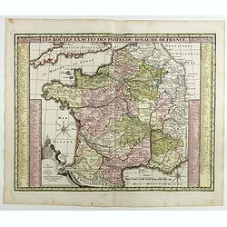
Les routes exactes des Postes du Royaume de France.
post road maps map of France. Seutter the elder (1678-1757) was apprenticed to Johann Baptist Homann in the last years of the seventeenth century in Nuremberg, however, a...
Date: Augsburg, 1740
Selling price: ????
Please login to see price!
Sold in 2017
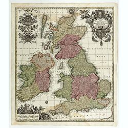
Tabula Novissima Accuratissima Regnorum Angliae, Scotiae, Hiberniae. . .
Decorative map of the British Isles, with 5 large coats of arms, portrait and two large decorative allegorical cartouches. The garlanded cartouche features a portrait of ...
Date: Augsburg, 1740
Selling price: ????
Please login to see price!
Sold in 2018
Salisburgum, Salssburg.
Very decorative panoramic view of Saltsburg with an explanation in German and Latin underneath the view. Published by Martin Engelbrecht (1684 - 1756) after a design by F...
Date: Augsburg, 1740
Selling price: ????
Please login to see price!
Sold in 2018
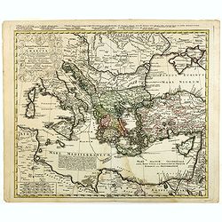
Imperii Turcici Europaei Terra, in primis Graecia. . .
An unusual map showing the Turkish Empire, extending from Corsica and Sardinia in the west, to Asia Minor, Cyprus and the Black Sea in the east. Parts of North Africa als...
Date: Nuremberg, 1740
Selling price: ????
Please login to see price!
Sold in 2020
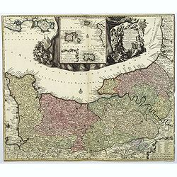
Duche et Gouvernment General de Normandie. . .
A splendid map of Normandy by the German cartographer Seutter, published in the first half of the eighteenth century. Map stretches from Cherbourg in the west, to Alecon ...
Date: Augsburg, ca 1740
Selling price: ????
Please login to see price!
Sold in 2018
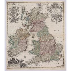
Tabula Accuratissima Regnorum Anglae Scotiae Hiberniae.
A beautiful colored example of Seutter's map of the British Isles, with 5 large coats of arms, portrait and two large decorative allegorical cartouches. One of the most d...
Date: Augsberg, 1740
Selling price: ????
Please login to see price!
Sold in 2019
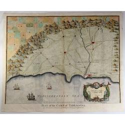
Plan of the Camp of Tarragona.
An interesting map of the Battle of Tarragona in Spain. With a splendid cartouche with Neptune and two sea monsters, and with three detailed ships in the harbour. Paul d...
Date: London, 1740
Selling price: ????
Please login to see price!
Sold in 2019
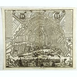
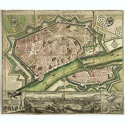
Amsterdam die Weltberuhmte Haupt-und Handel Statt in Holland auf das neuest und accurateste eintworffen und verlegt.
Birds-eye plan view of Amsterdam, depicting the city's architectural landmarks.Matthaus Seutter the elder first published his "Atlas Geographicus" in 1720 and a...
Date: Augsburg, ca. 1740
Selling price: ????
Please login to see price!
Sold in 2018
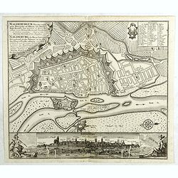
Magdeburgum ducatus cognominis . . .
Birds-eye plan view of Magdeburg.Matthaus Seutter the elder first published his "Atlas Geographicus" in 1720 and added to the contents in subsequent editions un...
Date: Augsburg, ca. 1740
Selling price: ????
Please login to see price!
Sold in 2020
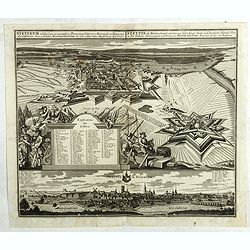
Stetinum celeberima et munitissima Pomeranice Citerioris Metropolis . . .
Birds-eye plan view of Stettin in Poland.Matthaus Seutter the elder first published his "Atlas Geographicus" in 1720 and added to the contents in subsequent edi...
Date: Augsburg, ca. 1740
Selling price: ????
Please login to see price!
Sold in 2018
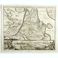
Prospect, Grundris und Gegent der Königl. Schwed. Vestung Stralsund wie solche den 15 July 1715 von den Nordischen Hohen. . .
Detailed battle plan of Stralsund, showing the commencement of the decisive battle of the Siege of Stralsund (1711-1715) on July 15, 1715, with a birds-eye plan view of S...
Date: Augsburg, ca. 1740
Selling price: ????
Please login to see price!
Sold in 2020
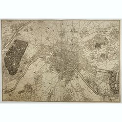
Typus choro-Topographicus regiae et totius Orbis celebrrimae urbis Lutetiae Parisiorum. . .
Map of Paris and its surrounding areas, covering more or less present-day Paris.Matthaus Seµtter the elder first published his "Atlas Geographicus" in 1720 and...
Date: Augsburg, ca. 1740
Selling price: ????
Please login to see price!
Sold in 2021
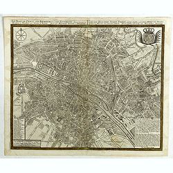
Le plan de Paris et ses Faubourgs et ses environs . . .
Plan of Paris.Matthaus Seutter the elder first published his "Atlas Geographicus" in 1720 and added to the contents in subsequent editions under the title "...
Date: Augsburg, ca. 1740
Selling price: ????
Please login to see price!
Sold in 2018
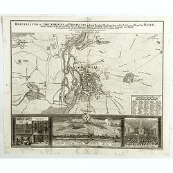
Darstellung des Grundrisses und Prospectes der Königl. Preussisch Magdeburgischen und des Saal-Crayses Haupt Stadt Halle. . .
City plan of Halle with a bird-eye view, the Salt-fountain and the "Auditorium maximum", the largest lecture-room of the university, below.
Date: Augsburg, ca. 1740
Selling price: ????
Please login to see price!
Sold in 2021
![Haga comitum [Germ Graven-Haag GallLA Haye] . . .](/uploads/cache/42506-250x250.jpg)
Haga comitum [Germ Graven-Haag GallLA Haye] . . .
A beautiful and detailed plan of Den Haag (The Hague), in The Netherlands, with fine striking prospect of the town, as it was in the mid eighteenth century, below the pla...
Date: Augsburg, ca. 1740
Selling price: ????
Please login to see price!
Sold in 2018
Celeberrima ac Spatiossima Thuringiae Metropolis Erfurtum . . .
A beautiful general view and city plan of Erfurt.Matthaus Seutter the elder first published his "Atlas Geographicus" in 1720 and added to the contents in subseq...
Date: Augsburg, ca. 1740
Selling price: ????
Please login to see price!
Sold in 2018
Accurata recens delineatta ichnographia celeberrmae Imperii Civitatis ac Sveviae Metropolis Augustae Vindelicorum . . .
Augsburg city map with a bird-eye view of the city and the main monuments.Matthaus Seutter the elder first published his "Atlas Geographicus" in 1720 and added ...
Date: Augsburg, ca. 1740
Selling price: ????
Please login to see price!
Sold in 2021
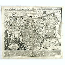
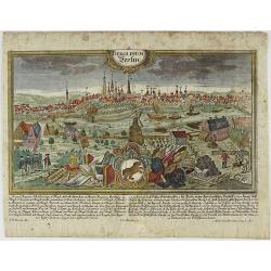
Berlin prächtigste und mächtigste Hauptstadt...
Berlin city map with a bird-eye view of the city and the main monuments.Matthaus Seutter the elder first published his "Atlas Geographicus" in 1720 and added to...
Date: Augsburg, ca. 1740
Selling price: ????
Please login to see price!
Sold in 2018
![[Set of 10 bird-eye views of Vienna]](/uploads/cache/42518-250x250.jpg)
[Set of 10 bird-eye views of Vienna]
The famous bird's-eye views of the Vienna suburbs by J. Schachner. Nine bird's-eye views of today's districts 2-9, each with its own, up to 50-piece legend.Matthaus Seutt...
Date: Augsburg, ca. 1740
Selling price: ????
Please login to see price!
Sold in 2018
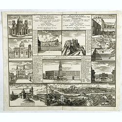
Prospectus illustriores celeberrimae Archiepiscopalis Urbis Salisburgensis praecipuorumque in ea magnificorum ac admirabilium. . .
Ten views of Salzburg. Matthaus Seutter the elder first published his "Atlas Geographicus" in 1720 and added to the contents in subsequent editions under the ti...
Date: Augsburg, ca. 1740
Selling price: ????
Please login to see price!
Sold in 2021
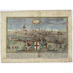
LONDINUM Konden.
A rare and decorative city view of London, England, an engraving after F.B. Werner by J.G. Ringlin published in the “Europäische Städteansichten”, made by Martin En...
Date: Augsburg, ca 1740
Selling price: ????
Please login to see price!
Sold in 2021
BEROLINUM Berlin.
A rare and decorative city view of Berlin, Germany, an engraving after F.B. Werner by J.G. Ringlin published in the “Europäische Städteansichten”, made by Martin En...
Date: Augsburg, ca 1740
Selling price: ????
Please login to see price!
Sold in 2023
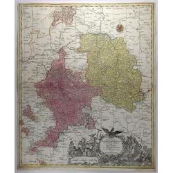
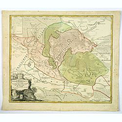
Tabulae Principatus Brandenburgico Culmbacensis Sive Baruthini.
A decorative map of Upper Franconia. The map was prepared by J. A. Riediger. From Graefental to Lauf, from Eger to Lichtenfels. Very large, decorative title cartouche wit...
Date: Augsburg, 1740
Selling price: ????
Please login to see price!
Sold in 2019
Mappae Imperii Moscovitici . . .
An ORIGINAL 18th century copperplate engraved map by De L'isle. Published in Augsburg by M. Seutter. NICELY detailed and beautifully engraved. Archangel is just left of c...
Date: Augsberg, 1740
Selling price: ????
Please login to see price!
Sold in 2019
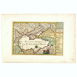
Nova et accurata Tartariae Europae. . . Crimeae. . .
An extremely rare, very large carte-a-figure map of the Black Sea area. With decorative title cartouche and surrounded by four borders with 10 city views, each accompanie...
Date: Augsburg, 1740
Selling price: ????
Please login to see price!
Sold in 2019
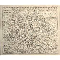
Nuovo Carta del Regno di Ungheria e Della Transilvania...
Detailed map of Hungary and Romania including hundreds of tiny villages. Title in block style.Copied after Isaak Tirion (1705 – 1765).
Date: Venice, 1740
Selling price: ????
Please login to see price!
Sold in 2019
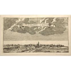
La Citta di Strasburgo o Sia Argentina.
Fine city view engraving of Strasburg, France by Thomas Salmon. Published in Rome by Giambattista Albrizzi in 1740.Giambattita Albrizzi was a famous Venetian publisher an...
Date: Venice, 1740
Selling price: ????
Please login to see price!
Sold in 2023
Comitatus Stolbergici ad Hercyniam. . .
The County of Stolberg (Grafschaft Stolberg) was a county of the Holy Roman Empire located in the Harz mountain range in present-day Saxony-Anhalt, Germany. It was ruled ...
Date: Nuremberg, ca 1740
Selling price: ????
Please login to see price!
Sold in 2021
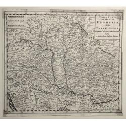
Nuovo Carta del Regno di Ungheria, e della Transilvania ...
Detailed map of Hungary, Slovenia, Transylvania, and parts of Croatia, Bosnia, Serbia, Romania and Bulgaria, from an Italian edition of Thomas Salmon's , “Modern Histor...
Date: Venice, 1740
Selling price: ????
Please login to see price!
Sold in 2019
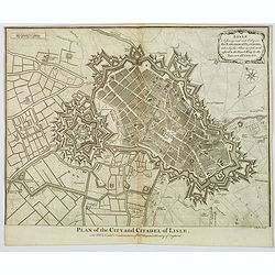
Plan of the City and Citadel of Lisle.
An elaborate bird's-eye view of the fortifications and city of the northern French town of Lisle, and the surrounding countryside. With fortifications shown in great deta...
Date: London, 1740
Selling price: ????
Please login to see price!
Sold in 2020
Nuova Carta del Ducato di Brabante Limburgo e della Gheldria Superre.
A fine map of the Duchy of Brabant and Limburg, Germany that appeared in "Novissimo Atlas published by Giovanni Albrizzi, a work based on the work of Isaak Tirion. I...
Date: Venice, 1740
Selling price: ????
Please login to see price!
Sold in 2020
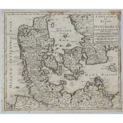
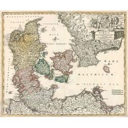
Carta Nuovo del Regno di Danimarca.
A detailed map of Denmark and the southern part of Sweden. With title in block style.The map appeared in "Novissimo Atlas published by Giovanni Albrizzi, a work base...
Date: Venice, 1740
Selling price: ????
Please login to see price!
Sold in 2021
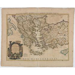
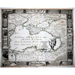
Carte de la Grece.(Accurata Totius Archipelagi et Greciae ...
The map was originally issued by G.de L'Isle.
Date: Amsterdam, 1740
Selling price: ????
Please login to see price!
Sold in 2020
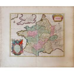
La France Dressée sur un grand nombre de Cartes particulières manuscrites ou imprimées levées sur les lieux et conférées avec les Itinéraires
Decorative map of France prepared by G. de l'Isle and re-issued by Covens and Mortier.
Date: Amsterdam, ca. 1740
Selling price: ????
Please login to see price!
Sold in 2020
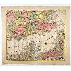
La plus grande partie de la Manche, qui contient les Côtes d'Angleterre...
Map of the English Channel. With a large decorative vignette cartouche which includes Neptune and his sea horses, Apollo, a sailing ship, and other allegorical figures.T....
Date: Augsburg, 1740
Selling price: ????
Please login to see price!
Sold in 2021
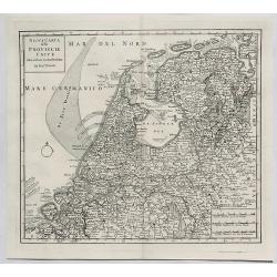
Nuova Carta delle Provincie Unite. . .
A fine map of The Netherlands and Belgium by Tirion from his "Atlante Novissimo Che Contiene Tutte Le Parti Del Mondo...." This atlas was published in Venice an...
Date: Amsterdam, 1740
Selling price: ????
Please login to see price!
Sold in 2023
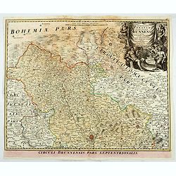
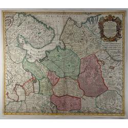
Marchionatus Moraviae circulus brunnensis. . .
Johann Baptist Homann's well-engraved map has a large decorative cartouche. Detailed map centered on Bruenn in Moravia. Prepared by Johann Chr. Mueller. Very decorative t...
Date: Nuremberg, 1740
Selling price: ????
Please login to see price!
Sold in 2020
![[Lot of 10 maps] In Notitiam Eclesiasticam Africae Tabula Geogrphica.](/uploads/cache/19552-250x250.jpg)
[Lot of 10 maps] In Notitiam Eclesiasticam Africae Tabula Geogrphica.
Very decorative copper engraved map of the northern coast of Africa, Spain, Italy and the western part of the Mediterranean with the islands of Sardinia, Corsica, Major...
Date: Paris, c. 1740
Selling price: ????
Please login to see price!
Sold in 2022
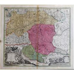
Stiria Ducatus
A fine map of Stiria /Austria includes Graz, Wiener Neustadt (Vienna Newtown), down to Croatia.
Date: Augusburg, ca 1740
Selling price: ????
Please login to see price!
Sold in 2023
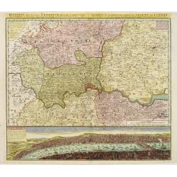
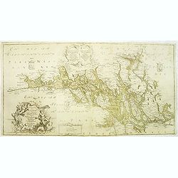
Regionis, quae est circa Londinum ..
Detailed map of greater area of London. At bottom an panoramic view (116x569mm). A most decorative item.
Date: Nuremberg 1741
Selling price: ????
Please login to see price!
Sold
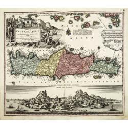
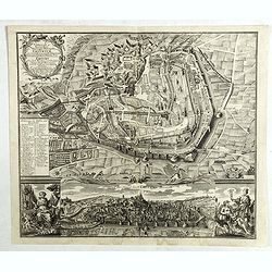
Insula Creta nunc Candia. . .
One of the most spectacular maps of Crete, divided into its four territories, and the islands to its north. The lower part is filled with a bird's-eye view of the city of...
Date: Augsburg, 1741
Selling price: ????
Please login to see price!
Sold in 2011
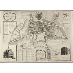
A New and Accurate Plan of the Ancient Borough of Bury Saint Edmunds in the Country of Suffolk By Alexander Downing. 1740
Important and very rare plan of Bury St. Edmunds by A. DowningA large and detailed copper engraved plan of Bury St. Edmunds, Suffolk, drawn and published by Alexander Dow...
Date: London, 1741
Selling price: ????
Please login to see price!
Sold in 2010
Gallia vetus ex C.Iulii Caesaris Comentariis Descripta.
Sanson map of France republished by the Covens and Mortier firm, with fine color. Depicts France described by Julius Caesar marking the locations of tribes and ancient to...
Date: Amsterdam, 1741
Selling price: ????
Please login to see price!
Sold in 2010

Platea ac Templum D: D: Joannis et Pauli et proxime magnum Sodalitium D. . .
Very fine etching with engraving by Michele Giovanni Marieschi (1696-1743), from the book "Magnificentiores selectioresque urbis Venetiarum prospectus".Michele ...
Date: Venice, 1741
Selling price: ????
Please login to see price!
Sold in 2014
Die Europaeische oder kleine Tartarey, nebst den angraentzenden Laendern. . ..
Showing the Black Sea region. Uncommon map from the "Atlas Selectus" by the German cartographer Johann Georg Schreiber (1676-1750). Schreiber followed in the fo...
Date: Leipzig, 1741
Selling price: ????
Please login to see price!
Sold in 2015
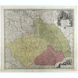
Mappa Geographica Regnum Bohemiae Cum Adiunctis Ducatu Silesiae, . . .
Map of part of Germany, Czech Republic and Poland, with engraved detailed hand colored map. Includes decorative cartouche. Shows cities and towns, place names, rivers, fo...
Date: Augsbourg, 1741
Selling price: ????
Please login to see price!
Sold in 2018
Regni Galliae seu Franciae et Navarrae.
A secondary title in French above the map : "Carte de France dressée par Guillaume de L'Isle et accomodée par les Heritiers d'Homann. With a large decorative title...
Date: Nuremberg, 1741
Selling price: ????
Please login to see price!
Sold in 2021
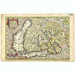
Das Gros-Hertzogthum Finland. . .
A scarce map shows the southern part of Finland with the cities Oulu, Kajana, Vasa, Helsinki, Kristinestad, Hollola and the now Russian city Wyborg in the historic area o...
Date: Leipzig, ca 1741
Selling price: ????
Please login to see price!
Sold in 2021
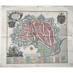
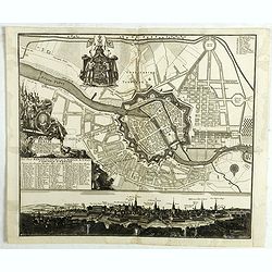
Hannoverae / Hannover
A map of the city of Hannover in Germany, 'Altstadt' and 'Neustadt'), depicted within its fortifications with all its streets and important buildings, with very detailed ...
Date: Augsburg, 1741
Selling price: ????
Please login to see price!
Sold in 2022
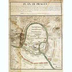
Nouveau Plan de la Ville de Prague Et de ses Environs, Capiltale de Bohème
A rare separately issued battle plan of Prague by Baillieul and Jombert. Showing the Siege of Prague in 1742 with deployment of troops. With one mileage scale, text carto...
Date: Paris, 1742
Selling price: ????
Please login to see price!
Sold in 2011
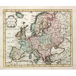
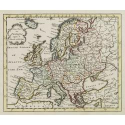
Nieuwe Kaart van Europa.
A map of Europe from a Dutch pocket-atlas.
Date: Amsterdam/ Deventer, 1742
Selling price: ????
Please login to see price!
Sold
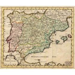
Nieuwe Kaart van Portugal en Spanjen.
A small map of the Iberian peninsula.
Date: Amsterdam/ Deventer, 1742
Selling price: ????
Please login to see price!
Sold
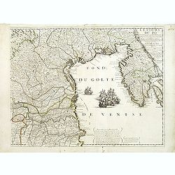
Le Cours du Pô Depuis Turin jusques a ses Embouchures. . . Ce qui fait aujourd'huy Le Théatre de la Guerre en Italie (partie droite seule).
Attractive map of the gulf of Venice, covering the Adriatic coast from the delta of the river Po as far as Istria. It shows many important towns: Ravenna, Ferrara, Vicenz...
Date: Paris, ca. 1742
Selling price: ????
Please login to see price!
Sold in 2019
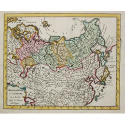
T Russische Ryk zoo in Europa als in Asia.
A map of the Russian empire both in Europe and Asia. Also depicting China and Japan.
Date: Amsterdam, 1742
Selling price: ????
Please login to see price!
Sold
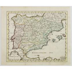
Nieuwe Kaart van Portugal en Spanjen.
Attractive and uncommon map of Spain and Portugal. From Atlas Portatif . RARE.
Date: Amsterdam/ Deventer, 1742
Selling price: ????
Please login to see price!
Sold in 2008
Nieuwe Kaart van Europa.
Attractive and uncommon map of Europe. From Atlas Portatif. RARE.
Date: Amsterdam/ Deventer, 1742
Selling price: ????
Please login to see price!
Sold in 2009
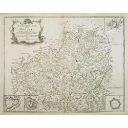
Carte Particuliere de la Moravie Divisée en six Cercles . . .
Detailed map of former Czechoslovakia now part of the province of Moravia and Silesia. From the original survey by Mr. Muller with inset plans of Olmutz, Iglaw, Neustatt ...
Date: Paris, 1742
Selling price: ????
Please login to see price!
Sold in 2023
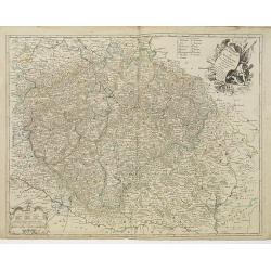
Le Royaume de Boheme. Carte reduite sur celle de 25 feuilles faite a Prague, par Müller, a Paris. Par et chez le sieur leRouge Ingr. Géographe du Roy . . .
Uncommon general map of the Czech Republic, centered on Prague. Prepared after the 25 sheet wall map of Muller, and published by Le Rouge. Folio maps by Le Rouge are quit...
Date: Paris, 1742
Selling price: ????
Please login to see price!
Sold in 2010
Regni Daniae in quo funt ducatus holsatia et slesvicum insulae danicae provinciae Iutia scania blekingia nova tabula
Denmark by Homann
Date: Nurnberg, 1742
Selling price: ????
Please login to see price!
Sold in 2010
Cours du Danube feuille II contenant la Bavière suivant les cartes faites sur les lieux Par Homann et Seuter. . .
Detailed map representing the south of Germany and centered on the Danube. In the upper part six cartouches representing different important cities : Munich, Salzburg, Re...
Date: Paris, 1742
Selling price: ????
Please login to see price!
Sold in 2011
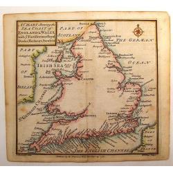
A Chart Shewing the Sea coast of England & Wales.
A fine map drawn by Thomas Badeslade and engraved by William Henry Toms which was published in the atlas "Chorographia Britannia". Thomas Badeslade (active 172...
Date: London, 1742
Selling price: ????
Please login to see price!
Sold in 2013
Charta öfwer Mälaren, med Kongl: Maj.ts. nådigste privilegio utgifven af Kong:e Landtmäteri Contoiret.
A scarce map of the district of Mälaren Sweden. A large title cartouche upper left and a key in the lower left corner. The map is a part of a work by Kongl. Landtmäteri...
Date: Stockholm, 1742
Selling price: ????
Please login to see price!
Sold in 2015
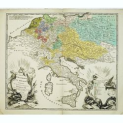
Carte D'Allemagne Et D'Italie Contenant La Succession de l'Empereur Charles VI. Ou sont marqués les Etats presents des Princes de l'Empire
Uncommon map showing the territories after the reign of Charles VI, who was emperor of the Holy Roman Empire, which he ruled from 1711 until 1740). Charles VI's was fathe...
Date: Paris, 1742
Selling price: ????
Please login to see price!
Sold in 2012
Plan de Prague.
Rare and separately published plan of Prague published by Joan Baptista Nolin with the address à l'enseigne de la Place des Victoires et chez le Sr. Humblot rue St. Jaqu...
Date: Paris, ca. 1742
Selling price: ????
Please login to see price!
Sold in 2012
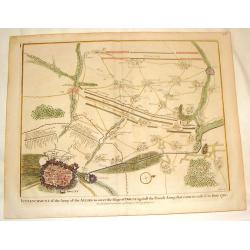
Plan of the Army of the Allies to Cover the Siege of Douay.
Fine detailed plan of the Siege of Douay in 1710. Copper engraving featuring the city of Douay and the Fort of Scarpe. Nicholas Tindal (1687-1774) / Paul de Rapin (1661-...
Date: London, 1742
Selling price: ????
Please login to see price!
Sold in 2016
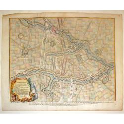
Plan of the Situation Where the Battle of Ramillies was Fought.
Battle Plan of the famous battle in 1706 in Flanders. Detailed cities as well as the battle. colored copper engraving. Nicholas Tindal (1687-1774) / Paul de Rapin (1661-1...
Date: London, 1742
Selling price: ????
Please login to see price!
Sold in 2016
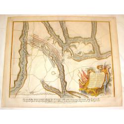
Plan of the Lines of Brabant.
Fine copper engraved plan featuring the 1705 battle in Brabant between the Duke of Marborough and Field-Marshall d'Averquerque. Decorative rococco cartouche with the expl...
Date: London, 1742
Selling price: ????
Please login to see price!
Sold in 2016
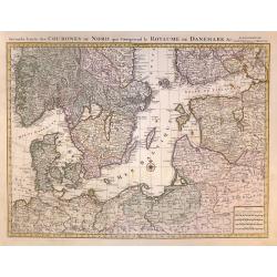
Seconde Carte des COURONES DU NORD qui Comprend le ROYAUME DE DENEMARK &c.
A superb, large scale sheet map of Scandinavia,Finland Estonia,and part of Russia by one of France's greatest cartographers, This is one of a two part map from a Dutch ed...
Date: Amsterdam, 1742
Selling price: ????
Please login to see price!
Sold in 2020
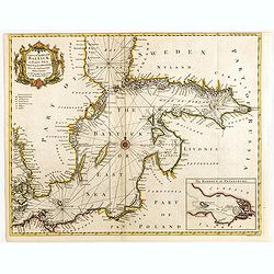
A correct chart of the Baltick or East Sea from ye Sound to St. Petersburg. . .
Attractive uncommon sea chart of the Baltic Sea. Inset plan of St Petersburg (97x131mm.) . Compass rose and rhumb lines. Decorative title cartouche. Engraved by R.W. Seal...
Date: London, 1742
Selling price: ????
Please login to see price!
Sold in 2015