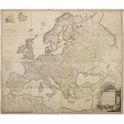
Browse Listings in Europe
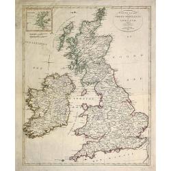
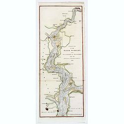
(Two copies of ) Nieuwe kaart van Groot Brittanje en Ierland.
Uncommon map of England and Ireland, printed by François Bohn in Haarlem, who was active from 1786 till 1819. Engraved by C.van Baarsel.
Date: Haarlem 1807
Selling price: ????
Please login to see price!
Sold in 2013
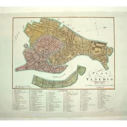
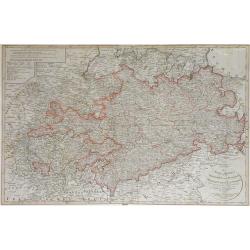
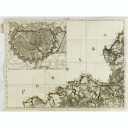
PLAN VON VENEDIG
An uncommon and finely rendered plan of Venice. The work is highly detailed and provides a 133 point legend identifying the town's key sites and places of import.Seldom s...
Date: Weimar, Germany, dated 1807
Selling price: ????
Please login to see price!
Sold
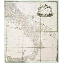
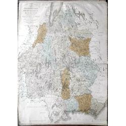
Carta del Regno di Napoli Indicante la divisione delle XIV sue provincie.
Separately published wall map of the southern part of Italy. Engraved by Vincenze Aloja and published by Rizzi Zanoni. The map representation is by Cassini with the Prime...
Date: Naples, 1807
Selling price: ????
Please login to see price!
Sold in 2008
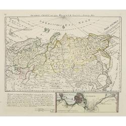
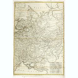
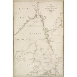
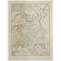
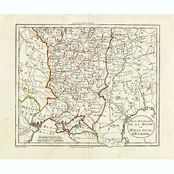
General Charte von ganz Rusland, Europaischer u. Asiatischer Theil.
Very rare map of Russia, with in lower part an inset of S.Petersburg (67x210mm) . From "Neuer Hand- und Staats-Atlas von Europa".The map is of interest for the ...
Date: Leipzig, 1807
Selling price: ????
Please login to see price!
Sold
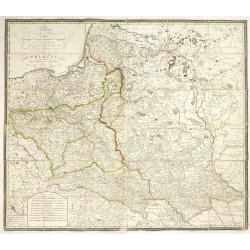
Polen in die dermaligen Besitzungen eingetheilt Nach der vortreflichen Karte von Rizzi Zannoni. . . / Carte de la Pologne. . .
A rare wall map-sized map (more than one meter wide) of Poland and Lithuania set in a decorative frame. The authors of maps, contrary to what the title states, are Schrä...
Date: Vienna, before 1807
Selling price: ????
Please login to see price!
Sold
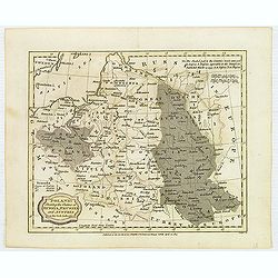
Poland, Shewing the Claims of Austria, Russia, Prussia & Austria from the best Authorities.
Uncommon map of Poland and Lithuania from Rev. E Blomfield's Geography. The atlas was published by C. Brightly & E. Kennersly. Engraved by J. Barlow.
Date: Bungay, Suffolk, 1807
Selling price: ????
Please login to see price!
Sold in 2012
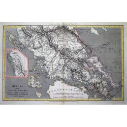
Hellas sive Graecia propria Thessalia et Epirus...
Interesting map showing a part of Greece during ancient times, extending from Kefalonia and Zakynthos (Zante) Island to Nisos Evvoia. Includes Korfu, parts of Macedonia, ...
Date: London, 1807
Selling price: ????
Please login to see price!
Sold in 2012
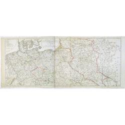
Carte générale du Théâtre de la guerre : comprenant les etats prussiens, la Pologne et tous les pays depuis le Rhin jusqu'en Russie / a Paris 1807 chez Charles Dien, Rue de Jardinet No.13
Scarce map of Poland and eastern Germany. In lower left corner inset map "Carte de la principauté de Neuchatel" (given by Napoleon to Marshal Berthier Louis-Al...
Date: Paris, 1807
Selling price: ????
Please login to see price!
Sold in 2014
Nouvelle Carte Géographique et des Postes de l'Europe .../ Neueste Post- und General-Karte von Europa ...
A rare wall map of Europe and its Post Roads based on a map by Arron Arrowsmith. Scale ca. 1:3.800.000. Engraved by Johann Spiegl (the younger)Title in German, placed in ...
Date: Vienna, Artaria et Compagnie, 1807
Selling price: ????
Please login to see price!
Sold
Carte de la Russie d'Europe dressée par Herisson elève du Cen Bonne. . .
Scarce detailed map of European part of Russia prepared by Eustache Hérisson (b. 1759), engraved by Chamouin, 128 rue de la Bouclerie, Paris. Text engraved by Dien.Accor...
Date: Paris, 1807
Selling price: ????
Please login to see price!
Sold in 2014
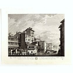
Veduta del Ponte di Porta Marenco lungo il Naviglo, venendo del Ponte de Fabbri in Milano. . .
Showing the bridge of Porta Marenco along the Naviglio Grande coming from the Ponte de' Fabbriin in Milan after a design of Gaspare Galliari (c.1760-1818). With a dedicat...
Date: Milan, 1807
Selling price: ????
Please login to see price!
Sold in 2014
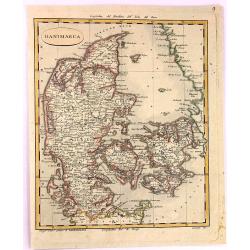
Danimarca.
A fine copper engraved Map of Denmark by Carlo Barbiellini. Engraved by Camiani. It is from "Atlante Delle Geograpfia Antica e Moderna".
Date: Italy, 1807
Selling price: ????
Please login to see price!
Sold in 2016
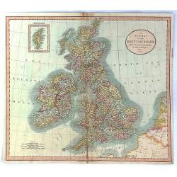
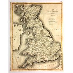
A New Map of the British Isles from the Latest Authorities.
An accurate map of early nineteenth century Great Britain. Two scales at bottom left and title at top right. With an insert of Shetland Islands. All British counties have...
Date: London, 1807
Selling price: ????
Please login to see price!
Sold in 2017
![[Part of a wall map of Hungary].](/uploads/cache/42560-250x250.jpg)
[Part of a wall map of Hungary].
The Upper left corner of the large folding wall map of Hungary was prepared by Ignac Müller and published first in 1769. The map was made for official use and was kept ...
Date: Vienna, T.Mollo, 1769 - 1807
Selling price: ????
Please login to see price!
Sold in 2023
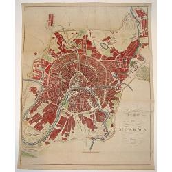
Map von Moskwa.
A scarce bird's-eye plan of Moscow was published in Prague, possibly in cooperation with military sources. The work centers on the Kremlin and provides fine detailing of ...
Date: Prague, dated 1808
Selling price: ????
Please login to see price!
Sold
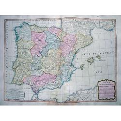
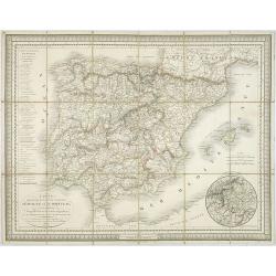
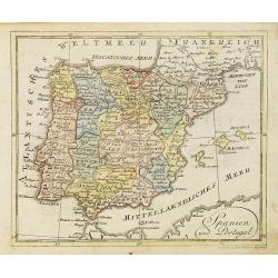
A New Map of the Kingdoms of Spain and Portugal...
Attractive map of the Iberian Peninsula, including the Balearic Islands, parts of north Africa, and south France. Very detailed map with many place names, main roads, a l...
Date: London, 1808
Selling price: ????
Please login to see price!
Sold in 2012
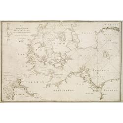
Karta öfver Syd Westra delen af Öster Sjön..
Map centred on the south-western part of the Baltic Sea, namely on the Isles of Fyn and Sjaelland in Denmark. It gives also good detail of the southern coast of Germany a...
Date: Stockholm 1808
Selling price: ????
Please login to see price!
Sold
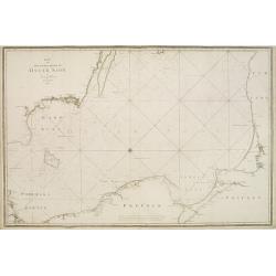
Karta öfver Kettegat och Bohus Bugten med en del af Skagerrack..
Chart encompassing the part of the North Sea between the Kattegat and the Skagerrak straits.It gives good detail of the Jutland seacoast as well as part of Norway and the...
Date: Stockholm, 1808
Selling price: ????
Please login to see price!
Sold in 2011
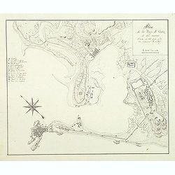
Plan de la baye de Cadiz et des environs Dressé en 1808 par ordre de l'amiral Rosillef
Anonymous pen and ink drawing with a lettered key (A-O) in left part. The Capture of the Rosily Squadron took place on 14 June 1808, in Cadiz, Spain, nearly three years a...
Date: ca. 1808
Selling price: ????
Please login to see price!
Sold in 2011
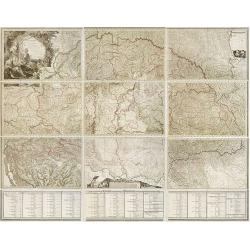
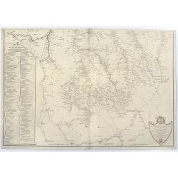
Mappa Generalis regni Hungariae partiumque adnexarum Croatiae, Slavoniae et Confiniorum Militarium Magni item PrincipatusTransylvaniae geometricis partium dimensionibus, recentissimisque astronomicis observationibus. . .
The map has been engraved by G. and F. Prixner Karacs. The map itself is on 9 sheets, measuring approx. 138 x 213 cm. Underneath with 3 sheets (each 27 cm high) with admi...
Date: Vienna, 1808
Selling price: ????
Please login to see price!
Sold in 2012
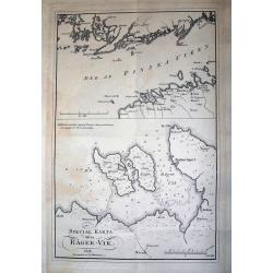
SPECIAL KARTA ösver RÄGER-VIK
Rare page with two maps. The map on top showing the coasts of Estonia and Finland at the Finnish sea bosom. Includes the city of Tallinn (Revel). The map below is a lar...
Date: Stockholm, 1808
Selling price: ????
Please login to see price!
Sold in 2012
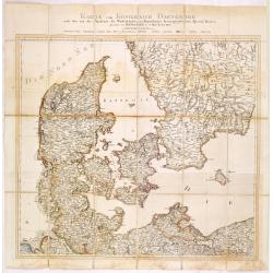
Karte vom Königreichs Daenemark nach den von der Akademie der Wissenschaften zu Kopenhagen harausgegebenen Special Karten. . .
Uncommon folding map of Denmark and part of Sweden and Germany. A road system has been drawn in.More about folding maps. [+]
Date: Berlin, ca. 1808
Selling price: ????
Please login to see price!
Sold in 2013
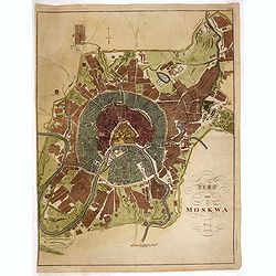
Plan von Moskwa . . . 1808
Rare plan of Moscow, Scale ca. 1:11,850. Relief shown by hachures. With in upper right corner "Taf: XVII." Uncommon bird's-eye plan of Moscow centered on the Kr...
Date: Prague, 1808
Selling price: ????
Please login to see price!
Sold in 2014
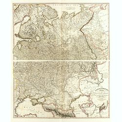
The Russian Dominions in Europe, drawn from the latest Maps, printed by the Academy of Sciences, St. Petersburg; revised and corrected, with the Post Roads. . .
A two-sheet map of Russia covering from the Arctic Sea to the Black and Caspian Seas and from East Prussia and Moldova to the Aral Sea and Tobolsk. Modern day nations of ...
Date: London, June, 1808
Selling price: ????
Please login to see price!
Sold in 2014

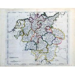
Germany.
Pleasant engraved map of Germany and Poland. Engraved by Neele and published in London in 1808 by Longman & Co.
Date: London, 1808
Selling price: ????
Please login to see price!
Sold in 2016

Billingsgate Market, from the Microcosm of London.
A beautiful first edition colored aquatint view of ‘old’ Billingsgate Market, early in the 19th century, where fresh fish were landed and sold directly on the docksid...
Date: London, 1808
Selling price: ????
Please login to see price!
Sold in 2017
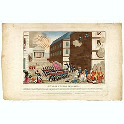
Bataille et prise de Burgos.
Print published in "Paris chez la Ve. Chéreau M.de d'estampes, rue St. Jacques N°10, aux deux Colonnes, près la Fontaine St. Séverin". The text below the pr...
Date: Paris, Vve. Chéreau, ca 1808
Selling price: ????
Please login to see price!
Sold in 2016
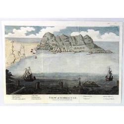
A View of Gibraltar
An interesting view of Gibraltar by J.F. Bourgoing, including a birds-eye view from the water and a view at the bottom looking out to sea featuring two sailing vessels.Te...
Date: London, 1808
Selling price: ????
Please login to see price!
Sold in 2020
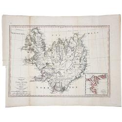
Charte von Island und den Faroer-Inseln.
An edition of this scarce map of Iceland, by an anonymous publisher in Prague.It shows excellent detail in the interior of the Island, including political subdivisions, t...
Date: Prague, 1808
Selling price: ????
Please login to see price!
Sold in 2021
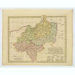
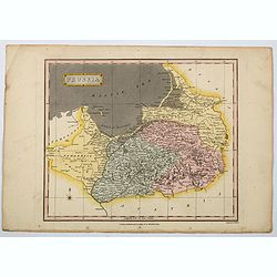
Prussia.
An attractive map with full original color from Wilkinson's General Atlas of the World, Quarters, Empires, Kingdoms, States &c. with Appropriate Tables published by R...
Date: London, 1808
Selling price: ????
Please login to see price!
Sold in 2021
Die Baierische Monarchie. Entworfen in zwey Blättern von Conrad Mannert.
First edition of this important folding map of Southern Germny prepared by Professor Conrad Mannert. The map was kept simple despite its relatively large scale and saw a ...
Date: HOMANN HEIRS, Nuremberg, 1808
Selling price: ????
Please login to see price!
Sold in 2021
Das Sconigr. Sachsen mit den Kurfurstlich und Herzoglich Saechsischen Laendern. . .
Detailed map of the region of eastern Germany published by the Nuremberg firm Schneider and Weigel in 1809. Shows the cities of Berlin (at the north), Dresden, Leipzig an...
Date: Nuremberg, 1809
Selling price: ????
Please login to see price!
Sold in 2010
Map of the Roman Roads in Britain
Interesting map featuring the comparison of current roads (in 1809) to the ancient Roman roads. It was published by J. White, and the engraver was Neele. I could not find...
Date: London, 1809
Selling price: ????
Please login to see price!
Sold in 2017
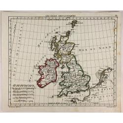
Les Isles Britanniques.
Interesting map of the British Isles engraved on copper by Glot. From the scarce “Atlas Portatif, contenant la G‚ographie Universelle Ancienne et Moderne” by Eustac...
Date: Paris, 1809
Selling price: ????
Please login to see price!
Sold in 2018
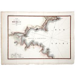
Plan du Golfe de BOURGAS.
A beautifully colored map, depicting the Bourgas gulf in Bulgaria. Taken from Pierre Lapie's work: "Reconnoissance nautique et militaire du Golfe de Bourgas", M...
Date: Paris, 1809
Selling price: ????
Please login to see price!
Sold in 2019
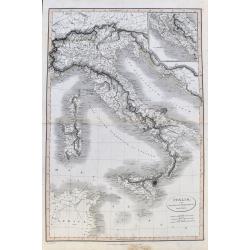
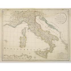
Italia, cum insulis et regionibus finitimis.
A large and unusual map of Italy from Smith's 'Classical Atlas'. It shows all of Italy with Corsica, Sardinia, Sicily, and Malta. Filled with historic place names. An ins...
Date: London, 1809
Selling price: ????
Please login to see price!
Sold in 2021
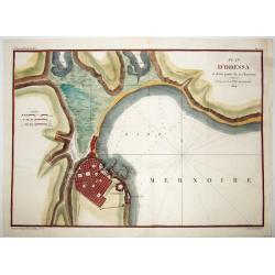
PLAN D'ODESSA, et d'une partie de ses Environs . . .
A rare large copper engraved map of Odessa, by P.Lapie. One of the earliest plans of this town, produced just 15 years after it's founding in 1794. From: "Notice sur...
Date: Paris, 1809
Selling price: ????
Please login to see price!
Sold in 2021
Karta öfver Syd Ostra Delen af Öster Sjön..
Uncommon chart centred on the southern part of the Baltic Sea, giving good detail of the southern Swedish coast, part of Poland, Russia, Lithuania and Latvia.Decorated wi...
Date: Stockholm 1810
Selling price: ????
Please login to see price!
Sold
Carte des routes de postes et itinéraires d'Espagne et de Portugal par Ch. Pochet. . .
A charming dissected, linen mounted post route map of Spain and Portugal. With inset of the area around Madrid. Prepared by Lapie, who according to the title used materia...
Date: Paris, 1810
Selling price: ????
Please login to see price!
Sold in 2009
General Charte des Russischen Reichs Europaeis- chen antheils, nach der grossen Charte der Akademie zu Petersburg in 100 blatter. . . .
Uncommon and detailed map of the European part of Russia. The Ukraine and Crimea are marked as "Neu Russische Provinzen." Based on the Stolistowaja = 100-sheet ...
Date: Weimar, 1810
Selling price: ????
Please login to see price!
Sold in 2015
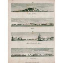
Elba, Malta, Alexandria.
Unusual sheet with four attractive views from the seaside: Island of Elba, Malta, Inner Harbour of Malta, Alexandria. Small but detailed views, showing buildings, sailin...
Date: London, 1810
Selling price: ????
Please login to see price!
Sold in 2011
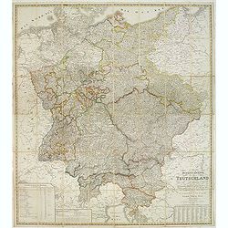
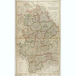
General-Karte von Teutschland in vier Blättern welche als Uebersichts-Tableau der Grosse Charte in 204 Blättern zugleich aber auch als vollständige Post- und orographische Charte dienen kann . . .
Napoleonic folding map of Germany and Italy prepared by Friedrich Wilhelm Streit. Also including Austria, Slovenia, Czech Republic etc.The map has been published during t...
Date: Weimar, 1810
Selling price: ????
Please login to see price!
Sold in 2013

Merkwurdige Gebaude in St. Petersburg
Attractive hand-colored engraving featuring The Cathedral and The Stock Market in St. Petersberg, Russia. Bertuch's "Bilderbuch für Kinder", is an enlightened...
Date: Weimar, 1810
Selling price: ????
Please login to see price!
Sold in 2013
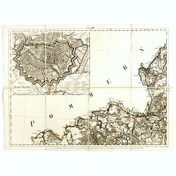
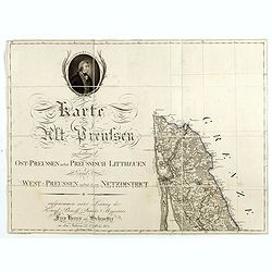
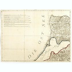
(Single sheet Sect. VIII with inset of Danzig from) Karte von Alt-Preussen enthaltend Ost=Preusen nebst Preussisch Lithauen. . .
Section VIII of the rare first edition of this important 25-sheet map prepared by Friedrich Leopold von Schrötter. This map sheet was engraved by Paulus Schmidt.In the u...
Date: Berlin, ca.1803-1810
Selling price: ????
Please login to see price!
Sold in 2016
(Single sheet from) Karte von Alt-Preussen enthaltend Ost=Preusen nebst Preussisch Lithauen. . . 1796 bis 1802.
The title section of this important multi-sheet map of Prussia, Lithuania, and Poland, showing territories of present Lithuania (Klaipeda district). With a medallion repr...
Date: Berlin, 1802-1810
Selling price: ????
Please login to see price!
Sold in 2014
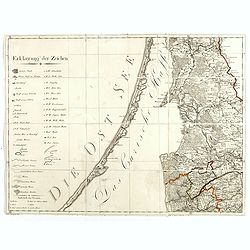
(Key sheet) General Tableau zur Karte von Alt Ost und West Preussen nebst dem aufgenommenen Trigonometrischen Netz. . .
Sheet II with part of Lithuania and the Key of this important multi sheet map of Prussia, Lithuania and Poland.The rare first edition of this important 25-sheet map prepa...
Date: Berlin, 1802-1810
Selling price: ????
Please login to see price!
Sold in 2014
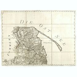
(Kaliningrad, Sheet VI of ) General Tableau zur Karte von Alt Ost und West Preussen nebst dem aufgenommenen Trigonometrischen Netz. . .
Sheet VI centered on Kaliningrad Oblast, the Russian exclave between Poland and Lithuania on the Baltic Sea., from this important multi sheet map of Prussia, Lithuania an...
Date: Berlin, 1802-1810
Selling price: ????
Please login to see price!
Sold in 2016
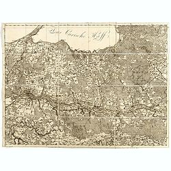
(Sheet IV with Puk Bay from) General Tableau zur Karte von Alt Ost und West Preussen nebst dem aufgenommenen Trigonometrischen Netz. . .
Sheet IV with Puk Bay and part of Gdansk Bay of this important multi sheet map of Prussia, Lithuania and Poland.The rare first edition of this important 25-sheet map prep...
Date: Berlin, 1802-1810
Selling price: ????
Please login to see price!
Sold in 2016
(East of Kaliningrad, Sheet VI of ) General Tableau zur Karte von Alt Ost und West Preussen nebst dem aufgenommenen Trigonometrischen Netz. . .
Sheet VI centered eastern part of Kaliningrad Oblast, the Russian exclave between Poland and Lithuania on the Baltic Sea., from this important multi sheet map of Prussia,...
Date: Berlin, 1802-1810
Selling price: ????
Please login to see price!
Sold in 2016
Partie méridionale de la Russie ou Moscovie d'Europe.
Map of part of Russia, focusing on Ukraine. The map is based on the Paris Meridian, only in 1884, at the International Meridian Conference in Washington DC, the Greenwich...
Date: Paris, c. 1810
Selling price: ????
Please login to see price!
Sold in 2015
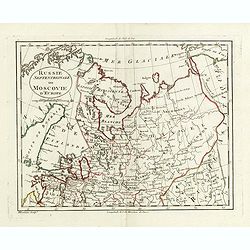
Russie septentrionale ou Moscovie d'Europe.
Map of northern part of European Russia. The map is based on the Paris Meridian, only in 1884, at the International Meridian Conference in Washington DC, the Greenwich Me...
Date: Paris, c. 1810
Selling price: ????
Please login to see price!
Sold in 2015
(Single sheet Sect. VIII with inset of Danzig from) Karte von Alt-Preussen enthaltend Ost=Preusen nebst Preussisch Lithauen. . .
Section VIII of the rare first edition of this important 25-sheet map prepared by Friedrich Leopold von Schrötter. This map sheet was engraved by Paulus Schmidt.In the u...
Date: Berlin, ca.1803-1810
Selling price: ????
Please login to see price!
Sold in 2015
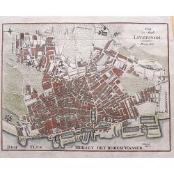
Plan der Stadt Liverpool.
Anonymous copper engraved plan of Liverpool, with German title but printed in Prague. Names numerous streets and buildings, and several docks and yards along the Mersey r...
Date: Prague, 1810
Selling price: ????
Please login to see price!
Sold in 2015
Carte des Rivieres et Ruisseaux du Bassin de la Seine, qui servent a l'Approvisionnement de Paris.
Map of rivers and streams of the Seine basin that supply Paris, France , divided into departments indicating the offices of supply. The map was dedicated to Commissioner ...
Date: Paris, ca. 1810
Selling price: ????
Please login to see price!
Sold in 2023

Prise de la ville de Vienne Capitale de l'Autriche.
Print published in "Paris chez la Ve. Chéreau M.de d'estampes, rue St. Jacques N°10, aux deux Colonnes, près la Fontaine St. Séverin". The text below the pr...
Date: Paris, Vve. Chéreau, ca 1810
Selling price: ????
Please login to see price!
Sold in 2016
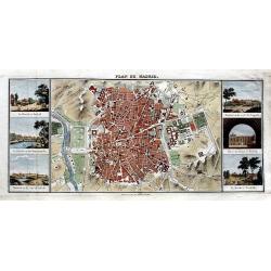
Plan de Madrid.
Very rare plan of Madrid. Names major streets, places, buildings, and gardens. Flanked by six views: La Florida á Madrid; Le Palais vu du Manzanarés; Madrid vu du coté...
Date: Paris, ca. 1810
Selling price: ????
Please login to see price!
Sold in 2016
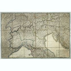
Carta dell'Italia superiore e di parte degli stati limitrofi.
Map of northern Italy and adjacent states by cartographer and engraver Giuseppe Caniani, reduced from the map of Bacler d'Albe.
Date: Milan, ca. 1810
Selling price: ????
Please login to see price!
Sold in 2018
Sketch of the River Scheldt, from Flushing to Antwerp with the Soundings Fortifications, &c. 1810
A chart of a portion of the Scheldt River in Belgium. It is after the earlier work by the French hydrographer Beautemps Beaupre. Named places include: Antwerp, Fort Lillo...
Date: London, 1810
Selling price: ????
Please login to see price!
Sold in 2019
Karta öfver Jönköpings Kronobergs och Blekings Höfdingdöme utgifven af Friherre S. G. Hermelin.
A highly detailed large-scale map of Småland and Blekinge in southern Sweden. The map shows the area from Gränna and Jönköping with the Vättern lake, until Kristians...
Date: Stockholm, 1810
Selling price: ????
Please login to see price!
Sold in 2019
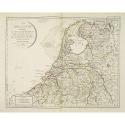
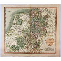
La hollande divisée en ses IX. Départemens d'apres sa réunion a la France, avec les départemens limitrophes. . .
Very interesting map of the present-day Netherlands shown in 1811. During the period 1810 to 1813 the Low Countries were annexed by Napoleon to the French Empire and actu...
Date: Paris, 1811
Selling price: ????
Please login to see price!
Sold in 2010
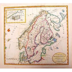
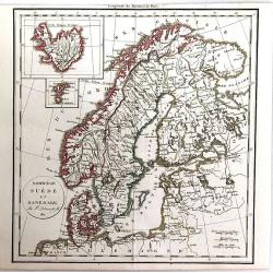
Sweden, Denmark, Norway and Finland from the Best Authorities.
A fine copper engraving map of Scandinavia engraved for Carey's American Edition of "Guthrie's Geography" improved. It has an inset of Iceland. Engraved by Sidn...
Date: Philadelphia, 1811
Selling price: ????
Please login to see price!
Sold in 2013
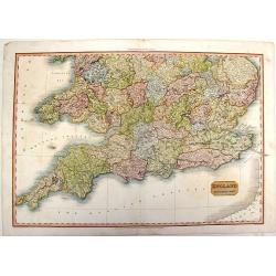
England, Southern Part.
A fine, detailed map of southern England and the English Channel. John Pinkerton (1758 – 1826) was a Scottish antiquarian, cartographer and historian. Pinkerton was a...
Date: London, 1811
Selling price: ????
Please login to see price!
Sold in 2015
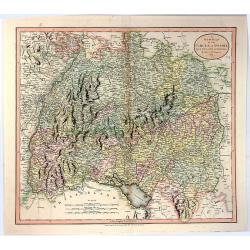
A New Map of the Circle of Swabia, from the Latest Authorities
A fine map of the Swabia region of Germany. Map covers from the Upper Rhine region south as far as Switzerland. Extends eastward as far as Bavaria and westward as far as ...
Date: London, 1811
Selling price: ????
Please login to see price!
Sold in 2016
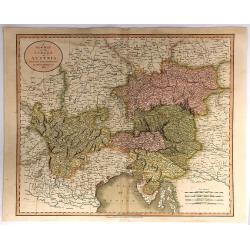
A New Map of the Circle of Austria, From the Latest Authorities . . .
A detailed map of John Cary’s Austria, from the important early 19th century “NEW UNIVERSAL ATLAS”. It covers from Lake Constance and eastward as far as Lake Pelso...
Date: London, 1811
Selling price: ????
Please login to see price!
Sold in 2018
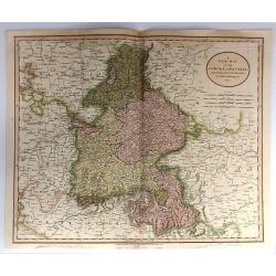
A New Map of the Circle of Bavaria, From the Latest Authorities . . .
A detailed map of John Cary’s Bavaria, from the important early 19th century “NEW UNIVERSAL ATLAS”. The map covers the entire circle of Bavaria. Ronald Vere Tooley...
Date: Paris, 1811
Selling price: ????
Please login to see price!
Sold in 2017
Norwege, Suede et Danemark.
A striking map of Scandinavia, with a large inset of Iceland, and a smaller one of the Faroe Islands. Félix Delamarche was a French geographer and engineer who flourishe...
Date: Paris, 1811
Selling price: ????
Please login to see price!
Sold in 2016

A New Map of the Kingdom of Prussia ...
A fine map by John Cary of Prussia.
Date: London, 1811
Selling price: ????
Please login to see price!
Sold in 2016
A New Map of the Circles of the Upper and Lower Rhine, from the Latest Authorities
A fine map of the Rhine region of Germany. Map covers from the Westphalia region south as far as France. Extends eastward as far as Luxemburg, and westward as far as Fran...
Date: London, 1811
Selling price: ????
Please login to see price!
Sold in 2016
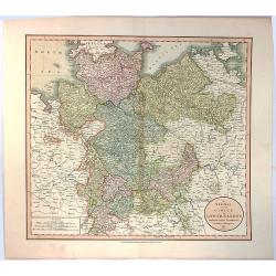
A New Map of the Circle of Lower Saxony, from the Latest Authorities.
A fine map of the Lower Saxony region of Germany. Map covers from the Holstein region south as far as Lower Rhine. Extends eastward as far as Westphalia and westward as ...
Date: London, 1811
Selling price: ????
Please login to see price!
Sold in 2016
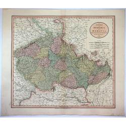
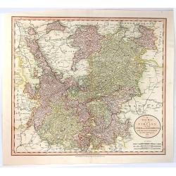
A New Map of Bohemia and Moravia from the Latest Authorities.
Attractive example of John Cary's 1811 map of Bohemia and Moravia. Covers the territory claimed by the modern day Czech Republic. Offers a great deal of detail and has p...
Date: London, 1811
Selling price: ????
Please login to see price!
Sold in 2017
A New Map of the Circle of Westphalia From the Latest Authorities.
An attractive example of John Cary's 1811 map of the Westphalia region of Germany. Map covers from the North Sea to the Lower Rhine, it also includes much of Holland, Bel...
Date: London, 1811
Selling price: ????
Please login to see price!
Sold in 2017
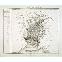
Département de Gênes Divisé en 5 Arrondissemens et en 41 cantons.
Published in the "Atlas National de France" at Chanlaire. Engraved by P.A.F. Tardieu. Represents the department of Genoa which was under French administration b...
Date: Paris, 1790-1811
Selling price: ????
Please login to see price!
Sold in 2018
Prussia.
A general map of Prussia, engraved by J.Wallis for Oddy's General Atlas in full original color. Prussia was a historically prominent German state that originated in 1525 ...
Date: London, 1811
Selling price: ????
Please login to see price!
Sold in 2021
Germany.
A simple, yet elegant, map of Germany by M. Carey done in the early 19th century.
Date: Philadelphia, 1812
Selling price: ????
Please login to see price!
Sold in 2010
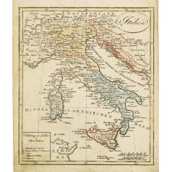
Carte générale de l'Italie rédigée sur les observations les plus authentiques. . .
Map showing Italy and the islands of Corsica, Sardinia and Sicily.
Date: Paris, 1812
Selling price: ????
Please login to see price!
Sold in 2010
Spanien und Portugal.
Nice small map of Spain and Portugal published by Johannes Walch in his rare Allgemeiner Atlas Nach den bewährsten Hülfsmitteln und astronomischen Ortsbestimungen…, e...
Date: Augsburg, 1812
Selling price: ????
Please login to see price!
Sold in 2023
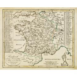
Frankreich nach dem Friedensschluss. . .
Nice small map of France published by Johannes Walch in his rare Allgemeiner Atlas Nach den bewährsten Hülfsmitteln und astronomischen Ortsbestimungen…, edition of 18...
Date: Augsburg, 1812
Selling price: ????
Please login to see price!
Sold
Italien.
Nice small map of Italy by Johannes Walch in his rare Allgemeiner Atlas Nach den bewährsten Hülfsmitteln und astronomischen Ortsbestimungen…, edition of 1812.Johann W...
Date: Augsburg, 1812
Selling price: ????
Please login to see price!
Sold in 2023
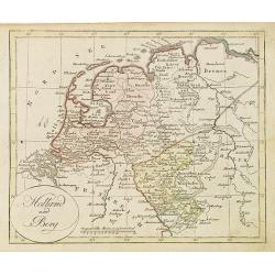
Holland und Berg.
Nice small map of The northern part of The Netherlands and part of Germany by Johannes Walch in his rare Allgemeiner Atlas Nach den bewährsten Hülfsmitteln und astronom...
Date: Augsburg, 1812
Selling price: ????
Please login to see price!
Sold in 2019
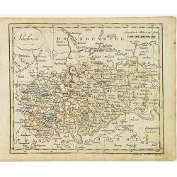
Sachsen.
Nice small map of Saxe in Germany by Johannes Walch in his rare Allgemeiner Atlas Nach den bewährsten Hülfsmitteln und astronomischen Ortsbestimungen…, edition of 181...
Date: Augsburg, 1812
Selling price: ????
Please login to see price!
Sold in 2017