Browse Listings in Europe
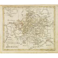
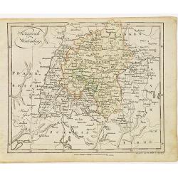
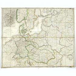
Das Grossherzogthum Würzburg, und die Fûrst Primatischen Staaten.
Nice small map of Wurzburg in Southern Germany by Johannes Walch in his rare Allgemeiner Atlas Nach den bewährsten Hülfsmitteln und astronomischen Ortsbestimungen…, e...
Date: Augsburg, 1812
Selling price: ????
Please login to see price!
Sold in 2018
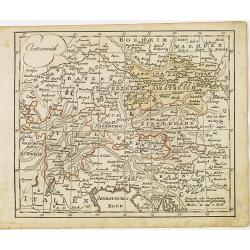
Oesterreich.
Nice small map of Austria by Johannes Walch in his rare Allgemeiner Atlas Nach den bewährsten Hülfsmitteln und astronomischen Ortsbestimungen…, edition of 1812.Johann...
Date: Augsburg, 1812
Selling price: ????
Please login to see price!
Sold in 2015
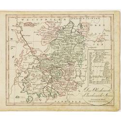
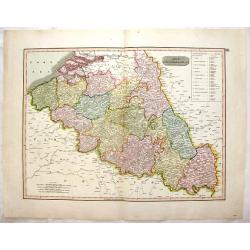
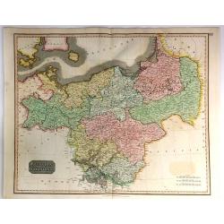
Der Oberrheinische u. Churrheinische Kreis.
Nice small map centered on Frankfurt in Eastern part of Germany by Johannes Walch in his rare Allgemeiner Atlas Nach den bewährsten Hülfsmitteln und astronomischen Orts...
Date: Augsburg, 1812
Selling price: ????
Please login to see price!
Sold in 2020
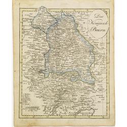
Das Königreich Baiern.
Nice small map of Bayern in Southern Germany by Johannes Walch in his rare Allgemeiner Atlas Nach den bewährsten Hülfsmitteln und astronomischen Ortsbestimungen…, edi...
Date: Augsburg, 1812
Selling price: ????
Please login to see price!
Sold in 2015
Königreich Wirtemberg.
Nice small map of Wirtemberg in Southern Germany by Johannes Walch in his rare Allgemeiner Atlas Nach den bewährsten Hülfsmitteln und astronomischen Ortsbestimungen…,...
Date: Augsburg, 1812
Selling price: ????
Please login to see price!
Sold in 2017
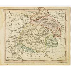
Ungarn und Galizien.
Nice small map of Hungary by Johannes Walch in his rare Allgemeiner Atlas Nach den bewährsten Hülfsmitteln und astronomischen Ortsbestimungen…, edition of 1812.Johann...
Date: Augsburg, 1812
Selling price: ????
Please login to see price!
Sold in 2010
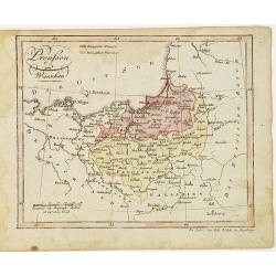
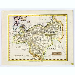
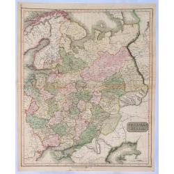
Preussen und Warschau.
Nice small map of Prussia by Johannes Walch in his rare Allgemeiner Atlas Nach den bewährsten Hülfsmitteln und astronomischen Ortsbestimungen…, edition of 1812.Johann...
Date: Augsburg, 1812
Selling price: ????
Please login to see price!
Sold in 2012
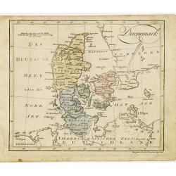
Daenemark.
Nice small map of Denmark by Johannes Walch in his rare Allgemeiner Atlas Nach den bewährsten Hülfsmitteln und astronomischen Ortsbestimungen…, edition of 1812.Johann...
Date: Augsburg, 1812
Selling price: ????
Please login to see price!
Sold in 2012
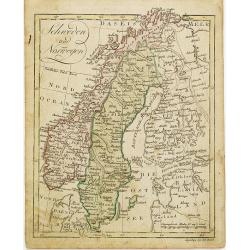
Schweden und Norwegen.
Nice small map of Scandinavia by Johannes Walch in his rare Allgemeiner Atlas Nach den bewährsten Hülfsmitteln und astronomischen Ortsbestimungen…, edition of 1812.Jo...
Date: Augsburg, 1812
Selling price: ????
Please login to see price!
Sold in 2012
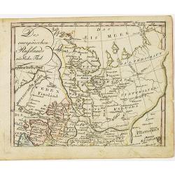
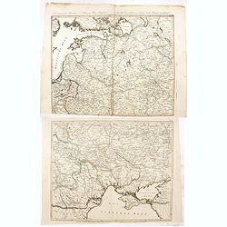
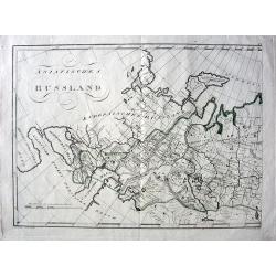
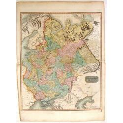
Des europäischen Ruslands nördlicher Theil.
Nice small map of European part of Russia by Johannes Walch in his rare Allgemeiner Atlas Nach den bewährsten Hülfsmitteln und astronomischen Ortsbestimungen…, editio...
Date: Augsburg, 1812
Selling price: ????
Please login to see price!
Sold in 2010
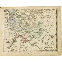
Des europäischen Ruslands südlicher Theil.
Nice small map of the South European part of Russia, including Crimea by Johannes Walch in his rare Allgemeiner Atlas Nach den bewährsten Hülfsmitteln und astronomische...
Date: Augsburg, 1812
Selling price: ????
Please login to see price!
Sold in 2010
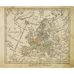
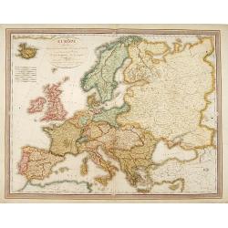
Europa.
Nice small map of Europe by Johannes Walch in his rare Allgemeiner Atlas Nach den bewährsten Hülfsmitteln und astronomischen Ortsbestimungen…, edition of 1812.Johann ...
Date: Augsburg, 1812
Selling price: ????
Please login to see price!
Sold in 2015
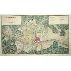
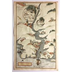
Plan de Polotsk.
Map of Polotsk at the river Dvina in Belarus.
Date: Hyères, 1812
Selling price: ????
Please login to see price!
Sold in 2010
![[No title - on manuscript label : Carte Russe des routes de poste. . . Carte pour la campagne de russie de 1812.]](/uploads/cache/30620-250x250.jpg)
[No title - on manuscript label : Carte Russe des routes de poste. . . Carte pour la campagne de russie de 1812.]
A post road maps map of west of Russia. Map showing the region of North of Moscow and including Saint Petersburg.The map is part of a larger map, and this section has no ...
Date: France, ca. 1812
Selling price: ????
Please login to see price!
Sold in 2011
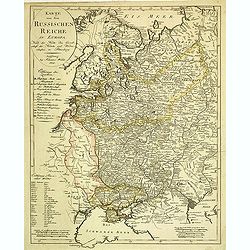
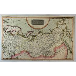
Karte von dem Russischen Reiche in Europa : Nach der Karte der Gesellschaft der Ku¨nste und Wissenschaften in Petersburg.
Scarce map of Russia including Ukraine and Finland. Caspian Sea in lower right corner. J. Walch was a Cartographer and map publisher in Augsburg (1757-1824).
Date: Augsburg, ca. 1812
Selling price: ????
Please login to see price!
Sold in 2012
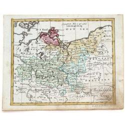
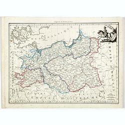
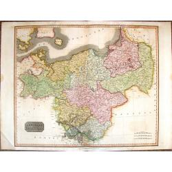
Obersachsischer Kreis Nordlicher Theil. (Brandenberg & Pommern)
Infomative little map of Brandenberg and Pommern. By Johann Walsh (1757 - 1824) from the 1812 edition of his atlas, "ALLGEMEINER ATLAS NACH DEN BEWAHSTEN".
Date: Augsburg, 1812
Selling price: ????
Please login to see price!
Sold in 2016
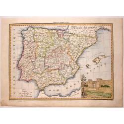
Espagne et Portugal.
This map of Spain and Portugal was included in Malte-Brun's "ATLAS COMPLETE DU [RECIS DE LA GEOGRAPHIC UNIVERSELLE" published in Paris in 1812. The artist and e...
Date: Paris, 1812
Selling price: ????
Please login to see price!
Sold in 2015
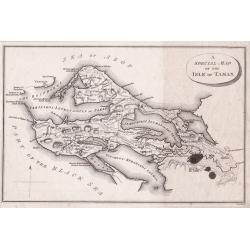
A Special Map of the Isle of Taman.
A detailed small plan of The Island of Taman in fact a peninsula was a strategic location on the Sea of Azof taken from ‘Travels through the southern Provinces of the ...
Date: London, 1812
Selling price: ????
Please login to see price!
Sold in 2014
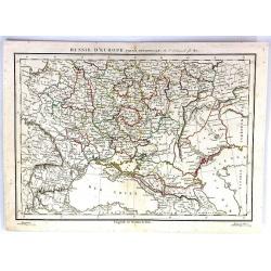
Russie D'Europe (Partie Neridionale)
A fine map of southwestern Russia by Charles Francois Delamarche in Paris in 1812. C.F. Delamarche was a French geographer and mapmaker. He was the successor to Robert de...
Date: Paris, 1812
Selling price: ????
Please login to see price!
Sold in 2016
Neue militairische Situations Karte von West-Russland ... (2 sheets)
Rare road map of Western Russia in two sheets. Prepared by J.E. Knittel. Scale ca. 1:1 400 000.
Date: Nürnberg, 1812
Selling price: ????
Please login to see price!
Sold in 2016
![[2 sheet wall map] Carte de l'empire français et de l'Allemagne, où l'on a marqué en lieues respectives, les postes de ces deux grandes parties de l'Europe / dressée par Hérisson, . .](/uploads/cache/39671-250x250.jpg)
[2 sheet wall map] Carte de l'empire français et de l'Allemagne, où l'on a marqué en lieues respectives, les postes de ces deux grandes parties de l'Europe / dressée par Hérisson, . .
A large, two sheet folded post road maps of France, Germany the Low Counties, Poland, Austria, Switzerland map of Africa, can be joined to make a wall map. Prepared and p...
Date: Paris, Basset, 1812
Selling price: ????
Please login to see price!
Sold
Grand Duche de Varsovie. Prusse.
Steel engraved map of Poland Warsaw Duchy. From the "Atlas Complet du precis de la Geographie Universelle…". Maps from this atlas were accurate, and reflected...
Date: Paris, 1812
Selling price: ????
Please login to see price!
Sold in 2023
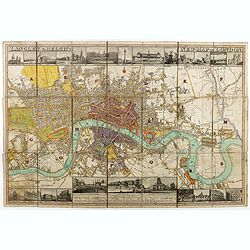
Langley & Belch's New Map of London.
Decorative plan of London, with illustrated views of prominent London buildings (including the newly opened docks) along the top and bottom of the plate. The plan is divi...
Date: London, 1812
Selling price: ????
Please login to see price!
Sold in 2020
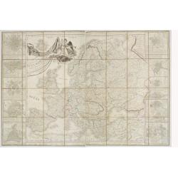
Carte des Europaisch- und eines Theils des Asiatisch russischen Reichs, nach den Neuesten Astronomischen Ortsbestimungen, den Grossen Atlas und Andern Karten des Russich-Kaiserl: Karten-Depots Verfasst ...
A large, rare (wall map sized) folding map of Russia, Lithuania, Poland with title in German and French published during the year of the Napoleonic campaign. Set consists...
Date: Vienna, T. Mollo, 1812
Selling price: ????
Please login to see price!
Sold in 2018
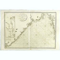
Carte particulière de la côte de Norwége, à l'est de Flekkeröe et Christiansand, avec partie de la côte de Suède jusqu'à. . .
Large sea chart showing northern part of Skagerrak with the coast of Norway with Kristiansand till Frederiksted and the Swedish coast till just north of Gothenburg. The c...
Date: Paris, 1812
Selling price: ????
Please login to see price!
Sold in 2018
![A Special Map of the Isle of Taman [and a map of the Sea of Azof].](/uploads/cache/45893-250x250.jpg)
A Special Map of the Isle of Taman [and a map of the Sea of Azof].
A detailed small plan of The Island of Taman which is in fact a peninsula, and is a strategic location on the Sea of Azof. Taken from Pallas' ‘Travels through the south...
Date: London, ca 1812
Selling price: ????
Please login to see price!
Sold in 2020
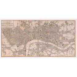
A New Pocket Plan of the Cities of London & Westminster with the Borough of Southwark: Comprehending the New Buildings and other Alterations to the Year 1812.
A detailed and well executed plan of central London, showing the extents from Angel down to Lambeth and Mile End across to Knightsbridge. Some very light original color a...
Date: London 1812
Selling price: ????
Please login to see price!
Sold in 2020
Asiatisches Russland.
Exciting and unusual copper-engraved map covering the area from Turkey to central Russia, showing parts of today's Russia, Kazakhstan, Ukraine, Georgia, Armenia, and Azer...
Date: Vienna, 1813
Selling price: ????
Please login to see price!
Sold in 2010
Carte itinéraire et politique d'Europe d'après les derniers traités de paix avec les plans des principales villes d'Europe.. . .
Large map of Europe, surrounded wit views of Rome, Naples, Madrid, Lisbon, Berlin, Varsovie, Copenhagen, Paris, London, Vienna, St.Petersburg and Constantinople. Large ti...
Date: Paris, 1813
Selling price: ????
Please login to see price!
Sold in 2010
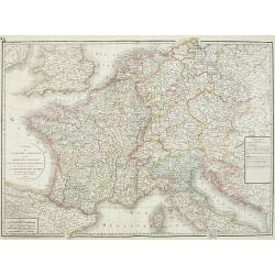
Carte de l'empire français et du royaume d'Italie Divisée par departemens et divisions militaires, avec les etats qui composent la Confédération du Rin. . .
Historically interesting map the Empire of France, including Corsica, now-a-days northern Italy, Netherlands, Croatia, Belgium, Germany with the regions according the &qu...
Date: Paris, 1813
Selling price: ????
Please login to see price!
Sold in 2012
![[No tittle] Lithuania and Poland. "A.6".](/uploads/cache/30629-250x250.jpg)
[No tittle] Lithuania and Poland. "A.6".
Very detailed map of Lithuania. Show the cities of Tilse, Chavli, Vilna. With parts of Poland. In upper right corner "A.6".Scale 1: 500.000. One sheet of from &...
Date: Paris, 1812-1813
Selling price: ????
Please login to see price!
Sold in 2012
Topographische Karte von Deutschland und Italien nebst den angrenzenden Landern. . .
Second edition of this rare Napoleonic folding map of Germany and Italy prepared by Joseph Dirwalt. Also including present-day Poland, part of Austria, Switzerland, and s...
Date: Vienna, 1813
Selling price: ????
Please login to see price!
Sold in 2013
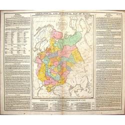
Geographical & Statistical Map of Russia.
Fine copper engraved map featuring Russia in Europe. Engraved by J. Walker after C. Gros and published by J. Barfield for Lavoisne's "COMPLETE GEOGRAPHICAL ATLAS&quo...
Date: London, 1813
Selling price: ????
Please login to see price!
Sold in 2014
![Schauplatz des Kriegs in Polen und Russland darstellend. . . [with 15 maps of Poland]](/uploads/cache/36177-250x250.jpg)
Schauplatz des Kriegs in Polen und Russland darstellend. . . [with 15 maps of Poland]
An extremely scarce atlas which records the Russian campaign of 1812 and the continuation of the French army in Poland in 1813. Starting with a engraved title page in Ger...
Date: Leipzig, 1813
Selling price: ????
Please login to see price!
Sold in 2017
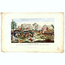
Bataille de Vurtchen Remportée par les Français, sous les ordres de Napoléon I.er sur les Armées de Prusse et de Russie, combinées le 20 Mai 1813.
Print published in "Paris chez Jean Rue Saint Jean de Beauvais N° 10". Showing the battle of Würschen won by Napoléon over the Prussian/Russian army.Read mor...
Date: Paris, Jean, ca 1813
Selling price: ????
Please login to see price!
Sold in 2016

Bonaparte flight in disguise, from his ruined Grand Army in Russia 1812.
Aquatint from the Napoleonic Wars (1800-1815) by Matthew Dubourg (active 1786-1838), after James Atkinson (1780-1852), showing Napoleon and staff fleeing in covered sled ...
Date: London, 1813
Selling price: ????
Please login to see price!
Sold in 2016
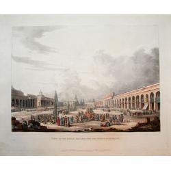
View of the Great Square, with the shops at Moscow.
Scarce aquatint with original hand-color. Shows the square with many people, horses, and goods being traded.This view was published in Ackermann's "Historical sketch...
Date: London, 1813
Selling price: ????
Please login to see price!
Sold in 2016
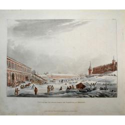
View of the ice hills, during the carnival at Moscow.
Scarce aquatint with original hand-color. Shows the a large square with many people, and horses pulling sledges!This view was published in Ackermann's "Historical sk...
Date: London, 1813
Selling price: ????
Please login to see price!
Sold in 2016
View of Moscow, taken from the balcony of the Imperial Palace.
Scarce aquatint with original hand-color. Shows a panorama of the city and the river. This view was published in Ackermann's "Historical sketch of Moscow" and i...
Date: London, 1813
Selling price: ????
Please login to see price!
Sold in 2016
![[No title, showing central Ukrainia with Dnieper River and Marioupol in lower right corner. ]](/uploads/cache/35719-250x250.jpg)
[No title, showing central Ukrainia with Dnieper River and Marioupol in lower right corner. ]
Very detailed map of central Ukrainia with Dnieper River and Marioupol in lower right corner. Scale 1: 500.000. Upper right corner "C.9." One sheet of from &quo...
Date: Paris, 1812-1813
Selling price: ????
Please login to see price!
Sold in 2017
![[No title, showing the Crimean Peninsula and Sea of Azov with Sevastopol . .] C.10.](/uploads/cache/35720-250x250.jpg)
[No title, showing the Crimean Peninsula and Sea of Azov with Sevastopol . .] C.10.
Very detailed map of larger part of Crimean Peninsula and Sea of Azov with Sevastopol . . Scale 1: 500.000. Upper right corner "C.10." One sheet of from "C...
Date: Paris, 1812-1813
Selling price: ????
Please login to see price!
Sold in 2017
![[No title, showing Western Ukrania.] C.7.](/uploads/cache/35721-250x250.jpg)
[No title, showing Western Ukrania.] C.7.
Very detailed map of Western Ukrania. Scale 1: 500.000. Upper right corner "C.10." One sheet of 104 from "Carte de la Russie Européenne en LXXVII feuilles...
Date: Paris, 1812-1813
Selling price: ????
Please login to see price!
Sold in 2020
![[Very detailed map of Eastern Ukrania.] C.8.](/uploads/cache/35722-250x250.jpg)
[Very detailed map of Eastern Ukrania.] C.8.
Very detailed map of larger part of Ukrania with city of Kharkov located in the east of Ukraine. Scale 1: 500.000. Upper right corner "C.8." One sheet of 104 fr...
Date: Paris, 1812-1813
Selling price: ????
Please login to see price!
Sold in 2022
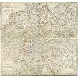
Carte générale d'Allemagne comprenant l'empire d'Autriche, la Confédération du Rhin, le Dannemarck, la Prusse et la Pologne, une partie de la Suède, des empires de France, de Russie et de Turquie . . .
Uncommon large folding map published during the Napoleonic Wars (1803–1815). Showing Central Europe, including Germany, Poland, Lithuania, Low Countries, Denmark, Easte...
Date: Paris, Direction générale de l'imprimerie, 1813
Selling price: ????
Please login to see price!
Sold in 2019
St. Pétersbourg.
Beautiful and detailed plan of St. Petersburg engraved by Tardeau, originally for the Atlas Volume of "Histoire physique, morale, civile et politique de la Russie An...
Date: Paris, 1813
Selling price: ????
Please login to see price!
Sold in 2019
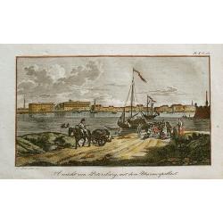
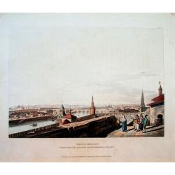
Ansicht von Petersburg, mit dem Marmorpallast.
Rare little view of Saint Petersburg's Marble Palace. With a horse carriage and people in the foreground, and sailing ships on the Neva River. Unusual and decorative i...
Date: unknown, c1814
Selling price: ????
Please login to see price!
Sold in 2012
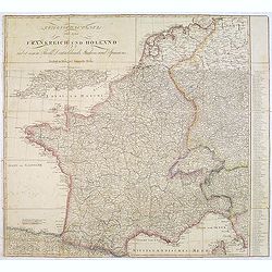
Kriegsschauplatz von ganz Frankreich und Holland.
Rare folding map map of France and the Low Countries published in the year of the defeat of Napoleon. Also including Switzerland and small part of Italy. In Italy the par...
Date: Vienna, 1814
Selling price: ????
Please login to see price!
Sold in 2013
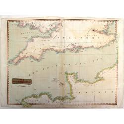
The British Channel.
Fine example of John Thomson’s 1814 map of the English Channel. John Thomson (1777-c1840), was a Scottish cartographer from Edinburgh, celebrated for his 1817 New Gen...
Date: Edinburgh, 1814
Selling price: ????
Please login to see price!
Sold in 2015
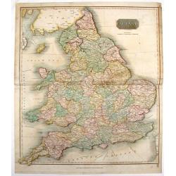
England.
Fine hand-colored, engraved map of England and Wales with Thomson's high level of detail. From "New General Atlas".John Thomson (1777-1840), was a Scottish cart...
Date: Edinburgh, 1814
Selling price: ????
Please login to see price!
Sold in 2016
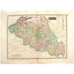
The Netherlands. (Belgium)
Striking, large map of Belgium here called The Netherlands divided into thirteen departments.John Thomson (1777-c1840) was a Scottish cartographer from Edinburgh, celebra...
Date: Edinburgh, 1814
Selling price: ????
Please login to see price!
Sold in 2016
The Netherlands. (Belgium)
This striking hand colored 1814 Thomson map shows modern day Belgium, here called the Netherlands divided into thirteen departments. The labeled the Netherlands or “Low...
Date: Edinburgh, 1814
Selling price: ????
Please login to see price!
Sold in 2016
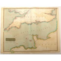
The British Channel.
Fine hand-colored map of the English Channel from John Thomson,s "GENERAL ATLAS" published in 1814. Engraved and signed in print by J & G Menzies.
Date: Edinburgh, 1814
Selling price: ????
Please login to see price!
Sold in 2016
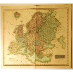
Europe
A very finely engraved, detailed, and attractive early hand colored, 19th century map of Europe, dating from 1814. John Thomson (1777-c1840) was a Scottish cartographer f...
Date: Edinbugh. 1814
Selling price: ????
Please login to see price!
Sold in 2017
Fowey Haven & C., From a Chart Drawn in the Reign of K. Hen. VIII.
Plan of Fowey Haven. Published by Daniel & Samuel Lysons in 1814. It features views in almost a cartoon style of villages, from a chart of Cornwall, produced during t...
Date: London, 1814
Selling price: ????
Please login to see price!
Sold in 2017
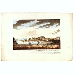
Vue générale de l'île d'Elbe, de la Ville et du château de Porto Ferrajo . . .
This aquatint print figures the town of Porto-Ferrario and it's fortress which was Napoleon's residence during his exile.With address "A Paris chez le Coeur graveur,...
Date: Paris, Le Cœur et Bance ainé, ca 1814
Selling price: ????
Please login to see price!
Sold in 2016
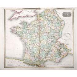
France
A beautiful map of France, engraved and published during Napoleon Bonaparte's time, with stunning color, and magnificent detail. Engraved by Hewitt.
Date: London, ca 1814
Selling price: ????
Please login to see price!
Sold in 2016
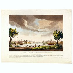
Vue de la ville de Novogorod en Russie . . .
This aquatint print figures a panoramic view of the town of Nizhny Novgorod, located about 400 km east of Moscow, where the Oka empties into the Volga.The city is an impo...
Date: Paris, Le Cœur et Bance ainé, ca 1814
Selling price: ????
Please login to see price!
Sold in 2016
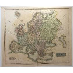
Europe.
A striking hand colored map of 1814 that depicts Europe one year before Napoleon's defeat at Waterloo in 1815. Thomson's maps are known for their stunning color, large si...
Date: Edinbourgh, 1814
Selling price: ????
Please login to see price!
Sold in 2018
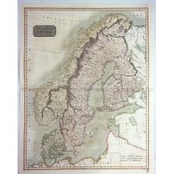
Scandinavia, or Sweden, Denmark & Norway.
A pleasing hand colored 1817 map of Scandinavia; depicting Sweden, Denmark, and Norway. Modern day Finland, though included, was then part of the Kingdom of Sweden. Thoms...
Date: Edinbourgh, 1814
Selling price: ????
Please login to see price!
Sold in 2019
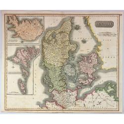
Denmark.
A pleasing, hand colored, 1814 Thomson map that features Denmark, with inserts of Iceland, and the Faeroe Islands. It is engraved in the minimalist English style pioneere...
Date: Edinbourgh, 1814
Selling price: ????
Please login to see price!
Sold in 2019
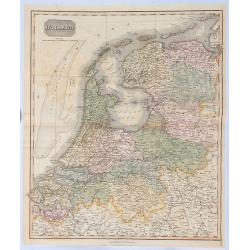
Holland.
A fine hand colored 1814 map of Holland, engraved in the minimalist English style pioneered in the early part of the 19th century. Thomson maps are known for their stunni...
Date: Edinbourgh, 1814
Selling price: ????
Please login to see price!
Sold in 2018
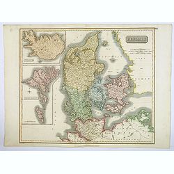
Denmark.
This fascinating hand colored 1814 map that depicts Denmark, Iceland and the Faeroe Islands. The whole is beautifully engraved in the minimalist English style pioneered i...
Date: Edinburgh, 1814
Selling price: ????
Please login to see price!
Sold in 2021
Prussia.
A small, early nineteenth-century map of Prussia. The cities of Berlin, Dantzick and Konigsberg are highlighted in red. Map extent is from Magdeburg in the west to Poznan...
Date: Liverpool, ca 1814
Selling price: ????
Please login to see price!
Sold in 2021
![Generalkarte vom Königreich Preussen u. d. Herz[ogtum] Warschau nach astronomischen Ortsbestim[m]ungen und geodätischen Messungen. . .](/uploads/cache/37060-250x250.jpg)
Generalkarte vom Königreich Preussen u. d. Herz[ogtum] Warschau nach astronomischen Ortsbestim[m]ungen und geodätischen Messungen. . .
Rare seemingly unrecorded map of Poland with its borders after the Congress of Vienna, probably based on a lost first edition of Daniel Friedrich Sotzmann's (1754-1840) m...
Date: Nuremberg, Schneider & Weigel 1815

Ceremony of Te Deum by the allied armies..
View of a military ceremony at the square Louis XV in Paris.
Date: London 1815
Selling price: ????
Please login to see price!
Sold
EUROPE Dressée.. congres de Vienne..
A charming map of Europe according to the convention of Vienna, drawn by J.N.Champion. The map has a detailed roadsystem drawn in.
Date: Paris 1815
Selling price: ????
Please login to see price!
Sold
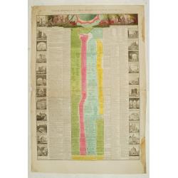
TABLEAU HISTORIQUE ET CHRONOLOGIQUE DU ROYAUME DES PAYS-BAS.
Very large leaf with historical events in the Netherlands from Roman times till 1815. In left and right borders at the sides and on top. Surrounded by 22 engravings of ci...
Date: France, 1815
Selling price: ????
Please login to see price!
Sold

Costumes Russes.
An amusing and rare caricatured engraving of three Russian military in their uniform, made by Godefroy.
Date: Paris, Martinet, 1814-1815
Selling price: ????
Please login to see price!
Sold in 2013
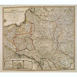
A Map of the Kingdom of Poland, Describing its Ancient Limits with the Dismemberments. Likewise its Present Boundary as Settled by Act of Congressat Vienna.. .
A 1815 edition of this finely engraved map of Poland by William Faden (1749-1836), geographer to the King and H.R.H. the Prince of Wales. The map is based on the Rizzi-Za...
Date: London, 1815
Selling price: ????
Please login to see price!
Sold in 2013
European Russia.
Fine hand-colored. engraved map of European Russia including the Ukraine and the Crimean Peninsula. John Thomson (1777-c1840), was a Scottish cartographer from Edinburg...
Date: Edinburgh, 1815
Selling price: ????
Please login to see price!
Sold in 2015
Prussian Dominions.
A vivid hand colored 1815 Thomson map of Prussia or Northern and Central Europe. It comes from Thomson's "NEW GENERAL ATLAS".
Date: Edinburgh, 1815
Selling price: ????
Please login to see price!
Sold in 2017
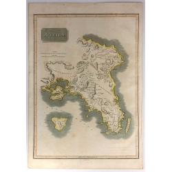
Attica.
This is an attractive 1814 John Thomson map of Attica, Greece. The map features many of the important cities and sites in early Greek History. It shows Athens, the Plain ...
Date: Edinburgh, 1815
Selling price: ????
Please login to see price!
Sold in 2017
Prussian Dominions
An excellent hand colored 1815 map by the cartographer John Thomson. It depicts Prussia (central and northern Europe). The Map covers from the Baltic Sea to Upper Silesia...
Date: Edinburgh, 1815
Selling price: ????
Please login to see price!
Sold in 2018
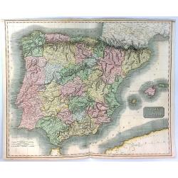
Spain & Portugal
A fine hand colored map of Spain and Portugal published by John Thomson in 1815.It is engraved in the minimalist English style begun in the early part of the 19th century...
Date: Edinbourgh, 1815
Selling price: ????
Please login to see price!
Sold in 2020
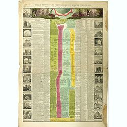
TABLEAU HISTORIQUE ET CHRONOLOGIQUE DU ROYAUME DES PAYS-BAS.
Very large leaf with historical events in the Netherlands from Roman times till 1815. In left and right borders at the sides and on top. Surrounded by 22 engravings of ci...
Date: France, 1815
Selling price: ????
Please login to see price!
Sold in 2018
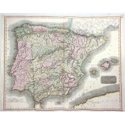
Spain & Portugal.
A fine hand colored 1815 map of Spain and Portugal, engraved in the minimalist English style pioneered in the early part of the 19th century. Thomson's map includes both ...
Date: Edinbourgh, 1815
Selling price: ????
Please login to see price!
Sold in 2020
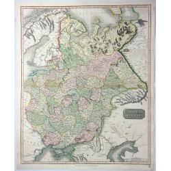
European Russia.
A fine 1815 Thomson map of the European part of Russia, engraved in the minimalist English style pioneered in the early part of the 19th century. Coincidentally, it was p...
Date: Edinbourgh, 1815
Selling price: ????
Please login to see price!
Sold in 2021
European Russia.
An attractive large format copper engraved antique map of Russia in Europe covering present day Ukraine, Belarus, Latvia, Lithuania, Estonia and Western Russia eastwards ...
Date: Edinbourgh, 1815
Selling price: ????
Please login to see price!
Sold in 2023
Russian Empire.
A fine map of Russia by Thomas Kelly. It features Siberia and its provinces. Published in London in about 1815.
Date: London, 1815
Selling price: ????
Please login to see price!
Sold in 2018
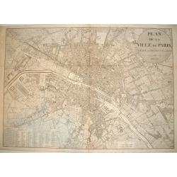
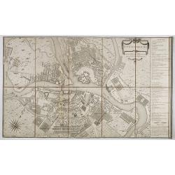
PLAN DE LA VILLE DE PARIS, DIDIE ET PRESENTE AU ROI
A very large and exceedingly rare copperplate engraved plan of Paris with the River Seine at its center. An incredibly detailed work that identifies all streets, parks, g...
Date: Paris, dated 1816
Selling price: ????
Please login to see price!
Sold