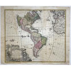
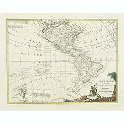
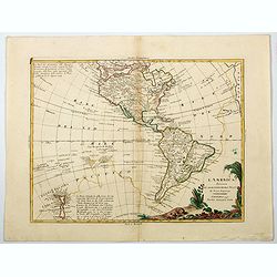
Americae Mappa generalis...
Important map of the Americas with contemporary hand color. Shows a partially unexplored Northwest. Locates Quivira, Tecas (Texas), and many native Indian areas. Indicate...
Date: Nuremberg, 1746
Selling price: ????
Please login to see price!
Sold in 2018

Francis Drake.
Fine hand-colored copperplate engraving featuring Francis Drake, the famous pirate. From "Heads of Illustrius Persons of Great Britain" by Thomas Birch. Engrave...
Date: London, 1747
Selling price: ????
Please login to see price!
Sold in 2013
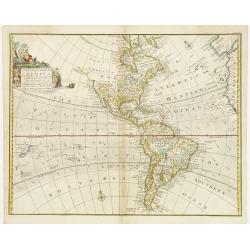
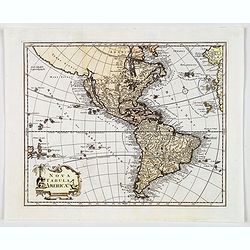
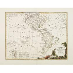
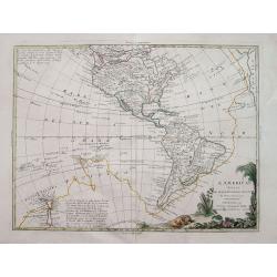
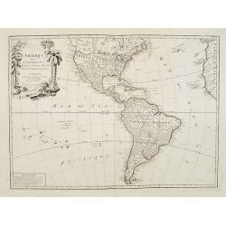
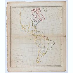
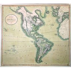
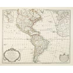
A New and Accurate Map of America..
An attractive map showing the full expanse of America. With decorative title cartouche featuring several Indians, one of whom casually rests his feet on an alligator.Alas...
Date: London ca 1744 - 1748
Selling price: ????
Please login to see price!
Sold
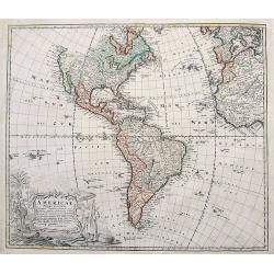
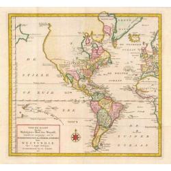
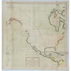
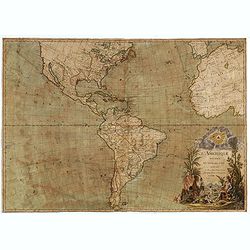
Americae Mappa generalis.
Full title and impressum in an extensive cartouche bottom left: 'Americae Mappa generalis Secundum legimitas projectionis Stereiographiae regulas (..) Homannianis Heredib...
Date: Nuremberg, 1748
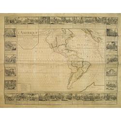
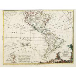
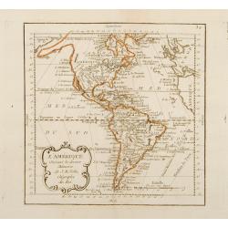
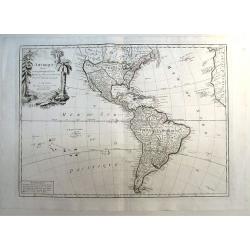
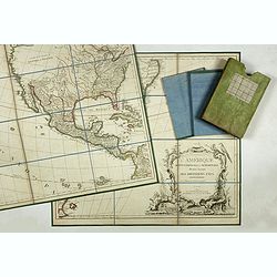
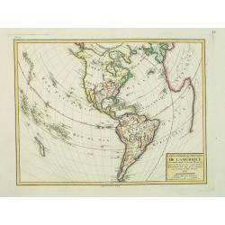
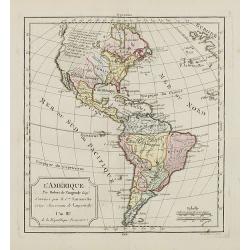
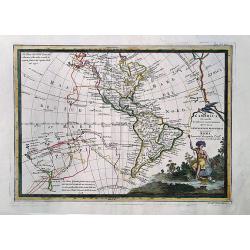
L'Amerique divisée en ses principalesparties. . .
RARE WALL MAP OF THE AMERICAS WITH DECORATIVE BORDERS. This wall map by Daudet is first described by Mcguirk, in his work about the "Mer de l'Ouest Mythe, see "...
Date: Lyon, 1752
Selling price: ????
Please login to see price!
Sold
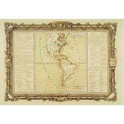
![[Eight scenes depicting various stages in the history of America]](/uploads/cache/25007-250x250.jpg)
[Eight scenes depicting various stages in the history of America]
The side border of Longchamps wall map of America, here still in its uncut form. The eight scenes depicting various stages in the history of the continent. - Monarchie de...
Date: Paris, 1754
Selling price: ????
Please login to see price!
Sold in 2008
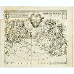
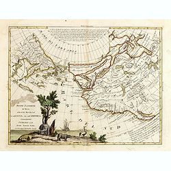
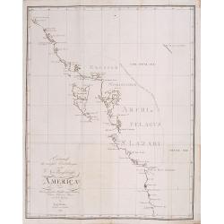
Kaart der nieuwe ontdekkingen benoorden de Zuyd Zee zo wel ten oosten van Siberien en Kamtschatka als ten westen van Nieuw Vrankrijk
A uncommon Dutch edition of this landmark map in the history of northwestern cartography, charting the common boundaries of North America, Asia and the fictitious "M...
Date: Haarlem, 1754
Selling price: ????
Please login to see price!
Sold in 2015
Nova Tabula Americae.
A rare map of the Americas showing California as an island, published by Georg Christoph Kilian. Map gives some very good detail, however, Brazil is still distorted, Cali...
Date: Augsburg, 1759
Selling price: ????
Please login to see price!
Sold in 2019
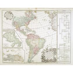
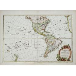
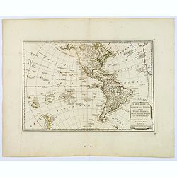
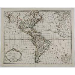
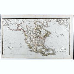
L'Amérique septentrionale et Meridionale divisée en ses principales parties . . .
Unrecorded state of this fine map of the western hemisphere with inset maps of Martinique and Santa Domingo. To the right a text column showing the regional division of t...
Date: Paris, 1760
Selling price: ????
Please login to see price!
Sold in 2015
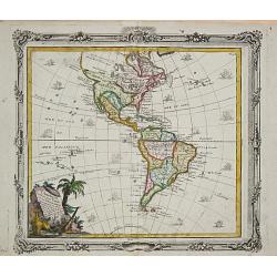
L'Amerique divisée en ses principaux Etats.
A large uncommon map published by Lattré. This map is most notable for it's depiction of Mer ou Baye de L'Quest or Sea of the West. A great sea, easily the size of the M...
Date: Paris, c 1760
Selling price: ????
Please login to see price!
Sold in 2014
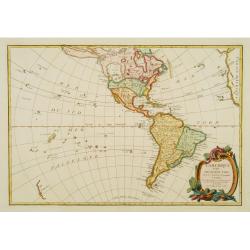
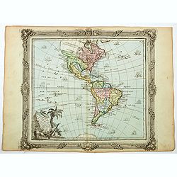
![[The Americas] AMERIQUE](/uploads/cache/20599-(2)-250x250.jpg)
[The Americas] AMERIQUE
A map depicting both the Americas. With on both sides a descriptionary text. All within an elaborate and very decorative border. Claude Buy de Mornas (d. 1783), géogra...
Date: Paris, 1761
Selling price: ????
Please login to see price!
Sold in 2025
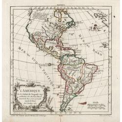
Amérique.
Map of north and south America.Left and right a box with geographical information for America.Prepared by Buy de Mornas, who was a professor of geography and history and ...
Date: Paris 1762
Selling price: ????
Please login to see price!
Sold
L'Amerique divisée Pars Grands Etats. . .
Engraved by Lattré. This map is most notable for its depiction of "Mer de L'Ouest" or "Sea of the West". A great sea, easily the size of the Mediterr...
Date: Paris, 1762
Selling price: ????
Please login to see price!
Sold in 2020
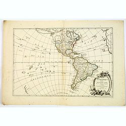
L'Amérique.
General map of America. From Gilles Robert de Vaugondy's Nouvel Atlas Portatif.
Date: Paris, 1762
Selling price: ????
Please login to see price!
Sold in 2012
L'Amerique divisée Pars Grands Etats.
Engraved by Lattré. This map is most notable for it's depiction of Mer ou Baye de L'Ouest or Sea of the West. A great sea, possibly the size of the Mediterranean, to flo...
Date: Paris, 1762
Selling price: ????
Please login to see price!
Sold in 2019
![L'AMERIQUE divisee par Grands Etats.[Bay of the West]](/uploads/cache/83601-250x250.jpg)
L'AMERIQUE divisee par Grands Etats.[Bay of the West]
First state of Janvier's map of America, published in Paris in 1762. It shows a gloriously oversized mythical Bay of the West, unusual Alaskan Archipelago (again complete...
Date: Paris, 1762
Selling price: ????
Please login to see price!
Sold in 2020
Court card with The nine of Amerique. (Letterweight)
A playing card with a map including detail with "Nouvelle York" and Nassau in the top: St.Augustine in Florida, and Coca, St.Asee, Panuco, Guadalajara, La Guate...
Date: Paris, 1763
Selling price: ????
Please login to see price!
Sold in 2012
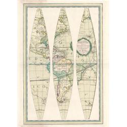
![[Six engraved gores for a 20cm diameter terrestrial globe, showing the western hemisphere]](/uploads/cache/27976-250x250.jpg)
[Six engraved gores for a 20cm diameter terrestrial globe, showing the western hemisphere]
Six engraved globe gores for a 20cm diameter terrestrial globe, published by Peter Anich (1723-1766), a Tyrolean shepherd who became an eminent geographer and maker of ma...
Date: Vienna, 1765
Selling price: ????
Please login to see price!
Sold in 2009
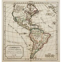
L' Amerique.
Louis Brion de la Tour (1756-1823), ' Atlas Géneral, Civil et Ecclésiastique', 1766, ' Atlas Général', 1790-98. Louis Charles Desnos (fl.1750-70), Le Rouge's 'Atlas N...
Date: Paris, 1766
Selling price: ????
Please login to see price!
Sold
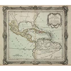
Guayana, Terre Ferme, Isles Antilles et N.lle Espagne.
Louis Brion de la Tour (1756-1823), ' Atlas Géneral, Civil et Ecclésiastique', 1766, ' Atlas Général', 1790-98. Louis Charles Desnos (fl.1750-70), Le Rouge's 'Atlas N...
Date: Paris, 1769
Selling price: ????
Please login to see price!
Sold
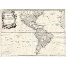
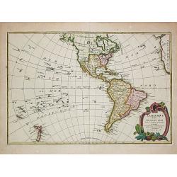
Carte Nouvel le D'Amerique pour les..
Fine detailed and uncommon map of America. This map is most notable for it's depiction of Mer de L'Ouest or "Sea of the West": a great sea, easily the size of t...
Date: Paris, 1769
Selling price: ????
Please login to see price!
Sold in 2010
Nieuwe Kaart van het Westelykste Deel der Weereld.
Izaak Tirion (d. 1769) Amsterdam publisher. His ' Nieuwe en beknopte handatlas' saw 6 editions between before 1740 and after 1784. Also ' Tegenwoordige staat van alle vol...
Date: Amsterdam, c. 1770
Selling price: ????
Please login to see price!
Sold
L\'Amérique.
A nice map of America.
Date: Paris, ca.1770
Selling price: ????
Please login to see price!
Sold in 2011
Hemisphere Occidental.
This is a most informative map of the Western Hemisphere by Brion de la Tour, dating to 1786. It covers the entire hemisphere in generous detail, covering North America a...
Date: Paris, ca 1770
Selling price: ????
Please login to see price!
Sold in 2019
Mapa general de América ó hemisferio occidental. . .
A rare and very detailed map of Americas and the Western Hemisphere. With a decorative cartouche flanked by two trees, an exotic bird and a crocodile.
Date: Madrid, 1772
Selling price: ????
Please login to see price!
Sold in 2020
![[Untitled] but Chart of the Track of the Dolphin, Tamar, Swallow & Endeavour through the South Seas & the track of M.Bougainville. . .](/uploads/cache/42647-250x250.jpg)
[Untitled] but Chart of the Track of the Dolphin, Tamar, Swallow & Endeavour through the South Seas & the track of M.Bougainville. . .
The map is one of a three part set, comprising of three sheets covering the world, and detailing Cook's first voyage. This is the Americas map is (part 1) and was issued ...
Date: London, 1773
Selling price: ????
Please login to see price!
Sold in 2020
Carte des Declinaisons et Incluinaisons de Laiguille Aimantee. . .
An uncommon chart of America, designed to display the magnetic variation in the Pacific, published in Buffon's 'Histoire Naturelle', in the mineralogy volumes. One of six...
Date: Amsterdam, 1775
Selling price: ????
Please login to see price!
Sold in 2018
L'America divisa ne suoi principali Stati..
Attractive map of The Americas, with the first voyage of Capt. Cook (1768) depicted around South America and across the Pacific to New Zealand, which is well charted. Nor...
Date: Venice 1776
Selling price: ????
Please login to see price!
Sold
L'America divisa ne suoi principali Stati..
Attractive map of The Americas, with the first voyage of Capt. Cook (1768) depicted around South America and across the Pacific to New Zealand, which is well charted. Nor...
Date: Venice, 1776
Selling price: ????
Please login to see price!
Sold in 2017
L\'America divisa ne suoi principali Stati..
Attractive map of The Americas, with the first voyage of Capt. Cook (1768) depicted around South America and across the Pacific to New Zealand, which is well charted. Nor...
Date: Venice, 1776
Selling price: ????
Please login to see price!
Sold in 2011
Nuove Scoperte de' Russi al Nord del Mare del Sud si nell'Asia, che nell'America...
Nice example of Zatta's map of the northern Pacific Coastal regions one of the best illustrations of a late rendition of the Northwest Passage, here illustrating two wide...
Date: Venice, 1776
Selling price: ????
Please login to see price!
Sold in 2016
L'America divisa ne suoi principali Stati. . .
Interesting map of the Americas illustrating the first voyage of Captain Cook around South America and across the Pacific to New Zealand. Mentions a Chinese Colony in the...
Date: Venice, 1776
Selling price: ????
Please login to see price!
Sold in 2015

Christopher Columbus & the Discovery of America.
[Two Engraved Prints] A pair of historical copper engravings, including a portrait of Christopher Columbus, and another with Columbus’ landfall in the New World. He str...
Date: London, 1778
Selling price: ????
Please login to see price!
Sold in 2018
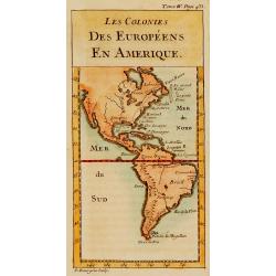
Les colonies des Européens en Amérique.
Map of the American continent showing the European settlements.
Date: Paris, c.1780
Selling price: ????
Please login to see price!
Sold
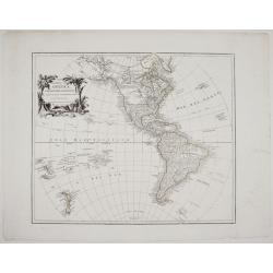
![L\'Amerique divisee en ses principaux Etats . . . [Sea of the West]](/uploads/cache/34033-250x250.jpg)
L\'Amerique divisee en ses principaux Etats . . . [Sea of the West]
America showing massive Seam of the West, Mississippi & tributaries, Colonies, excellent detail in southwest along Rio Grande, and strangely misspelled L.Winnepeg wit...
Date: Venise, 1780
Selling price: ????
Please login to see price!
Sold in 2013
L' Amerique divisee par grands Etats.
Jean Lattré, Paris-based engraver and publisher. Worked with Robert de Vaugondy, J. Janvier and R. Bonne. "" Atlas Monderne', 1771, 1783 , 1793. Jean Janvier, ...
Date: Paris, 1783
Selling price: ????
Please login to see price!
Sold
L'Amérique Suivant les dernier Mémoires de J.B.Nolin..
Map of the Western Hemispher after J.B.Nolin and published by Monhare for his Atlas Général a l'usage des colleges et maisons d'education.. Louis Joseph Mondhare publis...
Date: Paris, 1783
Selling price: ????
Please login to see price!
Sold in 2010
L'Amerique divisee Par Grand Etats by Jean Janvier.
Second edition of Janvier's map, reworked by Giovanni Antonio Rizzi-Zannoni.This is the later edition of this copper engraved map of the Americas with interesting norther...
Date: Paris, 1783
Selling price: ????
Please login to see price!
Sold in 2018
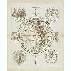
Hémisphère Oriental ou Nouveau Monde.
Scarce map of the eastern hemisphere with North and South America. The hemisphere is surrounded by the moon, sun, a sphere and celestial systems after Copernicus, Ptolemy...
Date: Paris, 1783
Selling price: ????
Please login to see price!
Sold in 2021
L'Amérique divisée en ses principaux Etats. . .
Uncommon map of the American continent after Janvier's, to whom Santini gives credit in the cartouche.This map is most notable for it's depiction of "Mer ou Baye de ...
Date: Venice, 1776 - 1784
Selling price: ????
Please login to see price!
Sold in 2012
L`Amerique Divisee en Ses Principaux Etats Assujettie aux Observations Astronomiqes...
Copper engraved map; overall size 53 x 75 cm by Robert Janvier, published by Francesco Santini and Giuseppe Antonio Remondini. This is the 2nd state of the Italian editi...
Date: Venice, 1784
Selling price: ????
Please login to see price!
Sold in 2016
L'Amerique dressee pour l'etude de la geogrpahie. . .
A 1786 map of the North America and South America by French cartographer Louis Brion de la Tour. Showing the whole of North and South America with a number of interesting...
Date: Paris, 1786
Selling price: ????
Please login to see price!
Sold in 2021
L' Amérique divisée en tous ses pays suivant, les nouvelles observations des plus celébres navigateurs. . . 1788
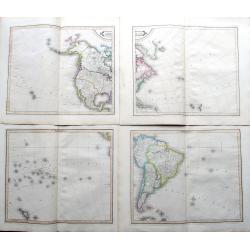
Rare wall map of the Americas and the north-west part of Africa, published by Jean and Louis Joseph Mondhare. Only mentioned by Tooley as a single chart with the one date...
Date: Paris: Mondhare et Jean, 1788
Selling price: ????
Please login to see price!
Sold in 2023
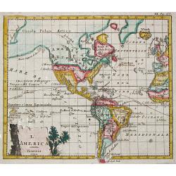
L' America.
A small map depicting the Americas, from the Italian edition of Claude Buffier's 'Geographie Universelle'.
Date: Venice, 1790
Selling price: ????
Please login to see price!
Sold

Hémisphére Occidental.
Map of Western hemisphere.Left and right a box with geographical information for spheres of different types.Prepared by Louis Brion de la Tour and published by Louis Char...
Date: Paris, 1790
Selling price: ????
Please login to see price!
Sold in 2020
Globo Terrestre Delineato sulle ultime osservazioni con i viaggi e nuove scoperte del Cap. Cook, inglese
One of four sheets that make up Cassini's terrestrial globe of 1790 which measured 34cm in diameter and delineated the tracks of all three of Captain Cook’s voyages, a...
Date: Rome, 1790
Selling price: ????
Please login to see price!
Sold in 2023
Entwurf der neuesten.. Nordwestküste von America.
Shows the most recent discoveries at the Northwest Coast of America according to Hanna, Johnstone, Wedgborough, Portlock, Dixon, Duncan, Meares and de la Quandra. Include...
Date: Falk 1791
Selling price: ????
Please login to see price!
Sold
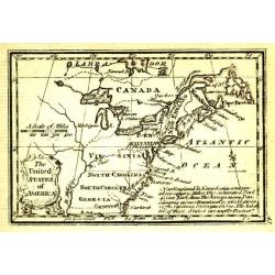
The United States of America.
Uncommon miniature map from Gibson's "Atlas Minimus, or a New Set of Pocket Maps of the several Empires, Kingdoms and States of the known World".
Date: London, 1792
Selling price: ????
Please login to see price!
Sold in 2011
L'Amerique Septentrionale et Meridionale Divisee Suivant ses Differens Pays...
Detailed four sheet wall map of America, first published by Robert De Vaugondy circa 1760.In North America, a large "Quivara et Teguaio" occupies the west along...
Date: Paris, 1792
Selling price: ????
Please login to see price!
Sold in 2017
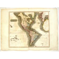
America North and South and the West Indies, with the Atlantic, Aethiopic and Pacific Oceans. . .
A Laurie and Whittle produced map of Samuel Dunn's earlier work of the Americas from A New Atlas of the Mundane System, or of Geography and Cosmography. Of particular int...
Date: London, 1794
Selling price: ????
Please login to see price!
Sold in 2018

George Washington.
Very fine steel engraving of George Washington.
Date: Amsterdam 1795
Selling price: ????
Please login to see price!
Sold
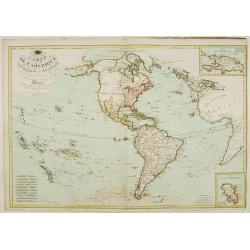
Carte de L'Amérique Septentrionale et Méridionale ou se trouvent les Découvertes les plus nouvelles..
Rare map of Asia, prepared by Hérisson after R.Bonne. Showing the tracks of Captain James Cook. Insets with the islands of Martinique and St. Domingue (Haïti)
Date: Paris 1795
Selling price: ????
Please login to see price!
Sold
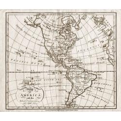
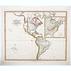
Map of America with the latest Discoveries 1795.
Map of America with the latest Discoveries 1795, by Samuel John Neele. Published May 10th 1795 by Cadell & Davies of the Strand London.Attractive small map of North a...
Date: London 1795
Selling price: ????
Please login to see price!
Sold in 2017
L'America divisa ne suoi principali Stati. . .
An attractive map of The Americas, with the first voyage of Capt. Cook (1768) depicted around South America and across the Pacific to New Zealand, which is well charted. ...
Date: Venice, 1796
Selling price: ????
Please login to see price!
Sold in 2020
A plain map of America, according to the method of the Abbe Gaultier by Mr. Wauthier, his pupil. 1797.
Engraved map. Hand colored. Outline map showing boundaries and unnamed rivers, mountains, cities, etc. Prime meridian: Ferro.
Date: Philadelphia, 1797
Selling price: ????
Please login to see price!
Sold in 2020
Carte générale et Politique de l'Amérique.
Copper-engraved map, hand-colored in outline. Well-engraved and attractive map of North and South America, from the French Atlas National, dated An VI, No. 155 in upper l...
Date: Paris, 1798
Selling price: ????
Please login to see price!
Sold in 2014
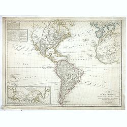
Carte de L'Amerique ..
Fine detailed map of America, with inset map of the Northern regions, including Alaska. Prepared by J.B.Poirson and Herison. Upper left hand corner 2 blocks listing the f...
Date: Paris, 1798
Selling price: ????
Please login to see price!
Sold in 2022
Carte d'Amérique, Dressée pour Instruction. . .
Dezauche's revision of the De l'Isle/Buache map of North and South America which first came out in 1722. This is rare 1800 issue. The map reflects the political changes i...
Date: Paris, 1800
Selling price: ????
Please login to see price!
Sold in 2019
![[Early folding promotial fan with map of Martin La Bastide and his project to join the Pacific Ocean and the Atlantic Ocean.]](/uploads/cache/44026-250x250.jpg)
[Early folding promotial fan with map of Martin La Bastide and his project to join the Pacific Ocean and the Atlantic Ocean.]
The fan is decorated on one side with an engraved map showing Central America and Lake Nicaragua. In the upper part is a long text on the work of Martin La Bastide and hi...
Date: France, ca. 1805
Selling price: ????
Please login to see price!
Sold in 2020
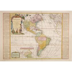
L'Amérique.
Although dated 1794/95 [l'An 3e.], the map is a copy of an earlier map which appeared in Robert de Vaugondy's 1778 atlas. Map of North and South America. By C. F. Delamar...
Date: Paris, 1794 - 1806
Selling price: ????
Please login to see price!
Sold
A NEW MAP OF AMERICA
John Cary’s important and very detailed 1806 Map of the Western Hemisphere. Prepared in 1805 by John Cary for issue in his magnificent 1808 New Universal Atlas. Alask...
Date: London, 1806
Selling price: ????
Please login to see price!
Sold in 2011
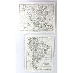
North America & South America (2 Maps)
Two separate maps published by Cadell & Davies in London in 1811. One is of North America, and the other is of South America. They are by John Pinkerton and from his ...
Date: London, 1811
Selling price: ????
Please login to see price!
Sold in 2016
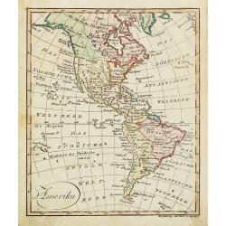
Amerika.
Nice small map of America published by Johannes Walch in his rare Allgemeiner Atlas Nach den bewährsten Hülfsmitteln und astronomischen Ortsbestimungen…, edition of 1...
Date: Augsburg, 1812
Selling price: ????
Please login to see price!
Sold in 2022
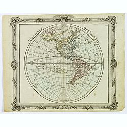
![[No Tittle] Map of the west of world.](/uploads/cache/29384-250x250.jpg)
[No Tittle] Map of the west of world.
Nice small map of the continent of America by Johannes Walch in his rare Allgemeiner Atlas Nach den bewährsten Hülfsmitteln und astronomischen Ortsbestimungen…, editi...
Date: Augsburg, 1812
Selling price: ????
Please login to see price!
Sold in 2015
America.
Fine hand-colored, engraved map of North & South America including parts of Europe, Africa and the South Pacific. Includes several geographical mistakes such as Green...
Date: Edinbourgh, 1817
Selling price: ????
Please login to see price!
Sold in 2015
Amérique ou Nouveau Continent Dressée Sur les Nouvelles Relations Découvertes et Observations, par J.B. Nolin. . .
Uncommon map of the Western hemisphere prepared by J.B.Nolin and improved by L.Denis. In the bottom an inset map of continuation of Americas west coast indicating a North...
Date: Paris, (1777) 1817
Selling price: ????
Please login to see price!
Sold in 2015
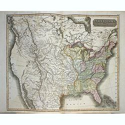
United States and additions, 1820
In this map showing the United States from coast to coast, John Thomson offers significant detail with rivers, mountains and Indian villages. Transmississippi West is tru...
Date: Edinburgh, 1820
Selling price: ????
Please login to see price!
Sold in 2013
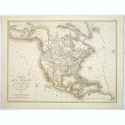
Carte de L'Amerique Septentrionale. . .
An uncommon map of North America, published shortly after the Louisiana Purchase, and the first publication of Lewis & Clark's official report.What makes this map imp...
Date: Paris, 1821
Selling price: ????
Please login to see price!
Sold in 2017
L'America Settentrionale.
Upper part of a two-sheet Italian map depicting North America. A massive Luigiana runs through the center of the United States, overlapping with a large Missouri Territor...
Date: Roma, 1821
Selling price: ????
Please login to see price!
Sold in 2020
L'America secondo le ultime osservazioni divisa ne' suoi stati principali.
Rare last edition of Cassini's map of America, showing the voyages of Captain James Cook through the South Pacific, Hawaii, New Zealand and the Northwest Coast of America...
Date: Rome, 1825
Selling price: ????
Please login to see price!
Sold in 2020
Carte d'Amérique, Dressée pour Instruction, Par Guil. Delisle et Phil. Buache, Premiers Geographes de l'Academie des Sciences. Nouvellement Revue, Augmentée et Assujetie aux Nles. . .
Unrecorded edition dated 1826. Dezauche's revision of the De l'Isle/Buache map of North and South America which first came out in 1722. This 1812 issue is completely new ...
Date: Paris, 1826
Selling price: ????
Please login to see price!
Sold in 2014

Christophe Colomb rencontre les premiers indiens.
Aquatint depicting the first meeting between Christopher Colombus and the indians.From Giulio Ferrario's work Le Costume ancien et moderne ou histoire du gouvernement, de...
Date: Milan, 1827
Selling price: ????
Please login to see price!
Sold

Allégorie de l'Amérique.
Allegory depicting America as a naked woman seated on a stone, her head leaned on her hand. Her limbs are tall and well-proportioned, she has long and black hairs and her...
Date: Milan, 1827
Selling price: ????
Please login to see price!
Sold
![[Person, 6 masks and spears]](/uploads/cache/37457-250x250.jpg)
[Person, 6 masks and spears]
Nice print showing a person, 6 masks and spears.From Giulio Ferrario's work Le Costume Ancien et Moderne ou Histoire du gouvernement, de la milice, de la religion, des ar...
Date: Milan, 1827
Selling price: ????
Please login to see price!
Sold in 2016
America entworfen von C. G. Reichard...
Unusual German map of the Americas, published in an early edition of Stielers Hand-Atlas. Dated 1816, improved 1828. Includes interesting details in North America, for e...
Date: Gotha, ca. 1830
Selling price: ????
Please login to see price!
Sold in 2015
America.
Lizar's fantastic 4-sheet map of the Americas, pubslished by Daniel Lizars son, William Hole Lizars. The map shows an unfinished coast lines towards the Northwest Passage...
Date: Edinburgh, ca 1830
Selling price: ????
Please login to see price!
Sold in 2019
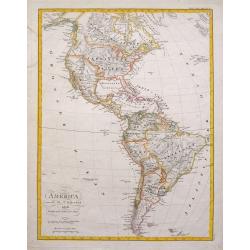
North & South America for the Elucidation of the Abbe Gaultier's Geographical Games.
An original 19th century antique map of the Americas, with an inset detail map of the eastern United States. Further enhanced with attractive hand coloring. The Abbe Gaul...
Date: London, ca 1830
Selling price: ????
Please login to see price!
Sold in 2023
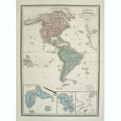
Nouvelle Carte des Ameriques Septentrionale et Meridionale
Large, skillfully engraved, and quite scarce map of North and South America, with insets at bottom of Guadeloupe, Martinique, and Plan de Cayenne.
Date: Paris, Garnier Fréres, 1832
Selling price: ????
Please login to see price!
Sold in 2011

Hémisphére Occidental.
Uncommon map of the western hemisphere. Published by F.G.Levrault, who was active in Strasbourg, Rue des Juifs, 33 and Paris, rue de la Harpe, 81.
Date: Strasbourg 1833
Selling price: ????
Please login to see price!
Sold in 2014
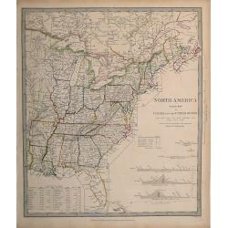
North America, Index Map of Canada and the United States,
Map published by the SDUK/Society for the Diffusion of Useful Knowledge. Shows the United States east of the Mississippi, and parts of Canada, and includes the Census of ...
Date: London, 1834
Selling price: ????
Please login to see price!
Sold in 2012
