Browse Listings
Le temple de la Mecque avec une description de tout ce qu'on y voit . . .
Fascinating engraving depicting the Muslim Kaaba at Mecca. Below the main image are two smaller vignette images of people praying. In between the two vignettes is a key (...
Publisher: CHATELAIN, H.
Date: Amsterdam, 1728
Histoire Naturelle, Civile, Et Ecclésiastique..'
First French edition, published by P.Gosse, J.Neaulme and B.Lakeman. The basic work on Japan from the second half of the 17th century when it was still forbidden to forei...
Publisher: KAEMPFER, E.
Date: Amsterdam, 1729
Insularum Moluccarum Nova description.
Exquisite map of the famous Spice Islands based on the islands described by Jan Huyghen van Linschoten. This map was the first large scale map of the region and depicts t...
Publisher: SCHENK, P. / VALK, G.
Date: Amsterdam, 1730
Colossus Monarchic. Statua Danielis
Fantastic double page allegorical map of a colossus figure representing the great world empires as Daniel interpreted in Nebuchadnezzar's dream. The warrior stands stolid...
Publisher: BAECK, E.
Date: Augsbourg, 1730
Lo Stati Presente di Tutti i Paesi e Popoli del Mondo..
This most uncommon work provides an interesting focus on the dissemination of the outline of Japan provided by Kaempfer. Beside the description of Japan, the book include...
Publisher: ALBRIZZI, G.
Date: Venice, 1734
A large draught of the North part of CHINA. Shewing all the passages and chanells into the harbour of CHUSAN. / To the honourable the court of mannagers for the UNITED TRADE to the EAST INDIES.
A very fine sea chart of China's Zhejiang Province, from the celebrated Third Book of 'The English Pilot'This elegant and large captures China's modern day Zhejiang prov...
Publisher: THORNTON, J.
Date: London, William Mount & Thomas Page, 1734
Potentissimo Borussorum Regi Friderico Wilhelmo Maiestate, Fortitudine Clementia Augustissimo Hancce Lithuaniam Borussicam : in qua luca coloniis Salisburg., ad incolendum Regio nutu concessa chorographice exhibentur D. D. D. Regiae Suae Maiestatis.
Large 2-sheet map of an area of Lithuania and Eastern Prussia (Russian province of Kaliningrad) stretching from Klaipeda (Memel) in the north to Goldap in the south (a to...
Publisher: HOMANN HEIRS
Date: Nuremberg, 1735
Province de Fo-Kien.
Important map of Fujian Province, showing the east coast of China and the west coast of Taiwan. With a quite elaborately pictorial cartouche featuring a rococo chinoiseri...
Publisher: ANVILLE, J.B.D'
Date: Paris, P.G. Le Mercier, 1735
Royaume de Corée.
With a quite elaborately pictorial cartouche, engraved by G.Kondet. One of the earliest separate maps of Korea. Jean Baptiste Bourguignon d' Anville (1697-1782), French c...
Publisher: ANVILLE, J.B.D'
Date: The Hague, 1737
A Map of the British Empire in AMERICA with the French, Spanish and Hollandish Settlements Adjacent Thereto. by Henry Popple. / Nouvelle Carte Particuliere de L'Amerique . . .
The four sheet Dutch edition of Popple's monumental map of North America, in mint condition. Encompassing the West Indies, Florida, Louisiana, Texas and Central America.T...
Publisher: POPPLE,H / MORTIER, J.& C.
Date: Amsterdam, ca. 1737
Province de Fo-Kien. [Includes West Coast of Taiwan]
Important map of Fujian Province, showing the east coast of China and the west coast of Taiwan. It shows that for the Manchu Qing, only the western half of Formosa was co...
Publisher: ANVILLE, J.B.D'
Date: The Hague, H. Scheurleer, 1737
Bern in der Schweitz.
Very fine panoramic of Bern. With a numbered key (1-25) of principal buildings in town.
Publisher: WOLFF HEIRS, J.
Date: Augsburg, 1740
Paris.
A spectacular panoramic view of Paris, with legends numbered from 1-70 in French. With the title in a banderol.After a design by Friedrich Bernhard Werner (1690-1776) who...
Publisher: WOLFF, J.
Date: Augsburg, ca. 1740
Paris.
A spectacular panoramic view of Paris, with legends numbered from 1-70 in French. With the title in a banderol.After a design by Friedrich Bernhard Werner (1690-1776) who...
Publisher: WOLFF, J.
Date: Augsbourg, ca. 1740
Les Provinces confederées du Pais-Bas
The first wall map of the Seven Provinces of 1651, re-issued as 'Stoel des Oorlogs' by Covens & Mortier. The first issue of the present wall-map is known to be includ...
Publisher: COVENS / MORTIER
Date: Amsterdam, c. 1740
Algemene kaart van Suriname Algemeene kaart van de Colonie of Provintie van Suriname : met de rivieren, districten, ontdekkingen door militaire togten. . .
Uncommon large scale map of of Suriname, indicating the different plantations and their owners. Consists of two glued-together sheets. Completed with funding by the Direc...
Publisher: DE LETH, H.
Date: Amsterdam, 1740
Carte particulière des environs de St Peters-bourg. . . / Plan de la ville faubourg et environs de St Petersbourg. . . / Carte pour l'intelligence de la guerre de Moscovie et de Suede. . .
A scarce and unusual plan of Saint Petersburg shown at a large scale and also, in a separate compartment, shown in its geographical context between the Gulf of Finland an...
Publisher: DE BEAURAIN
Date: Paris, c.1741
La Rareté de Prague / De Praagsche Rarirkiek.
A rare separately issued broadsheet satirising Cardinal Fleury, Louis XV of France, European heads of state and politicians at the time of the War of the Austrian Success...
Publisher: COOPER, T. / LAM
Date: Amsterdam, 1741
Imperii Russici et Tartariae Universae tabula novissima.
Decorative and rare map covering Russia, Tibet, China, Tartary, Korea, Taiwan and Japan prepared by J. M. Hasius. The sea between Japan and Korea is mentioned Mare Orient...
Publisher: BROEDELET, J.
Date: Utrecht, 1743
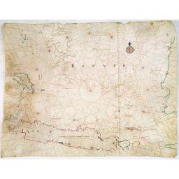
[Manuscript chart on vellum of the Java Sea]
One of the few manuscript charts on vellum in private hands, signed by Isaac de Graaf. ORIGINAL MANUSCRIPT MAP IN RED, GREEN AND BLACK INK showing the Java Sea centered o...
Publisher: GRAAF, I.
Date: Amsterdam, 1743
Allerneuester geographisch- und topographischer Schau-Platz von Africa und Ost-Indien. . .
An early issue of this important book by Johann Wolfgang Heydt's describing the Dutch factories, settlements and stations at the hands of the Dutch East India Company in ...
Publisher: HEYDT, J. W.
Date: Wilhermsdorf, Tetscher u. Nürnberg, Homanns Erben, 1744
Gustaaf Willem Baron van Imhoff.
Decorative portrait of Gustaaf Willem Baron van Imhoff, who was Governor for the V.O.C. (Dutch East Indian Company) in Indonesia.
Publisher: TANJÉ, P.
Date: Amsterdam, 1745
ATLAS RUSSICUS mappa una generali et undeviginti specialibus vastissimum Imperium Russicum cum adiacentibus regionibus [repeated in French].
After an unnumbered general map of Russia there are 13 numbered maps that cover European Russia (scale 1, 1.527.000). The other (last) 6 maps cover Asian Russia (Siberia,...
Publisher: Akademie von Wissenschaften
Date: St Peterburg, Akademie von Wissenschaften. 1745
Le Neptune Oriental ou routier general des Cotes des Indes orientales et de la Chine..
THE RARE FIRST EDITION of this important French Sea Atlas of the Red Sea, India, the East Indies, Indochina and Formosa.2° (640 x 490 mm). Title printed in red and b...
Publisher: D'APRES DE MANNEVILLETTE.
Date: Paris, 1745
Carte de la coste orientale de la Chine depuis Amoy, jusqu'à Chusan avec une partie de l'Isle Formose [with] Plan du port d'Amoy ou Emouy.
Important French of the China Sea with the coast of Northern China, including a large depiction of Formosa.Latitude and longitude scales, compass rose and system of rhum...
Publisher: D'APRES DE MANNEVILLETTE.
Date: Paris, Jean-François Robustel, 1745
Le Théâtre du monde dédié au roi contenant les cartes générales et particulières des royaumes et états qui le composent.
The present example of the Théâtre du monde is the reissue of 1746 by Jean-Baptiste Nolin II. This scarce atlas is illustrated with 123 maps mostly double-page, in orig...
Publisher: NOLIN, J.-B.
Date: Paris, 1746
Kantong [The Dutch Folly Fort off Canton]
Charming 18th water color on paper depicting The Dutch "Folly Fort" off Canton. Probably made by a western artist visiting China.Forts were built in several pla...
Publisher: ANONYMOUS
Date: Canton?, c.1750
Isola Di Ceylan. (Manuscript map of Sri Lanka)
Manuscript map of Sri Lanka (Ceylon). Inland filled with a good number of place names, mountains.
Publisher: ANONYMOUS
Date: Italy, ca. 1750
Painting of Tupinamba cannibals of Brazil set in a local landscape on wooden panel.
The iconography of this painting is actually directly derived from one of the plates illustrating the third volume of "Grands Voyages" Theodore Bry devoted to B...
Publisher: Follower of Jan van Kessel
Date: ca. 1750
Nangasakij.
Charming 18th watercolor on paper depicting a panoramic view of Nagasaki and the factory Deshima of the V.OC. Probably made by a Western artist visiting Japan.RARE. Due ...
Publisher: ANONYMOUS
Date: c.1750
Nieuwe Pas=Caart strekkende van Pta Cataon tot Pta. Lamtoan, langs de kusten van Cochinchina, Tonquin, Quangsi en Quantung [?] van Macao.
A finely engraved and detailed chart of Vietnam reaching till Macao and present-day Hong Kong..Very rare: only included in 6th volume (so-called secret atlas) of Van Keul...
Publisher: VAN KEULEN, J.
Date: Amsterdam, 1753
Pas-Kaat vaneen gedeelte van de Aethiopische Zee behelsende de Kusten Zanguebar, Ajan en Abex, en een gedeelte van de Arabische Kust. . .
A finely engraved and detailed chart of most eastern tip of Africa, including Somalia, Djibouti, Yemen, Mauritius, and many other islands in the Indian Ocean.Very rare: o...
Publisher: VAN KEULEN, J.
Date: Amsterdam, 1753
Carte des Possessions Françoises et Angloises dans le Canada et partie de la Lousiane. . .
Proof state. Here without the decorations around the title cartouche in the what is called in the reference books the first state the cartouche in upper left . No double ...
Publisher: LONGCHAMPS, le Sieur.
Date: Paris, 1756
Carte de l'Amerique Septle. Pour Servir a l'intelligence de la Guerre entre les Anglois et les Insurgents...
Second state of this extremely rare separate publication. This separately issued map is one of the most beautiful of the thirteen American Colonies from the Revolutionary...
Publisher: BEAURAIN, Jean Chev. de
Date: Paris, ca. 1756
Belgica Foederata. . .
Decorated with a cartouche showing the coats of arms of Zeeland, Holland, Utrecht, Friesland, Groningen and Overijssel. T.C. Lotter married M. Seutter's daughter in 1740 ...
Publisher: LOTTER, T. C.
Date: Augsburg, ca.1760
Karte von den Kusten von Arabien . . .
Manuscript map of Arabia. A close copy of Bellin's map of the Arabian Peninsular. In the lower right margin "Tom A, vol V."A title cartouche in lower left corne...
Publisher: ANONYMOUS
Date: Germany, ca. 1760
Pianta Geografia delle Isole di Malta, e Gozo della Sagra Religione Gerosolimitana di S. Giovanni delineata, ed incisa in quest anno 1761.
A rare map of Malta and Gozo printed by the priest Antonio Bova (1688 - 1775), who was active as engraver in Palermo ca. 1727-1773. He produced cartographic engravings, s...
Publisher: BOVA, A.
Date: Bova Ant., Palermo, 1761
Nader prolongatie van het Octroy voor de Westindische Compagnie voor den tyd van nog dertig jaaren. . .
A proclamation by the Dutch States General, dated 1761, extending the charter of the Dutch West India Company for another thirty years. Like the 1730 proclamation, it has...
Publisher: SCHELTUS, I.
Date: Amsterdam, 1761
[MANUSCRIPT] Carte nouvelle de la Crimée et des pays circonvoisins.
Beautiful manuscript map on paper. Showing the northern part of the Black Sea region with Crimea.Interesting are the border lines of "New Serbia", shown in the ...
Publisher: ANONYMOUS
Date: ca. 1752-1764
Carta Topografica dell' Isola Del Maritaggio di Monsieur le Boble per la prima volta. Tradotta dal francese in italiano.
Second Italian printing of Eustache Le Noble’s "Carte de l’isle de marriage." The book’s text offers instructions on how to reach this matrimonial island ...
Publisher: LE NOBLE, E.
Date: Cosmopoli, 1766
The Coast of New Found Land From Salmon Cove to Cape Bonavista. . . [together with] The Coast of New Found Land from Cape-Raze to Cape St-Francis.
Two charts showing the coast of New Found Land from Salmon Cove to Cape Bonavista and from Cape-Raze to Cape St-Francis. With inset chart of Trinity HarborGrierson publis...
Publisher: MOUNT & PAGE / BOULTER GRIERSON
Date: Dublin, 1767
The Harbour of Casco Bay and Islands Adjacent Bt Capt. Cyprian Southicke.
The earliest printed chart of Casco Bay, an inlet of the Gulf of Maine on the southern coast of Maine, New England. First issued in 1720 by Mount and Page, it remained in...
Publisher: MOUNT & PAGE / BOULTER GRIERSON
Date: Dublin, 1767
Vue de la Rivière d'Endeavour sur la Côte de la Nouvelle Hollande ou le Vaisseau fut mis à la bande. [Tome IV Pl. 1ère.]
The first known landscape drawing of the east coast of Australia. A View of the Endeavour River, on the coast of New Holland, where the ship was laid on shore, in order t...
Publisher: COOK, Captain James.
Date: Paris, 1773
Le globe terrestre representé en deux plans-hemispheres, Dressé sur la Projection de Mr. De la Hyre...
“This splendid GlobeTerrestre originally published by J.B. Nolin is one of the finest large-scale world maps to be produced and is a fitting bridge between the geograph...
Publisher: NOLIN, J.-B. / CREPY.
Date: Paris, c. 1780
Par permission sur l'aprobation des médecins du roi...la véritable Boule de Mars...
Printed broadsheet promoting the "Boule de Mars" (March Ball) produced and sold by Renault in Nancy and Paris. Ornated with the royal coat of arms of France. Pr...
Publisher: Advertising placard for the
Date: Paris, ca.. 1780
La Pologne Dressée sur ce qu'en ot donné Starovolsk, Beauplan, Hartnoch. . .
Large map of Poland, Lithuania, Belarus and part of Ukraine. The map is filled with detail and decorated with a title cartouche flanked by mythological figures.According ...
Publisher: L'ISLE, G. de. / BUACHE, Ph.
Date: Paris, 1773 - 1780
Nouvelle Mappa Monde.
State 2 of this fine double hemisphere world map, from an unusual perspective, with a "Mer de L'Ouest" or "Sea of the West". Paris is located at the c...
Publisher: SANTINI, P. / REMONDINI, M.
Date: Venice, 1776 - 1784
Carte D'Amerique Divisée en ses Principaux Pays. . .
Rare. Uncommon and decorative wall map of America, prepared by Clouet. With superb decorative borders, 170mm wide at the sides and 150mm at the bottom, containing twenty ...
Publisher: CLOUET, J. B. L. abbé / MONDHARE, L.
Date: Paris, Cadiz, 1785
[Crimea]. Carte de la Cromée.
Mapmaker, Captain Jan Hendrik van Kinsbergen (1735-1819). Published by H. Friesman in 1787. This map first appeared in 1776 and was the first Russian map of the newly ann...
Publisher: KINSBERGEN, J.H. van
Date: Amsterdam, H. Frieseman, 1787
Calendrier de la cour, tiré des éphémérides, pour l'Année bissextile.. / Notebook bearing silver plates with the VOC monogram.
A personal gift, only made for the trustees of the V.O.C. The silver plate was probably made by Drick van Hengel and Company because an entry in the diary of mintmaster J...
Publisher: HÉRISSANT, Ve.
Date: Paris, 1787
Carte d'Europe . . .
Rare. Uncommon and decorative wall map of Europe, prepared by Clouet. With superb decoration including a wonderful rococo border with vignettes describing historical scen...
Publisher: CLOUET / MONDHARE
Date: Paris, 1785-1788
Carte d'Europe divisée en ses Empires et Royaumes.
Uncommon and decorative wall map of Europe, prepared by Clouet. Superb decoration including a wonderful rococo border with vignettes describing historical scenes. Below t...
Publisher: CLOUET / MONDHARE.
Date: Paris, Mondhare, 1788
Tableau des guerres de Frédéric le Grand: ou plans figurés de vingt-six batailles rangées, ou combats essentiels donnés dans les trois guerres de Silésie. . .
The book includes a large folded map "Tableaux des Guerres de Frédéric le Grand", showing a map of Prussia, with present-day Poland and Eastern Germany surrou...
Publisher: MULLER, L.
Date: Potzdam, Strasbourg, Paris, 1788
L' Amérique divisée en tous ses pays suivant, les nouvelles observations des plus celébres navigateurs. . . 1788
Rare wall map of the Americas and the north-west part of Africa, published by Jean and Louis Joseph Mondhare. Only mentioned by Tooley as a single chart with the one date...
Publisher: MONDHARE, L,J. / J.
Date: Paris: Mondhare et Jean, 1788
Map of Louisiana from D'Anville's Atlas.
This map presents a highly detailed treatment of the region from Cabo Del Norte to the Apalachiola River, centered on the mouth of the Mississippi and extending inland to...
Publisher: BOWEN, Th.
Date: London, 1788
CH'ONHA CHIDO [Atlas of all under Heaven]
The Ch’onha chido [Atlas of all under Heaven] is a late 18th century copy of the traditional Korean atlas produced in the early Choson dynasty (1392-1910). One of the m...
Publisher: Anonymous
Date: Korea, ca. 1790
[Tableau Général de l'Empire Ottoman]. 11 plates with the panoramic view of Mecca.
A collection of 11 engraved plates (3 folding) from "Tableau Général de l'Empire Ottoman", Paris, Imprimerie de Monsieur, 1790, comprising the famous panorami...
Publisher: MOURADJA D'OHSSON, Ignace.
Date: Paris, 1790
[ LANDSKROON ]. Oranda Fune no zu [= Depiction of a Dutch Ship].
A very large and extremely detailed Japanese drawing on rice paper of a Dutch ship at the artificial island Deshima, the VOC's outpost in Nagasaki harbour. In the drawing...
Publisher: ANONYMOUS
Date: Japan, Kansei 4, 2nd month, 9th day, 30 March? 1792
Mapa De la parte de la Isla Formosa sa perteneciente al Emperadotde la China sacado por Ord. De S.M.
Extremely rare map of the west coast of Taiwan, the Punghu or Pescadore Islands, and the Fokien or Fujian coast of China. Several ancient Taiwanese cities are noted, incl...
Publisher: DE LA CONCEPTION, J.
Date: Manilla, Seminario Conciliar, y Real de San Carlos, 1788-1792
Imperium Russicum, cum regionibus adiacentibus duabus Tabulis ex optima quae A. 1784 tribus foliis comparavit Mappa geographica, aliisque subsidiis delineatum a C. Mannert, Tabula Ima. . .
A detailed map of the European part of the Russian Empire. Scarce map. Copper etching by C. Mannert and edited by Adam Gottlieb Schneider and Johann Christoph Weigel. Man...
Publisher: MANNERT, C.
Date: Nuremberg, 1794
A Plan of the city and harbour of Macao : a colony of the Portugueze, situated at the southern extremity of the Chinese Empire. . .
A large chart of Macao engraved by Benjamin Baker (fl. 1766-1824) and published by George Nicol. The town is shown in detail, with a 37-point key in English listing Forts...
Publisher: NICOL, G.
Date: London, 1796
New Jersey entworfen von D.F. Sotzmann. Hamburg bey Carl Ernst Bohn 1796 . . . NO.VIII
Extremely rare map of New Hampshire prepared by Daniel Friedrich Sotzmann for Christopher Ebeling's "Erdbeschreibung von Amerika", a project ended after only te...
Publisher: SOTZMANN, D.F.
Date: Hamburg, Carl Ernst Bohn, 1797
Rhode Island entworfen von D.F. Sotzmann. Hamburg bey Carl Ernst Bohn 1798 . . . NO.V
Extremely rare map of Rhode Island prepared by Daniel Friedrich Sotzmann for Christopher Ebeling's "Erdbeschreibung von Amerika", a project ended after only ten...
Publisher: SOTZMANN, D.F.
Date: Hamburg, Carl Ernst Bohn, 1797
SETTSU MEISHO ZUE. Illustrations of famous places in Settsu.
Settsu Meisho Zue was printed in two series of 8 and 4 volumes. The principal illustrator was Takehara Shunchosai, but many illustrations in the 4 volumes supplement are ...
Publisher: AKIZATO, Rito - TAKEHARA, Shunchosai
Date: Osaka, Yanagiwara Kibei, Kansei 8-10 or 1796-1798
La nuova Zelanda delineate sulle ultima osservazioni del Capitan Cook.
First edition on laid paper Cassini’s splendid early map of New Zealand, being the most decorative version of Captain Cook's map of New Zealand, published in the very s...
Publisher: CASSINI, G.M.
Date: Rome, 1798
La parte orientale dell' antico.. messico con la Florida..
A splendid two-sheet map of Mexico, including California, Arizona, New Mexico, part of Texas, Baja California and Mexico (west part) and of the Southeast Part of the US, ...
Publisher: CASSINI, G.
Date: Rome, 1798
Charta öfver Storfurstendömet Finland på Friherre S. G. Hermelins Anstalt och Omkostnad. Sammandragen och författad af C. P. Hällström. Philos. Magister och Auscultant i Kongl. BergsColl. 1799.
This is the beautiful set of key map and separate maps of Samuel Gustav Hermelins map of Finland. The maps have been engraved by Fredrik Akrel, a very skilled and product...
Publisher: HERMELIN, SAMUEL GUSTAV
Date: Källa: J.Strang & E.- S. Harju: Suomen karttakirja 1799
New Yok entworfen von D.F. Sotzmann. Hamburg bey Carl Ernst Bohn 1799 . . . NO.VII
Extremely rare map of New York prepared by Daniel Friedrich Sotzmann for Christopher Ebeling's "Erdbeschreibung von Amerika", a project ended after only ten map...
Publisher: SOTZMANN, D.F.
Date: Hamburg, Carl Ernst Bohn, 1799
Reis-kaart van het Britsche gezantschap van Hang-choe-foe naar Quang-choe-foe of Kanton in China.
Uncommon map of eastern part of China, showing a journey of the English Embassy from Hangzhou (south of Shanghai) to Guangzhou (Canton). The maps is giving a wealth of in...
Publisher: ANONYMOUS
Date: Netherlands, c.1800
Erfolgte Kapitulation zwischen dem General Bonaparte und den Gross Leister von Malta. Vor der Hauptstadt Walette zu Maltha, am 10 Juni 1798.
Copper engraving with three scenes and one portrait on one sheet. In upper a view of Bonaparte arriving at Valletta. Published in "Allgemeine Welt-Chronik oder neue ...
Publisher: GOTTFRIED BAUMANN & CO.
Date: Zittau, 1798-1800
Carte des côtes du Golfe du Mexique compris entre la pointe sud de la presqu'Ile de la Floride et la pointe nord de la presqu'Ile d'Yucatan: Dresée d'après le observations et las plans des espagnols, et publièe par ordre du Minstre de la Marine . . .
Detailed and important early chart of the Gulf Coast and Florida and dated 1800. First French edition of "the first printed [map] to show and name Galveston Bay&quo...
Publisher: DEPOT GÉNÉRAL DE LA MARINE
Date: Paris, 1800
[ Manuscript map of the Ligurian coast from Pietra to Genova ].
Very detailed French manuscript map of the Ligurian coast from Pietra and Finale, Savone to Genoa with the Maritime Alps in the background. The Liguria coast borders to n...
Publisher: ANONYMOUS
Date: France, ca. 1790-1800
Kaart Van Nieuw Zeeland in de Jaaren 1769 en 1770 bezogt door den Luitenant J. Cook met het Schip De Endeavour.
A uncommon issue of this key map of New Zealand from the Dutch edition of Cook's map of New Zealand, published in 'Reize rondom de Waereld door James Cook', a Dutch editi...
Publisher: COOK, J.
Date: Leyden, Amsterdam & The Hague: Honcoop, Allart & van Cleef, 1795-1801
Guyana, Surinam, Amapa.
Very rare Ottoman printed map of Guyana, Suriname and Amapa. With Trinidad, inset map of the mouth of the Rivers Essequibo, Courantyne, Suriname with Paramaribo, etc.From...
Publisher: RAIF EFENDI
Date: Üsküdar (Istanbul), 1803
A Map of the Environs of Constantinople Drawn from a great number of accurate astronomical & geographical manuscripts and printed documents, by A. Arrowsmith 1801 and 1804.
Arrowsmith’s large and detailed map of the Ottoman Empire and the Black Sea, with Cyprus, Crete and the Greek Islands in the Mediterranean Sea, Albania, Bosnia and Herz...
Publisher: ARROWSMITH,A.
Date: London, No.10 Soho Square, 4th September 1804
Morokoshi Meisho Zue [Illustrated Description of Famous Sites of China].
Published in Osaka, Kawachiya Genhichiro, et al. [8 book sellers], slightly later issue but apparently in Edo period, using all the same woodblocks of original first edit...
Publisher: OKADA GYUKUZAN, OKA YUGAKU, OHARA TOYA MINSEI
Date: Osaka, Edo, slightly later than Bunka 3, year of the tiger - 1806
Boats of the Friendly Islands. [together with] A Sailing Canoe of Otaheite.
Early view of Queen charlotte's sound, taken from "Views in the South Seas" being a very important and early views depicting scenes encountered while employed a...
Publisher: WEBBER, J.
Date: London, Boydell and Co., 1808
The narta, or Sledge for burdens in Kamtschatka.
The narta, or Sledge for burdens in Kamtschatka, taken from "Views in the South Seas" being a very important and early views depicting scenes encountered while ...
Publisher: WEBBER, J.
Date: London, Boydell and Co., 1808
Par Brevets. / Eau admirable de Cologne, de A. Farina, ancien Distillateur de Cologne, breveté, Place Juliers, N°11.
Advertising Broadsheet promoting the toilet water "Eau de Cologne". Ornated with the royal coat of arms of France and 2 two-headed eagles. With the printed sign...
Publisher: FARIBA, A.
Date: After 1810
Carte Generale de la Terre Napoleon (à la Nouvelle Hollande)... par M.L. Freycinet an 1808.
Fine map of part of Australia prepared by Louis Freycinet during his voyage under Captain Thomas Baudin in 1800-1803. The longitude is calculated from Paris.The cartouche...
Publisher: FREYCINET, M.L.
Date: Paris, Imprimerie Royale, 1811