Pascaerte van OOST INDIEN
P.O.R.
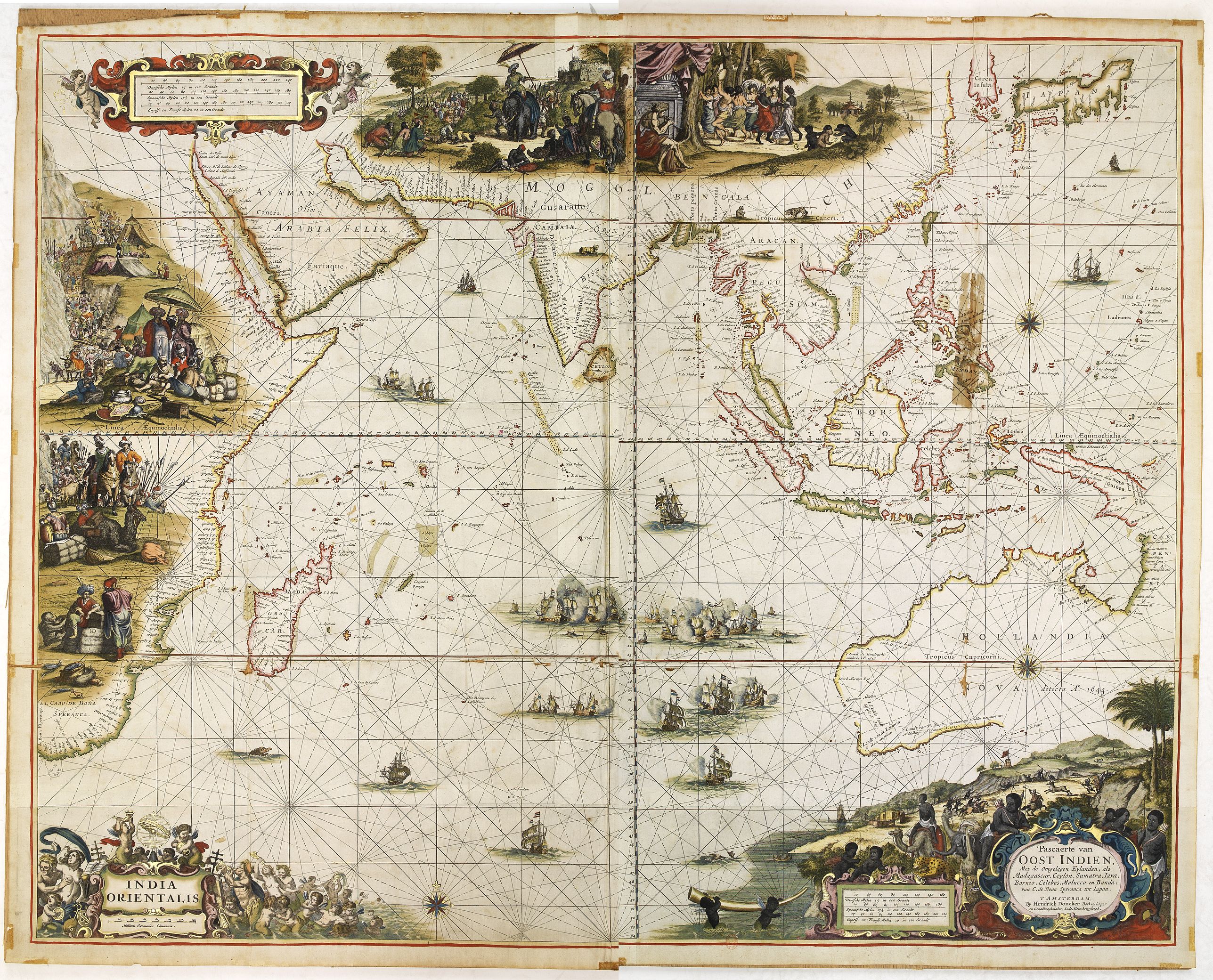
Extremely rare chart on Mercator projection of the Indian Ocean - showing Tasman's discoveries on the Australian continent - including the territory where the V.O.C. was active, from the east of Africa to the western and southern coasts of Australia, with C. of Good Hope, and the Korean peninsula and Japan in the north.The cartographic details first engraved by Hendrick Doncker ca. 1659, with added decorations by Johannes Leupenius shortly before or in 1664. Dating the chart itself is not possible other than roughly; generally the date of (before 1664) is applied, based on the advertisement in "Nieuw Groot Stuurmans Straetboeck" van 1664 : Seeve groote Paskaerten... een dito van Oost Indien... alle soo op pargament als papier gedrukt, en bequaem om in Vergulde lysten geset en tot cieraed in de huysen gebruykt te werden.". So Doncker advertised both paper and vellum versions. Jason Hubbard has to date only recorded one case of the chart on vellum (with all four sides cut short, as if removed from a frame with a sharp knife), the remaining size of the wall map is 718 X 893 mm. Only a handful of copies on paper are recorded.
The chart includes details of the Dutch discoveries in Australia of Hartog (1616); Houtman (1619); the Leeuwin (1622) and Carstenszoon (1623); as well as de Wits (1628); and Tasmans second voyage in 1644 (Northern Australia) and Peter Nuyts exploits (1627). On the eastern part "HOLLANDIA NOVA detecta A° 1644" is named. Along Australia's coastline we find the following names : CARPENTARIA, 't Hooge Landt, Rivier van Spult, Rivier Batavia, Water plaets, Rivier Coen, Vereenighde Riv, Water Plaets, Rivier Nassau, Staten Rivier, Van Diemens R, R. Caron, R. Maetsuyker, C. van Diemen, R. van Alphen, Abel Tasman's Riv, C. Vanderbilt Lin, C. Marie, Limmens bocht, Arnhems-Landt, Crocodrils Eyland, Vuyle hoeck, Baya van Diemen, Van Diemens Landt. Tasmania is not included.
