Browse Listings in Australia & Oceania
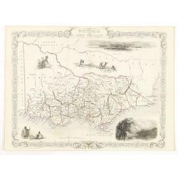
Victoria or Port Phillip.
Decorative steel engraved map of Victoria or Port Phillip, surrounded by illustrations of Melbourne, indigenous people and the Glenelg River. Interlocking border design. ...
Date: London, ca. 1851
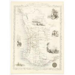
Western Australia. Swan River.
Decorative steel engraved map of part of Western Australia and Swan River, surrounded by illustrations of Perth, Aborigines and sheep shearing. With the seal of Western A...
Date: London, ca. 1851
![[Collection of six maps of Australia and New Zealand.]](/uploads/cache/48412-250x250.jpg)
[Collection of six maps of Australia and New Zealand.]
Collection of maps including 6 engraved maps by 19th century German, French and English cartographers depicting Australia and New Zealand.This made to order atlas contain...
Date: Germany, 1832-1852

(The City And Harbour Of Sydney From Near Vaucluse.)
One of the most sought after views of the city and harbour of Sydney seen from Near Vaucluse, 1852. Magnificent hand-colored tinted lithograph and finished by gum-Arabic....
Date: London, J. Hogarth, 1852
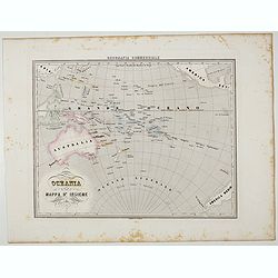
Oceania.
Uncommon map of the Pacific Ocean prepared by Francesco Costantino Marmocchi. Above the map "Geografia Commerciale". From "Il Globo Atlante di carte Geogra...
Date: Genova, Paolo Rivara fu Giacomo, 1858
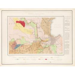
Geological Survey of Victoria.
The portfolio with the gold stamped title "Geological Survey of Victoria", contains 51 sheets maps. There is a pocket attached to the inside front cover contain...
Date: Mining and Geological Department, Melbourne, ca. 1864
![[Australia and New Zealand map with Ottoman script.]](/uploads/cache/44313-250x250.jpg)
[Australia and New Zealand map with Ottoman script.]
Post card size map in Ottoman script showing Australia and New Zealand prepared by Mehmet EŞREF in a small atlas : عمومولاياةىشهانيىحاوىكوچكاطلاس [Umum-i vilayat-ı Şaha...
Date: Istanbul, 1325 or 1909
![[Australia, New Zealand and Oceania map with Ottoman script]](/uploads/cache/44319-250x250.jpg)
[Australia, New Zealand and Oceania map with Ottoman script]
Postcard size map in Ottoman script showing Australia, New Zealand and Oceania prepared by Mehmet EŞREF in a small atlas : عمومولاياةىشهانيىحاوىكوچكاطلاس [Umum-i vilayat...
Date: Istanbul, 1325 or 1909
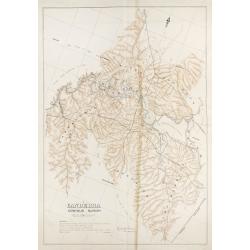
Canberra Contour Survey.
An important large-scale folding map by Charles Scrivener of the present-day city of Canberra, featuring contour lines and elevation data, created as part of the prelimin...
Date: Department of Lands, Sydney N.S.W. July, 1909
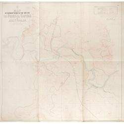
Map of contour survey of the site for the federal capital of Australia.
Map of contour survey of the site for the federal capital of Australia / drawn on stone by Messrs. O. Fischer and A.G. von Stach under direction of E.S. Vautin ; drawn on...
Date: Department of Lands, Sydney, 1910
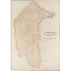
Topographical map of the Federal Territory, Australia.
This map, published by the New South Wales Department of Lands in Sydney in 1910, depicts the Federal Territory—the area designated to house Australia’s future federal ca...
Date: Sydney, Dept. of Lands, 1910
![[Lot of 2 maps] Map of part of New South Wales Australia shewing position of Commonwealth Territory / Map of New South Wales Australia…](/uploads/cache/49457-250x250.jpg)
[Lot of 2 maps] Map of part of New South Wales Australia shewing position of Commonwealth Territory / Map of New South Wales Australia…
Two maps depicting the region of New South Wales and the area designated as the future Commonwealth Territory (which later became the Australian Capital Territory).The fi...
Date: Department of Lands, Sydney NSW, 1911
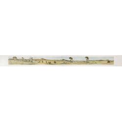
Cycloramic view of Canberra capital site, view looking from Camp Hill / … view looking from Vernon.
Showing an extensive panoramic view of the site of Canberra with various features named. Very large colour photo-mechanical print. Printed by John Sands Ltd [Syd].This 5 ...
Date: Sydney, John Sands, 1911
![[Lot of Five Pacific Brand crate labels]](/uploads/cache/45706-250x250.jpg)
[Lot of Five Pacific Brand crate labels]
1917 JOHNSTON FRUIT COMPANY - [The price is for the lot of five]. Advertising map with a lemon in the center.
Date: Santa Barbara, 1917
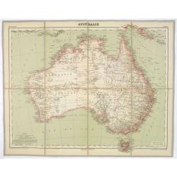
AUSTRALIE
Detailed folding maps of Australia. In upper left corner "Atlas Universal" and in upper right corner "Carte 78".In lower left "Dessiné: le trait ...
Date: Paris, ca. 1930

Histoire Socialiste.
Text includes “Imp. Centre de Propagande, des Républicains Nationaux, 102, rue Amelot, Paris (XIe), ou l’on peut se procurer cette affiche. Cette affiche ne peut être pla...
Date: Paris, 1931
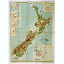
Bartholomew's Touring Map of New Zealand.
A full color map. 'Reduced Survey Map of New Zealand, colored to Show Height of Land'. With insets of Auckland Harbour, Wellington and Port, Christchurch and Port Lyttelt...
Date: Edinburgh, 1935
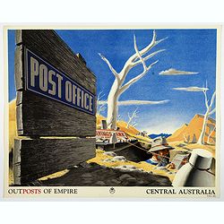
Outposts of Empire. Central Australia.
A large colored lithograph by John Vickery (1906-1983), he was an Australian artist. He worked in the fields of painting, illustration and advertising. He is the only Aus...
Date: London, ca 1937
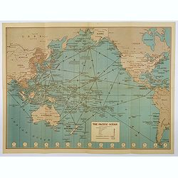
Hammond's War Map.
Drawn and published in early 1942 by C. S. Hammond & Co. in direct response to the bombing of Pearl Harbour, this is one of the most detailed USA maps of the Pacific ...
Date: New York, 1943
