Persian Gulf naming dispute
The sea bordering Iran (Persia), Iraq, Kuwait, Saudi Arabia, Bahrain, Qatar, United Arab Emirates and Oman, with an area of 240,000 km, is in Western countries normally referred to as the Persian Gulf.
The Persian Gulf naming dispute concerns the name of the body of water known as the Persian Gulf after Persia (the Western exonym for Iran). This name has become contested by some Arab countries since the 1960s in connection with the emergence of pan-Arabism and Arab nationalism, resulting in the use of "Arabian Gulf" (Arabic: الخليج العربي) as well as the "Gulf".
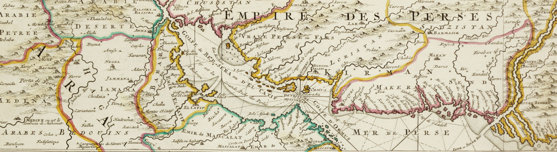
On almost all maps printed before 1960, and in most modern international treaties, documents and maps, this body of water is known by the name "Persian Gulf".
It was referred to as the Persian Gulf by Arab historians and geographers, including the Arab Christian writer Agapius, writing in the 10th century.
Sir Charles Belgrave (British adviser to the ruler of Bahrain) was "the first westerner to use and advocate the name 'Arabian gulf', first in the journal Soat al-Bahrain (Voice of Bahrain) in 1955."
With the rise of Arab nationalism during that decade, some Arab countries, including the ones bordering the Gulf, adopted widespread use of the term الخليج العربي (al-Khalīj al-ʻArabī; Arab Gulf or Arabian Gulf) to refer to this waterway.
The decreasing influence of Iran on the political and economic priorities of the English-speaking Western World, led to increasing acceptance, both in regional politics and the mostly petroleum-related business, of the new alternative naming convention "Arabian Gulf" in Arab countries.
Old maps
The area was well known by early local navigators and from the beginning of the 16th century by Portuguese, British, and Dutch traders. Useful bathymetric charts and sailing instructions appeared when the British commenced collection of hydrographic, meteorological, and oceanographic data at the end of the 18th century. The Danish Fisheries Expedition conducted important marine biological studies beginning in the 1930s, and further fisheries studies were undertaken by the Japanese in the 1970s.