Sign In or Sign Up
Sign In or Sign Up
Subscribe to be notified if similar examples become available.
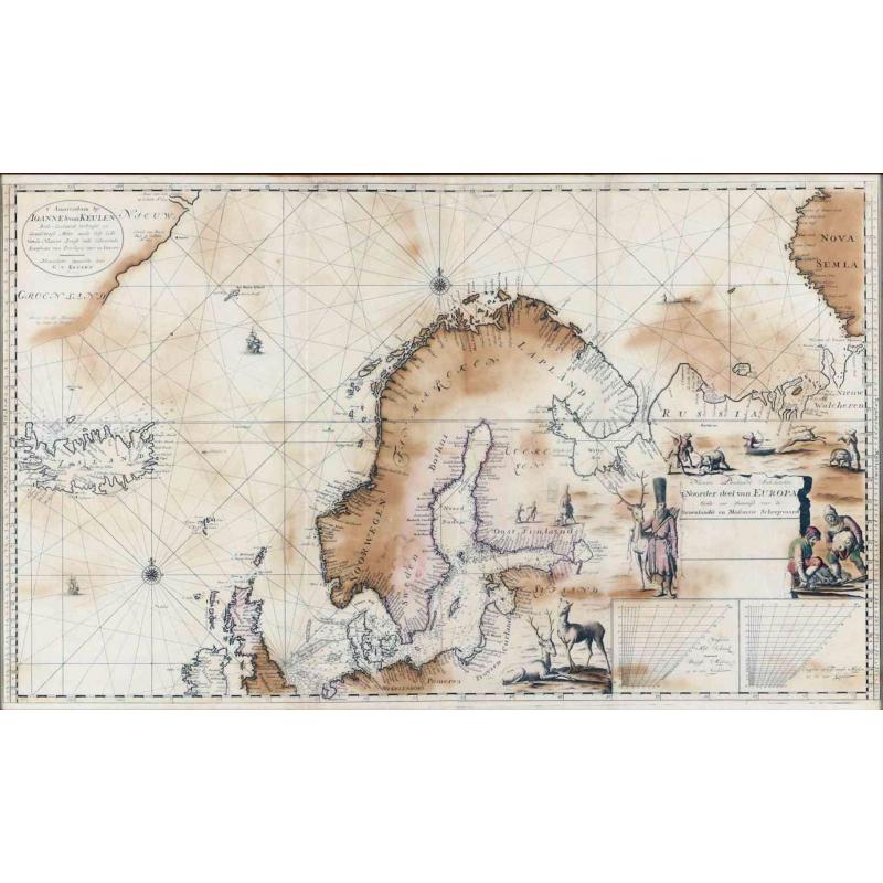
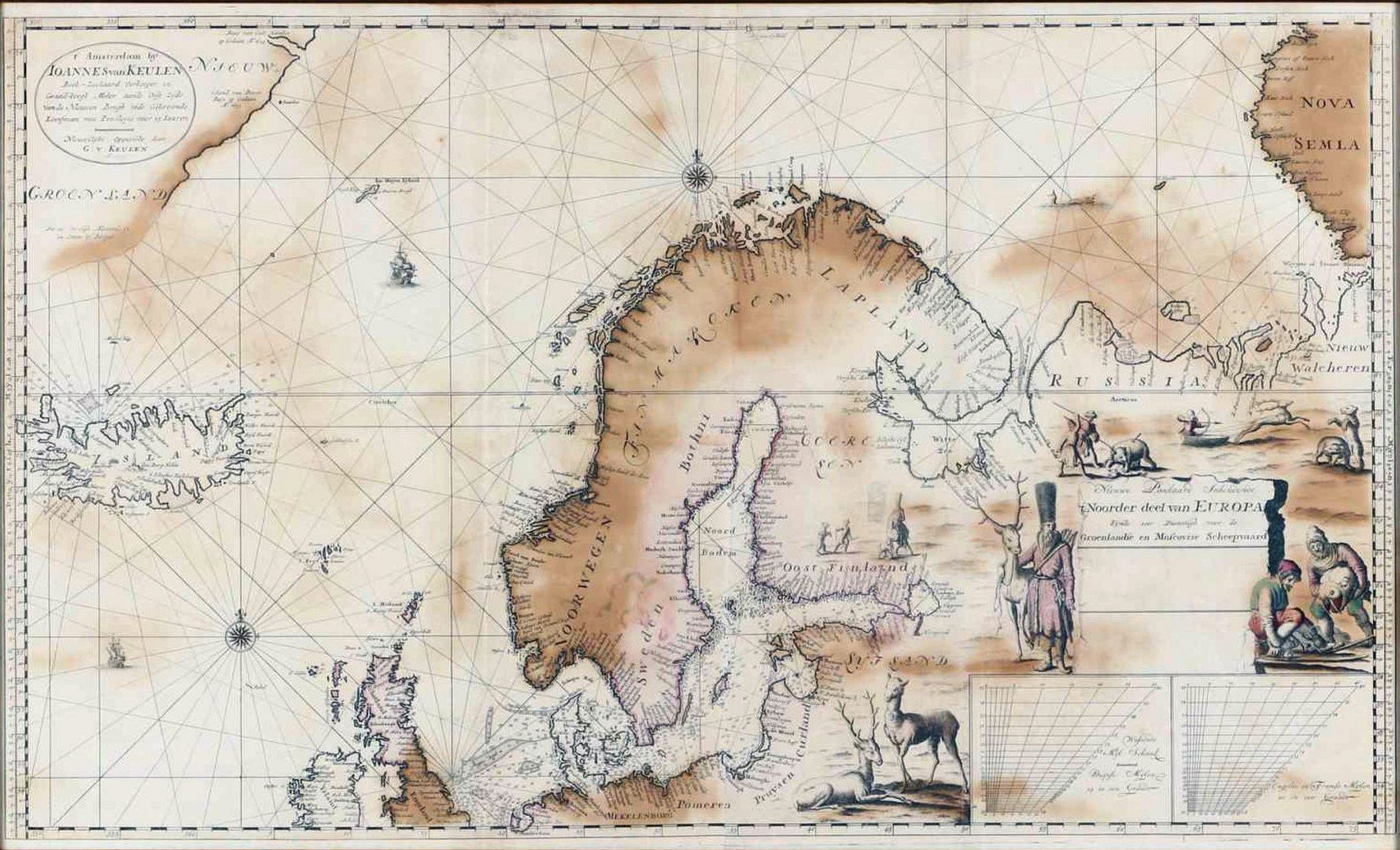
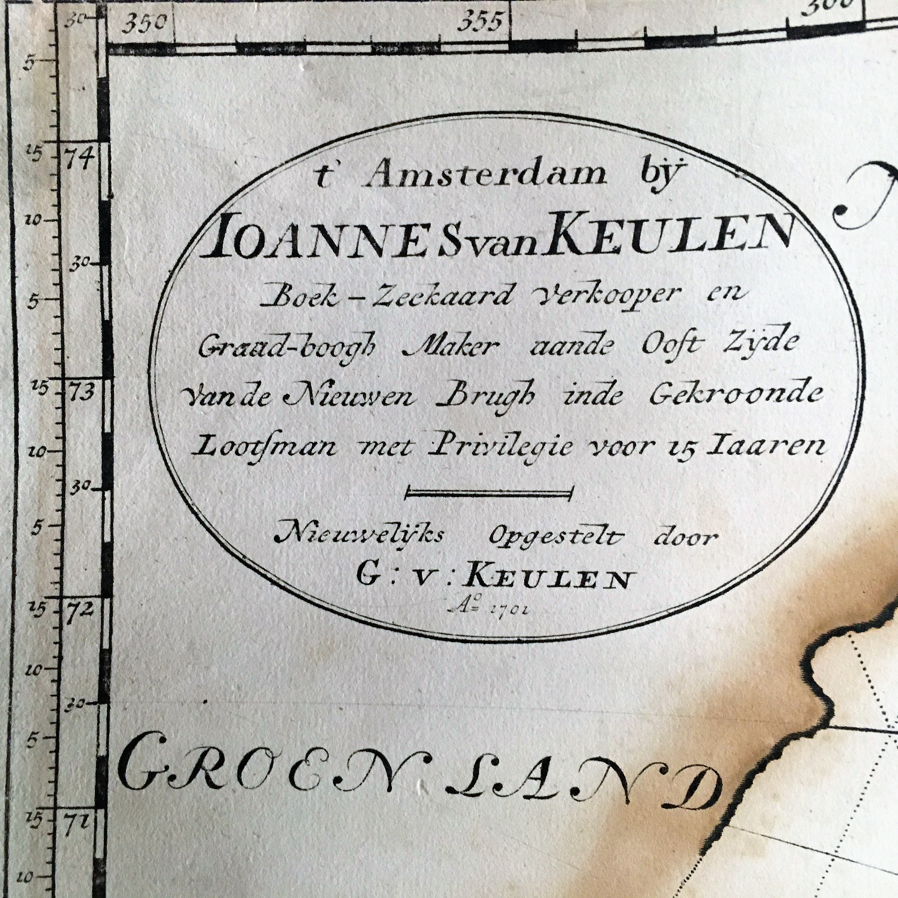
1701 VAN KEULEN, J. - Nieuwe Paskaart Inhoudende t'Noorder deel van Europa sijnde seer Dienstigh voor de Groenlandse en Moscovise Scheepvaard.
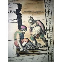
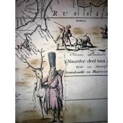
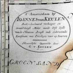
Nieuwe Paskaart Inhoudende t'Noorder deel van Europa sijnde seer Dienstigh voor de Groenlandse en Moscovise Scheepvaard. |
||||||||||||||||||||
|
||||||||||||||||||||
|
|
||||||||||||||||||||
|
Selling price: $ Please login to see price!
Sold in 2022 Missed this item! Add your name to our mailing list and be the first to get notified about our newly added listings. . |
My Collection +
Add this or any of your favorite items in one place. If you want to save the items permanently, you have to sign in or create an account first.   Add/Remove
Watchers:
3
|
|||||||||||||||||||



Description
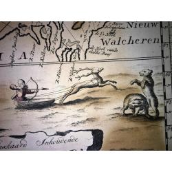
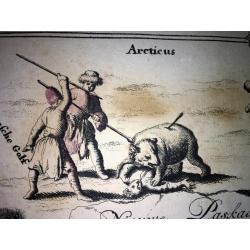
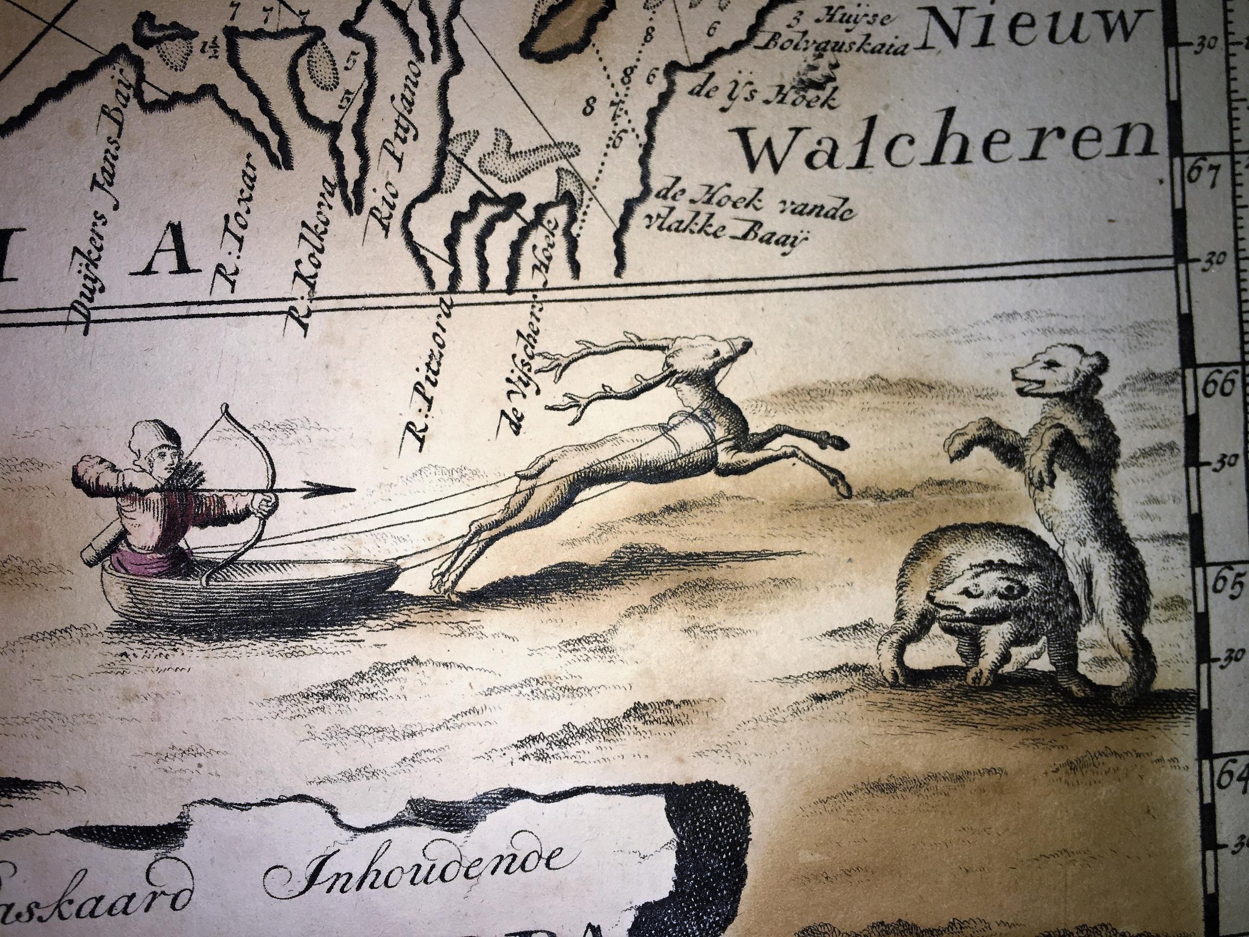
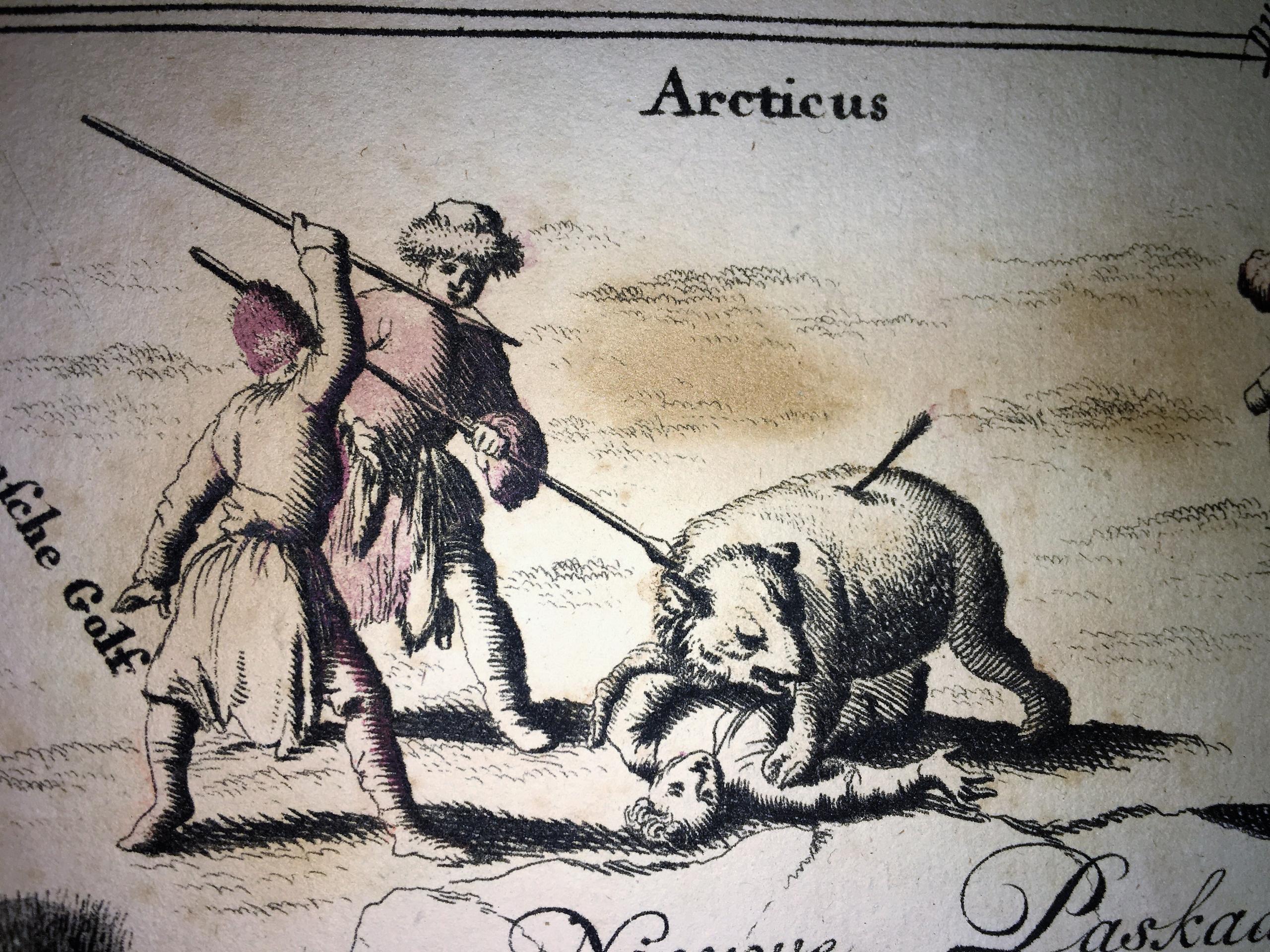
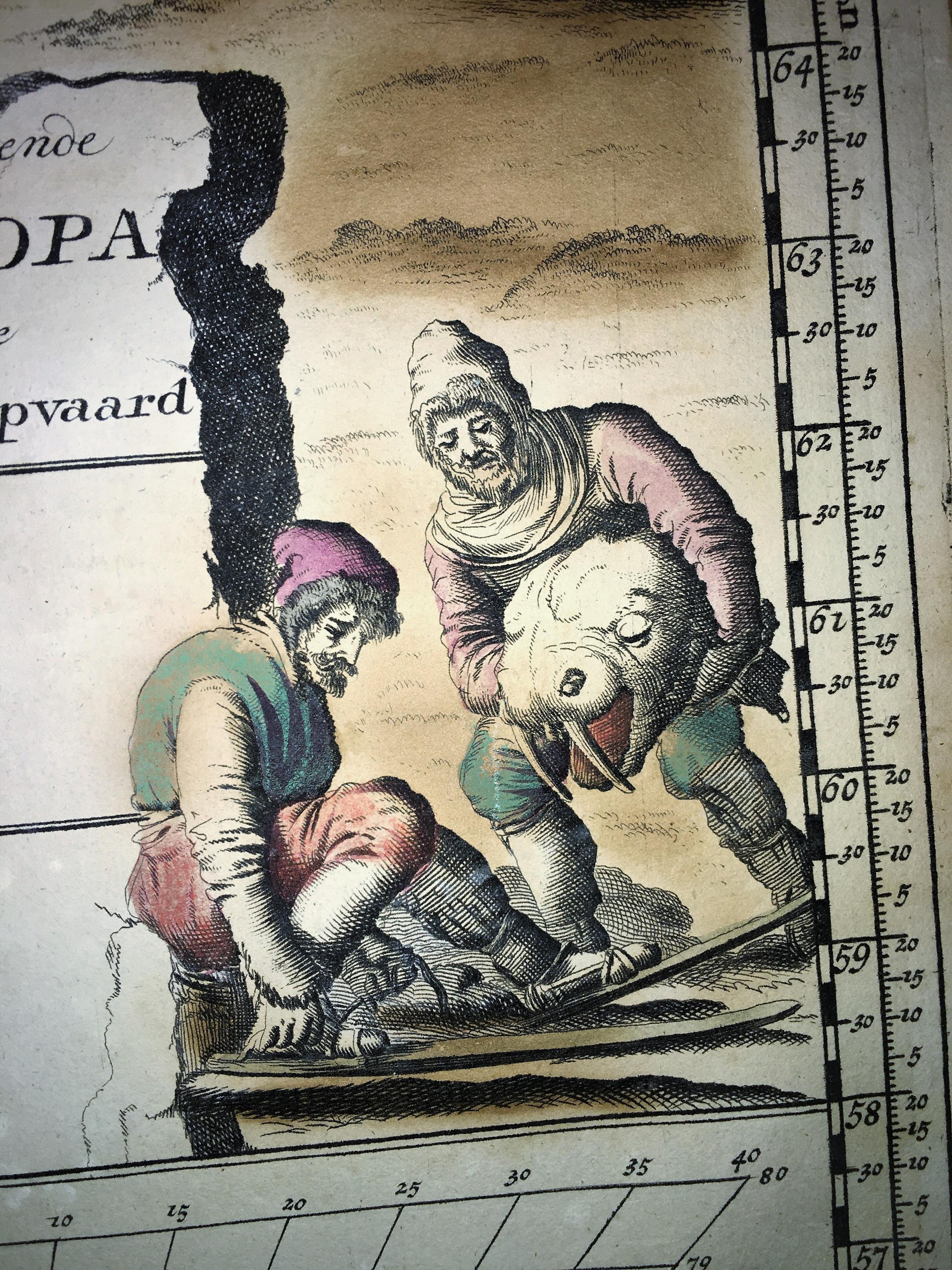
A very large, exceptionally rare, early navigation chart of Scandinavia by van Keulen, with highly decorative hunting scenes.
The chart is based on Mercator projection. Graduation scales are given in the lower right part, needed to compensate for the projection distortion at this latitude. The map shows also many depth soundings, particularly in the North Sea, in the Baltic Sea, next to Iceland, and along the Russian arctic coasts.
The chart was never included in regular atlases by van Keulen, probably because of its huge size (circa 59.0 cm x 100.5 cm), but rather sold as a loose navigation chart, particularly for whale hunting and for the trade with Archangelsk.
Occasionally, upon specific request, the chart was included in atlases. Koeman mentions one specimen like the one offered here, with date 1701, in the first part of 'De Nieuwe Groote Lichtende Zee-Fakkel' of 1734 (see Koeman IV, p. 379 nr. 215).
It exists also a later version of the chart, without the date "1701", in the upper left address cartouche, probably appeared in 1722.
Our example seems to be the only recorded first version of this important map that ever appeared on the market.
Johannes Van Keulen
The van Keulen family operated a chart-making and publishing firm in Amsterdam for nearly 200 years. It was founded by Johannes van Keulen who registered his business as a "bookseller and cross-staff maker". Under his management, the Nieuwe Lichtende Zee-Faakel (New Shining Sea Torch) was begun in 1681. It was expanded to five volumes, and then finally to six volumes, with the addition of material from the secret files of the East India Company.In 1693 van Keulen acquired the stock of Hendrik Doncker. In 1678, Johannes registered with the Amsterdam Booksellers Guild as a "bookseller and Cross-staff maker" By this time, most of the Amsterdam chart makers and instrument makers, like Blaeu, Janssonius, Hondius, Goos, and Doncker, had either closed down or were at the end of their fame. As a result, Johannes van Keulen could obtain copperplates, privileges, and stocks from many of his former competitors. Besides manuals and cross-staffs, Johannes produced his famed "ZeeAtlas" (Sea Atlas, 5 volumes), and "ZeeFakkel" (Sea pilot book, 5 volumes). ZeeFakkel was produced in numerous languages, including English, French, Italian, and Spanish. Gerard van Keulen, son of Johannes, born in 1678, took over from his father in 1714 and continued to expand the flourishing firm. Gerard’s accomplishments include hundreds of manuscript charts, now held in several European collections.
In 1726, Johannes van Keulen, son of Gerard, took over the business.
In 1743, Johannes was appointed "Official Chartmaker of the Dutch East Indies Company". The title appears to be nothing more than a formality, however, since the firm had supplied charts to the East Indies Company for many years, and the van Keulen family of Amsterdam had an interest in the East Indies Company. Still, van Keulen Chartmakers held the official title until the East Indies Company was dissolved in 1799. In 1753, Johannes finished his grandfather's work by publishing the sixth volume of "ZeeFakkel". This volume contained the previously kept 'secret' cartography of the East India Archipelago collected and used by the V.O.C. (THE DUTCH EAST INDIA COMPANY). Jan de Marre, the examiner of the Amsterdam Chamber of the East India Company, provided van Keulen with the data for the ZeeFakkel sixth volume, and it is also believed that de Marre influenced the van Keulen chart makers' decision to start producing the newly invented Hadley’s Octants in 1744. The company distributed these maps only internally and never sold them. Merchants had to return the maps after each journey to keep trade routes secret. Until van Keulen II printed the Atlas in 1753, the Dutch East India Company used costly manuscript versions prone to errors. Johannes II was appointed official mapmaker of the Dutch East India Company in 1743, a title his family held until the company's dissolution in 1799. Following the death of Johannes van Keulen (1770), the company was run by his widow and their two sons, Cornellis Buys and Gerard Hulst van Keulen. By then, they also owned an anchor factory, which they managed separately. In 1778, after brother Cornellis's death, Gerard Hulst van Keulen assumed leadership of the chart-making firm, adding sextants to their inventory for sale. Gerard was one of the three original members of the "Dutch Commission for Longitude at Sea", installed by the Dutch Admiralty in 1787. In 1788, Gerard van Keulen published the first "Dutch Nautical Almanac", an annual publication that continued until 1885. When Gerard Hulst van Keulen died in 1801, his widow ran the firm until her death in 1810, when Johannes Hulst van Keulen became the last van Keulen to run it. In 1823, Jacob Swart entered the service of the van Keulen firm, and in 1844, with the death of Johannes Hulst van Keulen, head of the van Keulen Chartmakers was passed to Jacob Swart. When Jacob died in 1866, he was succeeded by his son, Jacob Swart, Jr.
Under Jacob, Jr’s reign, the firm lost all of its standing in the Nautical world, and the possessions of the firm were sold at auction in 1885, bringing 200 years of "DeGekroonde Lootsman" to an end.
FAQ - Guarantee - Shipping
This item is available for immediate purchase when a "Add to Cart" or "Inquire Now" button is shown.
Payments are accepted in Euros or US Dollars. We accept most major credit cards, PayPal and bank transfer.
Authenticity Guarantee
 We provide professional descriptions, condition report and HiBCoR rating (based on 45 years experience in the map business)
We fully guarantee the authenticity of items we sell. We provide a certificate of authenticity for each purchased item.
Condition / Coloring
We indicate the condition of each item and use our unnique HiBCoR grading system in which four key items determine a map's value: Historical Importance, Beauty, Condition/Coloring and Rarity.
We offer many maps in their original black and white condition. We do not systematically color-up maps to make them more sellable to the general public or buyer.
Copper engraved or wood block maps are always hand colored. Maps were initially colored for aesthetic reasons and to improve readability. Nowadays, it is becoming a challenge to find maps in their original colors and are therefor more valuable.
We use the following color keys in our catalog:
Original colors; mean that the colors have been applied around the time the map was issued.
Colored; If the colors are applied recently or at the end of the 20th century, then "colored", or "attractive colors" will be used.
Original o/l colors; means the map has only the borders colored at the time of publication.
Read more about coloring of maps [+]
FAQ
Please have a look for more information about buying in the BuyNow gallery.
Many answers are likely to find in the general help section.
My Collection+

With My Collection+ you can collect all your favorite items in one place. It is free, and anyone can create his or her virtual map collection.
Unless you are logged in, the item is only saved for this session. You have to be registed and logged-in if you want to save this item permanently to My Collection+. Read More [+]
If you want to save the items permanently, please sign in
or create account first.
Registering Here, it is and you do not need a credit card.
Add this item to My Collection+ or click the following link to see My Collection+.
Invoice
The invoice and certificates of authenticity are available in the client center >Invoices
|
Digital Image Download Paulus Swaen maintains an archive of most of our high-resolution rare maps, prints, posters and medieval manuscript scans. We make them freely available for download and study. Read more about free image download |
Click the image for a free small image download. |

YOUR RIGHT TO CANCEL THE PURCHASE OF A LOT
In accordance with the EU Consumer Rights Directive and habitually reside in the European Union you have the right to cancel the contract for the purchase of a lot, without giving any reason.
The cancellation period will expire 14 calendar days from the day after the date on which you or a third party (other than the carrier and indicated by you) acquires, physical possession of the lot. To exercise the right to cancel you must inform Paulus Swaen Inc, of your decision to cancel this contract by a clear statement (e.g. a letter sent by post, or e-mail.
To meet the cancellation deadline, it is sufficient for you to send your communication concerning your exercise of the right to cancel before the cancellation period has expired.
