Subscribe to be notified if similar examples become available.
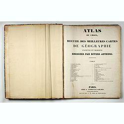
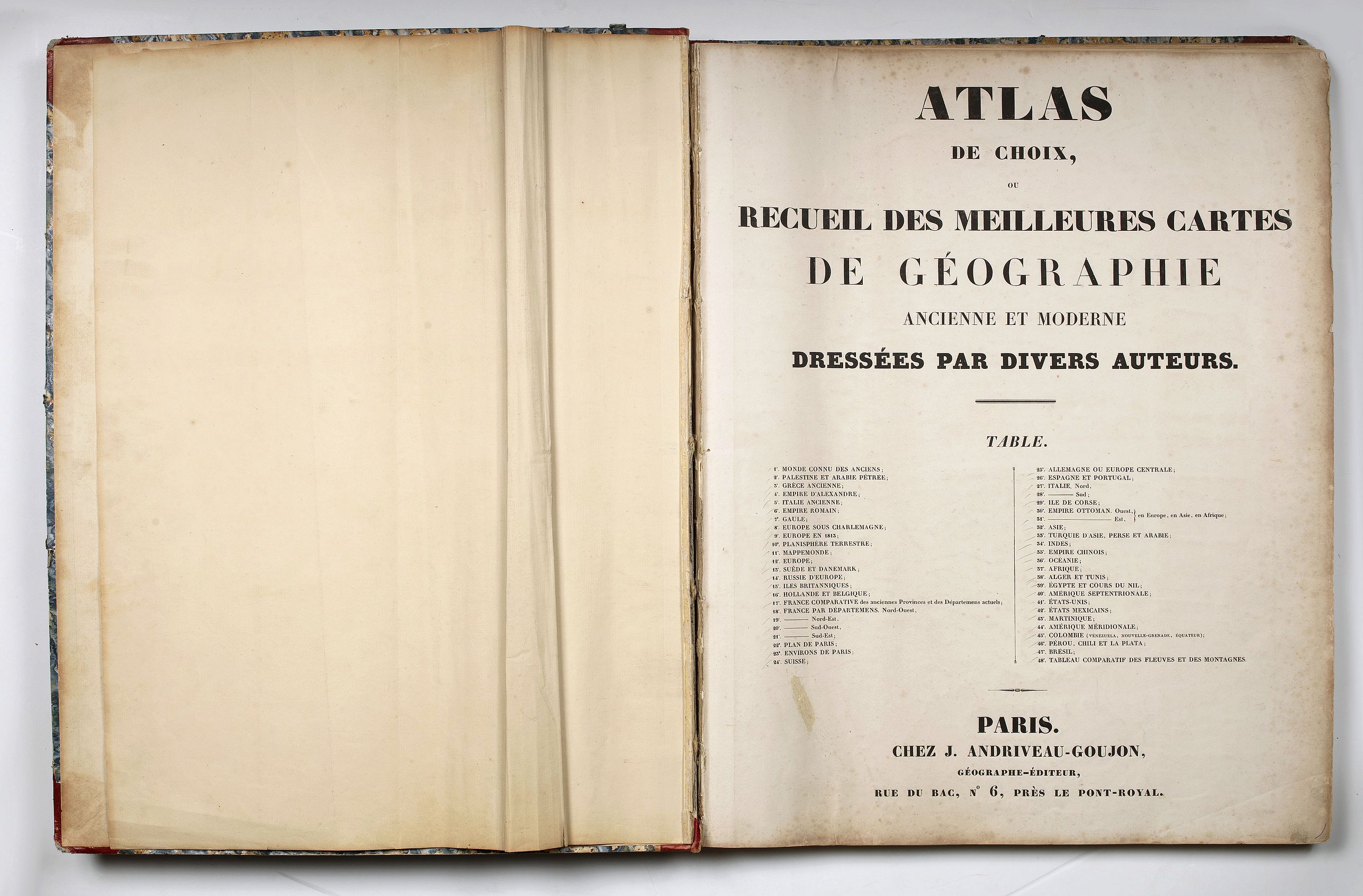
Atlas de choix, ou recueil des meilleures cartes de géographie ancienne et moderne dressées par divers auteurs. |
||||||||||||||||||||
|
||||||||||||||||||||
|
|
||||||||||||||||||||
|
Selling price: $7700
Sold in 2019 Missed this item! Be the first to get notified about our newly added listings. Feel free to contact us if you have a question about this item. Add your name to our mailing list. |
Virtual Collection - Save and collect your favorite items in one place.
Unless logged in, the item is only saved for that session. If you want to save the items permanently, please Login first Learn more [+] |
|||||||||||||||||||
Description
The atlas contains ancient and modern geographical maps, engraved and hand colored, in 48 sheets, some are folded.
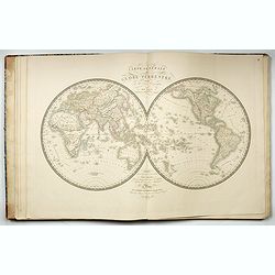
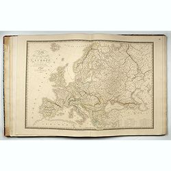
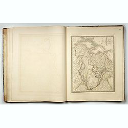
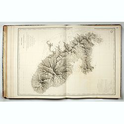
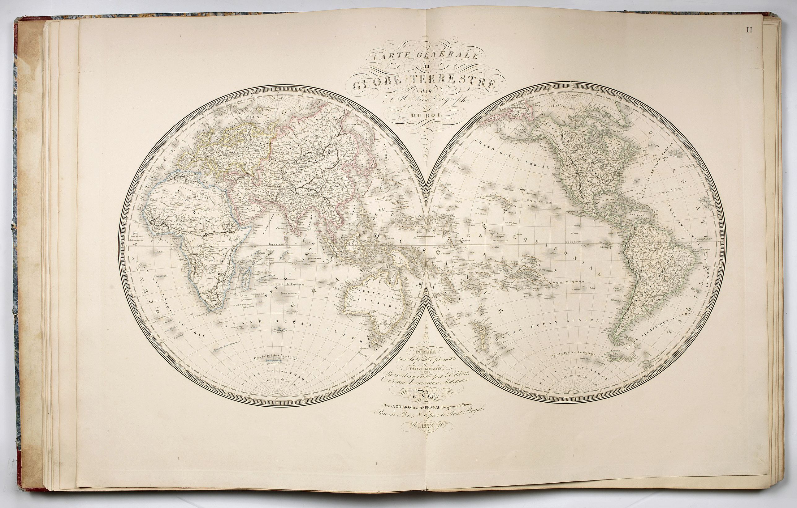
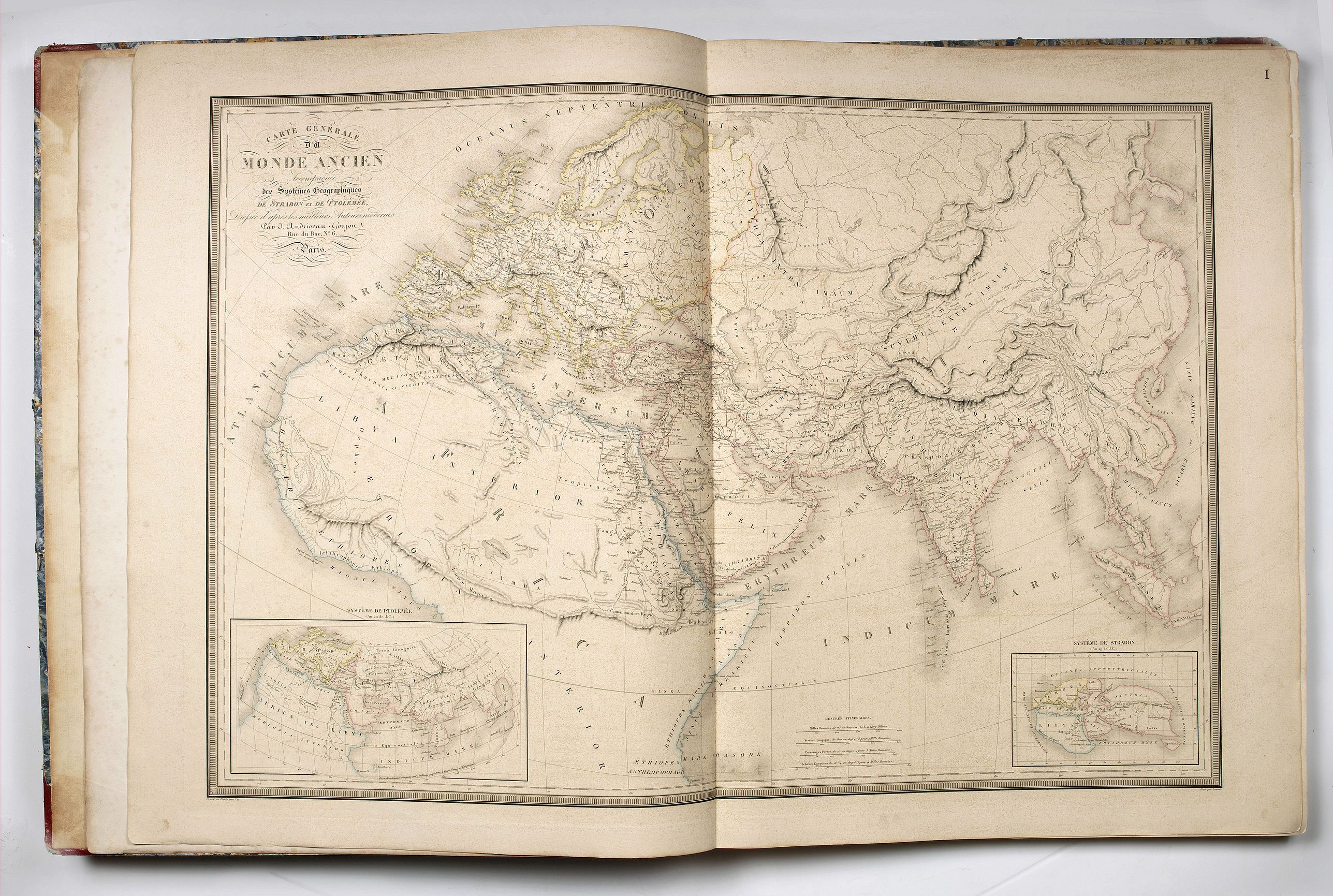
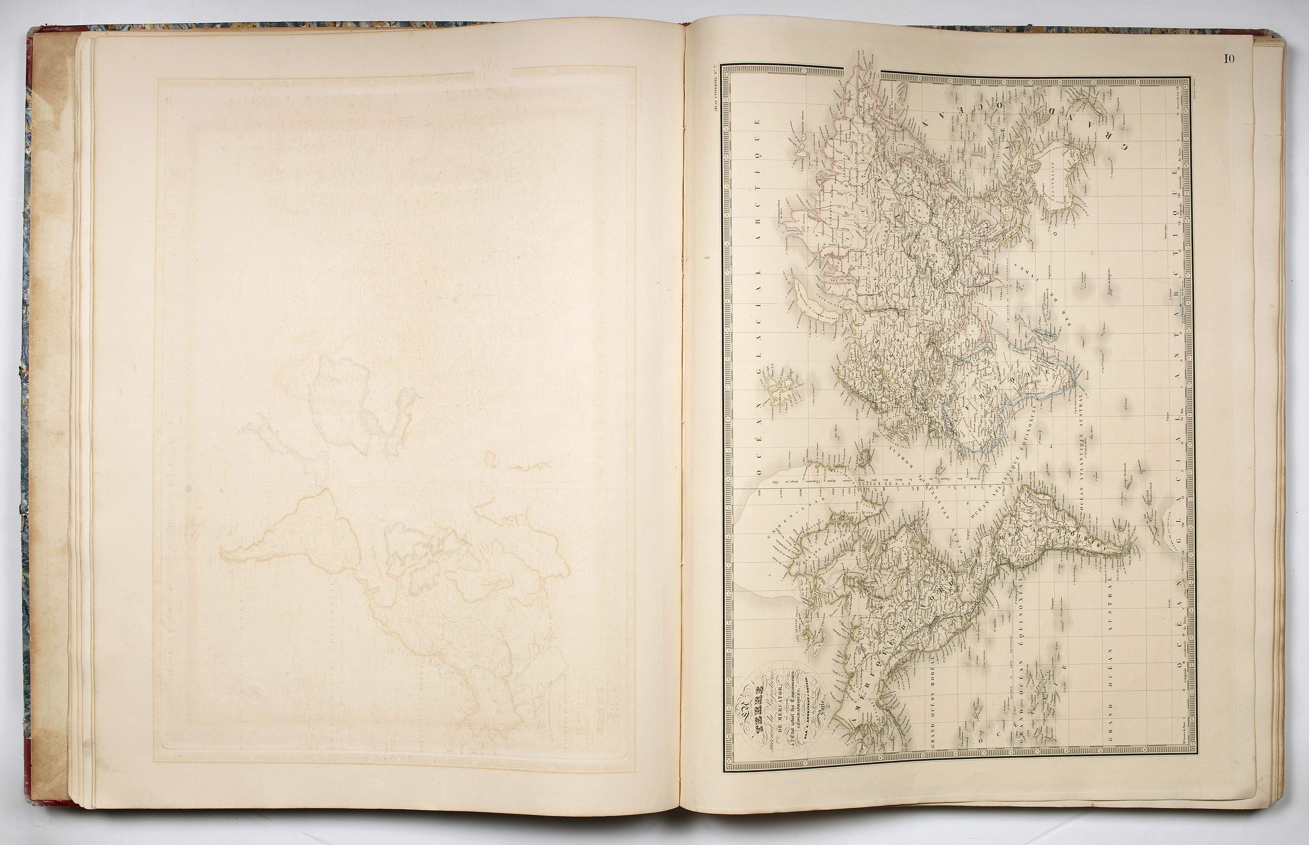
Shows the old world (10 maps) with the spreading and development of the different peoples, including Holy Land, the ancient world, a world map after Mercator, and the New World including a world map,
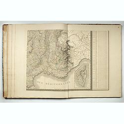
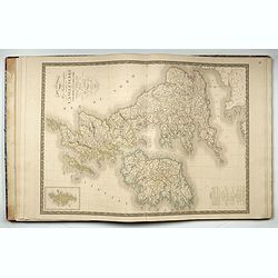
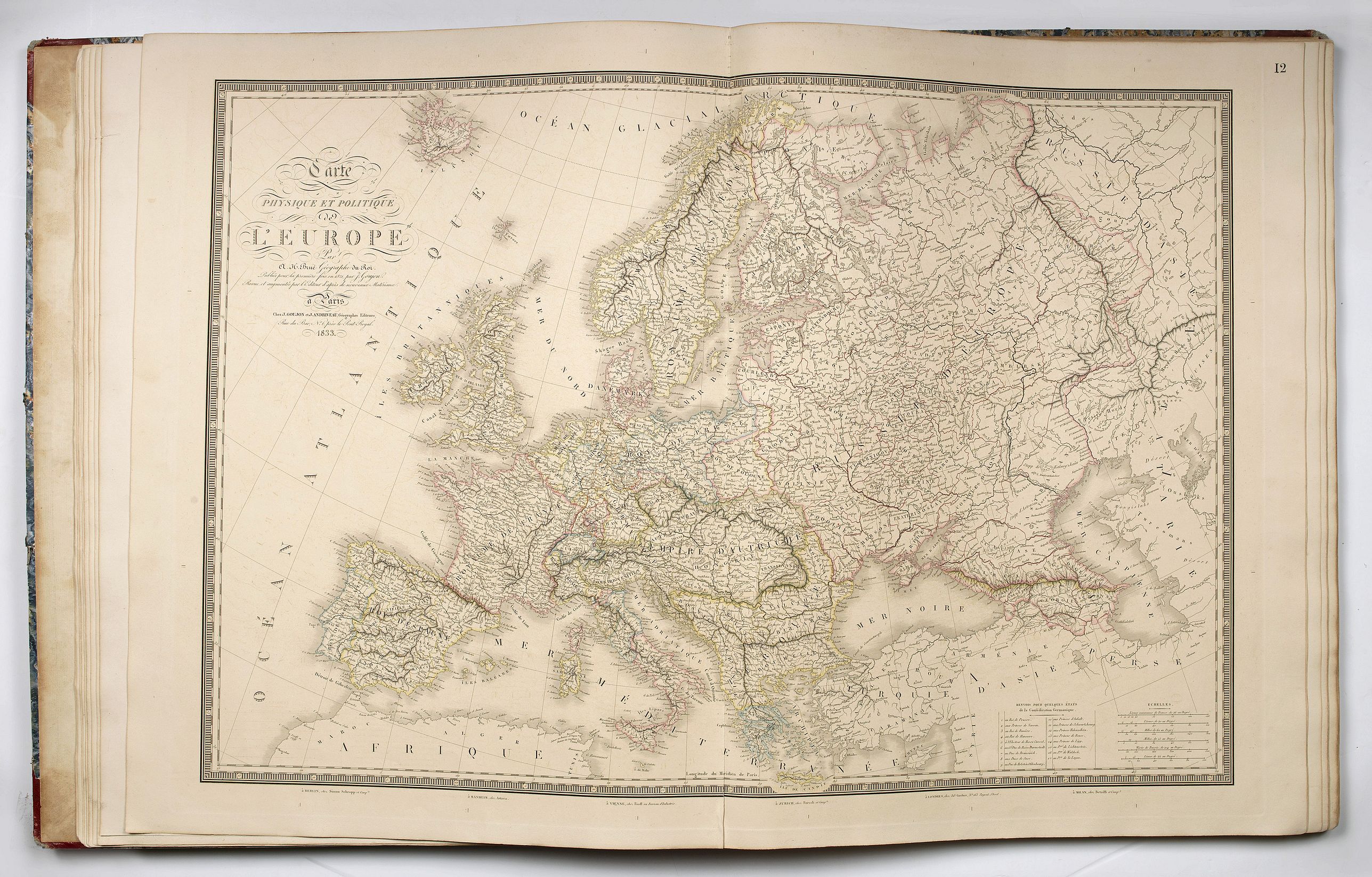
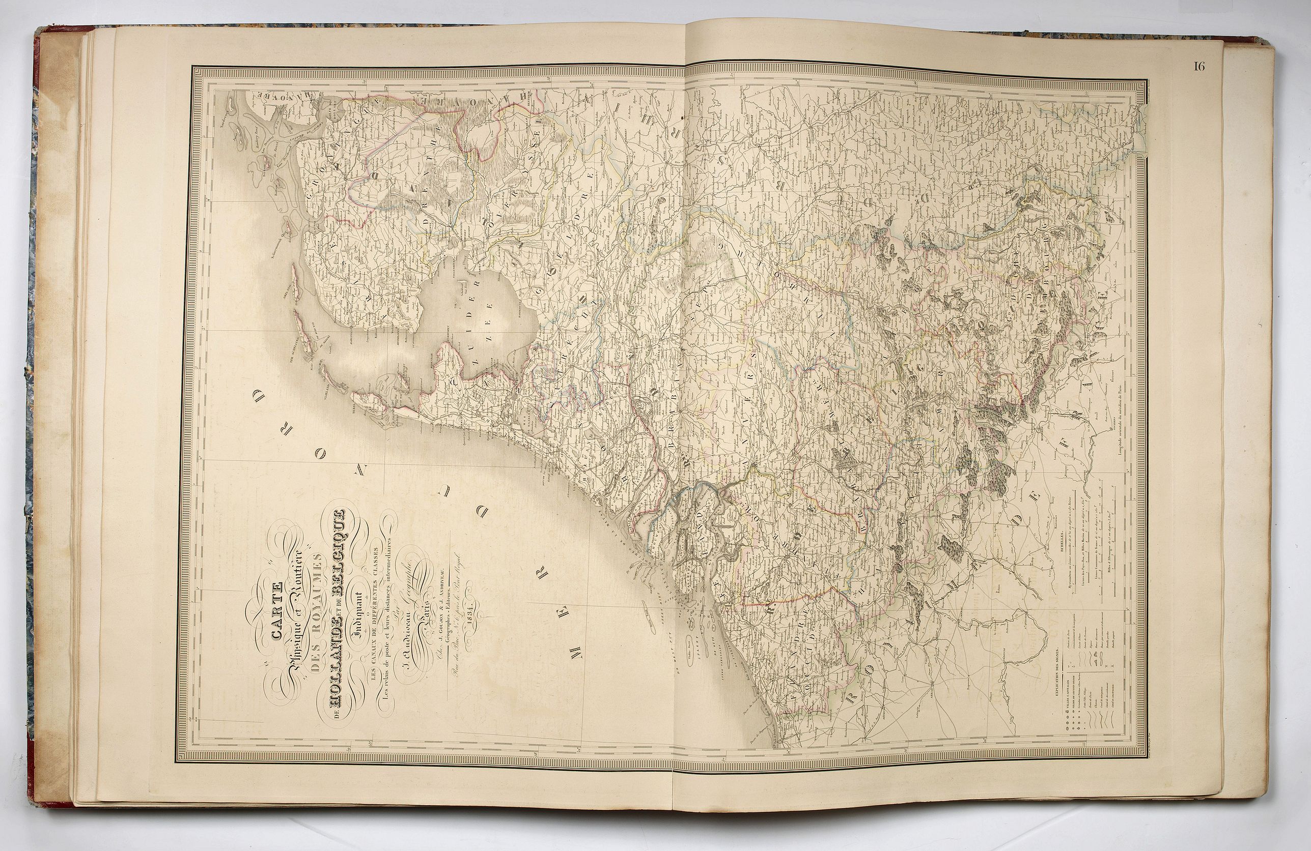
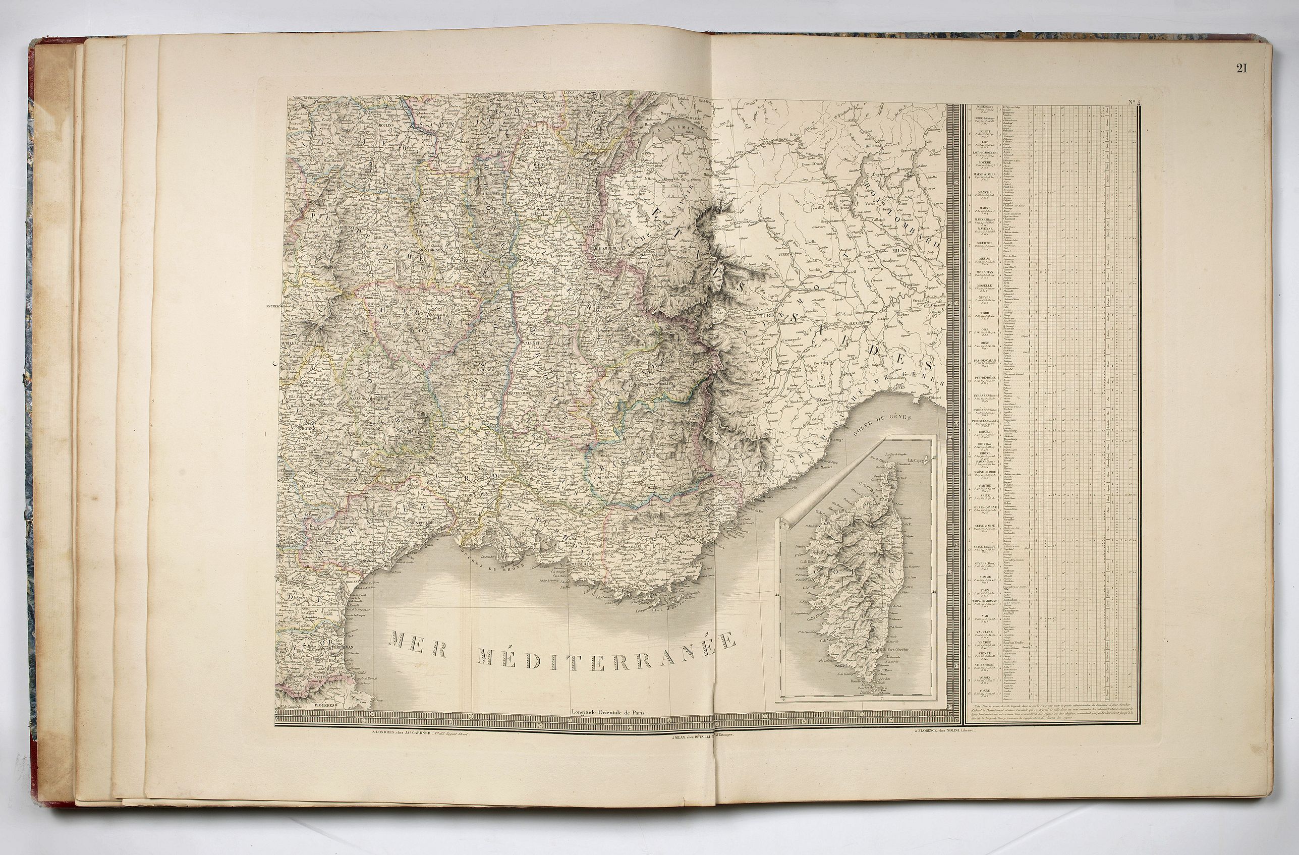
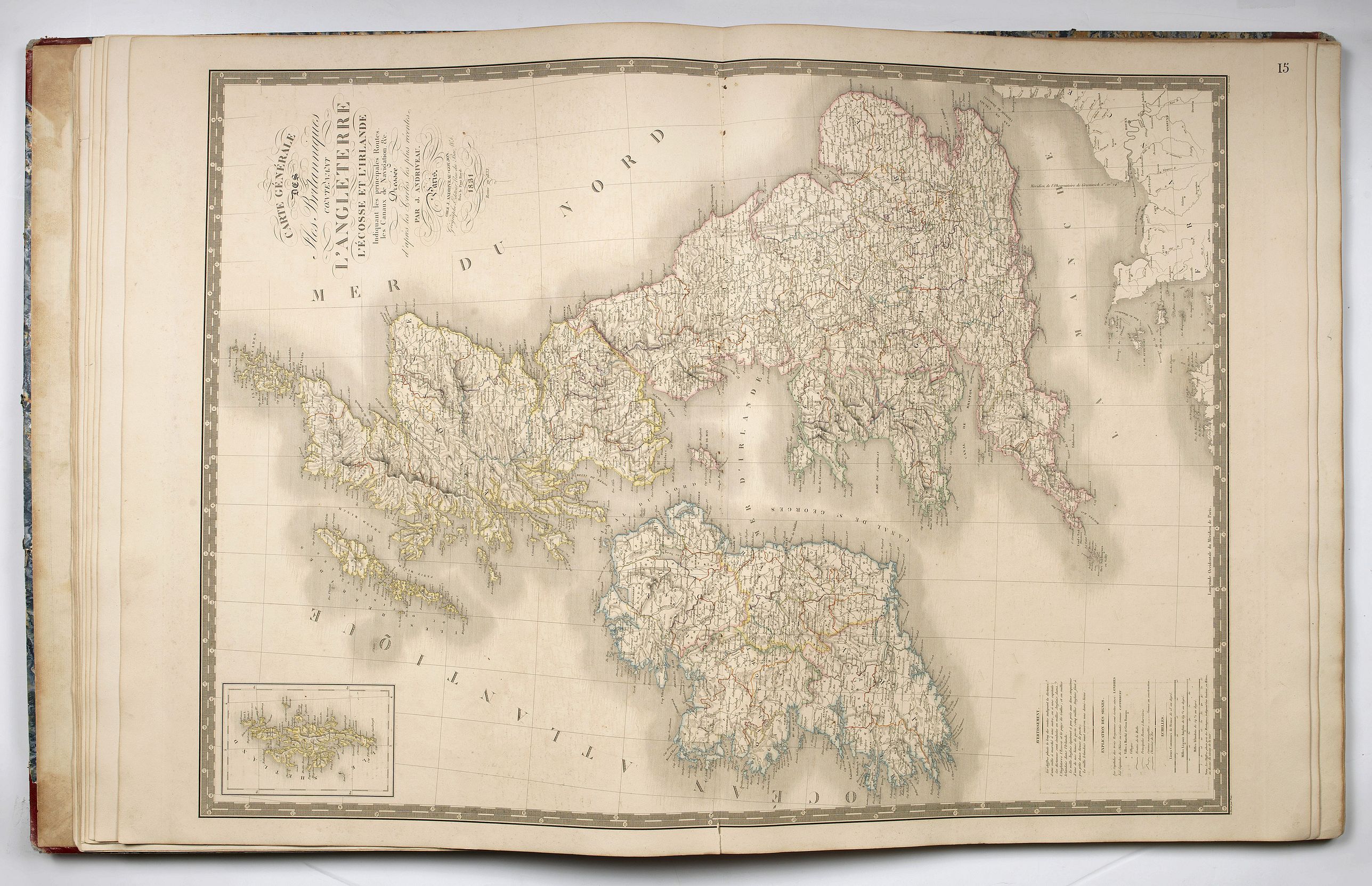
a map of Europe, maps of Scandinavia, Russia, Great Britain, the Netherlands and Belgium, France (one half-sheets and one four-sheets map), a plan of Paris, one of its “environs”, Switzerland, Germany, Spain and Portugal, Italy (two-sheets map), Corsica chart by Hell,
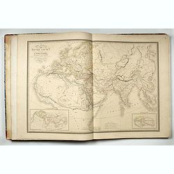
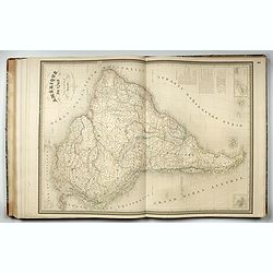
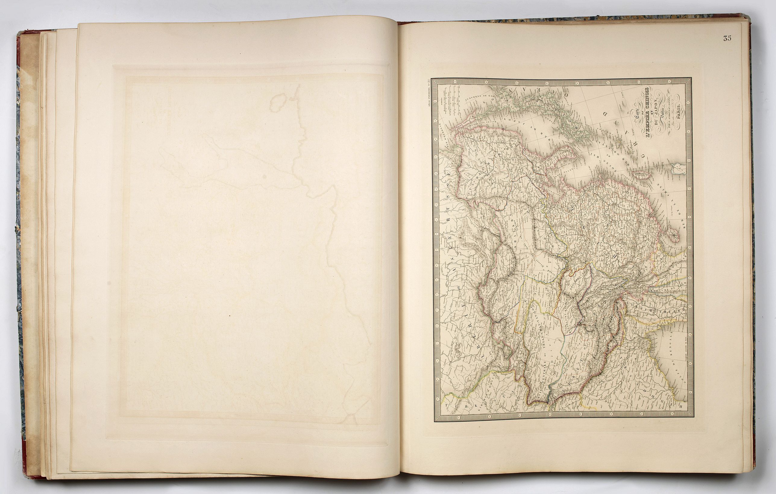
the Ottoman Empire (two-sheets map), Asia, Turkey and Arabia, India, the Chinese Empire,
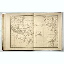
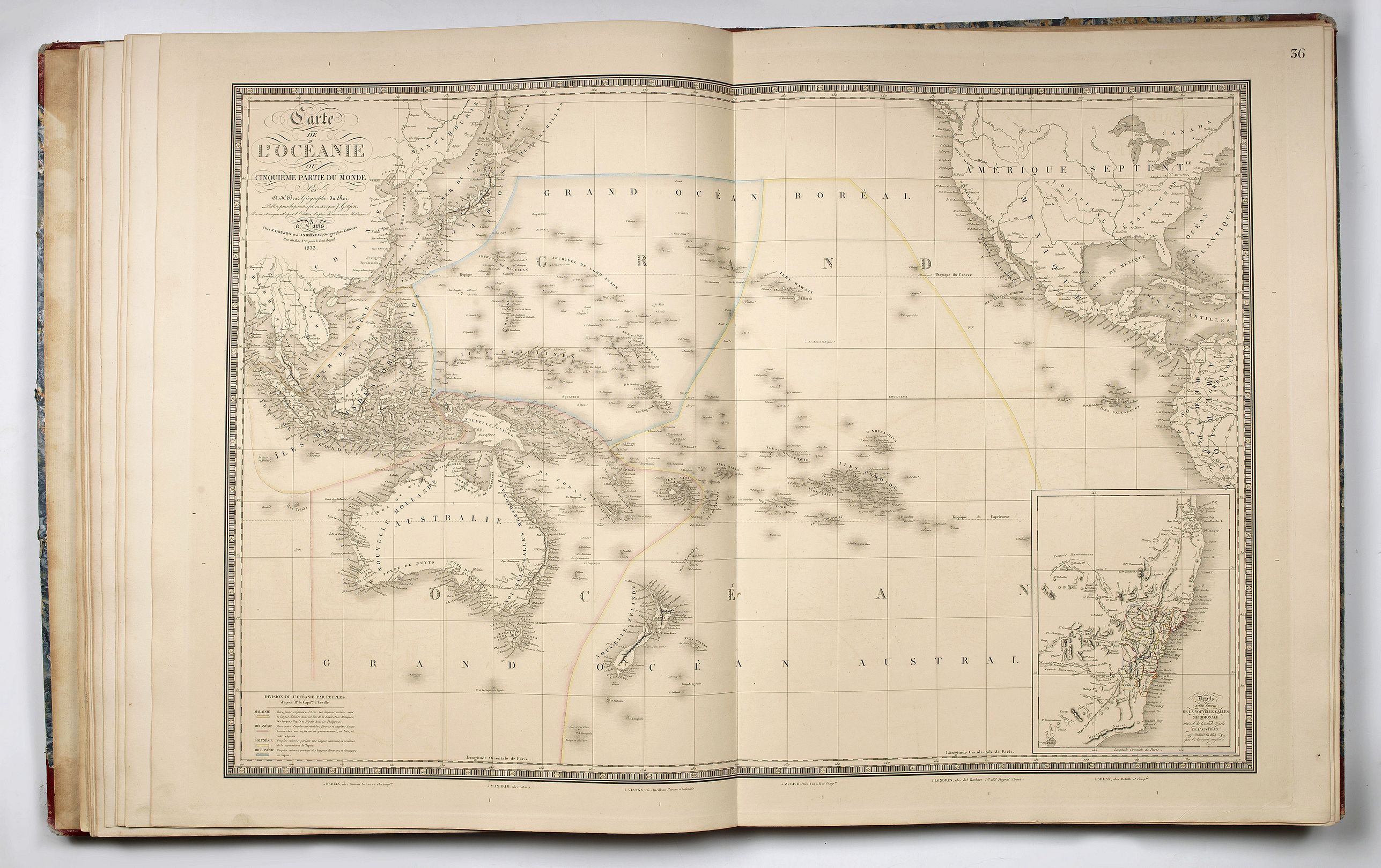
Oceania,
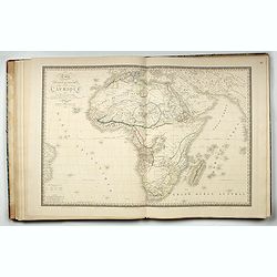
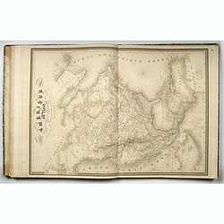
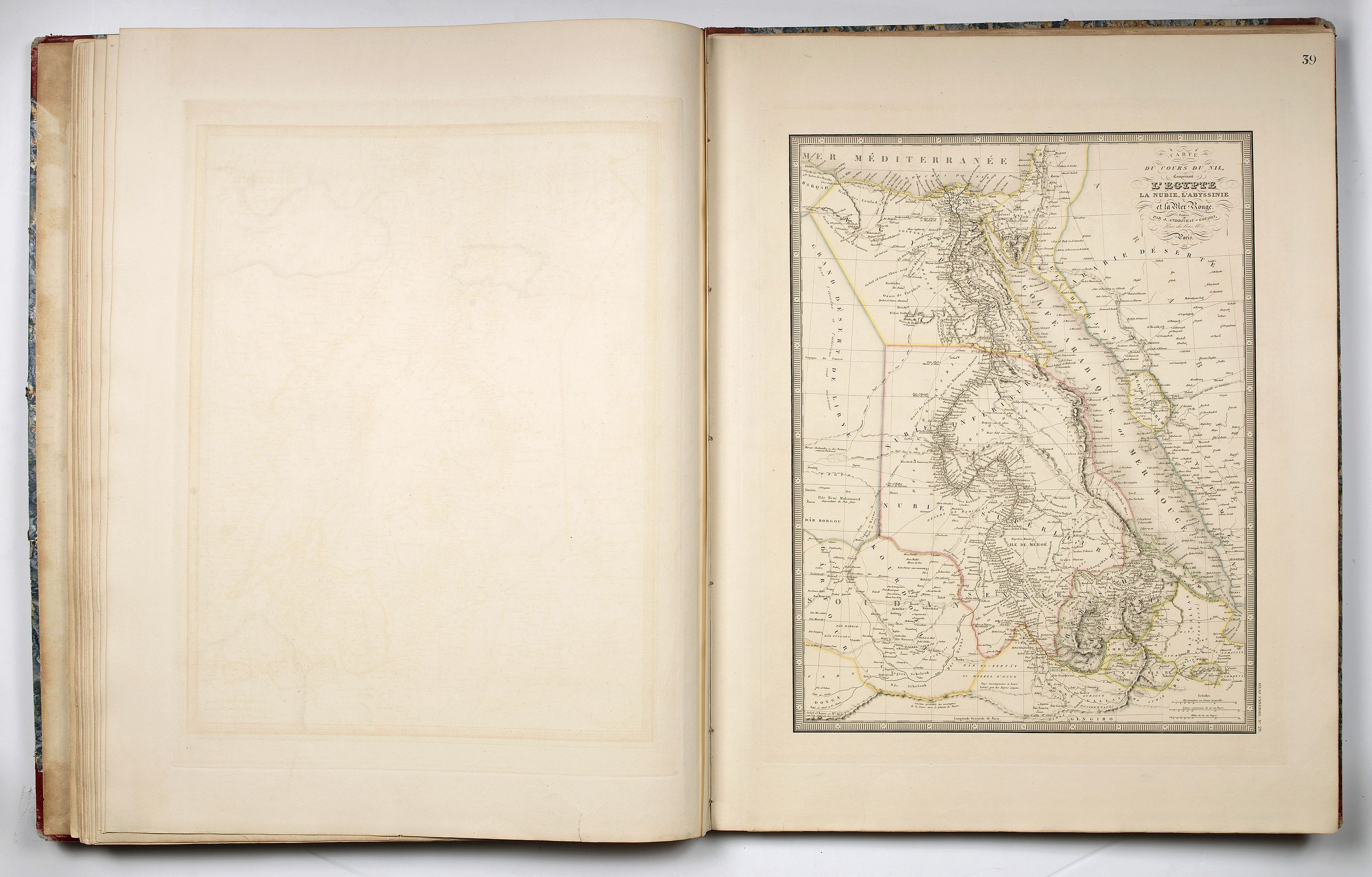
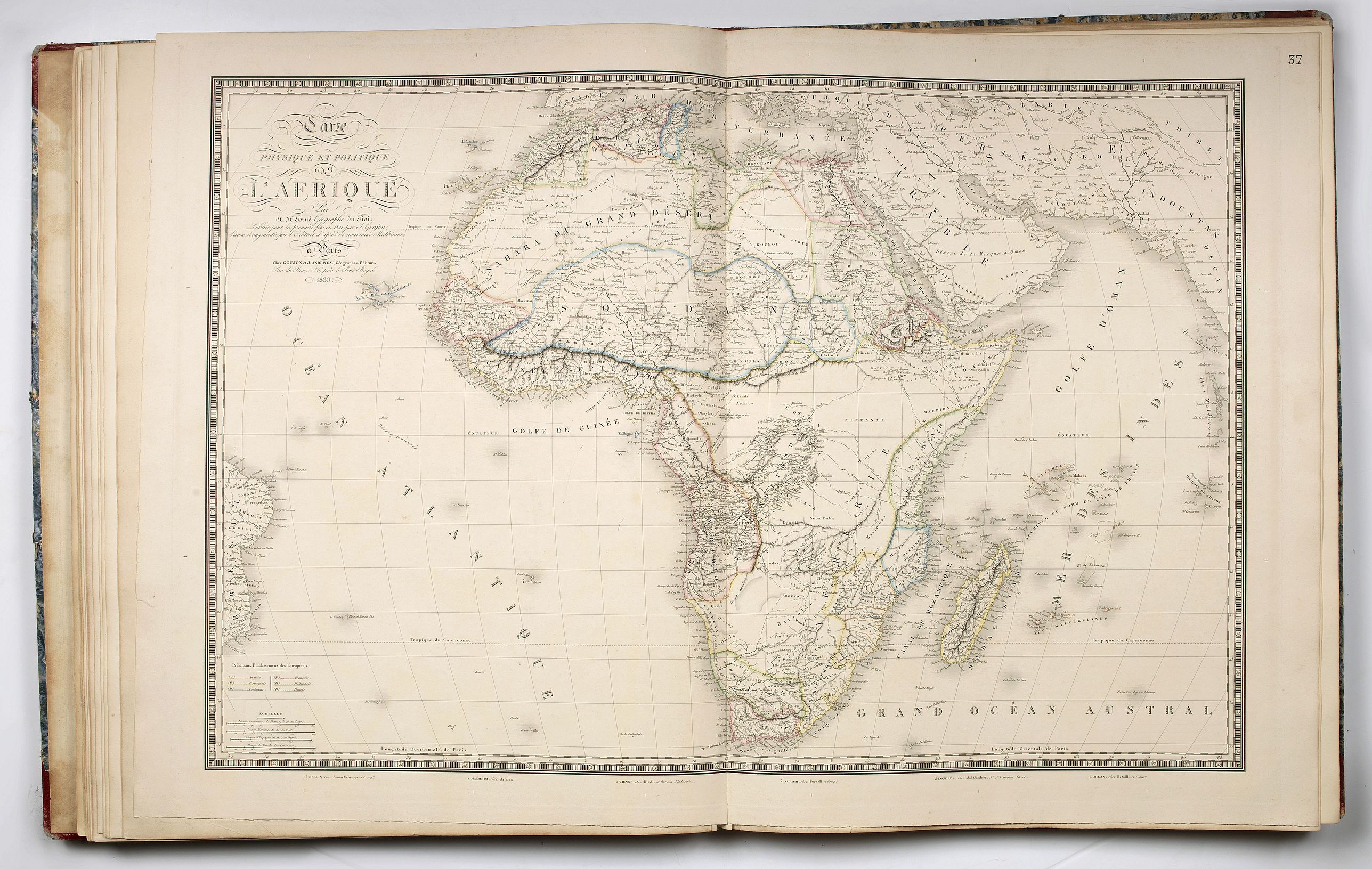
Africa, Algeria, Egypt,
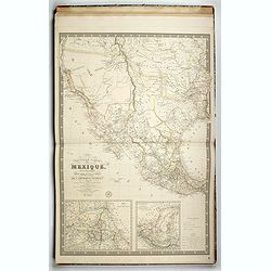
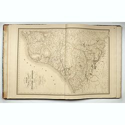
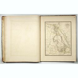
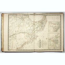
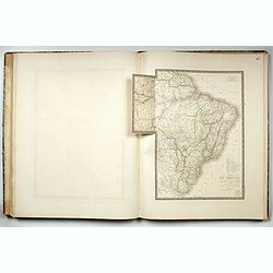
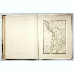
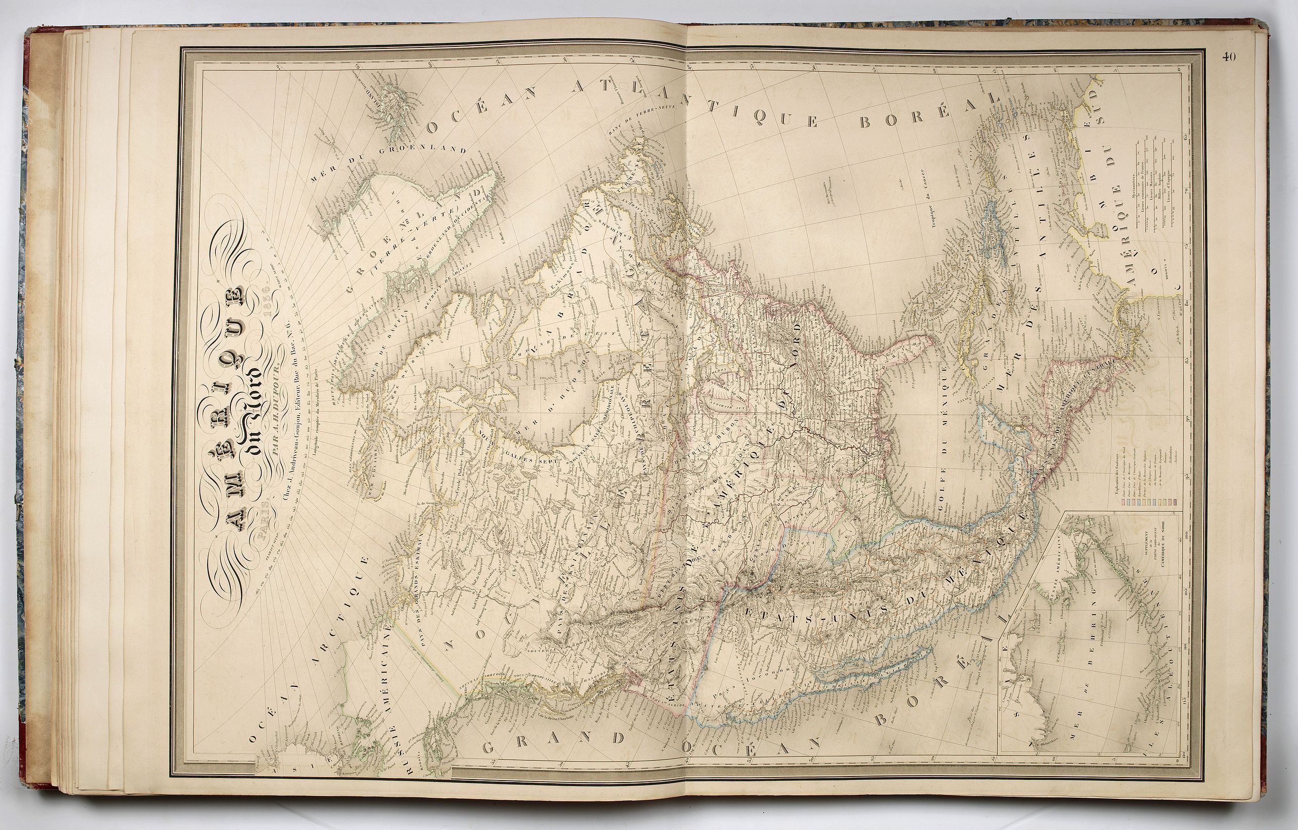
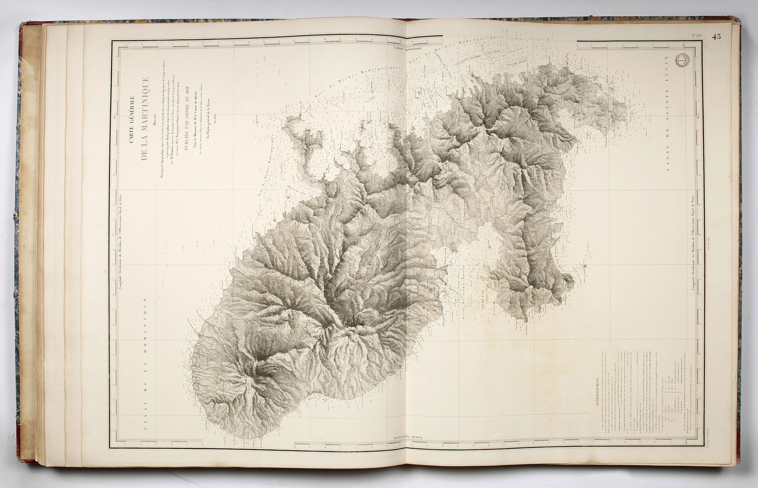
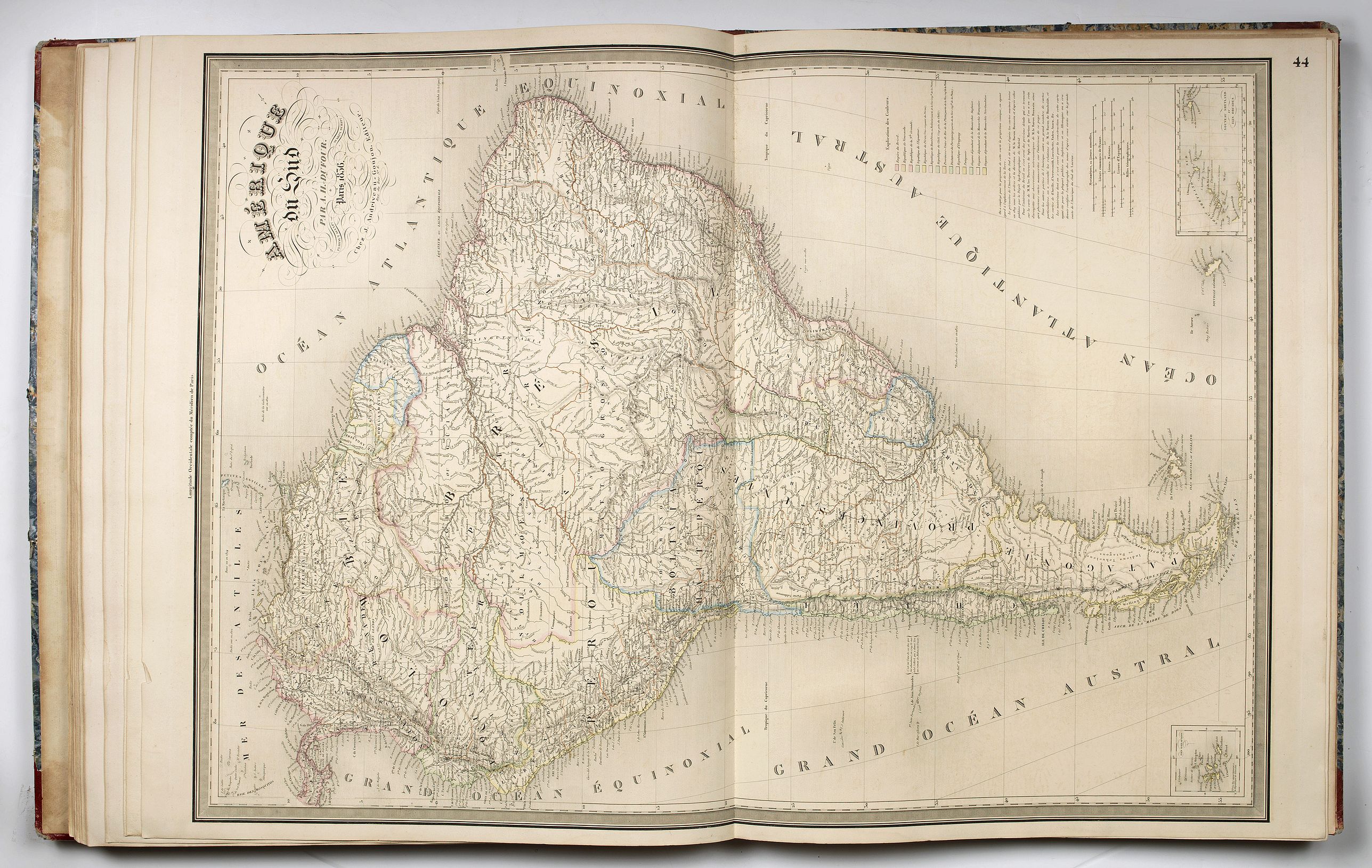
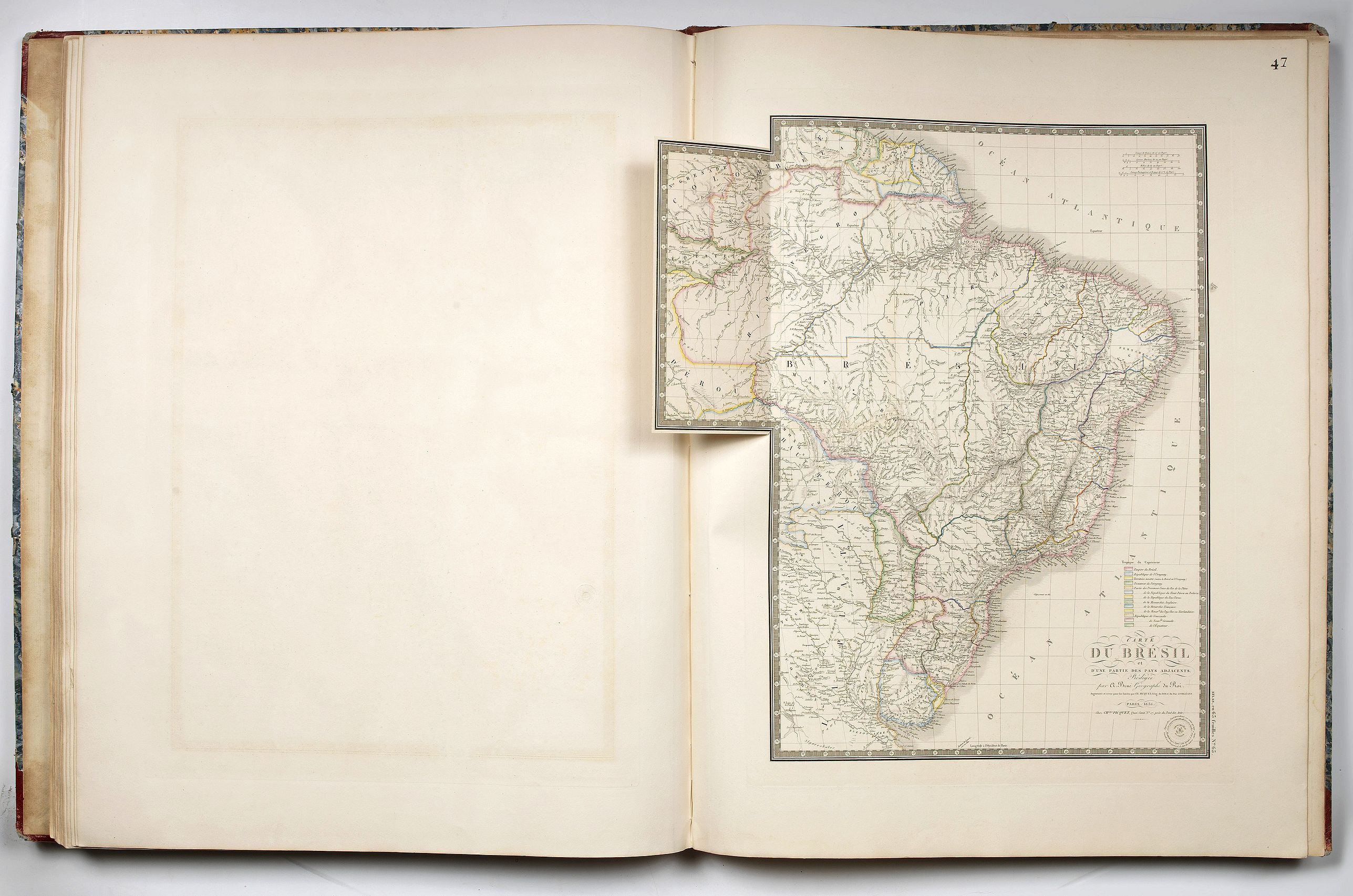
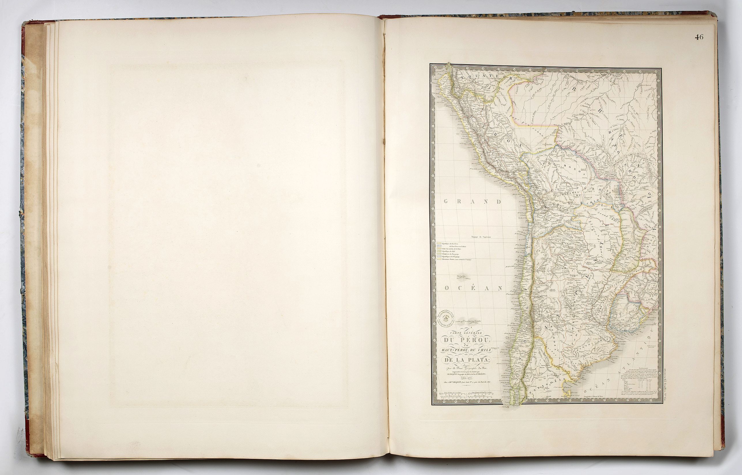
North America, the United States, the States of Mexico, Martinique, South America, Colombia, Peru and Chile, Brazil,
the last plate "Tableau Comparatif et Figure de La Hauteur des Principales Montagnes et du Cours des Principaux Fleuves due Monde.", includes a large and beautiful colored comparative view of the main mountains and the main rivers of the world.
The maps are embellished with engraved cartouches, geographical, agricultural, physical information, tables and text.
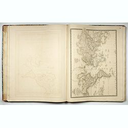
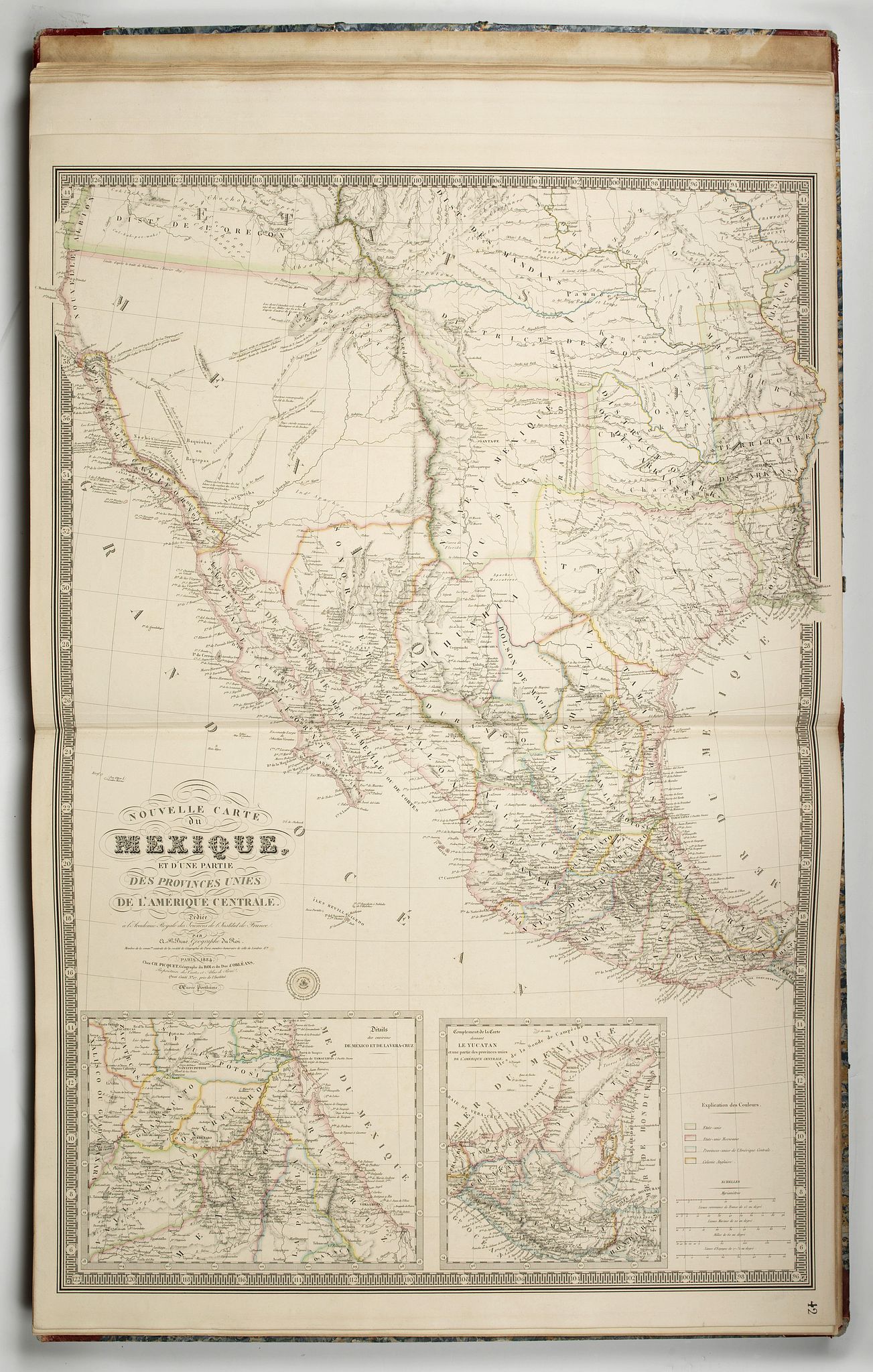
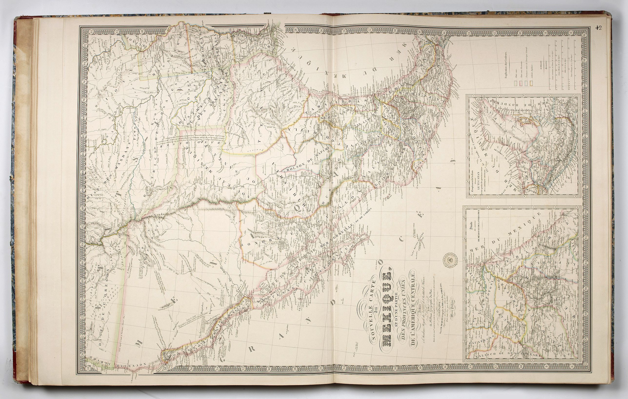
Seven maps relating to the Americas of which the famous monumental map (930 x 625 mm) by A.H. Brué : "Nouvelle carte du Mexique et d'une partie des Provinces Unies de l'Amérique centrale, 1734". Beautifully engraved map showing Texas as a province, Upper California and Mexico, with 2 insets and a key lower right. One of the most important map of the region during the period showing Jedediah Smith's journey to California and back in 1826.
"A monumental map, much on the order of the Arrowsmith and Wyld maps of the period" (Wheat)
A magnificent map showing Texas as a province, Upper California and Mexico, and of importance for showing Jedediah Smith's journey to California and back in 1826. "In fact, a most important map of 1834 - historically speaking - was that of A.H. Brue, also published posthumously by his widow. It was a map of Mexico, beautifully engraved, as were all the maps of this cartographer.
It... carries many of the legends of the 1833 Brue map. On this map, however, a line has been added from the Lac Teguayo (Lac Sale) area south to the R. Adams, thence southwest past the Rock Salt Cavern to the Seeds-Keeder River, and finally across to San Diego, the line being labeled in the north â ˜Route de Smith en 1826 and farther south merely "Route de Smith"...
All but one of the names mentioned by Jedediah Smith in his letter dated October 11, 1827... are present on this map... (Wheat 404) The insets are: Details des environs De Mexico et de la Vera-Cruz Complement de la Carte donnant Le Yucatan et une partie des provinces unies de L'Amerique Centrale.
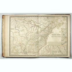
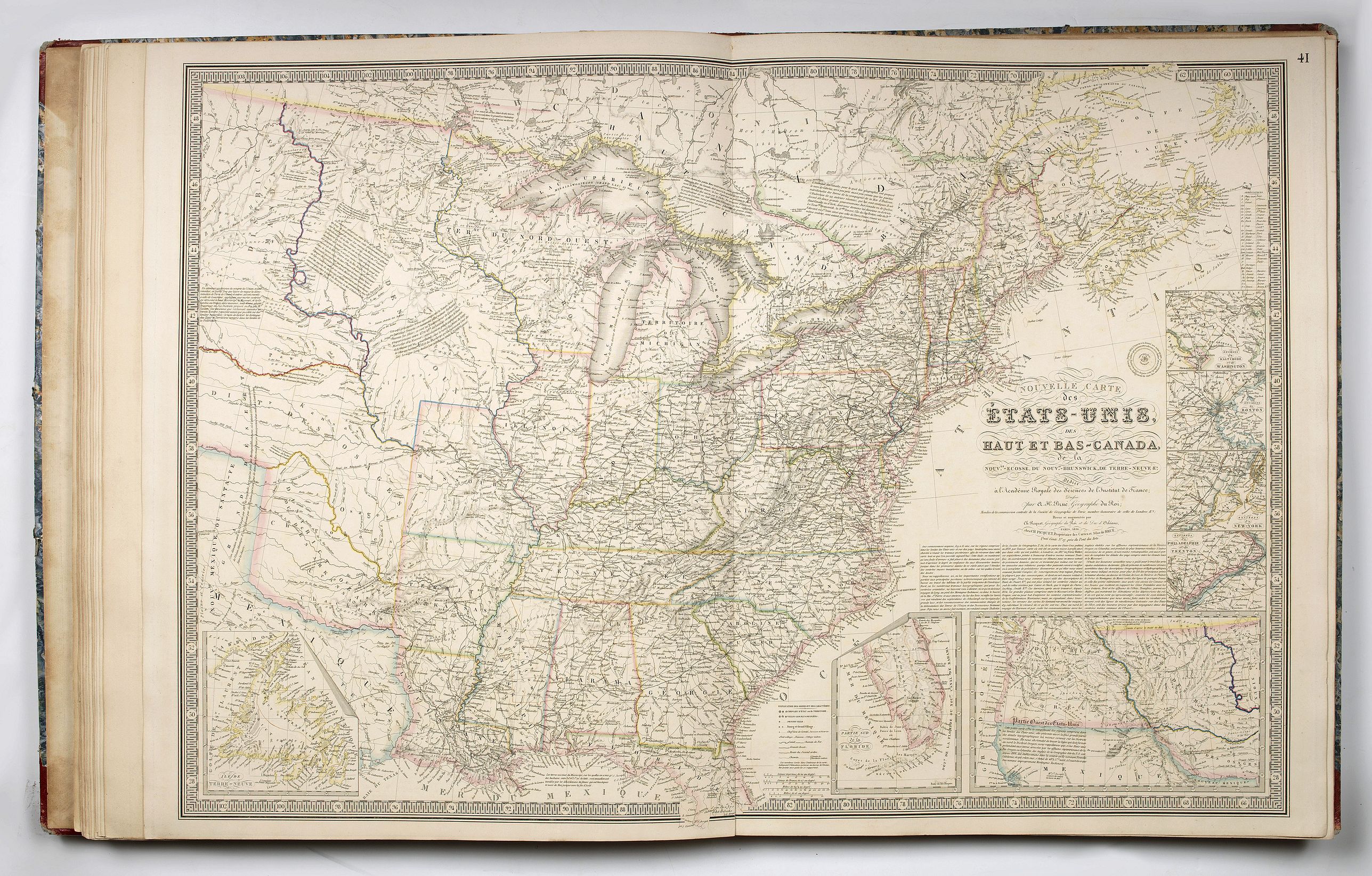
Including also Brué « Nouvelle Carte des Etats-Unis, des Haut et Bas-Canada, de la Nouvle. Ecosse, du Nouvau-Brunswick, de Terre-Neuve &c, 1836 ». A large map of the United States and Canada, showing Arkansas, made a state that year. Seven inset maps show details including the western Territories. Texas is shown as a Republic. (Wheat 420).
The last one is a beautiful colored plate showing the heights of mountains.
It was indeed an atlas of "choice" of the publisher and as such consists in a wide variety of maps that Andriveau-Goujon favoured to include at the time.
Brue was an important and prolific French cartographer, who for a time held the position of Geographe de Roi. His most significant achievement was his Atlas Geographique, Historique, Politique et Administratif de la France published between 1820 and 1828 and extending to 36 maps in a planned series of 48.
Reference: Wheat 404.
FAQ - Guarantee - Shipping
Buying in the BuyNow Gallery
This item is available for immediate purchase when a "Add to Cart" or "Inquire Now" button is shown.
Items are sold in the EU margin scheme
Payments are accepted in Euros or US Dollars.
Authenticity Guarantee
 We provide professional descriptions, condition report (based on 45 years experience in the map business)
Paulus Swaen warrants the authenticity of our items and a certificate of authenticity is provided for each acquired lot.
Condition and Coloring
We indicate the condition of each item and use our unnique HiBCoR grading system in which four key items determine a map's value: Historical Importance, Beauty, Condition/Coloring and Rarity.
Color Key
We offer many maps in their original black and white condition. We do not systematically color-up maps to make them more sellable to the general public or buyer.
Copper engraved or wood block maps are always hand colored. Maps were initially colored for aesthetic reasons and to improve readability. Nowadays, it is becoming a challenge to find maps in their original colors and are therefor more valuable.
We use the following color keys in our catalog:
Original colors; mean that the colors have been applied around the time the map was issued.
Original o/l colors; means the map has only the borders colored at the time of publication.
Colored; If the colors are applied recently or at the end of the 20th century.
Read more about coloring of maps [+]
Shipping fee
A flat shipping fee of $ 30 is added to each shipment by DHL within Europe and North America. This covers : International Priority shipping, Packing and Insurance (up to the invoice amount).
Shipments to Asia are $ 40 and rest of the world $50
We charge only one shipping fee when you have been successful on multiple items or when you want to combine gallery and auction purchases.
Read more about invoicing and shipping
FAQ
Please have a look for more information about buying in the BuyNow gallery
Many answers are likely to find in the general help section.
Virtual Collection
![]()
With Virtual Collection you can collect all your favorite items in one place. It is free, and anyone can create his or her Virtual map collection.
Unless you are logged in, the item is only saved for this session. You have to be registed and logged-in if you want to save this item permanently to your Virtual Collection.
Read More[+]
Register here, it is free and you do not need a credit card.
Add this item to
Virtual Collection
or click the following link to see my Virtual Collection.
| High-Resolution Digital Image Download | |
|
Paulus Swaen maintains an archive of most of our high-resolution rare maps, prints, posters and medieval manuscript scans. We make them freely available for download and study. Read more about free image download |
Click this image for a free HR-image download. |
In accordance with the EU Consumer Rights Directive and habitually reside in the European Union you have the right to cancel the contract for the purchase of a lot, without giving any reason.
The cancellation period will expire 14 calendar days from the day after the date on which you or a third party (other than the carrier and indicated by you) acquires, physical possession of the lot. To exercise the right to cancel you must inform Paulus Swaen Europe bv, which is offering to sell the lot either as an agent for the seller or as the owner of the lot, of your decision to cancel this contract by a clear statement (e.g. a letter sent by post, or e-mail (amsterdam@swaen.com).
To meet the cancellation deadline, it is sufficient for you to send your communication concerning your exercise of the right to cancel before the cancellation period has expired.