Sign In or Sign Up
Subscribe to be notified if similar examples become available.
1857 NAGAKUBO / NINOMIYA. - Historical atlas of China throughout the successive dynasties Or Sina rekidai enkaku zu.
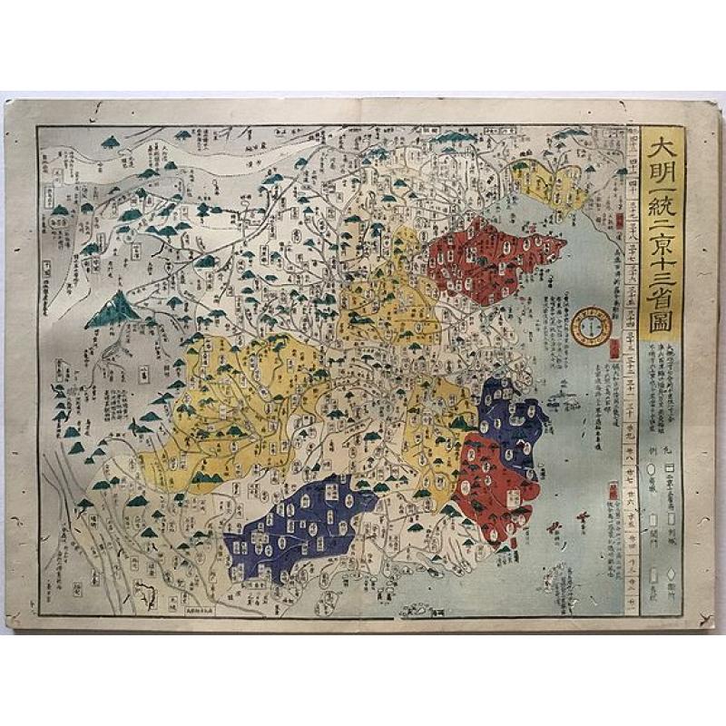
Historical atlas of China throughout the successive dynasties Or Sina rekidai enkaku zu. |
||||||||||||||||||||
|
||||||||||||||||||||
|
|
||||||||||||||||||||
|
Selling price: $ Please login to see price!
Sold in 2017 Missed this item! Add your name to our mailing list and be the first to get notified about our newly added listings. . |
My Collection +
Add this or any of your favorite items in one place. If you want to save the items permanently, you have to sign in or create an account first.   Add/Remove
 |
|||||||||||||||||||



Description
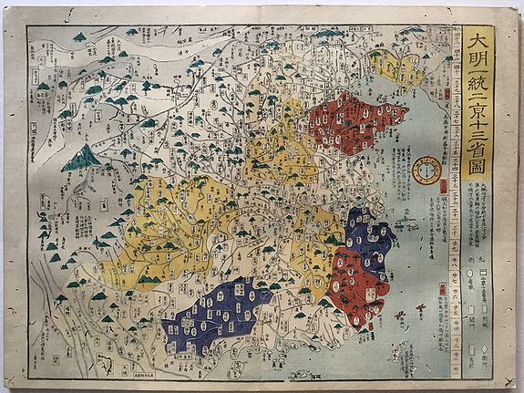
A beautiful woodblock atlas of China. Maps were originally made by the great Japanese cartographer, Nagakubo Sekisui, with this edition published by Ninomiya. There are 13 maps in the atlas, 12 of which show the geographic extent of various Chinese Dynasties. Maps include the Ming Dynasty, Tang Dynasty, Yuan, Qin, Three Warring States, Eastern Han and others. There is also one map of the North East Asian region, showing China, Korea and Japan. Maps are 37cm x 50cm.THE AUTHOR: Ninomiya Seiken was the compiler and also wrote the preface. It is interesting that Ninomiya did a private publishing of this book which was by and largely copied from NAGAKUBO Sekisui's work on the same subject. Actual production of the maps are: Maps 1 -3 drawn by NAGAKUBO Sekisui's original title: MOROKOSHI REKIDAI SHU GUN ENKAKU CHIZU. Maps 4 -6, NINOMIYA Seiken imitated NAGAKUBO's MOROKOSHI REKIDAI SHU GUN ENKAKU CHIZU. *** SUBJECTS OF THE MAPS: As an historical atlas, this work shows each of the dynasties beginning with the Great Ch'in, Western Ch'in, Eastern Han, Three Kingdoms, Northern & Southern Dynasties, T'ang, Ming, with a final map of Western Pacific region, it shows the West coast of North America with "Night Country" island at the top, all of Japan, Hokkaido all of Okinawa, down to the Malacca straits, Cambodia, Annam [Vietnam], Hainan Island, Guandong, Korea, Siberian and Tartary, with parts of the Great Wall, Peking and what a unified Ming Dynasty China looked like. Also other maps of the Yuan Mongol, Later Chou, Warring States, Thirty-six Provinces of Ch'in &c. This is essentially a Japanese impression of a Chinese map. * Each map shows the degrees for both latitude and longitude, as well as a Japanese compass, key to symbols. The ocean is skillfully colored in a pastel blue for the depths, fading and lighter blue effect near the coast lines. Each province, or country is a different color & properly named, with copious notes on the various islands, and inland waterways, mountains, cities, and the Gobi desert noted. Mongolia, Manchuria, Tartary is at the top, with a very large ocean above named 'Mizuumi' or Lake but this joins the Pacific ocean, leaving one the impression that this is part of the Pacific. Other period maps get more complicated as time passes into modern ages. * The earlier maps show fewer names, but still have considerable detail, with a several waterways from Japan to various destinations in China in red. Internal or land roads within China are also in red. As more political control over wider areas and the unification of China expanded, the provinces shifted, changed in size. What makes this set of maps fascinating, is they are all from a similar key block, with subtle variations in the coast line & of course the ever changing administrative areas. * An-nan [old Viet-nam or the 'Pacified South'] is always shown, as are all of the 'outer' areas or tributary areas that paid respect to the Chinese Emperors, thus the need to show these lands. Many of the maps clearly show the central or unified China area in a single color, with the outer areas of tributary lands & tributary kingdoms shown in separate and different colors. By the Han period [221 B.C.], the Chinese clearly knew themselves to be people of "Han" in contrast to other outlying ethnological people. * Very rare and unusual item and fascinating resource. * WOODBLOCK COLOR PRINTED: Entirely color printed by woodblocks on hand-made Washi paper. **** BIBLIOGRAPHY: George H. Beans: A LIST OF JAPANESE MAPS OF THE TOKUGAWA ERA, Supplement C, p.20 as entry: 1855. In fact this map was published in Ansei 4 [1857] and the colophon shows that date, but Beans entered this by the introduction date of Ansei 2nd year. Four entries later in the same volume on p.21 Beans lists [1877.2] MAP OF CHINA UNDER THE TS'ING [Qing] DYNASTY, which looks much more like this item, thus the confusing dates. This work was authored by Mito Sekisui per the colophon
FAQ - Guarantee - Shipping
This item is available for immediate purchase when a "Add to Cart" or "Inquire Now" button is shown.
Items are sold in the EU margin scheme
Payments are accepted in Euros or US Dollars.
Authenticity Guarantee
 We provide professional descriptions, condition report (based on 45 years experience in the map business)
Paulus Swaen warrants the authenticity of our items and a certificate of authenticity is provided for each acquired lot.
Condition and Coloring
We indicate the condition of each item and use our unnique HiBCoR grading system in which four key items determine a map's value: Historical Importance, Beauty, Condition/Coloring and Rarity.
Color Key
We offer many maps in their original black and white condition. We do not systematically color-up maps to make them more sellable to the general public or buyer.
Copper engraved or wood block maps are always hand colored. Maps were initially colored for aesthetic reasons and to improve readability. Nowadays, it is becoming a challenge to find maps in their original colors and are therefor more valuable.
We use the following color keys in our catalog:
Original colors; mean that the colors have been applied around the time the map was issued.
Original o/l colors; means the map has only the borders colored at the time of publication.
Colored; If the colors are applied recently or at the end of the 20th century.
Read more about coloring of maps [+]
Shipping fee
A flat shipping fee of $ 30 is added to each shipment by DHL within Europe and North America. This covers : International Priority shipping, Packing and Insurance (up to the invoice amount).
Shipments to Asia are $ 40 and rest of the world $50
We charge only one shipping fee when you have been successful on multiple items or when you want to combine gallery and auction purchases.
Read more about invoicing and shipping
FAQ
Please have a look for more information about buying in the BuyNow gallery
Many answers are likely to find in the general help section.
My Collection+

With My Collection+ you can collect all your favorite items in one place. It is free, and anyone can create his or her virtual collection.
Unless you are logged in, the item is only saved for this session. You have to be registed and logged-in if you want to save this item permanently to My Collection+. Read More[+]
Register here, it is free and you do not need a credit card.
Add this item to My Collection+ or click the following link to see My Collection+.
|
Digital Image Download Paulus Swaen maintains an archive of most of our high-resolution rare maps, prints, posters and medieval manuscript scans. We make them freely available for download and study. Read more about free image download |
Click the image for a free small image download. |
YOUR RIGHT TO CANCEL THE PURCHASE OF A LOT
In accordance with the EU Consumer Rights Directive and habitually reside in the European Union you have the right to cancel the contract for the purchase of a lot, without giving any reason.
The cancellation period will expire 14 calendar days from the day after the date on which you or a third party (other than the carrier and indicated by you) acquires, physical possession of the lot. To exercise the right to cancel you must inform Paulus Swaen Inc, of your decision to cancel this contract by a clear statement (e.g. a letter sent by post, or e-mail.
To meet the cancellation deadline, it is sufficient for you to send your communication concerning your exercise of the right to cancel before the cancellation period has expired.
