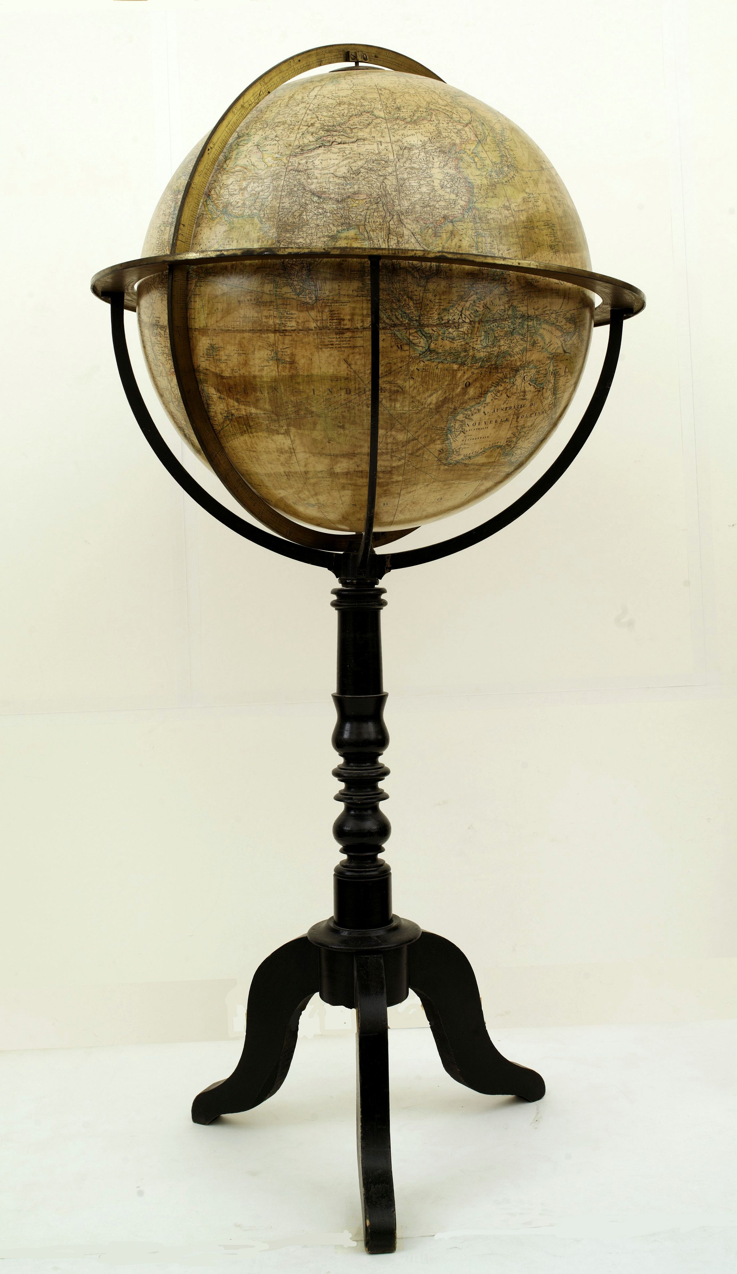
Globe terrestre d'après les découvertes.. |
||||||||||||||||||||
|
||||||||||||||||||||
|
|
||||||||||||||||||||
$6000 / ≈ €5246This item is available for immediate sale! Questions before Buying ?
We are happy to answer your questions.
6000.00
|
My Collection +
Add this or any of your favorite items in one place. If you want to save the items permanently, you have to sign in or create an account first. |
|||||||||||||||||||
Description
Attractive and large (height 112cm) library globe by a prominent Paris globe maker, with a brass meridian circle, horizon ring, and hour ring, supported by four brass quadrants on an elegant baluster-turned wooden column with three inswept legs terminating in pad feet.
Twelve colored lithographed gores and two polar calottes, showing steamship navigation routes and ocean currents, political and geographical boundaries defined, telegraph cable routes, explorations until 1878/80 (by Nordenskïold), Ocean currents colored by hand.
NOTE: Additional shipping costs apply. The item is located in Zwijndrecht (The Netherlands) and can be seen or collected during regular business hours.
In the 1867 International Exhibition, he was awarded a bronze medal and he devised a clockwork-driven planetarium contained within a glass sphere.
A globe clock using one of his globes is known.
In 1875, Bertaux joined the house of Delamarche, at the solicitation of the managing director, Gosselin. A founding member of the Société Astronomique de France in 1887 and both its secretary and its treasurer, Bertaux was awarded the Prix de Dames for his services in 1903.
He was succeeded in the direction of the Delamarche business by G. Thomas. He included in his range the Moon globe of C.M. Gaudibert and Camille Flammarion, the Mars globes of E. Antoniadi and Flammarion (1884) and a terrestrial ‘Globe métrique’. A 30cm terrestrial globe by him is dated 1886.
Globe sizes: terrestrial 8cm to 66cm (including a Spanish edition); celestial 8cm to 66cm. These were issues of the Delamarche/Dien globes revised by E. Desbuissons.
Armillary spheres, either Ptolemaic or Copernican, were available from 8cm to 33cm, as were geared planetaria. Among the atlases he published was MAGER, Henri. 'Petit Atlas de géographie en relief ' [n.d. but ca. 1880 - 1883.
Reference: A Bio-bibliographical Dictionary of precision Instrument-makers and related craftsmen in France & Switzerland, 1430-1960.
FAQ - Guarantee - Shipping
Buying in the BuyNow Gallery
This item is available for immediate purchase when a "Add to Cart" or "Inquire Now" button is shown.
Items are sold in the EU margin scheme
Payments are accepted in Euros or US Dollars.
Authenticity Guarantee
 We provide professional descriptions, condition report (based on 45 years experience in the map business)
Paulus Swaen warrants the authenticity of our items and a certificate of authenticity is provided for each acquired lot.
Condition and Coloring
We indicate the condition of each item and use our unnique HiBCoR grading system in which four key items determine a map's value: Historical Importance, Beauty, Condition/Coloring and Rarity.
Color Key
We offer many maps in their original black and white condition. We do not systematically color-up maps to make them more sellable to the general public or buyer.
Copper engraved or wood block maps are always hand colored. Maps were initially colored for aesthetic reasons and to improve readability. Nowadays, it is becoming a challenge to find maps in their original colors and are therefor more valuable.
We use the following color keys in our catalog:
Original colors; mean that the colors have been applied around the time the map was issued.
Original o/l colors; means the map has only the borders colored at the time of publication.
Colored; If the colors are applied recently or at the end of the 20th century.
Read more about coloring of maps [+]
Shipping fee
A flat shipping fee of $ 30 is added to each shipment by DHL within Europe and North America. This covers : International Priority shipping, Packing and Insurance (up to the invoice amount).
Shipments to Asia are $ 40 and rest of the world $50
We charge only one shipping fee when you have been successful on multiple items or when you want to combine gallery and auction purchases.
Read more about invoicing and shipping
FAQ
Please have a look for more information about buying in the BuyNow gallery
Many answers are likely to find in the general help section.
My Collection+
![]()
With My Collection+ you can collect all your favorite items in one place. It is free, and anyone can create his or her virtual collection.
Unless you are logged in, the item is only saved for this session. You have to be registed and logged-in if you want to save this item permanently to My Collection+.
Read More[+]
Register here, it is free and you do not need a credit card.
Add this item to
My Collection+
or click the following link to see My Collection+.
| Digital Image Download | |
|
Paulus Swaen maintains an archive of most of our high-resolution rare maps, prints, posters and medieval manuscript scans. We make them freely available for download and study. Read more about free image download |
Click the image for a free small image download. |
In accordance with the EU Consumer Rights Directive and habitually reside in the European Union you have the right to cancel the contract for the purchase of a lot, without giving any reason.
The cancellation period will expire 14 calendar days from the day after the date on which you or a third party (other than the carrier and indicated by you) acquires, physical possession of the lot. To exercise the right to cancel you must inform Paulus Swaen Inc, of your decision to cancel this contract by a clear statement (e.g. a letter sent by post, or e-mail.
To meet the cancellation deadline, it is sufficient for you to send your communication concerning your exercise of the right to cancel before the cancellation period has expired.
Recently Viewed
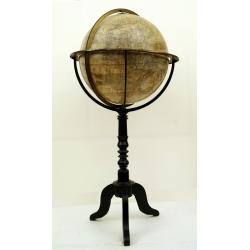
Globe terrestre d'après les découvertes..
Attractive and large (height 112cm) library globe by a prominent Paris globe maker, with a brass meridian circle, horizon ring, and hour ring, supported by four brass qua...
Date: Paris, ca. 1885
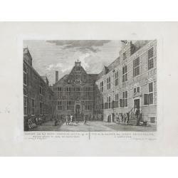
Gezicht van het Oost-Indisch-Huys, op de binnen plaats te zien, tot Amsterdam.
Taken from the "Atlas of Amsterdam". Showing the inner square of the East Indian House of the V.O.C. in Amsterdam.A place for meeting, trading and storage of sp...
Date: Amsterdam, 1780
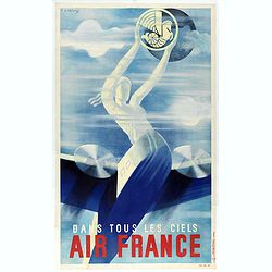
Air France dans tous les ciels.
Rare travel mini-poster made by Roger de Valerio in 1935. This example is one of the first advertising poster made by Air France. Roger de Valerio (1886 - 1951) is a Fren...
Date: Imprimerie Perceval, Paris, 1936
![[Women dancing in a Ulietea house ].](/uploads/cache/26376-250x250.jpg)
[Women dancing in a Ulietea house ].
Aquatint depicting women dancing in front of musicians and local villagers in a Ulietea house. Plate N° 87. From Giulio Ferrario's work Le Costume Ancien et Moderne ou Hi...
Date: Milan, 1827
