Mappemonde ou carte générale du globe terrestre dessinée suivant les règles de la projection des cartes réduites… |
|||||||||||||||||||||||
|
|||||||||||||||||||||||
|
|
|||||||||||||||||||||||
|
WATCH
Bidder pays on top of the buy price:
|
My Collection +
Add this or any of your favorite items in one place. If you want to save the items permanently, you have to sign in or create an account first.   Add/Remove
Bids:
0
|
||||||||||||||||||||||



Description
Large world map showing the sea-tracks of Captain Cook in his three Pacific voyages published by C. F. Delamarche. Rare state 4, dated 1786, of this large world map featuring for the first time Cook's third Voyage and "Mer de l'Ouest" has been removed*. Figurs the island of Owhyhée (Sandwich islands) where Capt. Cook has been killed on 24 February 1779.
Mappemonde ou carte générale du globe terrestre dessinée suivant les règles de la projection des cartes réduites / Robert de Vaugondy, géographe ; corrigée et augmentée des découvertes du Cap. Cook et de ses trois voyages par C.F. Delamarche géogr. Successeur de Vaugondy. Engraved by E. Dussy. Title cartouche drawn and engraved by Arrivet.
Delamarche, a student of De Vaugondy, reissued a number of maps of his teacher Robert de Vaugondy, updating them to reflect the latest discoveries.
George Vancouver entered the history of exploration by joining both the second and the third expedition of James Cook. On his third expedition, Cook had been looking for the possible existence of the Northwest Passage (a sea route through or around North America), and in 1791 Vancouver was sent out to complete this search.
The "Sea of the West" present on the Vaugondy's first edition (1760) has desappeared.
On this state, the Asia/North America connection is erased and the polar regions are shown free of any land mass.
In Asia, the sea between Korea and Japan is called "Mer de Corée" (Sea of Korea).
Shows a totally redefined shape of Australia with numerous location names and New Zealand has been fully delineated with numerous place names, after Cook's third track.
It is surprising that Didier Robert De Vaugondy included a Mer de l'Ouest on this map as he had violently disagreed with Buache's and J. N. De l'Isle's concepts regarding their geographical concepts of the northwest coast of North America. Pedley describes the acrimonious correspondence and debate in regard to this matter (p. 78). This world map is also striking for its absence of an Antarctic land mass. Cartouche marked, "Arrivet inv. & sculp." Also noted, "gravé par E. Dussy."
For Pedley, this map has four states. There may be a fifth (see below). State 1: Dated 1760. Artic land mass has a connection to North America. State 2: Dated 1775. "Censeur Royal" added to title. State 3: Dated 1778, "Chez Fortin Ingr." *State 4: c. 1786 ("Carte corrigée, augmentée … en 1786.") Not observed. Published in Paris by Delamarche (par C.F. Delamarche. Gravé par E. Dussy.) As the map was not observed, Pedley could not state if the Mer de l'Ouest persists on this last state. Also noted, "A Paris : chez le Cit. Delamarche, géographe, rue du Foin Saint-Jacques au Collége de Mtre Gervais, 1786." State 5: A map by this title and author, dated 1804, Delamarche, "corrigée et augmentée des découvertes du Cap. Cook … de celles de la Perouse en 1801; de Vancouver, de Mackensie en 1802 … Par Delamarche … Gravé par E. Dussy." (McGuirk).
Reference: Pedley, p. 78 ; McGuik,The last great cartographic myth, Mer de l'Ouest, 85, state 4
FAQ - Guarantee - Shipping
994 BuyBidBuying in the BuyNow Gallery
This item is available for immediate purchase when a "Add to Cart" or "Inquire Now" button is shown.
Payments are accepted in Euros or US Dollars. We accept most major credit cards, PayPal and bank transfer.
Authenticity Guarantee
 We provide professional descriptions, condition report and HiBCoR rating (based on 45 years experience in the map business)
We fully guarantee the authenticity of items we sell. We provide a certificate of authenticity for each purchased item.
Condition / Coloring
We indicate the condition of each item and use our unnique HiBCoR grading system in which four key items determine a map's value: Historical Importance, Beauty, Condition/Coloring and Rarity.
We offer many maps in their original black and white condition. We do not systematically color-up maps to make them more sellable to the general public or buyer.
Copper engraved or wood block maps are always hand colored. Maps were initially colored for aesthetic reasons and to improve readability. Nowadays, it is becoming a challenge to find maps in their original colors and are therefor more valuable.
We use the following color keys in our catalog:
Original colors; mean that the colors have been applied around the time the map was issued.
Colored; If the colors are applied recently or at the end of the 20th century, then "colored", or "attractive colors" will be used.
Original o/l colors; means the map has only the borders colored at the time of publication.
Read more about coloring of maps [+]
FAQ
Please have a look for more information about buying in the BuyNow gallery.
Many answers are likely to find in the general help section.
My Collection+

With My Collection+ you can collect all your favorite items in one place. It is free, and anyone can create his or her virtual map collection.
Unless you are logged in, the item is only saved for this session. You have to be registed and logged-in if you want to save this item permanently to My Collection+.
Read More [+]
If you want to save the items permanently, please sign in
or create account first.
Registering Here, it is and you do not need a credit card.
Add this item to
My Collection+
or click the following link to see My Collection+.
Invoice
The invoice and certificates of authenticity are available in the client center >Invoices
| Digital Image Download | |
|
Paulus Swaen maintains an archive of most of our high-resolution rare maps, prints, posters and medieval manuscript scans. We make them freely available for download and study. Read more about free image download |
Click the image for a free small image download. |
In accordance with the EU Consumer Rights Directive and habitually reside in the European Union you have the right to cancel the contract for the purchase of a lot, without giving any reason.
The cancellation period will expire 14 calendar days from the day after the date on which you or a third party (other than the carrier and indicated by you) acquires, physical possession of the lot. To exercise the right to cancel you must inform Paulus Swaen Inc, of your decision to cancel this contract by a clear statement (e.g. a letter sent by post, or e-mail.
To meet the cancellation deadline, it is sufficient for you to send your communication concerning your exercise of the right to cancel before the cancellation period has expired.
Recently Viewed

Mappemonde ou carte générale du globe terrestre dessinée suivant les règles de la projection des cartes réduites…
Large world map showing the sea-tracks of Captain Cook in his three Pacific voyages published by C. F. Delamarche. Rare state 4, dated 1786, of this large world map featu...
Starting Bid: $2000
BidAsk spread: $2500 - $3500
Maker: ROBERT DE VAUGONDY, G. / DELAMARCHE, C. F.Date: Paris, Robert de Vaugondy/Delamarche, 1786
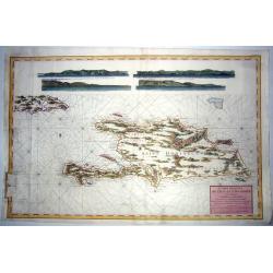
ST DOMINGUE,- CARTE REDUITE DE L'ISLE DE .. 1787
Extra-large sea chart of the island of Saint Domingue, present-day Haiti, and Santo Domingo. Also includes the eastern part of Cuba, as well as four profiles showing the ...
Starting Bid: $192
BidAsk spread: $240 - $330
Maker: Count Chastenet-Puisegur / Depot de la MarineDate: Paris, 1787
