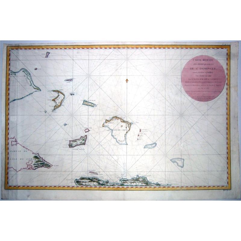
TURKS-CAICOS-BAHAMAS,- CARTE REDUITE DES DEBOUQUEMENTS DE St. DOMINGUE. . . |
|||||||||||||||||||||||
|
|||||||||||||||||||||||
|
|
|||||||||||||||||||||||
|
WATCH
Bidder pays on top of the buy price:
|
My Collection +
Add this or any of your favorite items in one place. If you want to save the items permanently, you have to sign in or create an account first.   Add/Remove
Bids:
0
|
||||||||||||||||||||||



Description
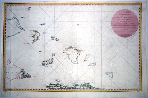
A rare, extra-large, double-page sea chart with rhumb lines, of the northern coastline of Santo Domingo, featuring the Turks and Caicos Islands, the Lower Bahamas, eastern parts of Cuba.
A very nice example of an intriguing and attractive chart, published by the French Depot de Marine in 1787, after a survey taken in 1784/5, by the Count Chastenet-Puisegur, commander of the corvette 'Vautour'.
The Dépôt de la Marine, known more formally as the Dépôt des cartes et plans de la Marine, was the central charting institution of France. The centralization of hydrography in France began in earnest when Jean-Baptiste Colbert became First Minister of France in 1661. Under his watch, the first Royal School of Hydrography began operating, as did the first survey of France’s coasts (1670-1689).
In 1680, Colbert consolidated various collections of charts and memoirs into a single assemblage, forming the core of sources for what would become the Dépôt. The Dépôt itself began as the central deposit of charts for the French Navy. In 1720, the Navy consolidated its collection with those government materials covering the colonies, creating a single large repository of navigation.
By 1737, the Dépôt was creating its own original charts, and, from 1750, they participated in scientific expeditions to determine the accurate calculation of longitude. In 1773, the Dépôt received a monopoly over the composition, production, and distribution of navigational materials, solidifying their place as the main producer of geographic knowledge in France.
Dépôt approved charts were distributed to official warehouses in port cities and sold by authorized merchants. The charts were of the highest quality, as many of France’s premier mapmakers worked at the Dépôt in the eighteenth century, including Philippe Bauche, Jacques-Nicolas Bellin, Rigobert Bonne, Jean Nicolas Buache, and Charles-François Beautemps-Beaupré.
The Dépôt continued to operate until 1886, when it became the Naval Hydrographic Service. In 1971, it changed names again, this time to the Naval and Oceanographic Service (SHOM). Although its name has changed, its purpose is largely the same, to provide high-quality cartographic and scientific information to the France’s Navy and merchant marine.
FAQ - Guarantee - Shipping
994 BuyBidBuying in the BuyNow Gallery
This item is available for immediate purchase when a "Add to Cart" or "Inquire Now" button is shown.
Payments are accepted in Euros or US Dollars. We accept most major credit cards, PayPal and bank transfer.
Authenticity Guarantee
 We provide professional descriptions, condition report and HiBCoR rating (based on 45 years experience in the map business)
We fully guarantee the authenticity of items we sell. We provide a certificate of authenticity for each purchased item.
Condition / Coloring
We indicate the condition of each item and use our unnique HiBCoR grading system in which four key items determine a map's value: Historical Importance, Beauty, Condition/Coloring and Rarity.
We offer many maps in their original black and white condition. We do not systematically color-up maps to make them more sellable to the general public or buyer.
Copper engraved or wood block maps are always hand colored. Maps were initially colored for aesthetic reasons and to improve readability. Nowadays, it is becoming a challenge to find maps in their original colors and are therefor more valuable.
We use the following color keys in our catalog:
Original colors; mean that the colors have been applied around the time the map was issued.
Colored; If the colors are applied recently or at the end of the 20th century, then "colored", or "attractive colors" will be used.
Original o/l colors; means the map has only the borders colored at the time of publication.
Read more about coloring of maps [+]
FAQ
Please have a look for more information about buying in the BuyNow gallery.
Many answers are likely to find in the general help section.
My Collection+

With My Collection+ you can collect all your favorite items in one place. It is free, and anyone can create his or her virtual map collection.
Unless you are logged in, the item is only saved for this session. You have to be registed and logged-in if you want to save this item permanently to My Collection+.
Read More [+]
If you want to save the items permanently, please sign in
or create account first.
Registering Here, it is and you do not need a credit card.
Add this item to
My Collection+
or click the following link to see My Collection+.
Invoice
The invoice and certificates of authenticity are available in the client center >Invoices
| Digital Image Download | |
|
Paulus Swaen maintains an archive of most of our high-resolution rare maps, prints, posters and medieval manuscript scans. We make them freely available for download and study. Read more about free image download |
Click the image for a free small image download. |
In accordance with the EU Consumer Rights Directive and habitually reside in the European Union you have the right to cancel the contract for the purchase of a lot, without giving any reason.
The cancellation period will expire 14 calendar days from the day after the date on which you or a third party (other than the carrier and indicated by you) acquires, physical possession of the lot. To exercise the right to cancel you must inform Paulus Swaen Inc, of your decision to cancel this contract by a clear statement (e.g. a letter sent by post, or e-mail.
To meet the cancellation deadline, it is sufficient for you to send your communication concerning your exercise of the right to cancel before the cancellation period has expired.
Recently Viewed
TURKS-CAICOS-BAHAMAS,- CARTE REDUITE DES DEBOUQUEMENTS DE St. DOMINGUE. . .
A rare, extra-large, double-page sea chart with rhumb lines, of the northern coastline of Santo Domingo, featuring the Turks and Caicos Islands, the Lower Bahamas, easter...
Starting Bid: $400
BidAsk spread: $500 - $720
Maker: LE DÉPÔT GÉNÉRAL DE LA MARINE / Chastenet-Puisegur.Date: Paris, 1787
MARTINIQUE NAVAL ROUTES,- CARTE REDUITE POUR LA NAVIGATION DE CAYENNE A LA MARTINIQUE.
A rare, extra-large decorative nautical map of the Lesser Antilles or Windward Islands and vicinity, with an inset map of the city of Cayenne on the Island of Cayenne is ...
Starting Bid: $288
BidAsk spread: $360 - $520
Maker: BELLIN, J.N.Date: Paris, 1764
