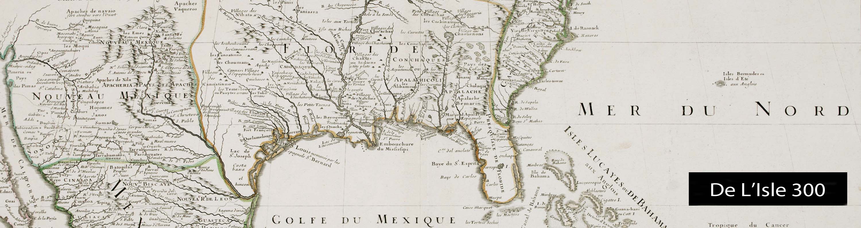
PAULUS SWAEN OLD & RARE MAPS
We specialize in rare maps, atlases, globes, travel posters, master prints, and decorative prints from the 16th to 18th centuries and offer antique maps from all parts of the world, produced by renowned cartographers such as Ortelius, Mercator, Blaeu, Janssonius, Hondius, Visscher, and de Wit.
Our BuyNow catalog offers old and rare maps, decorative prints, travel posters, books and Medieval manuscripts!
Every sold item will receive a certificate of authenticity. We offer a lifetime guarantee on all our items.
The high standards of our map and atlas collection are world-renowned.
Swaen BuyNow CATALOG
Our BuyNow-catalog offers immediate sale items, and no commission is charged. The catalog includes old maps of the World - America - Asia - Europe - Africa - Medieval Manuscripts - Nuremberg Chronicle - Prints - Posters, atlases, globes, etc.
Our stock is updated weekly, and our most recent additions are conveniently displayed in our "Latest Listings".
Have a look at our Gallery highlights or our Curated Collection of carefully selected old and rare maps, all graded 8-10 stars in the HiBCoR grading system.
Latest Listings & Updates
You can always check our latest listings page. It is updated daily and you see what we’ve recently added. Let's take a look at some rare maps we've recently acquired.Join our newsletter and be the first to be notified of new acquisitions and get exclusive offers.
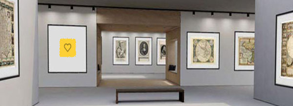
Gallery Highlights
In this highlights section of the BuyNow catalog, we present some personal favorites from our large stock of authentic maps, atlases, prints, globes, posters and Medieval manuscripts.
The items are immediately available, and no commission is charged.
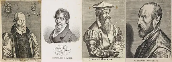
Mapmakers and explorers
Sometimes, maps become more famous than their makers. Many cartographers only become famous after they’ve created a masterpiece.
Still, others make a famous map, then disappear from history forever.
My Collection+
Now you can save any of your favorite items from our BuyNow catalog, Latest Listings or Archive in one place. Build your own Virtual Collection. It is free and you can delete an item at any time. Previously acquired items are automatically added to the My Collection+ list.
The Mapping of . . .
We have created some short articles on the mapping of Arabia, Australia, Canada, China, Hungary, the Invasion of Minorca, Japan, Korea, Malta, the Mer de l'Ouest, the Northwest Passage, Poland, Russia, Southeast Asia, Taiwan, and Ukraine, among other regions.

Archive of sold items
Paulus Swaen maintains an archive of sold items, including images. Most map images are not subject to copyright and can be used freely, as they are in the public domain. These historically achieved prices can help understand the pricing development of old maps.

Read our short articles
If you are interested in the backgrounds of antique maps, prints, mapmakers, etc. then you should read our short but informative articles >>>>
Or about posters, old prints, Nuremberg Chronicle, optical prints, medieval manuscripts, etc.
Featured Listings
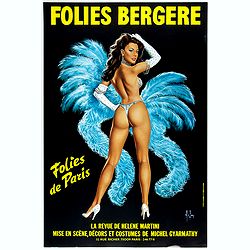
Folies Bergere - Folies de Paris. La revue de Hélène Martin . . .
Original advertising poster for Les Folies Bergère cabaret in Paris. The Théâtre des Folies Bergère is a famous Parisian performance hall inaugurated on May 2, 1869 a...
Date: Paris, ca. 1977
![[ Manuscript map of the Ligurian coast from Pietra to Genova ].](/uploads/cache/26627-250x250.jpg)
[ Manuscript map of the Ligurian coast from Pietra to Genova ].
Very detailed French manuscript map of the Ligurian coast from Pietra and Finale, Savone to Genoa with the Maritime Alps in the background. The Liguria coast borders to n...
Date: France, ca. 1790-1800
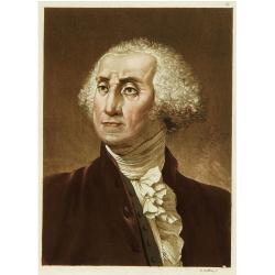
Portrait de George Washington.
Portrait of the first president of the United States of America.From Giulio Ferrario's work Le Costume ancien et moderne ou histoire du gouvernement, de la milice, de la ...
Date: Milan 1827
![[Set of 3 optical prints] Vue du Pallais du l'Empereur de Perse avec la Mosquée, ou Eglise a Ispahan.](/uploads/cache/49123-250x250.jpg)
[Set of 3 optical prints] Vue du Pallais du l'Empereur de Perse avec la Mosquée, ou Eglise a Ispahan.
An optical print of the court of the Persian Emperor. Engraved by F.X. Habermann (1721-1796). The Academie Imperiale was a well-known publisher of optical prints establis...
Date: Augsburg, 1750
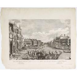
Veduta della Magnifica REGATA seguita in Venezia li 2. Aprile 1791 alla quale intervennero li Augusti Viaggiator.
Decorative engraving of a Venice regatta on the Grand Canal, by Teodoro Viero (1740-1819) after a paining by Canaletto.The tradition of Venetian origin of the race is lin...
Date: Venice, c. 1791

Typus Frisiae Orientalis à Dullarto
One of the most decorative maps of East Frisia and its important shipping center of Emden and the Watten Islands, from the cartography of Ubbo Emmius, a local cartographe...
Date: Amsterdam, ca. 1624
Popular Listings
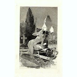
A rare suite of 12 original etchings by Martin van Maele to the famous work by Edmond Haracourt.
A rare suite of 12 original etchings by Martin van Maele to the famous work by Edmond Haracourt. The series was published anonymously in a small edition. These etchings a...
Date: Nevers, Brussels, 1882,1883

Nova Totius Terrarum Orbis Geographica ac Hydrographica Tabula.
A beautifully decorative world map taken from the 'English Atlas' by Moses Pitt and Steven Swart, based on an earlier engraved world map by Pieter van den Keere ca. 1630,...
Date: Oxford, 1680
![[Anti capitalism Soviet Union propaganda poster]](/uploads/cache/47032-250x250.jpg)
[Anti capitalism Soviet Union propaganda poster]
Propaganda mini anti-capitalism poster published in Russia during The Cold War. By the 1960’s and 1970’s, outrageous practices in Soviet bureaucracy flourished. Poor ...
Date: Leningrad, 1974
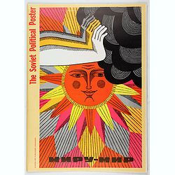
The Soviet Political Poster. - a portfolio collection of 32, full-color posters.
An attractive, large portfolio set of 32 reproductions published in Leningrad in 1976 by Aurora Art Publishers, containing various Soviet Union political posters from 191...
Date: Leningrad, Aurora Art Publishers, 1976
