1644
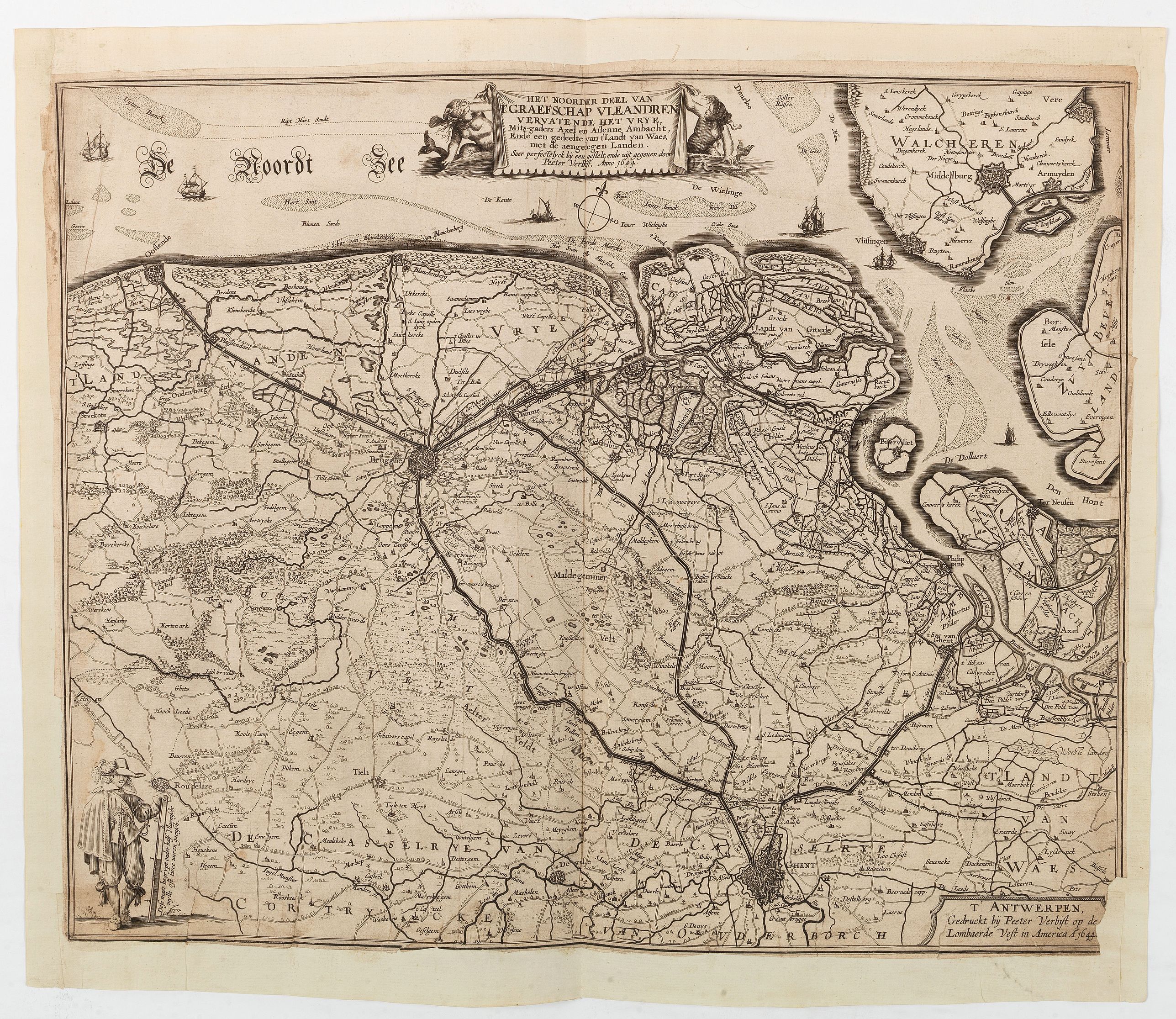
Het Noorder deel van T'Graefschap Vleandren vervatende het vrye Mits-gaders Axe… |
||||||||||||||||||||
|
||||||||||||||||||||
|
|
||||||||||||||||||||
$3000 / ≈ €2669This item is available for immediate sale! Questions before Buying ?
We are happy to answer your questions. |
My Collection +
Add this or any of your favorite items in one place. If you want to save the items permanently, you have to sign in or create an account first.   Add/Remove
|
|
| |||||||||||||||||



Description
A separately published map in Antwerp of the utmost rarity : " T’Antwerpen, Gedruckt bÿ Peeter Verbiest op de Lombaerde Vest in America A° 1644".
An exceptionally rare and highly sought-after mid-17th-century regional map delineating the northern maritime sector of the historical County of Flanders, published at the height of the Eighty Years' War.
Engraved and published in Antwerp by the prominent Flemish cartographer Peeter Verbiest (also known as Pieter Verbiest), this beautifully detailed sheet explicitly highlights the vital territorial buffer zone known as the Brugse Vrije (the Liberty of Bruges) alongside the strategic amphibious frontlines of Axel and the surrounding polders. This map serves as an analytical military snapshot capturing the delicate balance of power between the Spanish Netherlands and the United Provinces of the Dutch Republic.
The Frontlines of 1644: Printed just four years prior to the historic Peace of Münster (1648), the map focuses directly on military architecture and operational defenses. It meticulously plots heavily fortified strongholds, bastions, defensive redoubts, and newly raised dikes. Crucially, it tracks active tactical inundation zones, areas where polders were intentionally breached and flooded by engineers to halt Spanish or State troop movements.
One copy is preserved at the Museum Plantin-Moretus / Prentenkabinet (Antwerp, Belgium) in Antwerp.
Peter Verbiest (1605 - 1693)
The Verbiest family was a family of mapmakers, printers and publishers. The family fled after the fall of Antwerp to the Netherlands, but returned in 1609 for the duration of the twelve-year truce. The family set up shop in Antwerp at Op de lombaerde vest onder het uithangbord Americ sign, the only map publishing firm to return to the south and publishing.
The patriarch of the family, Pieter Verbiest (ca. 1560-1643) had two sons, among whom Peter II (1607-1669) was the most prolific. It is not always clear which of them was the author of a particular map. Their cartographic production mainly consisted of loose maps. The firm never published a standard folio atlas, but did produce a small atlas of the Netherlands (1636).
FAQ - Guarantee - Shipping
This item is available for immediate purchase when a "Add to Cart" or "Inquire Now" button is shown.
Items are sold in the EU margin scheme
Payments are accepted in Euros or US Dollars.
Authenticity Guarantee
 We provide professional descriptions, condition report (based on 45 years experience in the map business)
Paulus Swaen warrants the authenticity of our items and a certificate of authenticity is provided for each acquired lot.
Condition and Coloring
We indicate the condition of each item and use our unnique HiBCoR grading system in which four key items determine a map's value: Historical Importance, Beauty, Condition/Coloring and Rarity.
Color Key
We offer many maps in their original black and white condition. We do not systematically color-up maps to make them more sellable to the general public or buyer.
Copper engraved or wood block maps are always hand colored. Maps were initially colored for aesthetic reasons and to improve readability. Nowadays, it is becoming a challenge to find maps in their original colors and are therefor more valuable.
We use the following color keys in our catalog:
Original colors; mean that the colors have been applied around the time the map was issued.
Original o/l colors; means the map has only the borders colored at the time of publication.
Colored; If the colors are applied recently or at the end of the 20th century.
Read more about coloring of maps [+]
Shipping fee
A flat shipping fee of $ 30 is added to each shipment by DHL within Europe and North America. This covers : International Priority shipping, Packing and Insurance (up to the invoice amount).
Shipments to Asia are $ 40 and rest of the world $50
We charge only one shipping fee when you have been successful on multiple items or when you want to combine gallery and auction purchases.
Read more about invoicing and shipping
FAQ
Please have a look for more information about buying in the BuyNow gallery
Many answers are likely to find in the general help section.
My Collection+

With My Collection+ you can collect all your favorite items in one place. It is free, and anyone can create his or her virtual collection.
Unless you are logged in, the item is only saved for this session. You have to be registed and logged-in if you want to save this item permanently to My Collection+. Read More[+]
Register here, it is free and you do not need a credit card.
Add this item to My Collection+ or click the following link to see My Collection+.
|
Digital Image Download Paulus Swaen maintains an archive of most of our high-resolution rare maps, prints, posters and medieval manuscript scans. We make them freely available for download and study. Read more about free image download |
Click the image for a free small image download. |
YOUR RIGHT TO CANCEL THE PURCHASE OF A LOT
In accordance with the EU Consumer Rights Directive and habitually reside in the European Union you have the right to cancel the contract for the purchase of a lot, without giving any reason.
The cancellation period will expire 14 calendar days from the day after the date on which you or a third party (other than the carrier and indicated by you) acquires, physical possession of the lot. To exercise the right to cancel you must inform Paulus Swaen Inc, of your decision to cancel this contract by a clear statement (e.g. a letter sent by post, or e-mail.
To meet the cancellation deadline, it is sufficient for you to send your communication concerning your exercise of the right to cancel before the cancellation period has expired.
