Maps with figured borders. "Carte à bordure" maps.
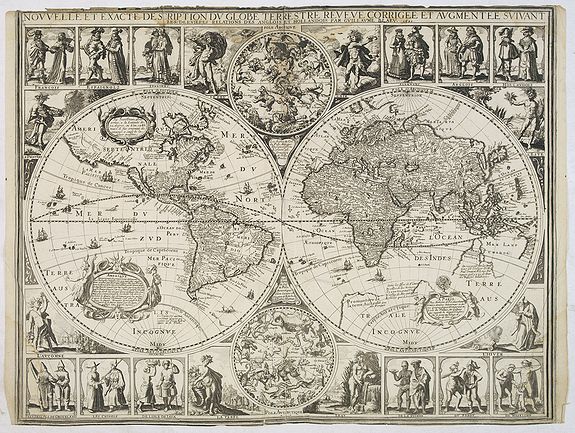
The map decoration was relegated to the map borders to avoid detracting from the map's actual contents. A more rigorous approach was developed, in which the decorative elements were related directly to the map area involved.
Town plans and views, combined with costumed figures of native characteristics for the map area, were the most sought-after subject matter for the decorative borders.
It is noteworthy that publishers, even though they could call upon a large stock of existing prints, still specially commissioned well-known artists to produce new designs.
The most complete reference work on folio-sized Dutch carte-à-figures maps is volume VI of "Monumenta Cartographica Neerlandica", by Prof. Guenter Schilder and Prof. Klaus Stopp.
The two-volume work contains an illustrated descriptive catalog of all Dutch single-sheet maps with decorative borders. In this cartobibliography the history of each copperplate in its different states are described (c.120 prototypes in about 350 states). Attention will be paid to both art-historical and geographical aspects.
A separate volume contains a selection of full-scale reproductions.
The third chapter provides an overview of the development of decorative borders on folio maps. The preferred design of these borders combined town views with costumed figures from the regions depicted.
The printed sources used by the engravers and etchers, as well as the surviving manuscript models made for specially commissioned designs, are discussed in some detail.
