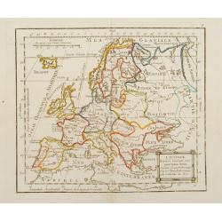
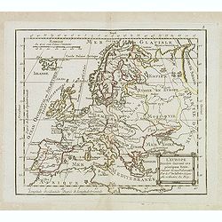
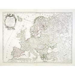
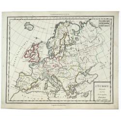
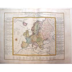
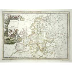
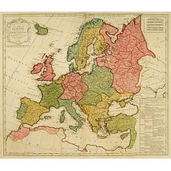
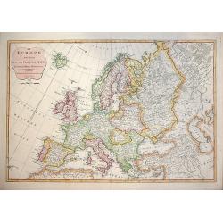
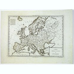
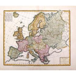
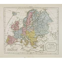
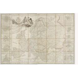
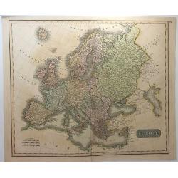
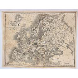
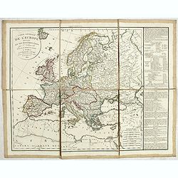
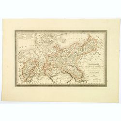
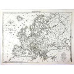
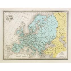
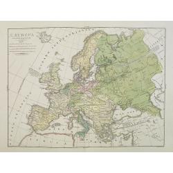
L\'Europe Divisée Suivant ses principaux Etats ..
Map of Europe prepared by de La Fosse and published by Monhare for his Atlas Général a l\'usage des colleges et maisons d\'education.. Louis Joseph Mondhare published s...
Date: Paris, 1783
Selling price: ????
Please login to see price!
Sold in 2009
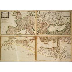
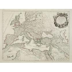
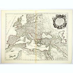
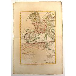
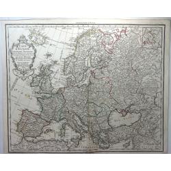
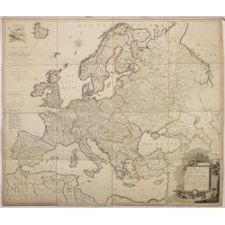
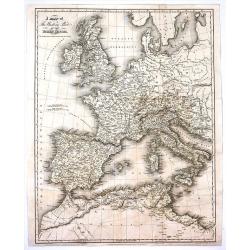
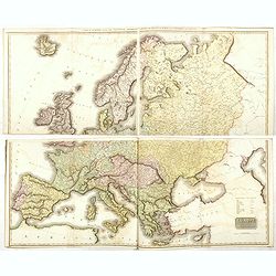
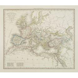
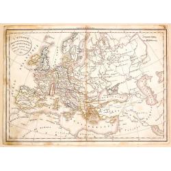
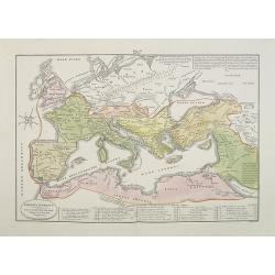
Imperii Romani Pars Occidentalis Superior / Inferior / Pars Orientalis superior / Inferior.
Jean Lattré, Paris-based engraver and publisher. Worked with Robert de Vaugondy, J. Janvier and R. Bonne. " Atlas Monderne', 1771, 1783 , 1793. Rigobert Bonne (1727...
Date: Paris, 1783
Selling price: ????
Please login to see price!
Sold
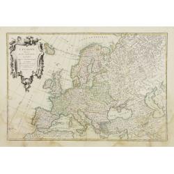
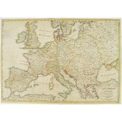
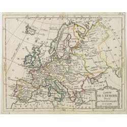
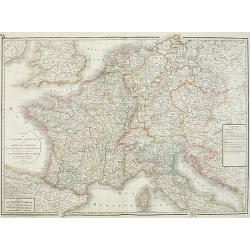
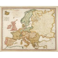
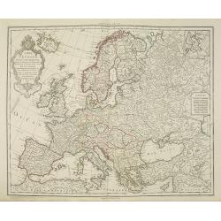
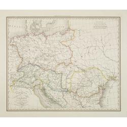
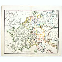
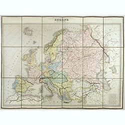
L'Europe divisée en ses principaux Etats..
Attractive map of Europe, ornated with a decorative title cartouche. Boundaries outlined in hand color.Prepared by Le Sieur Janvier, Jean denis [Robert], French geographe...
Date: Paris, ca 1783
Selling price: ????
Please login to see price!
Sold
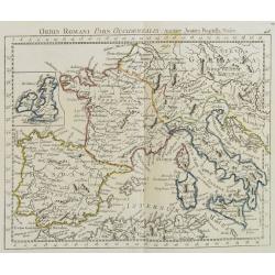
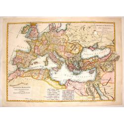
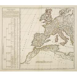
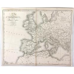
Orbis Romani Pars Occidentalis. . .
Map of the ancient Roman Empire, prepared by J.B.Nolin and published by Monhare for his Atlas Général a l\'usage des colleges et maisons d\'education.. Louis Joseph Mon...
Date: Paris, 1783
Selling price: ????
Please login to see price!
Sold in 2009
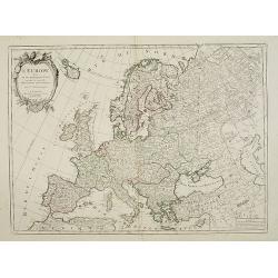
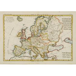
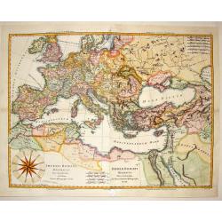
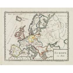
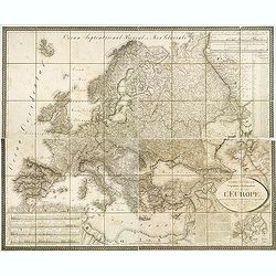
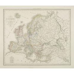
L'Europe Divisée Suivant ses principaux Etats . . .
Scarce map of Europe prepared by de La Fosse and published by L.J. Mondhare for his Atlas Général a l'usage des colleges et maisons d'education.. Louis Joseph Mondhare ...
Date: Paris, 1783
Selling price: ????
Please login to see price!
Sold in 2019
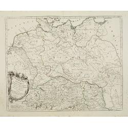
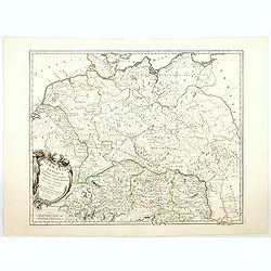
Germania Antiqua in quatuor magnos populos..
A fine map of ancient Germany, Poland and the Netherlands. Ornamental title cartouche in the lower left corner.Venetian edition of Giles Didier Robert De Vaugondy's map, ...
Date: Venice, 1776 - 1784
Selling price: ????
Please login to see price!
Sold in 2008
Romani Imperii occidentis .. Tabula Geographica..
Finely and crisply engraved map of the Roman Empire centered on Italy and Greece.Showing the Mediterranean basin together with its hinterland in Africa and Asia. Inset ma...
Date: Venice, 1776 - 1784
Selling price: ????
Please login to see price!
Sold in 2009
L'Europe divisée en ses principaux Etats..
Attractive map of Europe, ornated with a decorative title cartouche. From "Atlas Universel" published by Santini in 1776-84.Prepared by Le Sieur Janvier, Jean d...
Date: Venice, 1776 - 1784
Selling price: ????
Please login to see price!
Sold in 2008
L\'Europe divisée en ses principaux Etats..
Attractive map of Europe, ornated with a decorative title cartouche. From "Atlas Universel" published by Santini in 1776-84.Prepared by Le Sieur Janvier, Jean d...
Date: Venice, 1776 - 1784
Selling price: ????
Please login to see price!
Sold in 2013
Romani Imperii occidentis . . . Tabula Geographica. . .
Finely and crisply engraved map of the Roman Empire centered on Italy and Greece.Showing the Mediterranean basin together with its hinterland in Africa and Asia. Inset ma...
Date: Venice, 1776 - 1784
Selling price: ????
Please login to see price!
Sold in 2021
Germania Antiqua in quatuor magnos populos. . .
A fine map of ancient Germany, Poland and the Netherlands. Ornamental title cartouche in the lower left corner.Venetian edition of Giles Didier Robert De Vaugondy's map, ...
Date: Venice, 1776 - 1784
Selling price: ????
Please login to see price!
Sold in 2021
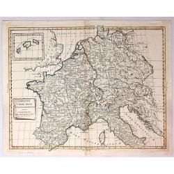
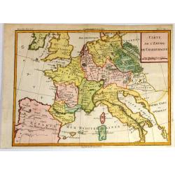
Imperium Caroli Magni Occidentis Imperatoris.
A detailed map of the Empire of Charlemagne covering Germany, France, Belgium, the Netherlands, Switzerland, Austria, Italy and Corsica. Issued as part of Antonio Zatta's...
Date: Venice, 1785
Selling price: ????
Please login to see price!
Sold in 2018
L'Europe Divissee en Ses Principales Parties et Leurs Capitales.
A striking, highly detailed, fine and unusual 1785 Mentelle copper engraved map of the whole European Continent. The map is filled with good topographic details as well a...
Date: Paris, 1785
Selling price: ????
Please login to see price!
Sold in 2019
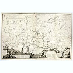
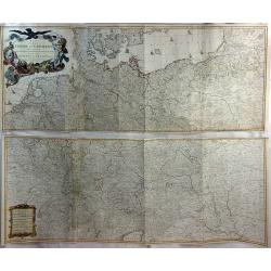
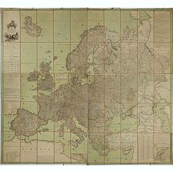
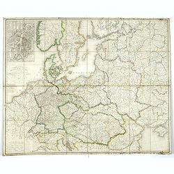
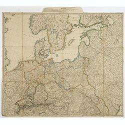
Carte Hydrographique des Etats de la Maison d'Autriche en deça du Rhin.
Rare wall map in four joined sheets which cover the Adriatic Sea north to Frankfurt and Dresden, from Dresden east to Prague and the Czech / Polish border and east from t...
Date: Vienna, ca.1786
Selling price: ????
Please login to see price!
Sold in 2016
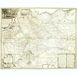
Neue und vollstaendige Postkarte durch ganz Deutschland. . . Carte des postes d'Allemagne partie du sud ouest. . .
A folding post route map of Germany, The Low Countries, Poland, Switzerland, Austria and Northern Italy. Typical for a post-route map the mail routes with distances and p...
Date: Nuremberg, 1786
Selling price: ????
Please login to see price!
Sold in 2020
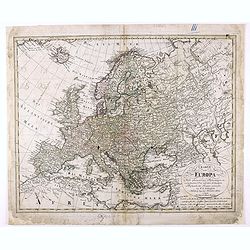
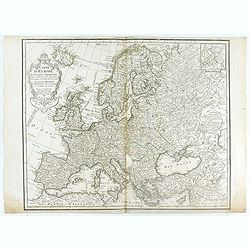
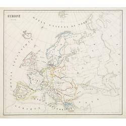
L'Europe.
Fine map of Europe. Elegant hand coloring, prepared by R.Bonne and included in his Atlas Ecyclopédique..Rigobert Bonne (1727-1795) was engineer, mathematician and cartog...
Date: Paris 1787
Selling price: ????
Please login to see price!
Sold
Neue Karte Von Europa
One of the first economic thematic maps of Europe containing a variety of symbols to show the cost of 56 commodities. Other symbols are of cities, ports, and natural and ...
Date: Vienna, 1787
Selling price: ????
Please login to see price!
Sold in 2013
Imperium Romanum Pars Occidentalis.
Interesting map of the Roman Empire published in "Atlas Encyclopedique" and includes Britain, France, Germany, Spain, Italy & part of North Africa. Rigober...
Date: Paris, 1787
Selling price: ????
Please login to see price!
Sold in 2013
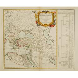
Imperium Romanum pars Occidentalis & pars Orientalis.
Interesting European map of the Eastern and Western parts of the Roman Empire. Two maps (East & West, that were meant to be make up the total)were professionally join...
Date: Paris, 1787
Selling price: ????
Please login to see price!
Sold in 2016
Imperii Romani Distracta pars Occidentalis & Orientalis.
Attractive hand colored map of the Mediterranean part of the Roman Empire. Issued as two maps (east & west), they have been joined resulting in an unusually large Bon...
Date: Paris, 1787
Selling price: ????
Please login to see price!
Sold in 2014
L' Europa Secondo Le ultime osservazioni divisa ne' suoi Stati Principali
Uncommon Italian map of Europe with considerable detail of both topography and place names. The large title cartouche features the allegorical female representation of Eu...
Date: Rome, 1788
Selling price: ????
Please login to see price!
Sold
Carte de l'Empire de Charlemagne.
Striking decorative copper engraved French edition map of the European Continent at the time of the Emperor Charlemagne. Cannot find this exact map on the Internet.
Date: Paris, 1788
Selling price: ????
Please login to see price!
Sold in 2017
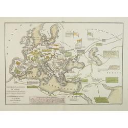
Quatrieme Age Depuis la Loy Ecrite ou la Sortie D'Egypte Jusqu'a la Dedicace du Temple de Salomon.
An attractive and informative map of the exit from Egypt, to the dedication of Solomon, by French cartographer, Louis Brion de la Tour. To the left and right of the map a...
Date: Paris, 1790
Selling price: ????
Please login to see price!
Sold in 2017
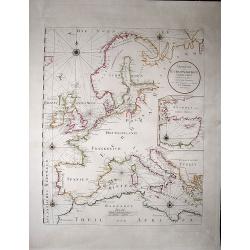
Uebersicht der Europaeischen Seeküsten verfasst von Herrn Caington Bowles. . .
A very decorative, very large map showing all European coasts: includes North sea, East sea, Atlantic ocean and the Mediterranean sea. On inset you see the eastern Medite...
Date: Vienna, 1791
Selling price: ????
Please login to see price!
Sold in 2020
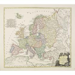
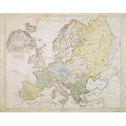
A map of Europe divided into its Empires Kingdoms &c.
Detailed map of Europe showing northern part of Africa. Prepared by L.Delarochette after Jean Pallairet (1697-1774). A geographer born in Montauban, France, who died in W...
Date: London c.1792
Selling price: ????
Please login to see price!
Sold
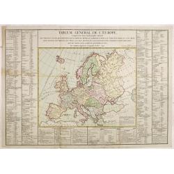
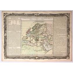
Tableau général de l'Europe,..
Uncommon map of Europe. Surrounded by geographical information for each country along with useful statistical information.Prepared by Louis Brion de la Tour and published...
Date: Paris, 1792
Selling price: ????
Please login to see price!
Sold in 2014
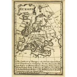
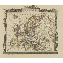
Europe.
Uncommon miniature map from Gibson's "Atlas Minimus, or a New Set of Pocket Maps of the several Empires, Kingdoms and States of the known World".
Date: London, 1792
Selling price: ????
Please login to see price!
Sold in 2011
Europa volgens de nieuwste verdeeling.
Uncommon map of Europe with Dutch title and text.Published in "Boertige reis door Europa", by A.Fokke.Printed by Francois Bohn in Haarlem, who was active from 1...
Date: Haarlem, 1794
Selling price: ????
Please login to see price!
Sold in 2009
EUROPE, Divided into Principal States. . .
Decorative and highly detailed map of Europe by the famous mathematician Samuel Dunn and published by Laurie & Whittle, 53 Fleet Street London
Date: London, 12th May, 1794
Selling price: ????
Please login to see price!
Sold in 2015
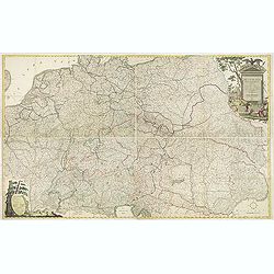
Map of the Empire of Germany, Including All the States Comprehended Under that Name: With the Kingdom of Prussia, &c.
A huge, striking, two panel wall map of Germany, Austria, Bohemia (Czech Republic), Poland, Lithuania, Prussia, Switzerland, Holland (the Netherlands), Belgium and Denmar...
Date: London, 1794
Selling price: ????
Please login to see price!
Sold in 2016
Carte générale de Europe, ou L'on voit le départ et le retour du Captaine Cook, dans ses différens Voyages.
Uncommon map of Europe, prepared by Hérisson after R.Bonne. Showing the departure and return tracks of Captain James Cook.
Date: Paris 1795
Selling price: ????
Please login to see price!
Sold
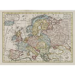
Karte von Europa.
An attractive oversized map of Europe. With a decorative title cartouche in the lower right-hand corner. Engraved by Kil. Ponheimer.Franz Johann Josef von Reilly (Vienna ...
Date: Vienna, 1795
Selling price: ????
Please login to see price!
Sold in 2012
Carte Generale et Politique de L'Europe.
Engraved by Tardieu for Mentelle's "Atlas Universel de Géographie Physique et Politique, Ancienne et Moderne, Présenté a l'Instruction des Écoles Centrales, Pour...
Date: Paris, ca 1797
Selling price: ????
Please login to see price!
Sold in 2019
Carte de l'Europe dediée a Son Altesse royale Monseigneur Charles Louis archiduc d'Autriche, prince royal de Hongrie et de Bohéme, chevalier de la Toison d'Or, Grand-Croix de l'ordre militaire de Marie-Thérése . . .
Wall map of Europe during the regime of Napoleon. Engraved by Joannes Berken. With a dedication to Archduke Charles of Austria, ( 5 September 1771 – 30 April 1847) who ...
Date: Paris / Vienna 1798
Selling price: ????
Please login to see price!
Sold in 2015
Charte von Europa Nach den neuesten Astronomischen Ortsbestimmungen entworfen und berichtiget auf der Sternwarte Seeberg, bey Gotha. . .
Nice map of Europa.
Date: Nuremberg, 1798
Selling price: ????
Please login to see price!
Sold in 2020
Imperii Romani occidentis..
Detailed map of the eastern part of the roman Empire showing Greece, Near East, Egypt and Libya. Very decorative title cartouche surrounded with roman legion's arms and e...
Date: Paris 1799
Selling price: ????
Please login to see price!
Sold
Imperii Occidentis Tabula synoptica.
Map of the Western part of the Empire of Julius Caesar. The map includes Western Europe, up to the east coast of Greece. With the western part of the Mediterranean with t...
Date: Paris, c.1800
Selling price: ????
Please login to see price!
Sold in 2013
Deutschlands Postkarte begraenzt von Oesterreich, Preussen, Frankreich, Holland, Italien und der Schweiz. . .
Detailed and important post road mapspost route map prepared by Ignaz Heymann.
Date: Triest, 1800
Selling price: ????
Please login to see price!
Sold in 2013
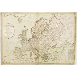
Carte de l'Europe Dressée pour l'Instruction . . .
The finely engraved map shows Europe divided up into its countries and the adjacenting regions Russia, the Middle East and North Africa. In the upper left corner we find ...
Date: Paris, 1800
Selling price: ????
Please login to see price!
Sold in 2020
![[Set of 4 plans] Ichonographia urbis antique Ravenne / Sunbridge Place, Bore Place and Sharps Place, the seats of John Hyde / Icon urbis Caesenae / Lilla in Flandra.](/uploads/cache/43026-250x250.jpg)
[Set of 4 plans] Ichonographia urbis antique Ravenne / Sunbridge Place, Bore Place and Sharps Place, the seats of John Hyde / Icon urbis Caesenae / Lilla in Flandra.
[Set of 4 European city plans] - Ichonographia urbis antique Ravenne (Ravenna in Italy) - Sunbridge Place, Bore Place and Sharps Place, the seats of John Hyde in England ...
Date: Amsterdam, Paris, ca 1783 - 1800
Selling price: ????
Please login to see price!
Sold in 2019
Europe
Very rare Ottoman printed map of Europe from Jedid Atlas Tercümesi or New Atlas, printed 1218 H. or 1803 in Üsküdar, a part of Istanbul. Title, scale and place names i...
Date: Üsküdar, 1803
Selling price: ????
Please login to see price!
Sold in 2011
L'Europe Divisee en Ses Principaux Etats et D'Apres le Traite de Paix de Luneville.
Date: Paris, 1803
Selling price: ????
Please login to see price!
Sold in 2016
Carte D'Europe Dressee pour L'Instruction. . .
A striking example of Dezauche's revised edition of Delisle's map of Europe. With a new decorative cartouche, which was replaced after the French Revolution to remove th...
Date: Paris, 1804
Selling price: ????
Please login to see price!
Sold in 2018
Charte Itineraire de l'Europe pour le guide des Voyageurs..
Uncommon road map of Europe. Prepared for the travel guide of Reichard, prepared by Güssefeld. Engraved by Frentzel.
Date: Weimar 1805
Selling price: ????
Please login to see price!
Sold
Europe en 1806.
Map of Europe, from Atlas de la Géographie de toutes les parties du monde .. Ouvrage destiné pour l\'education, et nécessaire aux négocians, aux voyageurs, aux foncti...
Date: Paris, Prudhomme, Levrault, Debray, 1806
Selling price: ????
Please login to see price!
Sold in 2009
L'Europe. . .
Map of the European continent. By C. F. Delamarche, successor of Robert de Vaugondy, Geographer.
Date: Paris, 1794 - 1806
Selling price: ????
Please login to see price!
Sold in 2008
Carte de l' Europe . . .
General map of Europe from Atlas moderne portatif composé de vingt-huit cartes sur toutes les parties du globe terrestre .. A l'usage des Colléges, des Pensions & d...
Date: Paris, Prudhomme, Levrault, Debray, 1806
Selling price: ????
Please login to see price!
Sold in 2009
Nouvelle Carte Géographique et des Postes de l'Europe .../ Neueste Post- und General-Karte von Europa ...
A rare wall map of Europe and its Post Roads based on a map by Arron Arrowsmith. Scale ca. 1:3.800.000. Engraved by Johann Spiegl (the younger)Title in German, placed in ...
Date: Vienna, Artaria et Compagnie, 1807
Selling price: ????
Please login to see price!
Sold
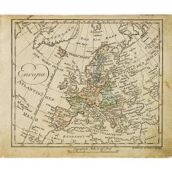
Europa.
Nice small map of Europe by Johannes Walch in his rare Allgemeiner Atlas Nach den bewährsten Hülfsmitteln und astronomischen Ortsbestimungen…, edition of 1812.Johann ...
Date: Augsburg, 1812
Selling price: ????
Please login to see price!
Sold in 2015
![[2 sheet wall map] Carte de l'empire français et de l'Allemagne, où l'on a marqué en lieues respectives, les postes de ces deux grandes parties de l'Europe / dressée par Hérisson, . .](/uploads/cache/39671-250x250.jpg)
[2 sheet wall map] Carte de l'empire français et de l'Allemagne, où l'on a marqué en lieues respectives, les postes de ces deux grandes parties de l'Europe / dressée par Hérisson, . .
A large, two sheet folded post road maps of France, Germany the Low Counties, Poland, Austria, Switzerland map of Africa, can be joined to make a wall map. Prepared and p...
Date: Paris, Basset, 1812
Selling price: ????
Please login to see price!
Sold
Carte itinéraire et politique d'Europe d'après les derniers traités de paix avec les plans des principales villes d'Europe.. . .
Large map of Europe, surrounded wit views of Rome, Naples, Madrid, Lisbon, Berlin, Varsovie, Copenhagen, Paris, London, Vienna, St.Petersburg and Constantinople. Large ti...
Date: Paris, 1813
Selling price: ????
Please login to see price!
Sold in 2010
Carte de l'empire français et du royaume d'Italie Divisée par departemens et divisions militaires, avec les etats qui composent la Confédération du Rin. . .
Historically interesting map the Empire of France, including Corsica, now-a-days northern Italy, Netherlands, Croatia, Belgium, Germany with the regions according the &qu...
Date: Paris, 1813
Selling price: ????
Please login to see price!
Sold in 2012
Carte générale d'Allemagne comprenant l'empire d'Autriche, la Confédération du Rhin, le Dannemarck, la Prusse et la Pologne, une partie de la Suède, des empires de France, de Russie et de Turquie . . .
Uncommon large folding map published during the Napoleonic Wars (1803–1815). Showing Central Europe, including Germany, Poland, Lithuania, Low Countries, Denmark, Easte...
Date: Paris, Direction générale de l'imprimerie, 1813
Selling price: ????
Please login to see price!
Sold in 2019
Europe
A very finely engraved, detailed, and attractive early hand colored, 19th century map of Europe, dating from 1814. John Thomson (1777-c1840) was a Scottish cartographer f...
Date: Edinbugh. 1814
Selling price: ????
Please login to see price!
Sold in 2017
Europe.
A striking hand colored map of 1814 that depicts Europe one year before Napoleon's defeat at Waterloo in 1815. Thomson's maps are known for their stunning color, large si...
Date: Edinbourgh, 1814
Selling price: ????
Please login to see price!
Sold in 2018
EUROPE Dressée.. congres de Vienne..
A charming map of Europe according to the convention of Vienna, drawn by J.N.Champion. The map has a detailed roadsystem drawn in.
Date: Paris 1815
Selling price: ????
Please login to see price!
Sold
Carte générale Orographique et Hydrographique de l'Europe, qui montre les principales ramifications des montagnes, fleuves, et chemins. . .
Napoleonic folding map of Europe prepared by Général Baron Sorriot de L'Host ( 1767-1831) and engraved by Joseph List, active in Vienna (1805-1835).The map shows the ri...
Date: Vienna, 1816
Selling price: ????
Please login to see price!
Sold in 2013
Carte de France et Pays Limitiophies avec les Divisions d'Apres les Derniers Tiaites.
An uncommon map of France and Italy with parts of Great Britain, Spain and Germany. The best of the map is the "Pavillons" insert featuring twenty finely colore...
Date: Paris, 1816
Selling price: ????
Please login to see price!
Sold in 2022
Europe According to the General Treaty of Vienna, 1815.
A detailed map of Europe showing the lands and countries covered under the Treaty of Vienna signed in 1815. Published in Leeds, England by Edward Baines in 1816. Engrave...
Date: Leeds, 1816
Selling price: ????
Please login to see price!
Sold in 2017
A Map of the Western Part of the Roman Empire.
Interesting map of the western Roman Empire in Europe with both the current names and ancient names. By Sidney Hall and published by Longman, Hurst et al. in London in 18...
Date: London, 1818
Selling price: ????
Please login to see price!
Sold in 2017
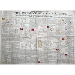
Third and Improved Edition of The Present State of Europe, With Maps of the Territories, as Settled by the Congress of Vienna.
A rare broadside printed on two sheets, showing the political changes of Europe between 1783 and 1818. With 14 inset maps, some with their flags. Extensive text about eac...
Date: Derby, ca 1818
Selling price: ????
Please login to see price!
Sold in 2018
A Map of the Western Part of the Roman Empire
An interesting map of Europe and North Africa during the time it was ruled by the Roman Empire. The names are those as used during that time of occupation. Published by T...
Date: London, 1820
Selling price: ????
Please login to see price!
Sold in 2016
Carte générale de L'Europe. . .
Map of Europe prepared by Felix Delamarche, after R.de Vaugondy. In the right hand a lengthy description of geographical details of the different European countries, moun...
Date: Paris, 1820
Selling price: ????
Please login to see price!
Sold in 2020
Carte de l'Europe Dressée par G. Delisle et Ph. Buache.. Revue.. Par J. A. Dezauche.
The finely engraved map shows Europe divided up into its countries and the adjacenting regions Russia, the Middle East and North Africa. In the upper left corner we find ...
Date: Paris, 1821
Selling price: ????
Please login to see price!
Sold in 2011
Europe after the Congress of Vienna.
When assembled, this strikingly large 4 sheet map of Europe, measures some 1020 x 1250 mm. The map graphically depicts the political divisions after the Peace of Paris an...
Date: Edinburgh, 1821
Selling price: ????
Please login to see price!
Sold in 2018
Europe. . .
Attractive map of Europe with decorative borders depicting typical artifacts and produce of the continent. Published in Les jeunes voyageurs en Europe.. . Engraved by J.G...
Date: Brussels, 1824
Selling price: ????
Please login to see price!
Sold in 2013
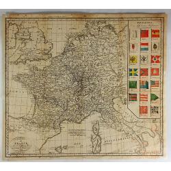
Carte Generale du Royaume de Prusse. . .
A nice French map, typical of the period, of the Kingdom of Prussia, by Vivien, from the "Atlas Universel Pour servir a l'Etude De la Geographie et de l'Histoire Anc...
Date: Paris, 1824
Imperium Romanum ou Empire Romain . . .
Detailed map of the ancient Roman Empire covering southern Europe, North Africa and part of Asia, prepared by A. H. Basset, rue Saint-Jacques, no. 64, Paris and published...
Date: Paris, A.H. Basset, 1828
Selling price: ????
Please login to see price!
Sold in 2009
Germania pannonia d'Acia et Sarmatia ad Juventutis Institutionem . . .
Map of Ancient central Europe, prepared by A. H. Basset, rue Saint-Jacques, no. 64, Paris and published in Atlas classique et Universel de Géographie . . . .The engraver...
Date: Paris, A.H. Basset, 1828
Selling price: ????
Please login to see price!
Sold in 2009
Carte de l'Europe . . .
Detailed map of Europe, prepared by A. H. Basset, rue Saint-Jacques, no. 64, Paris and published in Atlas classique et Universel de Géographie . . . .The engraver of the...
Date: Paris, A.H. Basset, 1828
Selling price: ????
Please login to see price!
Sold in 2009
Carta Dell' Europa da Fare d'llustrazione al Nuovo Dizionario Geografico Universale....
A strikingly attractive and detailed copper engraved map of Antonelli's 1829 map of the whole European Continent. This large map provides excellent topographic details on...
Date: Venice, 1829
Selling price: ????
Please login to see price!
Sold in 2016
Karte des mittlern und östlichen Europa, von der Seine bis an der Dnieper. . .
Detailed map of the north west of Europe centered on Poland and Lithuania. The map is prepared by D.G. Reymann and published in Berlin by Simon Schropp & Co.A road sy...
Date: Berlin, ca. 1830
Selling price: ????
Please login to see price!
Sold in 2018
L'Europe a l'Epoque du Demembrement de L'Empire de Charlemagne.
Fine map featuring the empire of CHARLEMAGNE in Europe. It was developed by F. Delamarche in Paris in 1831. It was published in "ATLAS DE LA GEOGRAPHIE".
Date: Paris, 1831
Selling price: ????
Please login to see price!
Sold in 2017
The Central Part of Europe for the Elucidation of the Abbe Gaultier's Geographical Games.
A detailed map of central Europe from A Complete Course of Geography, by Means of Instructive Games invented by the Abbé Gaultier included ‘numerous emendations and ad...
Date: London, 1832
Selling price: ????
Please login to see price!
Sold in 2020
Europe aprés l'invasion des Barbares..
Ancient map of Europe in the 5th and 6th century.From Malte-Brun's Atlas G�ographie Universelle.., revised by Jean Jacques Nicolas Huot.This very fine executed map h...
Date: Paris 1837
Selling price: ????
Please login to see price!
Sold in 2008
EUROPE Dressée par C.V. Monin.
Detailed map of Europe with different scales in lower right corner.Engraved by L.Grenier, Rue des Noyers, No. 33. and printed by Mangeon.Here the map is issued as a singl...
Date: Paris, Armand Aubrée, ca. 1837
Selling price: ????
Please login to see price!
Sold in 2017
Europe - Mars 1839
Fine manuscript map of Europe with relief shown pictorially. The Oceans in wash color and the borders in different colors. Dated 1839 and signed by the author in the lowe...
Date: Paris, 1839
Selling price: ????
Please login to see price!
Sold in 2009
Transmigrazioni ed invasioni de\' Barbari . . .
A rare double-page map of Barbarian invasion.According to the title cartouche, prepared by A de La Sage for l\'Atlante Storico, Letterario, Biografico, Archeologico. . . ...
Date: Venice, 1840
Selling price: ????
Please login to see price!
Sold in 2009
L'Europa colle politiche divisioni nel 1827.
A rare and detailed double-page map of Europe. From l'Atlante Storico, Letterario, Biografico, Archeologico. . . with attributions by Giambatista Albrizzi.Upper left a k...
Date: Venice, 1840
Selling price: ????
Please login to see price!
Sold in 2009
Impero Romano . . .
A rare double-page map of the Roman Empire. From l'Atlante Storico, Letterario, Biografico, Archeologico. . . with attributions by Giambatista Albrizzi.Lower part a key....
Date: Venice, 1840
Selling price: ????
Please login to see price!
Sold in 2009
