Browse Listings in America > South America
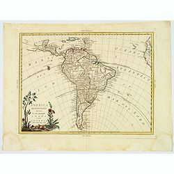
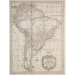
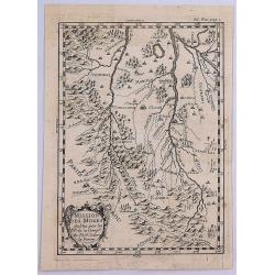
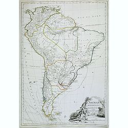
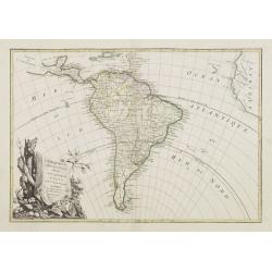
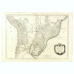
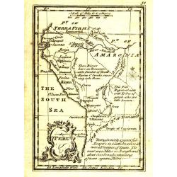
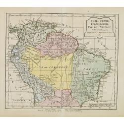
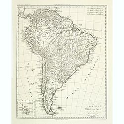
America meridionale divisa ne'fuoi principali Stati.
An attractive map depicting all of South America in the grand Zatta style. With a splendid ornate cartouche with Zatta's normal flourish. The map illustrates many of the ...
Date: Venice, 1776
Selling price: ????
Please login to see price!
Sold in 2021
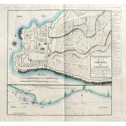
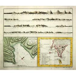
Plano de la Plaza de la Colonia del Sacramento...
A highly rare map of Colonia del Sacramento in Uruguay, at the Rio de la Plata, facing Buenos Aires.The plan includes an A-X legend of places, churches, batteries and oth...
Date: Madrid, 1777
Selling price: ????
Please login to see price!
Sold
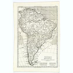
America Meridionalis per sua regna provinc: et Ins. . .
Miniature map of South America, showing the continent too narrowly and the Salomon Islands too near to South America. The coastline is surrounded with place names. Routes...
Date: Augsburg, J.M.Will, 1778
Selling price: ????
Please login to see price!
Sold in 2012
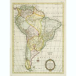
Carte de L\'Amerique Méridionale. . .
Detailed map of South America. The map was prepared by William Roberts (1721-1793) in 1777 for the English edition, in 1778 the first French edition followed, L'Histoire ...
Date: Paris, Panckoucke, 1778
Selling price: ????
Please login to see price!
Sold in 2011
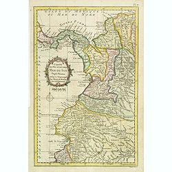
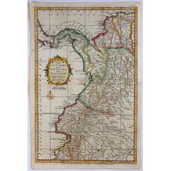
Carte des Pays situés sur la Mer du Sud. . .
Detailed map of Panama, Colombia and Ecuador. The map was prepared by William Roberts (1721-1793) in 1777 for the English edition, in 1778 the first French edition follow...
Date: Paris, Panckoucke, 1778
Selling price: ????
Please login to see price!
Sold in 2011
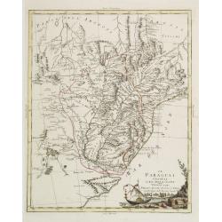
Mappa Paraquariae in multis a me correcta. . .
A rare map of Paraguay from Dobrizhoffer Martin (1717-1791) Historia de Avipones y Mocobies. Engraved by F.Assner.The map includes all of Argentina from 11º to 370º sou...
Date: Vienna, 1780
Selling price: ????
Please login to see price!
Sold in 2011
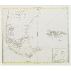
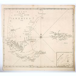
Kaart van het Zuidlyk Eind van Amerika. 1775.
Uncommon chart of the tip of South America, showing Patagonia, Tierra del Fuego and the Falkland Islands. With an inset of Staaten Land in the lower right corner.Publishe...
Date: Amsterdam c. 1780
Selling price: ????
Please login to see price!
Sold
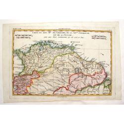
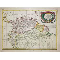
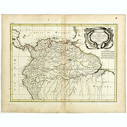
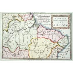
Carte du Nouvelle Royaume de Grenade, de Andalousie et de la Guyane.
Copper engraved for "Atlas de Toutes les Parties Connues du Globe Terrestre". From Panama to the mouth of the Amazon. BONNE, RIGOBERT (1729-1795). Bonne was �...
Date: Paris, 1780
Selling price: ????
Please login to see price!
Sold in 2013
Carte de l'Amérique Méridionale, pour l'Histoire Générale des Voyages in 8º.
A nice map of South-America.
Date: Paris, 1780
Selling price: ????
Please login to see price!
Sold in 2010
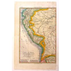
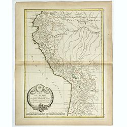
Carte du Perou avec Une Partie des Pays Qui en Sont a L'Est
An interesting map of Peru with the "Country of Amazon" on it Eastern border. From "Atlas de Toutes les Parties Connues du Globe Terrestre". Detailed ...
Date: Paris, 1780
Selling price: ????
Please login to see price!
Sold in 2014
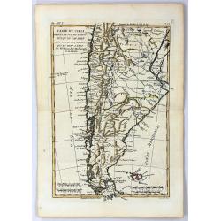
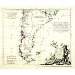
Carte du Chili depuis le Sud du Perou Ju Squ\'au Cap horn avec partie des Regions qui en sont a L\'Est. Par M. Bonne, Ingr. Hydrographe de la Marine.
The decorative map is showing Chili, Patagonia, the Magellan Street and the Falkland Islands.
Date: Paris 1780
Selling price: ????
Please login to see price!
Sold in 2013
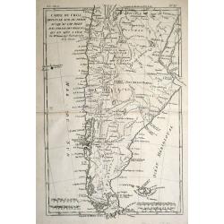
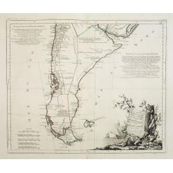
Carte du Chili Depuis le Sud du Perou Jusqu'au Cap Horn
A fine example of Rigobert Bonne and Guillaume Raynal's 1780 map of Chile. Covers modern day Chile, Argentina, Uruguay, the Falkland Islands, Tierra del Fuego, and Cape H...
Date: Paris, 1780
Selling price: ????
Please login to see price!
Sold in 2016
Missiion des Moxes Etablie par les PP de la Comp'e de Jesus dans le Perou.
A fine detailed map of Peru showing the topographical locations and details of the many Jesuit missions. It features an attractive title cartouche.
Date: Paris, 1780
Selling price: ????
Please login to see price!
Sold in 2017
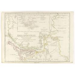
Extrémité Meridionale De Amérique.
Map shows Tierra del Fuego, with 5 inset maps of Canal de Noel, Terre de Feu, Bay Dubon, and the coast.Rigobert Bonne (1727–1795) was one of the most important cartogra...
Date: Paris, ca. 1780
Selling price: ????
Please login to see price!
Sold in 2018
A Map of South America, With all the European Settlements. . .
A pleasant map of South America, showing great detail along the west coast, and the east coast of Brazil, however, the vast interior of Brazil and the Amazon is labelled ...
Date: London, 1780
Selling price: ????
Please login to see price!
Sold in 2020
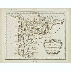
Terre Magellanique le Chili et le Paraguay. . .
Scarce map of southern most South America, prepared by Nolin and published by L.J. Mondhare for his Atlas Général a l'usage des colleges et maisons d'education.. Louis ...
Date: Paris, 1781
Selling price: ????
Please login to see price!
Sold in 2014
Carte de la Terre Ferme du Perou du Bresil et du Pays des Amazones.
A later issue of this detailed and surprisingly accurate map of the northern part of South America prepared by De l'Isle. It is filled with place names and notations spec...
Date: Paris, 1782
Selling price: ????
Please login to see price!
Sold in 2021
L'Amérique méridionale.
Map of South America embellished with a figurative title cartouche.
Date: Paris, 1783
Selling price: ????
Please login to see price!
Sold in 2020
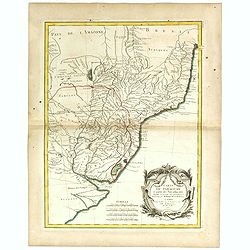
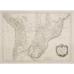
Carte du Paraguay et partie des Pays adjacants.
Jean Lattré, Paris-based engraver and publisher. Worked with Robert de Vaugondy, J. Janvier and R. Bonne. " Atlas Monderne', 1771, 1783 , 1793. Rigobert Bonne (1727...
Date: Paris, 1783
Selling price: ????
Please login to see price!
Sold
Carte de la Terre Ferme, dela Guyane et du Pays des Amazones.
Jean Lattré, Paris-based engraver and publisher. Worked with Robert de Vaugondy, J. Janvier and R. Bonne. " Atlas Monderne', 1771, 1783 , 1793. Rigobert Bonne (1727...
Date: Paris, 1783
Selling price: ????
Please login to see price!
Sold
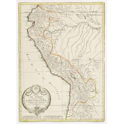
Carte du Perou ou se trouvent les Audiences de Quito, Lima et la Plata..
Attractive map centered on Peru, covering the northern half of the South American Pacific coast, from Ecuador to northern Chili.Boundaries outlined in hand color. Large o...
Date: Paris ca 1783
Selling price: ????
Please login to see price!
Sold
Carte Carte du Perou ou se trouvent les Audiences de Quito, Lima et la Plata.
Jean Lattré, Paris-based engraver and publisher. Worked with Robert de Vaugondy, J. Janvier and R. Bonne. " Atlas Monderne', 1771, 1783 , 1793. Rigobert Bonne (1727...
Date: Paris, 1783
Selling price: ????
Please login to see price!
Sold in 2019
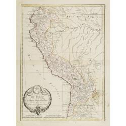
Carte du Perou ou se trouvent les Audiences de Quito, Lima et la Plata..
Attractive map centered on Peru, covering the northern half of the South American Pacific coast, from Ecuador to northern Chili.Boundaries outlined in hand color. Large o...
Date: Paris, ca 1783
Selling price: ????
Please login to see price!
Sold in 2012
Carte de la Terre Ferme, de la Guyane et du Pays des Amazones..
Attractive map centered on the Amazon drainage basin, covering the northern part of South America. Ornated with a rococo title cartouche. Boundaries outlined in hand colo...
Date: Paris, ca 1783
Selling price: ????
Please login to see price!
Sold
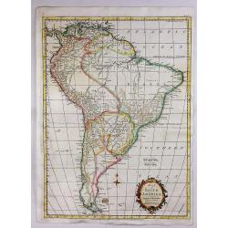
L' Amerique Meridionale divisée en ses principaux Etats..
Attractive map of South America, ornated with a decorative title cartouche. Boundaries outlined in hand color.Prepared by Le Sieur Janvier, Jean denis [Robert], French ge...
Date: Paris, ca 1783
Selling price: ????
Please login to see price!
Sold in 2012
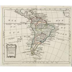
Amerique Meridionale divisée en ses principales parties ou sont distingués les uns des autres LES ETATS SUIVANTS qu'ils appartiennent presentement aux FRANCOIS, CASTILLANS, PORTUGAIS HOLLANDOIS etc. . .
Large map of South America, by Hubert Jaillot after Nicolas Sanson and updated by Desnos.
Date: Paris, after 1783
Selling price: ????
Please login to see price!
Sold in 2011
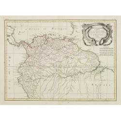
Carte de la Terre Ferme de la Guyane et du Pays des Amazones . . .
Attractive map of Guyana and Amazonia, ornated with a decorative title cartouche. Boundaries outlined in hand color.Prepared by Le Sieur Janvier, Jean Denis [Robert], Fre...
Date: Paris, ca 1783
Selling price: ????
Please login to see price!
Sold in 2019
Carte du Paraguay et partie des Pays adjacants . . .
Attractive map of Paraguay and close countries.
Date: Paris, ca 1783
Selling price: ????
Please login to see price!
Sold in 2019
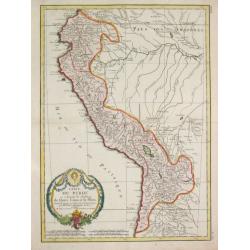
Carte du Perou ou se trouvent les audiences de Quito, Lima et la Plata . .
Attractive map of Peru, ornated with a decorative title cartouche. Boundaries outlined in hand color.Prepared by Le Sieur Janvier, Jean Denis [Robert], French geographer ...
Date: Paris, ca 1783
Selling price: ????
Please login to see price!
Sold in 2019
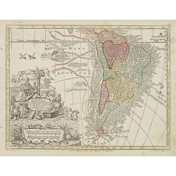
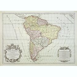
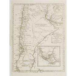
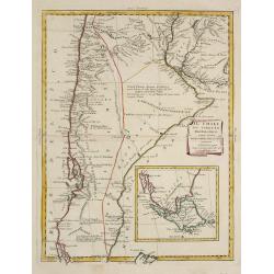
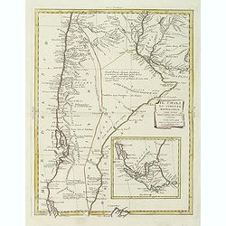
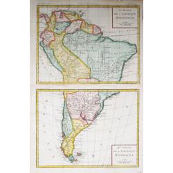
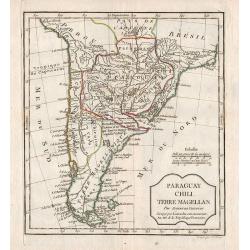
Carte du Chili Méridional, du Rio de la Plata, des Patagons, et du Détroit de Magellan. . .
Finely and crisply engraved map representing the southern tip of South America. It extends northwards as far as the river de la Plata estuary.Venetian edition of d\'Anvil...
Date: Venice, 1776 - 1784
Selling price: ????
Please login to see price!
Sold in 2008
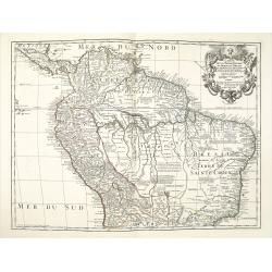
Carte qui représente la Partie Méridionale du Brésil et du Perou..
Finely and crisply engraved map representing the central part of South America, including part of Brazil, Chile and Peru as well as Uruguay and Paraguay.It covers the Atl...
Date: Venice, 1776 - 1784
Selling price: ????
Please login to see price!
Sold in 2009
Carte du Chili Méridional, du Rio de la Plata, des Patagons, et du Détroit de Magellan. . .
Finely and crisply engraved map representing the southern tip of South America. It extends northwards as far as the river de la Plata estuary.Venetian edition of d'Anvill...
Date: Venice, 1776 - 1784
Selling price: ????
Please login to see price!
Sold in 2012
Carte qui représente la Partie Méridionale du Brésil et du Perou..
Finely and crisply engraved map representing the central part of South America, including part of Brazil, Chile and Peru as well as Uruguay and Paraguay.It covers the Atl...
Date: Venice, 1776 - 1784
Selling price: ????
Please login to see price!
Sold in 2015
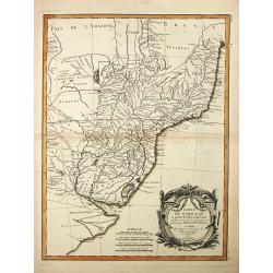
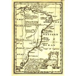
Kaart van het Noordlijk gedeelte van Bresil.
Uncommon and attractive map of most of Brazil. The directions of the trade winds are shown. Very nice detail of the river systems, mines, forts, missions, and villages. A...
Date: Amsterdam 1785
Selling price: ????
Please login to see price!
Sold
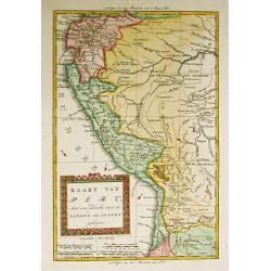
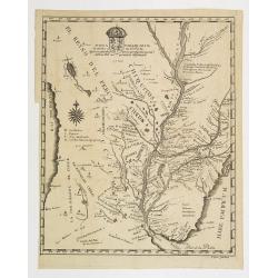
Kaart van Peru, Met een gedeelte van de Landen ten oosten gelegen.
Willem Albert Bachiene (1712-1783), Dutch geographer in Maastricht. Most important work ' Heilige Geographie', a work on the Holy Land. Mathijs Schalenkamp published in 1...
Date: Amsterdam, 1785
Selling price: ????
Please login to see price!
Sold in 2008
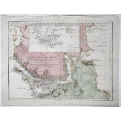
Karte der Magellanischen-Strasse. . .
Very detailed map of Strait of Magellan, with in top inset map of Southern tip of South America with the Falklands. Incorporating the discoveries of Herrn, Byron, Wallis,...
Date: Vienna, 1787
Selling price: ????
Please login to see price!
Sold in 2017
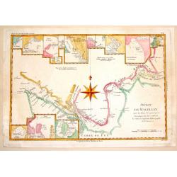
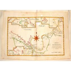
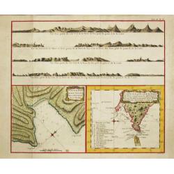
Detroit de Magellan.
A detailed engraved chart of the Straits of Magellan (between South America and Terra del Fuego), showing the best route through the dangerous straits. With 16 separate i...
Date: Paris, 1787
Selling price: ????
Please login to see price!
Sold in 2014
Amérique Méridionale.
A fine map of the South American continent, prepared by R.Bonne and included in his Atlas Encyclopédique. Plenty of good map detail, including hills, mountains, rivers p...
Date: Paris, 1787
Selling price: ????
Please login to see price!
Sold in 2020
Karte der Magellanischen Strasse.
Full title at center of the map: 'Karte der Magellanischen Strasse von Herrn Don Juan de la Cruz Canoy Olmedillo. Und nach den Beobachtungen der Herrn Byron, Wallis, Cart...
Date: Wien, 1787
Selling price: ????
Please login to see price!
Sold in 2021
Detroit de Magellan avec les Plans des Pricipaux, Ports, Baves & de ce Detroit.
Interesting hand-colored, copperplate map of The Straits of Magellanshowing the direction of the currents, bays, points, soundings, harbours, islands, shoals etc. Large c...
Date: Paris, 1788
Selling price: ????
Please login to see price!
Sold in 2015

Uomo del Brasile. / Homme du Brasil.
Full portrait of a Brazilian hunter. From "Raccolta di ? stampe." a series of historically significant eighteenth-century copper plate engravings by Venetian en...
Date: Venice, Antonio Zatta, c.1790
Selling price: ????
Please login to see price!
Sold in 2013
Kaart van het Zuidlyk Eind van Amerika. 1775.
An uncommon Dutch chart of the tip of South America, showing Patagonia, Tierra del Fuego and the Falkland Islands. With an inset of Staaten Land in the lower right corner...
Date: Amsterdam ca 1790
Selling price: ????
Please login to see price!
Sold in 2020
![[Lot of 11 maps of the Strait of Magellan] Carte du detroit de Magellan avec les Routes de la Bodeuse et de l'Etoile.](/uploads/cache/19991-(3)-250x250.jpg)
[Lot of 11 maps of the Strait of Magellan] Carte du detroit de Magellan avec les Routes de la Bodeuse et de l'Etoile.
Carte du Detroit de Magellan avec les Routes de la Bodeuse et de l'Etoile taken by the French discoverer Comte de Bougainvile, L.A. With in addition 10 maps / prints of...
Date: Paris, c. 1790
Selling price: ????
Please login to see price!
Sold in 2022
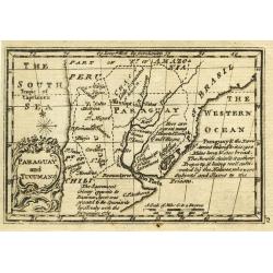
Paraguay and Tucuman.
Uncommon miniature map from Gibson's "Atlas Minimus, or a New Set of Pocket Maps of the several Empires, Kingdoms and States of the known World".
Date: London, 1792
Selling price: ????
Please login to see price!
Sold in 2011
Brasil.
Uncommon miniature map from Gibson's "Atlas Minimus, or a New Set of Pocket Maps of the several Empires, Kingdoms and States of the known World".
Date: London, 1792
Selling price: ????
Please login to see price!
Sold in 2011
South America.
Uncommon miniature map from Gibson's "Atlas Minimus, or a New Set of Pocket Maps of the several Empires, Kingdoms and States of the known World".
Date: London, 1792
Selling price: ????
Please login to see price!
Sold in 2011
Peru.
Uncommon miniature map from Gibson's "Atlas Minimus, or a New Set of Pocket Maps of the several Empires, Kingdoms and States of the known World".
Date: London, 1792
Selling price: ????
Please login to see price!
Sold
Il Chili lo Stretto Magellanico coll' Isola della Terra del Fuoco.
A finely engraved copper plate map that covers Chili and most of Argentina. Good detail of the region around Buenos Ayres and the Rio de la Plata. Santiago here is named ...
Date: Venise 1794
Selling price: ????
Please login to see price!
Sold
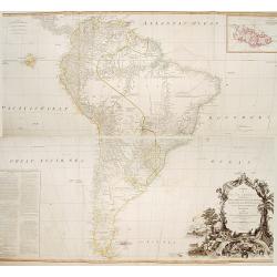
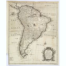
A map of South America containing Terra-Firma.. Brasil.. Patagonia..
A large wall map of south America. Impressive title cartouche lower right and a large text block lower left : "Division of South America with a summary account of it...
Date: London,1794
Selling price: ????
Please login to see price!
Sold in 2013
Il Chili lo Stretto Magellanico coll' Isola della Terra del Fuoco.
A finely engraved copper plate map that covers Chili and most of Argentina. Good detail of the region around Buenos Ayres and the Rio de la Plata. Santiago here is named ...
Date: Venise, 1794
Selling price: ????
Please login to see price!
Sold in 2009
Il Chili lo Stretto Magellanico coll' Isola della Terra del Fuoco.
A finely engraved copper plate map that covers Chili and most of Argentina. Good detail of the region around Buenos Ayres and the Rio de la Plata. Santiago here is named ...
Date: Venise, 1794
Selling price: ????
Please login to see price!
Sold in 2011
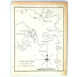
Canal de Noël sur la côte S.O. de la Terre de Feu.
A simple map of Christmas Sound from James Cook’s voyages. Cook reached Christmas Sound near Tierra del Fuego on 25th & 26th December 1774, returning to England on ...
Date: London, 1794
Selling price: ????
Please login to see price!
Sold in 2016
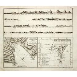
Carte de la Baye du Bon Succès dans le Détroit de le Maire./ Carte de la partie S.E. de la Terre de Feu comprenant le Détroit de le Maire et une part.ie de la Terre des Etats. 1769.
Captain James Cook (1728-79), explorer, circumnavigator and hydrographer. Three voyages, 1768-71, 1772-75 and 1776-79. From 1778 on printed editions of ' Captain Cook's T...
Date: Paris, c. 1795
Selling price: ????
Please login to see price!
Sold
Il Paraguai Uraguai e Rio della Plata.
A finely engraved copper plate map that covers Paraguay, Uruguay and part of the contiguous countries. Good detail of the region around Buenos Ayres and the Rio de la Pla...
Date: Venise 1795
Selling price: ????
Please login to see price!
Sold
Iere / II Feuille de L' Amérique Méridionale
Louis Brion de la Tour (1756-1823), French geographer. ' Atlas Géneral, Civil et Ecclésiastique', 1766, ' Atlas Général', 1790-98.A map of South America on 2 sheets.
Date: Paris, c. 1795
Selling price: ????
Please login to see price!
Sold
Carte de la Baye du Bon Succès dans le Détroit de le Maire./ Carte de la partie S.E. de la Terre de Feu comprenant le Détroit de le Maire et une part.ie de la Terre des Etats. 1769.
Captain James Cook (1728-79), explorer, circumnavigator and hydrographer. Three voyages, 1768-71, 1772-75 and 1776-79. From 1778 on printed editions of ' Captain Cook's T...
Date: Paris, c. 1795
Selling price: ????
Please login to see price!
Sold in 2010
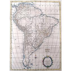
Map of South America.
Interesting map of South America. Features large blank areas inside Brazil and Argentina, but also a lot of details and place names along the coasts and rivers. Names als...
Date: London, 1795
Selling price: ????
Please login to see price!
Sold in 2016
Map of South America.
A map of South America for the Rev. Dr. Robertson's “History of America” by Thos. Kitchin, 'Hydrographer to his Majesty'. It features a decorative floral title cartou...
Date: London, 1795
Selling price: ????
Please login to see price!
Sold in 2020
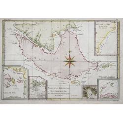
Map of the Countries of the South Sea from Panama to Guayquil.
A striking map of Central America, including Columbia, Ecuador, Panama, the New Kingdom of Granada and Quito. From Dr. Robertson's 'History of America'.Thomas Kitchin (17...
Date: London, 1795
Selling price: ????
Please login to see price!
Sold in 2018
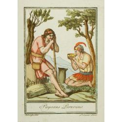
Paysans Peruviens.
Hand-colored mezzotints of Native Americans drawn by Labrousse and engraved by Laroque after Jacques Grasset de Saint-Sauveur.
Date: Paris,1796
Selling price: ????
Please login to see price!
Sold in 2010
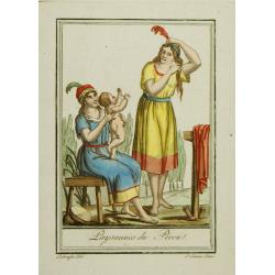
Paysannes du Pérou.
Hand-colored mezzotints of Native Americans drawn by Labrousse and engraved by Laroque after Jacques Grasset de Saint-Sauveur.
Date: Paris,1796
Selling price: ????
Please login to see price!
Sold in 2010
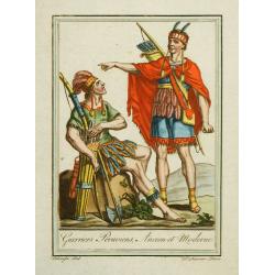
Guerriers Peruviens, Ancien et Moderne.
Hand-colored mezzotints of Native Americans drawn by Labrousse and engraved by Laroque after Jacques Grasset de Saint-Sauveur.
Date: Paris,1796
Selling price: ????
Please login to see price!
Sold in 2010
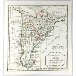
Paraguay, Chili, Terre Magellan.
Map of the southern part of South America.
Date: Paris, 1796
Selling price: ????
Please login to see price!
Sold in 2012
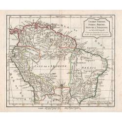
Terre-Ferme, Perou, Brésil, Pays de l\'Amazone.
Map of the northern part of South America.
Date: Paris, 1796
Selling price: ????
Please login to see price!
Sold in 2012
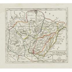
Le Paraguay.
Nice small map covering the basin drained by the main tributaries of the Río de la Plata (the Uruguay and Paraná, and the important Paraná...
Date: Paris, 1799
Selling price: ????
Please login to see price!
Sold in 2009
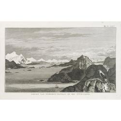
GEZIGT VAN KERSMIS-KANAAL OP HET VUUR-LAND . Pl. LXX*.
A landscape and sea coast view of mountains and a ship in the Strait of Magellan. From a Dutch edition of James Cook.
Date: Amsterdam, ca. 1800
Selling price: ????
Please login to see price!
Sold in 2010
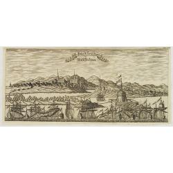
Die Stadt Carthagena in West Indien.
Panoramic view of the town of Cartagena in present-day Colombia, with a variety of boats and ships who dominate the foreground with the town and its surroundings depicted...
Date: Zittau, 1798 - 1800
Selling price: ????
Please login to see price!
Sold in 2013
Kaart van de Good Success Baai in de Straat van le Maire. / Kaart van het Z.O.gedeelte van het Vuurland de Straat Le Maire en een gedeelte van Staaten-Land 1769.
Captain James Cook (1728-79), explorer, circumnavigator and hydrographer. Three voyages, 1768-71, 1772-75 and 1776-79. From 1778 on printed editions of ' Captain Cook's T...
Date: Leiden, 1795-1803
Selling price: ????
Please login to see price!
Sold in 2018

Guyana, Surinam, Amapa.
Very rare Ottoman printed map of Guyana, Suriname and Amapa. With Trinidad, an inset map of the mouth of the Rivers Essequibo, Courantyne, Suriname with Paramaribo.From C...
Date: Uskudar (Istanbul), 1803
Selling price: ????
Please login to see price!
Sold in 2024
Terre-Ferme, Perou, Brésil, Pays de l'Amazone.
Map of northern half of South America, with Peru, Venezuela, Guyane and Brazil. By C. F. Delamarche, successor of Robert de Vaugondy, Geographer. Uncommon later edition, ...
Date: Paris, ca.1806
Selling price: ????
Please login to see price!
Sold in 2013
L'Amérique Méridionale . . .
Map of the South American continent, from Atlas moderne portatif composé de vingt-huit cartes sur toutes les parties du globe terrestre .. A l'usage des Colléges, des P...
Date: Paris, Prudhomme, Levrault, Debray, 1806
Selling price: ????
Please login to see price!
Sold in 2019
Amérique méridionale. . .
Detailed map of South of America. Includes a cartouche for the Galapagos island.Jean Baptiste Poirson (1760-1831) was a French geographer and engineer.
Date: Paris, 1808
Selling price: ????
Please login to see price!
Sold in 2011
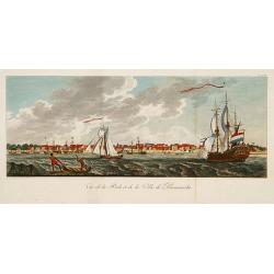
Vue de la Rade et de la Ville de Paramaribo.
A very decorative panoramic view of the town with a large Dutch vessel in the foreground.
Date: Paris 1810
Selling price: ????
Please login to see price!
Sold
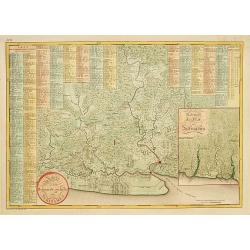
Kaart van het bebouwde gedeelte van Suriname.
With inset map of general Suriname. Scarce map covering the area of Paramaribo. 751 Plantation identified to key panels at top and left of the sheet.
Date: Amsterdam, 1810
Selling price: ????
Please login to see price!
Sold in 2013
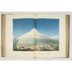
Vues des Cordillères et Monuments des Peuples Indigènes de l Amérique. . .
The book describes the travels of Alexander Humbolt together with the botanist Aime Bonpland in 1799 via Tenerife to Venezuela, through the Orinoco area and through Colom...
Date: Paris, [de l'imprimerie de J.H. Stône] chez F. Schoell, 1810
Selling price: ????
Please login to see price!
Sold
Paraguay, Chili, Terre Magellan. . .
An antique copper engraved map, published 1795, in Paris for the "Nouvel Atlas Portatif..." by Robert de Vaugondy & Charles Francois Delamarche.
Date: Paris, ca. 1811
Selling price: ????
Please login to see price!
Sold in 2016
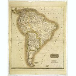
South America.
Map of South America by the Edinburg cartographer John Tomson. Hand colored. Relief shown by hachures.John Thomson was one of the leading masters of the Edinburgh school ...
Date: Edinburgh, London, 1814
Selling price: ????
Please login to see price!
Sold in 2012
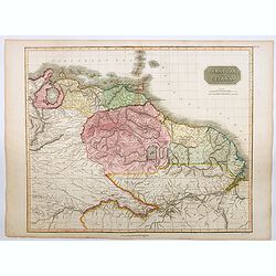
Caraccas and Guiana.
An attractive and very detailed map of Venezuela and Guiana, extending from Martinique in the north as far south northern Brazil, westwards to Lake Maracaibo across to th...
Date: Edinburgh, 1815
Selling price: ????
Please login to see price!
Sold in 2023
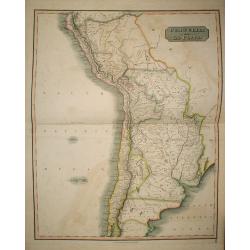
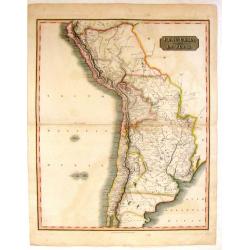
Peru, Chili and La Plata.
The Peru, Chile, and Argentina (La Plata, not including Magellanica), from Thomson's New General Atlas.
Date: Edinburgh, 1816
Selling price: ????
Please login to see price!
Sold in 2009
Peru, Chili and La Plata.
A handsome map of part of South America including Peru, Chile and La Plata (which currently includes most of Paraquay, Uruguay and Bolivia and North Argentina. John Thom...
Date: Edinbourgh, 1816
Selling price: ????
Please login to see price!
Sold in 2015
