Browse Listings
Carte Generale de la Terre Napoleon (à la Nouvelle Hollande)... par M.L. Freycinet an 1808.
Fine map of part of Australia prepared by Louis Freycinet during his voyage under Captain Thomas Baudin in 1800-1803. The longitude is calculated from Paris.The cartouche...
Publisher: FREYCINET, M.L.
Date: Paris, Imprimerie Royale, 1811
Carte von West=Gallizien welche auf allerhöchsten Befehl Seiner Kaiserlich oesterreichischen und Königlich apostolischen Majestät in den Jahren 1801 bis 1804. . .
Important early map of Western Galicia, as given to Austria by the third Partition of Poland (1795). Due to its long development period, a rare map rich in detail shows t...
Publisher: VON HELDENSFELD, A. M. / BENEDICTI.
Date: Vienna, (1808) after 1811
Essai sur la langue et la littérature chinoises.
The French sinologist Jean-Pierre Abel-Remusat (September 5, 1788 - June 2, 1832) was born in Paris and educated for the medical profession, but a Chinese herbal in the c...
Publisher: Abel-Remusat Jean-Pierre
Date: Paris, Treuttel et Wurtz ,1811
Napoleon.
Satirical broadside hand colored allegorical profile of Napoleon published by Ackermann, London. The letter press text underneath ends with the following explanation : &q...
Publisher: ACKERMANN, R.
Date: London, ca. 1814
Generalkarte vom Königreich Preussen u. d. Herz[ogtum] Warschau nach astronomischen Ortsbestim[m]ungen und geodätischen Messungen. . .
Rare seemingly unrecorded map of Poland with its borders after the Congress of Vienna, probably based on a lost first edition of Daniel Friedrich Sotzmann's (1754-1840) m...
Publisher: SOTZMANN, D. F.
Date: Nuremberg, Schneider & Weigel 1815
Nuova Pianta Iconografica.. Venezia.
Precise bird's-eye town-plan of Venice, clearly depicting the city's architectural landmark, being a reduction of Ughi's 8-sheet map of 1725. There is a grid engraved ove...
Publisher: VIERO, T.
Date: Venice, 1818
Carte d'Afrique Dressée pour l'instruction par Guillaume DeLisle. . .
The map is a rare re-issue of the Delisle map of 1722. In his first map of the continent in 1700, Delisle re-measured the Mediterranean, being the first to establish its ...
Publisher: DELISLE, G . / BUACHE, Ph. / DEZAUCHE, J.
Date: Paris, J.Dezauche, 1819
Jeu Royal de la vie d'Henri IV.
Large sheet with an animated game of goose of 63 numbered squares, spiral, counter clockwise, centripetal focused on the French king Henri IV.André Basset offers a life ...
Publisher: BASSET, P.A.
Date: Paris, ca. 1816-1820
Chungguk-do [Map of China and Korea]
Chungguk-do [Map of China] taken from a Korean printed Ch’onha chido [Atlas of all under Heaven] which is a 19th century version of the traditional Korean atlas produce...
Publisher: ANONYMOUS
Date: Korea, ca. 1820
Oursins.
Decorative plate of a sea urchin, engraved by Boquet. Marie Jules César Lelorgne de Savigny (April 5, 1777 - October 5, 1851) was a French zoologist. In 1798 he traveled...
Publisher: LELORGNE DE SAVIGNY, M.J.C.
Date: Paris, 1822
Hommards.
Decorative engraving of a lobster, by Tresca. Marie Jules César Lelorgne de Savigny (April 5, 1777 - October 5, 1851) was a French zoologist. In 1798 he traveled to Egyp...
Publisher: LELORGNE DE SAVIGNY, M,J.C.
Date: Paris, 1822
Astéries.
Decorative engraving of star fishes, by Macret and Leleu. Marie Jules César Lelorgne de Savigny (April 5, 1777 - October 5, 1851) was a French zoologist. In 1798 he trav...
Publisher: LELORGNE DE SAVIGNY, M,J.C.
Date: Paris, 1822
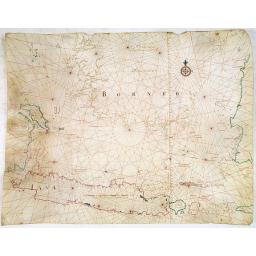
Eastern passage to China. sheet 1.
James Horsburgh early of the coasts of Java, Bali, Lombok, with part of Sulawesi, and Borneo. Insets of "Sketch of Bally Strait", Sketch of Lombock Strait"...
Publisher: HORSBURGH, JAMES, F.R.S
Date: London, 1824
The Traveller's Guide. A Map Of The Roads, Canals And Steam Boat Routes Of The United States ... Designed for the use of Travellers, By H.S. Tanner.
Rare first edition of Tanner's travel map in pocket map form, in it original red leather covers, with the map and no text, as issued. Ristow says the first edition was 18...
Publisher: TANNER, H.S.
Date: Philadelphia, 1825
A Map of North America, Constructed According To The Latest Information . . . Improved to 1825.
It says in the title: "improved to 1825". This milestone map was first issued separately in 1822 and bound in four sheets into Tanner's "New American Atlas...
Publisher: TANNER, Henry S.
Date: Philadelphia, Henry Tanner, 1825
Province de Pologne contenant 22 Col. une M.on Prof 5 Pen. 2 Nov. 6 Rés. 30 Maisons 1050 Jésuites.
Rare map of Poland from "Atlas Universel indiquant les établissemens des Jésuites: avec la manière dont ils divisent la terre, suivi desévénemens remarquables d...
Publisher: DENIS, L.
Date: Paris, Ambroise Dupont , 1826
Atlas Universel de Géographie. Sixième partie - Océanique.
Volume 6 including detailed maps of Australia, New Zealand, Hawaii, Pacific islands, Indonesia and 3 maps of the Philippines. With title page and one general map.Supporte...
Publisher: VANDERMAELEN, Ph.
Date: Brussels 1827
Hendrik Doeff and his dog.
Because of the scarcely of impressions from abroad many of the Nagasaki subjects, prints and paintings are copies. The lack of understanding usually makes these impressio...
Publisher: NAGASAKI SCHOOL
Date: Nagasaki, c. 1820-1830
A.D. 1100. Period of the first crusade.
Plate from An historical atlas: in a series of maps of the world as known at different periods constructed upon an uniform scale and colored according to the political ch...
Publisher: QUIN, E.
Date: London, 1830
Carte des Iles Hawaii.
A lovely small map of the complete chain of Pacific islands known today as the Hawaiian islands, from Dumont d'Urville's atlas "Voyage pittoresque autour du Monde.&q...
Publisher: DUMONT D'URVILLE, Jules.
Date: Paris, 1834
Les honneurs du Panthéon . . . . (Plate 433 from La Caricature.)
On the front wall is written: "To the great men and women, our country is grateful". This lithograph shows people hanging in front of the Panthéon, and may be ...
Publisher: DAUMIER, H.
Date: Paris, October 23, 1834
Sincapour.
Early view of Singapore after Paris and engraved in aquatint technique by Sigismond Himely (1801-1872). Published as plate 28 in Voyage autour du monde par les mers de l'...
Publisher: HIMELY, S.
Date: Paris, Finot, 1835
A-Na-Cam-E-Gish-Ca. A Chippeway Chief.
Half-length portrait of Anacamegishca, bare-chested, wearing a blanket and a peace medal. A-Na-Cam-E-Gish-Ca (1785-1862) - was a Chippeway Indian Chief. The Chippewa is o...
Publisher: MCKENNEY, T & HALL, J.
Date: Philadelphia, 1837
[Manuscript map of Kangwon Province part of North Korea]
Detailed map of eastern part of North Korea, centered on Wonsan, previously known as Wonsanjin, Port Lazarev, and Gensan, a port city and naval base located in Kangwon Pr...
Publisher: ANONYMOUS
Date: ca, 1820 - 1840
Optique de St.Cloud.
This perspective view of St. Cloud comprises 6 hand colored images of the grand Bassin d'Apollon viewed through an square and two round holes cut out from the front card ...
Publisher: [VUE DEPLIANTE A PERSPECTIVE].
Date: Paris, ca.1845
Geographisk Hand-Atlas.
An very rare atlas. The maps have dates ranging from 1816 to 1848. Åkerland died in 1835 which means that some of the maps were updated after his death by others. The ti...
Publisher: ÅKERLAND, E
Date: A. Wiborgs förlag, Stockholm, ca. 1848
20 small lithographed views of Washington DC and Georgetown.
20 small lithographed town-views of Washington DC and Georgetown, cut out from a larger sheet. Showing the East Front of the Capitol, Treasury, Smithsonian Institute, Pre...
Publisher: WEBER, E.
Date: Casimir Bohn, Washington, D.C.: 1849
Océanie.
A very decorative 19th century map of the Pacific Ocean, with hand colored lines indicating the extent of Polynesia, Mirconesia, Melanesia, and Malaysia (or Southeast Asi...
Publisher: LEVASSEUR, V.
Date: Paris, 1850
Océanie.
A very decorative 19th century map of the Pacific Ocean, with hand colored lines indicating the extent of Polynesia, Micronesia, Melanesia, and Malaysia (or Southeast Asi...
Publisher: LEVASSEUR, V.
Date: Paris, 1850
Plan de Constantinople, non compris ses faubourgs. Grave d'apres les documents du ministere de la Guerre par E. Olivier.
A very rare lithographic town-plan of Istanbul, Scale 98 yards to one inch., printed in Pera, Istanbul by E. Olivier. The ornate design on the top of the title is a tugh...
Publisher: OLIVIER, E.
Date: Péra, Istanbul, 1851
(The City And Harbour Of Sydney From Near Vaucluse.)
One of the most sought after views of the city and harbour of Sydney seen from Near Vaucluse, 1852. Magnificent hand-colored tinted lithograph and finished by gum-Arabic....
Publisher: ANGAS, G.F.
Date: London, J. Hogarth, 1852
Map of the Great Salt Lake And Adjacent Country in the Territory Of Utah. Surveyed in 1849 and 1850, under the orders of Col. J.J. Abert .. by Capt. Howard Stansbury .. aided by Lieut. J.W. Gunnison . . .
Map of the Great Salt Lake and adjacent country in the Territory of Utah made in 1849 and 1850 under the orders of Col. J.J. Abert, Chief of the Topographical Bureau by C...
Publisher: STANSBURY, H./J. W. GUNNISON/CHAS. PRUESS.
Date: Ackerman, New York, 1852
Posesiones de America : Isla de Cuba. . .
Wall size map of land areas showing all of Cuba, part of Florida Keys plus San Adios and Salvador Grande in the Bahamas.Minute topographical, political, and hydrographic ...
Publisher: MADOZ, P. / COELLO, F.
Date: Madrid, 1853
Le Sacre Hagard [Haggard-falcon]
A beautiful elephant folio sized colored lithograph of a Hagard Falcon, taken from the famous book on Falconry Traite de Fauconnerie by Schlegel and A.H. Verster van Wulv...
Publisher: SCHLEGEL, ARNZ, A & COMP
Date: Leiden, 1844-1853
The town & harbour of Sevastopol with the batteries & approaches. . .
Rare colored linen backed map showing the harbour and town of Sevastopol, with soundings. In upper left corner a inset map (65x150mm) of the Black Sea. In bottom part a l...
Publisher: WYLD, J.
Date: London, March 27th, 1854
(Lübeck) Lvbeca vrbs. imperialis libera. civitatvm. Wandalicarvm. . . .
Impressive more than 3 meters wide panoramic town view after a woodbock engraving from Elias Diebel, originally made in 1552. Of this original woodblock Bachmann mentions...
Publisher: DIEBEL, E. after
Date: Germany, c. 1855
Carte d'unne partie de l'Arabie Septentrionale Pour suivre les Voyages de Mr. G.A. Vallin. . .
This is the original hand drawn map by Victor Adolphe Malte-Brun of "Carte d'unne partie de l'Arabie Septentrionale Pour suivre les Voyages de Mr. G.A. Wallin",...
Publisher: MALTE-BRUN, V.A.
Date: Paris, November 1855
Military map of the countries between Odessa & Perekop with the stations of the Russian forces.
Rare colored linen backed map showing Russian troop positions and Odessa Batteries. On the inside of the cover a list of "Wyld's list of recent publications : seat o...
Publisher: WYLD, J.
Date: London, ca. 1855
Carte des Colonies établies dans la partie Sud-Ouest de la Russie.
Finely and crisply engraved map centered on Crimea, showing the Black Sea and its hinterland.Noteworthy topographical detail is shown with a color key to the settlements ...
Publisher: MALTE BRUN.
Date: Paris, c.1860
(Untitled view from Scutari with a view of Constantinople)
Panoramic view from Scutari with a view of Constantinople in the distance, after a design by Johann Schranz. Published by J. Missiriè.
Publisher: JACOMME et CIE.
Date: Paris, 1860
Carte générale de L'Empire Ottoman en Europe et en Asie dressée par Henri Kiepert . . .
Large School wall map of Turkish Empire printed in chromo-lithography. Published by Dieter Reimer and printed by Ferdind Barth in Berlin. This rare map has two insets in ...
Publisher: KIEPERT, H.
Date: Berlin, Verlag von Dietrich Reimer, 1867
CARTE de la Côte Occidentale de COREE, Plan Croquis de la Rivière HAN-KANG ou de SEOUL, depuis son Embouchure jusqu'à Séoul, dressée en 1866 par ordre du C.A. ROZE. . .
Uncommon chart of the Han-Kang River from its mouth to Seoul, prepared in 1866 by order of C.A. ROZE, Commander-in-Chief of the French " la Station des Mers de Chine...
Publisher: DEPOT DES CARTES ET PLANS DE LA MARINE
Date: Paris, 1868
North Pacific.
Huge three sheet so-called Blue-back sailing chart of the Northern Pacific including China, Korea (with Matu Is. and Liancourt), Japan, Philippines, Kamchatka, Hawaii, Al...
Publisher: IMRAY AND SON, J.
Date: London, 1868
The Family Atlas Containing Eighty maps Constructed by Eminent Geographers. . .
Un unrecorded later edition of the S.D.U.K. Family atlas, with 80 plus one extra map. Most maps are single sheet but several are double page maps. Printed on heavy paper ...
Publisher: S.D.U.K.
Date: London Edward Stanford, 1874
La Pieuvre Germanique.
Scarce lithographed plate not dated, by Eugène Danzanvilliers, printed by Grandremy in Paris. The plate listed by Adhemar is dated 1874. Eugène Danzanvilliers was a dra...
Publisher: DANZANVILLIERS, Eugène.
Date: Paris, 28 Quai de la Rapée, c.1874
Histoire de la Guerre Civile en Amerique par M. Le Comte de Paris, Ancien Aide de Camp du General Mac Clellan (McClellan). ...
These 30 maps were made by Vorzet to accompany Louis Phillipe d'Orleans' (Comte de Paris) multi volume "Histoire de la Guerre Civile en Amérique". The set incl...
Publisher: VORZET, Ed. Dumas
Date: Paris. Michel Levy Freres, 1875
Trop d'Appetit par A. Le Petit.
Dated in lower right dated "Le 9 juin 1875". The drawing is representing an alligator's jaw wearing a Prussian helmet, and about to chew a globe. Alfred Le Peti...
Publisher: LE PETIT, A.
Date: Paris, 1875
Mapa geogra´fico de la mayor parte de la Ame´rica Meridional que contiene los paises por donde debe trazarse la li´nia divisoria que divida los dominios de Espan~a y Portugal. . .
Rare first edition of the map drawn by Francisco Requena (1743-1824) after his expedition to the Amazon in order to delineate the boundary between the Spanish and Portugu...
Publisher: REQUENA, F.
Date: Bourquin, F. Philadelphia, ca. 1876
L'Art arabe d'après les monuments du Kaire depuis le VIIe siècle jusqu'à la fin du XVIIIe.
Prisse d’Avennes was one of the foremost scholars of Arabic art and architecture of the 19th century; this work represents the summation of his studies. From the aspect...
Publisher: PRISSE D'AVENNES, Achille Constant.
Date: Paris, Morel, 1877
Asie.
Manuscript map made by miss Marie Demeule, dated Elbeuf 1879. Elbeuf is a town within the Upper Normandy region in France.In the 19th century many students, and quite oft...
Publisher: DEMEULE, M.
Date: France, Elbeuf, 1879
内務省地理局 (Administratif atlas of the Empire of Japan.)
Atlas of Japan published by the Home Ministry shortly after the start of Meiji period. The atlas contains 16 double page maps, with the border in original out line colors...
Publisher: Home Ministry (内務省, Naimu-shō)
Date: Tokyo, Meiji 14 or 1881
Hong Kong. [Queen's Road]
Finely executed water color made by Henri Dieth of a charming atmospheric street scene at Queen's Road in Hong Kong. The water color is made after Eduard Hildebrandt (181...
Publisher: DIETH, H.
Date: Germany, 1882
Hongkong Piratenstrasse. [Pirate Street]
Finely executed water color made by Henri Dieth of a charming street scene at "Pirate Street" in Hong Kong. The water color is made after Eduard Hildebrandt (18...
Publisher: DIETH, H.
Date: Germany, 1882
Runde Strasse in Peking.
Finely executed water color made by Henri Dieth of a charming street scene in Peking. The water color is made after Eduard Hildebrandt (1818-1869). Hildebrandt, was born ...
Publisher: DIETH, H.
Date: Germany, 1882
A rare suite of 12 original etchings by Martin van Maele to the famous work by Edmond Haracourt.
A rare suite of 12 original etchings by Martin van Maele to the famous work by Edmond Haracourt. The series was published anonymously in a small edition. These etchings a...
Publisher: VAN MAELE, M.
Date: Nevers, Brussels, 1882,1883
Driving chart of Hartford and vicinity : 15 miles around.
Road map by Albert A. Hyde & Co. of Hartford and vicinity, with the Connecticut River in the center. Published by Albert A. Hyde & Co., in New York and lithograph...
Publisher: HYDE & Co, A. A.
Date: New York / Philadelphia, 1884
Au quartier Latin.
This image also appears on the Christmas cover of the magazine in 1900. This is the version before the magazine boilerplate was added, but "this black-and-white vers...
Publisher: MUCHA, A.
Date: Paris, ca. 1899
[West Central London from Booth's Poverty Map of London]
A map of West Central London, one section (of twenty) of an extended version of the incredibly influential Poverty Map, originally published in Charles Booth's 'Life and ...
Publisher: BOOTH, Charles.
Date: London, 1900
La Lune à un Mètre [Mini poster for Paris Exposition Universelle)
Original lithograph poster for "Paris Exposition Universelle" held between April and November, 1900, which received 50 million visitors. In 1899, director Geor...
Publisher: TRUCHET, A.
Date: Paris, c.1900
Eight Indian erotic paintings, accordion mounted.
SUPERB SET of eight remarkable free miniatures, presenting couples in natural decorations. The miniatures are painted in Iran or India in late 19th - early 20th century]....
Publisher: IRAN or INDIA
Date: Iran, India, ca. 1900
COLLECTION OF HONG KONG MAPS, BOOKS & FLYERS. Including CHINA - HONGKONG surveyed by Captn. Sir Edward Belcher, in H.M.S. Sulphur 1841. Corrected to 1901.
A collection of 30 maps, prints, publications relating to Hong Kong. Including : - BELCHER, E. Sir, An updated version of this most important nautical chart of Hong Kong....
Publisher: BRITISH ADMIRALTY/ AMONG OTHERS
Date: London, 1841 - 1901
CANTON Kong-Teheou.
Very detailed (1:1.000.000) map centered on Macao and Victoria Island, showing soundings, English, Australian, Danish telegraph lines reaching Hong Kong and extended to M...
Publisher: SERVICE GEOGRAPHIQUE DE L\'ARMEE.
Date: Paris, 1898 updated for june 1904
Excelsiori (Rana N. 28 - Cent. 20).
"After so many wars and so many troubles, young Russia, in a more serene glaze all the beautiful sun of freedom you will enjoy ... ". Fascinating allegorical sa...
Publisher: CETTO, M.
Date: Bologna, 1905
Parliamentary Papers - Foreign Office - Annual Series - Diplomatic and Consular Reports on Trade and Finance.
Very scarce - Only for the British Parliament and the British Crown printed - and not for the trade! Accounts about the Korean country during the time span of the last th...
Publisher: FOREIGN OFFICE
Date: London, Harrison and Sons, 1882-1906
Nuevo plano de la ciudad de Buenos Aires y parte del partido de avellaneda . . .
A rare detailed city plan of Buenos Aires prepared in 1912 by Ernesto Escalante. The plan depicts the city from the Partido de Avellaneda and the Villa Riachuelo to the R...
Publisher: ESCALANTE, E.
Date: Buenos Aires, 1912
Karte von Europa im Jahre 1870 nach einem französischen Holzschnitte.
Satirical illustration by Paul Hadol showing disposition of power in Europe at the beginning of 1870. Satirical print depicting a map of Europe in which the countries are...
Publisher: HADOL.
Date: Hamburg, Fuchs, 1914
Hark ! Hark ! The dogs do bark.
This very rare political caricature map of Europe depicts the continent at the outbreak of World War I, or as it was called at the time the Great War. Designed by Johnson...
Publisher: BACON, G.W.
Date: London, Johnson Riddle & Co., 1914
Tutte le strade conducono a Roma. [All roads lead to Rome]
Game board of the game "All roads lead to Rome" from the Fascist era, offered by the chocolate or cocoa company Talmone-Unica. Showing a world map surrounded by...
Publisher: ISTITUTO ITALIANO D'ARTI GRAFICHE - BERGAMO
Date: Turin, 1928
Planisphere des fuseaux horaires.
Poster showing the different time zones.
Publisher: ANONYMOUS
Date: Paris, ca. 1930
World Flight Routes (all in Japanese).
A large very decorative Japanese world map published as sugoroku (a Japanese game which might be compared to backgammon) published as a supplement to the 1930 New Year’...
Publisher: OSAKA MAINICHI SHINBUN
Date: Osaka, 1930
(Art déco gouache)
Outstanding "art deco" gouache (unsigned) from the workshop of "Robert Pichon. Ateliers de Dessin et Lithographie – 10, rue Rochechouart – Paris. The g...
Publisher: PICHON, R. (Workshop).
Date: Paris, ca. 1930
(Art déco gouache)
Outstanding "art deco" gouache (unsigned) from the workshop of "Robert Pichon. Ateliers de Dessin et Lithographie – 10, rue Rochechouart – Paris. The g...
Publisher: PICHON, R. (Workshop).
Date: Paris, ca. 1930
(Art déco gouache)
Outstanding "art deco" gouache (unsigned) from the workshop of "Robert Pichon. Ateliers de Dessin et Lithographie – 10, rue Rochechouart – Paris. The g...
Publisher: PICHON, R. (Workshop).
Date: Paris, ca. 1930
(Art déco gouache)
Outstanding "art deco" gouache (unsigned) from the workshop of "Robert Pichon. Ateliers de Dessin et Lithographie – 10, rue Rochechouart – Paris. The g...
Publisher: PICHON, R. (Workshop).
Date: Paris, ca. 1930
(Art-déco gouache)
Outstanding "art deco" gouache (unsigned) from the workshop of "Robert Pichon. Ateliers de Dessin et Lithographie – 10, rue Rochechouart – Paris. The g...
Publisher: PICHON, R. (Workshop).
Date: Paris, ca. 1930
(Art-déco gouache)
Outstanding "art deco" gouache (unsigned) from the workshop of "Robert Pichon. Ateliers de Dessin et Lithographie – 10, rue Rochechouart – Paris. The g...
Publisher: PICHON, R. (Workshop).
Date: Paris, ca. 1930
Five Art déco labels.
5 Lithographed perfume labels laid on original cardboard sheet. A striking example of commercial artworks produced by the artist and graphic designer Robert Pichon and hi...
Publisher: PICHON, Robert (Workshop).
Date: Paris, between 1925 and 1930
Art déco label for Georges Salomon Paris.
Lithographed perfume label "Savon Cold cream N°1531 - Georges Salomon Paris" laid on original cardboard sheet. A striking example of commercial artworks produc...
Publisher: PICHON, Robert (Workshop).
Date: Paris, between 1925 and 1930
Art déco label Biette Savon - Tein de fleur.
Lithographed perfume label " Biette Savon - Tein de fleur" laid on original cardboard sheet. A striking example of commercial artworks produced by the artist an...
Publisher: PICHON, Robert (Workshop).
Date: Paris, between 1925 and 1930
Art déco label for Parfum Mary France.
Lithographed perfume label "Parfum Mary France" laid on original cardboard sheet. A striking example of commercial artworks produced by the artist and graphic d...
Publisher: PICHON, Robert (Workshop).
Date: Paris, between 1925 and 1930